United States · Terrestrial
Haleakalā National Park
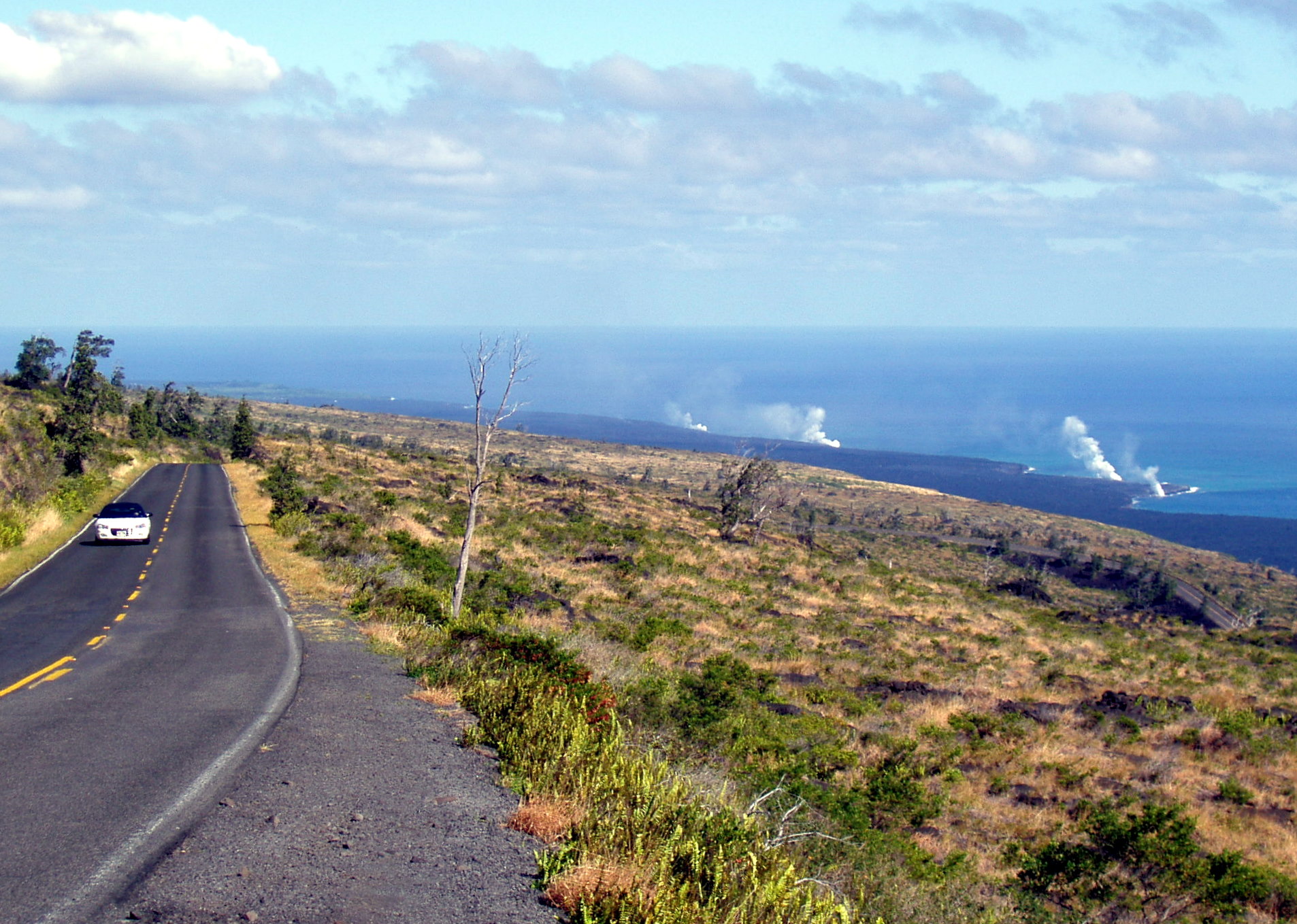
National park of 13,460 hectares in the United States, established in 1961.
Overview
National park of 13,460 hectares in the United States, established in 1961.
Haleakalā National Park is located in the United States (Oceania). It is a predominantly terrestrial area. Established on 1 July 1961, it covers about 13,460 hectares. The site is managed by National Park Service.
Protections and designations
UNESCO Biosphere Reserve
Protected as a national park. International labels and designations: UNESCO Biosphere Reserve (“Hawaiian Islands Biosphere Reserve”). Key dates: established in 1961 and Biosphere Reserve in 1980.
In our collections
Timeline
-
1961
Established
-
1980
UNESCO Biosphere Reserve Hawaiian Islands Biosphere Reserve
Sources: Wikidata (CC0) for establishment and international labels; EEA Natura 2000 database (CC-BY 4.0) for site designation dates.
Frequently asked questions
Where is Haleakalā National Park?
In the United States (Oceania). Representative point: 20.7204° N, 156.1552° W.
How large is Haleakalā National Park?
About 13,460 hectares (135 km²). It is the 52nd largest of the 62 national parks in the United States covered by Parkavela.
When was Haleakalā National Park established?
On 1 July 1961.
What habitats and landscapes does Haleakalā National Park include?
A terrestrial area, with forests and mountains.
What is the highest point of Haleakalā National Park?
Puʻuʻulaʻula, at 3,055 m (OpenStreetMap).
What are the main summits of Haleakalā National Park?
Puʻuʻulaʻula (3,055 m), Magnetic Peak (3,052 m), Pākaʻaoʻao (3,006 m), Kilohana (2,906 m) and Haupaʻakea Peak (2,788 m) (OpenStreetMap).
Which international labels apply to Haleakalā National Park?
UNESCO Biosphere Reserve (“Hawaiian Islands Biosphere Reserve”).
When is the best time to visit Haleakalā National Park?
The climate suits visits all year round.
What is there to see in Haleakalā National Park?
4 waterfalls, including Makahiku Falls, Waimoku Falls (330 m), Alelele Falls and Other Oheo Gulch Waterfalls (Wikidata).
Where can I stay in Haleakalā National Park?
3 mountain huts, including Kapalaoa Cabin (2,214 m), Hōlua Cabin (2,110 m) and Palikū Cabin (2,047 m) (Wikidata).
Are there historic monuments in Haleakalā National Park?
Yes. According to Wikidata, one monument listed in the National Register of Historic Places stands within the boundary. For example: “Crater Historic District”.
What is the nearest airport to Haleakalā National Park?
Nearest airport: Kahului (OGG), about 24 km away.
Where can I get visitor information on site?
Haleakalā Visitor Center and Park Headquarters Visitor Center.
Are there waymarked hiking trails in Haleakalā National Park?
Yes. Waymarked hiking routes listed in OpenStreetMap: 1.
Which species can be seen in Haleakalā National Park?
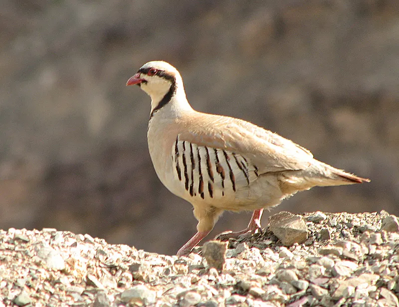
Among the species most often recorded on GBIF are Alectoris chukar (Chukar Partridge), Branta sandvicensis (Nene), Chlorodrepanis virens (Hawaii 'Amakihi) and Himatione sanguinea (Apapane).
Who manages Haleakalā National Park?
National Park Service.
What is the official website of Haleakalā National Park?
© OpenStreetMap
Download the boundary: GeoJSON · GPX Boundary © OpenStreetMap contributors (ODbL).
Geography
The representative point of the site lies at around 2,027 m above sea level. Over the 1996–2025 period, the mean annual temperature is about 12.3 °C and total precipitation reaches roughly 1,985 mm per year. The warmest month is usually August, the coolest February, and the wettest March.
Area
- Area
- 13,460 ha
- Elevation
- 2,027 m
- Median elevation
- 1,934 m
- Mean slope
- 20°
- Coordinates
- 20.7204, -156.1552
Terrain: Mapzen Terrain Tiles (SRTM, USGS)
Elevation bands
- below 500 m 11%
- 500–1,000 m 12%
- 1,000–1,500 m 12%
- 1,500–2,000 m 18%
- 2,000–2,500 m 40%
- 2,500–3,000 m 8%
share of the site in each elevation band (smoothed terrain model: summits are rounded off) · Terrain: Mapzen Terrain Tiles (SRTM, USGS)
Main summits
- Puʻuʻulaʻula3,055 m
- Magnetic Peak3,052 m
- Pākaʻaoʻao3,006 m
- Kilohana2,906 m
- Haupaʻakea Peak2,788 m
- Hanakauhi2,697 m
- Lauʻulu2,515 m
- Haleakalā2,502 m
- Kamaʻoliʻi2,490 m
- Kumuʻiliahi2,479 m
Data © OpenStreetMap contributors (ODbL)
Climate
● Mean temperature (°C) · ▮ Precipitation (mm)
Source: Copernicus ERA5-Land (C3S, doi:10.24381/cds.68d2bb30), monthly averages 1996–2025 interpolated to the representative point, temperatures adjusted for elevation.
Contains modified Copernicus Climate Change Service information 2026. Neither the European Commission nor ECMWF is responsible for any use that may be made of the Copernicus information or data it contains.
Natural habitats
According to the global MODIS land cover (NASA, 2024), the site is mainly made up of grassland and meadows (39%), forests (35%) and heath and scrub (14%). It is mostly dense evergreen broadleaved forest. Elevation ranges from about 150 m to 3,055 m (highest point: Puʻuʻulaʻula). Median elevation is 1,934 m, and 47% of the site lies above 2,000 m (SRTM elevation model). The terrain is steep: 22% of slopes exceed 30° (mean slope 20°).
Biodiversity
Based on occurrences aggregated by GBIF, several species are regularly recorded within the site. Among the most frequent are Alectoris chukar (Chukar Partridge), Branta sandvicensis (Nene), Chlorodrepanis virens (Hawaii 'Amakihi) and Himatione sanguinea (Apapane). The full list of documented taxa is shown below.
Species to look out for
Bird
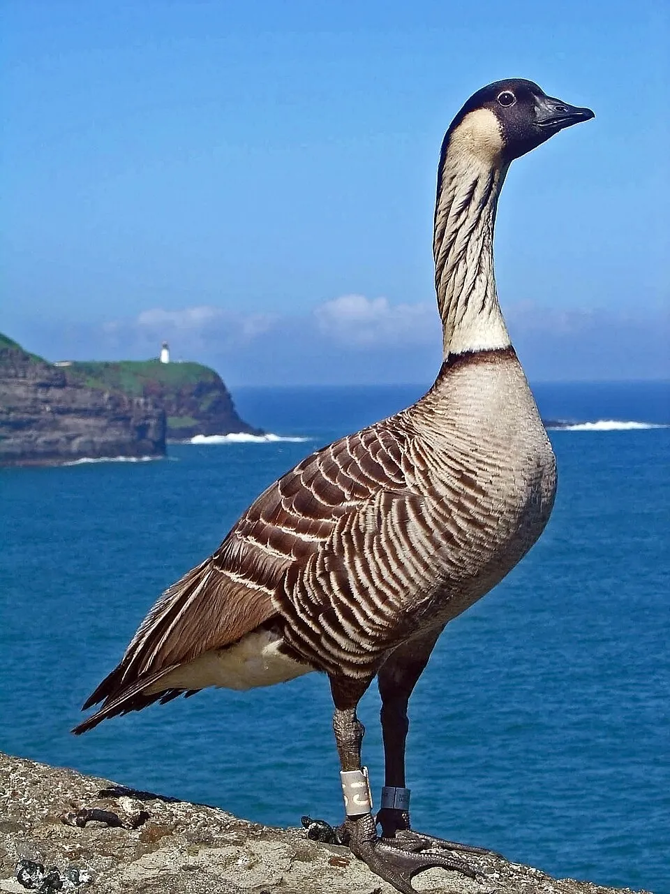
Nene
Branta sandvicensis1,379 records © Brenda Zaun of U.S. Fish and Wildlife Service Headquarters · CC BY 2.0

Bird
Hawaii 'Amakihi
Chlorodrepanis virens1,344 records © James Brennan from Molokai Hawaii, United States · CC BY 2.0
Observed species
Occurrences documented via GBIF; they are neither an exhaustive inventory nor proof of current presence.
- Chukar Partridge · Alectoris chukar · 1911
- Nene · Branta sandvicensis · 1379
- Hawaii 'Amakihi · Chlorodrepanis virens · 1344
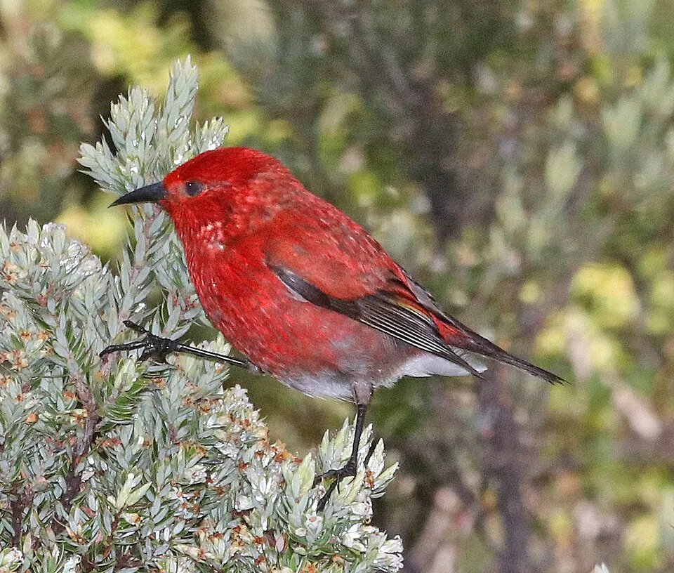
- Apapane · Himatione sanguinea · 1315
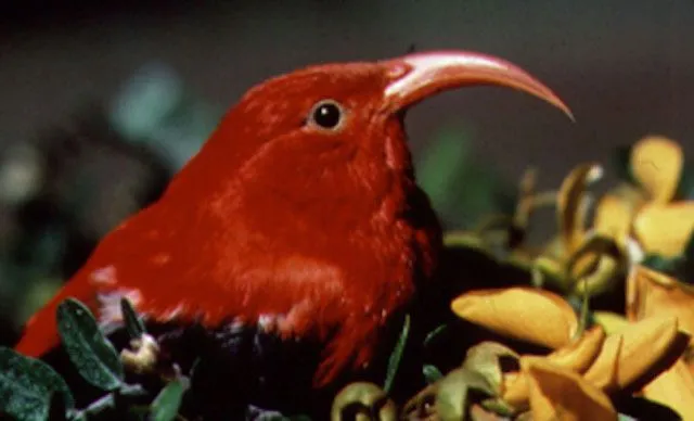
- 'i'iwi · Vestiaria coccinea · 1209
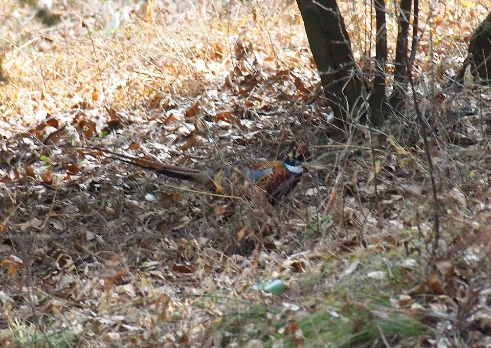
- Common Pheasant · Phasianus colchicus · 1124
- Warbling white-eye · Zosterops japonicus · 996
- House Sparrow · Passer domesticus · 810
- House finch · Haemorhous mexicanus · 753
- Short-eared Owl · Asio flammeus · 668
- Maui Alauahio · Paroreomyza montana · 637
- Eurasian Skylark · Alauda arvensis · 596
+18 more species
- Common myna · Acridotheres tristis · 518
- Northern Cardinal · Cardinalis cardinalis · 437
- Pacific Golden Plover · Pluvialis fulva · 373
- Red-crested Cardinal · Paroaria coronata · 357
- Chinese Hwamei · Garrulax canorus · 356
- Red-billed Leiothrix · Leiothrix lutea · 318
- Zebra Dove · Geopelia striata · 291
- Spotted Dove · Spilopelia chinensis · 291
- Hawaiian Petrel · Pterodroma sandwichensis · 243
- White-tailed Tropicbird · Phaethon lepturus · 219
- Japanese Bush Warbler · Horornis diphone · 219
- Northern Mockingbird · Mimus polyglottos · 199
- Grey Francolin · Ortygornis pondicerianus · 164
- Scaly-breasted Munia · Lonchura punctulata · 163
- Velvet tree · Miconia calvescens · 152
- Great Frigatebird · Fregata minor · 141
- Mountain dubautia · Dubautia menziesii · 132
- Western Cattle Egret · Bubulcus ibis · 127
Records: GBIF.org (CC-BY). Names: Wikidata (CC0), GBIF. Photos: Wikimedia Commons.
Conservation challenges
The primary purpose of the site is to preserve its natural habitats and the biodiversity they support. The species recorded (Biodiversity tab) reflect its ecological value. The designations it holds frame its management and the control of land use.
According to Global Forest Change data (University of Maryland, Global Forest Watch), about 23 ha of tree cover were lost within the boundary between 2001 and 2023 (under 1% of its area), peaking in 2001 and 2009. These losses include logging, storms and fires, and do not account for regrowth. At night, the area gives off virtually no artificial light detectable from space (NASA VIIRS Black Marble composite, 2016).
Pressure indicators
Tree cover lost
23 ha
2001–2023 · < 1% of the area
20012023
Light at night
< 1%
of the area gives off artificial light visible from space
DarkLit
Sources: Global Forest Change (Hansen et al., University of Maryland, via Global Forest Watch, CC-BY 4.0); EFFIS, European Commission / Copernicus; NASA Black Marble 2016 (public domain); CORINE Land Cover 2018 (Copernicus) or MODIS.
Practical information
Cities and airport
- Airport: Kahului (OGG)
24 km as the crow flies
Visitor information
- Haleakalā Visitor Center
within the site - Park Headquarters Visitor Center
< 1 km from the site boundary
Parking
13 public car parks listed within the site · 2 trailheads
Haleakala SummitLeleiwi Overlook Trailhead
Things to see
4 waterfalls
- Makahiku Falls
waterfall - Waimoku Falls
waterfall · 330 m - Alelele Falls
waterfall - Other Oheo Gulch Waterfalls
waterfall
Where to stay
3 mountain huts
- Kapalaoa Cabin
mountain hut · 2,214 m - Hōlua Cabin
mountain hut · 2,110 m - Palikū Cabin
mountain hut · 2,047 m
Hiking
1 waymarked routes listed
Wheelchair access
- Park Headquarters Visitor Center
visitor information
accessible toilets: 4
Reported by OpenStreetMap contributors (ODbL); check with the park before visiting.
Data © OpenStreetMap contributors (ODbL) · Wikidata (CC0)
Access and visiting
Nearest airport: Kahului (OGG), about 24 km away. About 49,000 people live within 20 km of the site boundary, 8,800 of them within 10 km; the site itself is virtually uninhabited (GHSL estimate, 2020). This population has grown by about 26% since 2000. Visitor information on site: Haleakalā Visitor Center and Park Headquarters Visitor Center. Public car parks listed within the site: 13, including Haleakala Summit and Leleiwi Overlook Trailhead. Waymarked hiking routes listed in OpenStreetMap: 1. OpenStreetMap contributors list 2 wheelchair-accessible places, including Park Headquarters Visitor Center; check with the park before visiting. To see: 4 waterfalls, including Makahiku Falls, Waimoku Falls (330 m), Alelele Falls and Other Oheo Gulch Waterfalls. Where to stay: 3 mountain huts, including Kapalaoa Cabin (2,214 m), Hōlua Cabin (2,110 m) and Palikū Cabin (2,047 m). To plan a visit (access, opening periods, visitor rules), it is best to consult the official information from the managing body (National Park Service) and the official website listed in this page's sources.
Source: OpenStreetMap (ODbL), Wikidata (CC0), October 2026.
Built heritage
According to Wikidata, one monument listed in the National Register of Historic Places stands within the boundary. It is “Crater Historic District”.
Source: Wikidata (CC0), monuments in each country’s official heritage protection registers, at national or regional level. Each item links to its Wikidata entry.
When to visit
The climate suits visits all year round. These averages apply to the site's representative point (2,027 m); higher up it is markedly cooler and snow lasts longer. Day length ranges from about 10 h 53 min in December to 13 h 23 min in June. Wildlife records published on GBIF peak for birds (February and March), plants (from June to August) and butterflies and moths (June and July). These peaks also reflect when observers are most active.
Source: Copernicus ERA5-Land (C3S), monthly averages 1996–2025 at the representative point, temperatures adjusted for elevation.
Contains modified Copernicus Climate Change Service information 2026. Neither the European Commission nor ECMWF is responsible for any use that may be made of the Copernicus information or data it contains.
Wildlife records calendar
JFMAMJJASOND
Birds
Plants
Butterflies & moths
Monthly records published on GBIF (CC-BY), relative to the busiest month; also reflects observer activity.
Gallery
© Michael Oswald · Public domain
© Niagara66 · CC BY-SA 4.0
© Sophia-Rose Veilleux · CC BY-SA 4.0
© Christoph Strässler · CC BY-SA 2.0
© Tony Webster · CC BY-SA 3.0
© Aaron Zhu · CC BY-SA 3.0
Sources and licences
- Wikidata: Q1137640
- OpenStreetMap: relation 8174174
- Official website: https://nps.gov/hale
- Wikipedia: en.wikipedia.org/wiki/Haleakalā_National_Park
- WDPA: 999915
References
- cds.climate.copernicus.eu: climate · CC-BY-4.0
- registry.opendata.aws: elevation of the reference point, detailed relief · PD
- lpdaac.usgs.gov: land cover · PD
- doi.org: population around the site · CC-BY-4.0
- naturalearthdata.com: sea share · PD
- wikidata.org: official area, establishment date, protected heritage, managing body, nearby cities and airport, access and peaks, lake depths, places to see, official website · CC0-1.0
- en.eurovelo.com: EuroVelo cycle routes · ODbL-1.0
- cycling.waymarkedtrails.org: cycle routes · ODbL-1.0
- opentopodata.org: elevations · PD
- globalforestwatch.org: tree cover loss · CC-BY-4.0
- gbif.org: seasonality of sightings, observed species · CC-BY-4.0
- openstreetmap.org: official name, access and peaks, trail difficulty, wheelchair access · ODbL-1.0
- earthobservatory.nasa.gov: night light · PD
- nsidc.org: snow cover · PD
- wikidata.org: Wikipedia article · CC-BY-SA-4.0
Data © OpenStreetMap contributors (ODbL), Wikidata (CC0) and the sources cited.