
Poland · Terrestrial
Książ Landscape Park
Landscape park of 3,155 hectares in Poland, established in 1981.
Overview
Landscape park of 3,155 hectares in Poland, established in 1981.
Książ Landscape Park is located in Poland (Europe). It is a predominantly terrestrial area. Established in 1981, it covers about 3,155 hectares.
Protections and designations
Natura 2000 · habitats (SAC) · 2 sites
- Dobromierz PLH020034
- Przełomy Pełcznicy pod Książem PLH020020
Protected as a landscape park. International labels and designations: Natura 2000 network (2 sites). Key dates: established in 1981 and first Natura 2000 site under the Habitats Directive in 2009.
In our collections
Timeline
-
1981
Established
-
2009
First Natura 2000 site under the Habitats Directive 2 such sites designated up to 2009
Sources: Wikidata (CC0) for establishment and international labels; EEA Natura 2000 database (CC-BY 4.0) for site designation dates.
Frequently asked questions
Where is Książ Landscape Park?
In Poland (Europe). Representative point: 50.8569° N, 16.2489° E.
How large is Książ Landscape Park?
About 3,155 hectares (32 km²). It is the 118th largest of the 121 landscape parks in Poland covered by Parkavela.
When was Książ Landscape Park established?
In 1981.
What habitats and landscapes does Książ Landscape Park include?
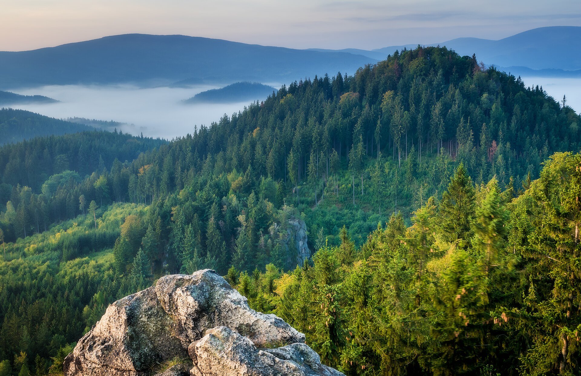
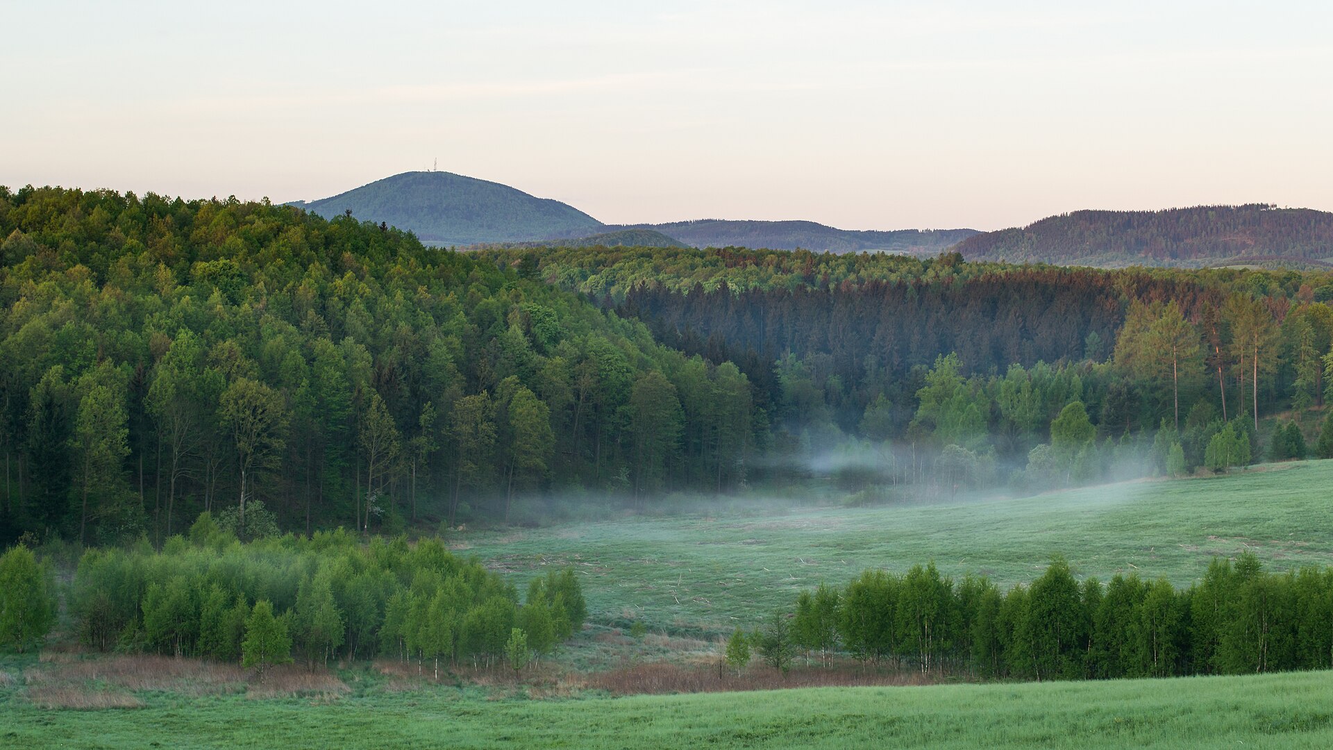
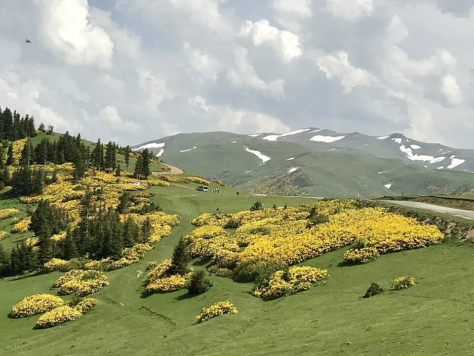
A terrestrial area, with forests.
What rocks lie beneath Książ Landscape Park?
According to the European 1:1 million geological map (EGDI), the bedrock consists mainly of phyllites and slates (44% of sampled points), conglomerates and breccias (33%) and sands and gravels (22%). The geological units date mainly from the Ordovician (44% of sampled points).
What is the highest point of Książ Landscape Park?
Witosz, at 459 m (OpenStreetMap).
What are the main summits of Książ Landscape Park?
Witosz (459 m), Skiba (433 m), Kruczyce (422 m), Radoń (422 m) and Sosnowica (421 m) (OpenStreetMap).
Which international labels apply to Książ Landscape Park?
Natura 2000 network (2 sites).
When is the best time to visit Książ Landscape Park?
Mildest period: from June to August, with average temperatures of 16 to 19 °C.
What is there to see in Książ Landscape Park?
16 viewpoints, 5 lakes and ponds and 1 cave, including Dawny punkt widokowy, Jezioro Daisy, Jaskinia Daisy - sztolnia and Staw Poleśnicki I (OpenStreetMap).
Where can I stay in Książ Landscape Park?
Campsite Czarci Jar (OpenStreetMap).
Are there historic monuments in Książ Landscape Park?
Yes. According to Wikidata, 30 monuments listed in the Polish register of monuments stand within the boundary. For example: “Main gate in Książ” in Wałbrzych, “Dom szwajcarski I” in Świebodzice and “Stud farm of the Książ Castle” in Wałbrzych.
What is the nearest large city to Książ Landscape Park?
Nearest towns of over 50,000 people, as the crow flies: Wałbrzych (6 km) and Świdnica (7 km). Nearest airport: Wrocław – Copernicus (WRO), about 47 km away.
How can I reach Książ Landscape Park by train?
The nearest railway station is Świebodzice, about 1 km from the site boundary.
Where can I get visitor information on site?
Leśnictwo and Centrum Turystyczne Granitowego Szlaku.
Are there waymarked hiking trails in Książ Landscape Park?
Yes. Waymarked hiking routes listed in OpenStreetMap: 13, including Szlak Zamków Piastowskich, Witków Śląski, Zamek Książ and Szczawno Zdrój. The “Szlak Zamków Piastowskich” route runs for about 12 km through the site, with some 190 m of ascent on its longest section.
Which species can be seen in Książ Landscape Park?
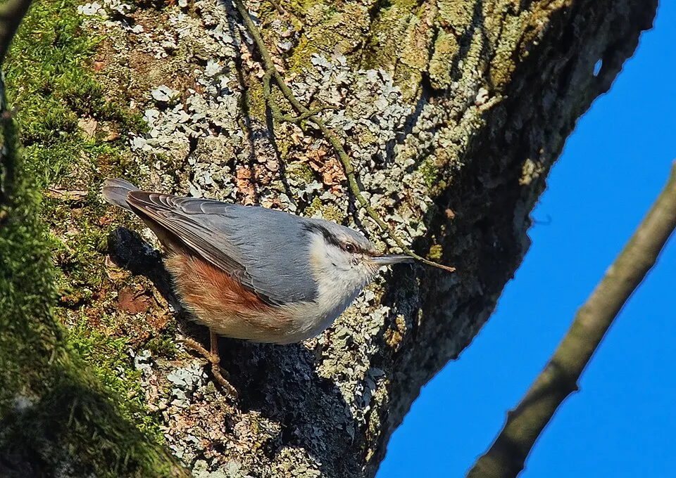
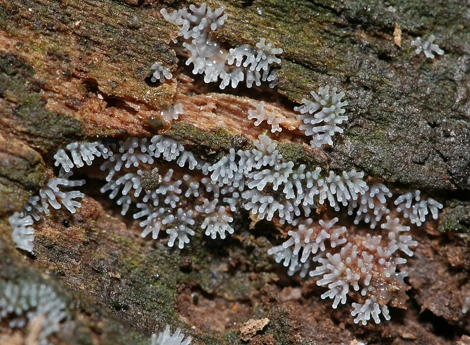
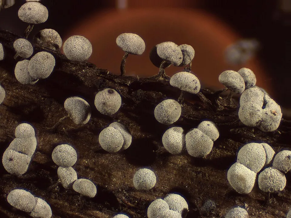
Among the species most often recorded on GBIF are Fagus sylvatica (European Beech), Sitta europaea (Eurasian Nuthatch), Ceratiomyxa fruticulosa (Honeycomb Coral Slime Mold) and Lycogala epidendrum (Wolf's Milk).
© OpenStreetMap
Download the boundary: GeoJSON · GPX Boundary © OpenStreetMap contributors (ODbL).
Geography
The representative point of the site lies at around 373 m above sea level. Over the 1996–2025 period, the mean annual temperature is about 8.5 °C and total precipitation reaches roughly 833 mm per year. The warmest month is usually July, the coolest January, and the wettest July. According to the European 1:1 million geological map (EGDI), the bedrock consists mainly of phyllites and slates (44% of sampled points), conglomerates and breccias (33%) and sands and gravels (22%). The geological units date mainly from the Ordovician (44% of sampled points). The site contains one lake larger than 10 ha (Jezioro Dobromierskie), totalling 64 ha of water (HydroLAKES).
Area
- Area
- 3,155 ha
- Elevation
- 373 m
- Mean slope
- 6°
- Lakes over 10 ha
- 1 (64 ha)
- Coordinates
- 50.8569, 16.2489
Terrain: Mapzen Terrain Tiles (SRTM, USGS) · Lakes: HydroLAKES (Messager et al. 2016, hydrosheds.org, CC BY 4.0) · depths: Wikidata (CC0)
Bedrock
- Phyllites and slates 44 %
- Conglomerates and breccias 33 %
- Sands and gravels 22 %
Sedimentary rocks 56 % · Metamorphic rocks 44 % · Main age: Ordovician (44%)
Source: EGDI 1:1M geological map (EuroGeoSurveys and national geological surveys), CC BY 4.0 · 9 sampled points within the site.
Main summits
- Witosz459 m
- Skiba433 m
- Kruczyce422 m
- Radoń422 m
- Sosnowica421 m
- Czartki417 m
- Czepiec415 m
- Zwierzyniec413 m
- Borowiec Mały412 m
- Czyżowa411 m
Data © OpenStreetMap contributors (ODbL)
Climate
● Mean temperature (°C) · ▮ Precipitation (mm)
Source: Copernicus ERA5-Land (C3S, doi:10.24381/cds.68d2bb30), monthly averages 1996–2025 interpolated to the representative point, temperatures adjusted for elevation.
Contains modified Copernicus Climate Change Service information 2026. Neither the European Commission nor ECMWF is responsible for any use that may be made of the Copernicus information or data it contains.
Snow cover measured by satellite
J
F
M
A
M
J
J
A
S
O
N
D
average share of the site under snow · snowiest parts · ≈ 25 days a year
Snow cover: MODIS/Terra MOD10CM v61 (Hall & Riggs, 2021, NASA NSIDC DAAC, doi:10.5067/MODIS/MOD10CM.061), imagery from NASA GIBS (ESDIS); 2015–2025 average, grid of about 5 km.
Natural habitats
According to CORINE Land Cover (2018), the site is mainly made up of forests (74%), farmland (12%) and grassland and meadows (8%). Woodland mixes broadleaved and coniferous trees. Elevation ranges from about 300 m to 459 m (highest point: Witosz). The 2 Natura 2000 sites overlapping the area list 19 habitats of European interest (6 priority), the most extensive being Galio-Carpinetum oak-hornbeam forests, old acidophilous oak woods with Quercus robur on sandy plains and Tilio-Acerion forests of slopes, screes and ravines.
Biodiversity
Based on occurrences aggregated by GBIF, several species are regularly recorded within the site. Among the most frequent are Fagus sylvatica (European Beech), Sitta europaea (Eurasian Nuthatch), Ceratiomyxa fruticulosa (Honeycomb Coral Slime Mold) and Lycogala epidendrum (Wolf's Milk). The full list of documented taxa is shown below. The overlapping Natura 2000 sites list 8 species of European interest: 7 mammals and 1 invertebrate.
Habitats of European interest
From the official forms of the 2 Natura 2000 sites overlapping the area (areas reported for each whole site).
- Galio-Carpinetum oak-hornbeam forests 215 ha
- Old acidophilous oak woods with Quercus robur on sandy plains 211 ha
- Tilio-Acerion forests of slopes, screes and ravines priority 108 ha
- Lowland hay meadows (Alopecurus pratensis, Sanguisorba officinalis) 82 ha
- Euro-Siberian steppic woods with Quercus spp. priority 51 ha
- Semi-natural dry grasslands and scrubland facies on calcareous substrates (Festuco-Brometalia) (* important orchid sites) 32 ha
- Luzulo-Fagetum beech forests 25 ha
- Alluvial forests with Alnus glutinosa and Fraxinus excelsior (Alno-Padion, Alnion incanae, Salicion albae) priority 20 ha
and 11 more
Species of European interest
Mammals · 7
Barbastelle (Barbastella barbastellus), Eurasian Beaver (Castor fiber), Eurasian otter (Lutra lutra), Bechstein's bat (Myotis bechsteinii), Pond bat (Myotis dasycneme), Geoffroy's bat (Myotis emarginatus), Greater mouse-eared bat (Myotis myotis)
Invertebrates · 1
Source: Natura 2000 standard data forms (EEA, CC-BY 4.0). Not exhaustive: sensitive species are not published.
Species to look out for

Observed species
Occurrences documented via GBIF; they are neither an exhaustive inventory nor proof of current presence.
- European Beech · Fagus sylvatica · 18
- Eurasian Nuthatch · Sitta europaea · 16
- Honeycomb Coral Slime Mold · Ceratiomyxa fruticulosa · 16
- Wolf's Milk · Lycogala epidendrum · 15
- Physarum leucophaeum · 15
- Yellow Azalea · Rhododendron luteum · 15
- Hemitrichia clavata · 14
- Stemonitis axifera · 12
- Wasp's Nest Slime Mold · Metatrichia vesparia · 12
- Great Spotted Woodpecker · Dendrocopos major · 11
- Common Blackbird · Turdus merula · 11
- Stemonitopsis typhina · 11
+18 more species
- Toothwort · Lathraea squamaria · 11
- Dog vomit slime mold · Fuligo septica · 11
- Great tit · Parus major · 10
- Small balsam · Impatiens parviflora · 9
- Sweet woodruff · Galium odoratum · 9
- Physarum album · 9
- White Carnival Candy Slime Mold · Arcyria cinerea · 9
- Lapidary Snail · Helicigona lapicida · 9
- Eurasian blue tit · Cyanistes caeruleus · 8
- Common Wood Pigeon · Columba palumbus · 8
- Dark-brown wood-hair · Stemonitis fusca · 8
- White-footed Slime · Diachea leucopodia · 8
- Diderma testaceum · 8
- House Sparrow · Passer domesticus · 8
- Red Raspberry Slime Mold · Tubifera ferruginosa · 8
- Cribraria aurantiaca · 8
- Metatrichia floriformis · 8
- Tree Snail · Balea perversa · 8
Records: GBIF.org (CC-BY). Names: Wikidata (CC0), GBIF. Photos: Wikimedia Commons.
Conservation challenges
The primary purpose of the site is to preserve its natural habitats and the biodiversity they support. The species recorded (Biodiversity tab) reflect its ecological value. The designations it holds frame its management and the control of land use.
According to Global Forest Change data (University of Maryland, Global Forest Watch), about 157 ha of tree cover were lost within the boundary between 2001 and 2023 (5% of its area), peaking in 2019 and 2020. These losses include logging, storms and fires, and do not account for regrowth. Apart from forest felling and regrowth (about 60 ha in total), land cover remained almost unchanged between 1990 and 2018 according to CORINE Land Cover; only some 5 ha were built over. At night, 56% of the area gives off artificial light detectable from space (NASA VIIRS Black Marble composite, 2016). Built-up and developed land (buildings, business areas, roads, quarries) covers 3% of the area, and farmland 12% (CORINE Land Cover). According to the Natura 2000 forms, of 18 assessed habitats of European interest, 3 are in excellent condition and 4 in average or reduced condition. According to the Water Framework Directive assessment (2022 river basin management plans, data 2014–2019), only 15% of the 27 km of rivers assessed within the site are in good or high ecological potential; the others mostly have poor ecological potential. Invasive alien species have been recorded within the site since 2000 (GBIF observations), one of them listed as of Union concern. Among them: Impatiens glandulifera (Himalayan Balsam) and Impatiens parviflora (Small balsam).
Pressure indicators
Tree cover lost
157 ha
2001–2023 · 5% of the area
20012023
Fires since 2016
0
No large fire mapped (fires over about 30 ha)
Light at night
56%
of the area gives off artificial light visible from space
DarkLit
Built-up land
3%
buildings, business areas, roads, quarries · farmland 12%
Land cover change
< 0.5%
of the area changed, 1990–2018 · CORINE
forest felling and regrowth: 60 ha in total
Rivers and lakes
15%
of the 27 km of assessed rivers at good or high ecological potential (mostly heavily modified water bodies) · WFD 2022
assessments 2014–2019
Invasive alien species
2
incl. 1 of EU concern · since 2000
 Himalayan Balsam
 Small balsam
Photos: Himalayan Balsam © Guptaele · CC BY-SA 4.0; Small balsam © André Karwath aka Aka · CC BY-SA 2.5
Sources: Global Forest Change (Hansen et al., University of Maryland, via Global Forest Watch, CC-BY 4.0); EFFIS, European Commission / Copernicus; NASA Black Marble 2016 (public domain); CORINE Land Cover 2018 (Copernicus) or MODIS.
CORINE Land Cover Change 1990–2018: generated using European Union's Copernicus Land Monitoring Service information (EEA), aggregated by Parkavela; DOI 10.2909/f30f1000-7cf8-43bb-872c-5eb093911b24.
Ecological status of water bodies: European Environment Agency, WISE – Water Framework Directive, 3rd river basin management plans (2022), CC BY 4.0. Official national classification, not comparable between countries.
Invasive alien species: Global Register of Introduced and Invasive Species (ISSG, CC BY 4.0); Union list, Regulation (EU) 1143/2014 (INBO, CC0); GBIF.org records (CC0 / CC BY 4.0), at least 2 per species.
Practical information
Cities and airport
- Wałbrzych
6 km as the crow flies - Świdnica
7 km as the crow flies - Airport: Wrocław – Copernicus (WRO)
47 km as the crow flies
Visitor information
- Leśnictwo
3 km from the site boundary - Centrum Turystyczne Granitowego Szlaku
< 1 km from the site boundary
Things to see
16 viewpoints · 5 lakes and ponds · 1 cave
- Dawny punkt widokowy
viewpoint - Jezioro Daisy
lake or pond - Jaskinia Daisy - sztolnia
cave - Staw Poleśnicki I
lake or pond - Staw Poleśnicki II
lake or pond
Hiking
13 waymarked routes listed, including:
Szlak Zamków PiastowskichWitków ŚląskiZamek KsiążSzczawno ZdrójStare BogaczowiceWitoszów
By bike
K1 Szlak Bolka · 7 km
Signed cycle routes: this does not mean that cycling is allowed on footpaths.
Data © OpenStreetMap contributors (ODbL) · Wikidata (CC0)
Routes © OpenStreetMap contributors (ODbL), via Waymarked Trails
Waymarked hiking routes
Szlak Zamków Piastowskich
12.2 km within the site ↗ 187 m↘ 175 m 310–421 m
Stare Bogaczowice - Cis Bolko
5.4 km within the site ↗ 97 m↘ 34 m 310–395 m
Tracks © OpenStreetMap contributors (ODbL), clipped to the boundary; elevation gain and profiles computed on the longest section from Mapzen Terrain Tiles (≈ 30 m), indicative only.
Access and visiting
The nearest railway station is Świebodzice, about 1 km from the site boundary. Nearest towns of over 50,000 people, as the crow flies: Wałbrzych (6 km) and Świdnica (7 km). Nearest airport: Wrocław – Copernicus (WRO), about 47 km away. About 420,000 people live within 20 km of the site boundary, 260,000 of them within 10 km; some 4,500 people are estimated to live inside (GHSL estimate, 2020). This population has fallen by about 8% since 2000. Visitor information on site: Leśnictwo and Centrum Turystyczne Granitowego Szlaku. Waymarked hiking routes listed in OpenStreetMap: 13, including Szlak Zamków Piastowskich, Witków Śląski, Zamek Książ and Szczawno Zdrój. A signed cycle route crosses the site: “K1 Szlak Bolka” (OpenStreetMap). To see: 16 viewpoints, 5 lakes and ponds and 1 cave, including Dawny punkt widokowy, Jezioro Daisy, Jaskinia Daisy - sztolnia and Staw Poleśnicki I. Where to stay: campsite Czarci Jar. To plan a visit (access, opening periods, visitor rules), it is best to consult the official information from the managing body and the official website listed in this page's sources.
Source: OpenStreetMap (ODbL), Wikidata (CC0), October 2026.
Built heritage
According to Wikidata, 30 monuments listed in the Polish register of monuments stand within the boundary. Among them are 8 castles and fortifications, 6 houses and civic buildings and 3 bridges, lighthouses, mills and working buildings. Examples include “Main gate in Książ” in Wałbrzych, “Dom szwajcarski I” in Świebodzice and “Stud farm of the Książ Castle” in Wałbrzych.
8 castles and fortifications6 houses and civic buildings3 bridges, lighthouses, mills and working buildings
-
Main gate in Książ
Wałbrzych -
Dom szwajcarski I
Świebodzice · 18th c. -
Stud farm of the Książ Castle
Wałbrzych · 19th c. -
Mausoleum in Książ
Wałbrzych -
Mausoleum gate in Książ
Wałbrzych -
Dom szwajcarski II
Świebodzice · 18th c. -
D. kuźnia
Wałbrzych -
Stajnia I
Wałbrzych · 19th c.
and 22 more
Source: Wikidata (CC0), monuments in each country’s official heritage protection registers, at national or regional level. Each item links to its Wikidata entry.
When to visit
Mildest period: from June to August, with average temperatures of 16 to 19 °C. Average temperatures drop below 0 °C in January and February: frost is common. Precipitation peaks in July (up to 120 mm per month). Snow only makes brief appearances in winter (about 25 days a year on average, MODIS satellites 2015–2025). Day length ranges from about 7 h 58 min in December to 16 h 29 min in June. Wildlife records published on GBIF peak for birds (June and July), plants (June) and butterflies and moths (June). These peaks also reflect when observers are most active.
Source: Copernicus ERA5-Land (C3S), monthly averages 1996–2025 at the representative point, temperatures adjusted for elevation.
Contains modified Copernicus Climate Change Service information 2026. Neither the European Commission nor ECMWF is responsible for any use that may be made of the Copernicus information or data it contains.
Wildlife records calendar
JFMAMJJASOND
Birds
Plants
Butterflies & moths
Monthly records published on GBIF (CC-BY), relative to the busiest month; also reflects observer activity.
Gallery
© Mateusz Matwiejczuk · CC BY-SA 3.0
© Stephan van Helden · CC BY-SA 4.0
© Grzegorz W. Tężycki · CC BY-SA 4.0
© Koefbac · CC BY-SA 4.0
© Szymon Staniec · CC BY 4.0
© Mateusz Matwiejczuk · CC BY-SA 3.0
Sources and licences
- Wikidata: Q6440814
- OpenStreetMap: relation 4522349
- Wikipedia: en.wikipedia.org/wiki/Książ_Landscape_Park
- WDPA: 11634
References
- cds.climate.copernicus.eu: climate · CC-BY-4.0
- registry.opendata.aws: elevation of the reference point, detailed relief · PD
- land.copernicus.eu: land cover, land cover change, sea share · COPERNICUS
- doi.org: population around the site · CC-BY-4.0
- wikidata.org: official area, establishment date, protected heritage, nearby cities and airport, access and peaks, lake depths, places to see · CC0-1.0
- eea.europa.eu: bathing water quality, ecological status of waters · CC-BY-4.0
- en.eurovelo.com: EuroVelo cycle routes · ODbL-1.0
- cycling.waymarkedtrails.org: cycle routes · ODbL-1.0
- opentopodata.org: elevations · PD
- forest-fire.emergency.copernicus.eu: wildfires · COPERNICUS
- globalforestwatch.org: tree cover loss · CC-BY-4.0
- gbif.org: seasonality of sightings, invasive alien species, observed species · CC-BY-4.0
- europe-geology.eu: geology · CC-BY-4.0
- hydrosheds.org: lakes · CC-BY-4.0
- natura2000.eea.europa.eu: Natura 2000 habitats and species · CC-BY-4.0
- openstreetmap.org: official name, access and peaks, places to see, trail difficulty, wheelchair access · ODbL-1.0
- earthobservatory.nasa.gov: night light · PD
- hiking.waymarkedtrails.org: route difficulty · ODbL-1.0
- nsidc.org: snow cover · PD
- wikidata.org: Wikipedia article · CC-BY-SA-4.0
Data © OpenStreetMap contributors (ODbL), Wikidata (CC0) and the sources cited.