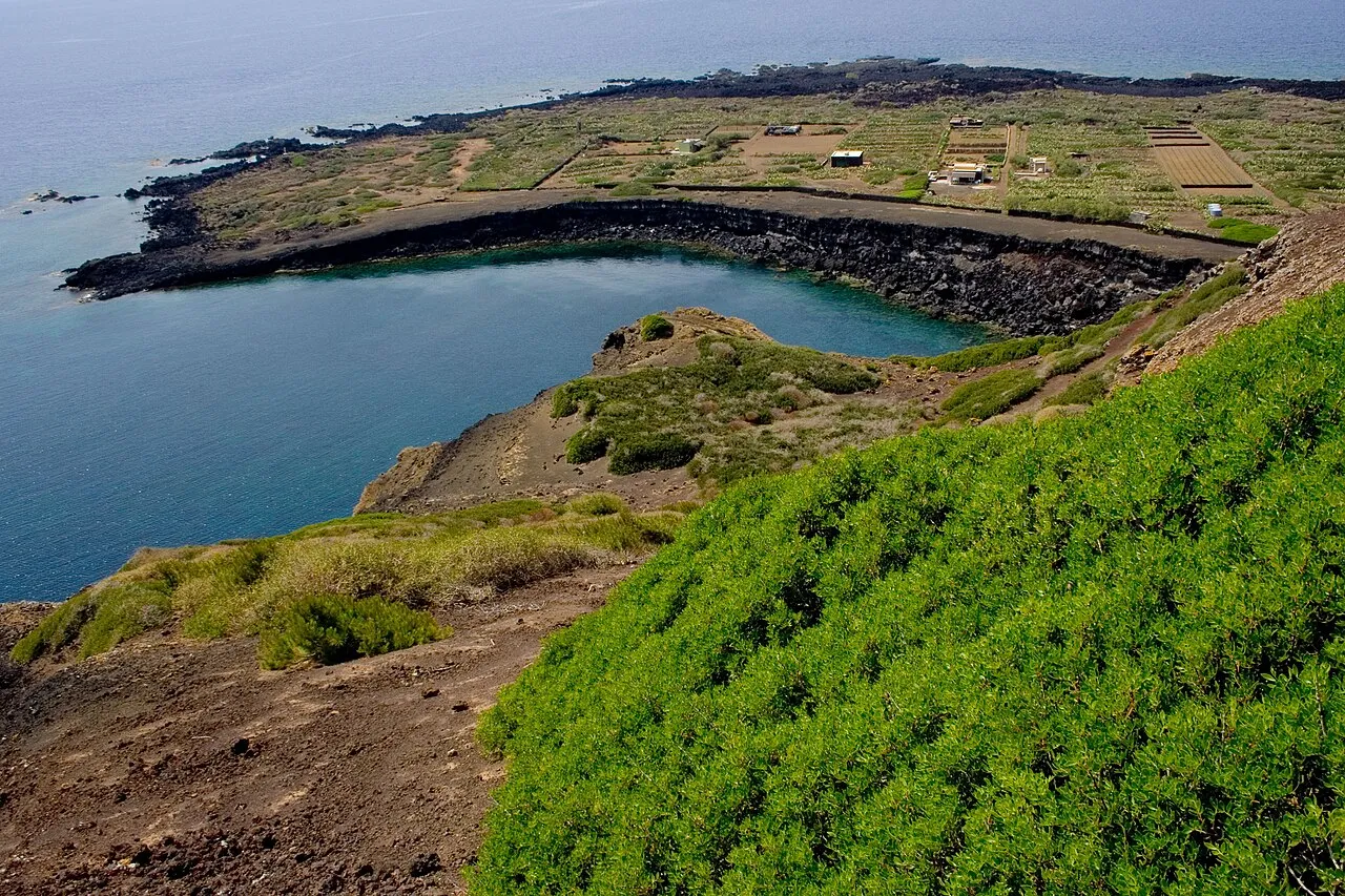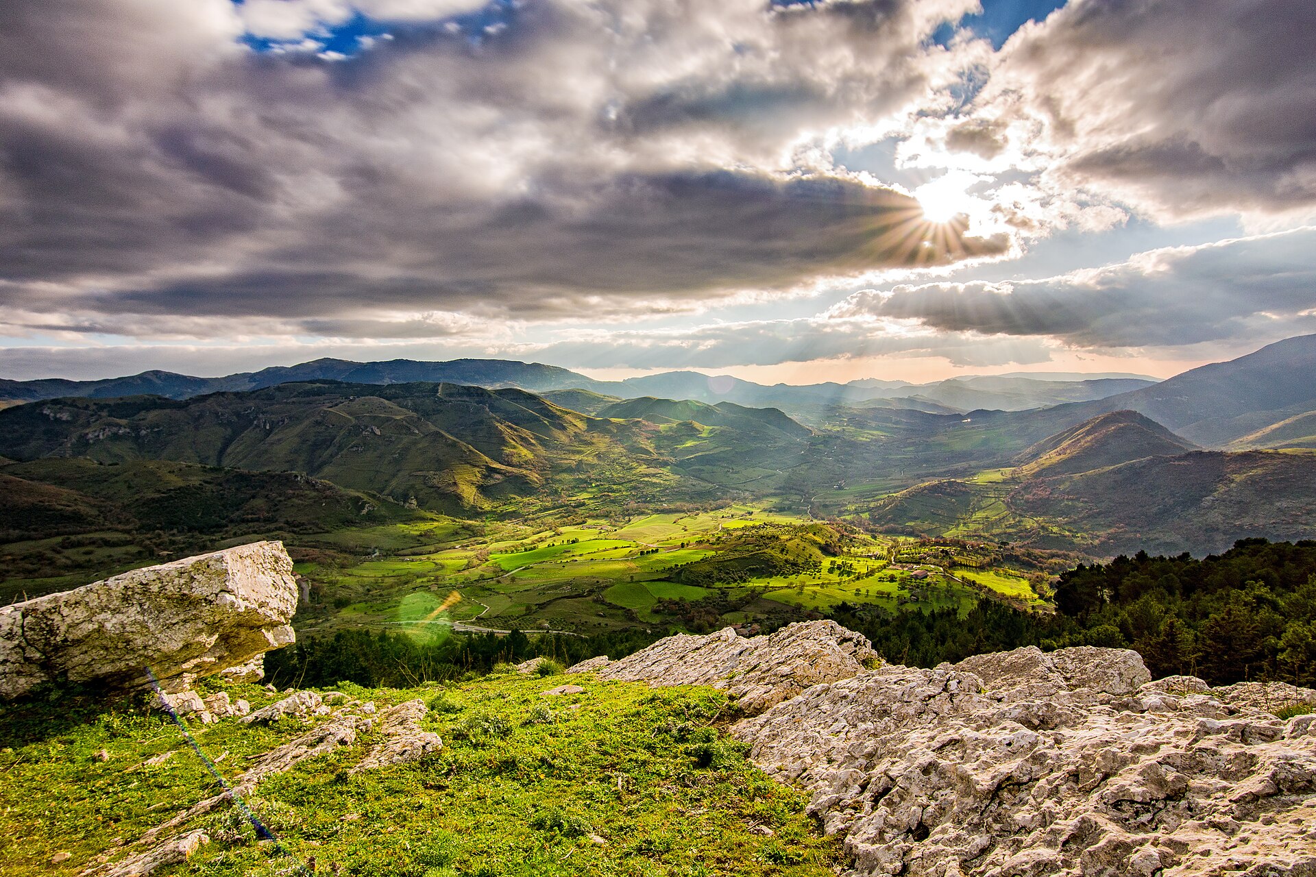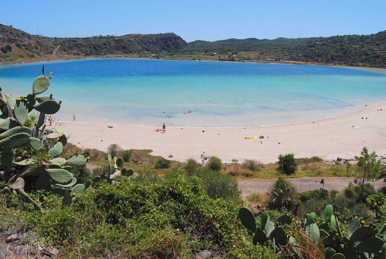

Italy · Terrestrial
Pantelleria National Park
National park of 6,640 hectares in Italy, established in 2016.
Overview
National park of 6,640 hectares in Italy, established in 2016.
Pantelleria National Park is located in Italy (Europe). It is a predominantly terrestrial area. Established in 2016, it covers about 6,640 hectares.
Protections and designations
Natura 2000 · habitats (SAC) · 2 sites
Natura 2000 · birds (SPA)
Protected as a national park. International labels and designations: Natura 2000 network (3 sites). Key dates: first Natura 2000 site under the Birds Directive in 2005 and established in 2016.
In our collections
Timeline
-
2005
First Natura 2000 site under the Birds Directive
-
2016
Established
Sources: Wikidata (CC0) for establishment and international labels; EEA Natura 2000 database (CC-BY 4.0) for site designation dates.
Frequently asked questions
Where is Pantelleria National Park?
In Italy (Europe). Representative point: 36.7908° N, 11.9939° E.
How large is Pantelleria National Park?
About 6,640 hectares (66 km²). It is the 24th largest of the 26 national parks in Italy covered by Parkavela.
When was Pantelleria National Park established?
In 2016.
What habitats and landscapes does Pantelleria National Park include?
A terrestrial area, with mountains.
What rocks lie beneath Pantelleria National Park?
According to the European 1:1 million geological map (EGDI), the bedrock consists mainly of rhyolites (94% of sampled points). These are mostly igneous rocks. The geological units date mainly from the Neogene (94% of sampled points).
What is the highest point of Pantelleria National Park?
Montagna Grande, at 836 m (OpenStreetMap).
What are the main summits of Pantelleria National Park?
Montagna Grande (836 m), Monte Gibéle (710 m), Kúddia Mída (592 m), Kúddia Attalóra (558 m) and Fossa del Russo (474 m) (OpenStreetMap).
Which international labels apply to Pantelleria National Park?
Natura 2000 network (3 sites).
When is the best time to visit Pantelleria National Park?
Best time to visit: from March to August, with average temperatures of 10 to 23 °C and moderate rainfall.
What is there to see in Pantelleria National Park?
58 viewpoints, 2 lakes and ponds and 6 caves, including Lago Specchio di Venere, Bagno Asciutto di Benikulà, Riserva Idrica di Montagna Grande and Grotta dei Briganti (OpenStreetMap).
Can you swim in Pantelleria National Park?
6 monitored bathing sites lie in or within 1 km of the site; official 2025 classification: 4 excellent (European Environment Agency). Swimming is only permitted at the sites and times authorised locally.
What is the nearest airport to Pantelleria National Park?
Nearest airport: Pantelleria (PNL), less than 1 km away.
Where can I get visitor information on site?
Info Point Punta Spadillo and Pantelleria tourism information.
Are there waymarked hiking trails in Pantelleria National Park?
Yes. Waymarked hiking routes listed in OpenStreetMap: 22. The “972” route runs for about 13 km through the site, with some 870 m of ascent on its longest section.
Which species can be seen in Pantelleria National Park?
Among the species most often recorded on GBIF are Hebeloma cistophilum, Cortinarius belleri, Penicillium melinii and Suillus bellini.
What is the official website of Pantelleria National Park?
© OpenStreetMap
Download the boundary: GeoJSON · GPX Boundary © OpenStreetMap contributors (ODbL).
Geography
The representative point of the site lies at around 520 m above sea level. Over the 1996–2025 period, the mean annual temperature is about 15.7 °C and total precipitation reaches roughly 490 mm per year. The warmest month is usually August, the coolest February, and the wettest October. According to the European 1:1 million geological map (EGDI), the bedrock consists mainly of rhyolites (94% of sampled points). These are mostly igneous rocks. The geological units date mainly from the Neogene (94% of sampled points).
Area
- Area
- 6,640 ha
- Elevation
- 520 m
- Median elevation
- 230 m
- Mean slope
- 11°
- Coordinates
- 36.7908, 11.9939
Terrain: Mapzen Terrain Tiles (SRTM, USGS)
Bedrock
- Rhyolites 94 %
- Andesites and dacites 6 %
Igneous rocks 100 % · Main age: Neogene (94%)
Source: EGDI 1:1M geological map (EuroGeoSurveys and national geological surveys), CC BY 4.0 · 16 sampled points within the site.
Main summits
- Montagna Grande836 m
- Monte Gibéle710 m
- Kúddia Mída592 m
- Kúddia Attalóra558 m
- Fossa del Russo474 m
- Kúddia del Moro442 m
- Kúddie Patíte429 m
- Kúddia del Gallo423 m
- Kúddia Randázzo415 m
- Kúddia di Muéggen344 m
Data © OpenStreetMap contributors (ODbL)
Climate
● Mean temperature (°C) · ▮ Precipitation (mm)
Source: Copernicus ERA5 (C3S, doi:10.24381/cds.f17050d7), monthly averages 1996–2025 interpolated to the representative point, temperatures adjusted for elevation.
Contains modified Copernicus Climate Change Service information 2026. Neither the European Commission nor ECMWF is responsible for any use that may be made of the Copernicus information or data it contains.
Natural habitats
According to CORINE Land Cover (2018), the site is mainly made up of farmland (57%), forests (23%) and Mediterranean scrub (12%). Woodland is mostly coniferous. Elevation ranges from sea level to 836 m (highest point: Montagna Grande). The 3 Natura 2000 sites overlapping the area list 15 habitats of European interest (3 priority), the most extensive being pseudo-steppe with grasses and annuals of the Thero-Brachypodietea, Thermo-Mediterranean and pre-desert scrub and Quercus ilex and Quercus rotundifolia forests.
Biodiversity
Based on occurrences aggregated by GBIF, several species are regularly recorded within the site. Among the most frequent are Hebeloma cistophilum, Cortinarius belleri, Penicillium melinii and Suillus bellini. The full list of documented taxa is shown below. The overlapping Natura 2000 sites list 53 species of European interest: 46 birds, 2 mammals, 3 reptiles, 1 invertebrate and 1 plant.
Habitats of European interest
From the official forms of the 3 Natura 2000 sites overlapping the area (areas reported for each whole site).
- Pseudo-steppe with grasses and annuals of the Thero-Brachypodietea priority 1,490 ha
- Thermo-Mediterranean and pre-desert scrub 1,317 ha
- Quercus ilex and Quercus rotundifolia forests 949 ha
- Mediterranean pine forests with endemic Mesogean pines 469 ha
- Vegetated sea cliffs of the Mediterranean coasts with endemic Limonium spp. 166 ha
- Salicornia and other annuals colonizing mud and sand 35 ha
- Coastal lagoons priority 20 ha
- Reefs 10 ha
and 7 more
Species of European interest
Birds · 46
Common Sandpiper (Actitis hypoleucos) passage, Mallard (Anas platyrhynchos) passage, Pallid Swift (Apus pallidus) passage, Grey Heron (Ardea cinerea) passage, Purple Heron (Ardea purpurea) passage, Common Pochard (Aythya ferina) passage, Common Buzzard (Buteo buteo) passage, Greater Short-toed Lark (Calandrella brachydactyla) passage, Little Stint (Calidris minuta) passage, Ruff (Calidris pugnax) passage, Scopoli's Shearwater (Calonectris diomedea) resident, Little Ringed Plover (Charadrius dubius) passage and 34 more
Mammals · 2
Mediterranean Monk Seal (Monachus monachus), Lesser horseshoe bat (Rhinolophus hipposideros)
Reptiles · 3
Ocellated skink (Chalcides ocellatus), Horseshoe Whip Snake (Hemorrhois hippocrepis), Hermann's tortoise (Testudo hermanni)
Invertebrates · 1
Myrmecophilus baronii
Plants · 1
Source: Natura 2000 standard data forms (EEA, CC-BY 4.0). Not exhaustive: sensitive species are not published.
Species to look out for


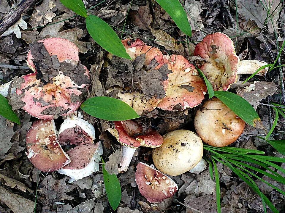

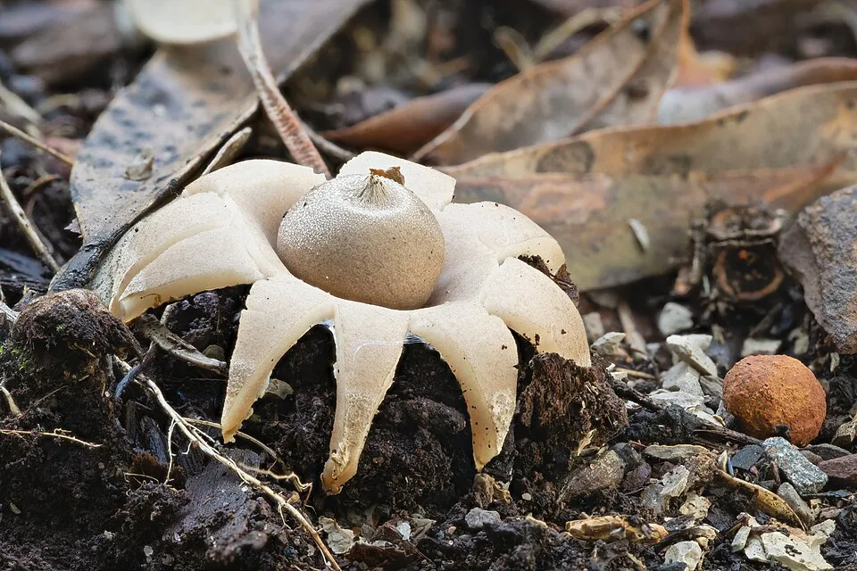
Fungus
Collared Earthstar
Geastrum triplex199 records © JJ Harrison (https://www.jjharrison.com.au/) · CC BY-SA 4.0
Observed species
Occurrences documented via GBIF; they are neither an exhaustive inventory nor proof of current presence.
- Hebeloma cistophilum · 909
- Cortinarius belleri · 520
- Penicillium melinii · 512
- Suillus bellini · 504
- Neurospora terricola · 442
- Russula recondita · 390
- Golden Chanterelle · Craterellus lutescens · 368
- Tricholoma squarrulosum · 319
- Russula nympharum · 309
- Thelephora atra · 295
- Red-cracking Bolete · Xerocomellus chrysenteron · 273
- Russula maculata · 252
+18 more species
- Cortinarius casimirii · 247
- Russula anatina · 247
- Mallocybe arenaria · 235
- Collared Earthstar · Geastrum triplex · 199
- Russula hortensis · 189
- Fruity Brittlegill · Russula queletii · 183
- Brawny Brittlegill · Russula torulosa · 182
- Knufia peltigerae · 164
- Umbelopsis isabellina · 156
- Mortierella rishikesha · 150
- Variable Brittlegill · Russula versicolor · 149
- Exophiala equina · 144
- Tuber melosporum · 140
- Saitozyma podzolica · 138
- Dothiora viticola · 134
- Persistent Waxcap · Hygrocybe acutoconica · 134
- Russula pseudoaeruginea · 129
- Tomentella fuscocinerea · 128
Records: GBIF.org (CC-BY). Names: Wikidata (CC0), GBIF. Photos: Wikimedia Commons.
Conservation challenges
The primary purpose of the site is to preserve its natural habitats and the biodiversity they support. The species recorded (Biodiversity tab) reflect its ecological value. The designations it holds frame its management and the control of land use.
According to Global Forest Change data (University of Maryland, Global Forest Watch), about 174 ha of tree cover were lost within the boundary between 2001 and 2023 (3% of its area), peaking in 2013 and 2017. These losses include logging, storms and fires, and do not account for regrowth. According to CORINE Land Cover, land cover here remained almost unchanged between 1990 and 2018 (less than 0.5% of the area affected); only some 6 ha were built over. Since 2016, the European EFFIS system (Copernicus) has mapped 2 fires here, burning about 715 ha within the boundary; the largest, in May 2016 (near Pantelleria), covered 446 ha. At night, 21% of the area gives off artificial light detectable from space (NASA VIIRS Black Marble composite, 2016). Built-up and developed land (buildings, business areas, roads, quarries) covers 4% of the area, and farmland 57% (CORINE Land Cover). According to the Natura 2000 forms, of 10 assessed habitats of European interest, 2 are in excellent condition and 2 in average or reduced condition. Since 2000, 6 invasive alien species have been recorded within the site (GBIF observations), one of them listed as of Union concern under EU Regulation 1143/2014. Among them: Ailanthus altissima (Tree-of-heaven), Nicotiana glauca (Tree tobacco) and Carpobrotus edulis (Hottentot-fig).
Pressure indicators
Tree cover lost
174 ha
2001–2023 · 3% of the area
20012023
Fires since 2016
715 ha
burned within the boundary (2 mapped fires)
- 2016 · Pantelleria · 446 ha
- 2016 · Pantelleria · 269 ha
Light at night
21%
of the area gives off artificial light visible from space
DarkLit
Built-up land
4%
buildings, business areas, roads, quarries · farmland 57%
Land cover change
< 0.5%
of the area changed, 1990–2018 · CORINE
Invasive alien species
6
incl. 1 of EU concern · since 2000
 Tree-of-heavenEU
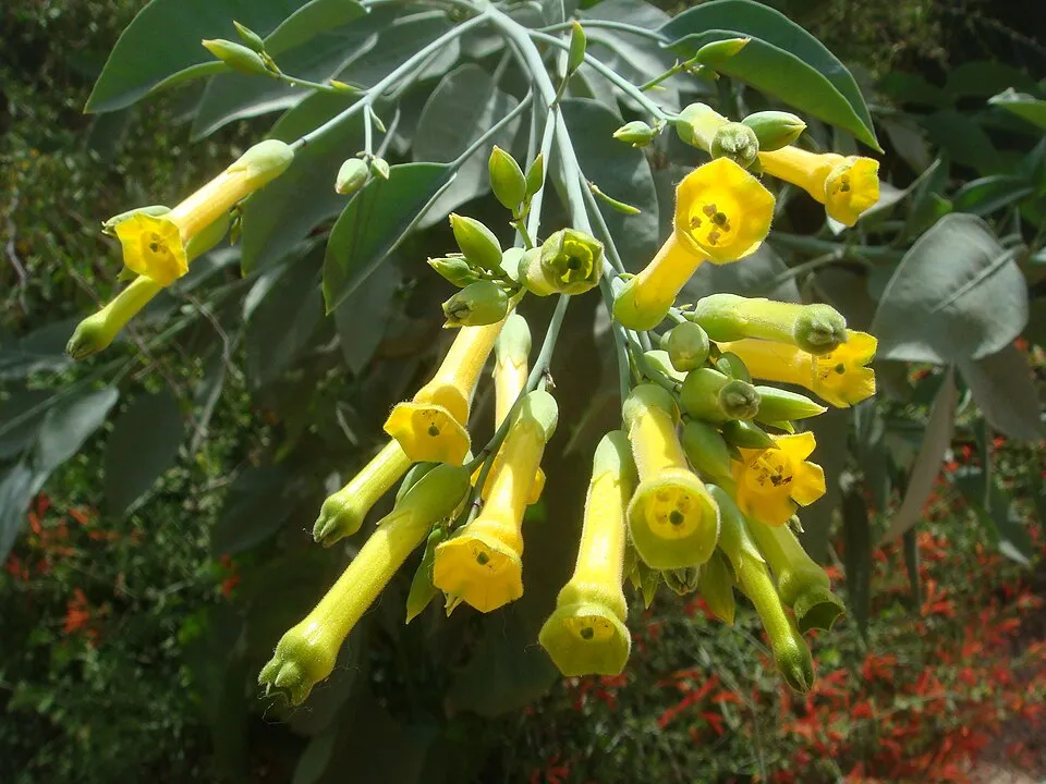 Tree tobacco
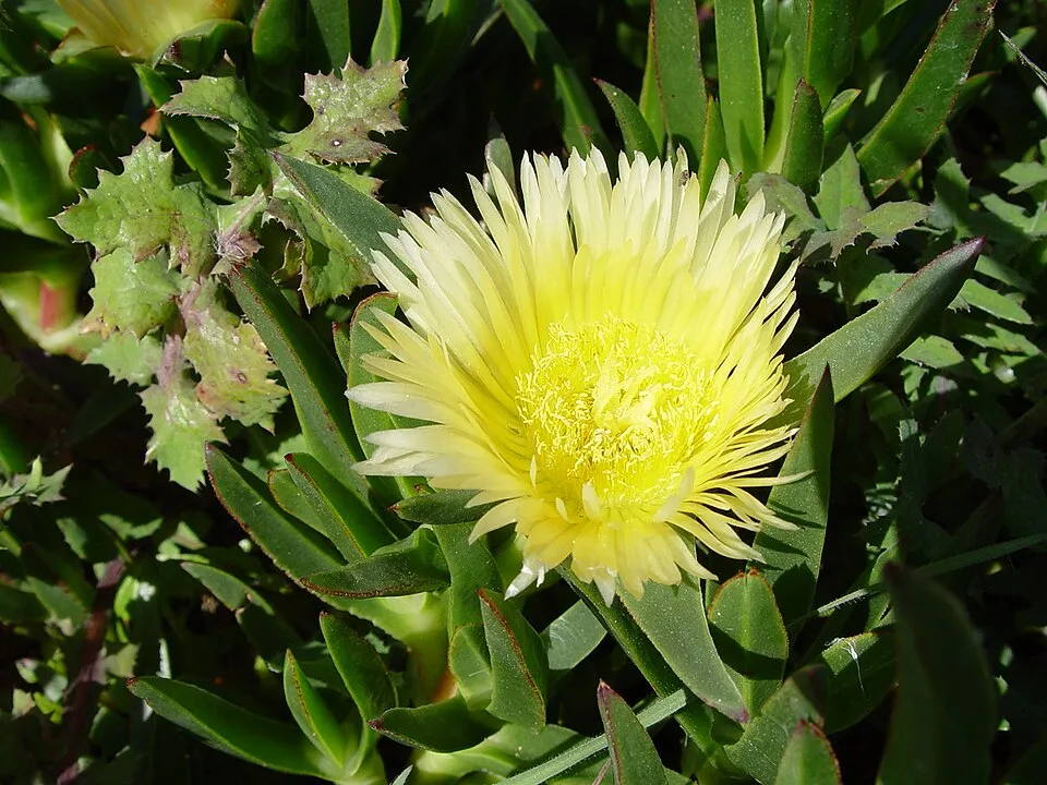 Hottentot-fig
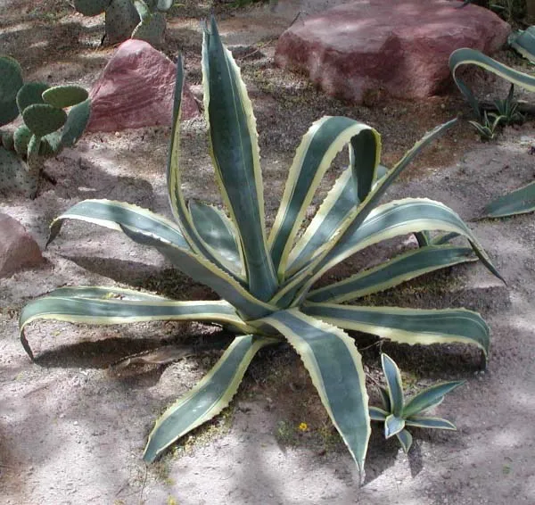 American century plant
 Bermuda buttercup
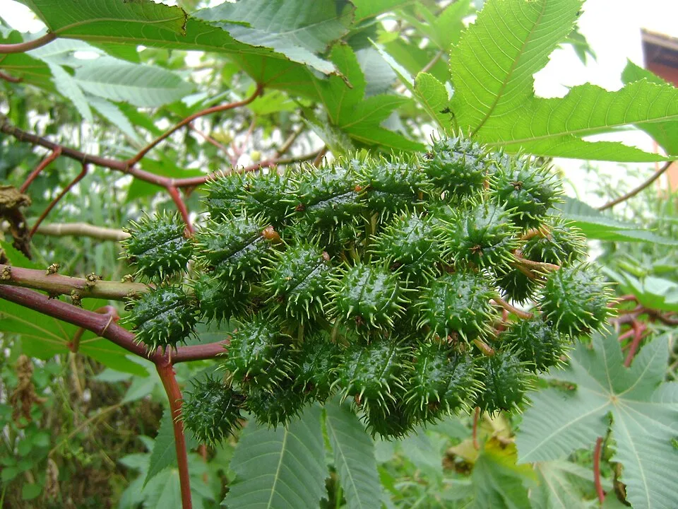 Castor oil plant
Photos: Tree-of-heaven © Darkone · CC BY-SA 2.5; Tree tobacco © Miwasatoshi · CC BY-SA 4.0; Hottentot-fig © Taken by Carsten Niehaus (user:Lumbar). · CC BY-SA 3.0; American century plant © Stan Shebs · CC BY-SA 3.0; Bermuda buttercup © MathKnight and Zachi Evenor אביר המתמטיקה וצחי אבנור · CC BY-SA 4.0; Castor oil plant © Onjacktallcuca · Public domain
Sources: Global Forest Change (Hansen et al., University of Maryland, via Global Forest Watch, CC-BY 4.0); EFFIS, European Commission / Copernicus; NASA Black Marble 2016 (public domain); CORINE Land Cover 2018 (Copernicus) or MODIS.
CORINE Land Cover Change 1990–2018: generated using European Union's Copernicus Land Monitoring Service information (EEA), aggregated by Parkavela; DOI 10.2909/f30f1000-7cf8-43bb-872c-5eb093911b24.
Invasive alien species: Global Register of Introduced and Invasive Species (ISSG, CC BY 4.0); Union list, Regulation (EU) 1143/2014 (INBO, CC0); GBIF.org records (CC0 / CC BY 4.0), at least 2 per species.
Practical information
Cities and airport
- Airport: Pantelleria (PNL)
< 1 km as the crow flies
Visitor information
- Info Point Punta Spadillo
within the site - Pantelleria tourism information
2 km from the site boundary
Parking
38 public car parks listed within the site
La PergolaKhattibuale - discesa a mareParcheggio di Punta Spadillo
Things to see
58 viewpoints · 2 lakes and ponds · 6 caves
- Lago Specchio di Venere
lake or pond - Bagno Asciutto di Benikulà
cave - Riserva Idrica di Montagna Grande
lake or pond - Grotta dei Briganti
cave - Grotta del Freddo
cave
Hiking
22 waymarked routes listed
Trail difficulty
- T1 · easy hiking · 5% · 1 km
- T2 · mountain hiking · 95% · 17 km
18 km graded out of 51 km of paths
SAC scale (T1–T6) © OpenStreetMap contributors (ODbL): indicative only, check with the park.
Data © OpenStreetMap contributors (ODbL) · Wikidata (CC0)
Waymarked hiking routes
975 Bagno Asciutto di Benikulá - Favara Grande - Tráçino
8.3 km within the site ↗ 354 m↘ 160 m 169–453 m
Tracks © OpenStreetMap contributors (ODbL), clipped to the boundary; elevation gain and profiles computed on the longest section from Mapzen Terrain Tiles (≈ 30 m), indicative only.
Bathing
6 monitored bathing sites in or within 1 km of the site · 2025 classification
Excellent · 4
Not classified · 2
- Cala di Gadir · sea · Excellent
- Cala di Levante · sea · Excellent
- Cala di Modica · sea · Excellent
- Porticello di Campobello · sea · Excellent
- Punte Tre Pietre · sea · Not classified
- Scalo S.gaetano · sea · Not classified
Source: European Environment Agency, official bathing water classification (Directive 2006/7/EC, CC-BY 4.0). Swimming is only permitted at the sites and times authorised locally.
Access and visiting
Nearest airport: Pantelleria (PNL), less than 1 km away. Fewer than 5,000 people live within 20 km of the site boundary, a very sparsely populated area; some 2,300 people are estimated to live inside (GHSL estimate, 2020). Visitor information on site: Info Point Punta Spadillo and Pantelleria tourism information. Public car parks listed within the site: 38, including La Pergola, Khattibuale - discesa a mare and Parcheggio di Punta Spadillo. Waymarked hiking routes listed in OpenStreetMap: 22. Of the roughly 20 km of paths with a difficulty grade in OpenStreetMap, 5% are easy hiking (T1) and 95% mountain hiking (T2). This is indicative only: check with the park. To see: 58 viewpoints, 2 lakes and ponds and 6 caves, including Lago Specchio di Venere, Bagno Asciutto di Benikulà, Riserva Idrica di Montagna Grande and Grotta dei Briganti. To plan a visit (access, opening periods, visitor rules), it is best to consult the official information from the managing body and the official website listed in this page's sources.
Source: OpenStreetMap (ODbL), Wikidata (CC0), October 2026.
When to visit
Best time to visit: from March to August, with average temperatures of 10 to 23 °C and moderate rainfall. Day length ranges from about 9 h 39 min in December to 14 h 40 min in June. Wildlife records published on GBIF peak for birds (May) and plants (November). These peaks also reflect when observers are most active.
Source: Copernicus ERA5 (C3S), monthly averages 1996–2025 at the representative point, temperatures adjusted for elevation.
Contains modified Copernicus Climate Change Service information 2026. Neither the European Commission nor ECMWF is responsible for any use that may be made of the Copernicus information or data it contains.
Wildlife records calendar
JFMAMJJASOND
Birds
Plants
Butterflies & moths
Monthly records published on GBIF (CC-BY), relative to the busiest month; also reflects observer activity.
Gallery
© mauro from PAVIA, ITALIA · CC BY 2.0
© Giorgio Galeotti · CC BY 4.0
© Michael Leithold · Public domain
© Luca Conti · CC BY 2.0
© Gino Roncaglia · CC BY 2.0
© Luca Conti · CC BY 2.0
Sources and licences
- Wikidata: Q26736078
- OpenStreetMap: relation 5826011
- Official website: https://www.parconazionalepantelleria.it
- Wikipedia: en.wikipedia.org/wiki/Pantelleria_National_Park
- WDPA: 555641769
References
- cds.climate.copernicus.eu: climate · CC-BY-4.0
- registry.opendata.aws: elevation of the reference point, detailed relief · PD
- land.copernicus.eu: land cover, land cover change, sea share · COPERNICUS
- doi.org: population around the site · CC-BY-4.0
- wikidata.org: official area, establishment date, protected heritage, official name, nearby cities and airport, access and peaks, lake depths, places to see, official website · CC0-1.0
- eea.europa.eu: bathing water quality, ecological status of waters · CC-BY-4.0
- en.eurovelo.com: EuroVelo cycle routes · ODbL-1.0
- cycling.waymarkedtrails.org: cycle routes · ODbL-1.0
- opentopodata.org: elevations · PD
- forest-fire.emergency.copernicus.eu: wildfires · COPERNICUS
- globalforestwatch.org: tree cover loss · CC-BY-4.0
- gbif.org: seasonality of sightings, invasive alien species, observed species · CC-BY-4.0
- europe-geology.eu: geology · CC-BY-4.0
- hydrosheds.org: lakes · CC-BY-4.0
- natura2000.eea.europa.eu: Natura 2000 habitats and species · CC-BY-4.0
- earthobservatory.nasa.gov: night light · PD
- openstreetmap.org: access and peaks, places to see, trail difficulty, wheelchair access · ODbL-1.0
- hiking.waymarkedtrails.org: route difficulty · ODbL-1.0
- nsidc.org: snow cover · PD
- wikidata.org: Wikipedia article · CC-BY-SA-4.0
Data © OpenStreetMap contributors (ODbL), Wikidata (CC0) and the sources cited.