Italy · Terrestrial
Sicani Mountains Regional Park
Regional nature park of 43,687 hectares in Italy.
Overview
Regional nature park of 43,687 hectares in Italy.
Sicani Mountains Regional Park is a regional nature park in Italy (Europe). It is a predominantly terrestrial area. It covers about 43,687 hectares.
Protections and designations
Natura 2000 · habitats (SAC) · 13 sites
- Bosco di S. Adriano ITA020025
- Calanchi, lembi boschivi e praterie di Riena ITA020022
- La Montagnola e Acqua Fitusa ITA040011
- Monte Cammarata - Contrada Salaci ITA040005
- Monte Carcaci, Pizzo Colobria e ambienti umidi ITA020034
- Monte d'Indisi, Montagna dei Cavalli, Pizzo Pontorno e Pian del Leone ITA020031
- and 7 more
Natura 2000 · birds (SPA) · 6 sites
- Calanchi, lembi boschivi e praterie di Riena ITA020022
- Monte Cammarata - Contrada Salaci ITA040005
- Monte d'Indisi, Montagna dei Cavalli, Pizzo Pontorno e Pian del Leone ITA020031
- Monti Sicani, Rocca Busambra e Bosco della Ficuzza ITA020048
- Pizzo della Rondine, Bosco di S. Stefano Quisquina ITA040007
- Rocche di Castronuovo, Pizzo Lupo, Gurghi di S. Andrea ITA020011
Protected as a regional nature park. International labels and designations: Natura 2000 network (14 sites).
In our collections
Frequently asked questions
Where is Sicani Mountains Regional Park?
In Italy (Europe). Representative point: 37.6498° N, 13.4184° E.
How large is Sicani Mountains Regional Park?
About 43,687 hectares (437 km²). It is the 10th largest of the 128 regional parks in Italy covered by Parkavela.
What habitats and landscapes does Sicani Mountains Regional Park include?
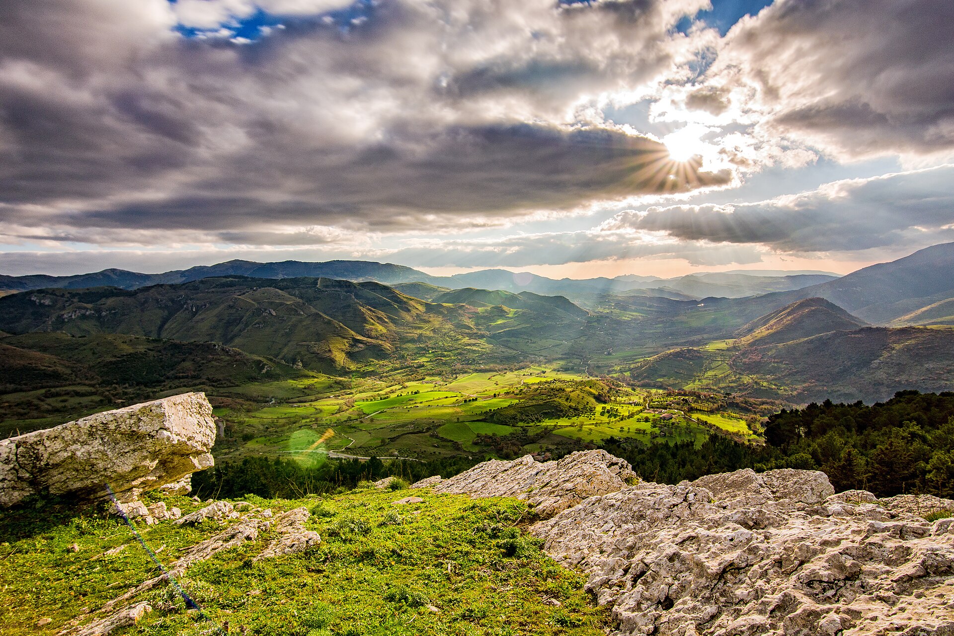
A terrestrial area, with mountains.
What rocks lie beneath Sicani Mountains Regional Park?
According to the European 1:1 million geological map (EGDI), the bedrock consists mainly of limestones (69% of sampled points) and marly limestones (19%). These are mostly sedimentary rocks. The geological units date mainly from the Triassic (38% of sampled points).
What is the highest point of Sicani Mountains Regional Park?
Monte Cammarata, at 1,578 m (OpenStreetMap).
What are the main summits of Sicani Mountains Regional Park?
Monte Cammarata (1,578 m), Monte Rose (1,436 m), Monte Gemini (1,397 m), Monte Pernice (1,363 m) and Pizzo dello Spagnolo (1,352 m) (OpenStreetMap).
Which international labels apply to Sicani Mountains Regional Park?
Natura 2000 network (14 sites).
When is the best time to visit Sicani Mountains Regional Park?
Best time to visit: from May to October, with average temperatures of 11 to 20 °C and moderate rainfall.
What is there to see in Sicani Mountains Regional Park?
6 viewpoints, 1 waterfall, 7 lakes and ponds and 2 caves, including Punto panoramico Kassar, Cascata di Montescuro, Fontana del Fico and 1° Grotta Stagnataro (OpenStreetMap).
Where can I stay in Sicani Mountains Regional Park?
5 mountain huts, including Primo Rifugio, Rifugio Campello and Rifugio Forestale Serra Canale (OpenStreetMap).
Are there historic monuments in Sicani Mountains Regional Park?
Yes. According to Wikidata, 8 monuments protected as Italian national cultural heritage stand within the boundary. For example: “Castello della Gristia” in Burgio, “Monte Adranone” in Sambuca di Sicilia and “Pietra Salamone” in Palazzo Adriano.
What is the nearest large city to Sicani Mountains Regional Park?
Nearest towns of over 50,000 people, as the crow flies: Agrigento (29 km) and Caltanissetta (36 km). Nearest airport: Falcone–Borsellino (PMO), about 50 km away.
How can I reach Sicani Mountains Regional Park by train?
The nearest railway station is Cammarata-San Giovanni Gemini, about 1 km from the site boundary.
Where can I get visitor information on site?
Ufficio Informazioni.
Are there waymarked hiking trails in Sicani Mountains Regional Park?
Yes. Waymarked hiking routes listed in OpenStreetMap: 31, including Magna Via Francigena and Itinerarium Rosaliae. The “ROS 2B · Itinerarium Rosaliae - Tappa 2B” route runs for about 19 km through the site, with some 620 m of ascent on its longest section.
Which species can be seen in Sicani Mountains Regional Park?
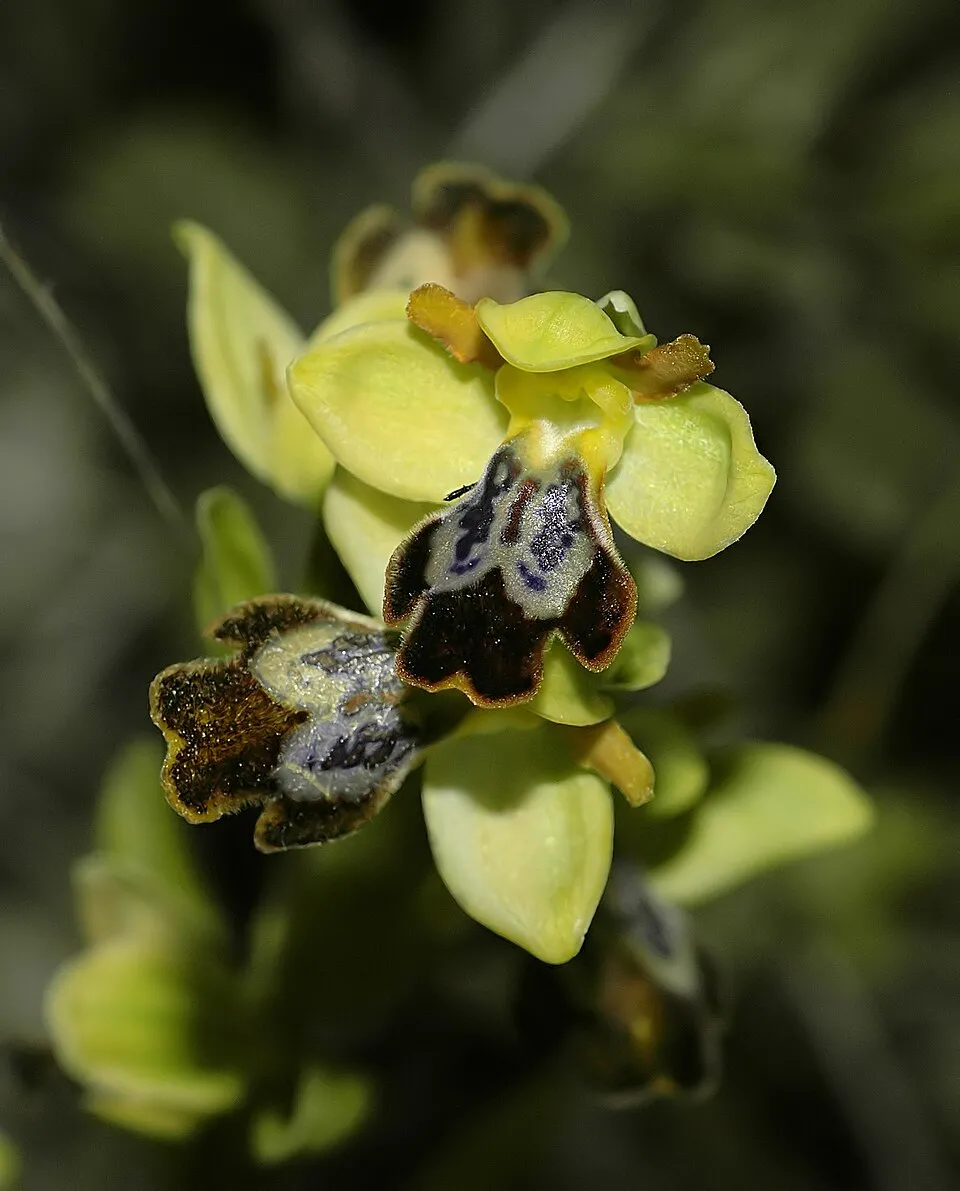
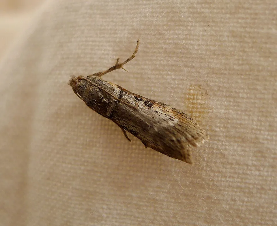
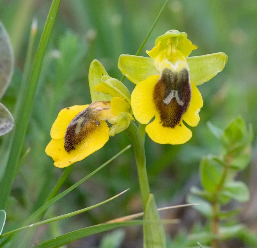
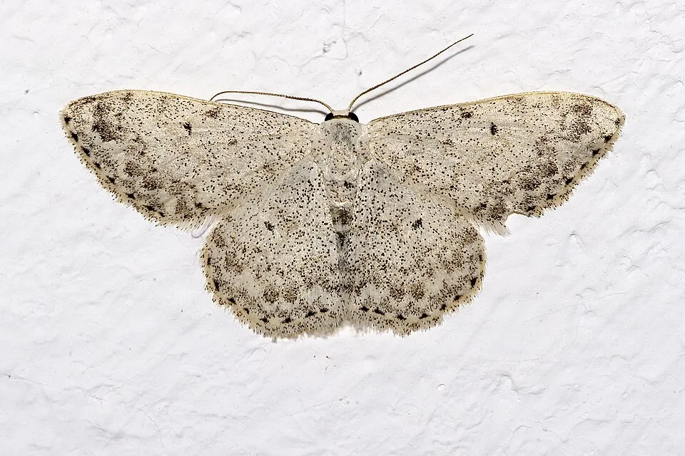
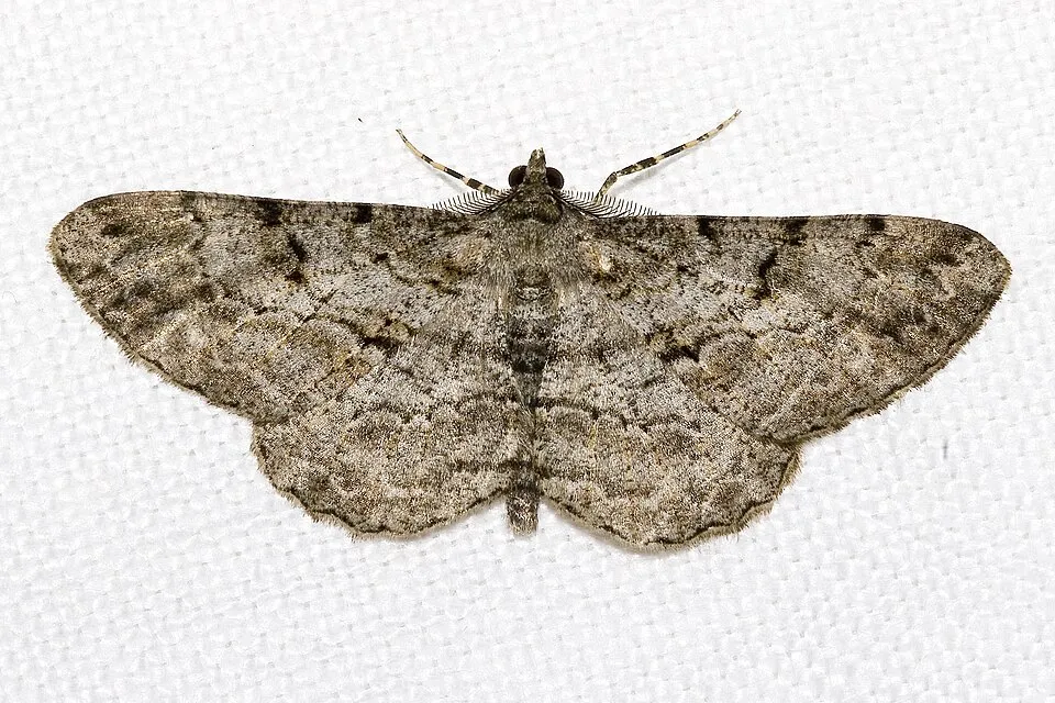
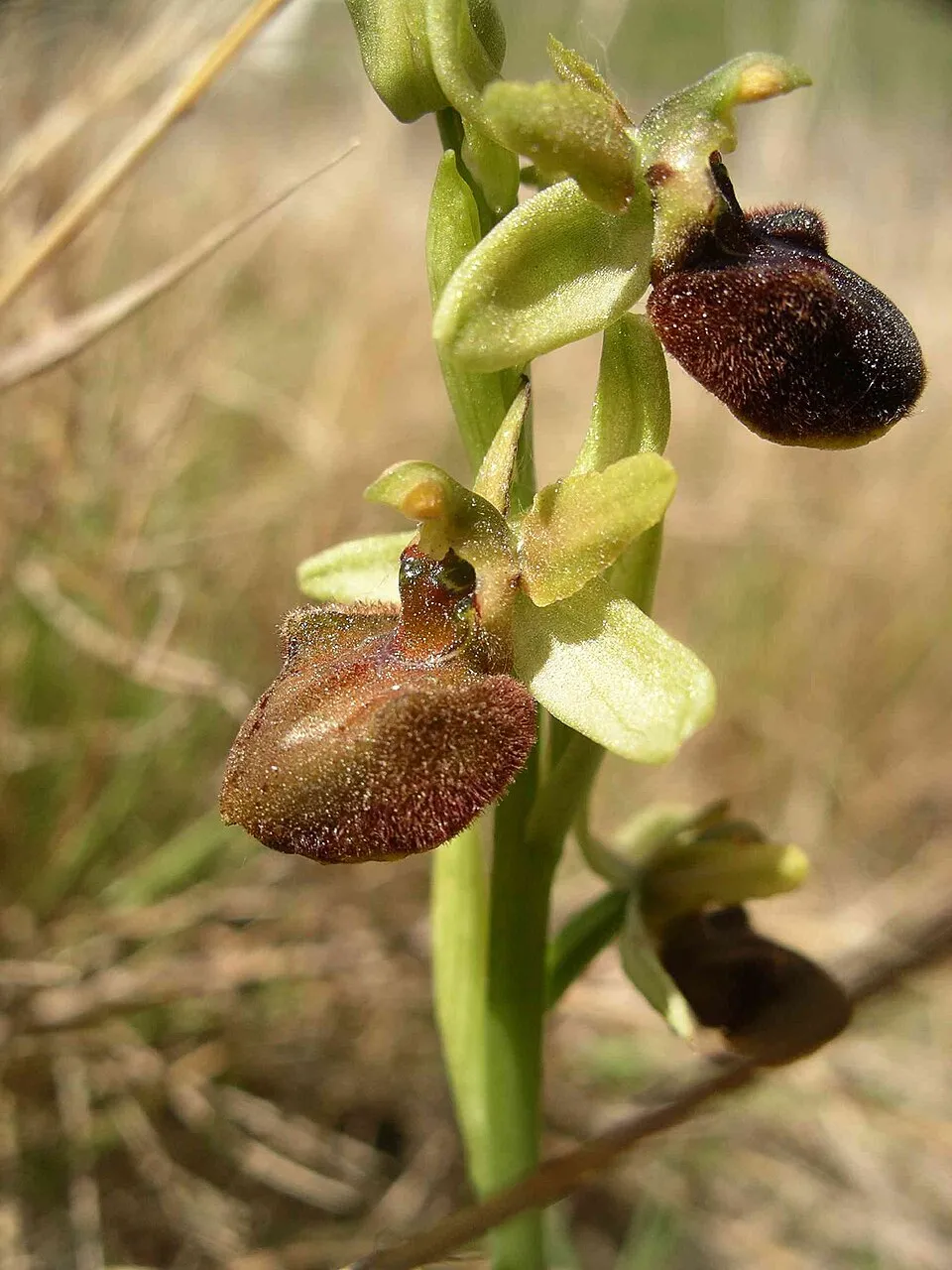
Among the species most often recorded on GBIF are Ophrys fusca (Dark bee orchid), Lamoria anella, Ophrys lutea (Yellow Ophrys) and Scopula marginepunctata (Mullein Wave).
© OpenStreetMap
Download the boundary: GeoJSON · GPX Boundary © OpenStreetMap contributors (ODbL).
Geography
The representative point of the site lies at around 1,358 m above sea level. Over the 1996–2025 period, the mean annual temperature is about 10.4 °C and total precipitation reaches roughly 611 mm per year. The warmest month is usually July, the coolest January, and the wettest October. According to the European 1:1 million geological map (EGDI), the bedrock consists mainly of limestones (69% of sampled points) and marly limestones (19%). These are mostly sedimentary rocks. The geological units date mainly from the Triassic (38% of sampled points). The site contains 3 lakes larger than 10 ha, totalling 94 ha of water; the largest, lago di Prizzi, covers 36 ha (HydroLAKES). lago Fanaco is 48 m deep (Wikidata).
Area
- Area
- 43,687 ha
- Elevation
- 1,358 m
- Median elevation
- 809 m
- Mean slope
- 14°
- Lakes over 10 ha
- 3 (94 ha)
- Coordinates
- 37.6498, 13.4184
Terrain: Mapzen Terrain Tiles (SRTM, USGS) · Lakes: HydroLAKES (Messager et al. 2016, hydrosheds.org, CC BY 4.0) · depths: Wikidata (CC0)
Elevation bands
- below 500 m 13%
- 500–1,000 m 71%
- 1,000–1,500 m 17%
share of the site in each elevation band (smoothed terrain model: summits are rounded off) · Terrain: Mapzen Terrain Tiles (SRTM, USGS)
Bedrock
- Limestones 69 %
- Marly limestones 19 %
- Carbonate rocks 6 %
- Basalts 6 %
Sedimentary rocks 94 % · Igneous rocks 6 % · Main age: Triassic (38%)
Source: EGDI 1:1M geological map (EuroGeoSurveys and national geological surveys), CC BY 4.0 · 16 sampled points within the site.
Main summits
- Monte Cammarata1,578 m
- Monte Rose1,436 m
- Monte Gemini1,397 m
- Monte Pernice1,363 m
- Pizzo dello Spagnolo1,352 m
- Monte Scuro1,301 m
- Pizzo della Rondine1,246 m
- Pizzo Gallinaro1,217 m
- Monte Colomba1,197 m
- Monte Carcaci1,194 m
Data © OpenStreetMap contributors (ODbL)
Climate
● Mean temperature (°C) · ▮ Precipitation (mm)
Source: Copernicus ERA5-Land (C3S, doi:10.24381/cds.68d2bb30), monthly averages 1996–2025 interpolated to the representative point, temperatures adjusted for elevation.
Contains modified Copernicus Climate Change Service information 2026. Neither the European Commission nor ECMWF is responsible for any use that may be made of the Copernicus information or data it contains.
Natural habitats
According to CORINE Land Cover (2018), the site is mainly made up of farmland (46%), forests (27%) and Mediterranean scrub (13%). Woodland is mostly coniferous. Elevation ranges from about 220 m to 1,578 m (highest point: Monte Cammarata). Median elevation is 809 m, and 17% of the site lies above 1,000 m (SRTM elevation model). The 14 Natura 2000 sites overlapping the area list 18 habitats of European interest (4 priority), the most extensive being Thermo-Mediterranean and pre-desert scrub, pseudo-steppe with grasses and annuals of the Thero-Brachypodietea and Quercus ilex and Quercus rotundifolia forests.
Biodiversity
Based on occurrences aggregated by GBIF, several species are regularly recorded within the site. Among the most frequent are Ophrys fusca (Dark bee orchid), Lamoria anella, Ophrys lutea (Yellow Ophrys) and Scopula marginepunctata (Mullein Wave). The full list of documented taxa is shown below. The overlapping Natura 2000 sites list 50 species of European interest: 28 birds, 5 mammals, 6 reptiles, 2 amphibians, 2 invertebrates and 7 plants.
Habitats of European interest
From the official forms of the 14 Natura 2000 sites overlapping the area (areas reported for each whole site).
- Thermo-Mediterranean and pre-desert scrub 4,409 ha
- Pseudo-steppe with grasses and annuals of the Thero-Brachypodietea priority 3,523 ha
- Quercus ilex and Quercus rotundifolia forests 3,052 ha
- Eastern white oak woods priority 2,717 ha
- Lowland hay meadows (Alopecurus pratensis, Sanguisorba officinalis) 2,535 ha
- Western Mediterranean and thermophilous scree 232 ha
- Calcareous rocky slopes with chasmophytic vegetation 201 ha
- Salix alba and Populus alba galleries 119 ha
and 10 more
Species of European interest
Birds · 28
Eurasian Skylark (Alauda arvensis) breeding, Rock Partridge (Alectoris graeca whitakeri) resident, Tawny Pipit (Anthus campestris) breeding, Golden Eagle (Aquila chrysaetos) resident, Bonelli's Eagle (Aquila fasciata) resident, Greater Short-toed Lark (Calandrella brachydactyla) breeding, European Nightjar (Caprimulgus europaeus) resident passage, Hen Harrier (Circus cyaneus) passage wintering, Pallid Harrier (Circus macrourus) passage, Montagu's Harrier (Circus pygargus) passage, European Roller (Coracias garrulus) breeding, Common Quail (Coturnix coturnix) breeding and 16 more
Mammals · 5
European wildcat (Felis silvestris), Crested porcupine (Hystrix cristata), European pine marten (Martes martes), Common bent-wing bat (Miniopterus schreibersii), Greater mouse-eared bat (Myotis myotis)
Reptiles · 6
Ocellated skink (Chalcides ocellatus), Smooth snake (Coronella austriaca), Sicilian pond turtle (Emys trinacris), Sicilian Wall Lizard (Podarcis waglerianus), Hermann's tortoise (Testudo hermanni), Italian Aesculapian Snake (Zamenis lineatus)
Invertebrates · 2
Greater Capricorn Beetle (Cerambyx cerdo), Italian goldenring (Cordulegaster trinacriae)
Plants · 7
Dianthus rupicola, Snowdrop (Galanthus nivalis), Leontodon siculus, Moon orchid (Ophrys lunulata), Butcher's-broom (Ruscus aculeatus), Stipa austroitalica, Tripolium sorrentinoi
Source: Natura 2000 standard data forms (EEA, CC-BY 4.0). Not exhaustive: sensitive species are not published.
Species to look out for
Insect
Mullein Wave
Scopula marginepunctata24 records © Please report references to olei@despammed.com · CC BY-SA 2.5
Observed species
Occurrences documented via GBIF; they are neither an exhaustive inventory nor proof of current presence.
- Dark bee orchid · Ophrys fusca · 46
- Lamoria anella · 31
- Yellow Ophrys · Ophrys lutea · 29
- Enteletes tschernyschewi · 24
- Mullein Wave · Scopula marginepunctata · 24
- Willow Beauty · Peribatodes rhomboidaria · 22
- Early spider-orchid · Ophrys sphegodes · 19
- Summer truffle · Tuber aestivum · 17
- Orange Naked Pearl · Achyra nudalis · 16
- Brighton Wainscot · Oria musculosa · 16
- Enteletes subaequivalvis · 15
- Small marbled · Eublemma parva · 14
Records: GBIF.org (CC-BY). Names: Wikidata (CC0), GBIF. Photos: Wikimedia Commons.
Conservation challenges
The primary purpose of the site is to preserve its natural habitats and the biodiversity they support. The species recorded (Biodiversity tab) reflect its ecological value. The designations it holds frame its management and the control of land use.
According to Global Forest Change data (University of Maryland, Global Forest Watch), about 578 ha of tree cover were lost within the boundary between 2001 and 2023 (1% of its area), peaking in 2021 and 2022. These losses include logging, storms and fires, and do not account for regrowth. According to CORINE Land Cover, land cover here remained almost unchanged between 1990 and 2018 (less than 0.5% of the area affected); only some 35 ha were built over. Since 2016, the European EFFIS system (Copernicus) has mapped 58 fires here, burning about 10,510 ha within the boundary; the largest, in July 2026 (near Bivona), covered 4,887 ha. At night, 4% of the area gives off artificial light detectable from space (NASA VIIRS Black Marble composite, 2016). According to the Natura 2000 forms, of 10 assessed habitats of European interest, 3 are in excellent condition and 2 in average or reduced condition. According to the Water Framework Directive assessment (2022 river basin management plans, data 2014–2019), none of the 50 km of rivers assessed within the site reaches good ecological status; they mostly have bad ecological status. Other assessed water bodies: lakes, 1 of 3 in good ecological status or better.
Pressure indicators
Tree cover lost
578 ha
2001–2023 · 1% of the area
20012023
Fires since 2016
10,510 ha
burned within the boundary (58 mapped fires)
- 2026 · Bivona · 4,887 ha
- 2021 · Prizzi · 742 ha
- 2026 · Castronovo di Sicilia · 490 ha
Light at night
4%
of the area gives off artificial light visible from space
DarkLit
Built-up land
< 1%
buildings, business areas, roads, quarries · farmland 46%
Land cover change
< 0.5%
of the area changed, 1990–2018 · CORINE
Rivers and lakes
0%
of the 50 km of assessed rivers in good or high ecological status · WFD 2022
Lakes: 1 of 3 good or better
assessments 2014–2019
Sources: Global Forest Change (Hansen et al., University of Maryland, via Global Forest Watch, CC-BY 4.0); EFFIS, European Commission / Copernicus; NASA Black Marble 2016 (public domain); CORINE Land Cover 2018 (Copernicus) or MODIS.
CORINE Land Cover Change 1990–2018: generated using European Union's Copernicus Land Monitoring Service information (EEA), aggregated by Parkavela; DOI 10.2909/f30f1000-7cf8-43bb-872c-5eb093911b24.
Ecological status of water bodies: European Environment Agency, WISE – Water Framework Directive, 3rd river basin management plans (2022), CC BY 4.0. Official national classification, not comparable between countries.
Practical information
Cities and airport
- Agrigento
29 km as the crow flies - Caltanissetta
36 km as the crow flies - Airport: Falcone–Borsellino (PMO)
50 km as the crow flies
Visitor information
- Ufficio Informazioni
< 1 km from the site boundary
Things to see
6 viewpoints · 1 waterfall · 7 lakes and ponds · 2 caves
- Punto panoramico Kassar
viewpoint - Cascata di Montescuro
waterfall - Fontana del Fico
lake or pond - 1° Grotta Stagnataro
cave - Gorgo Carcaci
lake or pond
Where to stay
5 mountain huts
- Primo Rifugio
Staffed hut - Rifugio Campello
Unstaffed hut - Rifugio Forestale Serra Canale
Unstaffed hut - Rifugio forestale Colobria-Carcaci
Unstaffed hut - rifugio forestale Case Ciccarello
Staffed hut
Hiking
31 waymarked routes listed, including:
Magna Via FrancigenaItinerarium Rosaliae
By bike
Sicily Divide · 30 km
Signed cycle routes: this does not mean that cycling is allowed on footpaths.
Data © OpenStreetMap contributors (ODbL) · Wikidata (CC0)
Routes © OpenStreetMap contributors (ODbL), via Waymarked Trails
Waymarked hiking routes
Magna Via Francigena: Tappa 6
1.2 km within the site ↗ 0 m↘ 137 m 366–511 m
Magna Via Francigena: Tappa 4
13.7 km within the site ↗ 227 m↘ 304 m 694–940 m
Magna Via Francigena - Variante 6.2
16.1 km within the site ↗ 533 m↘ 449 m 743–1,029 m
ROS 2B Itinerarium Rosaliae - Tappa 2B
19.3 km within the site ↗ 622 m↘ 714 m 793–1,370 m
ROS 3 Itinerarium Rosaliae - Tappa 3
11.4 km within the site ↗ 470 m↘ 270 m 615–987 m
Tracks © OpenStreetMap contributors (ODbL), clipped to the boundary; elevation gain and profiles computed on the longest section from Mapzen Terrain Tiles (≈ 30 m), indicative only.
Access and visiting
The nearest railway station is Cammarata-San Giovanni Gemini, about 1 km from the site boundary. Nearest towns of over 50,000 people, as the crow flies: Agrigento (29 km) and Caltanissetta (36 km). Nearest airport: Falcone–Borsellino (PMO), about 50 km away. About 250,000 people live within 20 km of the site boundary, 110,000 of them within 10 km; some 7,200 people are estimated to live inside (GHSL estimate, 2020). This population has fallen by about 14% since 2000. Visitor information on site: Ufficio Informazioni. Waymarked hiking routes listed in OpenStreetMap: 31, including Magna Via Francigena and Itinerarium Rosaliae. A signed cycle route crosses the site: “Sicily Divide” (OpenStreetMap). To see: 6 viewpoints, 1 waterfall, 7 lakes and ponds and 2 caves, including Punto panoramico Kassar, Cascata di Montescuro, Fontana del Fico and 1° Grotta Stagnataro. Where to stay: 5 mountain huts, including Primo Rifugio, Rifugio Campello and Rifugio Forestale Serra Canale. To plan a visit (access, opening periods, visitor rules), it is best to consult the official information from the managing body and the official website listed in this page's sources.
Source: OpenStreetMap (ODbL), Wikidata (CC0), October 2026.
Built heritage
According to Wikidata, 8 monuments protected as Italian national cultural heritage stand within the boundary. Among them are 5 castles and fortifications and 1 prehistoric or archaeological site. Examples include “Castello della Gristia” in Burgio, “Monte Adranone” in Sambuca di Sicilia and “Pietra Salamone” in Palazzo Adriano.
5 castles and fortifications1 prehistoric or archaeological site
-
Castello della Gristia
Burgio -
Monte Adranone
Sambuca di Sicilia -
Pietra Salamone
Palazzo Adriano -
Castello di Calatamauro
Contessa Entellina -
Pietra dei Saraceni
Palazzo Adriano -
Castello di Castronovo
Castronovo di Sicilia · 11th c. -
Masseria fortificata di Colobria
Castronovo di Sicilia -
Limen bizantino
Castronovo di Sicilia
Source: Wikidata (CC0), monuments in each country’s official heritage protection registers, at national or regional level. Each item links to its Wikidata entry.
When to visit
Best time to visit: from May to October, with average temperatures of 11 to 20 °C and moderate rainfall. These averages apply to the site's representative point (1,358 m); higher up it is markedly cooler. Day length ranges from about 9 h 34 min in December to 14 h 45 min in June. Wildlife records published on GBIF peak for birds (December), plants (June) and butterflies and moths (June). These peaks also reflect when observers are most active.
Source: Copernicus ERA5-Land (C3S), monthly averages 1996–2025 at the representative point, temperatures adjusted for elevation.
Contains modified Copernicus Climate Change Service information 2026. Neither the European Commission nor ECMWF is responsible for any use that may be made of the Copernicus information or data it contains.
Wildlife records calendar
JFMAMJJASOND
Birds
Plants
Butterflies & moths
Monthly records published on GBIF (CC-BY), relative to the busiest month; also reflects observer activity.
Gallery
© Giorgio La Susa · CC BY-SA 4.0
© Crazygabry89 · CC BY-SA 4.0
© Markos90 · Public domain
© Davide Mauro · CC BY-SA 4.0
© Davide Mauro · CC BY-SA 4.0
© Mickeysicily · CC BY-SA 4.0
Sources and licences
- Wikidata: Q3895478
- OpenStreetMap: relation 3313651
- Wikipedia: it.wikipedia.org/wiki/Parco_dei_Monti_Sicani
References
- cds.climate.copernicus.eu: climate · CC-BY-4.0
- registry.opendata.aws: elevation of the reference point, detailed relief · PD
- land.copernicus.eu: land cover, land cover change, sea share · COPERNICUS
- doi.org: population around the site · CC-BY-4.0
- wikidata.org: official area, protected heritage, nearby cities and airport, access and peaks, lake depths, places to see · CC0-1.0
- eea.europa.eu: bathing water quality, ecological status of waters · CC-BY-4.0
- en.eurovelo.com: EuroVelo cycle routes · ODbL-1.0
- cycling.waymarkedtrails.org: cycle routes · ODbL-1.0
- opentopodata.org: elevations · PD
- forest-fire.emergency.copernicus.eu: wildfires · COPERNICUS
- globalforestwatch.org: tree cover loss · CC-BY-4.0
- gbif.org: seasonality of sightings, invasive alien species, observed species · CC-BY-4.0
- europe-geology.eu: geology · CC-BY-4.0
- hydrosheds.org: lakes · CC-BY-4.0
- natura2000.eea.europa.eu: Natura 2000 habitats and species · CC-BY-4.0
- openstreetmap.org: official name, access and peaks, places to see · ODbL-1.0
- earthobservatory.nasa.gov: night light · PD
- hiking.waymarkedtrails.org: route difficulty · ODbL-1.0
- nsidc.org: snow cover · PD
- wikidata.org: Wikipedia article · CC-BY-SA-4.0
Data © OpenStreetMap contributors (ODbL), Wikidata (CC0) and the sources cited.