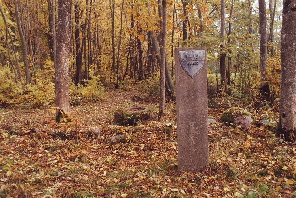
Lithuania · Terrestrial
Salantai Regional Park
Nature park of 13,230 hectares in Lithuania, established in 1992.
Overview
Nature park of 13,230 hectares in Lithuania, established in 1992.
Salantai Regional Park is a nature park in Lithuania (Europe). It is a predominantly terrestrial area. Established in 1992, it covers about 13,230 hectares.
Protections and designations
Natura 2000 · habitats (SAC) · 11 sites
- Alanto žemupys LTKRE0010
- Klausgalvų apylinkės LTKRE0011
- Kulalių riedulynas LTSKU0003
- Kulalių riedulynas II LTSKU0011
- Minijos slėnis ties Dyburiais LTKRE0002
- Mosėdžio apylinkės LTSKU0012
- and 5 more
Natura 2000 · birds (SPA) · 2 sites
- Erlos ir Salanto upių senslėniai LTSKUB002
- Minijos upės slėnis LTKLAB005
Protected as a nature park. International labels and designations: Natura 2000 network (13 sites). Key dates: established in 1992, first Natura 2000 site under the Birds Directive in 2004 and first Natura 2000 site under the Habitats Directive in 2009.
Timeline
-
1992
Established
-
2004
First Natura 2000 site under the Birds Directive 2 such sites designated up to 2004
-
2009
First Natura 2000 site under the Habitats Directive 2 such sites designated up to 2009
Sources: Wikidata (CC0) for establishment and international labels; EEA Natura 2000 database (CC-BY 4.0) for site designation dates.
Frequently asked questions
Where is Salantai Regional Park?
In Lithuania (Europe). Representative point: 56.0576° N, 21.5641° E.
How large is Salantai Regional Park?
About 13,230 hectares (132 km²). It is the 12th largest of the 29 nature parks in Lithuania covered by Parkavela.
When was Salantai Regional Park established?
In 1992.
What habitats and landscapes does Salantai Regional Park include?
A terrestrial area, where land cover is dominated by farmland (55%).
Which international labels apply to Salantai Regional Park?
Natura 2000 network (13 sites).
When is the best time to visit Salantai Regional Park?
Best time to visit: May and June, with average temperatures of 12 to 17 °C and moderate rainfall.
Is there snow in Salantai Regional Park?
Yes. According to NASA's MODIS satellites (2015–2025 average), snow covers most of the site in December and January, with about 60 snow-covered days a year on average.
What is the nearest large city to Salantai Regional Park?
Nearest towns of over 50,000 people, as the crow flies: Klaipėda (30 km) and Liepāja (47 km). Nearest airport: Palanga (PLQ), about 24 km away.
How can I reach Salantai Regional Park by train?
The nearest railway station is Šateikiai, about 2 km from the site boundary.
Are there waymarked hiking trails in Salantai Regional Park?
Yes. Waymarked hiking routes listed in OpenStreetMap: 5, including E 11 (22 km).
Which species can be seen in Salantai Regional Park?
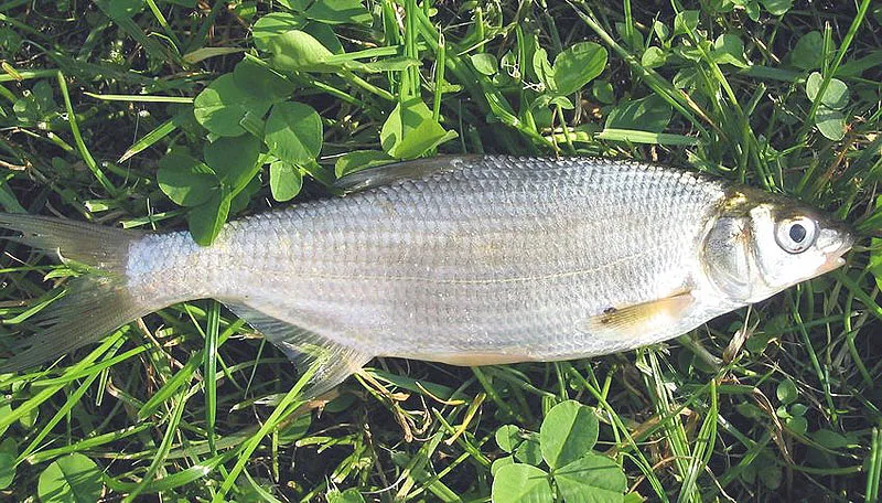
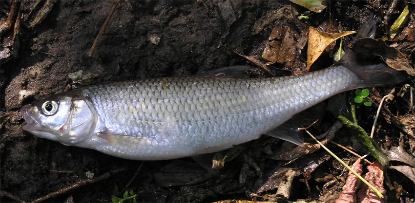
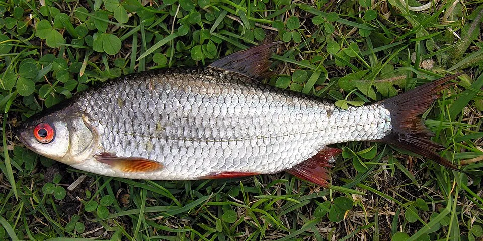
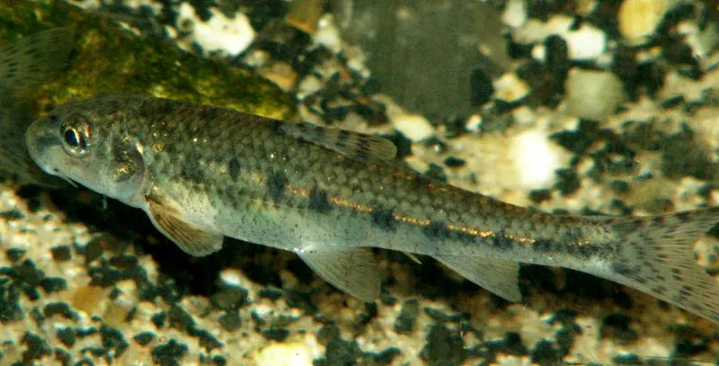
Among the species most often recorded on GBIF are Vimba vimba (Zarte), Leuciscus leuciscus (Common dace), Salmo trutta (Brown Trout) and Rhodeus amarus (European bitterling).
© OpenStreetMap
Download the boundary: GeoJSON · GPX Boundary © OpenStreetMap contributors (ODbL).
Geography
The representative point of the site lies at around 43 m above sea level. Over the 1996–2025 period, the mean annual temperature is about 7.9 °C and total precipitation reaches roughly 786 mm per year. The warmest month is usually July, the coolest January, and the wettest July.
Area
- Area of the boundary
- 13,230 ha
- Elevation
- 43 m
- Snow cover
- ≈ 60 days a year
- Coordinates
- 56.0576, 21.5641
Climate
● Mean temperature (°C) · ▮ Precipitation (mm)
Source: Copernicus ERA5-Land (C3S, doi:10.24381/cds.68d2bb30), monthly averages 1996–2025 interpolated to the representative point, temperatures adjusted for elevation.
Contains modified Copernicus Climate Change Service information 2026. Neither the European Commission nor ECMWF is responsible for any use that may be made of the Copernicus information or data it contains.
Snow cover measured by satellite
J
F
M
A
M
J
J
A
S
O
N
D
average share of the site under snow · snowiest parts · ≈ 60 days a year
Snow cover: MODIS/Terra MOD10CM v61 (Hall & Riggs, 2021, NASA NSIDC DAAC, doi:10.5067/MODIS/MOD10CM.061), imagery from NASA GIBS (ESDIS); 2015–2025 average, grid of about 5 km.
Natural habitats
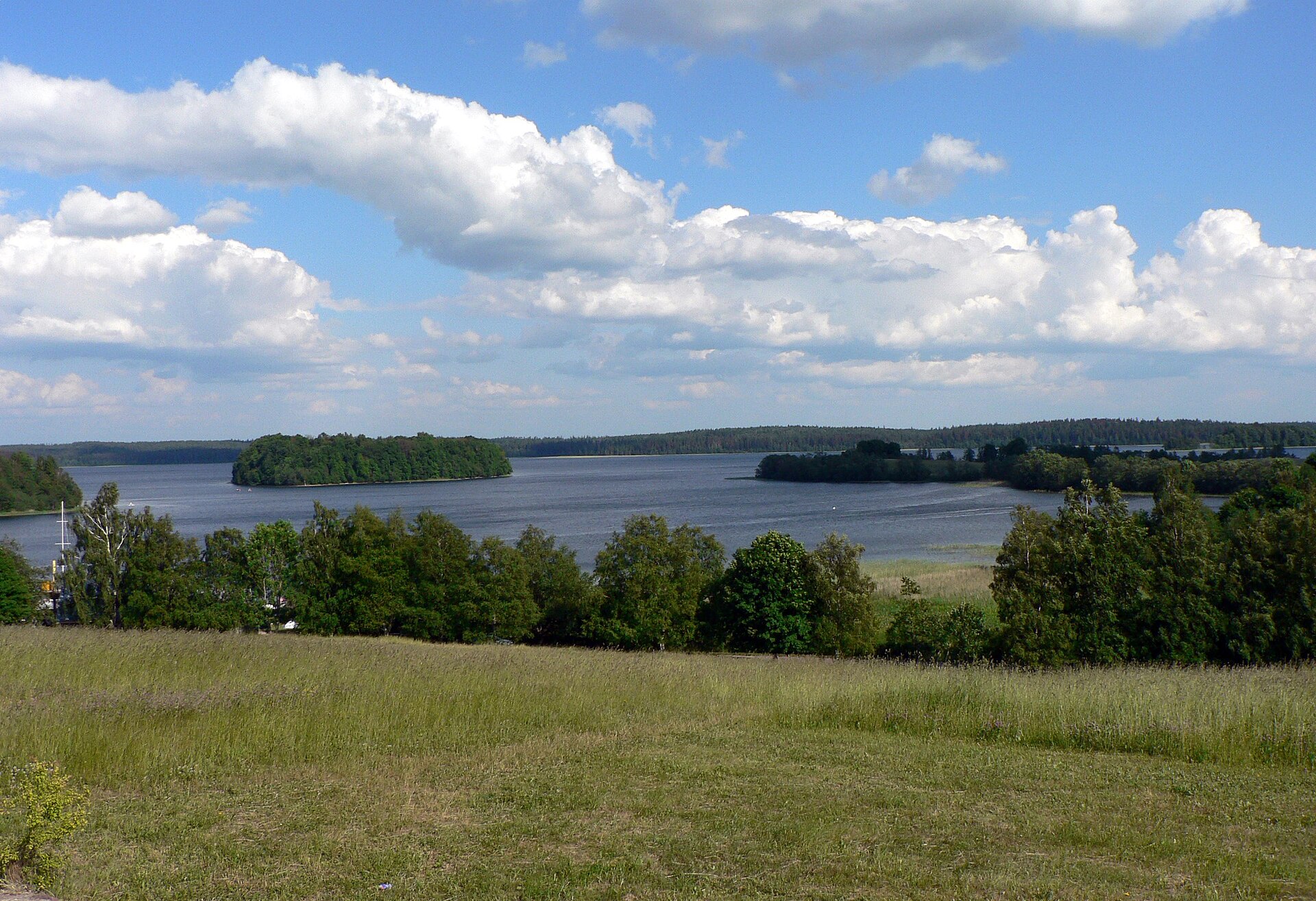
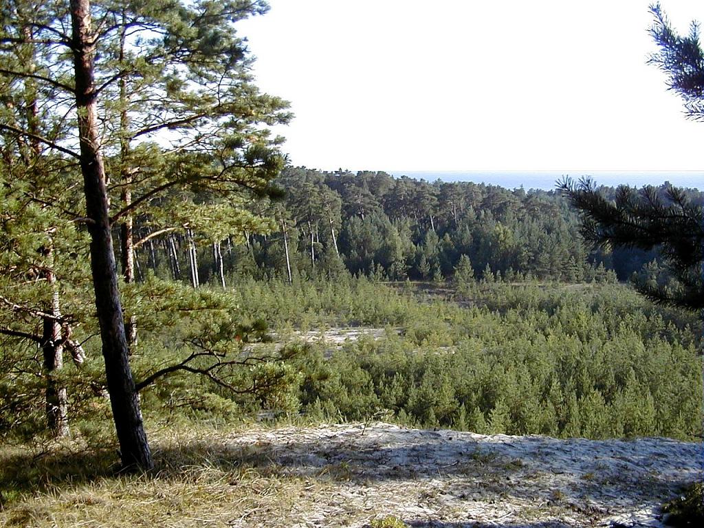
According to CORINE Land Cover (2018), the site is mainly made up of farmland (55%), forests (22%) and grassland and meadows (13%). Woodland mixes broadleaved and coniferous trees. The land is almost flat (mean slope under 2°). The 13 Natura 2000 sites overlapping the area list 19 habitats of European interest (7 priority), the most extensive being Fennoscandian lowland species-rich dry to mesic grasslands, Tilio-Acerion forests of slopes, screes and ravines and lowland hay meadows (Alopecurus pratensis, Sanguisorba officinalis).
Biodiversity
Based on occurrences aggregated by GBIF, several species are regularly recorded within the site. Among the most frequent are Vimba vimba (Zarte), Leuciscus leuciscus (Common dace), Salmo trutta (Brown Trout) and Rhodeus amarus (European bitterling). The full list of documented taxa is shown below. The overlapping Natura 2000 sites list 18 species of European interest: 11 birds, 2 mammals, 1 amphibian, 2 fish and 2 invertebrates.
Habitats of European interest
From the official forms of the 13 Natura 2000 sites overlapping the area (areas reported for each whole site).
- Fennoscandian lowland species-rich dry to mesic grasslands priority 220 ha
- Tilio-Acerion forests of slopes, screes and ravines priority 172 ha
- Lowland hay meadows (Alopecurus pratensis, Sanguisorba officinalis) 145 ha
- Northern boreal alluvial meadows 32 ha
- Juniperus communis formations on heaths or calcareous grasslands 32 ha
- Species-rich Nardus grasslands, on silicious substrates in mountain areas (and submountain areas in Continental Europe) priority 31 ha
- Western Taïga priority 25 ha
- Sub-Atlantic and medio-European oak or oak-hornbeam forests of the Carpinion betuli 15 ha
and 11 more
Species of European interest
Birds · 11
Common Kingfisher (Alcedo atthis) breeding, White stork (Ciconia ciconia) breeding, Western Marsh Harrier (Circus aeruginosus) breeding, Montagu's Harrier (Circus pygargus) breeding, Corn Crake (Crex crex) breeding, Whooper Swan (Cygnus cygnus) breeding, Common Crane (Grus grus) breeding, Red-backed Shrike (Lanius collurio) breeding, Grey-headed Woodpecker (Picus canus) breeding, Spotted Crake (Porzana porzana) breeding, Barred warbler (Sylvia nisoria) breeding
Mammals · 2
Gray Wolf (Canis lupus linnaeus), Eurasian otter (Lutra lutra)
Amphibians · 1
Invertebrates · 2
Clouded apollo (Parnassius mnemosyne), Thick shelled river mussel (Unio crassus)
Source: Natura 2000 standard data forms (EEA, CC-BY 4.0). Not exhaustive: sensitive species are not published.
Species to look out for
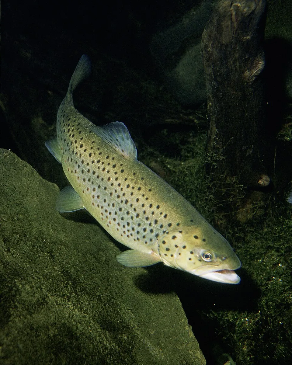
Fish
Brown Trout
Salmo trutta10 records © Eric Engbretson for U.S. Fish and Wildlife Service · Public domain

Observed species
Occurrences documented via GBIF; they are neither an exhaustive inventory nor proof of current presence.
- Zarte · Vimba vimba · 10
- Common dace · Leuciscus leuciscus · 10
- Brown Trout · Salmo trutta · 10
- European bitterling · Rhodeus amarus · 9
- Roach · Rutilus rutilus · 8
- Gudgeon · Gobio gobio · 8
- Common minnow · Phoxinus phoxinus · 8
- Pike · Esox lucius · 7
- Bleak · Alburnus alburnus · 7
- Chub · Squalius cephalus · 6
- Ide · Leuciscus idus · 6
- Stone loach · Barbatula barbatula · 6
+18 more species
- Ground-ivy · Glechoma hederacea · 5
- European bitterling · Rhodeus sericeus · 4
- European brook lamprey · Lampetra planeri · 4
- White stork · Ciconia ciconia · 4
- Daisy · Bellis perennis · 4
- European river lamprey · Lampetra fluviatilis · 3
- Natterjack toad · Epidalea calamita · 3
- Common Wood Pigeon · Columba palumbus · 3
- Spotted Dead-nettle · Lamium maculatum · 3
- Cabbage Thistle · Cirsium oleraceum · 3
- Black Redstart · Phoenicurus ochruros · 3
- Barn Swallow · Hirundo rustica · 3
- Black Sweat Bee · Lasioglossum nigrum · 2
- Rufous-footed Furrow Bee · Lasioglossum rufitarse · 2
- Castor Bean Tick · Ixodes ricinus · 2
- Rook · Corvus frugilegus · 2
- Whinchat · Saxicola rubetra · 2
- Icterine warbler · Hippolais icterina · 2
Records: GBIF.org (CC-BY). Names: Wikidata (CC0), GBIF. Photos: Wikimedia Commons.
Conservation challenges
The primary purpose of the site is to preserve its natural habitats and the biodiversity they support. The species recorded (Biodiversity tab) reflect its ecological value. The designations it holds frame its management and the control of land use.
According to Global Forest Change data (University of Maryland, Global Forest Watch), about 178 ha of tree cover were lost within the boundary between 2001 and 2023 (1% of its area), peaking in 2020 and 2023. These losses include logging, storms and fires, and do not account for regrowth. According to CORINE Land Cover, land cover here remained almost unchanged between 1990 and 2018 (less than 0.5% of the area affected); only some 11 ha were built over. At night, the area gives off virtually no artificial light detectable from space (NASA VIIRS Black Marble composite, 2016). Built-up and developed land (buildings, business areas, roads, quarries) covers 7% of the area, and farmland 55% (CORINE Land Cover). According to the Natura 2000 forms, of 19 assessed habitats of European interest, 6 are in excellent condition and 3 in average or reduced condition. According to the Water Framework Directive assessment (2022 river basin management plans, data 2014–2019), 83% of the 91 km of rivers assessed within the site are in good or high ecological status. Other assessed water bodies: lakes, 0 of 1 in good ecological status or better.
Pressure indicators
Tree cover lost
178 ha
2001–2023
20012023
Fires since 2016
0
No large fire mapped (fires over about 30 ha)
Light at night
0%
of the area gives off artificial light visible from space
DarkLit
Built-up land
7%
buildings, business areas, roads, quarries · farmland 55%
Land cover change
< 0.5%
of the area changed, 1990–2018 · CORINE
Rivers and lakes
83%
of the 91 km of assessed rivers in good or high ecological status · WFD 2022
Lakes: 0 of 1 good or better
assessments 2014–2019
Sources: Global Forest Change (Hansen et al., University of Maryland, via Global Forest Watch, CC-BY 4.0); EFFIS, European Commission / Copernicus; NASA Black Marble 2016 (public domain); CORINE Land Cover 2018 (Copernicus) or MODIS.
CORINE Land Cover Change 1990–2018: generated using European Union's Copernicus Land Monitoring Service information (EEA), aggregated by Parkavela; DOI 10.2909/f30f1000-7cf8-43bb-872c-5eb093911b24.
Ecological status of water bodies: European Environment Agency, WISE – Water Framework Directive, 3rd river basin management plans (2022), CC BY 4.0. Official national classification, not comparable between countries.
Practical information
Cities and airport
- Klaipėda
30 km as the crow flies - Liepāja
47 km as the crow flies - Airport: Palanga (PLQ)
24 km as the crow flies
Hiking
5 waymarked routes listed, including:
E 11 (22 km)
Data © OpenStreetMap contributors (ODbL) · Wikidata (CC0)
Waymarked hiking routes
E11 E11 section 84: Plateliai – Salantai
2.2 km within the site ↗ 5 m↘ 0 m 55–65 m
Tracks © OpenStreetMap contributors (ODbL), clipped to the boundary; elevation gain and profiles computed on the longest section from Mapzen Terrain Tiles (≈ 30 m), indicative only.
Access and visiting
The nearest railway station is Šateikiai, about 2 km from the site boundary. Nearest towns of over 50,000 people, as the crow flies: Klaipėda (30 km) and Liepāja (47 km). Nearest airport: Palanga (PLQ), about 24 km away. About 83,000 people live within 20 km of the site boundary, 17,000 of them within 10 km; some 5,000 people are estimated to live inside (GHSL estimate, 2020). This population has fallen by about 17% since 2000. Waymarked hiking routes listed in OpenStreetMap: 5, including E 11 (22 km). To plan a visit (access, opening periods, visitor rules), it is best to consult the official information from the managing body and the official website listed in this page's sources.
Source: OpenStreetMap (ODbL), Wikidata (CC0), October 2026.
When to visit
Best time to visit: May and June, with average temperatures of 12 to 17 °C and moderate rainfall. Average temperatures drop below 0 °C in January and February: frost is common. According to NASA's MODIS satellites (2015–2025 average), snow covers most of the site in December and January, with about 60 snow-covered days a year on average. Day length ranges from about 6 h 58 min in December to 17 h 36 min in June. Wildlife records published on GBIF peak for birds (May), plants (June) and butterflies and moths (July). These peaks also reflect when observers are most active.
Source: Copernicus ERA5-Land (C3S), monthly averages 1996–2025 at the representative point, temperatures adjusted for elevation.
Contains modified Copernicus Climate Change Service information 2026. Neither the European Commission nor ECMWF is responsible for any use that may be made of the Copernicus information or data it contains.
Wildlife records calendar
JFMAMJJASOND
Birds
Plants
Butterflies & moths
Monthly records published on GBIF (CC-BY), relative to the busiest month; also reflects observer activity.
Gallery
© Julius Kanarskas · CC BY-SA 3.0
© Anaiptol · CC0-1.0
© Rimantas Lazdynas · CC BY-SA 3.0
© Ta-Ntalas · CC BY-SA 3.0
© A.Mažūnas · CC BY-SA 3.0
© Rimantas Lazdynas · CC BY-SA 3.0
Sources and licences
- Wikidata: Q16471903
- OpenStreetMap: relation 7345144
References
- cds.climate.copernicus.eu: climate · CC-BY-4.0
- registry.opendata.aws: elevation of the reference point, detailed relief · PD
- land.copernicus.eu: land cover, land cover change, sea share · COPERNICUS
- doi.org: population around the site · CC-BY-4.0
- openstreetmap.org: access and peaks · ODbL-1.0
- eea.europa.eu: bathing water quality, ecological status of waters · CC-BY-4.0
- en.eurovelo.com: EuroVelo cycle routes · ODbL-1.0
- cycling.waymarkedtrails.org: cycle routes · ODbL-1.0
- opentopodata.org: elevations · PD
- wikidata.org: establishment date, official name, nearby cities and airport, access and peaks, lake depths, places to see · CC0-1.0
- forest-fire.emergency.copernicus.eu: wildfires · COPERNICUS
- globalforestwatch.org: tree cover loss · CC-BY-4.0
- gbif.org: seasonality of sightings, invasive alien species, observed species · CC-BY-4.0
- hydrosheds.org: lakes · CC-BY-4.0
- natura2000.eea.europa.eu: Natura 2000 habitats and species · CC-BY-4.0
- earthobservatory.nasa.gov: night light · PD
- hiking.waymarkedtrails.org: route difficulty · ODbL-1.0
- nsidc.org: snow cover · PD
Data © OpenStreetMap contributors (ODbL), Wikidata (CC0) and the sources cited.