
Spain · Terrestrial
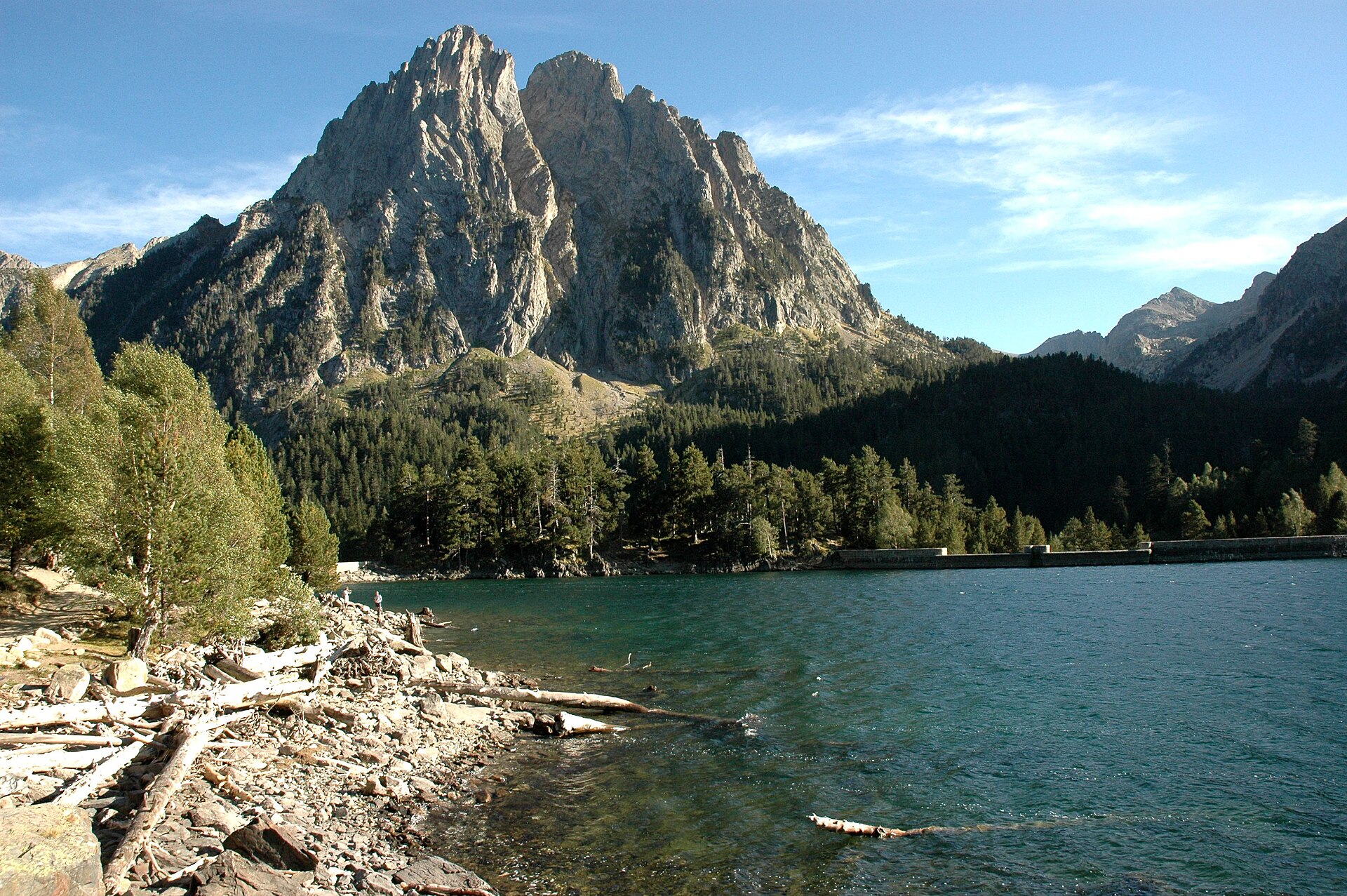
Aigüestortes i Estany de Sant Maurici National Park
National park of 13,926 hectares in Spain, established in 1955.
Overview
National park of 13,926 hectares in Spain, established in 1955.
Aigüestortes i Estany de Sant Maurici National Park is located in Spain (Europe). It is a predominantly terrestrial area. Established on 21 October 1955, it covers about 13,926 hectares.
Protections and designations
Ramsar site
Natura 2000 · habitats (SAC)
- Aigüestortes ES0000022
Natura 2000 · birds (SPA)
- Aigüestortes ES0000022
Other designations
Protected as a national park. International labels and designations: Ramsar site and Natura 2000 network (1 site: “Aigüestortes”). Key dates: established in 1955, first Natura 2000 site under the Birds Directive in 1988, Ramsar Site in 2007 and first Natura 2000 site under the Habitats Directive in 2013.
In our collections
Timeline
-
1955
Established
-
1988
First Natura 2000 site under the Birds Directive
-
2007
Ramsar Site (wetland of international importance) Aigüestortes i Estany de Sant Maurici National Park
-
2013
First Natura 2000 site under the Habitats Directive
Sources: Wikidata (CC0) for establishment and international labels; EEA Natura 2000 database (CC-BY 4.0) for site designation dates.
Frequently asked questions
Where is Aigüestortes i Estany de Sant Maurici National Park?
In Spain (Europe). Representative point: 42.5772° N, 0.9478° E.
How large is Aigüestortes i Estany de Sant Maurici National Park?
About 13,926 hectares (139 km²). It is the 11th largest of the 16 national parks in Spain covered by Parkavela.
When was Aigüestortes i Estany de Sant Maurici National Park established?
On 21 October 1955.
What habitats and landscapes does Aigüestortes i Estany de Sant Maurici National Park include?
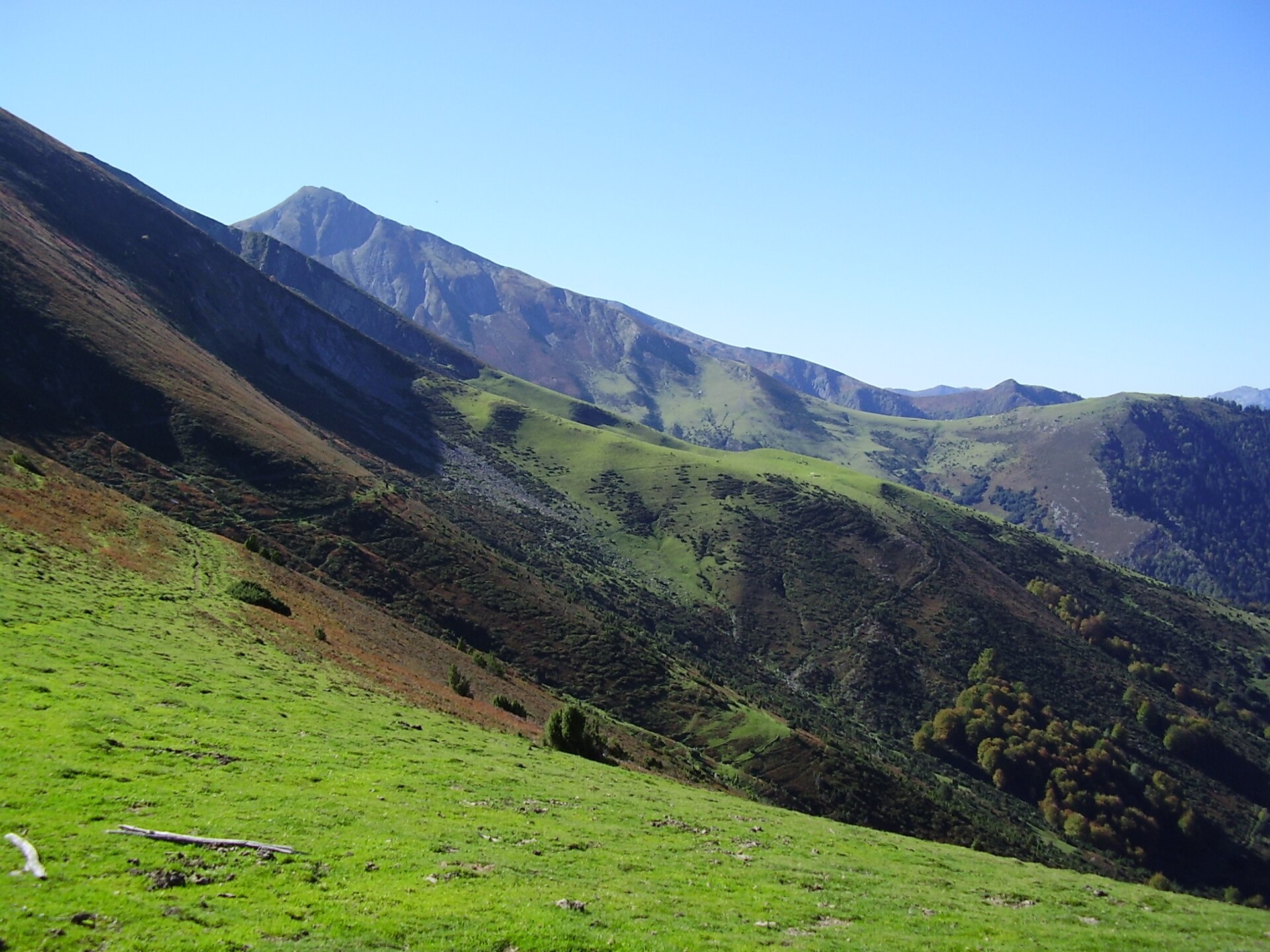
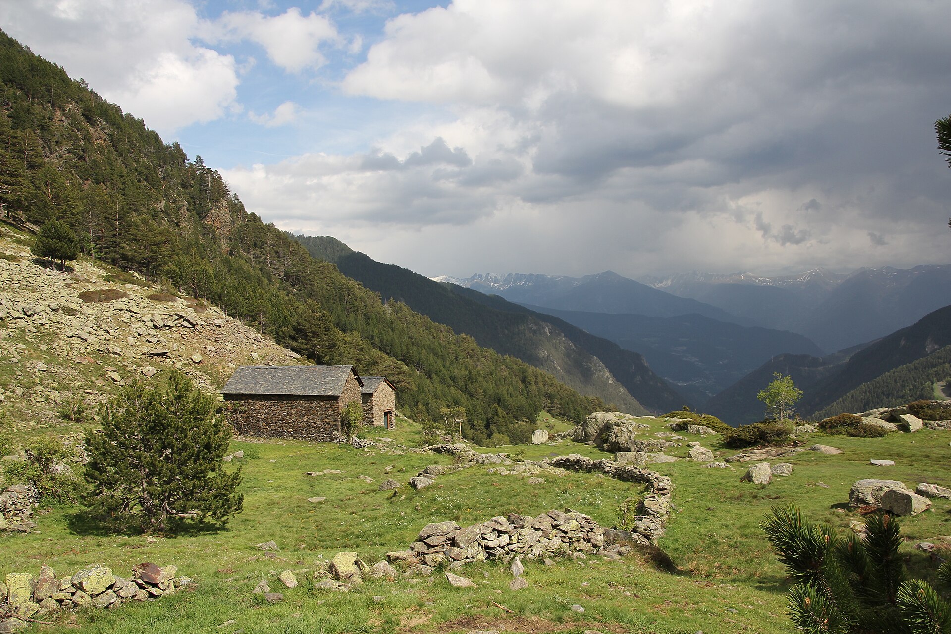
A terrestrial area, with mountains.
What rocks lie beneath Aigüestortes i Estany de Sant Maurici National Park?
According to the European 1:1 million geological map (EGDI), the bedrock consists mainly of igneous rocks (88% of sampled points) and mudstones (13%). These are mostly igneous rocks. The geological units date mainly from the Devonian (88% of sampled points).
What is the highest point of Aigüestortes i Estany de Sant Maurici National Park?
Pic de Comaloforno, at 3,029 m (OpenStreetMap).
What are the main summits of Aigüestortes i Estany de Sant Maurici National Park?
Pic de Comaloforno (3,029 m), Besiberri Sud (3,023 m), Punta Alta de Comalesbienes (3,014 m), Agulla Nord de Malvesina (3,010 m) and Besiberri Nord (3,008 m) (OpenStreetMap).
Which international labels apply to Aigüestortes i Estany de Sant Maurici National Park?
Ramsar site and Natura 2000 network (1 site: “Aigüestortes”).
When is the best time to visit Aigüestortes i Estany de Sant Maurici National Park?
Best time to visit: July and August, with average temperatures of 11 to 12 °C and moderate rainfall.
Is there snow in Aigüestortes i Estany de Sant Maurici National Park?
Yes. According to NASA's MODIS satellites (2015–2025 average), snow covers most of the site from November to April, and until May on higher ground, with about 175 snow-covered days a year on average.
What is there to see in Aigüestortes i Estany de Sant Maurici National Park?
1 waterfall and 3 caves, including Cascada de Sant Esperit (1,660 m), Foraca de l'Espelligó, Cova del Sardo and La Coveta (Wikidata).
Where can I stay in Aigüestortes i Estany de Sant Maurici National Park?
7 mountain huts, including Refugi de la Bretxa Peyta (2,760 m), Refugio de Amitges (2,365 m) and Refugio Josep Maria Blanc (2,350 m) (Wikidata).
What is the nearest airport to Aigüestortes i Estany de Sant Maurici National Park?
Nearest airport: Reus (REU), about 152 km away.
How can I reach Aigüestortes i Estany de Sant Maurici National Park by train?
The nearest railway station is Luchon, about 28 km from the site boundary.
Where can I get visitor information on site?
Casa del Parc, Punt d'informació and Parc Nacional d'Aigues Tortes i Estany de Sant Maurici.
Are there waymarked hiking trails in Aigüestortes i Estany de Sant Maurici National Park?
Yes. Waymarked hiking routes listed in OpenStreetMap: 13, including GR 11, Haute Randonnée Pyrénéenne, el Gran Bucle and Carros de Foc. The “CF · Carros de Foc” route runs for about 38 km through the site, with some 1,340 m of ascent on its longest section.
Which species can be seen in Aigüestortes i Estany de Sant Maurici National Park?
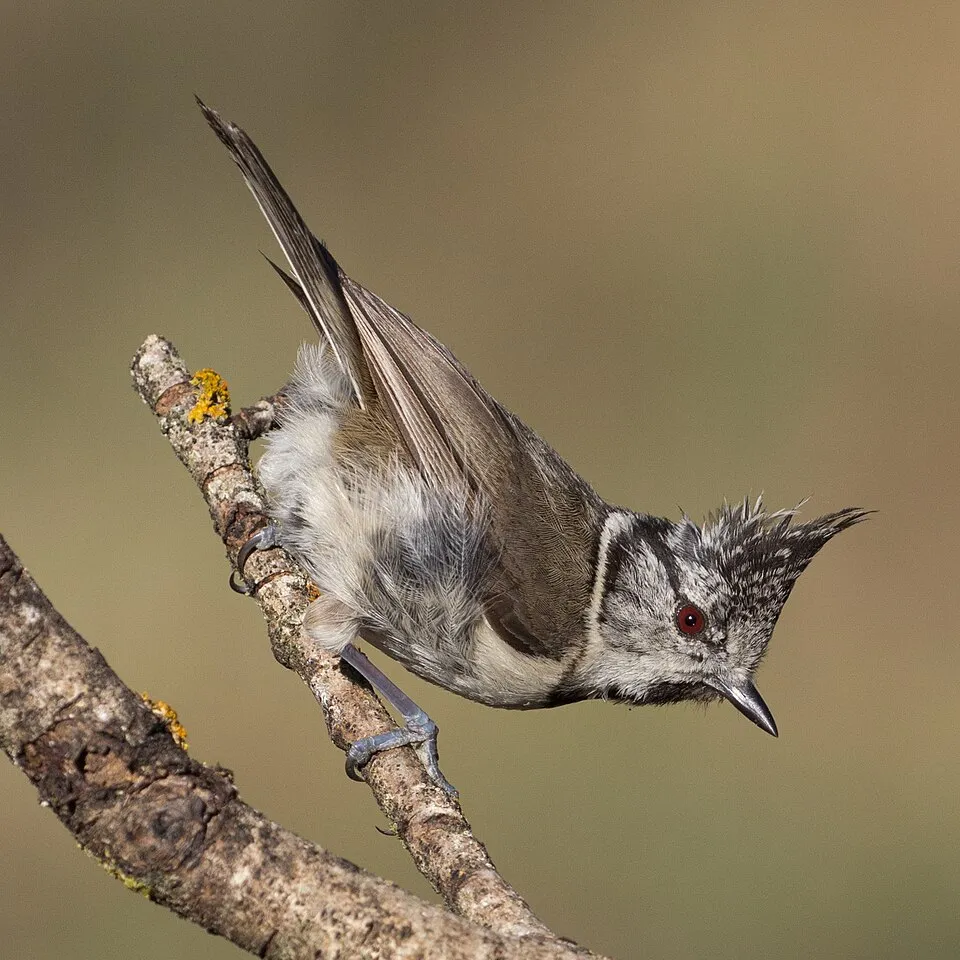
Among the species most often recorded on GBIF are Periparus ater (Coal tit), Lophophanes cristatus (European Crested Tit), Gyps fulvus (Griffon Vulture) and Fringilla coelebs (Eurasian Chaffinch).
What is the official website of Aigüestortes i Estany de Sant Maurici National Park?
© OpenStreetMap
Download the boundary: GeoJSON · GPX Boundary © OpenStreetMap contributors (ODbL).
Geography
The representative point of the site lies at around 2,361 m above sea level. Over the 1996–2025 period, the mean annual temperature is about 2.4 °C and total precipitation reaches roughly 1,121 mm per year. The warmest month is usually July, the coolest January, and the wettest May. According to the European 1:1 million geological map (EGDI), the bedrock consists mainly of igneous rocks (88% of sampled points) and mudstones (13%). These are mostly igneous rocks. The geological units date mainly from the Devonian (88% of sampled points). The site contains 2 lakes larger than 10 ha, totalling 41 ha of water; the largest, Lago Negro de Peguera, covers 26 ha (HydroLAKES). Lago Negro de Peguera (31 ha) is 70 m deep (Wikidata).
Area
- Area
- 13,926 ha
- Elevation
- 2,361 m
- Median elevation
- 2,416 m
- Mean slope
- 26°
- Snow cover
- ≈ 175 days a year
- Lakes over 10 ha
- 2 (41 ha)
- Coordinates
- 42.5772, 0.9478
Terrain: Mapzen Terrain Tiles (SRTM, USGS) · Lakes: HydroLAKES (Messager et al. 2016, hydrosheds.org, CC BY 4.0) · depths: Wikidata (CC0)
Elevation bands
- 1,500–2,000 m 11%
- 2,000–2,500 m 52%
- 2,500–3,000 m 37%
share of the site in each elevation band (smoothed terrain model: summits are rounded off) · Terrain: Mapzen Terrain Tiles (SRTM, USGS)
Bedrock
- Igneous rocks 88 %
- Mudstones 13 %
Igneous rocks 88 % · Sedimentary rocks 13 % · Main age: Devonian (88%)
Source: EGDI 1:1M geological map (EuroGeoSurveys and national geological surveys), CC BY 4.0 · 16 sampled points within the site.
Main summits
- Pic de Comaloforno3,029 m
- Besiberri Sud3,023 m
- Punta Alta de Comalesbienes3,014 m
- Agulla Nord de Malvesina3,010 m
- Besiberri Nord3,008 m
- Punta de Passet2,998 m
- Besiberri del Mig2,995 m
- Pic de Comalesbienes2,993 m
- Pic d'Abellers2,983 m
- Pic de la Pala Alta de Sarradé2,983 m
Data © OpenStreetMap contributors (ODbL)
Climate
● Mean temperature (°C) · ▮ Precipitation (mm)
Source: Copernicus ERA5-Land (C3S, doi:10.24381/cds.68d2bb30), monthly averages 1996–2025 interpolated to the representative point, temperatures adjusted for elevation.
Contains modified Copernicus Climate Change Service information 2026. Neither the European Commission nor ECMWF is responsible for any use that may be made of the Copernicus information or data it contains.
Snow cover measured by satellite
J
F
M
A
M
J
J
A
S
O
N
D
average share of the site under snow · snowiest parts · ≈ 175 days a year
Snow cover: MODIS/Terra MOD10CM v61 (Hall & Riggs, 2021, NASA NSIDC DAAC, doi:10.5067/MODIS/MOD10CM.061), imagery from NASA GIBS (ESDIS); 2015–2025 average, grid of about 5 km.
Natural habitats
According to CORINE Land Cover (2018), the site is mainly made up of bare rock and scree (48%), grassland and meadows (25%) and forests (19%). Elevation ranges from about 1,560 m to 3,029 m (highest point: Pic de Comaloforno). Median elevation is 2,416 m, and 37% of the site lies above 2,500 m (SRTM elevation model). The terrain is steep: 37% of slopes exceed 30° (mean slope 26°). The Natura 2000 site overlapping the area lists 44 habitats of European interest (11 priority), the most extensive being siliceous rocky slopes with chasmophytic vegetation, western Mediterranean and thermophilous scree and subalpine and montane Pinus uncinata forests (* if on gypsum or limestone).
Biodiversity
Based on occurrences aggregated by GBIF, several species are regularly recorded within the site. Among the most frequent are Periparus ater (Coal tit), Lophophanes cristatus (European Crested Tit), Gyps fulvus (Griffon Vulture) and Fringilla coelebs (Eurasian Chaffinch). The full list of documented taxa is shown below. The overlapping Natura 2000 site lists 106 species of European interest: 54 birds, 27 mammals, 5 reptiles, 4 amphibians, 2 fish, 10 invertebrates and 4 plants.
Habitats of European interest
From the official form of the Natura 2000 site overlapping the area (areas reported for the whole site).
- Siliceous rocky slopes with chasmophytic vegetation 8,831 ha
- Western Mediterranean and thermophilous scree 7,257 ha
- Subalpine and montane Pinus uncinata forests (* if on gypsum or limestone) 5,986 ha
- Siliceous Pyrenean Festuca eskia grasslands 5,406 ha
- Semi-natural dry grasslands and scrubland facies on calcareous substrates (Festuco-Brometalia) (* important orchid sites) 2,728 ha
- Species-rich Nardus grasslands, on silicious substrates in mountain areas (and submountain areas in Continental Europe) priority 2,102 ha
- Alpine and subalpine calcareous grasslands 1,909 ha
- Alpine and Boreal heaths 1,732 ha
and 36 more
Species of European interest
Birds · 54
Accipiter gentilis gentilis resident, Common Sandpiper (Actitis hypoleucos) breeding, Boreal Owl (Aegolius funereus) resident, Common Kingfisher (Alcedo atthis) resident, Mallard (Anas platyrhynchos) wintering breeding, Tawny Pipit (Anthus campestris) breeding, Water Pipit (Anthus spinoletta) breeding, Golden Eagle (Aquila chrysaetos) resident, Grey Heron (Ardea cinerea) wintering, Eurasian Eagle-owl (Bubo bubo) resident, Common Buzzard (Buteo buteo) breeding, European Nightjar (Caprimulgus europaeus) breeding and 42 more
Mammals · 27
Barbastelle (Barbastella barbastellus), Grey wolf (Canis lupus), Serotine bat (Eptesicus serotinus), European wildcat (Felis silvestris), Pyrenean desman (Galemys pyrenaicus), Savi's Pipistrelle (Hypsugo savii), Eurasian otter (Lutra lutra), European pine marten (Martes martes), Common bent-wing bat (Miniopterus schreibersii), Lesser mouse-eared myotis (Myotis blythii), Daubenton's bat (Myotis daubentonii), Geoffroy's bat (Myotis emarginatus) and 15 more
Reptiles · 5
Smooth snake (Coronella austriaca), Western Whip Snake (Hierophis viridiflavus), Pyrenean rock lizard (Iberolacerta bonnali), Western green lizard (Lacerta bilineata), Common wall lizard (Podarcis muralis)
Amphibians · 4
Midwife toad (Alytes obstetricans), Pyrenean brook salamander (Calotriton asper), Perez's Frog (Pelophylax perezi), Common frog (Rana temporaria)
Fish · 2
Pyrenean Sculpin (Cottus hispaniolensis), Ebro Nase (Parachondrostoma miegii)
Invertebrates · 10
White-clawed Crayfish (Austropotamobius pallipes), Greater Capricorn Beetle (Cerambyx cerdo), Marsh fritillary (Euphydryas aurinia), Jersey Tiger (Euplagia quadripunctaria), Spanish Moon Moth (Graellsia isabellae), Stag beetle (Lucanus cervus), Large Blue (Maculinea arion), Apollo (Parnassius apollo), Clouded apollo (Parnassius mnemosyne), Rosalia longicorn (Rosalia alpina)
Plants · 4
Mountain arnica (Arnica montana), Buxbaumia moss (Buxbaumia viridis), Snowdrop (Galanthus nivalis), Great Yellow Gentian (Gentiana lutea)
Source: Natura 2000 standard data forms (EEA, CC-BY 4.0). Not exhaustive: sensitive species are not published.
Species to look out for


Observed species
Occurrences documented via GBIF; they are neither an exhaustive inventory nor proof of current presence.
- Coal tit · Periparus ater · 278
- European Crested Tit · Lophophanes cristatus · 204
- Griffon Vulture · Gyps fulvus · 196
- Eurasian Chaffinch · Fringilla coelebs · 194
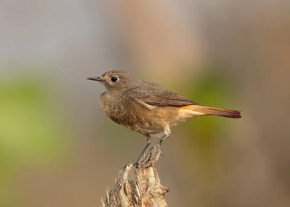
- Black Redstart · Phoenicurus ochruros · 194
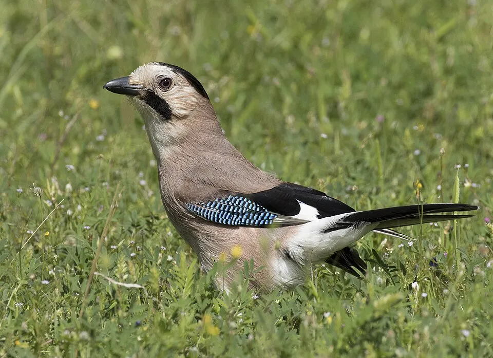
- Eurasian Jay · Garrulus glandarius · 152
- Great Spotted Woodpecker · Dendrocopos major · 145
- Goldcrest · Regulus regulus · 142
- European robin · Erithacus rubecula · 137
- Citril Finch · Carduelis citrinella · 119
- Red Crossbill · Loxia curvirostra · 118
- Dunnock · Prunella modularis · 115
+18 more species
- Great tit · Parus major · 112
- Mistle Thrush · Turdus viscivorus · 102
- Eurasian Wren · Troglodytes troglodytes · 102
- Grey Wagtail · Motacilla cinerea · 99
- Common Blackbird · Turdus merula · 99
- Common Chiffchaff · Phylloscopus collybita · 95
- Eurasian Crag Martin · Ptyonoprogne rupestris · 95
- Eurasian blue tit · Cyanistes caeruleus · 90
- Eurasian Blackcap · Sylvia atricapilla · 90
- Mallard · Anas platyrhynchos · 86
- White-throated Dipper · Cinclus cinclus · 75
- Red-billed Chough · Pyrrhocorax pyrrhocorax · 67
- Alpine Chough · Pyrrhocorax graculus · 67
- Carrion crow · Corvus corone · 67
- Water Pipit · Anthus spinoletta · 64
- Northern Wheatear · Oenanthe oenanthe · 62
- Short-toed Treecreeper · Certhia brachydactyla · 61
- Eurasian Nuthatch · Sitta europaea · 60
Records: GBIF.org (CC-BY). Names: Wikidata (CC0), GBIF. Photos: Wikimedia Commons.
Conservation challenges
The primary purpose of the site is to preserve its natural habitats and the biodiversity they support. The species recorded (Biodiversity tab) reflect its ecological value. The designations it holds frame its management and the control of land use.
According to CORINE Land Cover, land cover here remained almost unchanged between 1990 and 2018 (less than 0.5% of the area affected). Since 2016, the European EFFIS system (Copernicus) has mapped one fire here, in June 2022 (near Vall de Boí, La), which burned about 16 ha of the site. At night, the area gives off virtually no artificial light detectable from space (NASA VIIRS Black Marble composite, 2016). According to the Natura 2000 forms, of 38 assessed habitats of European interest, 28 are in excellent condition and 6 in average or reduced condition. According to the Water Framework Directive assessment (2022 river basin management plans, data 2018), 100% of the 14 km of rivers assessed within the site are in good or high ecological status. Other assessed water bodies: lakes, 15 of 18 in good ecological status or better.
Pressure indicators
Tree cover lost
1 ha
2001–2023 · < 1% of the area
20012023
Fires since 2016
16 ha
burned within the boundary (1 mapped fire)
- 2022 · Vall de Boí, La · 16 ha
Light at night
0%
of the area gives off artificial light visible from space
DarkLit
Land cover change
< 0.5%
of the area changed, 1990–2018 · CORINE
Rivers and lakes
100%
of the 14 km of assessed rivers in good or high ecological status · WFD 2022
Lakes: 15 of 18 good or better
assessments 2018
Invasive alien species
1
recorded since 2000
Sources: Global Forest Change (Hansen et al., University of Maryland, via Global Forest Watch, CC-BY 4.0); EFFIS, European Commission / Copernicus; NASA Black Marble 2016 (public domain); CORINE Land Cover 2018 (Copernicus) or MODIS.
CORINE Land Cover Change 1990–2018: generated using European Union's Copernicus Land Monitoring Service information (EEA), aggregated by Parkavela; DOI 10.2909/f30f1000-7cf8-43bb-872c-5eb093911b24.
Ecological status of water bodies: European Environment Agency, WISE – Water Framework Directive, 3rd river basin management plans (2022), CC BY 4.0. Official national classification, not comparable between countries.
Invasive alien species: Global Register of Introduced and Invasive Species (ISSG, CC BY 4.0); Union list, Regulation (EU) 1143/2014 (INBO, CC0); GBIF.org records (CC0 / CC BY 4.0), at least 2 per species.
Practical information
Cities and airport
- Airport: Reus (REU)
152 km as the crow flies
Visitor information
- Casa del Parc
1 km from the site boundary - Punt d'informació
2 km from the site boundary - Parc Nacional d'Aigues Tortes i Estany de Sant Maurici
3 km from the site boundary
Parking
1 public car parks listed within the site
la Molina
Things to see
1 waterfall · 3 caves
- Cascada de Sant Esperit
waterfall · 1,660 m - Foraca de l'Espelligó
cave - Cova del Sardo
cave - La Coveta
cave
Where to stay
7 mountain huts
- Refugi de la Bretxa Peyta
mountain hut · 2,760 m - Refugio de Amitges
mountain hut · 2,365 m - Refugio Josep Maria Blanc
mountain hut · 2,350 m - Refugio Ventosa i Calvell
mountain hut · 2,214 m - Refugio del Estany Llong
mountain hut · 1,985 m
Hiking
13 waymarked routes listed, including:
GR 11Haute Randonnée Pyrénéenneel Gran BucleCarros de FocCarros de Foc Plus
Trail difficulty
- T1 · easy hiking · 5% · 8 km
- T2 · mountain hiking · 65% · 87 km
- T3–T6 · demanding or alpine hiking · 30% · 42 km
137 km graded out of 209 km of paths
SAC scale (T1–T6) © OpenStreetMap contributors (ODbL): indicative only, check with the park.
Wheelchair access
- Camí de Sant Maurici
path
accessible toilets: 1
Reported by OpenStreetMap contributors (ODbL); check with the park before visiting.
Data © OpenStreetMap contributors (ODbL) · Wikidata (CC0)
Waymarked hiking routes
GR 11.18 Variant Port de Caldes
1.5 km within the site ↗ 152 m↘ 82 m 2,362–2,520 m
up to T3 · demanding mountain hiking
GR 11.20 Variant el Pont de Suert
6.8 km within the site ↗ 18 m↘ 668 m 1,991–2,650 m
HRP HRP Étape 24
1.5 km within the site ↗ 152 m↘ 82 m 2,362–2,520 m
up to T3 · demanding mountain hiking
CF Carros de Foc
37.5 km within the site ↗ 1,338 m↘ 1,253 m 1,928–2,745 m
up to T4 · alpine hiking
Tracks © OpenStreetMap contributors (ODbL), clipped to the boundary; elevation gain and profiles computed on the longest section from Mapzen Terrain Tiles (≈ 30 m), indicative only. Indicative difficulty (SAC scale, OpenStreetMap, via Waymarked Trails): check with the park.
Access and visiting
The nearest railway station is Luchon, about 28 km from the site boundary. Nearest airport: Reus (REU), about 152 km away. About 19,000 people live within 20 km of the site boundary, 6,600 of them within 10 km; some 160 people are estimated to live inside (GHSL estimate, 2020). This population has grown by about 19% since 2000. Visitor information on site: Casa del Parc, Punt d'informació and Parc Nacional d'Aigues Tortes i Estany de Sant Maurici. Public car parks listed within the site: 1, including la Molina. Waymarked hiking routes listed in OpenStreetMap: 13, including GR 11, Haute Randonnée Pyrénéenne, el Gran Bucle and Carros de Foc. Of the roughly 140 km of paths with a difficulty grade in OpenStreetMap, 5% are easy hiking (T1), 65% mountain hiking (T2) and 30% demanding or alpine hiking (T3–T6). This is indicative only: check with the park. OpenStreetMap contributors list one wheelchair-accessible place: Camí de Sant Maurici; check with the park before visiting. To see: 1 waterfall and 3 caves, including Cascada de Sant Esperit (1,660 m), Foraca de l'Espelligó, Cova del Sardo and La Coveta. Where to stay: 7 mountain huts, including Refugi de la Bretxa Peyta (2,760 m), Refugio de Amitges (2,365 m) and Refugio Josep Maria Blanc (2,350 m). To plan a visit (access, opening periods, visitor rules), it is best to consult the official information from the managing body and the official website listed in this page's sources.
Source: OpenStreetMap (ODbL), Wikidata (CC0), October 2026.
When to visit
Best time to visit: July and August, with average temperatures of 11 to 12 °C and moderate rainfall. Average temperatures drop below 0 °C from November to April: frost is common. These averages apply to the site's representative point (2,361 m); higher up it is markedly cooler and snow lasts longer. According to NASA's MODIS satellites (2015–2025 average), snow covers most of the site from November to April, and until May on higher ground, with about 175 snow-covered days a year on average. Day length ranges from about 9 h 04 min in December to 15 h 17 min in June. Wildlife records published on GBIF peak for birds (July and August), plants (July and August), butterflies and moths (July), dragonflies (July) and mammals (July and August). These peaks also reflect when observers are most active.
Source: Copernicus ERA5-Land (C3S), monthly averages 1996–2025 at the representative point, temperatures adjusted for elevation.
Contains modified Copernicus Climate Change Service information 2026. Neither the European Commission nor ECMWF is responsible for any use that may be made of the Copernicus information or data it contains.
Wildlife records calendar
JFMAMJJASOND
Birds
Plants
Butterflies & moths
Dragonflies
Mammals
Monthly records published on GBIF (CC-BY), relative to the busiest month; also reflects observer activity.
Gallery
© Josep Renalias · CC BY-SA 3.0
© Alcoron · CC BY-SA 3.0
© Marinator Sofos · CC BY-SA 3.0
© Egiptologoespaol · CC BY-SA 4.0
© Marinator Sofos · CC BY-SA 3.0
© Pimlico27 · CC BY-SA 4.0
Sources and licences
- Wikidata: Q1470066
- OpenStreetMap: relation 6014846
- Official website: http://parcsnaturals.gencat.cat/ca/aiguestortes
- Wikipedia: en.wikipedia.org/wiki/Aigüestortes_i_Estany_de_Sant_Maurici_National_Park
- Natura 2000: ES0000022
- WDPA: 196014
References
- cds.climate.copernicus.eu: climate · CC-BY-4.0
- registry.opendata.aws: elevation of the reference point, detailed relief · PD
- land.copernicus.eu: land cover, land cover change, sea share · COPERNICUS
- doi.org: population around the site · CC-BY-4.0
- wikidata.org: official area, establishment date, protected heritage, nearby cities and airport, access and peaks, lake depths, places to see, official website · CC0-1.0
- eea.europa.eu: bathing water quality, ecological status of waters · CC-BY-4.0
- en.eurovelo.com: EuroVelo cycle routes · ODbL-1.0
- cycling.waymarkedtrails.org: cycle routes · ODbL-1.0
- opentopodata.org: elevations · PD
- forest-fire.emergency.copernicus.eu: wildfires · COPERNICUS
- globalforestwatch.org: tree cover loss · CC-BY-4.0
- gbif.org: seasonality of sightings, invasive alien species, observed species · CC-BY-4.0
- europe-geology.eu: geology · CC-BY-4.0
- hydrosheds.org: lakes · CC-BY-4.0
- natura2000.eea.europa.eu: Natura 2000 habitats and species · CC-BY-4.0
- openstreetmap.org: official name, access and peaks, trail difficulty, wheelchair access · ODbL-1.0
- earthobservatory.nasa.gov: night light · PD
- hiking.waymarkedtrails.org: route difficulty · ODbL-1.0
- nsidc.org: snow cover · PD
- wikidata.org: Wikipedia article · CC-BY-SA-4.0
Data © OpenStreetMap contributors (ODbL), Wikidata (CC0) and the sources cited.