
Italy · Terrestrial
Aveto Regional Nature Park
Regional nature park of 3,019 hectares in Italy, established in 1995.
Overview
Regional nature park of 3,019 hectares in Italy, established in 1995.
Aveto Regional Nature Park is located in Italy (Europe). It is a predominantly terrestrial area. Established in 1995, it covers about 3,019 hectares.
Protections and designations
Natura 2000 · habitats (SAC)
- Parco dell'Aveto IT1331104
Protected as a regional nature park. International labels and designations: Natura 2000 network (1 site: “Parco dell'Aveto”).
In our collections
Frequently asked questions
Where is Aveto Regional Nature Park?
In Italy (Europe). Representative point: 44.4561° N, 9.3908° E.
How large is Aveto Regional Nature Park?
About 3,019 hectares (30 km²). It is the 86th largest of the 128 regional parks in Italy covered by Parkavela.
When was Aveto Regional Nature Park established?
In 1995.
What habitats and landscapes does Aveto Regional Nature Park include?
A terrestrial area, with forests and mountains.
What rocks lie beneath Aveto Regional Nature Park?
According to the European 1:1 million geological map (EGDI), the bedrock consists mainly of limestones (100% of sampled points). These are mostly sedimentary rocks. The geological units date mainly from the Jurassic (100% of sampled points).
What is the highest point of Aveto Regional Nature Park?
Monte Aiona, at 1,701 m (OpenStreetMap).
What are the main summits of Aveto Regional Nature Park?
Monte Aiona (1,701 m), Monte Aiona Cima Nord (1,692 m), Monte Aiona Cima Sud (1,688 m), Monte Cantomoro (1,654 m) and Poggio delle Lame (1,634 m) (OpenStreetMap).
Which international labels apply to Aveto Regional Nature Park?
Natura 2000 network (1 site: “Parco dell'Aveto”).
When is the best time to visit Aveto Regional Nature Park?
Best time to visit: from May to September, with average temperatures of 11 to 19 °C and moderate rainfall.
Is there snow in Aveto Regional Nature Park?
Yes. According to NASA's MODIS satellites (2015–2025 average), snow covers the site about 30 days a year, mostly from December to March.
What is there to see in Aveto Regional Nature Park?
5 viewpoints, 3 waterfalls and 7 lakes and ponds, including canalone, Cascata della Ravezza, Lago Lagastro (1,318 m) and Cascate del Rio Ronco del Diavolo (OpenStreetMap).
Where can I stay in Aveto Regional Nature Park?
5 mountain huts, including Rifugio Monte Aiona - Pratomollo (1,503 m), Rifugio Casermette del Penna and Rifugio Monte degli Abeti (OpenStreetMap).
What is the nearest large city to Aveto Regional Nature Park?
Nearest towns of over 50,000 people, as the crow flies: Genoa (37 km) and La Spezia (49 km). Nearest airport: Genoa Cristoforo Colombo (GOA), about 45 km away.
How can I reach Aveto Regional Nature Park by train?
The nearest railway station is Chiavari, about 19 km from the site boundary.
Are there waymarked hiking trails in Aveto Regional Nature Park?
Yes. Waymarked hiking routes listed in OpenStreetMap: 32, including Cammino di Assisi, Genova and Sentiero dei Celti e dei Liguri. The “Cammino di Assisi, Genova - San Miniato” route runs for about 8 km through the site, with some 150 m of ascent on its longest section.
Which species can be seen in Aveto Regional Nature Park?
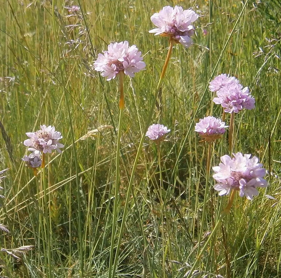
Among the species most often recorded on GBIF are Fagus sylvatica (European Beech), Armeria arenaria and Nebria tibialis.
What is the official website of Aveto Regional Nature Park?
© OpenStreetMap
Download the boundary: GeoJSON · GPX Boundary © OpenStreetMap contributors (ODbL).
Geography
The representative point of the site lies at around 1,023 m above sea level. Over the 1996–2025 period, the mean annual temperature is about 9.6 °C and total precipitation reaches roughly 1,493 mm per year. The warmest month is usually August, the coolest January, and the wettest November. According to the European 1:1 million geological map (EGDI), the bedrock consists mainly of limestones (100% of sampled points). These are mostly sedimentary rocks. The geological units date mainly from the Jurassic (100% of sampled points).
Area
- Area
- 3,019 ha
- Elevation
- 1,023 m
- Median elevation
- 1,404 m
- Mean slope
- 17°
- Snow cover
- ≈ 30 days a year
- Coordinates
- 44.4561, 9.3908
Terrain: Mapzen Terrain Tiles (SRTM, USGS)
Elevation bands
- 1,000–1,500 m 73%
- 1,500–2,000 m 27%
share of the site in each elevation band (smoothed terrain model: summits are rounded off) · Terrain: Mapzen Terrain Tiles (SRTM, USGS)
Bedrock
- Limestones 100 %
Sedimentary rocks 100 % · Main age: Jurassic (100%)
Source: EGDI 1:1M geological map (EuroGeoSurveys and national geological surveys), CC BY 4.0 · 15 sampled points within the site.
Main summits
- Monte Aiona1,701 m
- Monte Aiona Cima Nord1,692 m
- Monte Aiona Cima Sud1,688 m
- Monte Cantomoro1,654 m
- Poggio delle Lame1,634 m
- Monte delle Lame1,595 m
- Monte degli Abeti1,545 m
- Monte Cerighetto1,527 m
- La Scaletta1,446 m
- Rocca della Scaletta1,439 m
Data © OpenStreetMap contributors (ODbL)
Climate
● Mean temperature (°C) · ▮ Precipitation (mm)
Source: Copernicus ERA5-Land (C3S, doi:10.24381/cds.68d2bb30), monthly averages 1996–2025 interpolated to the representative point, temperatures adjusted for elevation.
Contains modified Copernicus Climate Change Service information 2026. Neither the European Commission nor ECMWF is responsible for any use that may be made of the Copernicus information or data it contains.
Snow cover measured by satellite
J
F
M
A
M
J
J
A
S
O
N
D
average share of the site under snow · snowiest parts · ≈ 30 days a year
Snow cover: MODIS/Terra MOD10CM v61 (Hall & Riggs, 2021, NASA NSIDC DAAC, doi:10.5067/MODIS/MOD10CM.061), imagery from NASA GIBS (ESDIS); 2015–2025 average, grid of about 5 km.
Natural habitats
According to CORINE Land Cover (2018), the site is mainly made up of forests (87%) and sparsely vegetated land (7%). Woodland is mostly broadleaved. Elevation ranges from about 1,030 m to 1,701 m (highest point: Monte Aiona). Median elevation is 1,404 m, and 27% of the site lies above 1,500 m (SRTM elevation model). The terrain is steep: 57% of slopes exceed 15° (mean slope 17°). The Natura 2000 site overlapping the area lists 23 habitats of European interest (4 priority), the most extensive being Luzulo-Fagetum beech forests, semi-natural dry grasslands and scrubland facies on calcareous substrates (Festuco-Brometalia) (* important orchid sites) and Castanea sativa woods.
Biodiversity
Based on occurrences aggregated by GBIF, several species are regularly recorded within the site. Among the most frequent are Fagus sylvatica (European Beech), Armeria arenaria and Nebria tibialis. The full list of documented taxa is shown below. The overlapping Natura 2000 site lists 28 species of European interest: 6 mammals, 3 reptiles, 4 amphibians, 2 fish, 5 invertebrates and 8 plants.
Habitats of European interest
From the official form of the Natura 2000 site overlapping the area (areas reported for the whole site).
- Luzulo-Fagetum beech forests 3,275 ha
- Semi-natural dry grasslands and scrubland facies on calcareous substrates (Festuco-Brometalia) (* important orchid sites) 685 ha
- Castanea sativa woods 247 ha
- Siliceous rocky slopes with chasmophytic vegetation 180 ha
- European dry heaths 117 ha
- Juniperus communis formations on heaths or calcareous grasslands 109 ha
- Lowland hay meadows (Alopecurus pratensis, Sanguisorba officinalis) 55 ha
- Alpine and Boreal heaths 28 ha
and 15 more
Species of European interest
Mammals · 6
Grey wolf (Canis lupus), Western Polecat (Mustela putorius), Whiskered bat (Myotis mystacinus), Natterer's bat (Myotis nattereri), Lesser noctule (Nyctalus leisleri), European free-tailed bat (Tadarida teniotis)
Reptiles · 3
Western Whip Snake (Hierophis viridiflavus), Common wall lizard (Podarcis muralis), Aesculapian Snake (Zamenis longissimus)
Amphibians · 4
Agile frog (Rana dalmatina), Italian stream frog (Rana italica), Common frog (Rana temporaria), Italian crested newt (Triturus carnifex)
Invertebrates · 5
White-clawed Crayfish (Austropotamobius pallipes), Greater Capricorn Beetle (Cerambyx cerdo), Jersey Tiger (Euplagia quadripunctaria), Stag beetle (Lucanus cervus), Apollo (Parnassius apollo)
Plants · 8
Aquilegia alpina, Mountain arnica (Arnica montana), Ladder spleenwort (Asplenium adulterinum), Great Yellow Gentian (Gentiana lutea), Interrupted clubmoss (Lycopodium annotinum), Red bog-moss (Sphagnum rubellum), Sphagnum Mosses (Sphagnum spp.), Summer lady's-tresses (Spiranthes aestivalis)
Source: Natura 2000 standard data forms (EEA, CC-BY 4.0). Not exhaustive: sensitive species are not published.
Species to look out for


Observed species
Occurrences documented via GBIF; they are neither an exhaustive inventory nor proof of current presence.
- Notholca squamula · 14
- Keratella quadrata · 11
- Trichocerca longiseta · 9
- European Beech · Fagus sylvatica · 9
- Armeria arenaria · 8
- Lepadella patella · 7
- Lecane lunaris · 7
- Nebria tibialis · 7
- Trichocerca cavia · 6
- Lecane flexilis · 6
- Lepadella ovalis · 5
- Trichocerca tigris · 5
+18 more species
- Trichocerca porcellus · 5
- Trichocerca elongata · 5
- Lepadella acuminata · 4
- Lepadella rhomboides · 4
- Trichocerca pusilla · 4
- Trichocerca bidens · 4
- Trichocerca ruttneri · 4
- Trichocerca vernalis · 4
- Trichocerca bicristata · 4
- Trichocerca insulana · 4
- Trichocerca rattus · 4
- Trichocerca insignis · 4
- Lecane closterocerca · 4
- Euchlanis meneta · 4
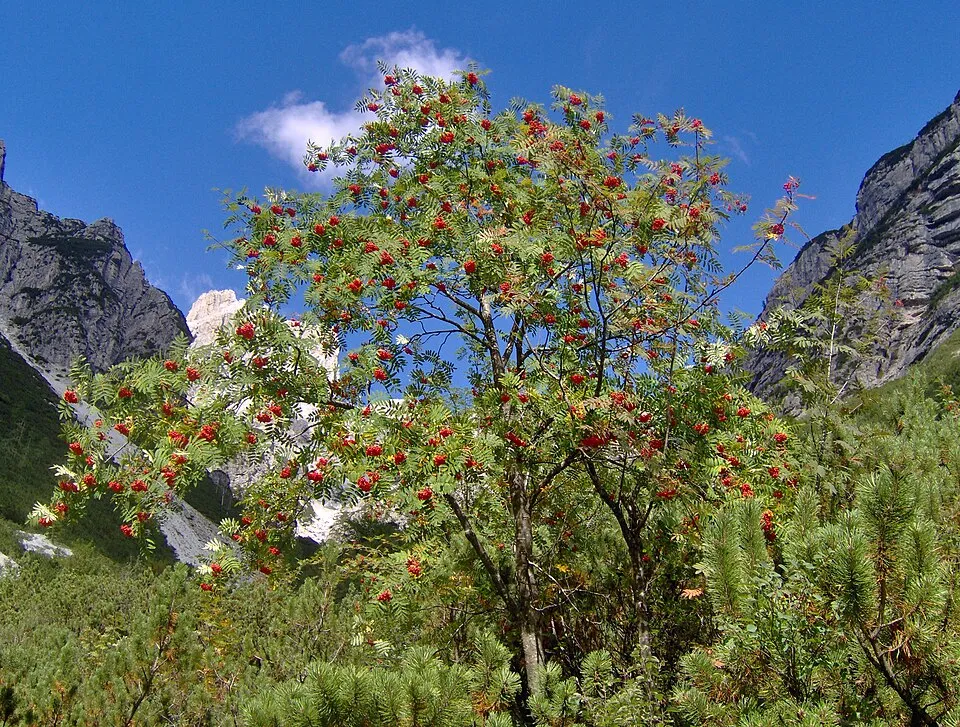
- Rowan · Sorbus aucuparia · 4
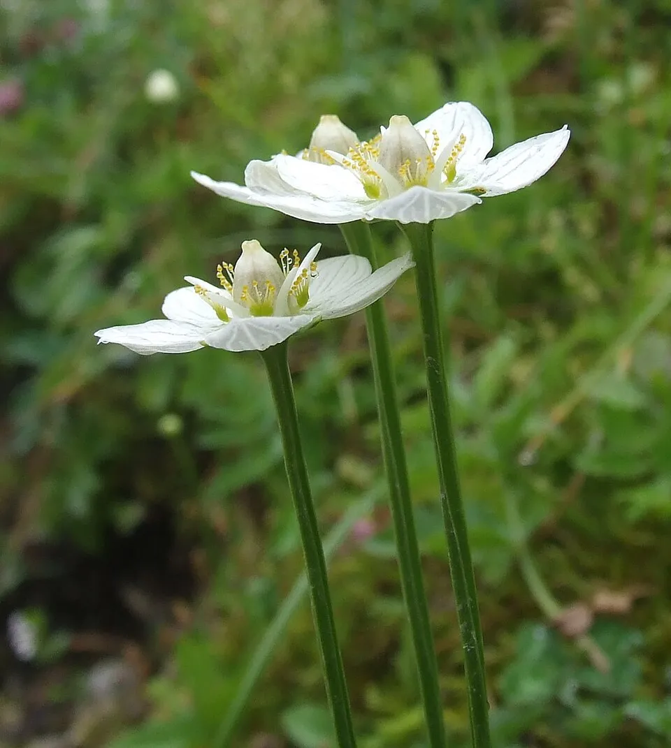
- Grass-of-Parnassus · Parnassia palustris · 4
- Brachionus quadridentatus · 3
- Mountain arnica · Arnica montana · 3
Records: GBIF.org (CC-BY). Names: Wikidata (CC0), GBIF. Photos: Wikimedia Commons.
Conservation challenges
The primary purpose of the site is to preserve its natural habitats and the biodiversity they support. The species recorded (Biodiversity tab) reflect its ecological value. The designations it holds frame its management and the control of land use.
According to Global Forest Change data (University of Maryland, Global Forest Watch), about 15 ha of tree cover were lost within the boundary between 2001 and 2023 (under 1% of its area). These losses include logging, storms and fires, and do not account for regrowth. According to CORINE Land Cover, land cover here remained almost unchanged between 1990 and 2018 (less than 0.5% of the area affected). At night, the area gives off virtually no artificial light detectable from space (NASA VIIRS Black Marble composite, 2016). According to the Natura 2000 forms, of 20 assessed habitats of European interest, 14 are in excellent condition and 2 in average or reduced condition.
Pressure indicators
Tree cover lost
15 ha
2001–2023 · < 1% of the area
20012023
Fires since 2016
0
No large fire mapped (fires over about 30 ha)
Light at night
0%
of the area gives off artificial light visible from space
DarkLit
Land cover change
< 0.5%
of the area changed, 1990–2018 · CORINE
Sources: Global Forest Change (Hansen et al., University of Maryland, via Global Forest Watch, CC-BY 4.0); EFFIS, European Commission / Copernicus; NASA Black Marble 2016 (public domain); CORINE Land Cover 2018 (Copernicus) or MODIS.
CORINE Land Cover Change 1990–2018: generated using European Union's Copernicus Land Monitoring Service information (EEA), aggregated by Parkavela; DOI 10.2909/f30f1000-7cf8-43bb-872c-5eb093911b24.
Practical information
Cities and airport
- Genoa
37 km as the crow flies - La Spezia
49 km as the crow flies - Airport: Genoa Cristoforo Colombo (GOA)
45 km as the crow flies
Things to see
5 viewpoints · 3 waterfalls · 7 lakes and ponds
- canalone
viewpoint - Cascata della Ravezza
waterfall - Lago Lagastro
lake or pond · 1,318 m - Cascate del Rio Ronco del Diavolo
waterfall - Lago Code d'Asino
lake or pond · 1,274 m
Where to stay
5 mountain huts
- Rifugio Monte Aiona - Pratomollo
Staffed hut · 1,503 m - Rifugio Casermette del Penna
Staffed hut - Rifugio Monte degli Abeti
Unstaffed hut - trapper
Unstaffed hut
Hiking
32 waymarked routes listed, including:
Cammino di Assisi, GenovaSentiero dei Celti e dei Liguri
Data © OpenStreetMap contributors (ODbL) · Wikidata (CC0)
Waymarked hiking routes
Cammino di Assisi, Genova - San Miniato
8.3 km within the site ↗ 147 m↘ 133 m 1,273–1,389 m
SCL Sentiero dei Celti e dei Liguri - tappa 8
1.8 km within the site ↗ 89 m↘ 6 m 1,393–1,491 m
AV34 Passo della Spingarda – Passo del Bocco
1.6 km within the site ↗ 0 m↘ 76 m 1,547–1,626 m
up to T2 · mountain hiking
301 Unnamed route
4.1 km within the site ↗ 467 m↘ 0 m 1,218–1,689 m
up to T2 · mountain hiking
A1 - Anello del Cereghetto
5.9 km within the site ↗ 315 m↘ 436 m 1,054–1,482 m
up to T2 · mountain hiking
A2 - Anello delle Lame
5.1 km within the site ↗ 113 m↘ 264 m 1,178–1,431 m
up to T2 · mountain hiking
Tracks © OpenStreetMap contributors (ODbL), clipped to the boundary; elevation gain and profiles computed on the longest section from Mapzen Terrain Tiles (≈ 30 m), indicative only. Indicative difficulty (SAC scale, OpenStreetMap, via Waymarked Trails): check with the park.
Access and visiting
The nearest railway station is Chiavari, about 19 km from the site boundary. Nearest towns of over 50,000 people, as the crow flies: Genoa (37 km) and La Spezia (49 km). Nearest airport: Genoa Cristoforo Colombo (GOA), about 45 km away. About 110,000 people live within 20 km of the site boundary, 7,900 of them within 10 km; the site itself is virtually uninhabited (GHSL estimate, 2020). This population has fallen by about 9% since 2000. Waymarked hiking routes listed in OpenStreetMap: 32, including Cammino di Assisi, Genova and Sentiero dei Celti e dei Liguri. To see: 5 viewpoints, 3 waterfalls and 7 lakes and ponds, including canalone, Cascata della Ravezza, Lago Lagastro (1,318 m) and Cascate del Rio Ronco del Diavolo. Where to stay: 5 mountain huts, including Rifugio Monte Aiona - Pratomollo (1,503 m), Rifugio Casermette del Penna and Rifugio Monte degli Abeti. To plan a visit (access, opening periods, visitor rules), it is best to consult the official information from the managing body and the official website listed in this page's sources.
Source: OpenStreetMap (ODbL), Wikidata (CC0), October 2026.
When to visit
Best time to visit: from May to September, with average temperatures of 11 to 19 °C and moderate rainfall. Precipitation peaks in October and November (up to 200 mm per month). These averages apply to the site's representative point (1,023 m); higher up it is markedly cooler and snow lasts longer. According to NASA's MODIS satellites (2015–2025 average), snow covers the site about 30 days a year, mostly from December to March. Day length ranges from about 8 h 51 min in December to 15 h 31 min in June. Wildlife records published on GBIF peak for plants (June). These peaks also reflect when observers are most active.
Source: Copernicus ERA5-Land (C3S), monthly averages 1996–2025 at the representative point, temperatures adjusted for elevation.
Contains modified Copernicus Climate Change Service information 2026. Neither the European Commission nor ECMWF is responsible for any use that may be made of the Copernicus information or data it contains.
Wildlife records calendar
JFMAMJJASOND
Plants
Monthly records published on GBIF (CC-BY), relative to the busiest month; also reflects observer activity.
Gallery
© vengomatto · CC BY 2.0
© Davide Papalini · CC BY-SA 3.0
© Vengomatto · CC BY-SA 3.0
© vengomatto from Italia · CC BY-SA 2.0
© Pampuco · CC BY-SA 4.0
© Pampuco · CC BY-SA 4.0
Sources and licences
- Wikidata: Q1515313
- OpenStreetMap: relation 2689881
- Official website: http://www.parks.it/parco.aveto
- Wikipedia: en.wikipedia.org/wiki/Aveto_Natural_Regional_Park
- WDPA: 63609
References
- cds.climate.copernicus.eu: climate · CC-BY-4.0
- registry.opendata.aws: elevation of the reference point, detailed relief · PD
- land.copernicus.eu: land cover, land cover change, sea share · COPERNICUS
- doi.org: population around the site · CC-BY-4.0
- wikidata.org: official area, establishment date, protected heritage, official name, nearby cities and airport, access and peaks, lake depths, places to see, official website · CC0-1.0
- eea.europa.eu: bathing water quality, ecological status of waters · CC-BY-4.0
- en.eurovelo.com: EuroVelo cycle routes · ODbL-1.0
- cycling.waymarkedtrails.org: cycle routes · ODbL-1.0
- opentopodata.org: elevations · PD
- forest-fire.emergency.copernicus.eu: wildfires · COPERNICUS
- globalforestwatch.org: tree cover loss · CC-BY-4.0
- gbif.org: seasonality of sightings, invasive alien species, observed species · CC-BY-4.0
- europe-geology.eu: geology · CC-BY-4.0
- hydrosheds.org: lakes · CC-BY-4.0
- natura2000.eea.europa.eu: Natura 2000 habitats and species · CC-BY-4.0
- earthobservatory.nasa.gov: night light · PD
- openstreetmap.org: access and peaks, places to see · ODbL-1.0
- hiking.waymarkedtrails.org: route difficulty · ODbL-1.0
- nsidc.org: snow cover · PD
- wikidata.org: Wikipedia article · CC-BY-SA-4.0
Data © OpenStreetMap contributors (ODbL), Wikidata (CC0) and the sources cited.