Italy · Terrestrial
Antola Regional Nature Park
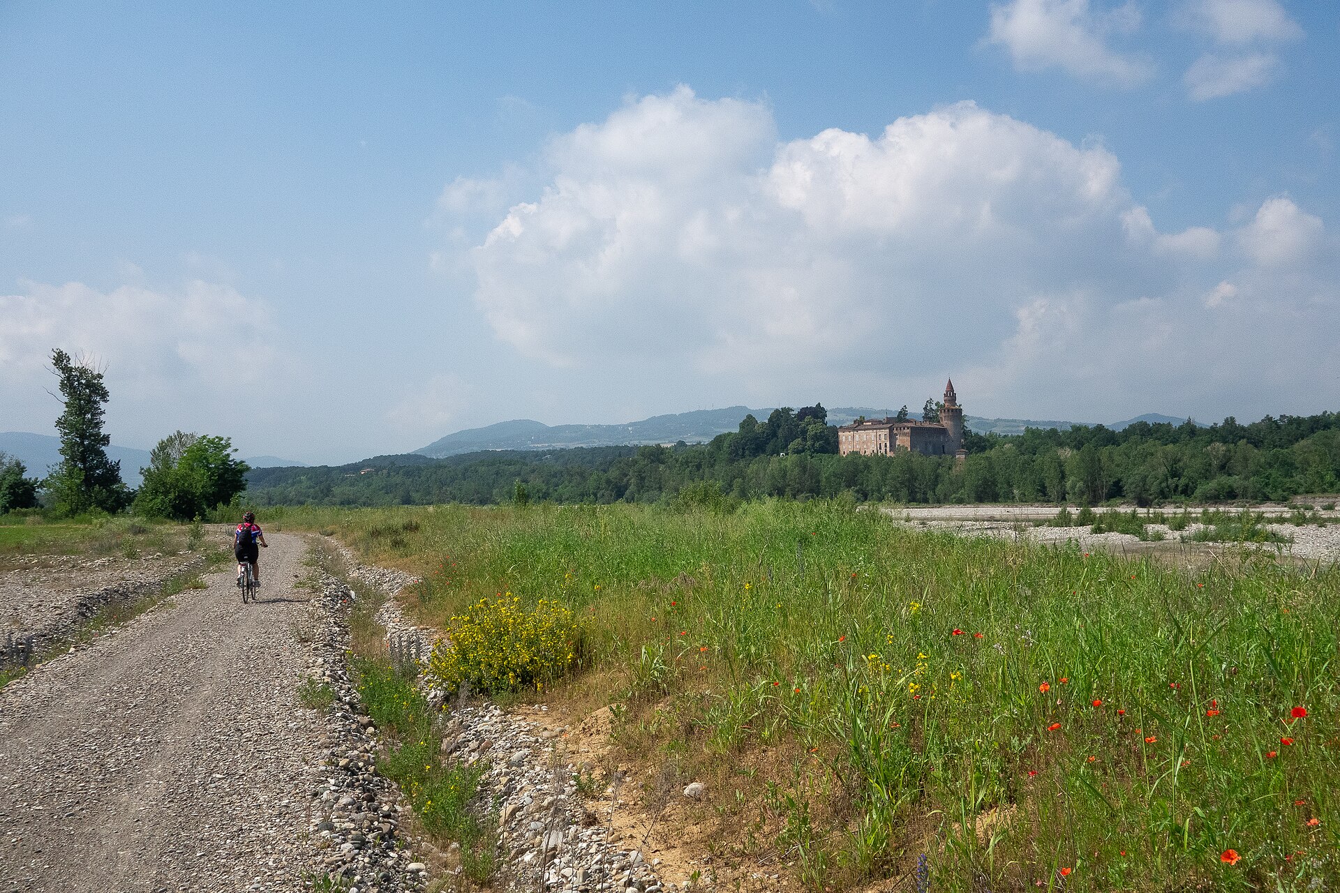
Regional nature park of 4,838 hectares in Italy, established in 1995.
Overview
Regional nature park of 4,838 hectares in Italy, established in 1995.
Antola Regional Nature Park is located in Italy (Europe). It is a predominantly terrestrial area. Established on 22 February 1995, it covers about 4,838 hectares.
Protections and designations
Natura 2000 · habitats (SAC) · 5 sites
- Conglomerato di Vobbia IT1330213
- Lago Brugneto IT1331019
- Massiccio dell'Antola - Monte Carmo - Monte Legnà IT1180011
- Parco dell'Antola IT1330905
- Rio di Vallenzona IT1330223
Protected as a regional nature park. International labels and designations: Natura 2000 network (5 sites).
In our collections
Frequently asked questions
Where is Antola Regional Nature Park?
In Italy (Europe). Representative point: 44.5754° N, 9.1179° E.
How large is Antola Regional Nature Park?
About 4,838 hectares (48 km²). It is the 75th largest of the 128 regional parks in Italy covered by Parkavela.
When was Antola Regional Nature Park established?
On 22 February 1995.
What habitats and landscapes does Antola Regional Nature Park include?
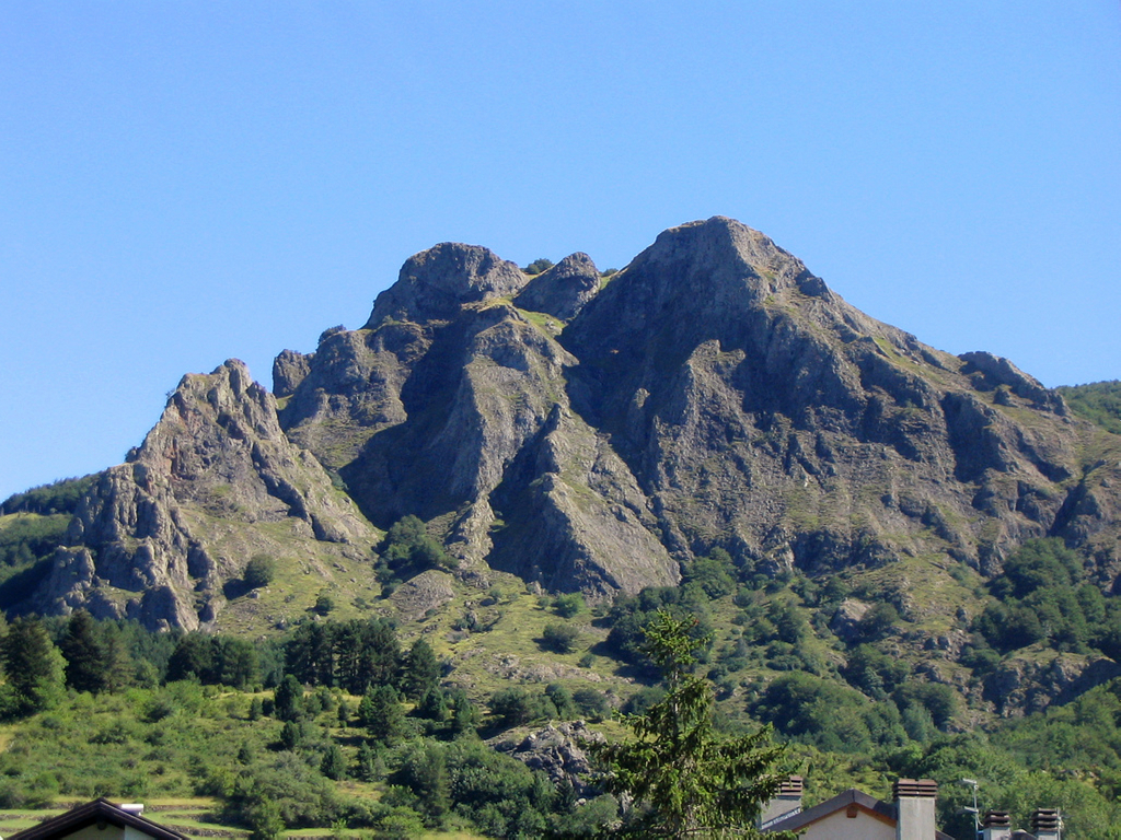
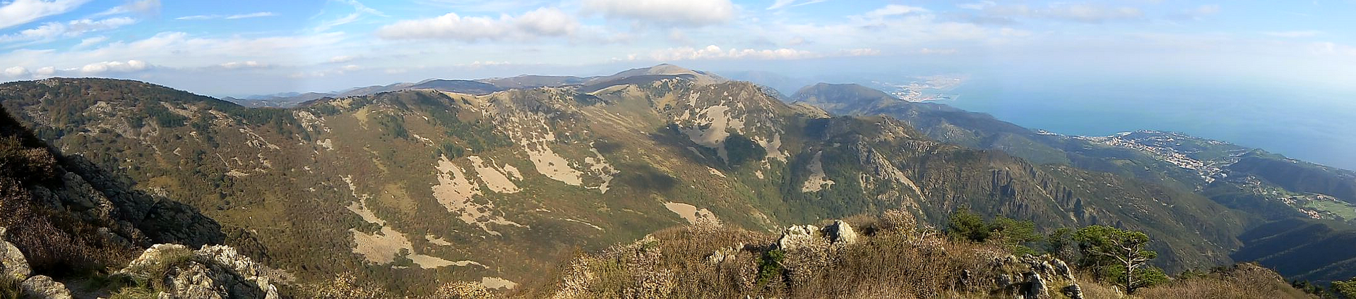
A terrestrial area, with forests and mountains.
What rocks lie beneath Antola Regional Nature Park?
According to the European 1:1 million geological map (EGDI), the bedrock consists mainly of marly limestones (94% of sampled points). These are mostly sedimentary rocks. The geological units date mainly from the Cretaceous (81% of sampled points).
What is the highest point of Antola Regional Nature Park?
Monte Cremado, at 1,513 m (OpenStreetMap).
What are the main summits of Antola Regional Nature Park?
Monte Cremado (1,513 m), Monte Duso (1,451 m), Monte Prelà (1,407 m), Monte Buio (1,402 m) and Monte Sotto Garzo (1,288 m) (OpenStreetMap).
Which international labels apply to Antola Regional Nature Park?
Natura 2000 network (5 sites).
When is the best time to visit Antola Regional Nature Park?
Best time to visit: from May to September, with average temperatures of 12 to 19 °C and moderate rainfall.
What is there to see in Antola Regional Nature Park?
5 viewpoints, 2 waterfalls and 1 lake or pond, including vista Castello della Pietra, Cascata Acquapendente and Lago del Brugneto (OpenStreetMap).
Where can I stay in Antola Regional Nature Park?
Rifugio Parco Antola (1,460 m) (OpenStreetMap).
Are there historic monuments in Antola Regional Nature Park?
Yes. According to Wikidata, one monument protected as Italian national cultural heritage stands within the boundary. For example: “Castello della Pietra” in Vobbia.
What is the nearest large city to Antola Regional Nature Park?
Nearest towns of over 50,000 people, as the crow flies: Genoa (18 km) and Alessandria (43 km). Nearest airport: Genoa Cristoforo Colombo (GOA), about 21 km away.
How can I reach Antola Regional Nature Park by train?
The nearest railway station is Ronco Scrivia, about 3 km from the site boundary.
Where can I get visitor information on site?
Centro di Turismo Equestre e Rifugio Escursionistico di Torriglia and La Torriglietta – Torriglia – Ente Parco Antola.
Are there waymarked hiking trails in Antola Regional Nature Park?
Yes. Waymarked hiking routes listed in OpenStreetMap: 65, including Cammino Piemonte Sud, Via del Mare and Via del Sale. The “Via del Mare” route runs for about 9 km through the site, with some 290 m of ascent on its longest section.
Which species can be seen in Antola Regional Nature Park?
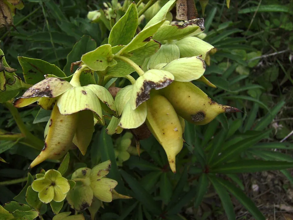
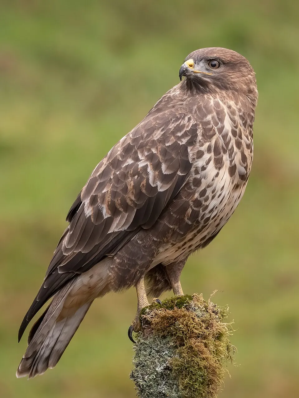
Among the species most often recorded on GBIF are Helleborus foetidus (Stinking Hellebore), Fagus sylvatica (European Beech), Buteo buteo (Common Buzzard) and Erithacus rubecula (European robin).
What is the official website of Antola Regional Nature Park?
© OpenStreetMap
Download the boundary: GeoJSON · GPX Boundary © OpenStreetMap contributors (ODbL).
Geography
The representative point of the site lies at around 1,012 m above sea level. Over the 1996–2025 period, the mean annual temperature is about 9.6 °C and total precipitation reaches roughly 1,337 mm per year. The warmest month is usually August, the coolest January, and the wettest November. According to the European 1:1 million geological map (EGDI), the bedrock consists mainly of marly limestones (94% of sampled points). These are mostly sedimentary rocks. The geological units date mainly from the Cretaceous (81% of sampled points). The site contains one lake larger than 10 ha (lago del Brugneto), totalling 63 ha of water (HydroLAKES). lago del Brugneto (97 ha) is 70 m deep (Wikidata).
Area
- Area
- 4,838 ha
- Elevation
- 1,012 m
- Median elevation
- 939 m
- Mean slope
- 22°
- Lakes over 10 ha
- 1 (63 ha)
- Coordinates
- 44.5754, 9.1179
Terrain: Mapzen Terrain Tiles (SRTM, USGS) · Lakes: HydroLAKES (Messager et al. 2016, hydrosheds.org, CC BY 4.0) · depths: Wikidata (CC0)
Elevation bands
- below 500 m 4%
- 500–1,000 m 55%
- 1,000–1,500 m 41%
- 1,500–2,000 m 1%
share of the site in each elevation band (smoothed terrain model: summits are rounded off) · Terrain: Mapzen Terrain Tiles (SRTM, USGS)
Bedrock
- Marly limestones 94 %
- Limestones 6 %
Sedimentary rocks 100 % · Main age: Cretaceous (81%)
Source: EGDI 1:1M geological map (EuroGeoSurveys and national geological surveys), CC BY 4.0 · 16 sampled points within the site.
Main summits
- Monte Cremado1,513 m
- Monte Duso1,451 m
- Monte Prelà1,407 m
- Monte Buio1,402 m
- Monte Sotto Garzo1,288 m
- Monte Scietto1,150 m
- Monte Pareto1,107 m
- Monte Cravì990 m
- Carega do Diao957 m
- Biurca Nord941 m
Data © OpenStreetMap contributors (ODbL)
Climate
● Mean temperature (°C) · ▮ Precipitation (mm)
Source: Copernicus ERA5-Land (C3S, doi:10.24381/cds.68d2bb30), monthly averages 1996–2025 interpolated to the representative point, temperatures adjusted for elevation.
Contains modified Copernicus Climate Change Service information 2026. Neither the European Commission nor ECMWF is responsible for any use that may be made of the Copernicus information or data it contains.
Natural habitats
According to CORINE Land Cover (2018), the site is mainly made up of forests (79%), heath and scrub (8%) and grassland and meadows (5%). Woodland is mostly broadleaved. Elevation ranges from about 360 m to 1,513 m (highest point: Monte Cremado). Median elevation is 939 m, and 41% of the site lies above 1,000 m (SRTM elevation model). The terrain is steep: 20% of slopes exceed 30° (mean slope 22°). The 5 Natura 2000 sites overlapping the area list 20 habitats of European interest (6 priority), the most extensive being Castanea sativa woods, Asperulo-Fagetum beech forests and semi-natural dry grasslands and scrubland facies on calcareous substrates (Festuco-Brometalia) (* important orchid sites).
Biodiversity
Based on occurrences aggregated by GBIF, several species are regularly recorded within the site. Among the most frequent are Helleborus foetidus (Stinking Hellebore), Fagus sylvatica (European Beech), Buteo buteo (Common Buzzard) and Erithacus rubecula (European robin). The full list of documented taxa is shown below. The overlapping Natura 2000 sites list 49 species of European interest: 20 mammals, 6 reptiles, 4 amphibians, 4 fish, 8 invertebrates and 7 plants.
Habitats of European interest
From the official forms of the 5 Natura 2000 sites overlapping the area (areas reported for each whole site).
- Castanea sativa woods 2,081 ha
- Asperulo-Fagetum beech forests 1,671 ha
- Semi-natural dry grasslands and scrubland facies on calcareous substrates (Festuco-Brometalia) (* important orchid sites) 459 ha
- Eastern white oak woods priority 343 ha
- Mountain hay meadows 255 ha
- Lowland hay meadows (Alopecurus pratensis, Sanguisorba officinalis) 186 ha
- Medio-European limestone beech forests of the Cephalanthero-Fagion 165 ha
- Alpine and Boreal heaths 106 ha
and 12 more
Species of European interest
Mammals · 20
Barbastelle (Barbastella barbastellus), Grey wolf (Canis lupus), Serotine bat (Eptesicus serotinus), Savi's Pipistrelle (Hypsugo savii), Crested porcupine (Hystrix cristata), Common bent-wing bat (Miniopterus schreibersii), Hazel dormouse (Muscardinus avellanarius), Daubenton's bat (Myotis daubentonii), Geoffroy's bat (Myotis emarginatus), Whiskered bat (Myotis mystacinus), Natterer's bat (Myotis nattereri), Lesser noctule (Nyctalus leisleri) and 8 more
Reptiles · 6
Smooth snake (Coronella austriaca), Western Whip Snake (Hierophis viridiflavus), Western green lizard (Lacerta bilineata), Dice snake (Natrix tessellata), Common wall lizard (Podarcis muralis), Aesculapian Snake (Zamenis longissimus)
Amphibians · 4
Italian stream frog (Rana italica), Common frog (Rana temporaria), Spectacled Salamander (Salamandrina terdigitata), North-west Italian cave salamander (Speleomantes strinatii)
Fish · 4
Brook barbel (Barbus caninus), Italian Barbel (Barbus plebejus), Italian Spined Loach (Cobitis bilineata), Italian Riffle Dace (Telestes muticellus)
Invertebrates · 8
White-clawed Crayfish (Austropotamobius pallipes), Eastern Eggar (Eriogaster catax), Jersey Tiger (Euplagia quadripunctaria), Roman Snail (Helix pomatia), Stag beetle (Lucanus cervus), Italian Meadow Bush-cricket (Metrioptera caprai), Hermit beetle (Osmoderma eremita), Southern Festoon (Zerynthia polyxena)
Plants · 7
Mountain arnica (Arnica montana), Snowdrop (Galanthus nivalis), Great Yellow Gentian (Gentiana lutea), Adriatic lizard orchid (Himantoglossum adriaticum), Fir Clubmoss (Huperzia selago), Interrupted clubmoss (Lycopodium annotinum), Butcher's-broom (Ruscus aculeatus)
Source: Natura 2000 standard data forms (EEA, CC-BY 4.0). Not exhaustive: sensitive species are not published.
Species to look out for



Observed species
Occurrences documented via GBIF; they are neither an exhaustive inventory nor proof of current presence.
- Stinking Hellebore · Helleborus foetidus · 21
- European Beech · Fagus sylvatica · 9
- Common Buzzard · Buteo buteo · 8
- European robin · Erithacus rubecula · 8
- Common Blackbird · Turdus merula · 7
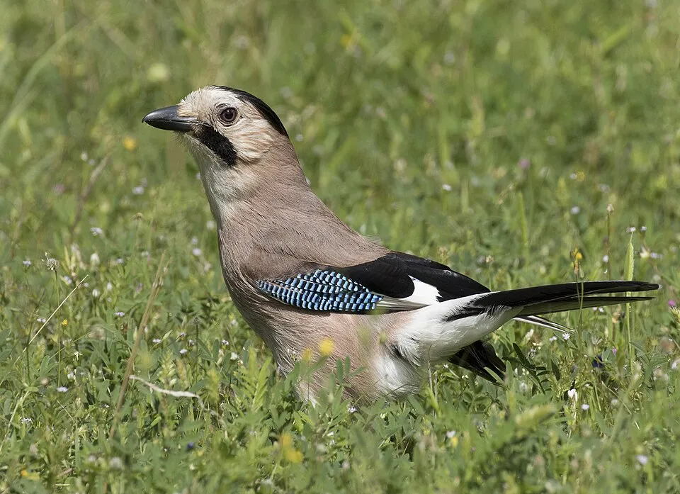
- Eurasian Jay · Garrulus glandarius · 7
- Hieracium boreoapenninum · 7
- Great tit · Parus major · 7
- Hart's tonguefern · Asplenium scolopendrium · 6
- Ramsons · Allium ursinum · 6
- Blackthorn · Prunus spinosa · 6
- Anemone trifolia · 6
+18 more species
- Pinnate Coralroot · Cardamine heptaphylla · 6
- Hooded Crow · Corvus cornix · 5
- Eurasian blue tit · Cyanistes caeruleus · 5
- Hazel · Corylus avellana · 5
- Knotted Crane's-bill · Geranium nodosum · 5
- Eurasian Wren · Troglodytes troglodytes · 5
- Straw Foxglove · Digitalis lutea · 5
- European Green Woodpecker · Picus viridis · 4
- Marsh Tit · Poecile palustris · 4
- Common Wood Pigeon · Columba palumbus · 4
- Pheasant's-eye Daffodil · Narcissus poeticus · 4
- Wood ragwort · Senecio ovatus · 4
- Sycamore · Acer pseudoplatanus · 4
- Derocrepis sodalis · 4
- Alpine Laburnum · Laburnum alpinum · 4
- Garlic Mustard · Alliaria petiolata · 4
- White swallow-wort · Vincetoxicum hirundinaria · 4
- Pulmonaria hirta · 4
Records: GBIF.org (CC-BY). Names: Wikidata (CC0), GBIF. Photos: Wikimedia Commons.
Conservation challenges
The primary purpose of the site is to preserve its natural habitats and the biodiversity they support. The species recorded (Biodiversity tab) reflect its ecological value. The designations it holds frame its management and the control of land use.
According to Global Forest Change data (University of Maryland, Global Forest Watch), about 16 ha of tree cover were lost within the boundary between 2001 and 2023 (under 1% of its area), peaking in 2019 and 2020. These losses include logging, storms and fires, and do not account for regrowth. According to CORINE Land Cover, land cover here remained almost unchanged between 1990 and 2018 (less than 0.5% of the area affected). At night, 1% of the area gives off artificial light detectable from space (NASA VIIRS Black Marble composite, 2016): it ranks among the darkest places in the atlas for this country. According to the Natura 2000 forms, of 18 assessed habitats of European interest, 2 are in excellent condition and 2 in average or reduced condition. According to the Water Framework Directive assessment (2022 river basin management plans, data 2014–2019), of the 2 rivers assessed within the site, 1 has good ecological status and 1 moderate ecological status. Other assessed water bodies: lakes, 1 of 1 in good ecological status or better.
Pressure indicators
Tree cover lost
16 ha
2001–2023 · < 1% of the area
20012023
Fires since 2016
0
No large fire mapped (fires over about 30 ha)
Light at night
1%
of the area gives off artificial light visible from space
DarkLit
Land cover change
< 0.5%
of the area changed, 1990–2018 · CORINE
Rivers and lakes
82%
of the 5 km of assessed rivers in good or high ecological status · WFD 2022
Lakes: 1 of 1 good or better
assessments 2014–2019
Sources: Global Forest Change (Hansen et al., University of Maryland, via Global Forest Watch, CC-BY 4.0); EFFIS, European Commission / Copernicus; NASA Black Marble 2016 (public domain); CORINE Land Cover 2018 (Copernicus) or MODIS.
CORINE Land Cover Change 1990–2018: generated using European Union's Copernicus Land Monitoring Service information (EEA), aggregated by Parkavela; DOI 10.2909/f30f1000-7cf8-43bb-872c-5eb093911b24.
Ecological status of water bodies: European Environment Agency, WISE – Water Framework Directive, 3rd river basin management plans (2022), CC BY 4.0. Official national classification, not comparable between countries.
Practical information
Cities and airport
- Genoa
18 km as the crow flies - Alessandria
43 km as the crow flies - Airport: Genoa Cristoforo Colombo (GOA)
21 km as the crow flies
Visitor information
- Centro di Turismo Equestre e Rifugio Escursionistico di Torriglia
< 1 km from the site boundary - La Torriglietta – Torriglia – Ente Parco Antola
1 km from the site boundary
Things to see
5 viewpoints · 2 waterfalls · 1 lake or pond
- vista Castello della Pietra
viewpoint - Cascata Acquapendente
waterfall - Lago del Brugneto
lake or pond
Hiking
65 waymarked routes listed, including:
Cammino Piemonte SudVia del MareVia del Sale
Data © OpenStreetMap contributors (ODbL) · Wikidata (CC0)
Waymarked hiking routes
Via del Mare
8.6 km within the site ↗ 293 m↘ 95 m 1,327–1,572 m
up to T2 · mountain hiking
Nenno - Cappelletta del Colletto
6.6 km within the site ↗ 327 m↘ 351 m 788–1,079 m
603 Unnamed route
8.4 km within the site ↗ 274 m↘ 73 m 1,327–1,554 m
up to T2 · mountain hiking
Crocefieschi - Monte Antola
4.6 km within the site ↗ 345 m↘ 58 m 1,249–1,572 m
up to T2 · mountain hiking
Tracks © OpenStreetMap contributors (ODbL), clipped to the boundary; elevation gain and profiles computed on the longest section from Mapzen Terrain Tiles (≈ 30 m), indicative only. Indicative difficulty (SAC scale, OpenStreetMap, via Waymarked Trails): check with the park.
Access and visiting
The nearest railway station is Ronco Scrivia, about 3 km from the site boundary. Nearest towns of over 50,000 people, as the crow flies: Genoa (18 km) and Alessandria (43 km). Nearest airport: Genoa Cristoforo Colombo (GOA), about 21 km away. About 670,000 people live within 20 km of the site boundary, 46,000 of them within 10 km; some 370 people are estimated to live inside (GHSL estimate, 2020). This population has fallen by about 8% since 2000. Visitor information on site: Centro di Turismo Equestre e Rifugio Escursionistico di Torriglia and La Torriglietta – Torriglia – Ente Parco Antola. Waymarked hiking routes listed in OpenStreetMap: 65, including Cammino Piemonte Sud, Via del Mare and Via del Sale. To see: 5 viewpoints, 2 waterfalls and 1 lake or pond, including vista Castello della Pietra, Cascata Acquapendente and Lago del Brugneto. Where to stay: Rifugio Parco Antola (1,460 m). To plan a visit (access, opening periods, visitor rules), it is best to consult the official information from the managing body and the official website listed in this page's sources.
Source: OpenStreetMap (ODbL), Wikidata (CC0), October 2026.
Built heritage
According to Wikidata, one monument protected as Italian national cultural heritage stands within the boundary. It is “Castello della Pietra” in Vobbia.
-
Castello della Pietra
Vobbia · 11th c.
Source: Wikidata (CC0), monuments in each country’s official heritage protection registers, at national or regional level. Each item links to its Wikidata entry.
When to visit
Best time to visit: from May to September, with average temperatures of 12 to 19 °C and moderate rainfall. Precipitation peaks in October and November (up to 180 mm per month). These averages apply to the site's representative point (1,012 m); higher up it is markedly cooler. Day length ranges from about 8 h 50 min in December to 15 h 32 min in June. Wildlife records published on GBIF peak for birds (March), plants (May and June), butterflies and moths (June) and mammals (March). These peaks also reflect when observers are most active.
Source: Copernicus ERA5-Land (C3S), monthly averages 1996–2025 at the representative point, temperatures adjusted for elevation.
Contains modified Copernicus Climate Change Service information 2026. Neither the European Commission nor ECMWF is responsible for any use that may be made of the Copernicus information or data it contains.
Wildlife records calendar
JFMAMJJASOND
Birds
Plants
Butterflies & moths
Mammals
Monthly records published on GBIF (CC-BY), relative to the busiest month; also reflects observer activity.
Gallery
© G80 · CC BY-SA 3.0
© Hectonichus · CC BY-SA 3.0
© Stefano59Rivara · CC BY-SA 4.0
© Pampuco · CC BY-SA 4.0
© Hectonichus · CC BY-SA 3.0
© Davide Papalini · CC BY-SA 3.0
Sources and licences
- Wikidata: Q182860
- OpenStreetMap: relation 2689409
- Official website: http://www.parcoantola.it
- Wikipedia: en.wikipedia.org/wiki/Antola_Natural_Regional_Park
- WDPA: 63610
References
- cds.climate.copernicus.eu: climate · CC-BY-4.0
- registry.opendata.aws: elevation of the reference point, detailed relief · PD
- land.copernicus.eu: land cover, land cover change, sea share · COPERNICUS
- doi.org: population around the site · CC-BY-4.0
- wikidata.org: official area, establishment date, protected heritage, official name, nearby cities and airport, access and peaks, lake depths, places to see, official website · CC0-1.0
- eea.europa.eu: bathing water quality, ecological status of waters · CC-BY-4.0
- en.eurovelo.com: EuroVelo cycle routes · ODbL-1.0
- cycling.waymarkedtrails.org: cycle routes · ODbL-1.0
- opentopodata.org: elevations · PD
- forest-fire.emergency.copernicus.eu: wildfires · COPERNICUS
- globalforestwatch.org: tree cover loss · CC-BY-4.0
- gbif.org: seasonality of sightings, invasive alien species, observed species · CC-BY-4.0
- europe-geology.eu: geology · CC-BY-4.0
- hydrosheds.org: lakes · CC-BY-4.0
- natura2000.eea.europa.eu: Natura 2000 habitats and species · CC-BY-4.0
- earthobservatory.nasa.gov: night light · PD
- openstreetmap.org: access and peaks, places to see · ODbL-1.0
- hiking.waymarkedtrails.org: route difficulty · ODbL-1.0
- nsidc.org: snow cover · PD
- wikidata.org: Wikipedia article · CC-BY-SA-4.0
Data © OpenStreetMap contributors (ODbL), Wikidata (CC0) and the sources cited.