Italy · Marine
Portofino marine protected area
Marine protected area of 346 hectares in Italy, established in 1999.
Overview
Marine protected area of 346 hectares in Italy, established in 1999.
Portofino marine protected area is located in Italy (Europe). It is a predominantly marine area. Established in 1999, it covers about 346 hectares.
Protections and designations
Natura 2000 · habitats (SAC) · 2 sites
- Fondali Monte Portofino IT1332674
- Parco di Portofino IT1332603
Designated as a marine protected area. International labels and designations: Natura 2000 network (2 sites).
In our collections
Frequently asked questions
Where is Portofino marine protected area?
In Italy (Europe). Representative point: 44.3039° N, 9.2078° E.
How large is Portofino marine protected area?
About 346 hectares (3 km²). It is the 11th largest of the 12 marine protected areas in Italy covered by Parkavela. About 300 ha are at sea.
When was Portofino marine protected area established?
In 1999.
What habitats and landscapes does Portofino marine protected area include?
A marine area, with coasts.
Which international labels apply to Portofino marine protected area?
Natura 2000 network (2 sites).
When is the best time to visit Portofino marine protected area?
Best time to visit: from April to September, with average temperatures of 13 to 25 °C and moderate rainfall.
What is there to see in Portofino marine protected area?
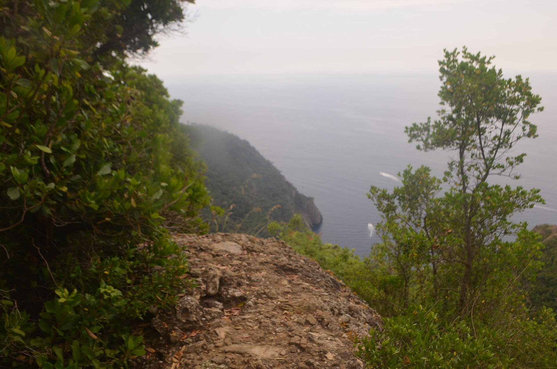
2 viewpoints (OpenStreetMap).
Can you swim in Portofino marine protected area?
15 monitored bathing sites lie in or within 1 km of the site; official 2025 classification: 13 excellent and 2 good (European Environment Agency). Swimming is only permitted at the sites and times authorised locally.
What is the nearest large city to Portofino marine protected area?
Nearest towns of over 50,000 people, as the crow flies: Genoa (19 km) and Savona (53 km). Nearest airport: Genoa Cristoforo Colombo (GOA), about 26 km away.
How can I reach Portofino marine protected area by train?
The nearest railway station is Camogli-San Fruttuoso, less than 1 km from the site boundary.
Where can I get visitor information on site?
Pro Loco Camogli, Wonderful Italy Homes & Experiences and Welcome Riviera.
Which species can be seen in Portofino marine protected area?
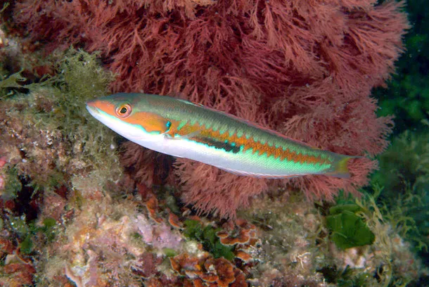
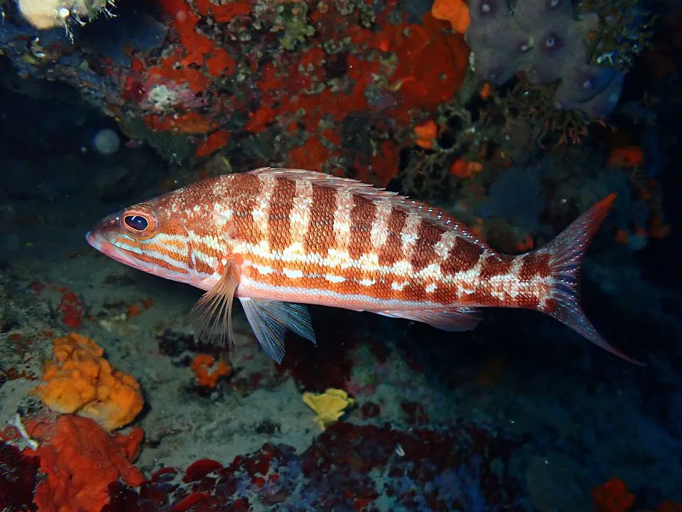
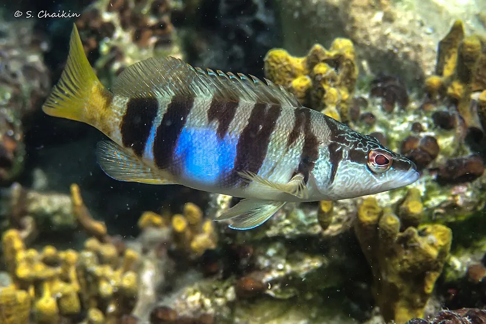
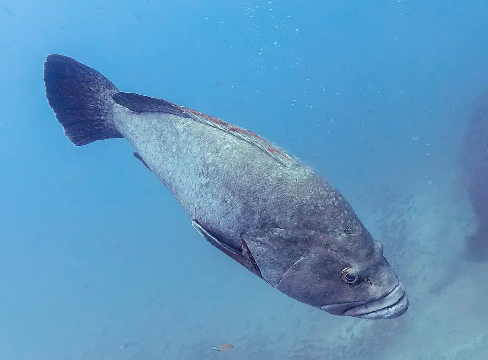
Among the species most often recorded on GBIF are Coris julis (Mediterranean rainbow wrasse), Serranus cabrilla (Comber), Serranus scriba (Painted comber) and Epinephelus marginatus (Dusky grouper).
What is the official website of Portofino marine protected area?
© OpenStreetMap
Download the boundary: GeoJSON · GPX Boundary © OpenStreetMap contributors (ODbL).
Geography
The representative point of the site lies at around 39 m above sea level. Over the 1996–2025 period, the mean annual temperature is about 15.8 °C and total precipitation reaches roughly 1,364 mm per year. The warmest month is usually August, the coolest January, and the wettest November.
Area
- Area
- 346 ha
- Elevation
- 39 m
- Coordinates
- 44.3039, 9.2078
Climate
● Mean temperature (°C) · ▮ Precipitation (mm)
Source: Copernicus ERA5-Land (C3S, doi:10.24381/cds.68d2bb30), monthly averages 1996–2025 interpolated to the representative point, temperatures adjusted for elevation.
Contains modified Copernicus Climate Change Service information 2026. Neither the European Commission nor ECMWF is responsible for any use that may be made of the Copernicus information or data it contains.
Natural habitats
The sea covers about 92% of the site. The seabed reaches about 77 m deep (median depth 30 m; GEBCO bathymetry). The 2 Natura 2000 sites overlapping the area list 21 habitats of European interest (6 priority), the most extensive being Quercus ilex and Quercus rotundifolia forests, Castanea sativa woods and reefs.
Biodiversity
Based on occurrences aggregated by GBIF, several species are regularly recorded within the site. Among the most frequent are Coris julis (Mediterranean rainbow wrasse), Serranus cabrilla (Comber), Serranus scriba (Painted comber) and Epinephelus marginatus (Dusky grouper). The full list of documented taxa is shown below. The overlapping Natura 2000 sites list 17 species of European interest: 1 mammal, 3 reptiles, 5 amphibians, 1 fish, 5 invertebrates and 2 plants.
Habitats of European interest
From the official forms of the 2 Natura 2000 sites overlapping the area (areas reported for each whole site).
- Quercus ilex and Quercus rotundifolia forests 171 ha
- Castanea sativa woods 134 ha
- Reefs 72 ha
- Posidonia beds (Posidonion oceanicae) priority 71 ha
- Mediterranean pine forests with endemic Mesogean pines 67 ha
- Thermo-Mediterranean and pre-desert scrub 60 ha
- Eastern white oak woods priority 57 ha
- Calcareous rocky slopes with chasmophytic vegetation 29 ha
and 13 more
Species of European interest
Mammals · 1
Reptiles · 3
Western Whip Snake (Hierophis viridiflavus), Common wall lizard (Podarcis muralis), Aesculapian Snake (Zamenis longissimus)
Amphibians · 5
Stripeless tree frog (Hyla meridionalis), Agile frog (Rana dalmatina), Italian stream frog (Rana italica), Spectacled Salamander (Salamandrina terdigitata), North-west Italian cave salamander (Speleomantes strinatii)
Invertebrates · 5
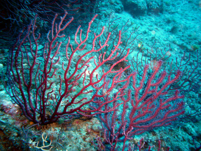
White-clawed Crayfish (Austropotamobius pallipes), Greater Capricorn Beetle (Cerambyx cerdo), Red coral (Corallium rubrum), Jersey Tiger (Euplagia quadripunctaria), Stag beetle (Lucanus cervus)
Source: Natura 2000 standard data forms (EEA, CC-BY 4.0). Not exhaustive: sensitive species are not published.
Species to look out for
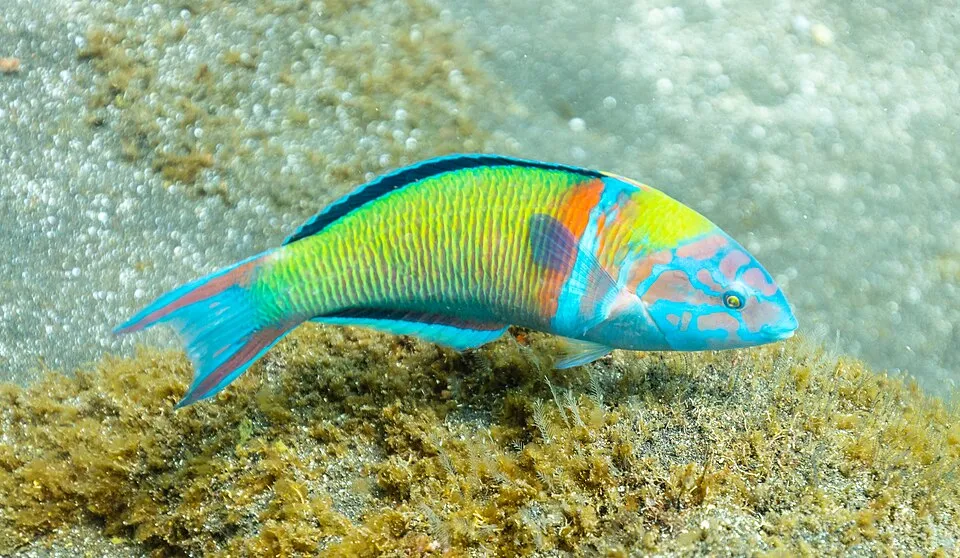
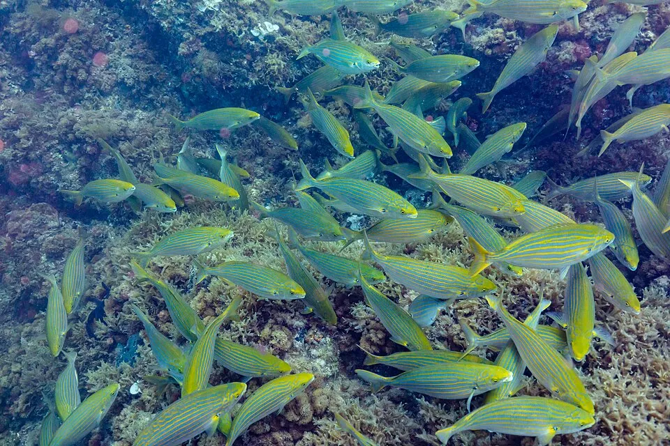
Observed species
Occurrences documented via GBIF; they are neither an exhaustive inventory nor proof of current presence.
- Mediterranean rainbow wrasse · Coris julis · 43
- Comber · Serranus cabrilla · 40
- Painted comber · Serranus scriba · 39
- Dusky grouper · Epinephelus marginatus · 35
- Ornate Wrasse · Thalassoma pavo · 18
- Salema porgy · Sarpa salpa · 18
- European shag · Phalacrocorax aristotelis · 5
- Ceratothoa parallela · 4
- Small European Locust Lobster · Scyllarus arctus · 4
- Gibb's sea spider · Pisa armata · 4
- Mauve stinger · Pelagia noctiluca · 4
- Small spider crab · Maja crispata · 4
+18 more species
- Inachus thoracicus · 4
- Mastic Tree · Pistacia lentiscus · 3
- Squat lobster · Galathea dispersa · 3
- Japanese cheesewood · Pittosporum tobira · 3
- Yellow-legged Gull · Larus michahellis · 3
- Pectenogammarus pungens · 2
- Velvet goose barnacle · Scalpellum scalpellum · 2
- Angular Crab · Goneplax rhomboides · 2
- Delectona madreporica · 2
- Xaiva biguttata · 2
- Spottail mantis squillid · Squilla mantis · 2
- Intermediate Periwinkle · Vinca difformis · 2
- Eurypon gracile · 2
- Harbour crab · Liocarcinus depurator · 2
- Elthusa sinuata · 2
- Large Parasitic Isopod · Anilocra physodes · 1
- Natatolana borealis · 1
- Pistol Shrimp · Alpheus glaber · 1
Records: GBIF.org (CC-BY). Names: Wikidata (CC0), GBIF. Photos: Wikimedia Commons.
Conservation challenges
The primary purpose of the site is to preserve its natural habitats and the biodiversity they support. The species recorded (Biodiversity tab) reflect its ecological value. The designations it holds frame its management and the control of land use.
According to the Natura 2000 forms, of 18 assessed habitats of European interest, 9 are in average or reduced condition and the rest in good condition. According to the Water Framework Directive assessment (2022 river basin management plans, data 2014–2019), water bodies assessed within the site: coastal waters, 2 of 3 in good ecological status or better.
Pressure indicators
Rivers and lakes
Coastal waters: 2 of 3 good or better
assessments 2014–2019
Sources: Global Forest Change (Hansen et al., University of Maryland, via Global Forest Watch, CC-BY 4.0); EFFIS, European Commission / Copernicus; NASA Black Marble 2016 (public domain); CORINE Land Cover 2018 (Copernicus) or MODIS.
Ecological status of water bodies: European Environment Agency, WISE – Water Framework Directive, 3rd river basin management plans (2022), CC BY 4.0. Official national classification, not comparable between countries.
Practical information
Cities and airport
- Genoa
19 km as the crow flies - Savona
53 km as the crow flies - Airport: Genoa Cristoforo Colombo (GOA)
26 km as the crow flies
Visitor information
- Pro Loco Camogli
< 1 km from the site boundary - Wonderful Italy Homes & Experiences
2 km from the site boundary - Welcome Riviera
2 km from the site boundary - Sede Parco Naturale di Portofino
2 km from the site boundary
Things to see
2 viewpoints
Data © OpenStreetMap contributors (ODbL) · Wikidata (CC0)
Bathing
15 monitored bathing sites in or within 1 km of the site · 2025 classification
Excellent · 13
Good · 2
- Auxilium · sea · Excellent
- Ovest Punta del Buco · sea · Excellent
- Paraggi · sea · Excellent
- Punta Carrega · sea · Excellent
- Punta Chiappa · sea · Excellent
- Punta Pedale · sea · Excellent
- S.fruttuoso · sea · Excellent
- San Giorgio · sea · Excellent
- Spiaggia Centro · sea · Excellent
- Spiaggia Levante · sea · Excellent
and 5 more
Source: European Environment Agency, official bathing water classification (Directive 2006/7/EC, CC-BY 4.0). Swimming is only permitted at the sites and times authorised locally.
Access and visiting
The nearest railway station is Camogli-San Fruttuoso, less than 1 km from the site boundary. Nearest towns of over 50,000 people, as the crow flies: Genoa (19 km) and Savona (53 km). Nearest airport: Genoa Cristoforo Colombo (GOA), about 26 km away. About 470,000 people live within 20 km of the site boundary, 110,000 of them within 10 km (GHSL estimate, 2020). This population has fallen by about 8% since 2000. Visitor information on site: Pro Loco Camogli, Wonderful Italy Homes & Experiences and Welcome Riviera. To see: 2 viewpoints. To plan a visit (access, opening periods, visitor rules), it is best to consult the official information from the managing body and the official website listed in this page's sources.
Source: OpenStreetMap (ODbL), Wikidata (CC0), October 2026.
When to visit
Best time to visit: from April to September, with average temperatures of 13 to 25 °C and moderate rainfall. Precipitation peaks in October and November (up to 200 mm per month). Day length ranges from about 8 h 52 min in December to 15 h 30 min in June. Wildlife records published on GBIF peak for plants (May) and butterflies and moths (July). These peaks also reflect when observers are most active.
Source: Copernicus ERA5-Land (C3S), monthly averages 1996–2025 at the representative point, temperatures adjusted for elevation.
Contains modified Copernicus Climate Change Service information 2026. Neither the European Commission nor ECMWF is responsible for any use that may be made of the Copernicus information or data it contains.
Wildlife records calendar
JFMAMJJASOND
Birds
Plants
Butterflies & moths
Monthly records published on GBIF (CC-BY), relative to the busiest month; also reflects observer activity.
Gallery
© Yoruno · CC BY-SA 3.0
© Yoruno · Public domain
© Clbianco · CC BY-SA 4.0
© Clbianco · CC BY-SA 4.0
© Yoruno · Public domain
Sources and licences
- Wikidata: Q771817
- OpenStreetMap: relation 6615887
- Official website: http://www.riservaportofino.it
- Wikipedia: de.wikipedia.org/wiki/Meeresschutzgebiet_Portofino
- WDPA: 5977
References
- cds.climate.copernicus.eu: climate · CC-BY-4.0
- registry.opendata.aws: elevation of the reference point · PD
- land.copernicus.eu: land cover, land cover change, sea share · COPERNICUS
- doi.org: population around the site · CC-BY-4.0
- wikidata.org: official area, establishment date, protected heritage, official name, nearby cities and airport, access and peaks, places to see, official website · CC0-1.0
- eea.europa.eu: bathing water quality, ecological status of waters · CC-BY-4.0
- gebco.net: depths · PD
- opentopodata.org: elevations · PD
- gbif.org: seasonality of sightings, invasive alien species, observed species · CC-BY-4.0
- natura2000.eea.europa.eu: Natura 2000 habitats and species · CC-BY-4.0
- openstreetmap.org: access and peaks, places to see, trail difficulty · ODbL-1.0
- wikidata.org: Wikipedia article · CC-BY-SA-4.0
Data © OpenStreetMap contributors (ODbL), Wikidata (CC0) and the sources cited.