Czechia · Terrestrial
Blaník Protected Landscape Area
Protected landscape area of 4,029 hectares in Czechia, established in 1982.
Overview
Protected landscape area of 4,029 hectares in Czechia, established in 1982.
Blaník Protected Landscape Area is located in Czechia (Europe). It is a predominantly terrestrial area. Established on 1 January 1982, it covers about 4,029 hectares.
Protections and designations
Natura 2000 · habitats (SAC) · 3 sites
- Podlesí CZ0214014
- Štola Mořic CZ0213620
- Vlašimská Blanice CZ0213009
Designated as a protected landscape area. International labels and designations: Natura 2000 network (3 sites). Key dates: established in 1982 and first Natura 2000 site under the Habitats Directive in 2008.
In our collections
Timeline
-
1982
Established
-
2008
First Natura 2000 site under the Habitats Directive 3 such sites designated up to 2012
Sources: Wikidata (CC0) for establishment and international labels; EEA Natura 2000 database (CC-BY 4.0) for site designation dates.
Frequently asked questions
Where is Blaník Protected Landscape Area?
In Czechia (Europe). Representative point: 49.6394° N, 14.8622° E.
How large is Blaník Protected Landscape Area?
About 4,029 hectares (40 km²). It is the 27th largest of the 27 protected landscape areas in Czechia covered by Parkavela.
When was Blaník Protected Landscape Area established?
On 1 January 1982.
What habitats and landscapes does Blaník Protected Landscape Area include?
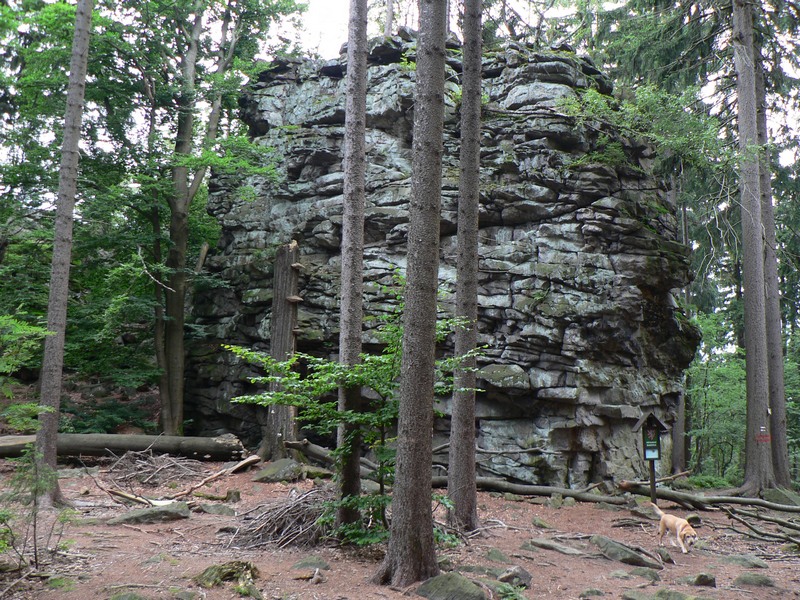
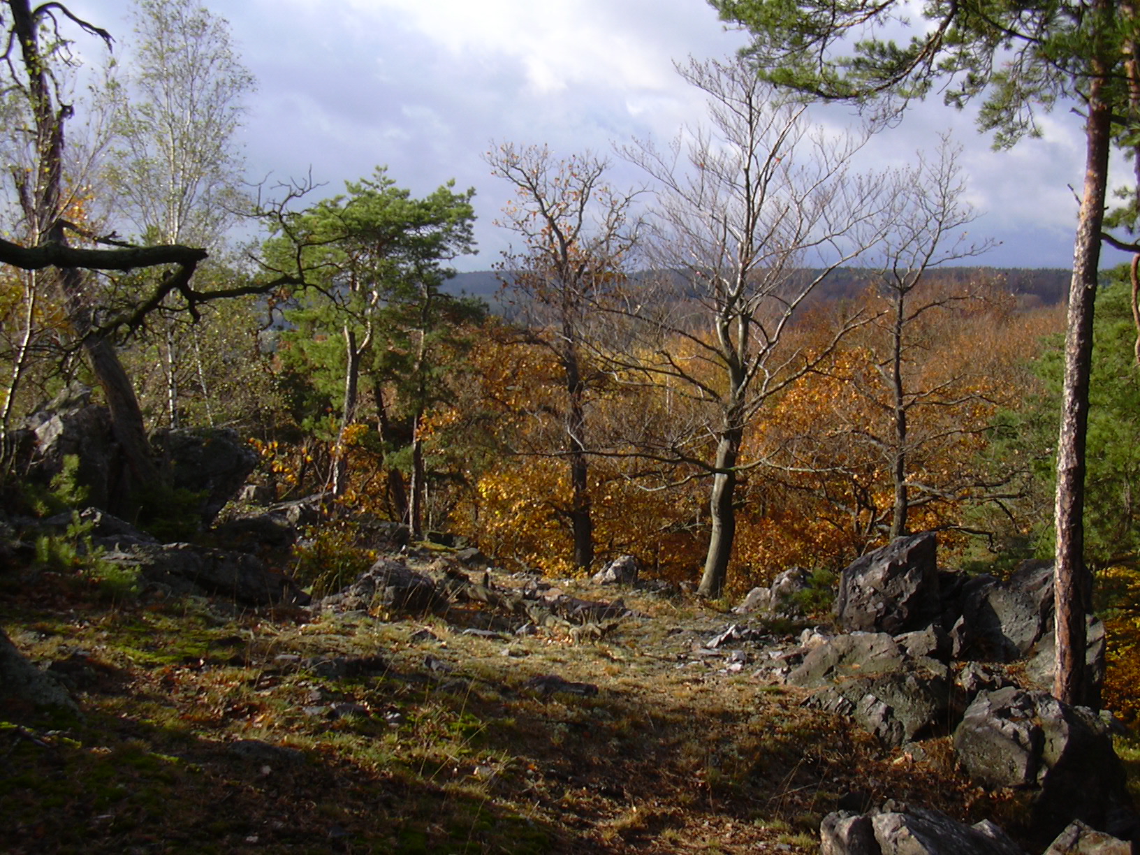
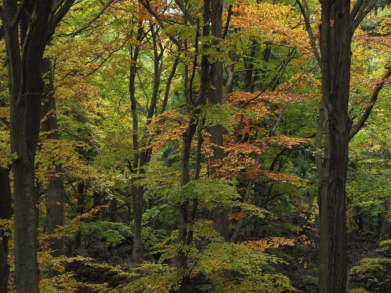
A terrestrial area, with forests.
What rocks lie beneath Blaník Protected Landscape Area?
According to the European 1:1 million geological map (EGDI), the bedrock consists mainly of gneiss (100% of sampled points). These are mostly metamorphic rocks. The geological units date mainly from the Paleozoic (100% of sampled points).
What is the highest point of Blaník Protected Landscape Area?
Velký Blaník, at 638 m (OpenStreetMap).
What are the main summits of Blaník Protected Landscape Area?
Velký Blaník (638 m), Křížovská hůra (582 m), Malý Blaník (580 m), Býkovická hůra (563 m) and Slepičí skála (560 m) (OpenStreetMap).
Which international labels apply to Blaník Protected Landscape Area?
Natura 2000 network (3 sites).
When is the best time to visit Blaník Protected Landscape Area?
Mildest period: from June to August, with average temperatures of 17 to 19 °C.
Is there snow in Blaník Protected Landscape Area?
Yes. According to NASA's MODIS satellites (2015–2025 average), snow covers most of the site in January, with about 40 snow-covered days a year on average.
Are there historic monuments in Blaník Protected Landscape Area?
Yes. According to Wikidata, 20 monuments listed in the Czech central register of cultural monuments stand within the boundary. For example: “Church of the Assumption of the Virgin Mary in Louňovice pod Blaníkem” in Louňovice pod Blaníkem, “Hradiště Malý Blaník” in Louňovice pod Blaníkem and “Podlouňovický mlýn” in Louňovice pod Blaníkem.
What is the nearest large city to Blaník Protected Landscape Area?
Nearest towns of over 50,000 people, as the crow flies: Jihlava (55 km) and Prague (55 km). Nearest airport: Václav Havel Airport Prague (PRG), about 63 km away.
How can I reach Blaník Protected Landscape Area by train?
The nearest railway station is Tomice, about 13 km from the site boundary.
Where can I get visitor information on site?
Zámek Louňovice pod Blaníkem and Dům přírody Blaníku.
Are there waymarked hiking trails in Blaník Protected Landscape Area?
Yes. Waymarked hiking routes listed in OpenStreetMap: 11, including Svatojakubská cesta, Jihočeská trasa, Vlašim, Via Czechia, Blaník and [Č] Chocerady. The “VIA-CZE-305 · Via Czechia - Centrální (5. Posázaví a Kraj blanických rytířů)” route runs for about 10 km through the site, with some 350 m of ascent on its longest section.
Which species can be seen in Blaník Protected Landscape Area?
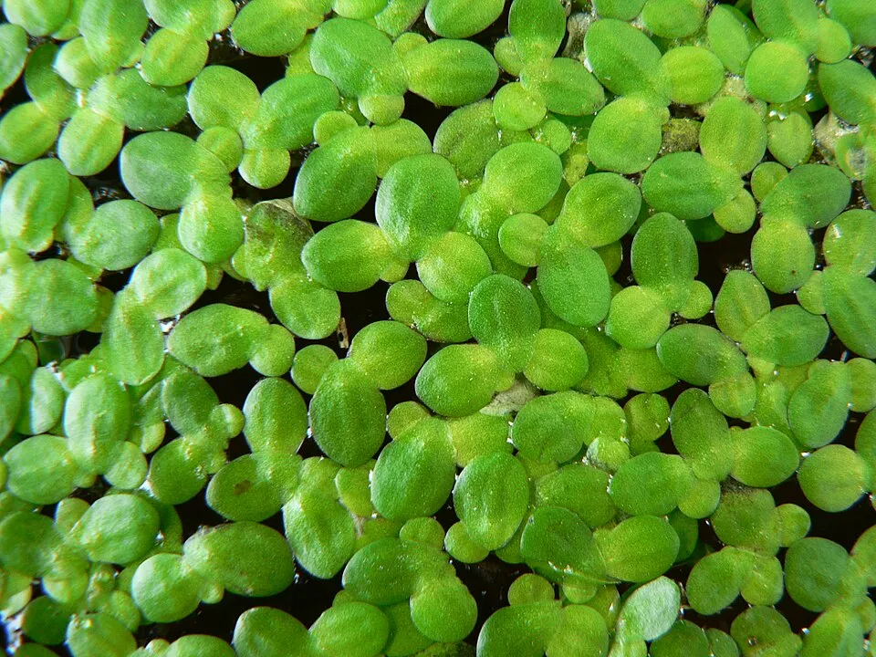
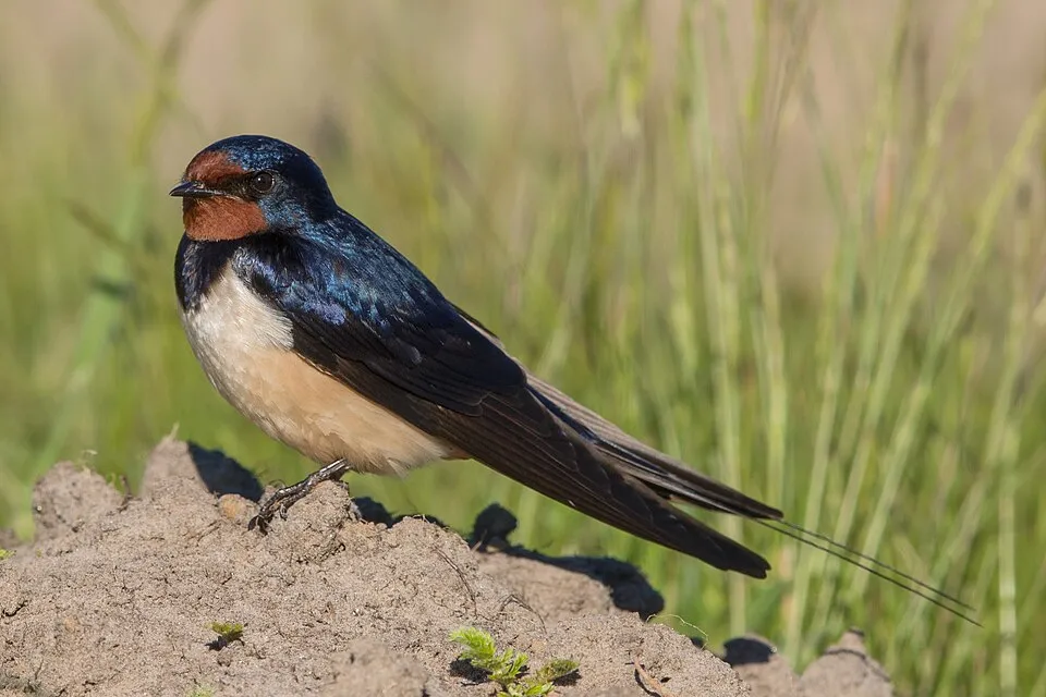
Among the species most often recorded on GBIF are Lemna minor (Common duckweed), Turdus merula (Common Blackbird), Parus major (Great tit) and Hirundo rustica (Barn Swallow).
What is the official website of Blaník Protected Landscape Area?
© OpenStreetMap
Download the boundary: GeoJSON · GPX Boundary © OpenStreetMap contributors (ODbL).
Geography
The representative point of the site lies at around 448 m above sea level. Over the 1996–2025 period, the mean annual temperature is about 9.0 °C and total precipitation reaches roughly 797 mm per year. The warmest month is usually July, the coolest January, and the wettest July. According to the European 1:1 million geological map (EGDI), the bedrock consists mainly of gneiss (100% of sampled points). These are mostly metamorphic rocks. The geological units date mainly from the Paleozoic (100% of sampled points).
Area
- Area
- 4,029 ha
- Elevation
- 448 m
- Median elevation
- 461 m
- Mean slope
- 6°
- Snow cover
- ≈ 40 days a year
- Coordinates
- 49.6394, 14.8622
Terrain: Mapzen Terrain Tiles (SRTM, USGS)
Bedrock
- Gneiss 100 %
Metamorphic rocks 100 % · Main age: Paleozoic (100%)
Source: EGDI 1:1M geological map (EuroGeoSurveys and national geological surveys), CC BY 4.0 · 13 sampled points within the site.
Main summits
- Velký Blaník638 m
- Křížovská hůra582 m
- Malý Blaník580 m
- Býkovická hůra563 m
- Slepičí skála560 m
- Holý vrch554 m
- Kozlův kopec545 m
- Krasovická hůra485 m
- Zadní hůrka480 m
- Bělčí hora465 m
Data © OpenStreetMap contributors (ODbL)
Climate
● Mean temperature (°C) · ▮ Precipitation (mm)
Source: Copernicus ERA5-Land (C3S, doi:10.24381/cds.68d2bb30), monthly averages 1996–2025 interpolated to the representative point, temperatures adjusted for elevation.
Contains modified Copernicus Climate Change Service information 2026. Neither the European Commission nor ECMWF is responsible for any use that may be made of the Copernicus information or data it contains.
Snow cover measured by satellite
J
F
M
A
M
J
J
A
S
O
N
D
average share of the site under snow · snowiest parts · ≈ 40 days a year
Snow cover: MODIS/Terra MOD10CM v61 (Hall & Riggs, 2021, NASA NSIDC DAAC, doi:10.5067/MODIS/MOD10CM.061), imagery from NASA GIBS (ESDIS); 2015–2025 average, grid of about 5 km.
Natural habitats
According to CORINE Land Cover (2018), the site is mainly made up of farmland (58%), forests (34%) and grassland and meadows (6%). Woodland is mostly coniferous. Elevation ranges from about 380 m to 638 m (highest point: Velký Blaník). The 3 Natura 2000 sites overlapping the area list 4 habitats of European interest, the most extensive being water courses of plain to montane levels with the Ranunculion fluitantis and Callitricho-Batrachion vegetation, natural eutrophic lakes with Magnopotamion or Hydrocharition-type vegetation and oligotrophic to mesotrophic standing waters with vegetation of the Littorelletea uniflorae and/or of the Isoëto-Nanojuncetea.
Biodiversity
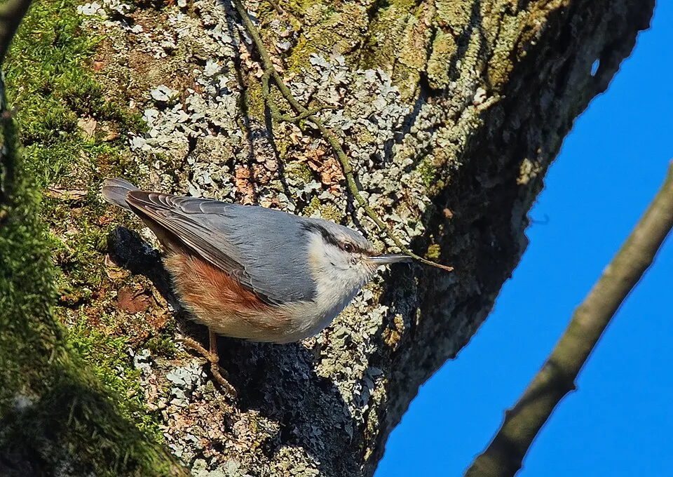
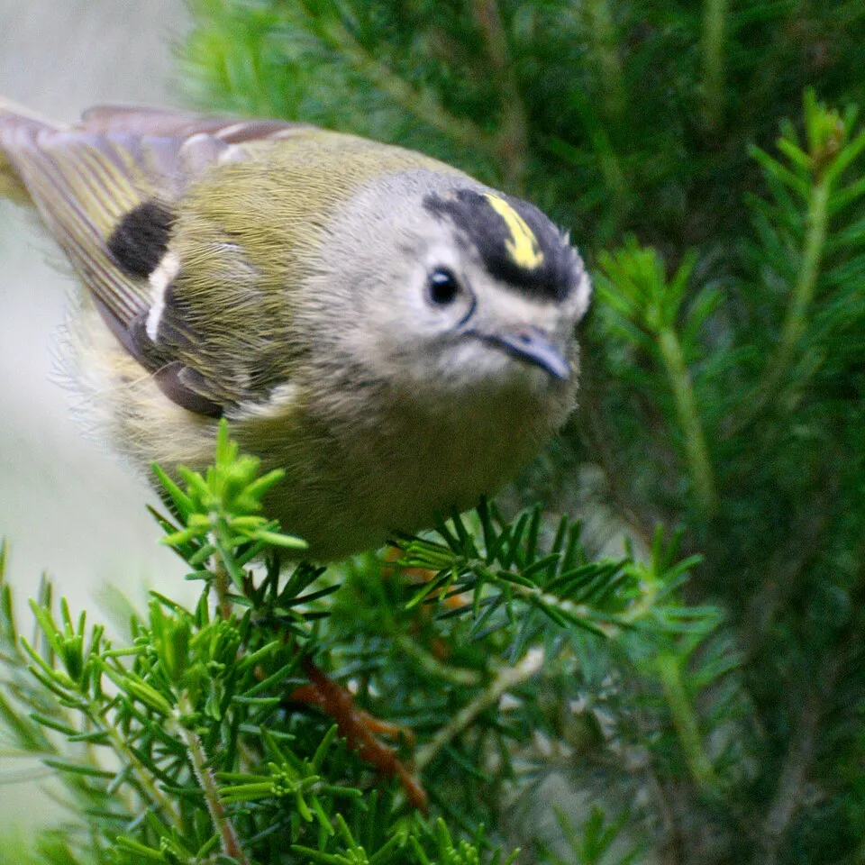
Based on occurrences aggregated by GBIF, several species are regularly recorded within the site. Among the most frequent are Lemna minor (Common duckweed), Turdus merula (Common Blackbird), Parus major (Great tit) and Hirundo rustica (Barn Swallow). The full list of documented taxa is shown below. The overlapping Natura 2000 sites list 8 species of European interest: 2 mammals, 1 fish, 4 invertebrates and 1 plant.
Habitats of European interest
From the official forms of the 3 Natura 2000 sites overlapping the area (areas reported for each whole site).
- Water courses of plain to montane levels with the Ranunculion fluitantis and Callitricho-Batrachion vegetation 9 ha
- Natural eutrophic lakes with Magnopotamion or Hydrocharition-type vegetation 3 ha
- Oligotrophic to mesotrophic standing waters with vegetation of the Littorelletea uniflorae and/or of the Isoëto-Nanojuncetea 2 ha
- Transition mires and quaking bogs 1 ha
Species of European interest
Invertebrates · 4
Yellow-spotted Whiteface (Leucorrhinia pectoralis), Eastern Hermit Beetle (Osmoderma barnabita), Thick shelled river mussel (Unio crassus), Narrow-mouthed whorl snail (Vertigo angustior)
Plants · 1
Source: Natura 2000 standard data forms (EEA, CC-BY 4.0). Not exhaustive: sensitive species are not published.
Species to look out for


Observed species
Occurrences documented via GBIF; they are neither an exhaustive inventory nor proof of current presence.
- Common duckweed · Lemna minor · 58
- Common Blackbird · Turdus merula · 41
- Great tit · Parus major · 40
- Barn Swallow · Hirundo rustica · 35
- Eurasian Nuthatch · Sitta europaea · 31
- Goldcrest · Regulus regulus · 28
- Greater duckweed · Spirodela polyrhiza · 27
- Eurasian Chaffinch · Fringilla coelebs · 26
- Fine-leaved water-dropwort · Oenanthe aquatica · 26
- Eurasian blue tit · Cyanistes caeruleus · 23
- Great Spotted Woodpecker · Dendrocopos major · 21
- Water-plantain · Alisma plantago-aquatica · 21
+18 more species
- Song Thrush · Turdus philomelos · 21
- Yellowhammer · Emberiza citrinella · 20
- European Beech · Fagus sylvatica · 18
- Large-flowered hemp-nettle · Galeopsis speciosa · 18
- European robin · Erithacus rubecula · 17
- Water horsetail · Equisetum fluviatile · 17
- Slender Tufted-sedge · Carex acuta · 17
- Floating Sweet-grass · Glyceria fluitans · 15
- Bulrush · Typha latifolia · 15
- Unbranched Bur-reed · Sparganium emersum · 14
- Common Starling · Sturnus vulgaris · 14
- Blister sedge · Carex vesicaria · 13
- Eurasian Tree Sparrow · Passer montanus · 13
- European Green Woodpecker · Picus viridis · 12
- Common Wood Pigeon · Columba palumbus · 12
- Eurasian Wren · Troglodytes troglodytes · 12
- European Greenfinch · Chloris chloris · 12
- Common Buzzard · Buteo buteo · 11
Records: GBIF.org (CC-BY). Names: Wikidata (CC0), GBIF. Photos: Wikimedia Commons.
Conservation challenges
The primary purpose of the site is to preserve its natural habitats and the biodiversity they support. The species recorded (Biodiversity tab) reflect its ecological value. The designations it holds frame its management and the control of land use.
According to Global Forest Change data (University of Maryland, Global Forest Watch), about 403 ha of tree cover were lost within the boundary between 2001 and 2023 (10% of its area), peaking in 2019 and 2020. These losses include logging, storms and fires, and do not account for regrowth. According to CORINE Land Cover, land cover here remained almost unchanged between 1990 and 2018 (less than 0.5% of the area affected). At night, the area gives off virtually no artificial light detectable from space (NASA VIIRS Black Marble composite, 2016). Built-up and developed land (buildings, business areas, roads, quarries) covers 2% of the area, and farmland 58% (CORINE Land Cover). According to the Natura 2000 forms, of 4 assessed habitats of European interest, 3 are in excellent condition and the rest in good condition. According to the Water Framework Directive assessment (2022 river basin management plans, data 2016–2018), of the 2 rivers assessed within the site, 1 has moderate ecological status and 1 poor ecological status.
Pressure indicators
Tree cover lost
403 ha
2001–2023 · 10% of the area
20012023
Fires since 2016
0
No large fire mapped (fires over about 30 ha)
Light at night
0%
of the area gives off artificial light visible from space
DarkLit
Built-up land
2%
buildings, business areas, roads, quarries · farmland 58%
Land cover change
< 0.5%
of the area changed, 1990–2018 · CORINE
Rivers and lakes
0%
of the 13 km of assessed rivers in good or high ecological status · WFD 2022
assessments 2016–2018
Invasive alien species
1
recorded since 2000
Sources: Global Forest Change (Hansen et al., University of Maryland, via Global Forest Watch, CC-BY 4.0); EFFIS, European Commission / Copernicus; NASA Black Marble 2016 (public domain); CORINE Land Cover 2018 (Copernicus) or MODIS.
CORINE Land Cover Change 1990–2018: generated using European Union's Copernicus Land Monitoring Service information (EEA), aggregated by Parkavela; DOI 10.2909/f30f1000-7cf8-43bb-872c-5eb093911b24.
Ecological status of water bodies: European Environment Agency, WISE – Water Framework Directive, 3rd river basin management plans (2022), CC BY 4.0. Official national classification, not comparable between countries.
Invasive alien species: Global Register of Introduced and Invasive Species (ISSG, CC BY 4.0); Union list, Regulation (EU) 1143/2014 (INBO, CC0); GBIF.org records (CC0 / CC BY 4.0), at least 2 per species.
Practical information
Cities and airport
- Jihlava
55 km as the crow flies - Prague
55 km as the crow flies - Airport: Václav Havel Airport Prague (PRG)
63 km as the crow flies
Visitor information
- Zámek Louňovice pod Blaníkem
within the site - Dům přírody Blaníku
within the site
Hiking
11 waymarked routes listed, including:
Svatojakubská cesta, Jihočeská trasa, VlašimVia CzechiaBlaník[Č] Chocerady[Č] Votice[Č] Vlašim
By bike
321 321 Louňovice pod Blaníkem - Kamenice nad Lipou · 6 km101 101 Český Štemberk - Louňovice pod Blaníkem · 4 km112 112 Louňovice pod Blaníkem - Kosova Hora · 3 km0070 · 8 km
Signed cycle routes: this does not mean that cycling is allowed on footpaths.
Data © OpenStreetMap contributors (ODbL) · Wikidata (CC0)
Routes © OpenStreetMap contributors (ODbL), via Waymarked Trails
Waymarked hiking routes
JW Svatojakubská cesta, Jihočeská trasa, Vlašim - Mladá Vožice
9.2 km within the site ↗ 362 m↘ 361 m 428–634 m
VIA-CZE-305 Via Czechia - Centrální (5. Posázaví a Kraj blanických rytířů)
9.9 km within the site ↗ 352 m↘ 349 m 377–633 m
1 Blaník - Říp - etapa 1: Louňovice pod Blaníkem - Český Šternberk
7 km within the site ↗ 270 m↘ 233 m 404–634 m
0026 [Č] Chocerady - Louňovice pod Blaníkem
3.7 km within the site ↗ 129 m↘ 90 m 377–514 m
3073 [Z] Mladá Vožice - Louňovice p. Blaníkem
8.6 km within the site ↗ 236 m↘ 125 m 404–579 m
Tracks © OpenStreetMap contributors (ODbL), clipped to the boundary; elevation gain and profiles computed on the longest section from Mapzen Terrain Tiles (≈ 30 m), indicative only.
Access and visiting
The nearest railway station is Tomice, about 13 km from the site boundary. Nearest towns of over 50,000 people, as the crow flies: Jihlava (55 km) and Prague (55 km). Nearest airport: Václav Havel Airport Prague (PRG), about 63 km away. About 94,000 people live within 20 km of the site boundary, 29,000 of them within 10 km; some 1,200 people are estimated to live inside (GHSL estimate, 2020). Visitor information on site: Zámek Louňovice pod Blaníkem and Dům přírody Blaníku. Waymarked hiking routes listed in OpenStreetMap: 11, including Svatojakubská cesta, Jihočeská trasa, Vlašim, Via Czechia, Blaník and [Č] Chocerady. The site is crossed by 5 signed cycle routes, including “321 321 Louňovice pod Blaníkem - Kamenice nad Lipou” and “101 101 Český Štemberk - Louňovice pod Blaníkem” (OpenStreetMap). To plan a visit (access, opening periods, visitor rules), it is best to consult the official information from the managing body and the official website listed in this page's sources.
Source: OpenStreetMap (ODbL), Wikidata (CC0), October 2026.
Built heritage
According to Wikidata, 20 monuments listed in the Czech central register of cultural monuments stand within the boundary. Among them are 6 religious buildings, 4 houses and civic buildings and 3 castles and fortifications. Examples include “Church of the Assumption of the Virgin Mary in Louňovice pod Blaníkem” in Louňovice pod Blaníkem, “Hradiště Malý Blaník” in Louňovice pod Blaníkem and “Podlouňovický mlýn” in Louňovice pod Blaníkem.
6 religious buildings4 houses and civic buildings3 castles and fortifications1 bridge, lighthouse, mill or working building
-
Church of the Assumption of the Virgin Mary in Louňovice pod Blaníkem
Louňovice pod Blaníkem -
Hradiště Malý Blaník
Louňovice pod Blaníkem -
Podlouňovický mlýn
Louňovice pod Blaníkem -
Radnice v Načeradci
Načeradec -
Church of Saint Joseph
Veliš -
Hradiště Velký Blaník
Louňovice pod Blaníkem -
Socha svatého Jana Nepomuckého u Podlouňovického mlýna
Louňovice pod Blaníkem -
Church of Saint Wenceslaus
Libouň
and 12 more
Source: Wikidata (CC0), monuments in each country’s official heritage protection registers, at national or regional level. Each item links to its Wikidata entry.
When to visit
Mildest period: from June to August, with average temperatures of 17 to 19 °C. Average temperatures drop below 0 °C in January: frost is common. Precipitation peaks in July (up to 100 mm per month). According to NASA's MODIS satellites (2015–2025 average), snow covers most of the site in January, with about 40 snow-covered days a year on average. Day length ranges from about 8 h 09 min in December to 16 h 17 min in June. Wildlife records published on GBIF peak for birds (April) and plants (August). These peaks also reflect when observers are most active.
Source: Copernicus ERA5-Land (C3S), monthly averages 1996–2025 at the representative point, temperatures adjusted for elevation.
Contains modified Copernicus Climate Change Service information 2026. Neither the European Commission nor ECMWF is responsible for any use that may be made of the Copernicus information or data it contains.
Wildlife records calendar
JFMAMJJASOND
Birds
Plants
Monthly records published on GBIF (CC-BY), relative to the busiest month; also reflects observer activity.
Gallery
© Juan de Vojníkov · CC BY-SA 3.0
© Denebola2 · CC BY-SA 4.0
© ŠJů · CC BY-SA 3.0
© KarelTvrdik · CC BY-SA 3.0
© Pavelwi · CC BY-SA 3.0
© Pavelwi · CC BY-SA 3.0
Sources and licences
- Wikidata: Q8465184
- OpenStreetMap: relation 2022064
- Official website: https://blanik.aopk.gov.cz
- WDPA: 344530
References
- cds.climate.copernicus.eu: climate · CC-BY-4.0
- registry.opendata.aws: elevation of the reference point, detailed relief · PD
- land.copernicus.eu: land cover, land cover change, sea share · COPERNICUS
- doi.org: population around the site · CC-BY-4.0
- wikidata.org: official area, highest point, establishment date, protected heritage, nearby cities and airport, access and peaks, lake depths, places to see, official website · CC0-1.0
- eea.europa.eu: bathing water quality, ecological status of waters · CC-BY-4.0
- en.eurovelo.com: EuroVelo cycle routes · ODbL-1.0
- cycling.waymarkedtrails.org: cycle routes · ODbL-1.0
- opentopodata.org: elevations · PD
- forest-fire.emergency.copernicus.eu: wildfires · COPERNICUS
- globalforestwatch.org: tree cover loss · CC-BY-4.0
- gbif.org: seasonality of sightings, invasive alien species, observed species · CC-BY-4.0
- europe-geology.eu: geology · CC-BY-4.0
- hydrosheds.org: lakes · CC-BY-4.0
- natura2000.eea.europa.eu: Natura 2000 habitats and species · CC-BY-4.0
- openstreetmap.org: official name, access and peaks, trail difficulty · ODbL-1.0
- earthobservatory.nasa.gov: night light · PD
- hiking.waymarkedtrails.org: route difficulty · ODbL-1.0
- nsidc.org: snow cover · PD
Data © OpenStreetMap contributors (ODbL), Wikidata (CC0) and the sources cited.