Italy · Terrestrial
Bric Tana Regional Nature Park
Regional nature park of 170 hectares in Italy, established in 1985.
Overview
Regional nature park of 170 hectares in Italy, established in 1985.
Bric Tana Regional Nature Park is located in Italy (Europe). It is a predominantly terrestrial area. Established on 27 February 1985, it covers about 170 hectares.
Protections and designations
Natura 2000 · habitats (SAC)
- Bric Tana - Bric Mongarda IT1322217
Protected as a regional nature park. International labels and designations: Natura 2000 network (1 site: “Bric Tana - Bric Mongarda”). Key dates: established in 1985 and first Natura 2000 site under the Habitats Directive in 2015.
In our collections
Timeline
-
1985
Established
-
2015
First Natura 2000 site under the Habitats Directive
Sources: Wikidata (CC0) for establishment and international labels; EEA Natura 2000 database (CC-BY 4.0) for site designation dates.
Frequently asked questions
Where is Bric Tana Regional Nature Park?
In Italy (Europe). Representative point: 44.3667° N, 8.2000° E.
How large is Bric Tana Regional Nature Park?
About 170 hectares (2 km²). It is the 126th largest of the 128 regional parks in Italy covered by Parkavela.
When was Bric Tana Regional Nature Park established?
On 27 February 1985.
What habitats and landscapes does Bric Tana Regional Nature Park include?
A terrestrial area, with forests.
What rocks lie beneath Bric Tana Regional Nature Park?
According to the European 1:1 million geological map (EGDI), the bedrock consists mainly of marly limestones (67% of sampled points). These are mostly sedimentary rocks. The geological units date mainly from the Cenozoic (67% of sampled points).
What is the highest point of Bric Tana Regional Nature Park?
Bric della Feia, at 672 m (OpenStreetMap).
Which international labels apply to Bric Tana Regional Nature Park?
Natura 2000 network (1 site: “Bric Tana - Bric Mongarda”).
When is the best time to visit Bric Tana Regional Nature Park?
Best time to visit: from April to September, with average temperatures of 11 to 23 °C and moderate rainfall.
What is the nearest large city to Bric Tana Regional Nature Park?
Nearest towns of over 50,000 people, as the crow flies: Savona (21 km) and Cuneo (52 km). Nearest airport: Genoa Cristoforo Colombo (GOA), about 49 km away.
How can I reach Bric Tana Regional Nature Park by train?
The nearest railway station is Cengio, about 4 km from the site boundary.
Where can I get visitor information on site?
Centro visite del Parco Regionale Bric Tana.
Are there waymarked hiking trails in Bric Tana Regional Nature Park?
Yes. Waymarked hiking routes listed in OpenStreetMap: 4.
Which species can be seen in Bric Tana Regional Nature Park?
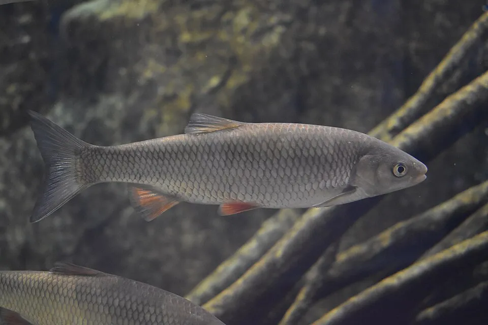
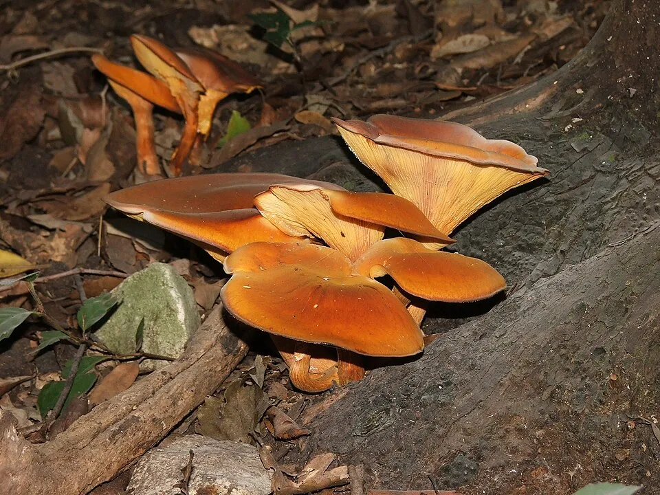
Among the species most often recorded on GBIF are Squalius cephalus (Chub), Omphalotus olearius (Jack o'Lantern mushroom), Carex austroalpina and Sambucus ebulus (Dwarf Elder).
© OpenStreetMap
Download the boundary: GeoJSON · GPX Boundary © OpenStreetMap contributors (ODbL).
Geography
The representative point of the site lies at around 421 m above sea level. Over the 1996–2025 period, the mean annual temperature is about 12.8 °C and total precipitation reaches roughly 1,192 mm per year. The warmest month is usually July, the coolest January, and the wettest November. According to the European 1:1 million geological map (EGDI), the bedrock consists mainly of marly limestones (67% of sampled points). These are mostly sedimentary rocks. The geological units date mainly from the Cenozoic (67% of sampled points).
Area
- Area
- 170 ha
- Elevation
- 421 m
- Median elevation
- 535 m
- Mean slope
- 16°
- Coordinates
- 44.3667, 8.2
Terrain: Mapzen Terrain Tiles (SRTM, USGS)
Bedrock
- Marly limestones 67 %
- Conglomerates and breccias 33 %
Sedimentary rocks 100 % · Main age: Cenozoic (67%)
Source: EGDI 1:1M geological map (EuroGeoSurveys and national geological surveys), CC BY 4.0 · 15 sampled points within the site.
Climate
● Mean temperature (°C) · ▮ Precipitation (mm)
Source: Copernicus ERA5-Land (C3S, doi:10.24381/cds.68d2bb30), monthly averages 1996–2025 interpolated to the representative point, temperatures adjusted for elevation.
Contains modified Copernicus Climate Change Service information 2026. Neither the European Commission nor ECMWF is responsible for any use that may be made of the Copernicus information or data it contains.
Natural habitats
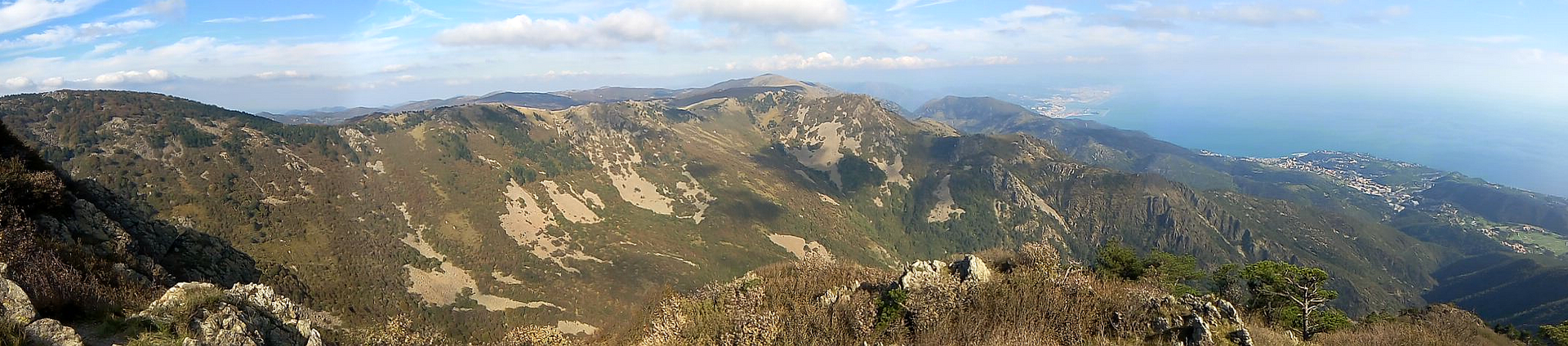
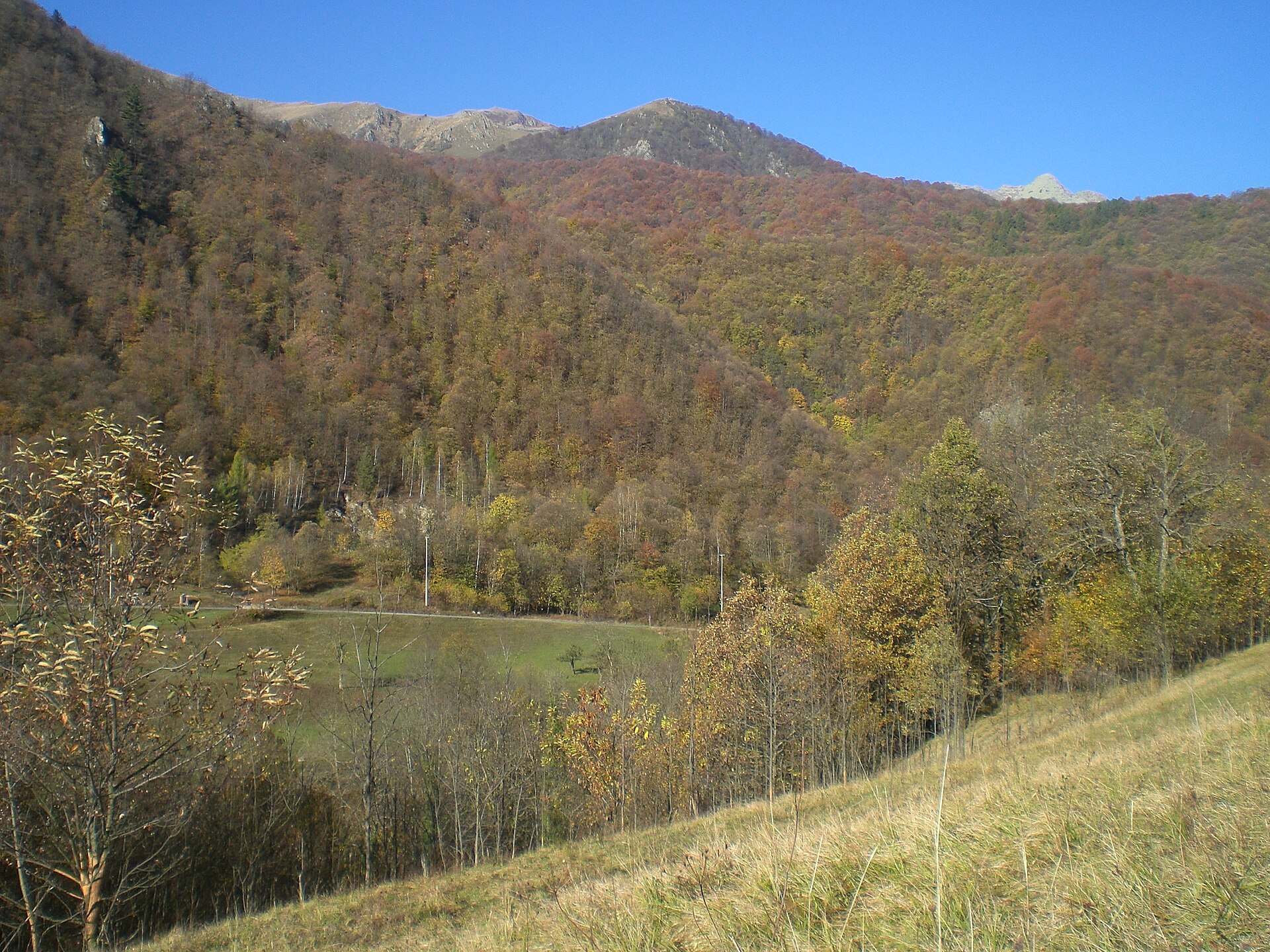
According to CORINE Land Cover (2018), the site is mainly made up of forests (87%) and farmland (10%). Woodland is mostly broadleaved. Elevation ranges from about 420 m to 672 m (highest point: Bric della Feia). The terrain is steep: 48% of slopes exceed 15° (mean slope 16°). The Natura 2000 site overlapping the area lists 8 habitats of European interest (3 priority), the most extensive being Castanea sativa woods, alluvial forests with Alnus glutinosa and Fraxinus excelsior (Alno-Padion, Alnion incanae, Salicion albae) and rupicolous calcareous or basophilic grasslands of the Alysso-Sedion albi.
Biodiversity
Based on occurrences aggregated by GBIF, several species are regularly recorded within the site. Among the most frequent are Squalius cephalus (Chub), Omphalotus olearius (Jack o'Lantern mushroom), Carex austroalpina and Sambucus ebulus (Dwarf Elder). The full list of documented taxa is shown below. The overlapping Natura 2000 site lists 15 species of European interest: 11 mammals, 1 reptile, 1 amphibian and 2 fish.
Habitats of European interest
From the official form of the Natura 2000 site overlapping the area (areas reported for the whole site).
- Castanea sativa woods 67 ha
- Alluvial forests with Alnus glutinosa and Fraxinus excelsior (Alno-Padion, Alnion incanae, Salicion albae) priority 9 ha
- Rupicolous calcareous or basophilic grasslands of the Alysso-Sedion albi priority 3 ha
- Semi-natural dry grasslands and scrubland facies on calcareous substrates (Festuco-Brometalia) (* important orchid sites) 3 ha
- Lowland hay meadows (Alopecurus pratensis, Sanguisorba officinalis) 2 ha
- Eastern white oak woods priority 1 ha
- Hydrophilous tall herb fringe communities of plains and of the montane to alpine levels 0 ha
- Caves not open to the public
Species of European interest
Mammals · 11
Serotine bat (Eptesicus serotinus), Savi's Pipistrelle (Hypsugo savii), Daubenton's bat (Myotis daubentonii), Whiskered bat (Myotis mystacinus), Natterer's bat (Myotis nattereri), Kuhl's pipistrelle (Pipistrellus kuhlii), Common pipistrelle (Pipistrellus pipistrellus), Mediterranean Horseshoe Bat (Rhinolophus euryale), Greater Horseshoe Bat (Rhinolophus ferrumequinum), Lesser horseshoe bat (Rhinolophus hipposideros), European free-tailed bat (Tadarida teniotis)
Reptiles · 1
Amphibians · 1
Source: Natura 2000 standard data forms (EEA, CC-BY 4.0). Not exhaustive: sensitive species are not published.
Species to look out for

Observed species
Occurrences documented via GBIF; they are neither an exhaustive inventory nor proof of current presence.
- Chub · Squalius cephalus · 3
- Jack o'Lantern mushroom · Omphalotus olearius · 3
- Carex austroalpina · 2
- Dwarf Elder · Sambucus ebulus · 2
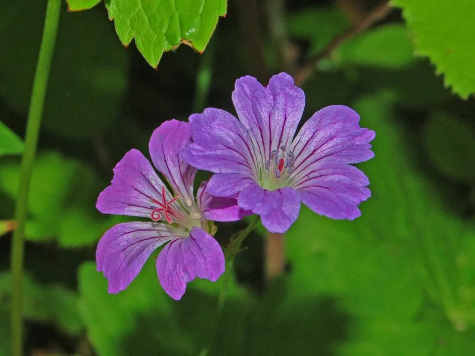
- Knotted Crane's-bill · Geranium nodosum · 2
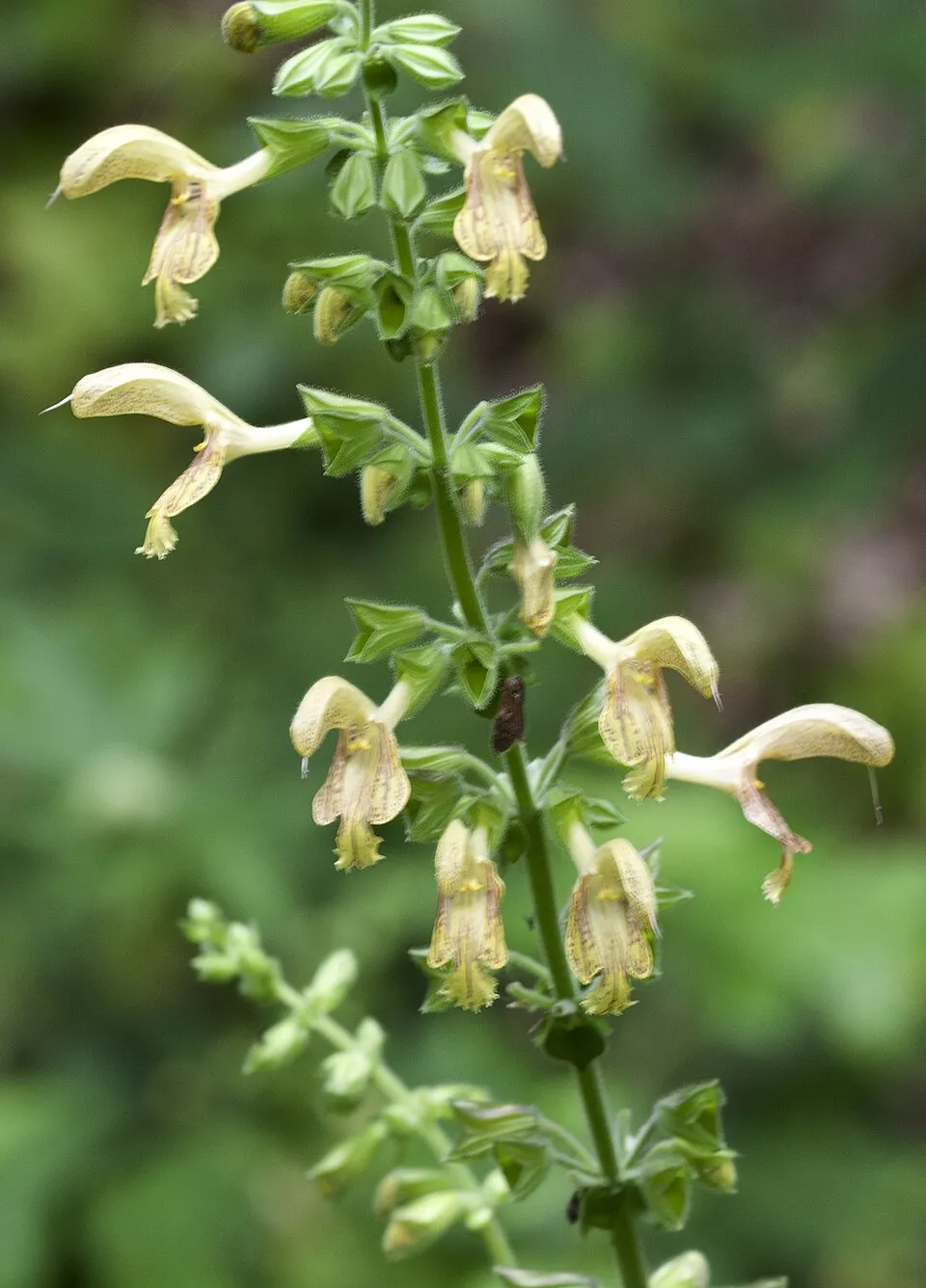
- Sticky clary · Salvia glutinosa · 2
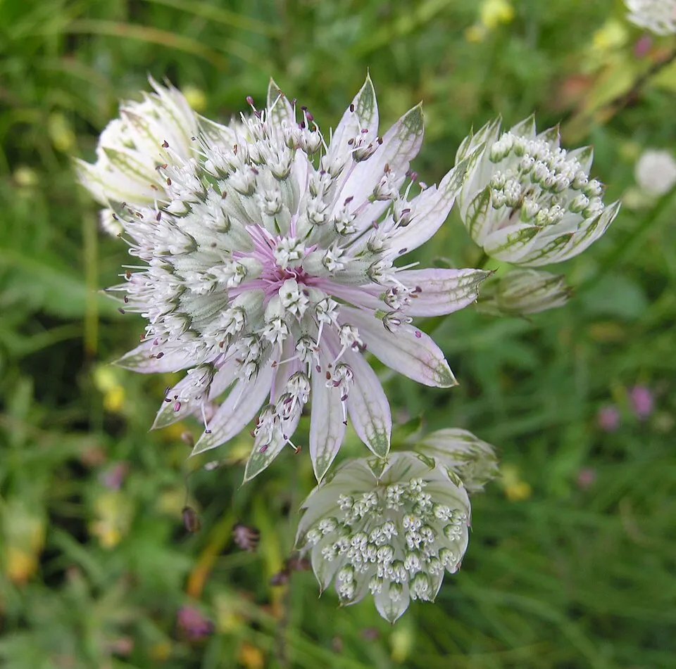
- Great masterwort · Astrantia major · 2
- Alpine enchanter’s-nightshade · Circaea alpina · 2
- Irish Spleenwort · Asplenium onopteris · 2
- Italian Barbel · Barbus plebejus · 2
- Downy hemp-nettle · Galeopsis pubescens · 2
- Kryptonesticus eremita · 2
Records: GBIF.org (CC-BY). Names: Wikidata (CC0), GBIF. Photos: Wikimedia Commons.
Conservation challenges
The primary purpose of the site is to preserve its natural habitats and the biodiversity they support. The species recorded (Biodiversity tab) reflect its ecological value. The designations it holds frame its management and the control of land use.
At night, 23% of the area gives off artificial light detectable from space (NASA VIIRS Black Marble composite, 2016). According to the Natura 2000 forms, of 6 assessed habitats of European interest, 1 is in average or reduced condition and the rest in good condition.
Pressure indicators
Tree cover lost
8 ha
2001–2023 · 5% of the area
20012023
Fires since 2016
0
No large fire mapped (fires over about 30 ha)
Light at night
23%
of the area gives off artificial light visible from space
DarkLit
Sources: Global Forest Change (Hansen et al., University of Maryland, via Global Forest Watch, CC-BY 4.0); EFFIS, European Commission / Copernicus; NASA Black Marble 2016 (public domain); CORINE Land Cover 2018 (Copernicus) or MODIS.
Practical information
Cities and airport
- Savona
21 km as the crow flies - Cuneo
52 km as the crow flies - Airport: Genoa Cristoforo Colombo (GOA)
49 km as the crow flies
Visitor information
- Centro visite del Parco Regionale Bric Tana
< 1 km from the site boundary
Hiking
4 waymarked routes listed
Data © OpenStreetMap contributors (ODbL) · Wikidata (CC0)
Waymarked hiking routes
Acquafredda - Bric della Feia - Tana dell'Orpe
2.3 km within the site ↗ 199 m↘ 96 m 492–652 m
Tracks © OpenStreetMap contributors (ODbL), clipped to the boundary; elevation gain and profiles computed on the longest section from Mapzen Terrain Tiles (≈ 30 m), indicative only.
Access and visiting
The nearest railway station is Cengio, about 4 km from the site boundary. Nearest towns of over 50,000 people, as the crow flies: Savona (21 km) and Cuneo (52 km). Nearest airport: Genoa Cristoforo Colombo (GOA), about 49 km away. About 110,000 people live within 20 km of the site boundary, 33,000 of them within 10 km (GHSL estimate, 2020). This population has fallen by about 5% since 2000. Visitor information on site: Centro visite del Parco Regionale Bric Tana. Waymarked hiking routes listed in OpenStreetMap: 4. To plan a visit (access, opening periods, visitor rules), it is best to consult the official information from the managing body and the official website listed in this page's sources.
Source: OpenStreetMap (ODbL), Wikidata (CC0), October 2026.
When to visit
Best time to visit: from April to September, with average temperatures of 11 to 23 °C and moderate rainfall. Precipitation peaks in November (up to 170 mm per month). Day length ranges from about 8 h 52 min in December to 15 h 31 min in June. Wildlife records published on GBIF peak for plants (July). These peaks also reflect when observers are most active.
Source: Copernicus ERA5-Land (C3S), monthly averages 1996–2025 at the representative point, temperatures adjusted for elevation.
Contains modified Copernicus Climate Change Service information 2026. Neither the European Commission nor ECMWF is responsible for any use that may be made of the Copernicus information or data it contains.
Wildlife records calendar
JFMAMJJASOND
Plants
Monthly records published on GBIF (CC-BY), relative to the busiest month; also reflects observer activity.
Gallery
© Alessandro470804 · CC BY-SA 4.0
Sources and licences
- Wikidata: Q945111
- Wikipedia: de.wikipedia.org/wiki/Naturpark_Bric_Tana
- WDPA: 15285
References
- cds.climate.copernicus.eu: climate · CC-BY-4.0
- registry.opendata.aws: elevation of the reference point, detailed relief · PD
- land.copernicus.eu: land cover, land cover change, sea share · COPERNICUS
- doi.org: population around the site · CC-BY-4.0
- wikidata.org: official area, establishment date, protected heritage, nearby cities and airport, access and peaks, lake depths, places to see · CC0-1.0
- eea.europa.eu: bathing water quality, ecological status of waters · CC-BY-4.0
- en.eurovelo.com: EuroVelo cycle routes · ODbL-1.0
- cycling.waymarkedtrails.org: cycle routes · ODbL-1.0
- opentopodata.org: elevations · PD
- forest-fire.emergency.copernicus.eu: wildfires · COPERNICUS
- globalforestwatch.org: tree cover loss · CC-BY-4.0
- gbif.org: seasonality of sightings, invasive alien species, observed species · CC-BY-4.0
- europe-geology.eu: geology · CC-BY-4.0
- hydrosheds.org: lakes · CC-BY-4.0
- natura2000.eea.europa.eu: Natura 2000 habitats and species · CC-BY-4.0
- openstreetmap.org: official name, access and peaks, places to see · ODbL-1.0
- earthobservatory.nasa.gov: night light · PD
- hiking.waymarkedtrails.org: route difficulty · ODbL-1.0
- nsidc.org: snow cover · PD
- wikidata.org: Wikipedia article · CC-BY-SA-4.0
Data © OpenStreetMap contributors (ODbL), Wikidata (CC0) and the sources cited.