Italy · Marine
Bergeggi Island Marine Protected Area
Marine protected area of 203 hectares in Italy, established in 2007.
Overview
Marine protected area of 203 hectares in Italy, established in 2007.
Bergeggi Island Marine Protected Area is located in Italy (Europe). It is a predominantly marine area. Established in 2007, it covers about 203 hectares.
Protections and designations
Natura 2000 · habitats (SAC) · 2 sites
- Fondali Noli - Bergeggi IT1323271
- Isola Bergeggi - Punta Predani IT1323202
Designated as a marine protected area. International labels and designations: Natura 2000 network (2 sites).
Frequently asked questions
Where is Bergeggi Island Marine Protected Area?
In Italy (Europe). Representative point: 44.2358° N, 8.4456° E.
How large is Bergeggi Island Marine Protected Area?
About 203 hectares (2 km²). It is the 12th largest of the 12 marine protected areas in Italy covered by Parkavela.
When was Bergeggi Island Marine Protected Area established?
In 2007.
What habitats and landscapes does Bergeggi Island Marine Protected Area include?
A marine area.
Which international labels apply to Bergeggi Island Marine Protected Area?
Natura 2000 network (2 sites).
When is the best time to visit Bergeggi Island Marine Protected Area?
Best time to visit: from April to September, with average temperatures of 13 to 25 °C and moderate rainfall.
What is there to see in Bergeggi Island Marine Protected Area?
2 viewpoints (OpenStreetMap).
Can you swim in Bergeggi Island Marine Protected Area?
2 monitored bathing sites lie in or within 1 km of the site; official 2025 classification: 2 excellent (European Environment Agency). Swimming is only permitted at the sites and times authorised locally.
What is the nearest large city to Bergeggi Island Marine Protected Area?
Nearest towns of over 50,000 people, as the crow flies: Savona (7 km) and Genoa (42 km). Nearest airport: Genoa Cristoforo Colombo (GOA), about 36 km away.
How can I reach Bergeggi Island Marine Protected Area by train?
The nearest railway station is Spotorno-Noli, about 3 km from the site boundary.
Where can I get visitor information on site?
Associazione Pro Loco di Bergeggi, Informazioni turistiche Bergeggi and Centro Congressi Palace.
Which species can be seen in Bergeggi Island Marine Protected Area?
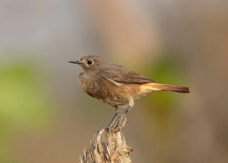
Among the species most often recorded on GBIF are Larus michahellis (Yellow-legged Gull), Phoenicurus ochruros (Black Redstart), Curruca melanocephala (Sardinian Warbler) and Phalacrocorax carbo (Great Cormorant).
What is the official website of Bergeggi Island Marine Protected Area?
© OpenStreetMap
Download the boundary: GeoJSON · GPX Boundary © OpenStreetMap contributors (ODbL).
Geography
Over the 1996–2025 period, the mean annual temperature is about 15.3 °C and total precipitation reaches roughly 1,191 mm per year. The warmest month is usually August, the coolest January, and the wettest November.
Area
- Area
- 203 ha
- Coordinates
- 44.2358, 8.4456
Climate
● Mean temperature (°C) · ▮ Precipitation (mm)
Source: Copernicus ERA5-Land (C3S, doi:10.24381/cds.68d2bb30), monthly averages 1996–2025 interpolated to the representative point, temperatures adjusted for elevation.
Contains modified Copernicus Climate Change Service information 2026. Neither the European Commission nor ECMWF is responsible for any use that may be made of the Copernicus information or data it contains.
Natural habitats
The site is almost entirely marine. The seabed reaches about 67 m deep (median depth 41 m; GEBCO bathymetry). The 2 Natura 2000 sites overlapping the area list 11 habitats of European interest (2 priority), the most extensive being Posidonia beds (Posidonion oceanicae), sandbanks which are slightly covered by sea water all the time and reefs.
Biodiversity
Based on occurrences aggregated by GBIF, several species are regularly recorded within the site. Among the most frequent are Larus michahellis (Yellow-legged Gull), Phoenicurus ochruros (Black Redstart), Curruca melanocephala (Sardinian Warbler) and Phalacrocorax carbo (Great Cormorant). The full list of documented taxa is shown below. The overlapping Natura 2000 sites list 9 species of European interest: 1 mammal, 2 reptiles, 5 invertebrates and 1 plant.
Habitats of European interest
From the official forms of the 2 Natura 2000 sites overlapping the area (areas reported for each whole site).
- Posidonia beds (Posidonion oceanicae) priority 73 ha
- Sandbanks which are slightly covered by sea water all the time 49 ha
- Reefs 46 ha
- Calcareous rocky slopes with chasmophytic vegetation 2 ha
- Mediterranean pine forests with endemic Mesogean pines 2 ha
- Vegetated sea cliffs of the Mediterranean coasts with endemic Limonium spp. 1 ha
- Thermo-Mediterranean and pre-desert scrub 1 ha
- Pseudo-steppe with grasses and annuals of the Thero-Brachypodietea priority 0 ha
and 3 more
Species of European interest
Mammals · 1
Invertebrates · 5
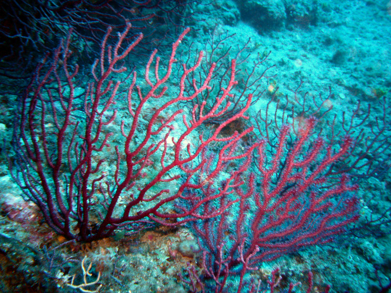
Centrostephanus longispinus, Red coral (Corallium rubrum), European date mussel (Lithophaga lithophaga), Fan Mussel (Pinna nobilis), Mediterranean Slipper Lobster (Scyllarides latus)
Plants · 1
Savona Hare-bell (Campanula sabatia)
Source: Natura 2000 standard data forms (EEA, CC-BY 4.0). Not exhaustive: sensitive species are not published.
Species to look out for

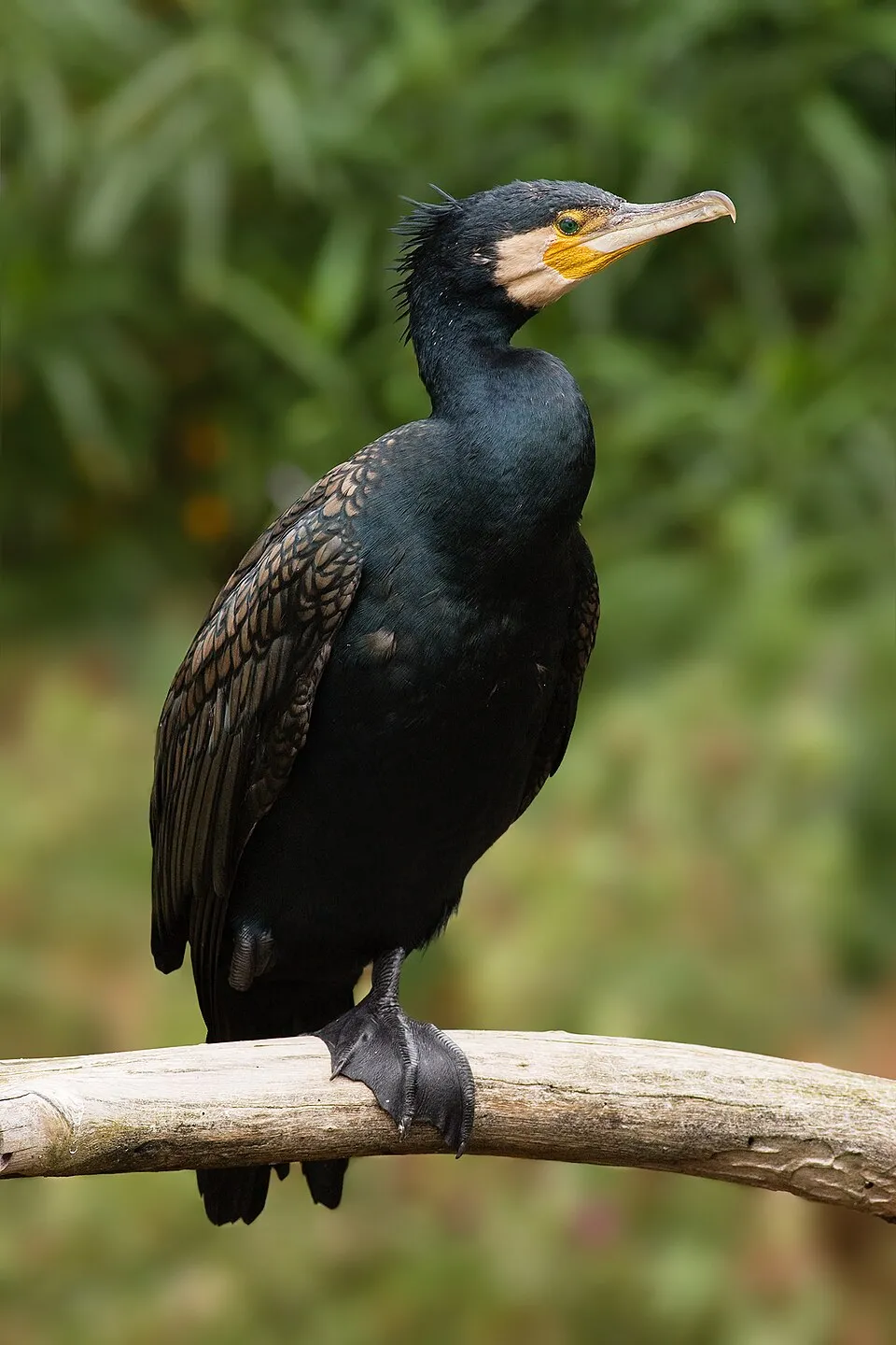
Bird
Great Cormorant
Phalacrocorax carbo5 records © JJ Harrison (https://www.jjharrison.com.au/) · CC BY-SA 3.0

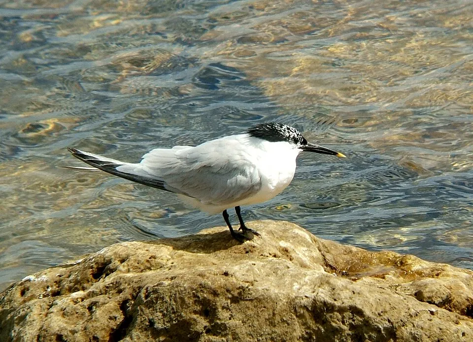
Observed species
Occurrences documented via GBIF; they are neither an exhaustive inventory nor proof of current presence.
- Yellow-legged Gull · Larus michahellis · 8
- Black Redstart · Phoenicurus ochruros · 6
- Sardinian Warbler · Curruca melanocephala · 6
- Great Cormorant · Phalacrocorax carbo · 5
- European robin · Erithacus rubecula · 5
- Sandwich Tern · Thalasseus sandvicensis · 4
- European shag · Phalacrocorax aristotelis · 3
- Rock Dove · Columba livia · 3
- Clove pink · Dianthus caryophyllus · 3
- Mauve stinger · Pelagia noctiluca · 2
- East Atlantic peacock wrasse · Symphodus tinca · 2
- Great tit · Parus major · 2
+18 more species
- Chicken liver sponge · Chondrosia reniformis · 1
- Black Sea urchin · Arbacia lixula · 1
- European clam · Varicorbula gibba · 1
- Green ormer · Haliotis tuberculata · 1
- Painted comber · Serranus scriba · 1
- Salema porgy · Sarpa salpa · 1
- Ringneck blenny · Parablennius pilicornis · 1
- Montagu's blenny · Coryphoblennius galerita · 1
- Boxlip mullet · Oedalechilus labeo · 1
- Peregrine Falcon · Falco peregrinus · 1
- Common Wood Pigeon · Columba palumbus · 1
- Stalked Lettuce Leaf Algae · Halimeda tuna · 1
- Mastic Tree · Pistacia lentiscus · 1
- Laugier's top shell · Calliostoma laugieri · 1
- Brown cowry · Luria lurida · 1
- Cat's paw scallop · Manupecten pesfelis · 1
- Spiny Myrtea · Myrtea spinifera · 1
- Spotted risso · Pusillina inconspicua · 1
Records: GBIF.org (CC-BY). Names: Wikidata (CC0), GBIF. Photos: Wikimedia Commons.
Conservation challenges
The primary purpose of the site is to preserve its natural habitats and the biodiversity they support. The species recorded (Biodiversity tab) reflect its ecological value. The designations it holds frame its management and the control of land use.
Built-up and developed land (buildings, business areas, roads, quarries) covers 2% of the area (CORINE Land Cover). According to the Natura 2000 forms, of 11 assessed habitats of European interest, 2 are in average or reduced condition and the rest in good condition. According to the Water Framework Directive assessment (2022 river basin management plans, data 2014–2019), water bodies assessed within the site: coastal waters, 1 of 1 in good ecological status or better.
Pressure indicators
Built-up land
2%
buildings, business areas, roads, quarries
Rivers and lakes
Coastal waters: 1 of 1 good or better
assessments 2014–2019
Sources: Global Forest Change (Hansen et al., University of Maryland, via Global Forest Watch, CC-BY 4.0); EFFIS, European Commission / Copernicus; NASA Black Marble 2016 (public domain); CORINE Land Cover 2018 (Copernicus) or MODIS.
Ecological status of water bodies: European Environment Agency, WISE – Water Framework Directive, 3rd river basin management plans (2022), CC BY 4.0. Official national classification, not comparable between countries.
Practical information
Cities and airport
- Savona
7 km as the crow flies - Genoa
42 km as the crow flies - Airport: Genoa Cristoforo Colombo (GOA)
36 km as the crow flies
Visitor information
- Associazione Pro Loco di Bergeggi
< 1 km from the site boundary - Informazioni turistiche Bergeggi
< 1 km from the site boundary - Centro Congressi Palace
2 km from the site boundary - IAT Spotorno (Casa del Turismo)
2 km from the site boundary
Things to see
2 viewpoints
Data © OpenStreetMap contributors (ODbL) · Wikidata (CC0)
Bathing
2 monitored bathing sites in or within 1 km of the site · 2025 classification
Excellent · 2
- Ristorante Faro · sea · Excellent
- Villaggio del Sole · sea · Excellent
Source: European Environment Agency, official bathing water classification (Directive 2006/7/EC, CC-BY 4.0). Swimming is only permitted at the sites and times authorised locally.
Access and visiting
The nearest railway station is Spotorno-Noli, about 3 km from the site boundary. Nearest towns of over 50,000 people, as the crow flies: Savona (7 km) and Genoa (42 km). Nearest airport: Genoa Cristoforo Colombo (GOA), about 36 km away. About 170,000 people live within 20 km of the site boundary, 83,000 of them within 10 km (GHSL estimate, 2020). Visitor information on site: Associazione Pro Loco di Bergeggi, Informazioni turistiche Bergeggi and Centro Congressi Palace. To see: 2 viewpoints. To plan a visit (access, opening periods, visitor rules), it is best to consult the official information from the managing body and the official website listed in this page's sources.
Source: OpenStreetMap (ODbL), Wikidata (CC0), October 2026.
When to visit
Best time to visit: from April to September, with average temperatures of 13 to 25 °C and moderate rainfall. Precipitation peaks in October and November (up to 180 mm per month). Day length ranges from about 8 h 53 min in December to 15 h 30 min in June. Wildlife records published on GBIF peak for birds (January) and plants (April). These peaks also reflect when observers are most active.
Source: Copernicus ERA5-Land (C3S), monthly averages 1996–2025 at the representative point, temperatures adjusted for elevation.
Contains modified Copernicus Climate Change Service information 2026. Neither the European Commission nor ECMWF is responsible for any use that may be made of the Copernicus information or data it contains.
Wildlife records calendar
JFMAMJJASOND
Birds
Plants
Monthly records published on GBIF (CC-BY), relative to the busiest month; also reflects observer activity.
Gallery
© Franciop · CC BY-SA 3.0
© Luca Sciurti · CC BY-SA 4.0
© Stefano Mazzone Geno… · CC BY-SA 3.0
© Stefano Mazzone · CC BY-SA 3.0
© Stefano Mazzone · CC BY-SA 3.0
© Silvia Franceschetti · CC BY-SA 3.0
Sources and licences
- Wikidata: Q3622010
- OpenStreetMap: relation 6608311
- Official website: http://www.ampisolabergeggi.it
- Wikipedia: it.wikipedia.org/wiki/Area_marina_protetta_Isola_di_Bergeggi
- WDPA: 390513
References
- cds.climate.copernicus.eu: climate · CC-BY-4.0
- registry.opendata.aws: elevation of the reference point · PD
- land.copernicus.eu: land cover, land cover change, sea share · COPERNICUS
- doi.org: population around the site · CC-BY-4.0
- wikidata.org: official area, establishment date, protected heritage, nearby cities and airport, access and peaks, places to see, official website · CC0-1.0
- eea.europa.eu: bathing water quality, ecological status of waters · CC-BY-4.0
- gebco.net: depths · PD
- opentopodata.org: elevations · PD
- gbif.org: seasonality of sightings, invasive alien species, observed species · CC-BY-4.0
- natura2000.eea.europa.eu: Natura 2000 habitats and species · CC-BY-4.0
- openstreetmap.org: official name, access and peaks, places to see, trail difficulty · ODbL-1.0
- wikidata.org: Wikipedia article · CC-BY-SA-4.0
Data © OpenStreetMap contributors (ODbL), Wikidata (CC0) and the sources cited.