Fungus
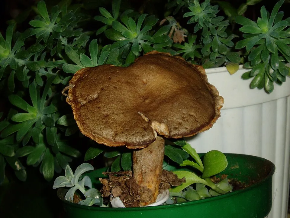
Scurfy Brittlegill
Russula melzeri381 records © Muséum national d'histoire naturelle · CC BY 4.0
Italy · Terrestrial
Regional nature park of 14,853 hectares in Italy, established in 1995.
Regional nature park of 14,853 hectares in Italy, established in 1995.
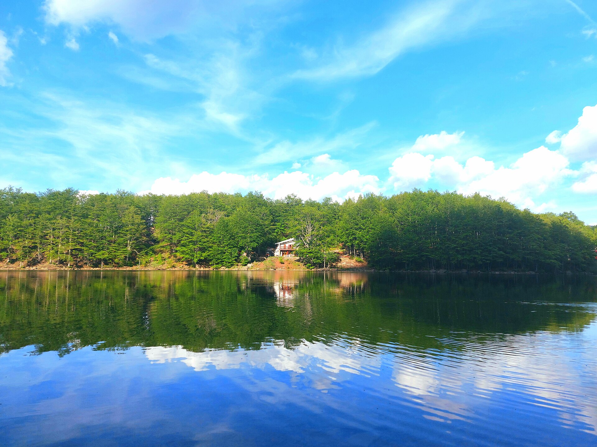
Cedra and Parma Valleys Regional Park is a regional nature park in Italy (Europe). It is a predominantly terrestrial area. Established in 1995, it covers about 14,853 hectares.
Protected as a regional nature park. International labels and designations: Natura 2000 network (2 sites). Key dates: established in 1995 and first Natura 2000 site under the Birds Directive in 2004.
Sources: Wikidata (CC0) for establishment and international labels; EEA Natura 2000 database (CC-BY 4.0) for site designation dates.
In Italy (Europe). Representative point: 44.4178° N, 10.0600° E.
About 14,853 hectares (149 km²). It is the 36th largest of the 128 regional parks in Italy covered by Parkavela.
In 1995.
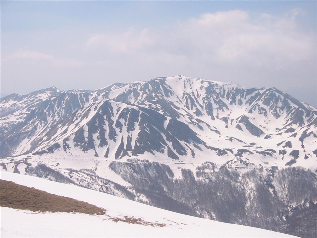
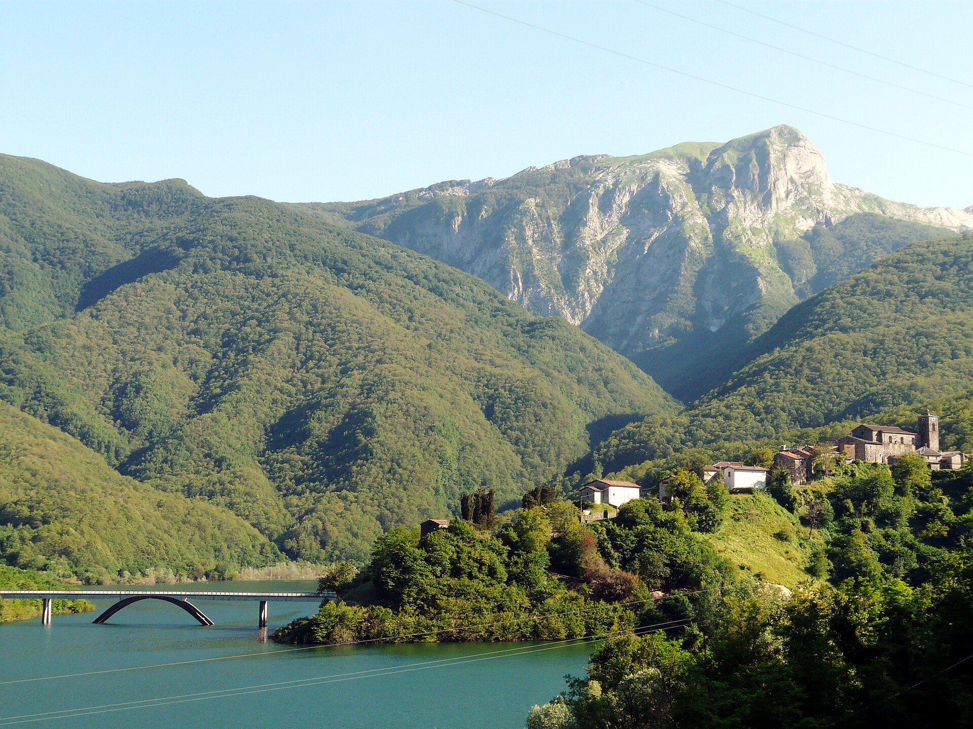
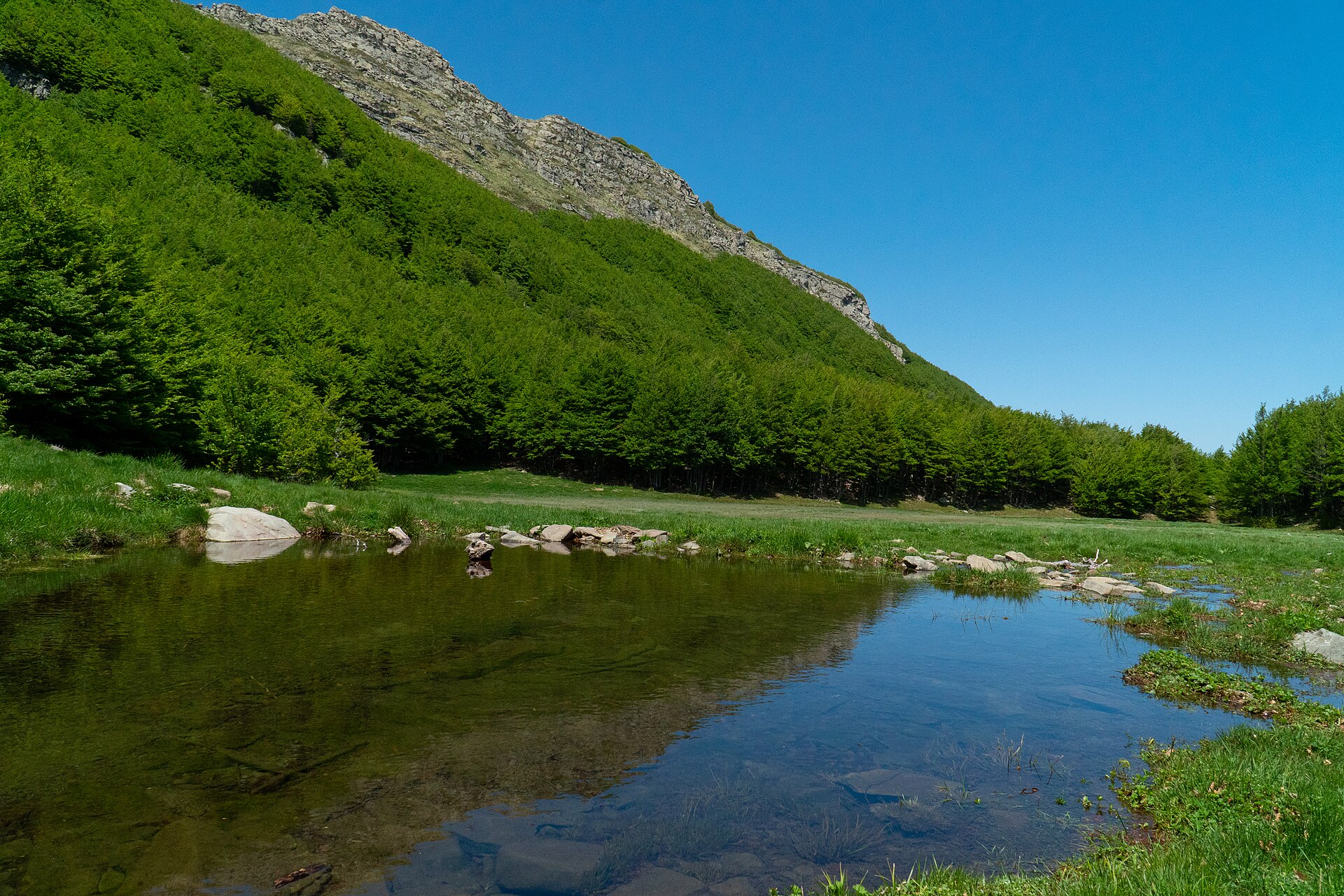
A terrestrial area, with forests and mountains.
According to the European 1:1 million geological map (EGDI), the bedrock consists mainly of marly limestones (63% of sampled points) and mudstones (38%). These are mostly sedimentary rocks. The geological units date mainly from the Cretaceous (69% of sampled points).
Monte Sillara, at 1,861 m (OpenStreetMap).
Monte Sillara (1,861 m), Monte Bragalata (1,836 m), Monte Orsaro (1,830 m), Monte Brusà (1,797 m) and Rocca Pianaccia (1,765 m) (OpenStreetMap).
Natura 2000 network (2 sites).
Best time to visit: from June to September, with average temperatures of 12 to 17 °C and moderate rainfall.
9 viewpoints, 2 waterfalls, 19 lakes and ponds and 1 cave, including Cascate di Canetolo, Lago Martini (1,714 m), Buca della Neve (1,637 m) and Sbocco condotta Parma di Badignana (OpenStreetMap).
10 mountain huts and 2 campsites, including Capanna del Braiola (1,610 m), Area campeggio libero Lago Ballano and Rifugio Giovanni Mariotti (1,508 m) (OpenStreetMap).
Yes. According to Wikidata, 13 monuments protected as Italian national cultural heritage stand within the boundary. For example: “Chiesa dei Santi Leonardo e Rocco” in Corniglio, “Castello di Bosco di Corniglio” in Corniglio and “Casa del Poeta Attilio Bertolucci” in Monchio delle Corti.
Nearest towns of over 50,000 people, as the crow flies: Carrara (29 km) and La Spezia (34 km). Nearest airport: Parma (PMF), about 42 km away.
The nearest railway station is Berceto, about 10 km from the site boundary.
Yes. Waymarked hiking routes listed in OpenStreetMap: 81, including E 1, Sentiero di spartiacque appenninico, Grande Escursione Appenninica and Sentiero dei Ducati. The “00 · Sentiero di spartiacque appenninico” route runs for about 12 km through the site, with some 60 m of ascent on its longest section.
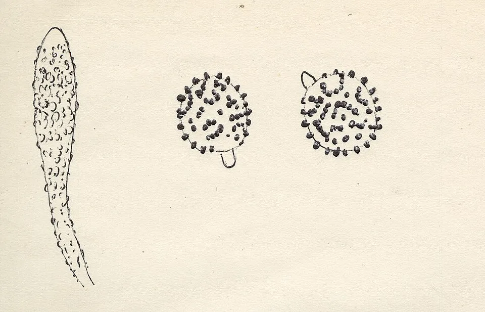
Among the species most often recorded on GBIF are Russula melzeri (Scurfy Brittlegill), Inocybe assimilata, Podila humilis and Hebeloma incarnatulum.
© OpenStreetMap
Download the boundary: GeoJSON · GPX Boundary © OpenStreetMap contributors (ODbL).
The representative point of the site lies at around 1,386 m above sea level. Over the 1996–2025 period, the mean annual temperature is about 7.3 °C and total precipitation reaches roughly 1,273 mm per year. The warmest month is usually July, the coolest January, and the wettest November. According to the European 1:1 million geological map (EGDI), the bedrock consists mainly of marly limestones (63% of sampled points) and mudstones (38%). These are mostly sedimentary rocks. The geological units date mainly from the Cretaceous (69% of sampled points).
Terrain: Mapzen Terrain Tiles (SRTM, USGS)
share of the site in each elevation band (smoothed terrain model: summits are rounded off) · Terrain: Mapzen Terrain Tiles (SRTM, USGS)
Sedimentary rocks 100 % · Main age: Cretaceous (69%)
Source: EGDI 1:1M geological map (EuroGeoSurveys and national geological surveys), CC BY 4.0 · 16 sampled points within the site.
Data © OpenStreetMap contributors (ODbL)
● Mean temperature (°C) · ▮ Precipitation (mm)
Source: Copernicus ERA5-Land (C3S, doi:10.24381/cds.68d2bb30), monthly averages 1996–2025 interpolated to the representative point, temperatures adjusted for elevation.
Contains modified Copernicus Climate Change Service information 2026. Neither the European Commission nor ECMWF is responsible for any use that may be made of the Copernicus information or data it contains.
According to CORINE Land Cover (2018), the site is mainly made up of forests (76%), farmland (10%) and heath and scrub (6%). Woodland is mostly broadleaved. Elevation ranges from about 690 m to 1,861 m (highest point: Monte Sillara). Median elevation is 1,136 m, and 11% of the site lies above 1,500 m (SRTM elevation model). The terrain is steep: 54% of slopes exceed 15° (mean slope 17°). The 2 Natura 2000 sites overlapping the area list 30 habitats of European interest (6 priority), the most extensive being Asperulo-Fagetum beech forests, Alpine and Boreal heaths and siliceous alpine and boreal grasslands.
Based on occurrences aggregated by GBIF, several species are regularly recorded within the site. Among the most frequent are Russula melzeri (Scurfy Brittlegill), Inocybe assimilata, Podila humilis and Hebeloma incarnatulum. The full list of documented taxa is shown below. The overlapping Natura 2000 sites list 48 species of European interest: 22 birds, 10 mammals, 1 reptile, 2 amphibians, 2 fish, 4 invertebrates and 7 plants.
From the official forms of the 2 Natura 2000 sites overlapping the area (areas reported for each whole site).
and 22 more
Tawny Pipit (Anthus campestris) breeding passage, Tree Pipit (Anthus trivialis) passage breeding, Golden Eagle (Aquila chrysaetos) passage breeding resident, European Nightjar (Caprimulgus europaeus) passage breeding, Eurasian Treecreeper (Certhia familiaris) passage breeding, Common House Martin (Delichon urbicum) breeding passage, Peregrine Falcon (Falco peregrinus) passage, Collared Flycatcher (Ficedula albicollis) passage breeding, Common Crane (Grus grus) passage, Barn Swallow (Hirundo rustica) passage breeding, Red-backed Shrike (Lanius collurio) passage breeding, Woodlark (Lullula arborea) breeding passage and 10 more
Barbastelle (Barbastella barbastellus), Grey wolf (Canis lupus), Serotine bat (Eptesicus serotinus), Savi's Pipistrelle (Hypsugo savii), Common bent-wing bat (Miniopterus schreibersii), Lesser noctule (Nyctalus leisleri), Common noctule (Nyctalus noctula), Nathusius's pipistrelle (Pipistrellus nathusii), Common pipistrelle (Pipistrellus pipistrellus), Greater Horseshoe Bat (Rhinolophus ferrumequinum)
White-clawed Crayfish (Austropotamobius pallipes), Jersey Tiger (Euplagia quadripunctaria), Apollo (Parnassius apollo), Clouded apollo (Parnassius mnemosyne)
Aquilegia alpina, Ladder spleenwort (Asplenium adulterinum), Great Yellow Gentian (Gentiana lutea), Interrupted clubmoss (Lycopodium annotinum), Stag's-horn Clubmoss (Lycopodium clavatum), Ground And Creeping Clubmosses (Lycopodium spp.), Primula apennina
Source: Natura 2000 standard data forms (EEA, CC-BY 4.0). Not exhaustive: sensitive species are not published.
Fungus
381 records © Muséum national d'histoire naturelle · CC BY 4.0


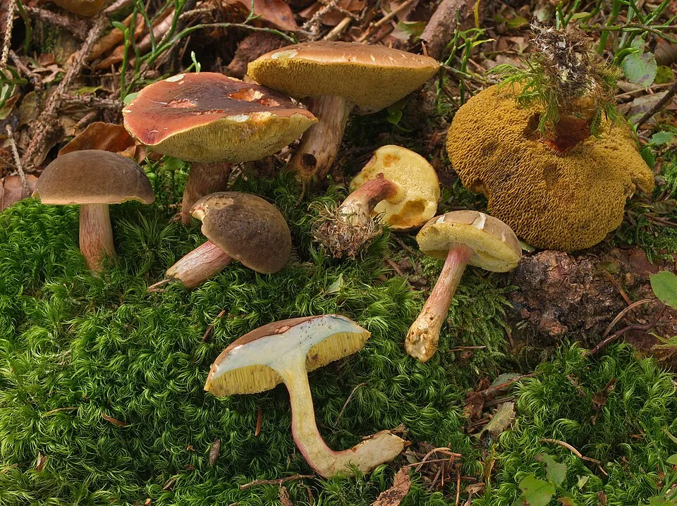

Occurrences documented via GBIF; they are neither an exhaustive inventory nor proof of current presence.
Records: GBIF.org (CC-BY). Names: Wikidata (CC0), GBIF. Photos: Wikimedia Commons.
The primary purpose of the site is to preserve its natural habitats and the biodiversity they support. The species recorded (Biodiversity tab) reflect its ecological value. The designations it holds frame its management and the control of land use.
According to Global Forest Change data (University of Maryland, Global Forest Watch), about 200 ha of tree cover were lost within the boundary between 2001 and 2023 (1% of its area), peaking in 2019 and 2023. These losses include logging, storms and fires, and do not account for regrowth. According to the European CORINE Land Cover inventory (Copernicus), land cover changed on about 832 ha of the site between 1990 and 2018 (6% of its area): forest grew by 688 ha, mostly at the expense of open natural land, while open natural land shrank by 516 ha, mostly giving way to forest. At night, the area gives off virtually no artificial light detectable from space (NASA VIIRS Black Marble composite, 2016). According to the Natura 2000 forms, of 30 assessed habitats of European interest, 12 are in excellent condition and the rest in good condition. According to the Water Framework Directive assessment (2022 river basin management plans, data 2014–2020), 70% of the 40 km of rivers assessed within the site are in good or high ecological status.
200 ha
2001–2023 · 1% of the area
0
No large fire mapped (fires over about 30 ha)
< 1%
of the area gives off artificial light visible from space
< 1%
buildings, business areas, roads, quarries · farmland 10%
832 ha
changed cover, 1990–2018 · CORINE · 6% of the area
70%
of the 40 km of assessed rivers in good or high ecological status · WFD 2022
assessments 2014–2020
Sources: Global Forest Change (Hansen et al., University of Maryland, via Global Forest Watch, CC-BY 4.0); EFFIS, European Commission / Copernicus; NASA Black Marble 2016 (public domain); CORINE Land Cover 2018 (Copernicus) or MODIS.
CORINE Land Cover Change 1990–2018: generated using European Union's Copernicus Land Monitoring Service information (EEA), aggregated by Parkavela; DOI 10.2909/f30f1000-7cf8-43bb-872c-5eb093911b24.
Ecological status of water bodies: European Environment Agency, WISE – Water Framework Directive, 3rd river basin management plans (2022), CC BY 4.0. Official national classification, not comparable between countries.
9 viewpoints · 2 waterfalls · 19 lakes and ponds · 1 cave
10 mountain huts · 2 campsites
81 waymarked routes listed, including:
Signed cycle routes: this does not mean that cycling is allowed on footpaths.
Data © OpenStreetMap contributors (ODbL) · Wikidata (CC0)
Routes © OpenStreetMap contributors (ODbL), via Waymarked Trails
7.7 km within the site ↗ 97 m↘ 207 m 1,510–1,643 m
up to T2 · mountain hiking
11.5 km within the site ↗ 55 m↘ 527 m 1,239–1,723 m
up to T3 · demanding mountain hiking
6.4 km within the site ↗ 44 m↘ 95 m 1,260–1,360 m
up to T2 · mountain hiking
4.6 km within the site ↗ 166 m↘ 221 m 1,130–1,303 m
Tracks © OpenStreetMap contributors (ODbL), clipped to the boundary; elevation gain and profiles computed on the longest section from Mapzen Terrain Tiles (≈ 30 m), indicative only. Indicative difficulty (SAC scale, OpenStreetMap, via Waymarked Trails): check with the park.
The nearest railway station is Berceto, about 10 km from the site boundary. Nearest towns of over 50,000 people, as the crow flies: Carrara (29 km) and La Spezia (34 km). Nearest airport: Parma (PMF), about 42 km away. About 81,000 people live within 20 km of the site boundary, 19,000 of them within 10 km; some 1,000 people are estimated to live inside (GHSL estimate, 2020). This population has fallen by about 7% since 2000. Waymarked hiking routes listed in OpenStreetMap: 81, including E 1, Sentiero di spartiacque appenninico, Grande Escursione Appenninica and Sentiero dei Ducati. A signed cycle route crosses the site: “Appennino Bike Tour [ABT]” (OpenStreetMap). To see: 9 viewpoints, 2 waterfalls, 19 lakes and ponds and 1 cave, including Cascate di Canetolo, Lago Martini (1,714 m), Buca della Neve (1,637 m) and Sbocco condotta Parma di Badignana. Where to stay: 10 mountain huts and 2 campsites, including Capanna del Braiola (1,610 m), Area campeggio libero Lago Ballano and Rifugio Giovanni Mariotti (1,508 m). To plan a visit (access, opening periods, visitor rules), it is best to consult the official information from the managing body and the official website listed in this page's sources.
Source: OpenStreetMap (ODbL), Wikidata (CC0), October 2026.
According to Wikidata, 13 monuments protected as Italian national cultural heritage stand within the boundary. Among them are 9 religious buildings, 1 house or civic building and 1 castle or fortification. Examples include “Chiesa dei Santi Leonardo e Rocco” in Corniglio, “Castello di Bosco di Corniglio” in Corniglio and “Casa del Poeta Attilio Bertolucci” in Monchio delle Corti.
and 5 more
Source: Wikidata (CC0), monuments in each country’s official heritage protection registers, at national or regional level. Each item links to its Wikidata entry.
Best time to visit: from June to September, with average temperatures of 12 to 17 °C and moderate rainfall. Average temperatures drop below 0 °C from December to February: frost is common. These averages apply to the site's representative point (1,386 m); higher up it is markedly cooler and snow lasts longer. Day length ranges from about 8 h 51 min in December to 15 h 31 min in June. Wildlife records published on GBIF peak for birds (December and January), plants (June and July) and butterflies and moths (July and August). These peaks also reflect when observers are most active.
Source: Copernicus ERA5-Land (C3S), monthly averages 1996–2025 at the representative point, temperatures adjusted for elevation.
Contains modified Copernicus Climate Change Service information 2026. Neither the European Commission nor ECMWF is responsible for any use that may be made of the Copernicus information or data it contains.
Monthly records published on GBIF (CC-BY), relative to the busiest month; also reflects observer activity.
Data © OpenStreetMap contributors (ODbL), Wikidata (CC0) and the sources cited.