
Italy · Terrestrial
Colfiorito Regional Park
Regional nature park of 338 hectares in Italy, established in 1995.
Overview
Regional nature park of 338 hectares in Italy, established in 1995.
Colfiorito Regional Park is a regional nature park in Italy (Europe). It is a predominantly terrestrial area. Established in 1995, it covers about 338 hectares.
Protections and designations
Natura 2000 · habitats (SAC)
- Palude di Colfiorito IT5210072
Natura 2000 · birds (SPA)
- Palude di Colfiorito IT5210072
Other designations
Protected as a regional nature park. International labels and designations: Natura 2000 network (1 site: “Palude di Colfiorito”). Key dates: first Natura 2000 site under the Birds Directive in 1988, established in 1995 and first Natura 2000 site under the Habitats Directive in 2014.
In our collections
Timeline
-
1988
First Natura 2000 site under the Birds Directive
-
1995
Established
-
2014
First Natura 2000 site under the Habitats Directive
Sources: Wikidata (CC0) for establishment and international labels; EEA Natura 2000 database (CC-BY 4.0) for site designation dates.
Frequently asked questions
Where is Colfiorito Regional Park?
In Italy (Europe). Representative point: 43.0288° N, 12.8882° E.
How large is Colfiorito Regional Park?
About 338 hectares (3 km²). It is the 121st largest of the 128 regional parks in Italy covered by Parkavela.
When was Colfiorito Regional Park established?
In 1995.
What habitats and landscapes does Colfiorito Regional Park include?
A terrestrial area, with forests and wetlands.
What rocks lie beneath Colfiorito Regional Park?
According to the European 1:1 million geological map (EGDI), the bedrock consists mainly of limestones (100% of sampled points). These are mostly sedimentary rocks. The geological units date mainly from the Cretaceous (86% of sampled points).
What is the highest point of Colfiorito Regional Park?
Monte Orve, at 926 m (OpenStreetMap).
Which international labels apply to Colfiorito Regional Park?
Natura 2000 network (1 site: “Palude di Colfiorito”).
When is the best time to visit Colfiorito Regional Park?
Best time to visit: from May to October, with average temperatures of 12 to 22 °C and moderate rainfall.
Are there historic monuments in Colfiorito Regional Park?
Yes. According to Wikidata, 3 monuments protected as Italian national cultural heritage stand within the boundary. For example: “MAC Museo Archeologico Colfiorito” in Foligno, “Museo naturalistico del Parco di Colfiorito” in Foligno and “Colfiorito park” in Foligno.
What is the nearest large city to Colfiorito Regional Park?
Nearest towns of over 50,000 people, as the crow flies: Foligno (15 km) and Perugia (40 km). Nearest airport: Perugia San Francesco d'Assisi (PEG), about 31 km away.
How can I reach Colfiorito Regional Park by train?
The nearest railway station is Nocera Umbra, about 12 km from the site boundary.
Are there waymarked hiking trails in Colfiorito Regional Park?
Yes. Waymarked hiking routes listed in OpenStreetMap: 14, including Cammino Francescano della Marca and Via Lauretana.
Which species can be seen in Colfiorito Regional Park?
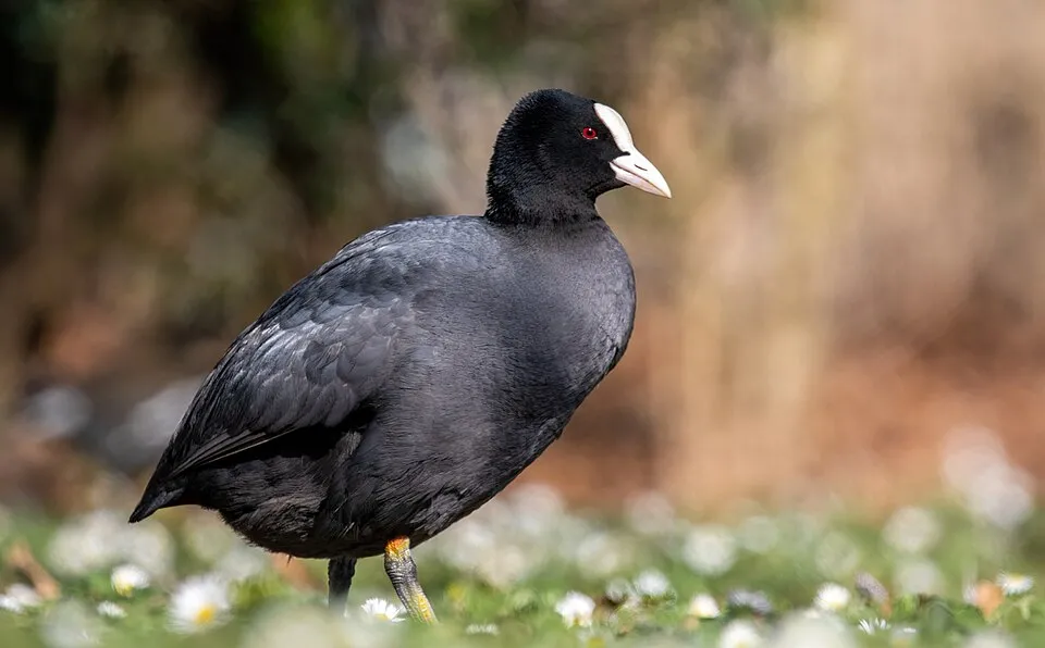
Among the species most often recorded on GBIF are Ardea cinerea (Grey Heron), Anas platyrhynchos (Mallard), Corvus cornix (Hooded Crow) and Fulica atra (Common Coot).
What is the official website of Colfiorito Regional Park?
© OpenStreetMap
Download the boundary: GeoJSON · GPX Boundary © OpenStreetMap contributors (ODbL).
Geography
The representative point of the site lies at around 814 m above sea level. Over the 1996–2025 period, the mean annual temperature is about 11.6 °C and total precipitation reaches roughly 868 mm per year. The warmest month is usually July, the coolest January, and the wettest November. According to the European 1:1 million geological map (EGDI), the bedrock consists mainly of limestones (100% of sampled points). These are mostly sedimentary rocks. The geological units date mainly from the Cretaceous (86% of sampled points).
Area
- Area
- 338 ha
- Elevation
- 814 m
- Median elevation
- 788 m
- Mean slope
- 8°
- Coordinates
- 43.0288, 12.8882
Terrain: Mapzen Terrain Tiles (SRTM, USGS)
Bedrock
- Limestones 100 %
Sedimentary rocks 100 % · Main age: Cretaceous (86%)
Source: EGDI 1:1M geological map (EuroGeoSurveys and national geological surveys), CC BY 4.0 · 7 sampled points within the site.
Climate
● Mean temperature (°C) · ▮ Precipitation (mm)
Source: Copernicus ERA5-Land (C3S, doi:10.24381/cds.68d2bb30), monthly averages 1996–2025 interpolated to the representative point, temperatures adjusted for elevation.
Contains modified Copernicus Climate Change Service information 2026. Neither the European Commission nor ECMWF is responsible for any use that may be made of the Copernicus information or data it contains.
Snow cover measured by satellite
J
F
M
A
M
J
J
A
S
O
N
D
average share of the area under snow · snowiest parts · ≈ 15 days a year
Snow cover: MODIS/Terra MOD10CM v61 (Hall & Riggs, 2021, NASA NSIDC DAAC, doi:10.5067/MODIS/MOD10CM.061), imagery from NASA GIBS (ESDIS); 2015–2025 average, grid of about 5 km.
Natural habitats
According to CORINE Land Cover (2018), the site is mainly made up of farmland (51%), marshes and bogs (24%) and forests (23%). Woodland is mostly broadleaved. Elevation ranges from about 750 m to 926 m (highest point: Monte Orve). The Natura 2000 site overlapping the area lists 5 habitats of European interest, the most extensive being natural eutrophic lakes with Magnopotamion or Hydrocharition-type vegetation, hard oligo-mesotrophic waters with benthic vegetation of Chara spp. and alkaline fens.
Biodiversity
Based on occurrences aggregated by GBIF, several species are regularly recorded within the site. Among the most frequent are Ardea cinerea (Grey Heron), Anas platyrhynchos (Mallard), Corvus cornix (Hooded Crow) and Fulica atra (Common Coot). The full list of documented taxa is shown below. The overlapping Natura 2000 site lists 159 species of European interest: 143 birds, 11 mammals, 1 amphibian and 4 invertebrates.
Habitats of European interest
From the official form of the Natura 2000 site overlapping the area (areas reported for the whole site).
- Natural eutrophic lakes with Magnopotamion or Hydrocharition-type vegetation 11 ha
- Hard oligo-mesotrophic waters with benthic vegetation of Chara spp. 4 ha
- Alkaline fens 1 ha
- Rivers with muddy banks with Chenopodion rubri p.p. and Bidention p.p. vegetation 0 ha
- Water courses of plain to montane levels with the Ranunculion fluitantis and Callitricho-Batrachion vegetation 0 ha
Species of European interest
Birds · 143
Eurasian Sparrowhawk (Accipiter nisus) resident, Great Reed Warbler (Acrocephalus arundinaceus) breeding passage, Moustached Warbler (Acrocephalus melanopogon) passage wintering, Sedge warbler (Acrocephalus schoenobaenus) passage, Eurasian Reed Warbler (Acrocephalus scirpaceus) breeding passage, Common Sandpiper (Actitis hypoleucos) passage, Long-tailed Tit (Aegithalos caudatus) resident, Eurasian Skylark (Alauda arvensis) resident, Common Kingfisher (Alcedo atthis) passage, Northern Pintail (Anas acuta) passage, Eurasian Teal (Anas crecca) passage wintering, Mallard (Anas platyrhynchos) resident breeding wintering and 131 more
Mammals · 11
Grey wolf (Canis lupus), European wildcat (Felis silvestris), Savi's Pipistrelle (Hypsugo savii), Crested porcupine (Hystrix cristata), Common bent-wing bat (Miniopterus schreibersii), Lesser mouse-eared myotis (Myotis blythii), Daubenton's bat (Myotis daubentonii), Geoffroy's bat (Myotis emarginatus), Greater mouse-eared bat (Myotis myotis), Kuhl's pipistrelle (Pipistrellus kuhlii), Common pipistrelle (Pipistrellus pipistrellus)
Amphibians · 1
Invertebrates · 4
Greater Capricorn Beetle (Cerambyx cerdo), Marsh fritillary (Euphydryas aurinia), Jersey Tiger (Euplagia quadripunctaria), Stag beetle (Lucanus cervus)
Source: Natura 2000 standard data forms (EEA, CC-BY 4.0). Not exhaustive: sensitive species are not published.
Species to look out for


Bird
Hooded Crow
Corvus cornix47 records © Ricardo Tulio Gandelman from Rio de Janeiro, Brazil · CC BY 2.0
Observed species
Occurrences documented via GBIF; they are neither an exhaustive inventory nor proof of current presence.
- Grey Heron · Ardea cinerea · 55
- Mallard · Anas platyrhynchos · 48
- Hooded Crow · Corvus cornix · 47
- Common Coot · Fulica atra · 45
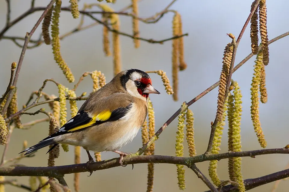
- European Goldfinch · Carduelis carduelis · 43
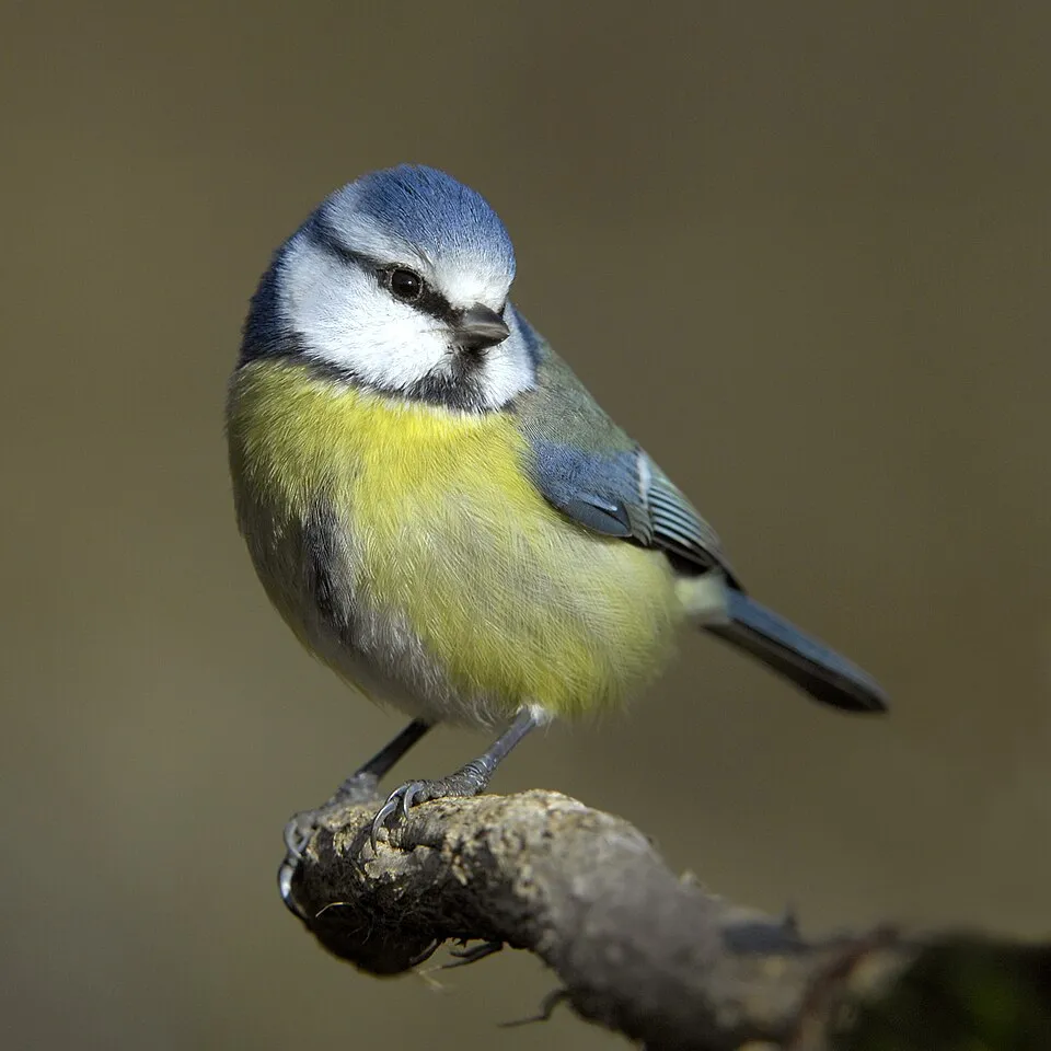
- Eurasian blue tit · Cyanistes caeruleus · 42
- Great Cormorant · Phalacrocorax carbo · 41
- Common Buzzard · Buteo buteo · 38
- Corn Bunting · Emberiza calandra · 36
- Common Kestrel · Falco tinnunculus · 35
- Great tit · Parus major · 31
- Common Blackbird · Turdus merula · 30
Records: GBIF.org (CC-BY). Names: Wikidata (CC0), GBIF. Photos: Wikimedia Commons.
Conservation challenges
The primary purpose of the site is to preserve its natural habitats and the biodiversity they support. The species recorded (Biodiversity tab) reflect its ecological value. The designations it holds frame its management and the control of land use.
At night, 70% of the area gives off artificial light detectable from space (NASA VIIRS Black Marble composite, 2016). Built-up and developed land (buildings, business areas, roads, quarries) covers 2% of the area, and farmland 51% (CORINE Land Cover). According to the Natura 2000 forms, of 4 assessed habitats of European interest, 3 are in average or reduced condition and the rest in good condition. One invasive alien species has been recorded within the site since 2000 (GBIF observations), listed as of Union concern: Threskiornis aethiopicus (African Sacred Ibis).
Pressure indicators
Tree cover lost
3 ha
2001–2023 · < 1% of the area
20012023
Fires since 2016
0
No large fire mapped (fires over about 30 ha)
Light at night
70%
of the area gives off artificial light visible from space
DarkLit
Built-up land
2%
buildings, business areas, roads, quarries · farmland 51%
Invasive alien species
1
incl. 1 of EU concern · since 2000
Sources: Global Forest Change (Hansen et al., University of Maryland, via Global Forest Watch, CC-BY 4.0); EFFIS, European Commission / Copernicus; NASA Black Marble 2016 (public domain); CORINE Land Cover 2018 (Copernicus) or MODIS.
Invasive alien species: Global Register of Introduced and Invasive Species (ISSG, CC BY 4.0); Union list, Regulation (EU) 1143/2014 (INBO, CC0); GBIF.org records (CC0 / CC BY 4.0), at least 2 per species.
Practical information
Cities and airport
- Foligno
15 km as the crow flies - Perugia
40 km as the crow flies - Airport: Perugia San Francesco d'Assisi (PEG)
31 km as the crow flies
Hiking
14 waymarked routes listed, including:
Cammino Francescano della MarcaVia Lauretana
Data © OpenStreetMap contributors (ODbL) · Wikidata (CC0)
Access and visiting
The nearest railway station is Nocera Umbra, about 12 km from the site boundary. Nearest towns of over 50,000 people, as the crow flies: Foligno (15 km) and Perugia (40 km). Nearest airport: Perugia San Francesco d'Assisi (PEG), about 31 km away. About 99,000 people live within 20 km of the site boundary, 6,800 of them within 10 km (GHSL estimate, 2020). Waymarked hiking routes listed in OpenStreetMap: 14, including Cammino Francescano della Marca and Via Lauretana. To plan a visit (access, opening periods, visitor rules), it is best to consult the official information from the managing body and the official website listed in this page's sources.
Source: OpenStreetMap (ODbL), Wikidata (CC0), October 2026.
Built heritage
According to Wikidata, 3 monuments protected as Italian national cultural heritage stand within the boundary. Examples include “MAC Museo Archeologico Colfiorito” in Foligno, “Museo naturalistico del Parco di Colfiorito” in Foligno and “Colfiorito park” in Foligno.
2 houses and civic buildings1 prehistoric or archaeological site
-
MAC Museo Archeologico Colfiorito
Foligno -
Museo naturalistico del Parco di Colfiorito
Foligno -
Colfiorito park
Foligno · 20th c.
Source: Wikidata (CC0), monuments in each country’s official heritage protection registers, at national or regional level. Each item links to its Wikidata entry.
When to visit
Best time to visit: from May to October, with average temperatures of 12 to 22 °C and moderate rainfall. Snow only makes brief appearances in winter (about 15 days a year on average, MODIS satellites 2015–2025). Day length ranges from about 9 h 01 min in December to 15 h 21 min in June. Wildlife records published on GBIF peak for birds (December) and plants (from April to June). These peaks also reflect when observers are most active.
Source: Copernicus ERA5-Land (C3S), monthly averages 1996–2025 at the representative point, temperatures adjusted for elevation.
Contains modified Copernicus Climate Change Service information 2026. Neither the European Commission nor ECMWF is responsible for any use that may be made of the Copernicus information or data it contains.
Wildlife records calendar
JFMAMJJASOND
Birds
Plants
Monthly records published on GBIF (CC-BY), relative to the busiest month; also reflects observer activity.
Gallery
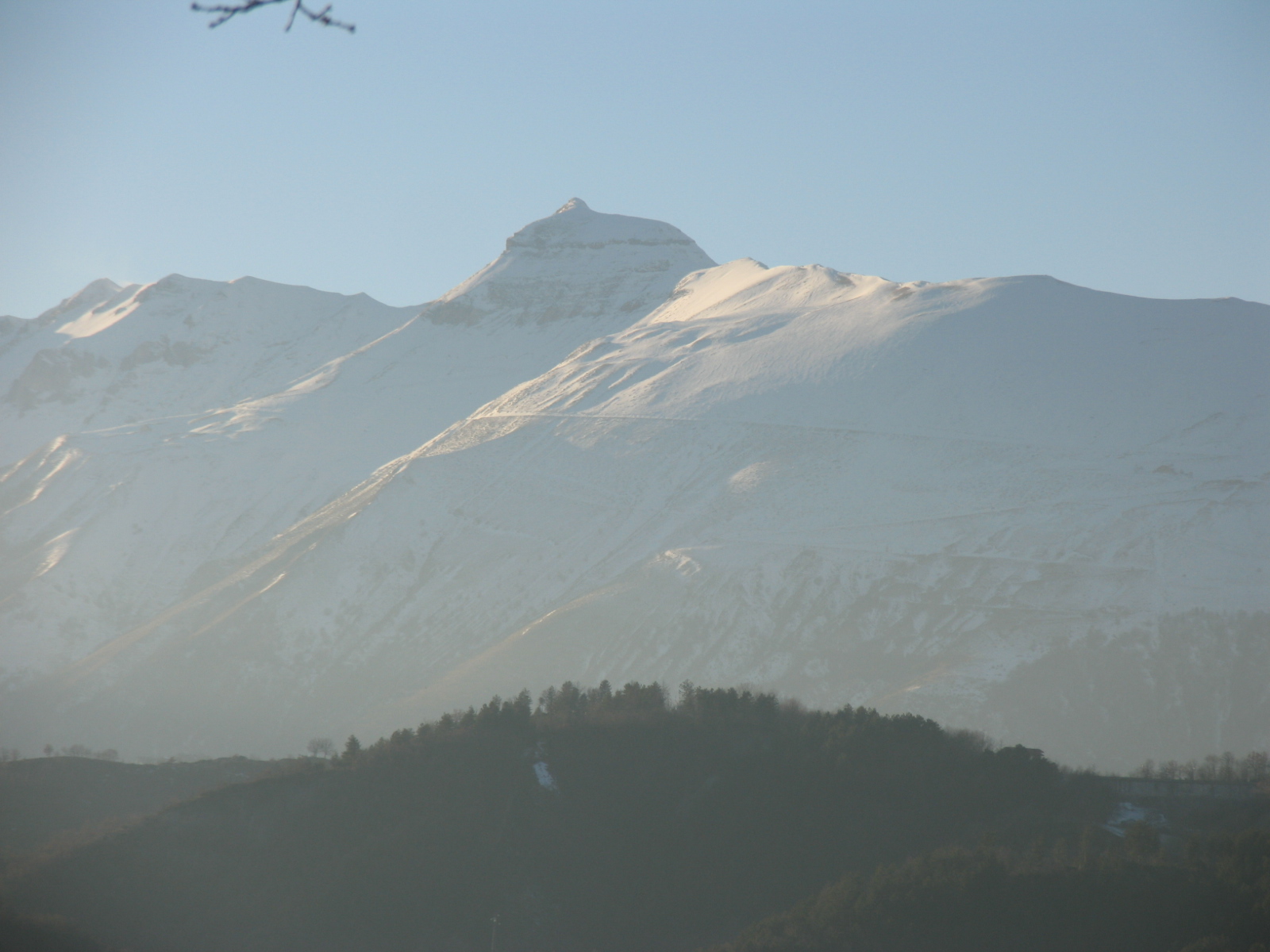
© cantalamessa · CC BY 2.5
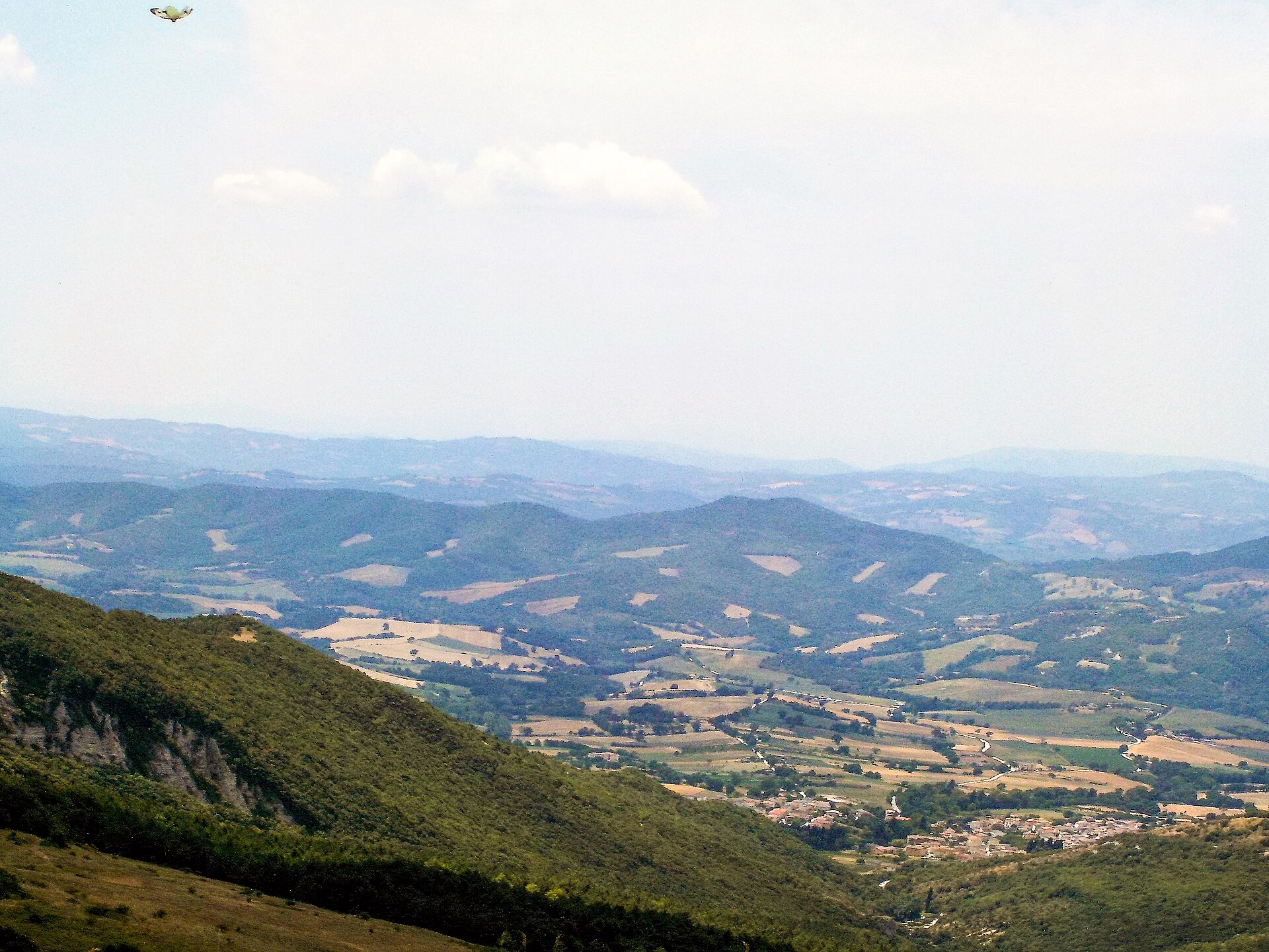
© Cantalamessa · CC BY 3.0
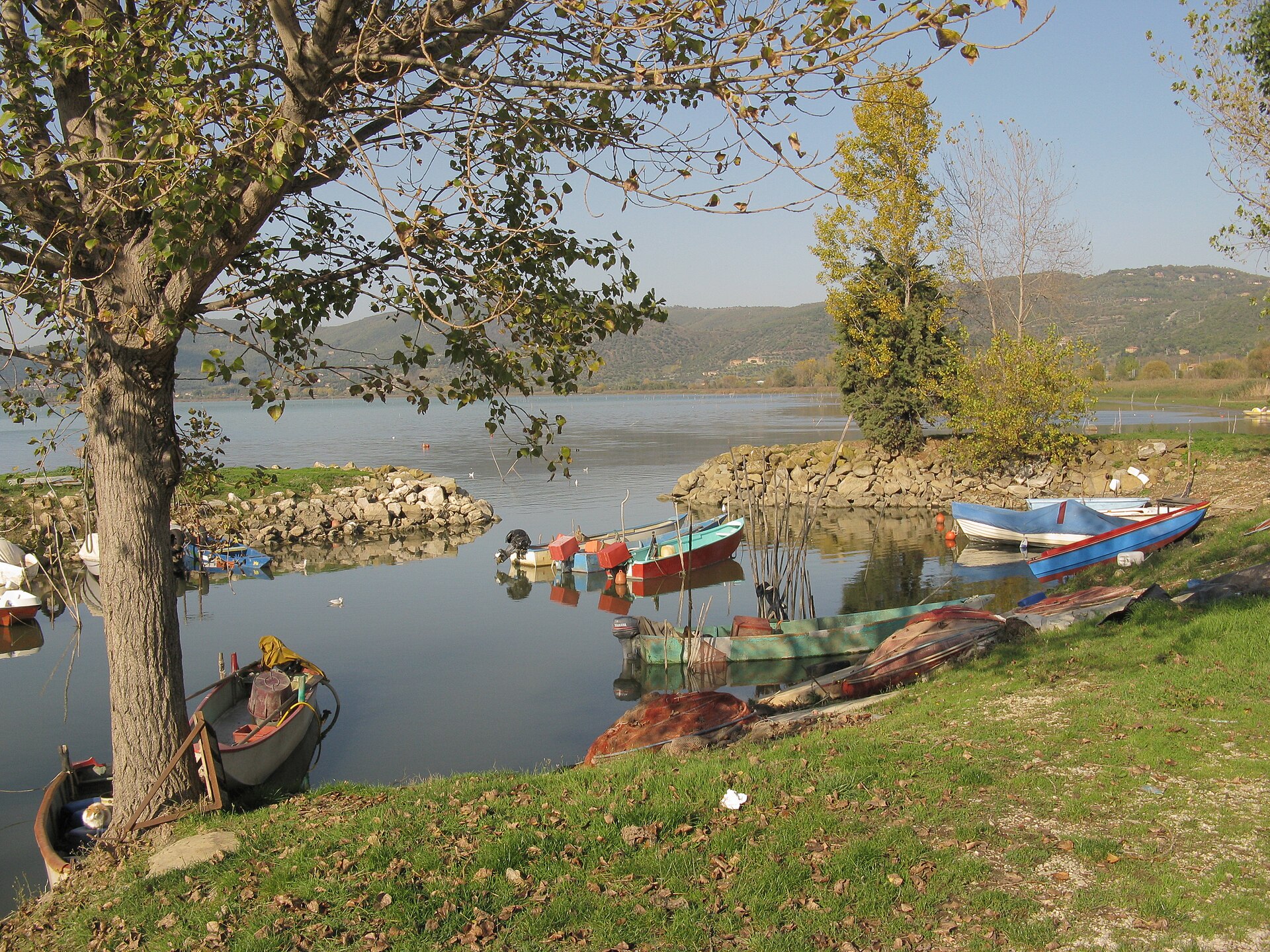
© Fabrizio Capsoni · CC BY-SA 4.0
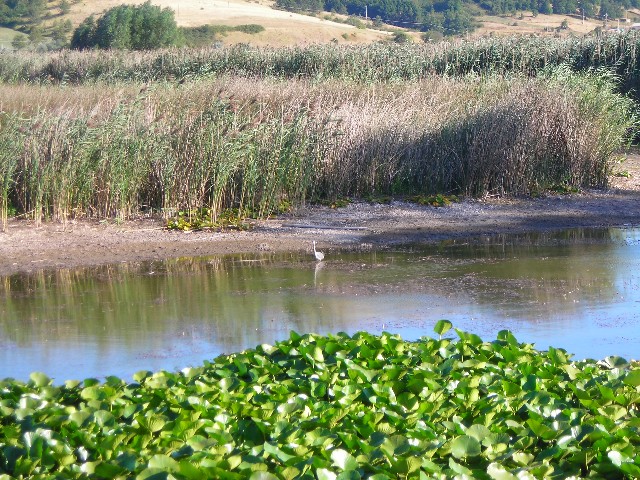
© Mongolo1984 · CC BY-SA 4.0
© Sirleonidas · CC BY-SA 4.0
© Assoaeronautica · CC BY-SA 3.0
Sources and licences
- Wikidata: Q3364636
- Official website: http://www.parks.it/parco.colfiorito/index.html
- Wikipedia: fr.wikipedia.org/wiki/Parc_naturel_régional_du_Colfiorito
- WDPA: 83521
References
- cds.climate.copernicus.eu: climate · CC-BY-4.0
- registry.opendata.aws: elevation of the reference point, detailed relief · PD
- land.copernicus.eu: land cover, land cover change, sea share · COPERNICUS
- doi.org: population around the site · CC-BY-4.0
- wikidata.org: official area, establishment date, protected heritage, nearby cities and airport, access and peaks, lake depths, places to see, official website · CC0-1.0
- eea.europa.eu: bathing water quality, ecological status of waters · CC-BY-4.0
- en.eurovelo.com: EuroVelo cycle routes · ODbL-1.0
- cycling.waymarkedtrails.org: cycle routes · ODbL-1.0
- opentopodata.org: elevations · PD
- forest-fire.emergency.copernicus.eu: wildfires · COPERNICUS
- globalforestwatch.org: tree cover loss · CC-BY-4.0
- gbif.org: seasonality of sightings, invasive alien species, observed species · CC-BY-4.0
- europe-geology.eu: geology · CC-BY-4.0
- hydrosheds.org: lakes · CC-BY-4.0
- natura2000.eea.europa.eu: Natura 2000 habitats and species · CC-BY-4.0
- openstreetmap.org: official name, access and peaks, places to see · ODbL-1.0
- earthobservatory.nasa.gov: night light · PD
- nsidc.org: snow cover · PD
- wikidata.org: Wikipedia article · CC-BY-SA-4.0
Data © OpenStreetMap contributors (ODbL), Wikidata (CC0) and the sources cited.