Spain · Terrestrial
Cornalvo Natural Park
Nature park of 11,601 hectares in Spain, established in 1998.
Overview
Nature park of 11,601 hectares in Spain, established in 1998.
Cornalvo Natural Park is a nature park in Spain (Europe). It is a predominantly terrestrial area. Established in 1998, it covers about 11,601 hectares.
Protections and designations
Natura 2000 · habitats (SAC)
- Embalse de Cornalvo y Sierra Bermeja ES0000069
Natura 2000 · birds (SPA)
- Embalse de Cornalvo y Sierra Bermeja ES0000069
Protected as a nature park. International labels and designations: Natura 2000 network (1 site: “Embalse de Cornalvo y Sierra Bermeja”). Key dates: first Natura 2000 site under the Birds Directive in 1989 and established in 1998.
In our collections
Timeline
-
1989
First Natura 2000 site under the Birds Directive
-
1998
Established
Sources: Wikidata (CC0) for establishment and international labels; EEA Natura 2000 database (CC-BY 4.0) for site designation dates.
Frequently asked questions
Where is Cornalvo Natural Park?
In Spain (Europe). Representative point: 39.0309° N, 6.2279° W.
How large is Cornalvo Natural Park?
About 11,601 hectares (116 km²). It is the 39th largest of the 73 nature parks in Spain covered by Parkavela.
When was Cornalvo Natural Park established?
In 1998.
What habitats and landscapes does Cornalvo Natural Park include?
A terrestrial area, where land cover is dominated by farmland (86%).
What rocks lie beneath Cornalvo Natural Park?
According to the European 1:1 million geological map (EGDI), the bedrock consists mainly of granites (63% of sampled points), limestones (13%) and mudstones (13%). These are mostly igneous rocks. The geological units date mainly from the Devonian (50% of sampled points).
Which international labels apply to Cornalvo Natural Park?
Natura 2000 network (1 site: “Embalse de Cornalvo y Sierra Bermeja”).
What is there to see in Cornalvo Natural Park?
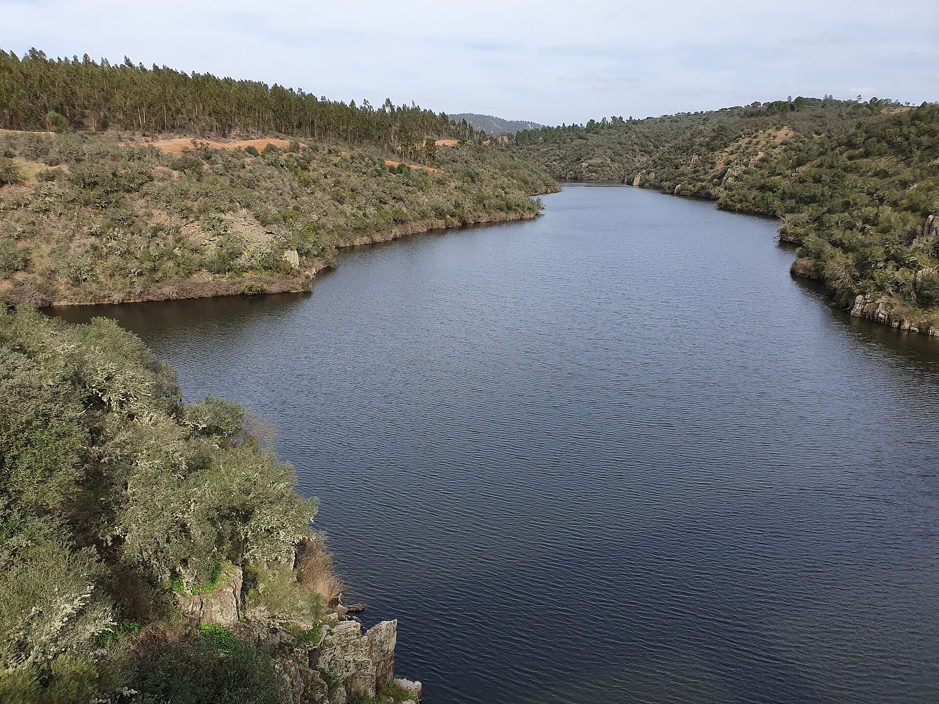
Pantano de Cornalvo (lake or pond) (Wikidata).
Are there historic monuments in Cornalvo Natural Park?
Yes. According to Wikidata, one monument listed as Bien de Interés Cultural stands within the boundary. For example: “Cornalvo Dam” in San Pedro de Mérida.
What is the nearest large city to Cornalvo Natural Park?
Nearest towns of over 50,000 people, as the crow flies: Mérida (10 km) and Cáceres (42 km). Nearest airport: San Pablo (SVQ), about 173 km away.
How can I reach Cornalvo Natural Park by train?
The nearest railway station is Guareña, about 8 km from the site boundary.
Are there waymarked hiking trails in Cornalvo Natural Park?
Yes. Waymarked hiking routes listed in OpenStreetMap: 9, including Camino Mozárabe, Vía de la Plata hiking and Camino Romano. The “VDLP · Vía de la Plata hiking - 02 Merida to Salamanca” route runs for about 7 km through the site, with some 80 m of ascent on its longest section.
Which species can be seen in Cornalvo Natural Park?
Among the species most often recorded on GBIF are Fringilla coelebs (Eurasian Chaffinch), Turdus merula (Common Blackbird), Curruca melanocephala (Sardinian Warbler) and Anas platyrhynchos (Mallard).
© OpenStreetMap
Download the boundary: GeoJSON · GPX Boundary © OpenStreetMap contributors (ODbL).
Geography
According to the European 1:1 million geological map (EGDI), the bedrock consists mainly of granites (63% of sampled points), limestones (13%) and mudstones (13%). These are mostly igneous rocks. The geological units date mainly from the Devonian (50% of sampled points).
Area
- Area
- 11,601 ha
- Median elevation
- 326 m
- Coordinates
- 39.0309, -6.2279
Terrain: Mapzen Terrain Tiles (SRTM, USGS)
Bedrock
- Granites 63 %
- Limestones 13 %
- Mudstones 13 %
- Sands and gravels 6 %
- Quartzites 6 %
Igneous rocks 63 % · Sedimentary rocks 31 % · Metamorphic rocks 6 % · Main age: Devonian (50%)
Source: EGDI 1:1M geological map (EuroGeoSurveys and national geological surveys), CC BY 4.0 · 16 sampled points within the site.
Natural habitats
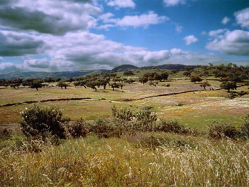
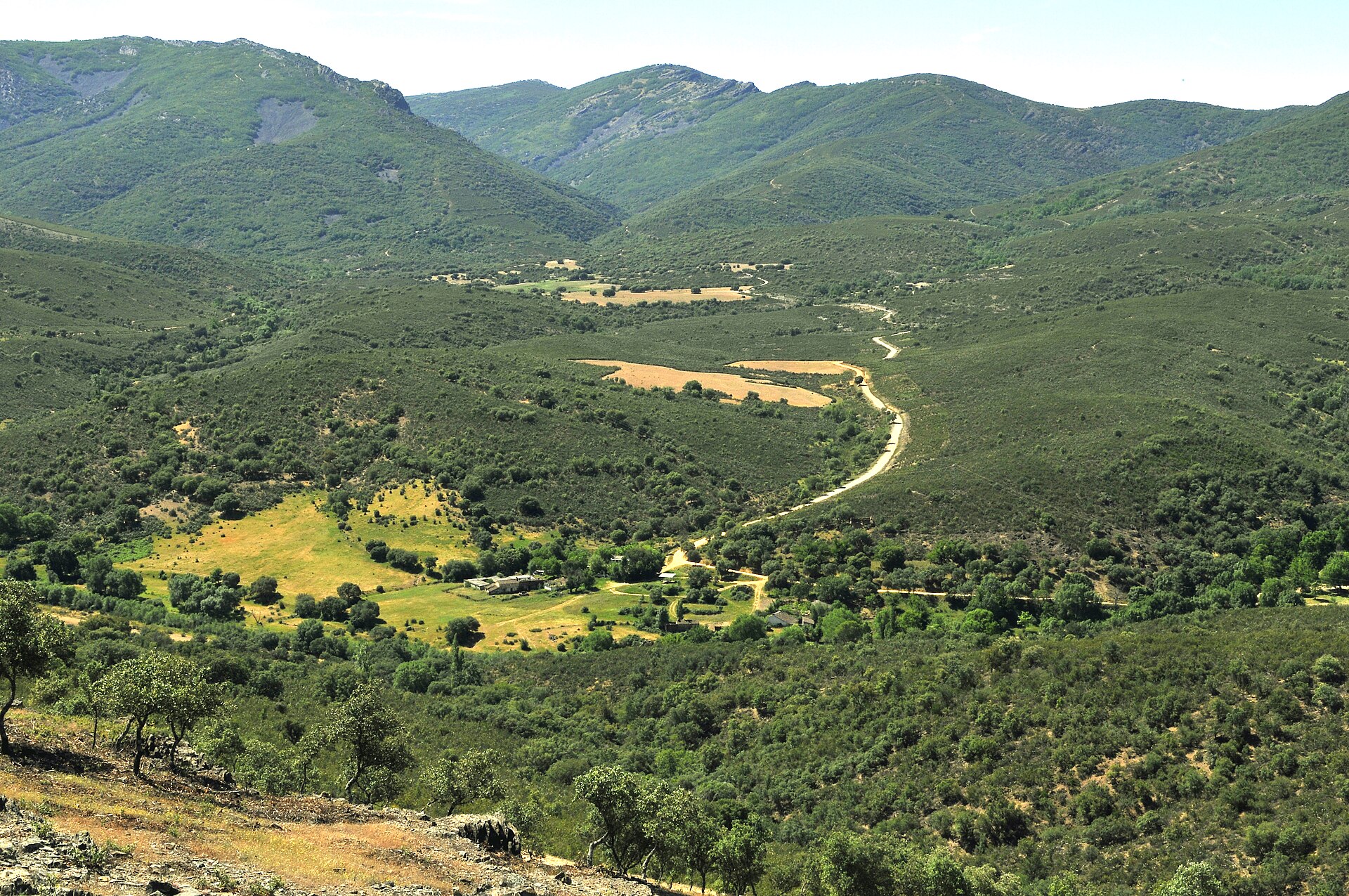
According to CORINE Land Cover (2018), the site is mainly made up of farmland (86%) and heath and scrub (6%). Elevation ranges from about 260 to 470 m (sampled elevations, SRTM). The Natura 2000 site overlapping the area lists 12 habitats of European interest (3 priority), the most extensive being dehesas with evergreen Quercus spp, pseudo-steppe with grasses and annuals of the Thero-Brachypodietea and Quercus suber forests.
Biodiversity
Based on occurrences aggregated by GBIF, several species are regularly recorded within the site. Among the most frequent are Fringilla coelebs (Eurasian Chaffinch), Turdus merula (Common Blackbird), Curruca melanocephala (Sardinian Warbler) and Anas platyrhynchos (Mallard). The full list of documented taxa is shown below. The overlapping Natura 2000 site lists 141 species of European interest: 119 birds, 3 mammals, 3 reptiles, 3 amphibians, 6 fish, 3 invertebrates and 4 plants.
Habitats of European interest
From the official form of the Natura 2000 site overlapping the area (areas reported for the whole site).
- Dehesas with evergreen Quercus spp. 8,092 ha
- Pseudo-steppe with grasses and annuals of the Thero-Brachypodietea priority 592 ha
- Quercus suber forests 260 ha
- Thermo-Mediterranean and pre-desert scrub 218 ha
- Quercus ilex and Quercus rotundifolia forests 149 ha
- Siliceous rocky slopes with chasmophytic vegetation 48 ha
- Mediterranean tall humid grasslands of the Molinio-Holoschoenion 44 ha
- Mediterranean temporary ponds priority 29 ha
and 4 more
Species of European interest
Birds · 119
Eurasian Goshawk (Accipiter gentilis) wintering, Great Reed Warbler (Acrocephalus arundinaceus) breeding, Common Sandpiper (Actitis hypoleucos) breeding passage wintering, Cinereous Vulture (Aegypius monachus) resident, Common Kingfisher (Alcedo atthis) resident, Northern Pintail (Anas acuta) wintering, Eurasian Teal (Anas crecca) wintering, Mallard (Anas platyrhynchos) wintering, Greylag Goose (Anser anser) wintering, Tawny Pipit (Anthus campestris) passage, Water Pipit (Anthus spinoletta) wintering passage, Spanish Imperial Eagle (Aquila adalberti) resident and 107 more
Mammals · 3
Eurasian otter (Lutra lutra), Western Polecat (Mustela putorius), Greater Horseshoe Bat (Rhinolophus ferrumequinum)
Reptiles · 3
European Pond Turtle (Emys orbicularis), Horseshoe Whip Snake (Hemorrhois hippocrepis), Iberian pond turtle (Mauremys leprosa)
Amphibians · 3
Iberian midwife toad (Alytes cisternasii), Iberian painted frog (Discoglossus galganoi), Perez's Frog (Pelophylax perezi)
Fish · 6
Jarabugo (Anaecypris hispanica), Lamprehuela (Cobitis paludica), Iberian arched-mouth nase (Iberochondrostoma lemmingii), Iberian Barbel (Luciobarbus comizo), Nase (Pseudochondrostoma willkommii), Squalius alburnoides
Invertebrates · 3
Wingless mantis (Apteromantis aptera), Greater Capricorn Beetle (Cerambyx cerdo), Marsh fritillary (Euphydryas aurinia)
Plants · 4
Lusitanian Water Clover (Marsilea batardae), Petticoat daffodil (Narcissus bulbocodium), Narcissus cavanillesii, Butcher's-broom (Ruscus aculeatus)
Source: Natura 2000 standard data forms (EEA, CC-BY 4.0). Not exhaustive: sensitive species are not published.
Species to look out for




Observed species
Occurrences documented via GBIF; they are neither an exhaustive inventory nor proof of current presence.
- Eurasian Chaffinch · Fringilla coelebs · 627
- Common Blackbird · Turdus merula · 617
- Sardinian Warbler · Curruca melanocephala · 595
- Mallard · Anas platyrhynchos · 562
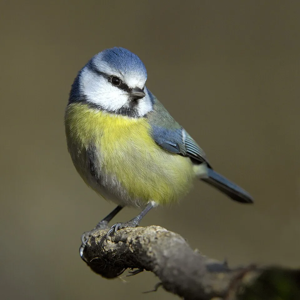
- Eurasian blue tit · Cyanistes caeruleus · 540
- Great tit · Parus major · 464
- European Serin · Serinus serinus · 454
- Corn Bunting · Emberiza calandra · 451
- European Goldfinch · Carduelis carduelis · 445
- White Wagtail · Motacilla alba · 423
- Grey Heron · Ardea cinerea · 413
- Spotless Starling · Sturnus unicolor · 412
Records: GBIF.org (CC-BY). Names: Wikidata (CC0), GBIF. Photos: Wikimedia Commons.
Conservation challenges
The primary purpose of the site is to preserve its natural habitats and the biodiversity they support. The species recorded (Biodiversity tab) reflect its ecological value. The designations it holds frame its management and the control of land use.
According to Global Forest Change data (University of Maryland, Global Forest Watch), about 384 ha of tree cover were lost within the boundary between 2001 and 2023 (3% of its area), peaking in 2002 and 2004. These losses include logging, storms and fires, and do not account for regrowth. According to the European CORINE Land Cover inventory (Copernicus), land cover changed on about 864 ha of the site between 1990 and 2018 (8% of its area): farmland grew by 586 ha, mostly at the expense of forest, while forest shrank by 567 ha, mostly giving way to farmland. Forest felling and regrowth add about 200 ha in total over the period. At night, the area gives off virtually no artificial light detectable from space (NASA VIIRS Black Marble composite, 2016). According to the Natura 2000 forms, of 12 assessed habitats of European interest, 3 are in excellent condition and 1 in average or reduced condition. According to the Water Framework Directive assessment (2022 river basin management plans, data 2010–2019), only 11% of the 12 km of rivers assessed within the site are in good or high ecological status; the others mostly have moderate ecological status. Other assessed water bodies: lakes, 0 of 1 in good ecological status or better. One invasive alien species has been recorded within the site since 2000 (GBIF observations), listed as of Union concern: Alopochen aegyptiaca (Egyptian Goose).
Pressure indicators
Tree cover lost
384 ha
2001–2023 · 3% of the area
20012023
Fires since 2016
0
No large fire mapped (fires over about 30 ha)
Light at night
< 1%
of the area gives off artificial light visible from space
DarkLit
Land cover change
864 ha
changed cover, 1990–2018 · CORINE · 8% of the area
- +586 ha · farmland
- −567 ha · forest
forest felling and regrowth: 200 ha in total
Rivers and lakes
11%
of the 12 km of assessed rivers in good or high ecological status · WFD 2022
Lakes: 0 of 1 good or better
assessments 2010–2019
Invasive alien species
1
incl. 1 of EU concern · since 2000
Sources: Global Forest Change (Hansen et al., University of Maryland, via Global Forest Watch, CC-BY 4.0); EFFIS, European Commission / Copernicus; NASA Black Marble 2016 (public domain); CORINE Land Cover 2018 (Copernicus) or MODIS.
CORINE Land Cover Change 1990–2018: generated using European Union's Copernicus Land Monitoring Service information (EEA), aggregated by Parkavela; DOI 10.2909/f30f1000-7cf8-43bb-872c-5eb093911b24.
Ecological status of water bodies: European Environment Agency, WISE – Water Framework Directive, 3rd river basin management plans (2022), CC BY 4.0. Official national classification, not comparable between countries.
Invasive alien species: Global Register of Introduced and Invasive Species (ISSG, CC BY 4.0); Union list, Regulation (EU) 1143/2014 (INBO, CC0); GBIF.org records (CC0 / CC BY 4.0), at least 2 per species.
Practical information
Cities and airport
- Mérida
10 km as the crow flies - Cáceres
42 km as the crow flies - Airport: San Pablo (SVQ)
173 km as the crow flies
Hiking
9 waymarked routes listed, including:
Camino MozárabeVía de la Plata hikingCamino Romano
By bike
EV1 · 3 km
Signed cycle routes: this does not mean that cycling is allowed on footpaths.
Data © OpenStreetMap contributors (ODbL) · Wikidata (CC0)
Contains information from EuroVelo GPX tracks downloaded from www.EuroVelo.com on 2026-10-22, which is made available here under the Open Database License (ODbL). EuroVelo® is a registered trademark of the ECF. Routes © OpenStreetMap contributors (ODbL), via Waymarked Trails
Waymarked hiking routes
VDLP Vía de la Plata hiking - 02 Merida to Salamanca
6.8 km within the site ↗ 75 m↘ 6 m 254–326 m
Verde Dehesas de Cornalvo
14.6 km within the site ↗ 137 m↘ 70 m 254–374 m
Tracks © OpenStreetMap contributors (ODbL), clipped to the boundary; elevation gain and profiles computed on the longest section from Mapzen Terrain Tiles (≈ 30 m), indicative only.
Access and visiting
The nearest railway station is Guareña, about 8 km from the site boundary. Nearest towns of over 50,000 people, as the crow flies: Mérida (10 km) and Cáceres (42 km). Nearest airport: San Pablo (SVQ), about 173 km away. About 94,000 people live within 20 km of the site boundary, 30,000 of them within 10 km; some 490 people are estimated to live inside (GHSL estimate, 2020). This population has fallen by about 8% since 2000. Waymarked hiking routes listed in OpenStreetMap: 9, including Camino Mozárabe, Vía de la Plata hiking and Camino Romano. The EuroVelo 1 cycle route (Atlantic Coast Route) crosses the site for about 3 km, mostly developed and signed (EuroVelo). To see: Pantano de Cornalvo (lake or pond). To plan a visit (access, opening periods, visitor rules), it is best to consult the official information from the managing body and the official website listed in this page's sources.
Source: OpenStreetMap (ODbL), Wikidata (CC0), October 2026.
Built heritage
According to Wikidata, one monument listed as Bien de Interés Cultural stands within the boundary. It is “Cornalvo Dam” in San Pedro de Mérida.
-
Cornalvo Dam
San Pedro de Mérida · 1st c.
Source: Wikidata (CC0), monuments in each country’s official heritage protection registers, at national or regional level. Each item links to its Wikidata entry.
Wildlife records calendar
JFMAMJJASOND
Birds
Plants
Butterflies & moths
Monthly records published on GBIF (CC-BY), relative to the busiest month; also reflects observer activity.
Gallery
© Parnacor15 · CC BY-SA 3.0
© Charly Morlock · CC BY-SA 2.0
© Alonso de Mendoza · CC BY-SA 4.0
© Better · Public domain
© Parnacor15 · CC BY-SA 3.0
© Lorenzo Vallés · CC BY-SA 3.0
Sources and licences
- Wikidata: Q90147627
- Wikipedia: es.wikipedia.org/wiki/Parque_natural_de_Cornalvo
- WDPA: 349274
References
- land.copernicus.eu: land cover, land cover change, sea share · COPERNICUS
- doi.org: population around the site · CC-BY-4.0
- wikidata.org: official area, establishment date, protected heritage, nearby cities and airport, access and peaks, lake depths, places to see · CC0-1.0
- eea.europa.eu: bathing water quality, ecological status of waters · CC-BY-4.0
- en.eurovelo.com: EuroVelo cycle routes · ODbL-1.0
- cycling.waymarkedtrails.org: cycle routes · ODbL-1.0
- opentopodata.org: elevations · PD
- forest-fire.emergency.copernicus.eu: wildfires · COPERNICUS
- globalforestwatch.org: tree cover loss · CC-BY-4.0
- gbif.org: seasonality of sightings, invasive alien species, observed species · CC-BY-4.0
- europe-geology.eu: geology · CC-BY-4.0
- hydrosheds.org: lakes · CC-BY-4.0
- natura2000.eea.europa.eu: Natura 2000 habitats and species · CC-BY-4.0
- openstreetmap.org: official name, access and peaks, trail difficulty · ODbL-1.0
- earthobservatory.nasa.gov: night light · PD
- registry.opendata.aws: detailed relief · PD
- hiking.waymarkedtrails.org: route difficulty · ODbL-1.0
- nsidc.org: snow cover · PD
- wikidata.org: Wikipedia article · CC-BY-SA-4.0
Data © OpenStreetMap contributors (ODbL), Wikidata (CC0) and the sources cited.