
Portugal · Terrestrial
International Tagus Natural Park
Nature park of 26,491 hectares in Portugal, established in 2000.
Overview
Nature park of 26,491 hectares in Portugal, established in 2000.
International Tagus Natural Park is a nature park in Portugal (Europe). It is a predominantly terrestrial area. Established in 2000, it covers about 26,491 hectares.
Protections and designations
Natura 2000 · birds (SPA)
- Tejo Internacional, Erges e Pônsul PTZPE0042
Protected as a nature park. International labels and designations: Natura 2000 network (1 site: “Tejo Internacional, Erges e Pônsul”). Key dates: first Natura 2000 site under the Birds Directive in 1999 and established in 2000.
In our collections
Timeline
-
1999
First Natura 2000 site under the Birds Directive
-
2000
Established
Sources: Wikidata (CC0) for establishment and international labels; EEA Natura 2000 database (CC-BY 4.0) for site designation dates.
Frequently asked questions
Where is International Tagus Natural Park?
In Portugal (Europe). Representative point: 39.7135° N, 7.2241° W.
How large is International Tagus Natural Park?
About 26,491 hectares (265 km²). It is the 9th largest of the 15 nature parks in Portugal covered by Parkavela.
When was International Tagus Natural Park established?
In 2000.
What habitats and landscapes does International Tagus Natural Park include?
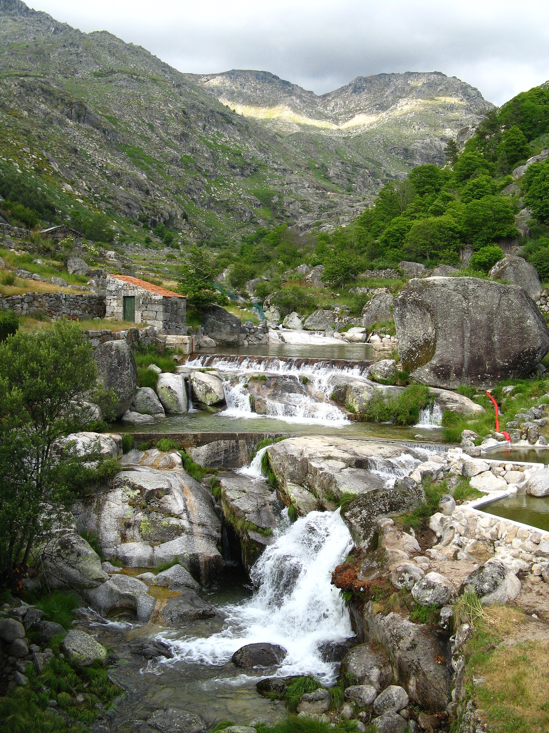
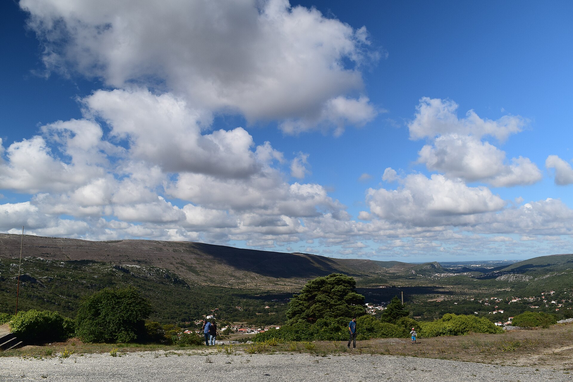
A terrestrial area, with forests.
What rocks lie beneath International Tagus Natural Park?
According to the European 1:1 million geological map (EGDI), the bedrock consists mainly of phyllites and slates (67% of sampled points) and sandstones (20%). These are mostly metamorphic rocks. The geological units date mainly from the Precambrian (73% of sampled points).
What is the highest point of International Tagus Natural Park?
Salvaterra, at 386 m (OpenStreetMap).
What are the main summits of International Tagus Natural Park?
Salvaterra (386 m), Negrais (331 m) and Fervedouro (272 m) (OpenStreetMap).
Which international labels apply to International Tagus Natural Park?
Natura 2000 network (1 site: “Tejo Internacional, Erges e Pônsul”).
When is the best time to visit International Tagus Natural Park?
Best time to visit: from April to June, with average temperatures of 14 to 24 °C and moderate rainfall.
What is the nearest large city to International Tagus Natural Park?
Nearest towns of over 50,000 people, as the crow flies: Cáceres (60 km) and Pombal (97 km). Nearest airport: Humberto Delgado (LIS), about 170 km away.
How can I reach International Tagus Natural Park by train?
The nearest railway station is Castelo Branco, about 6 km from the site boundary.
Where can I get visitor information on site?
Centro de Bio Diversidade de Segura.
Are there waymarked hiking trails in International Tagus Natural Park?
Yes. Waymarked hiking routes listed in OpenStreetMap: 2, including GR 29 (53 km). The GR 29 · Rota dos Veados route runs for about 11 km through the site.
Which species can be seen in International Tagus Natural Park?
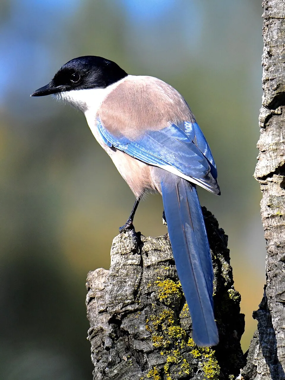
Among the species most often recorded on GBIF are Quercus rotundifolia (Ballota oak), Gyps fulvus (Griffon Vulture), Turdus merula (Common Blackbird) and Cyanopica cooki (Iberian Magpie).
© OpenStreetMap
Download the boundary: GeoJSON · GPX Boundary © OpenStreetMap contributors (ODbL).
Geography
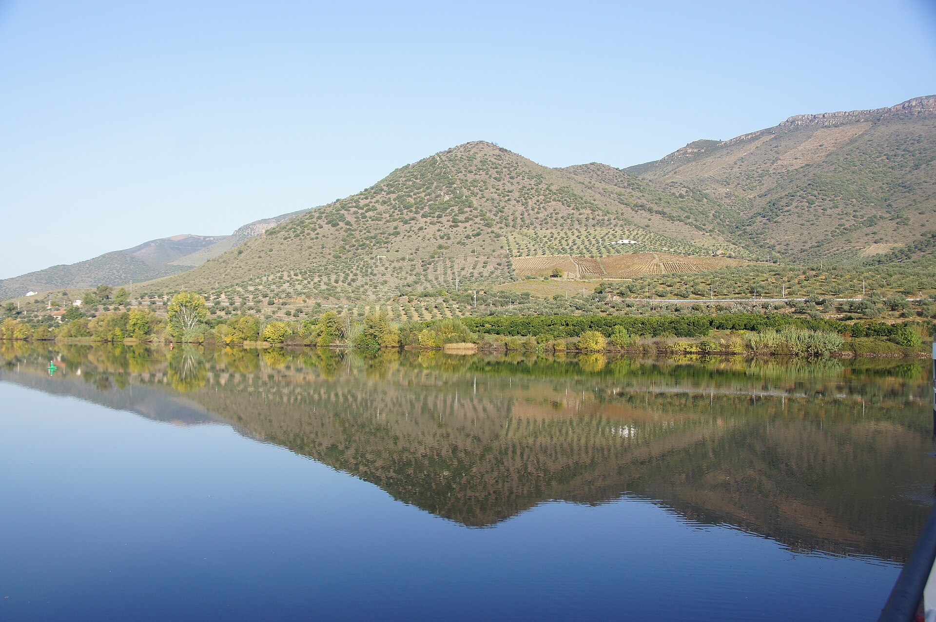
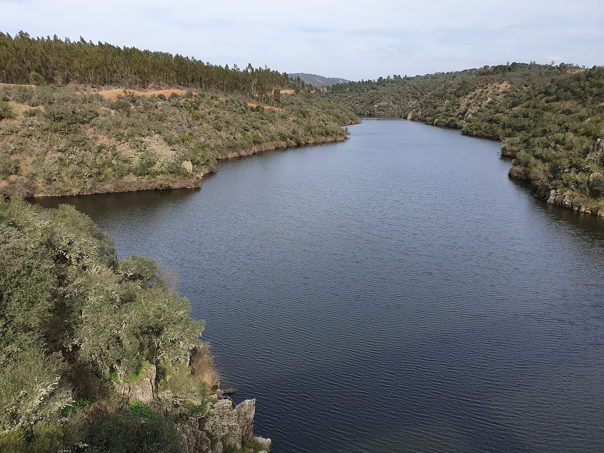
The representative point of the site lies at around 196 m above sea level. Over the 1996–2025 period, the mean annual temperature is about 16.8 °C and total precipitation reaches roughly 575 mm per year. The warmest month is usually August, the coolest January, and the wettest October. According to the European 1:1 million geological map (EGDI), the bedrock consists mainly of phyllites and slates (67% of sampled points) and sandstones (20%). These are mostly metamorphic rocks. The geological units date mainly from the Precambrian (73% of sampled points). The site contains one lake larger than 10 ha (Barragem de Cedillo), totalling 4.5 km² of water (HydroLAKES).
Area
- Area
- 26,491 ha
- Elevation
- 196 m
- Mean slope
- 8°
- Lakes over 10 ha
- 1 (4.5 km²)
- Coordinates
- 39.7135, -7.2241
Terrain: Mapzen Terrain Tiles (SRTM, USGS) · Lakes: HydroLAKES (Messager et al. 2016, hydrosheds.org, CC BY 4.0) · depths: Wikidata (CC0)
Bedrock
- Phyllites and slates 67 %
- Sandstones 20 %
- Mudstones 7 %
- Rhyolites 7 %
Metamorphic rocks 67 % · Sedimentary rocks 27 % · Igneous rocks 7 % · Main age: Precambrian (73%)
Source: EGDI 1:1M geological map (EuroGeoSurveys and national geological surveys), CC BY 4.0 · 15 sampled points within the site.
Climate
● Mean temperature (°C) · ▮ Precipitation (mm)
Source: Copernicus ERA5-Land (C3S, doi:10.24381/cds.68d2bb30), monthly averages 1996–2025 interpolated to the representative point, temperatures adjusted for elevation.
Contains modified Copernicus Climate Change Service information 2026. Neither the European Commission nor ECMWF is responsible for any use that may be made of the Copernicus information or data it contains.
Natural habitats
According to CORINE Land Cover (2018), the site is mainly made up of forests (35%), heath and scrub (28%) and farmland (16%). Woodland is mostly broadleaved. Elevation ranges from about 130 m to 386 m (highest point: Salvaterra).
Biodiversity
Based on occurrences aggregated by GBIF, several species are regularly recorded within the site. Among the most frequent are Quercus rotundifolia (Ballota oak), Gyps fulvus (Griffon Vulture), Turdus merula (Common Blackbird) and Cyanopica cooki (Iberian Magpie). The full list of documented taxa is shown below. The overlapping Natura 2000 site lists 55 species of European interest: 44 birds, 7 mammals, 2 reptiles and 2 fish.
Species of European interest
Birds · 44
Cinereous Vulture (Aegypius monachus) breeding, Common Kingfisher (Alcedo atthis) resident, Meadow Pipit (Anthus pratensis) wintering, Common Swift (Apus apus) breeding, Pallid Swift (Apus pallidus) breeding, Spanish Imperial Eagle (Aquila adalberti) resident, Golden Eagle (Aquila chrysaetos) resident, Bonelli's Eagle (Aquila fasciata) resident, Eurasian Eagle-owl (Bubo bubo) resident, Greater Short-toed Lark (Calandrella brachydactyla) breeding, Red-necked Nightjar (Caprimulgus ruficollis) breeding, Eastern Red-rumped Swallow (Cecropis daurica) breeding and 32 more
Mammals · 7
European wildcat (Felis silvestris), Egyptian mongoose (Herpestes ichneumon), Eurasian otter (Lutra lutra), Cabrera's vole (Microtus cabrerae), Kuhl's pipistrelle (Pipistrellus kuhlii), Soprano Pipistrelle (Pipistrellus pygmaeus), Greater Horseshoe Bat (Rhinolophus ferrumequinum)
Fish · 2
Luciobarbus bocagei, Iberian Barbel (Luciobarbus comizo)
Source: Natura 2000 standard data forms (EEA, CC-BY 4.0). Not exhaustive: sensitive species are not published.
Species to look out for



Observed species
Occurrences documented via GBIF; they are neither an exhaustive inventory nor proof of current presence.
- Ballota oak · Quercus rotundifolia · 1614
- Griffon Vulture · Gyps fulvus · 746
- Common Blackbird · Turdus merula · 669
- Iberian Magpie · Cyanopica cooki · 616
- Sardinian Warbler · Curruca melanocephala · 570
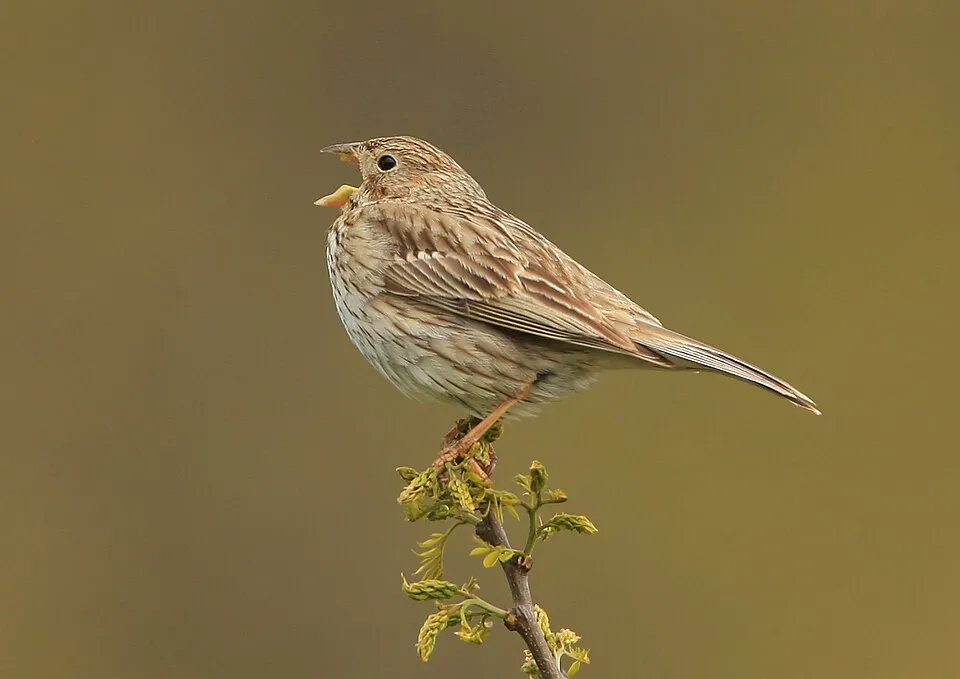
- Corn Bunting · Emberiza calandra · 535
- Spotless Starling · Sturnus unicolor · 493
- Eurasian blue tit · Cyanistes caeruleus · 479
- Eurasian Chaffinch · Fringilla coelebs · 477
- Great tit · Parus major · 446
- Barn Swallow · Hirundo rustica · 440
- Eurasian Hoopoe · Upupa epops · 435
+18 more species
- Thekla's Lark · Galerida theklae · 414
- European Serin · Serinus serinus · 393
- Eurasian Crag Martin · Ptyonoprogne rupestris · 390
- European Bee-eater · Merops apiaster · 388
- House Sparrow · Passer domesticus · 378
- European Goldfinch · Carduelis carduelis · 368
- Olive · Olea europaea · 365
- Red-legged Partridge · Alectoris rufa · 358
- Woodchat Shrike · Lanius senator · 357
- Cinereous Vulture · Aegypius monachus · 356
- Eurasian Collared Dove · Streptopelia decaocto · 354
- Common Wood Pigeon · Columba palumbus · 353
- European Stonechat · Saxicola rubicola · 338
- Maritime pine · Pinus pinaster · 336
- Common House Martin · Delichon urbicum · 322
- Common Nightingale · Luscinia megarhynchos · 313
- Eurasian Golden Oriole · Oriolus oriolus · 295
- Spanish Sparrow · Passer hispaniolensis · 293
Records: GBIF.org (CC-BY). Names: Wikidata (CC0), GBIF. Photos: Wikimedia Commons.
Conservation challenges
The primary purpose of the site is to preserve its natural habitats and the biodiversity they support. The species recorded (Biodiversity tab) reflect its ecological value. The designations it holds frame its management and the control of land use.
According to Global Forest Change data (University of Maryland, Global Forest Watch), about 760 ha of tree cover were lost within the boundary between 2001 and 2023 (3% of its area), peaking in 2003 and 2004. These losses include logging, storms and fires, and do not account for regrowth. According to the European CORINE Land Cover inventory (Copernicus), land cover changed on about 2,630 ha of the site between 1990 and 2018 (10% of its area): forest grew by 1,878 ha, mostly at the expense of open natural land, while open natural land shrank by 1,681 ha, mostly giving way to forest. Forest felling and regrowth add about 16,580 ha in total over the period. Since 2016, the European EFFIS system (Copernicus) has mapped 2 fires here, burning about 41 ha within the boundary; the largest, in August 2021 (near Cedillo), covered 31 ha. At night, 1% of the area gives off artificial light detectable from space (NASA VIIRS Black Marble composite, 2016): it ranks among the darkest places in the atlas for this country. According to the Water Framework Directive assessment (2022 river basin management plans, data 2014–2019), 88% of the 80 km of rivers assessed within the site are in good or high ecological status. Other assessed water bodies: lakes, 0 of 1 in good ecological status or better. One invasive alien species has been recorded within the site since 2000 (GBIF observations), listed as of Union concern: Alopochen aegyptiaca (Egyptian Goose).
Pressure indicators
Tree cover lost
760 ha
2001–2023 · 3% of the area
20012023
Fires since 2016
41 ha
burned within the boundary (2 mapped fires)
- 2021 · Cedillo · 31 ha
- 2026 · Zebreira e Segura · 10 ha
Light at night
1%
of the area gives off artificial light visible from space
DarkLit
Built-up land
< 1%
buildings, business areas, roads, quarries · farmland 16%
Land cover change
2,630 ha
changed cover, 1990–2018 · CORINE · 10% of the area
- +1,878 ha · forest
- −1,681 ha · open natural land
forest felling and regrowth: 16,580 ha in total
Rivers and lakes
88%
of the 80 km of assessed rivers in good or high ecological status · WFD 2022
Lakes: 0 of 1 good or better
assessments 2014–2019
Invasive alien species
1
incl. 1 of EU concern · since 2000
Sources: Global Forest Change (Hansen et al., University of Maryland, via Global Forest Watch, CC-BY 4.0); EFFIS, European Commission / Copernicus; NASA Black Marble 2016 (public domain); CORINE Land Cover 2018 (Copernicus) or MODIS.
CORINE Land Cover Change 1990–2018: generated using European Union's Copernicus Land Monitoring Service information (EEA), aggregated by Parkavela; DOI 10.2909/f30f1000-7cf8-43bb-872c-5eb093911b24.
Ecological status of water bodies: European Environment Agency, WISE – Water Framework Directive, 3rd river basin management plans (2022), CC BY 4.0. Official national classification, not comparable between countries.
Invasive alien species: Global Register of Introduced and Invasive Species (ISSG, CC BY 4.0); Union list, Regulation (EU) 1143/2014 (INBO, CC0); GBIF.org records (CC0 / CC BY 4.0), at least 2 per species.
Practical information
Cities and airport
- Cáceres
60 km as the crow flies - Pombal
97 km as the crow flies - Airport: Humberto Delgado (LIS)
170 km as the crow flies
Visitor information
- Centro de Bio Diversidade de Segura
within the site
Hiking
2 waymarked routes listed, including:
GR 29 (53 km)
Data © OpenStreetMap contributors (ODbL) · Wikidata (CC0)
Waymarked hiking routes
Tracks © OpenStreetMap contributors (ODbL), clipped to the boundary; elevation gain and profiles computed on the longest section from Mapzen Terrain Tiles (≈ 30 m), indicative only.
Access and visiting
The nearest railway station is Castelo Branco, about 6 km from the site boundary. Nearest towns of over 50,000 people, as the crow flies: Cáceres (60 km) and Pombal (97 km). Nearest airport: Humberto Delgado (LIS), about 170 km away. About 66,000 people live within 20 km of the site boundary, 42,000 of them within 10 km; some 220 people are estimated to live inside (GHSL estimate, 2020). This population has fallen by about 12% since 2000. Visitor information on site: Centro de Bio Diversidade de Segura. Waymarked hiking routes listed in OpenStreetMap: 2, including GR 29 (53 km). To plan a visit (access, opening periods, visitor rules), it is best to consult the official information from the managing body and the official website listed in this page's sources.
Source: OpenStreetMap (ODbL), Wikidata (CC0), October 2026.
When to visit
Best time to visit: from April to June, with average temperatures of 14 to 24 °C and moderate rainfall. Day length ranges from about 9 h 22 min in December to 14 h 58 min in June. Wildlife records published on GBIF peak for birds (April and May), plants (March and April), butterflies and moths (July), dragonflies (July) and mammals (April and May). These peaks also reflect when observers are most active.
Source: Copernicus ERA5-Land (C3S), monthly averages 1996–2025 at the representative point, temperatures adjusted for elevation.
Contains modified Copernicus Climate Change Service information 2026. Neither the European Commission nor ECMWF is responsible for any use that may be made of the Copernicus information or data it contains.
Wildlife records calendar
JFMAMJJASOND
Birds
Plants
Butterflies & moths
Dragonflies
Mammals
Monthly records published on GBIF (CC-BY), relative to the busiest month; also reflects observer activity.
Gallery
© GualdimG · CC BY-SA 4.0
© Sara Jaques · CC BY-SA 4.0
© GualdimG · CC BY-SA 4.0
© Para recordar sempre · CC BY-SA 4.0
© GualdimG · CC BY-SA 4.0
© Vitor Oliveira from Torres Vedras, PORTUGAL · CC BY-SA 2.0
Sources and licences
- Wikidata: Q3321094
- OpenStreetMap: relation 4574300
- Wikipedia: en.wikipedia.org/wiki/Tagus_International_Natural_Park
- WDPA: 388861
References
- cds.climate.copernicus.eu: climate · CC-BY-4.0
- registry.opendata.aws: elevation of the reference point, detailed relief · PD
- land.copernicus.eu: land cover, land cover change, sea share · COPERNICUS
- doi.org: population around the site · CC-BY-4.0
- wikidata.org: official area, establishment date, protected heritage, nearby cities and airport, access and peaks, lake depths, places to see · CC0-1.0
- eea.europa.eu: bathing water quality, ecological status of waters · CC-BY-4.0
- en.eurovelo.com: EuroVelo cycle routes · ODbL-1.0
- cycling.waymarkedtrails.org: cycle routes · ODbL-1.0
- opentopodata.org: elevations · PD
- forest-fire.emergency.copernicus.eu: wildfires · COPERNICUS
- globalforestwatch.org: tree cover loss · CC-BY-4.0
- gbif.org: seasonality of sightings, invasive alien species, observed species · CC-BY-4.0
- europe-geology.eu: geology · CC-BY-4.0
- hydrosheds.org: lakes · CC-BY-4.0
- natura2000.eea.europa.eu: Natura 2000 habitats and species · CC-BY-4.0
- openstreetmap.org: official name, access and peaks, trail difficulty · ODbL-1.0
- earthobservatory.nasa.gov: night light · PD
- hiking.waymarkedtrails.org: route difficulty · ODbL-1.0
- nsidc.org: snow cover · PD
- wikidata.org: Wikipedia article · CC-BY-SA-4.0
Data © OpenStreetMap contributors (ODbL), Wikidata (CC0) and the sources cited.