Estonia · Terrestrial
Haanja Nature Park
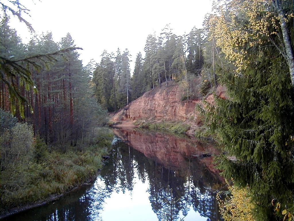
Nature park of 17,040 hectares in Estonia, established in 1957.
Overview
Nature park of 17,040 hectares in Estonia, established in 1957.
Haanja Nature Park is located in Estonia (Europe). It is a predominantly terrestrial area. Established in 1957, it covers about 17,040 hectares.
Protections and designations
Natura 2000 · habitats (SAC)
- Haanja EE0080613
Natura 2000 · birds (SPA)
- Haanja EE0080613
Other designations
Protected as a nature park. International labels and designations: Natura 2000 network (1 site: “Haanja”). Key dates: established in 1957, first Natura 2000 site under the Birds Directive in 2004 and first Natura 2000 site under the Habitats Directive in 2004.
In our collections
Timeline
-
1957
Established
-
2004
First Natura 2000 site under the Birds Directive
-
2004
First Natura 2000 site under the Habitats Directive
Sources: Wikidata (CC0) for establishment and international labels; EEA Natura 2000 database (CC-BY 4.0) for site designation dates.
Frequently asked questions
Where is Haanja Nature Park?
In Estonia (Europe). Representative point: 57.7167° N, 27.0333° E.
How large is Haanja Nature Park?
About 17,040 hectares (170 km²). It is the largest of the 3 nature parks in Estonia covered by Parkavela.
When was Haanja Nature Park established?
In 1957.
What habitats and landscapes does Haanja Nature Park include?
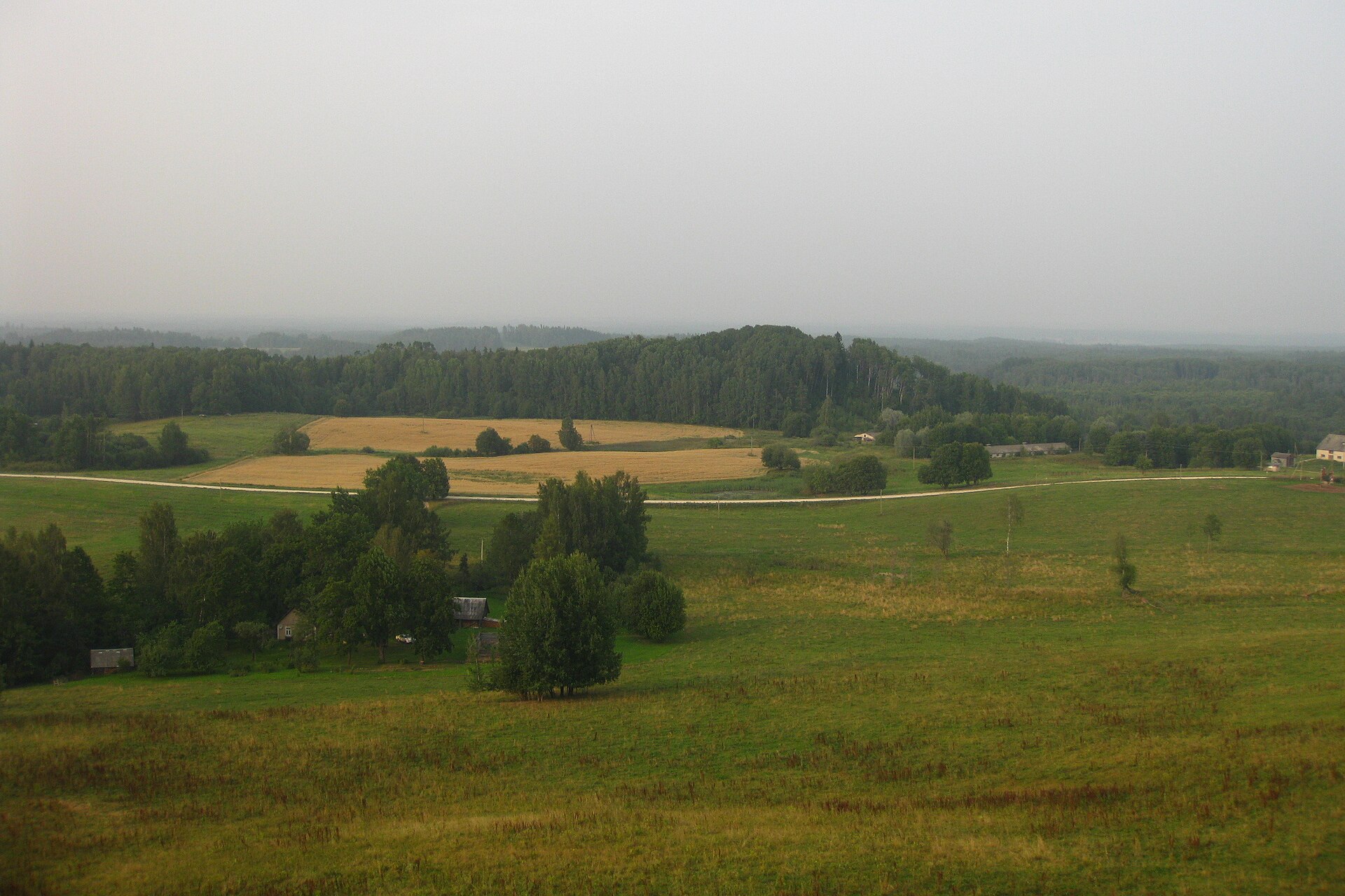
A terrestrial area, with forests.
What is the highest point of Haanja Nature Park?
Suur Munamägi, at 317 m (OpenStreetMap).
What are the main summits of Haanja Nature Park?
Suur Munamägi (317 m), Vällämägi (302 m), Hardomägi (270 m) and Meegomägi (206 m) (OpenStreetMap).
Which international labels apply to Haanja Nature Park?
Natura 2000 network (1 site: “Haanja”).
When is the best time to visit Haanja Nature Park?
Mildest period: July and August, with average temperatures of 16 to 18 °C.
Is there snow in Haanja Nature Park?
Yes. According to NASA's MODIS satellites (2015–2025 average), snow covers most of the site from December to March, with about 120 snow-covered days a year on average.
What is there to see in Haanja Nature Park?
77 lakes and ponds, including Suur Kõrbjärv (210 m), Väikene Kõrbjärv (206 m), Käpämäe land and Varõssõ järv (Wikidata).
Are there historic monuments in Haanja Nature Park?
Yes. According to Wikidata, 12 monuments listed in the Estonian national register of cultural monuments (kultuurimälestis) stand within the boundary. For example: “Plaani Cemetery” in Rõuge, “Rõuge linnamägi” in Rõuge and “Rogosi manor house” in Rõuge.
What is the nearest large city to Haanja Nature Park?
Nearest towns of over 50,000 people, as the crow flies: Tartu (67 km). Nearest airport: Tallinn (TLL), about 216 km away.
How can I reach Haanja Nature Park by train?
The nearest railway station is Piusa, about 17 km from the site boundary.
Where can I get visitor information on site?
Ööbikuoru keskus.
Are there waymarked hiking trails in Haanja Nature Park?
Yes. Waymarked hiking routes listed in OpenStreetMap: 10, including E 11 (23 km), Peraküla-Aegviidu-Ähijärve haru. X lõik, Jõulumatk and Rõuge ürgoru matkarada. The “PAÄ · Peraküla-Aegviidu-Ähijärve haru. X lõik: Piusa-Pähni” route runs for about 39 km through the site, with some 250 m of ascent on its longest section.
Which species can be seen in Haanja Nature Park?
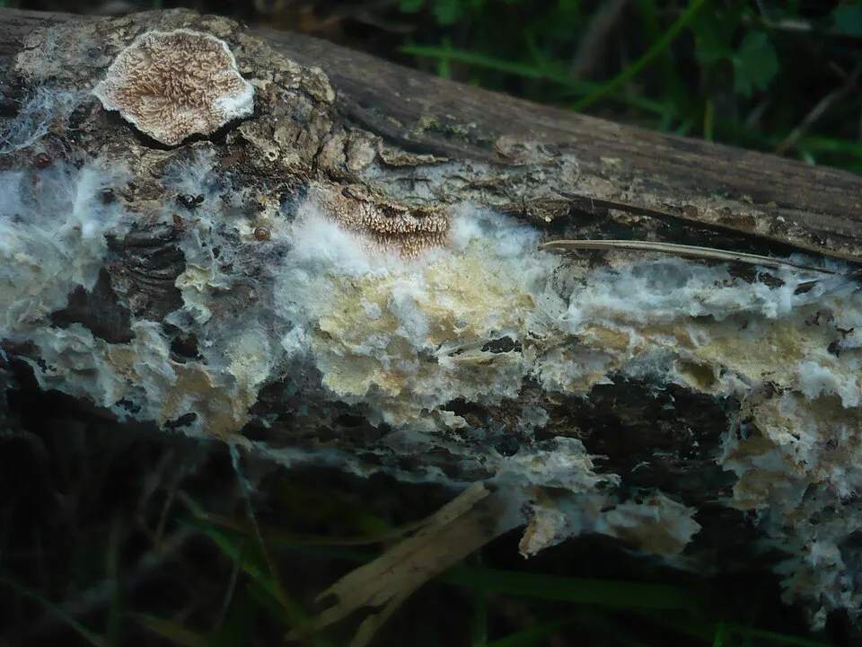
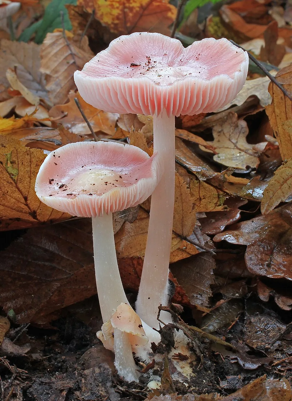
Among the species most often recorded on GBIF are Amphinema byssoides (Cratered Duster), Mycena rosea (Rosy Bonnet), Cortinarius casimirii and Podila humilis.
© OpenStreetMap
Download the boundary: GeoJSON · GPX Boundary © OpenStreetMap contributors (ODbL).
Geography
The representative point of the site lies at around 261 m above sea level. Over the 1996–2025 period, the mean annual temperature is about 5.5 °C and total precipitation reaches roughly 768 mm per year. The warmest month is usually July, the coolest January, and the wettest June. The site contains 6 lakes larger than 10 ha, totalling 1.2 km² of water; the largest, Kahrila järv, covers 41 ha (HydroLAKES).
Area
- Area
- 17,040 ha
- Elevation
- 261 m
- Snow cover
- ≈ 120 days a year
- Lakes over 10 ha
- 6 (1.2 km²)
- Coordinates
- 57.7167, 27.0333
Lakes: HydroLAKES (Messager et al. 2016, hydrosheds.org, CC BY 4.0) · depths: Wikidata (CC0)
Main summits
- Suur Munamägi317 m
- Vällämägi302 m
- Hardomägi270 m
- Meegomägi206 m
Data © OpenStreetMap contributors (ODbL)
Climate
● Mean temperature (°C) · ▮ Precipitation (mm)
Source: Copernicus ERA5-Land (C3S, doi:10.24381/cds.68d2bb30), monthly averages 1996–2025 interpolated to the representative point, temperatures adjusted for elevation.
Contains modified Copernicus Climate Change Service information 2026. Neither the European Commission nor ECMWF is responsible for any use that may be made of the Copernicus information or data it contains.
Snow cover measured by satellite
J
F
M
A
M
J
J
A
S
O
N
D
average share of the site under snow · snowiest parts · ≈ 120 days a year
Snow cover: MODIS/Terra MOD10CM v61 (Hall & Riggs, 2021, NASA NSIDC DAAC, doi:10.5067/MODIS/MOD10CM.061), imagery from NASA GIBS (ESDIS); 2015–2025 average, grid of about 5 km.
Natural habitats
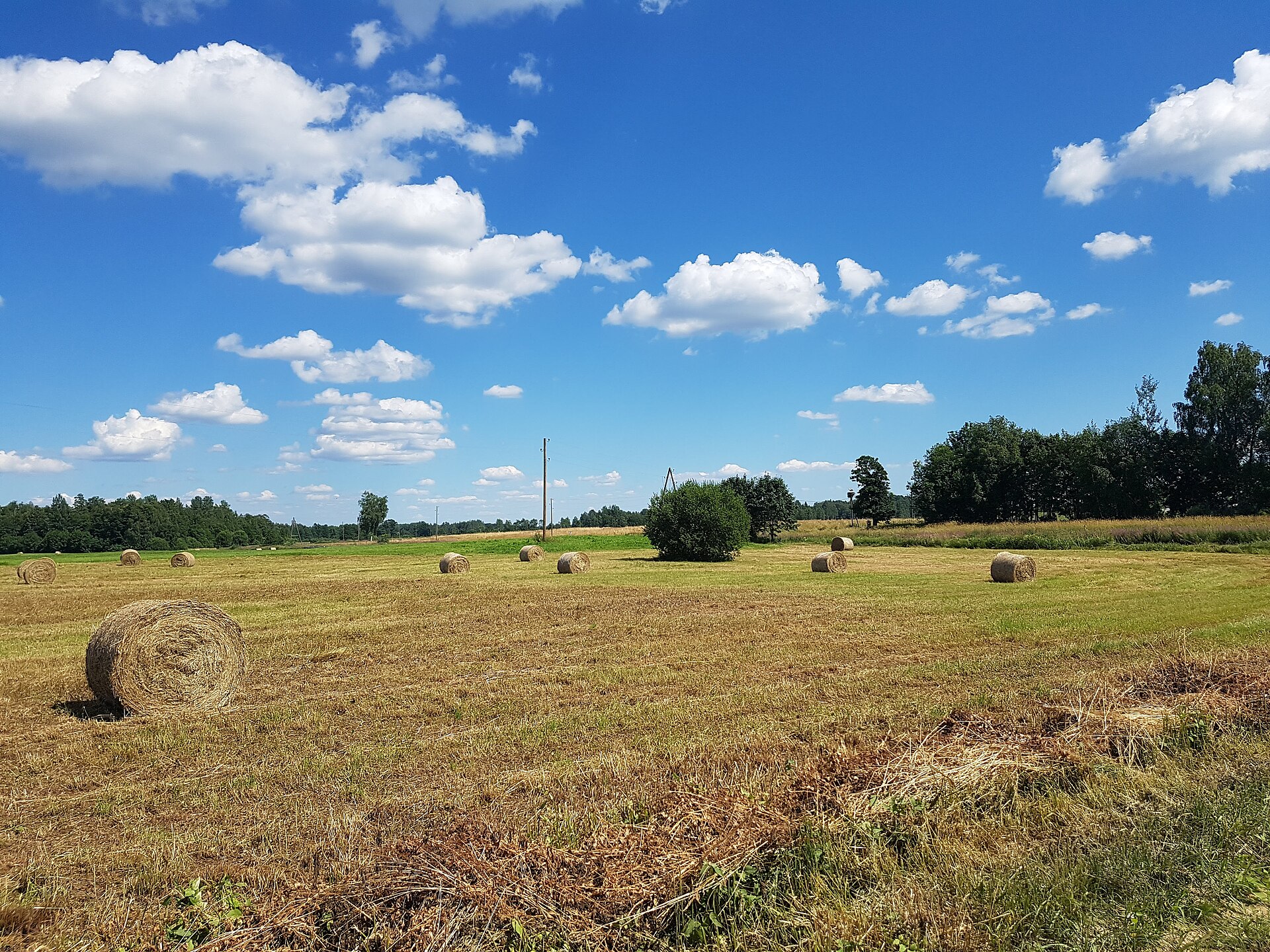
According to CORINE Land Cover (2018), the site is mainly made up of forests (59%) and farmland (38%). Woodland mixes broadleaved and coniferous trees. Elevation ranges from about 120 m to 317 m (highest point: Suur Munamägi). The Natura 2000 site overlapping the area lists 25 habitats of European interest (8 priority), the most extensive being Fennoscandian herb-rich forests with Picea abies, western Taïga and Fennoscandian lowland species-rich dry to mesic grasslands.
Biodiversity
Based on occurrences aggregated by GBIF, several species are regularly recorded within the site. Among the most frequent are Amphinema byssoides (Cratered Duster), Mycena rosea (Rosy Bonnet), Cortinarius casimirii and Podila humilis. The full list of documented taxa is shown below. The overlapping Natura 2000 site lists 16 species of European interest: 7 birds, 1 mammal, 2 amphibians, 2 fish, 2 invertebrates and 2 plants.
Habitats of European interest
From the official form of the Natura 2000 site overlapping the area (areas reported for the whole site).
- Fennoscandian herb-rich forests with Picea abies 391 ha
- Western Taïga priority 250 ha
- Fennoscandian lowland species-rich dry to mesic grasslands priority 246 ha
- Oligotrophic waters containing very few minerals of sandy plains (Littorelletalia uniflorae) 155 ha
- Lowland hay meadows (Alopecurus pratensis, Sanguisorba officinalis) 108 ha
- Hydrophilous tall herb fringe communities of plains and of the montane to alpine levels 107 ha
- Oligotrophic to mesotrophic standing waters with vegetation of the Littorelletea uniflorae and/or of the Isoëto-Nanojuncetea 71 ha
- Alkaline fens 61 ha
and 17 more
Species of European interest
Birds · 7
Great Reed Warbler (Acrocephalus arundinaceus) breeding, Common Kingfisher (Alcedo atthis) breeding, Eurasian Wigeon (Anas penelope) breeding, Mallard (Anas platyrhynchos) breeding, Hazel Grouse (Bonasa bonasia) breeding, Corn Crake (Crex crex) breeding, Eurasian Pygmy Owlet (Glaucidium passerinum) breeding
Mammals · 1
Invertebrates · 2
Green snaketail (Ophiogomphus cecilia), Thick shelled river mussel (Unio crassus)
Plants · 2
Hairy agrimony (Agrimonia pilosa), Yellow marsh saxifrage (Saxifraga hirculus)
Source: Natura 2000 standard data forms (EEA, CC-BY 4.0). Not exhaustive: sensitive species are not published.
Species to look out for
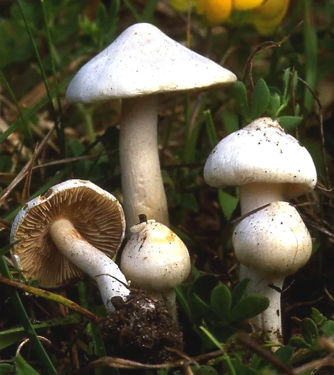
Observed species
Occurrences documented via GBIF; they are neither an exhaustive inventory nor proof of current presence.
- Cratered Duster · Amphinema byssoides · 359
- Rosy Bonnet · Mycena rosea · 181
- Cortinarius casimirii · 151
- Podila humilis · 149
- Solicoccozyma terricola · 133
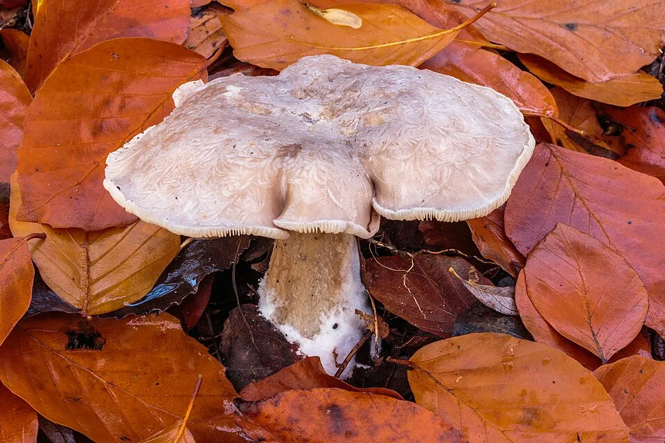
- Clouded Funnel · Clitocybe nebularis · 125
- Tylospora asterophora · 123
- Trichosporiella multisporum · 96
- Gymnostellatospora japonica · 92
- White Fibrecap · Inocybe geophylla · 90
- Phialocephala fortinii · 81
- Saitozyma podzolica · 81
Records: GBIF.org (CC-BY). Names: Wikidata (CC0), GBIF. Photos: Wikimedia Commons.
Conservation challenges
The primary purpose of the site is to preserve its natural habitats and the biodiversity they support. The species recorded (Biodiversity tab) reflect its ecological value. The designations it holds frame its management and the control of land use.
According to Global Forest Change data (University of Maryland, Global Forest Watch), about 1,880 ha of tree cover were lost within the boundary between 2001 and 2023 (11% of its area), peaking in 2016 and 2022. These losses include logging, storms and fires, and do not account for regrowth. According to CORINE Land Cover, land cover here remained almost unchanged between 1990 and 2018 (less than 0.5% of the area affected). At night, the area gives off virtually no artificial light detectable from space (NASA VIIRS Black Marble composite, 2016). According to the Natura 2000 forms, of 24 assessed habitats of European interest, 4 are in excellent condition and 7 in average or reduced condition. According to the Water Framework Directive assessment (2022 river basin management plans, data 2011–2019), 72% of the 52 km of rivers assessed within the site are in good or high ecological status. Other assessed water bodies: lakes, 1 of 1 in good ecological status or better.
Pressure indicators
Tree cover lost
1,875 ha
2001–2023 · 11% of the area
20012023
Fires since 2016
0
No large fire mapped (fires over about 30 ha)
Light at night
< 1%
of the area gives off artificial light visible from space
DarkLit
Built-up land
< 1%
buildings, business areas, roads, quarries · farmland 38%
Land cover change
< 0.5%
of the area changed, 1990–2018 · CORINE
Rivers and lakes
72%
of the 52 km of assessed rivers in good or high ecological status · WFD 2022
Lakes: 1 of 1 good or better
assessments 2011–2019
Sources: Global Forest Change (Hansen et al., University of Maryland, via Global Forest Watch, CC-BY 4.0); EFFIS, European Commission / Copernicus; NASA Black Marble 2016 (public domain); CORINE Land Cover 2018 (Copernicus) or MODIS.
CORINE Land Cover Change 1990–2018: generated using European Union's Copernicus Land Monitoring Service information (EEA), aggregated by Parkavela; DOI 10.2909/f30f1000-7cf8-43bb-872c-5eb093911b24.
Ecological status of water bodies: European Environment Agency, WISE – Water Framework Directive, 3rd river basin management plans (2022), CC BY 4.0. Official national classification, not comparable between countries.
Practical information
Cities and airport
- Tartu
67 km as the crow flies - Airport: Tallinn (TLL)
216 km as the crow flies
Visitor information
- Ööbikuoru keskus
within the site
Things to see
77 lakes and ponds
- Suur Kõrbjärv
lake or pond · 210 m - Väikene Kõrbjärv
lake or pond · 206 m - Käpämäe land
lake or pond - Varõssõ järv
lake or pond - Viro land
lake or pond
Hiking
10 waymarked routes listed, including:
E 11 (23 km)Peraküla-Aegviidu-Ähijärve haru. X lõikJõulumatkRõuge ürgoru matkaradaVällamäe matkaradaKavadi järve matkarada
By bike
R1 Euroroute R1 · 17 kmPAÄ RMK Peraküla-Aegviidu-Ähijärve bicycle route. X section: Piusa-Pähni · 37 km4 4: Valga - Tallinn cycle route · 17 km
Signed cycle routes: this does not mean that cycling is allowed on footpaths.
Wheelchair access
- Ööbikuoru keskus
visitor information - Suur Munamägi
viewpoint
Reported by OpenStreetMap contributors (ODbL); check with the park before visiting.
Data © OpenStreetMap contributors (ODbL) · Wikidata (CC0)
Routes © OpenStreetMap contributors (ODbL), via Waymarked Trails
Waymarked hiking routes
E11 E11 section 16: Loogamäe - Haanja (Suur Munamägi)
11.6 km within the site ↗ 116 m↘ 22 m 184–280 m
PAÄ Peraküla-Aegviidu-Ähijärve haru. X lõik: Piusa-Pähni
38.6 km within the site ↗ 254 m↘ 173 m 118–318 m
Tracks © OpenStreetMap contributors (ODbL), clipped to the boundary; elevation gain and profiles computed on the longest section from Mapzen Terrain Tiles (≈ 30 m), indicative only.
Access and visiting
The nearest railway station is Piusa, about 17 km from the site boundary. Nearest towns of over 50,000 people, as the crow flies: Tartu (67 km). Nearest airport: Tallinn (TLL), about 216 km away. About 28,000 people live within 20 km of the site boundary, 17,000 of them within 10 km; some 1,300 people are estimated to live inside (GHSL estimate, 2020). This population has fallen by about 24% since 2000. Visitor information on site: Ööbikuoru keskus. Waymarked hiking routes listed in OpenStreetMap: 10, including E 11 (23 km), Peraküla-Aegviidu-Ähijärve haru. X lõik, Jõulumatk and Rõuge ürgoru matkarada. The site is crossed by 3 signed cycle routes, including “R1 Euroroute R1” and “PAÄ RMK Peraküla-Aegviidu-Ähijärve bicycle route. X section: Piusa-Pähni” (OpenStreetMap). OpenStreetMap contributors list 2 wheelchair-accessible places: Ööbikuoru keskus and Suur Munamägi; check with the park before visiting. To see: 77 lakes and ponds, including Suur Kõrbjärv (210 m), Väikene Kõrbjärv (206 m), Käpämäe land and Varõssõ järv. To plan a visit (access, opening periods, visitor rules), it is best to consult the official information from the managing body and the official website listed in this page's sources.
Source: OpenStreetMap (ODbL), Wikidata (CC0), October 2026.
Built heritage
According to Wikidata, 12 monuments listed in the Estonian national register of cultural monuments (kultuurimälestis) stand within the boundary. Among them are 4 religious buildings, 1 house or civic building and 1 castle or fortification. Examples include “Plaani Cemetery” in Rõuge, “Rõuge linnamägi” in Rõuge and “Rogosi manor house” in Rõuge.
4 religious buildings1 house or civic building1 castle or fortification
-
Plaani Cemetery
Rõuge -
Rõuge linnamägi
Rõuge -
Rogosi manor house
Rõuge -
Monument to the War of Independence in Rõuge
Rõuge -
Plaani Orthodox Church
Rõuge · 19th c. -
Ilmamäe Spring
Võru -
Rõuge Church
Rõuge -
Kalmatõ Spring
Rõuge
and 4 more
Source: Wikidata (CC0), monuments in each country’s official heritage protection registers, at national or regional level. Each item links to its Wikidata entry.
When to visit
Mildest period: July and August, with average temperatures of 16 to 18 °C. Average temperatures drop below 0 °C from December to March: frost is common. According to NASA's MODIS satellites (2015–2025 average), snow covers most of the site from December to March, with about 120 snow-covered days a year on average. Day length ranges from about 6 h 34 min in December to 18 h 03 min in June. Wildlife records published on GBIF peak for birds (June), plants (from June to August), butterflies and moths (July), dragonflies (July) and mammals (from July to September). These peaks also reflect when observers are most active.
Source: Copernicus ERA5-Land (C3S), monthly averages 1996–2025 at the representative point, temperatures adjusted for elevation.
Contains modified Copernicus Climate Change Service information 2026. Neither the European Commission nor ECMWF is responsible for any use that may be made of the Copernicus information or data it contains.
Wildlife records calendar
JFMAMJJASOND
Birds
Plants
Butterflies & moths
Dragonflies
Mammals
Monthly records published on GBIF (CC-BY), relative to the busiest month; also reflects observer activity.
Gallery
© Vaido Otsar · CC BY-SA 3.0
© Kadri Niinsalu · CC BY-SA 3.0
© Aleksander Kaasik · CC BY-SA 4.0
© Ilme Parik · CC BY-SA 3.0
© Aleksander Kaasik · CC BY-SA 4.0
© Vaido Otsar · CC BY-SA 4.0
Sources and licences
- Wikidata: Q12363216
- OpenStreetMap: relation 11141958
- Wikipedia: en.wikipedia.org/wiki/Haanja_Landscape_Conservation_Area
- WDPA: 31562
References
- cds.climate.copernicus.eu: climate · CC-BY-4.0
- registry.opendata.aws: elevation of the reference point, detailed relief · PD
- land.copernicus.eu: land cover, land cover change, sea share · COPERNICUS
- doi.org: population around the site · CC-BY-4.0
- wikidata.org: official area, establishment date, protected heritage, nearby cities and airport, access and peaks, lake depths, places to see · CC0-1.0
- eea.europa.eu: bathing water quality, ecological status of waters · CC-BY-4.0
- en.eurovelo.com: EuroVelo cycle routes · ODbL-1.0
- cycling.waymarkedtrails.org: cycle routes · ODbL-1.0
- opentopodata.org: elevations · PD
- forest-fire.emergency.copernicus.eu: wildfires · COPERNICUS
- globalforestwatch.org: tree cover loss · CC-BY-4.0
- gbif.org: seasonality of sightings, invasive alien species, observed species · CC-BY-4.0
- hydrosheds.org: lakes · CC-BY-4.0
- natura2000.eea.europa.eu: Natura 2000 habitats and species · CC-BY-4.0
- openstreetmap.org: official name, access and peaks, trail difficulty, wheelchair access · ODbL-1.0
- earthobservatory.nasa.gov: night light · PD
- hiking.waymarkedtrails.org: route difficulty · ODbL-1.0
- nsidc.org: snow cover · PD
- wikidata.org: Wikipedia article · CC-BY-SA-4.0
Data © OpenStreetMap contributors (ODbL), Wikidata (CC0) and the sources cited.