
Latvia · Terrestrial
Salaca Valley Nature Park
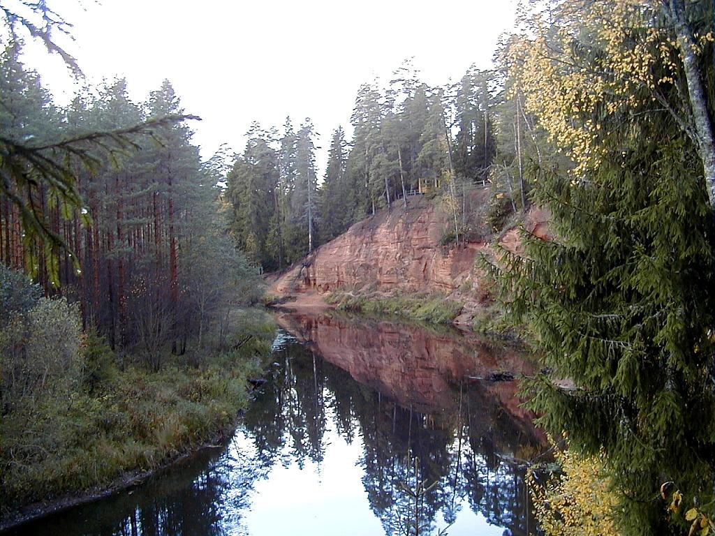
Nature park of 6,230 hectares in Latvia.
Overview
Nature park of 6,230 hectares in Latvia.
Salaca Valley Nature Park is located in Latvia (Europe). It is a predominantly terrestrial area. It covers about 6,230 hectares.
Protections and designations
Natura 2000 · habitats (SAC)
- Salacas ieleja LV0302200
Natura 2000 · birds (SPA)
- Salacas ieleja LV0302200
Protected as a nature park. International labels and designations: Natura 2000 network (1 site: “Salacas ieleja”). Key dates: first Natura 2000 site under the Birds Directive in 2004 and first Natura 2000 site under the Habitats Directive in 2004.
In our collections
Timeline
-
2004
First Natura 2000 site under the Birds Directive
-
2004
First Natura 2000 site under the Habitats Directive
Sources: Wikidata (CC0) for establishment and international labels; EEA Natura 2000 database (CC-BY 4.0) for site designation dates.
Frequently asked questions
Where is Salaca Valley Nature Park?
In Latvia (Europe). Representative point: 57.8587° N, 24.7188° E.
How large is Salaca Valley Nature Park?
About 6,230 hectares (62 km²). It is the 5th largest of the 11 nature parks in Latvia covered by Parkavela.
What habitats and landscapes does Salaca Valley Nature Park include?
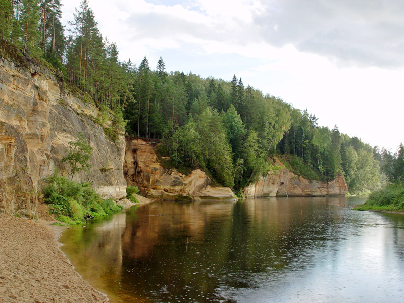
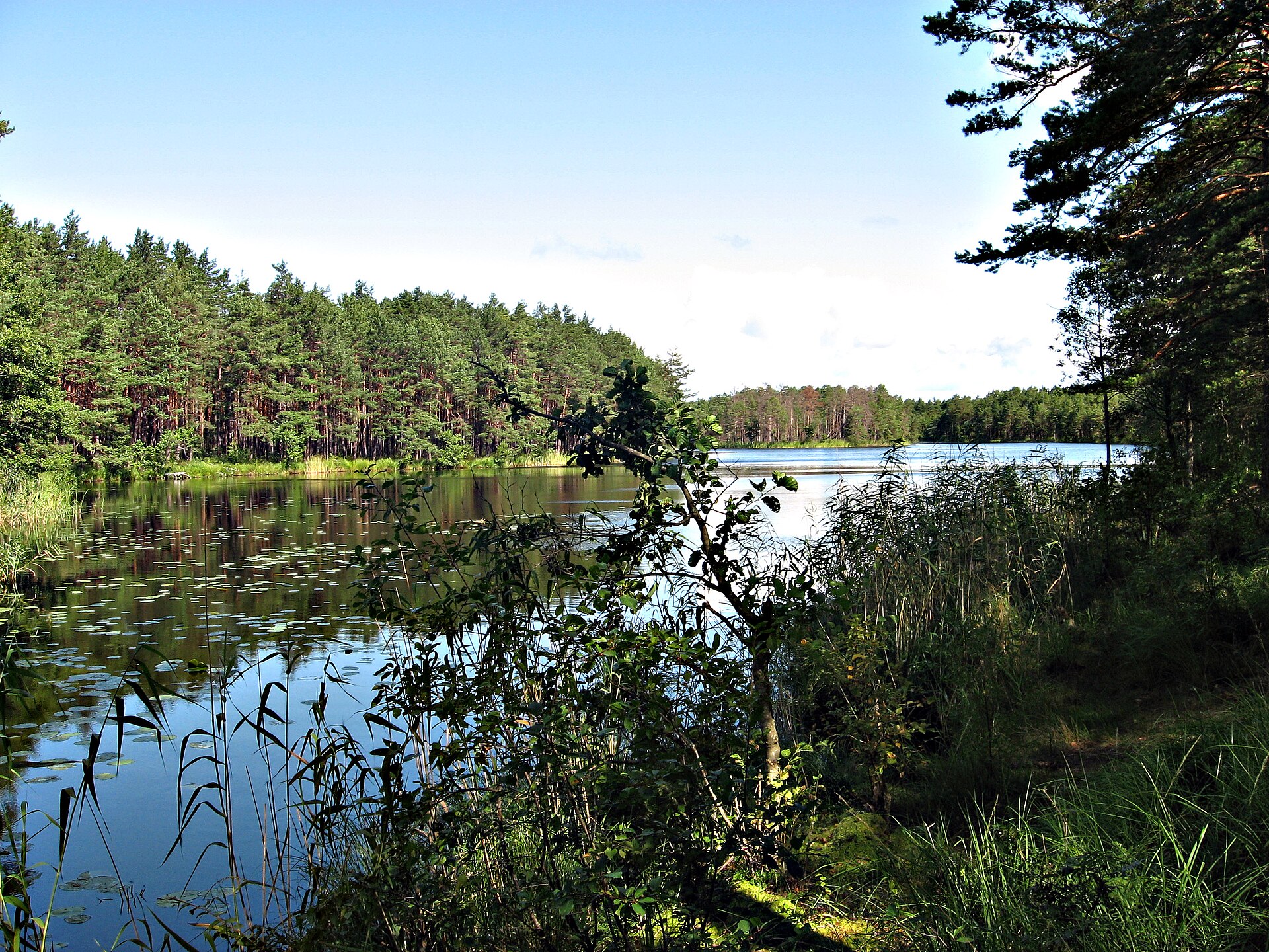
A terrestrial area, with forests.
Which international labels apply to Salaca Valley Nature Park?
Natura 2000 network (1 site: “Salacas ieleja”).
When is the best time to visit Salaca Valley Nature Park?
Mildest period: July and August, with average temperatures of 17 to 19 °C.
Is there snow in Salaca Valley Nature Park?
Yes. According to NASA's MODIS satellites (2015–2025 average), snow covers most of the site from November to February, with about 105 snow-covered days a year on average.
What is there to see in Salaca Valley Nature Park?
Cave Dauģēnu Lielā ala (Wikidata).
Are there historic monuments in Salaca Valley Nature Park?
Yes. According to Wikidata, 9 monuments listed in the Latvian register of cultural monuments of national significance stand within the boundary. For example: “Salacgrīva Fortress” in Salacgrīva, “Klēts” in Mazsalaca and “Mazsalacas Velna pagrabs - kulta vieta” in Mazsalacas pagasts.
Can you swim in Salaca Valley Nature Park?
One monitored bathing site lies in or within 1 km of the site; official 2025 classification: 1 excellent (European Environment Agency). Swimming is only permitted at the sites and times authorised locally.
What is the nearest large city to Salaca Valley Nature Park?
Nearest towns of over 50,000 people, as the crow flies: Riga (90 km) and Jūrmala (95 km). Nearest airport: Riga (RIX), about 95 km away.
Where can I get visitor information on site?
Ticket office, TIC and Dabas aizsardzības pārvalde, Ziemeļvidzemes biosfēras rezervāta administrācija.
Are there waymarked hiking trails in Salaca Valley Nature Park?
Yes. Waymarked hiking routes listed in OpenStreetMap: 3, including 1836 (Ziemeļmeita). The “1836 (Ziemeļmeita)” route runs for about 20 km through the site.
Which species can be seen in Salaca Valley Nature Park?
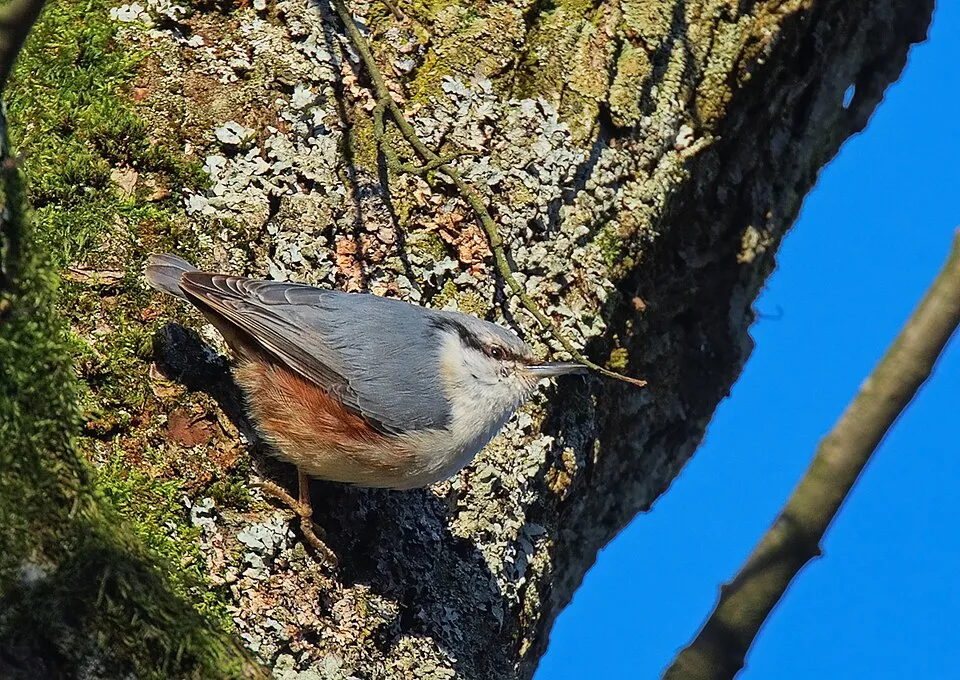
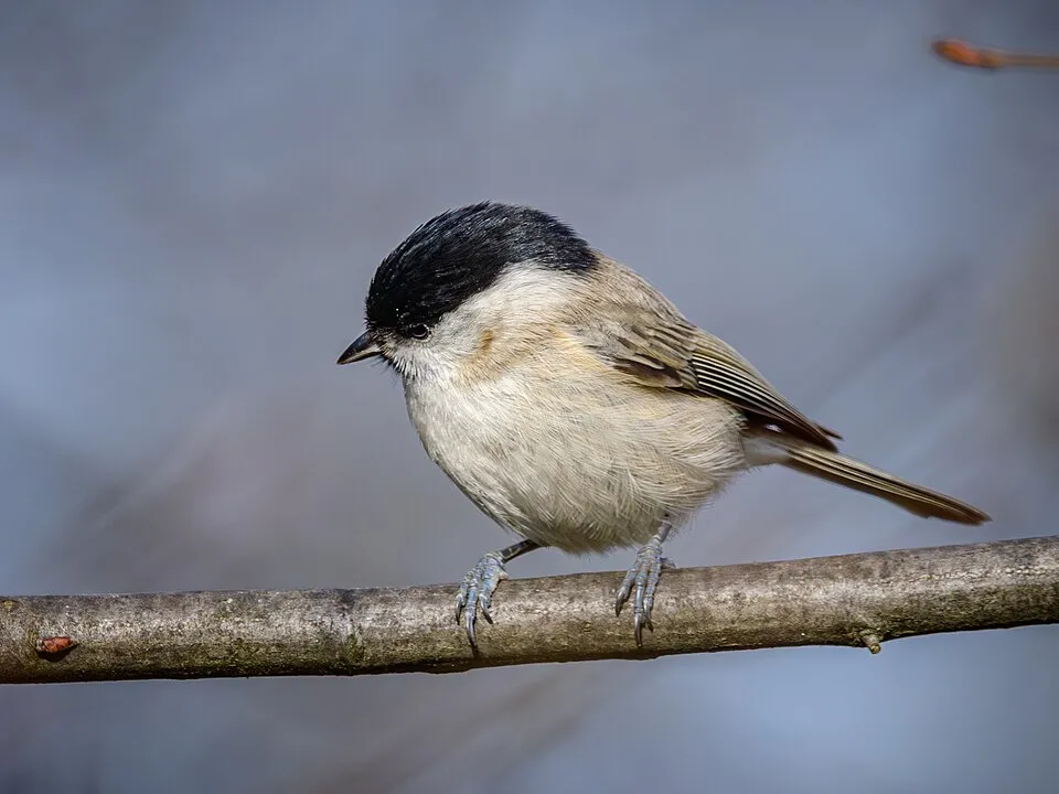
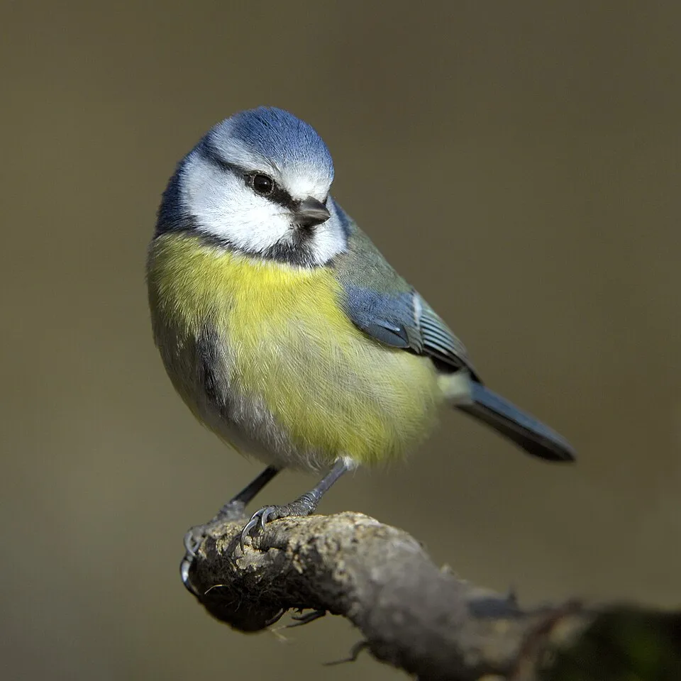
Among the species most often recorded on GBIF are Parus major (Great tit), Sitta europaea (Eurasian Nuthatch), Poecile palustris (Marsh Tit) and Cyanistes caeruleus (Eurasian blue tit).
© OpenStreetMap
Download the boundary: GeoJSON · GPX Boundary © OpenStreetMap contributors (ODbL).
Geography
The representative point of the site lies at around 56 m above sea level. Over the 1996–2025 period, the mean annual temperature is about 6.8 °C and total precipitation reaches roughly 775 mm per year. The warmest month is usually July, the coolest February, and the wettest August.
Area
- Area of the boundary
- 6,230 ha
- Elevation
- 56 m
- Snow cover
- ≈ 105 days a year
- Coordinates
- 57.8587, 24.7188
Climate
● Mean temperature (°C) · ▮ Precipitation (mm)
Source: Copernicus ERA5-Land (C3S, doi:10.24381/cds.68d2bb30), monthly averages 1996–2025 interpolated to the representative point, temperatures adjusted for elevation.
Contains modified Copernicus Climate Change Service information 2026. Neither the European Commission nor ECMWF is responsible for any use that may be made of the Copernicus information or data it contains.
Snow cover measured by satellite
J
F
M
A
M
J
J
A
S
O
N
D
average share of the site under snow · snowiest parts · ≈ 105 days a year
Snow cover: MODIS/Terra MOD10CM v61 (Hall & Riggs, 2021, NASA NSIDC DAAC, doi:10.5067/MODIS/MOD10CM.061), imagery from NASA GIBS (ESDIS); 2015–2025 average, grid of about 5 km.
Natural habitats
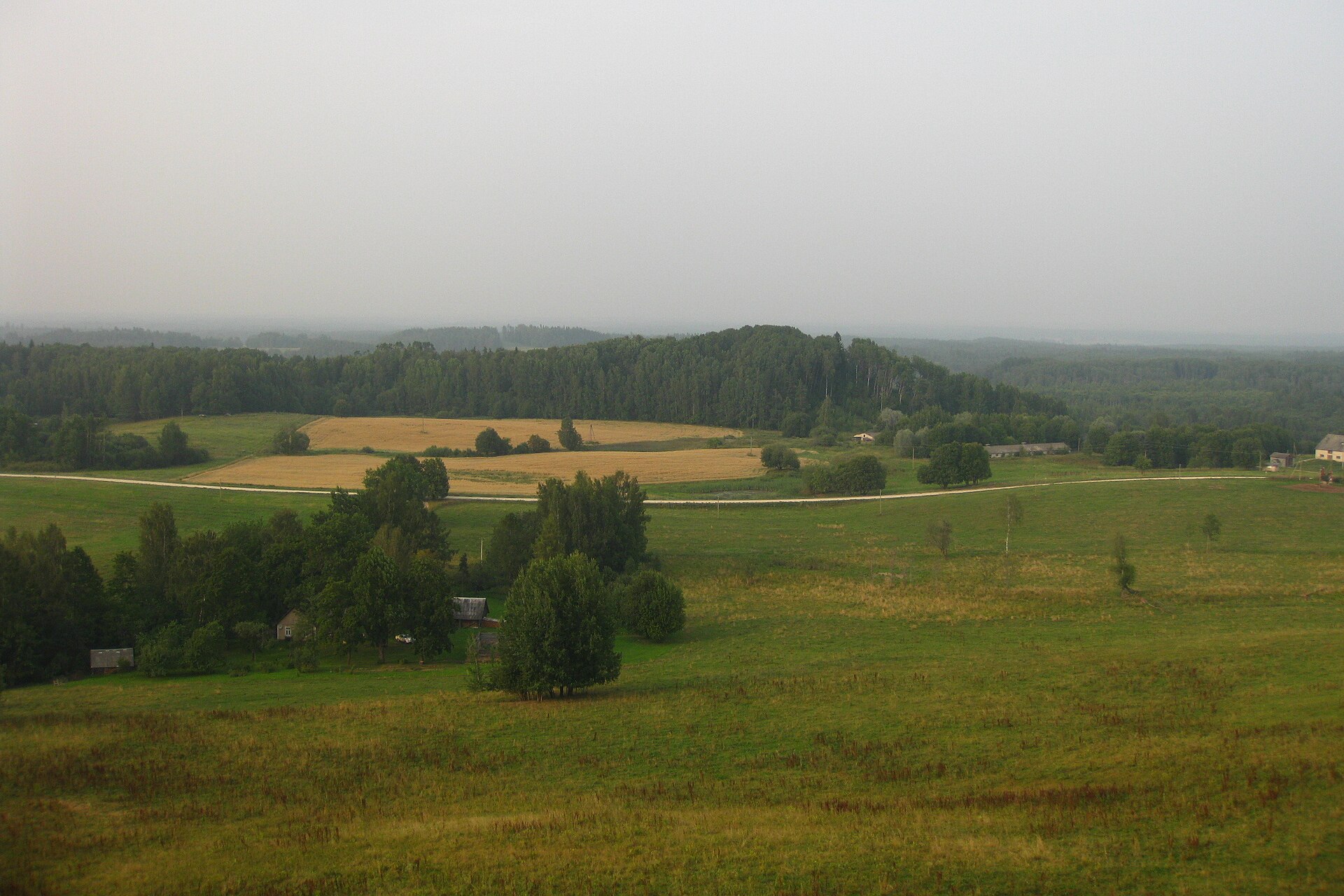
According to CORINE Land Cover (2018), the site is mainly made up of forests (54%), farmland (26%) and heath and scrub (15%). Woodland is mostly coniferous. The Natura 2000 site overlapping the area lists 23 habitats of European interest (10 priority), the most extensive being western Taïga, water courses of plain to montane levels with the Ranunculion fluitantis and Callitricho-Batrachion vegetation and Tilio-Acerion forests of slopes, screes and ravines.
Biodiversity
Based on occurrences aggregated by GBIF, several species are regularly recorded within the site. Among the most frequent are Parus major (Great tit), Sitta europaea (Eurasian Nuthatch), Poecile palustris (Marsh Tit) and Cyanistes caeruleus (Eurasian blue tit). The full list of documented taxa is shown below. The overlapping Natura 2000 site lists 67 species of European interest: 24 birds, 17 mammals, 4 amphibians, 9 fish, 8 invertebrates and 5 plants.
Habitats of European interest
From the official form of the Natura 2000 site overlapping the area (areas reported for the whole site).
- Western Taïga priority 516 ha
- Water courses of plain to montane levels with the Ranunculion fluitantis and Callitricho-Batrachion vegetation 323 ha
- Tilio-Acerion forests of slopes, screes and ravines priority 162 ha
- Bog woodland priority 133 ha
- Fennoscandian herb-rich forests with Picea abies 60 ha
- Active raised bogs priority 57 ha
- Alluvial forests with Alnus glutinosa and Fraxinus excelsior (Alno-Padion, Alnion incanae, Salicion albae) priority 39 ha
- Fennoscandian lowland species-rich dry to mesic grasslands priority 30 ha
and 15 more
Species of European interest
Birds · 24
Common Kingfisher (Alcedo atthis) breeding, Golden Eagle (Aquila chrysaetos) passage, Hazel Grouse (Bonasa bonasia) resident, European Nightjar (Caprimulgus europaeus) breeding, White stork (Ciconia ciconia) breeding, Black Stork (Ciconia nigra) breeding, Western Marsh Harrier (Circus aeruginosus) breeding, Lesser Spotted Eagle (Clanga pomarina) breeding, Corn Crake (Crex crex) breeding, White-backed Woodpecker (Dendrocopos leucotos) resident, Black Woodpecker (Dryocopus martius) resident, Red-breasted Flycatcher (Ficedula parva) breeding and 12 more
Mammals · 17
Eurasian Beaver (Castor fiber), Northern Bat (Eptesicus nilssonii), Mountain Hare (Lepus timidus), Eurasian otter (Lutra lutra), Eurasian Lynx (Lynx lynx), European pine marten (Martes martes), Western Polecat (Mustela putorius), Brandt's Bat (Myotis brandtii), Pond bat (Myotis dasycneme), Daubenton's bat (Myotis daubentonii), Natterer's bat (Myotis nattereri), Common noctule (Nyctalus noctula) and 5 more
Amphibians · 4
Edible frog (Pelophylax esculentus), Pool frog (Pelophylax lessonae), Moor frog (Rana arvalis), Common frog (Rana temporaria)
Fish · 9
Spined loach (Cobitis taenia), Powan (Coregonus lavaretus complex), European bullhead (Cottus gobio), European river lamprey (Lampetra fluviatilis), European brook lamprey (Lampetra planeri), Weatherfish (Misgurnus fossilis), Ziege (Pelecus cultratus), Rhodeus sericeus amarus, Atlantic salmon (Salmo salar)
Invertebrates · 8
Noble crayfish (Astacus astacus), Roman Snail (Helix pomatia), Yellow-spotted Whiteface (Leucorrhinia pectoralis), Green snaketail (Ophiogomphus cecilia), Eastern Hermit Beetle (Osmoderma barnabita), Thick shelled river mussel (Unio crassus), Narrow-mouthed whorl snail (Vertigo angustior), Geyer's whorl snail (Vertigo geyeri)
Plants · 5
Hairy agrimony (Agrimonia pilosa), Fir Clubmoss (Huperzia selago), Interrupted clubmoss (Lycopodium annotinum), Stag's-horn Clubmoss (Lycopodium clavatum), Eastern pasqueflower (Pulsatilla patens)
Source: Natura 2000 standard data forms (EEA, CC-BY 4.0). Not exhaustive: sensitive species are not published.
Species to look out for

Bird
Hooded Crow
Corvus cornix297 records © Ricardo Tulio Gandelman from Rio de Janeiro, Brazil · CC BY 2.0

Observed species
Occurrences documented via GBIF; they are neither an exhaustive inventory nor proof of current presence.
- Great tit · Parus major · 497
- Eurasian Nuthatch · Sitta europaea · 387
- Marsh Tit · Poecile palustris · 372
- Eurasian blue tit · Cyanistes caeruleus · 323
- Hooded Crow · Corvus cornix · 297
- Common Blackbird · Turdus merula · 249
- Great Spotted Woodpecker · Dendrocopos major · 245
- Middle Spotted Woodpecker · Dendrocoptes medius · 229
- Eurasian Chaffinch · Fringilla coelebs · 214
- Eurasian Treecreeper · Certhia familiaris · 208
- Eurasian Jay · Garrulus glandarius · 187
- Common Chiffchaff · Phylloscopus collybita · 152
+18 more species
- Eurasian Tree Sparrow · Passer montanus · 146
- Eurasian Wren · Troglodytes troglodytes · 138
- Eurasian Bullfinch · Pyrrhula pyrrhula · 137
- Fieldfare · Turdus pilaris · 133
- White Wagtail · Motacilla alba · 133
- Mallard · Anas platyrhynchos · 130
- Common Starling · Sturnus vulgaris · 115
- Common Kingfisher · Alcedo atthis · 113
- European robin · Erithacus rubecula · 108
- White stork · Ciconia ciconia · 102
- Common Goldeneye · Bucephala clangula · 99
- Common House Martin · Delichon urbicum · 90
- Goldcrest · Regulus regulus · 87
- European Goldfinch · Carduelis carduelis · 86
- Common Wood Pigeon · Columba palumbus · 86
- European Greenfinch · Chloris chloris · 80
- Eurasian Siskin · Spinus spinus · 79
- Common Sandpiper · Actitis hypoleucos · 76
Records: GBIF.org (CC-BY). Names: Wikidata (CC0), GBIF. Photos: Wikimedia Commons.
Conservation challenges
The primary purpose of the site is to preserve its natural habitats and the biodiversity they support. The species recorded (Biodiversity tab) reflect its ecological value. The designations it holds frame its management and the control of land use.
According to Global Forest Change data (University of Maryland, Global Forest Watch), about 513 ha of tree cover were lost within the boundary between 2001 and 2023 (8% of its area), peaking in 2020 and 2022. These losses include logging, storms and fires, and do not account for regrowth. Apart from forest felling and regrowth (about 200 ha in total), land cover remained almost unchanged between 1990 and 2018 according to CORINE Land Cover. At night, the area gives off virtually no artificial light detectable from space (NASA VIIRS Black Marble composite, 2016). Built-up and developed land (buildings, business areas, roads, quarries) covers 2% of the area, and farmland 26% (CORINE Land Cover). According to the Natura 2000 forms, of 13 assessed habitats of European interest, 6 are in excellent condition and the rest in good condition. According to the Water Framework Directive assessment (2022 river basin management plans, data 2015–2020), only 5% of the 70 km of rivers assessed within the site are in good or high ecological status; the others mostly have moderate ecological status. One invasive alien species has been recorded within the site since 2000 (GBIF observations), listed as of Union concern: Impatiens glandulifera (Himalayan Balsam).
Pressure indicators
Tree cover lost
513 ha
2001–2023
20012023
Fires since 2016
0
No large fire mapped (fires over about 30 ha)
Light at night
< 1%
of the area gives off artificial light visible from space
DarkLit
Built-up land
2%
buildings, business areas, roads, quarries · farmland 26%
Land cover change
< 0.5%
of the area changed, 1990–2018 · CORINE
forest felling and regrowth: 200 ha in total
Rivers and lakes
5%
of the 70 km of assessed rivers in good or high ecological status · WFD 2022
assessments 2015–2020
Invasive alien species
1
incl. 1 of EU concern · since 2000
Sources: Global Forest Change (Hansen et al., University of Maryland, via Global Forest Watch, CC-BY 4.0); EFFIS, European Commission / Copernicus; NASA Black Marble 2016 (public domain); CORINE Land Cover 2018 (Copernicus) or MODIS.
CORINE Land Cover Change 1990–2018: generated using European Union's Copernicus Land Monitoring Service information (EEA), aggregated by Parkavela; DOI 10.2909/f30f1000-7cf8-43bb-872c-5eb093911b24.
Ecological status of water bodies: European Environment Agency, WISE – Water Framework Directive, 3rd river basin management plans (2022), CC BY 4.0. Official national classification, not comparable between countries.
Invasive alien species: Global Register of Introduced and Invasive Species (ISSG, CC BY 4.0); Union list, Regulation (EU) 1143/2014 (INBO, CC0); GBIF.org records (CC0 / CC BY 4.0), at least 2 per species.
Practical information
Cities and airport
- Riga
90 km as the crow flies - Jūrmala
95 km as the crow flies - Airport: Riga (RIX)
95 km as the crow flies
Visitor information
- Ticket office
within the site - TIC
within the site - Dabas aizsardzības pārvalde, Ziemeļvidzemes biosfēras rezervāta administrācija
< 1 km from the site boundary - Tūrisma informācijas centrs
1 km from the site boundary
Hiking
3 waymarked routes listed, including:
1836 (Ziemeļmeita)
By bike
7 7: Nacionālais upju maršruts · 2 km17 17: Ainaži - Aloja - Matīši - Burtnieki - Rūjiena - Karksi Nuija (EST) · 16 km
Signed cycle routes: this does not mean that cycling is allowed on footpaths.
Data © OpenStreetMap contributors (ODbL) · Wikidata (CC0)
Routes © OpenStreetMap contributors (ODbL), via Waymarked Trails
Waymarked hiking routes
Tracks © OpenStreetMap contributors (ODbL), clipped to the boundary; elevation gain and profiles computed on the longest section from Mapzen Terrain Tiles (≈ 30 m), indicative only. Indicative difficulty (SAC scale, OpenStreetMap, via Waymarked Trails): check with the park.
Bathing
1 monitored bathing site in or within 1 km of the site · 2025 classification
Excellent · 1
- Baltijas Jūra, Salacgrīva · sea · Excellent
Source: European Environment Agency, official bathing water classification (Directive 2006/7/EC, CC-BY 4.0). Swimming is only permitted at the sites and times authorised locally.
Access and visiting
Nearest towns of over 50,000 people, as the crow flies: Riga (90 km) and Jūrmala (95 km). Nearest airport: Riga (RIX), about 95 km away. About 21,000 people live within 20 km of the site boundary, 11,000 of them within 10 km; some 1,200 people are estimated to live inside (GHSL estimate, 2020). This population has fallen by about 18% since 2000. Visitor information on site: Ticket office, TIC and Dabas aizsardzības pārvalde, Ziemeļvidzemes biosfēras rezervāta administrācija. Waymarked hiking routes listed in OpenStreetMap: 3, including 1836 (Ziemeļmeita). The site is crossed by 2 signed cycle routes: “7 7: Nacionālais upju maršruts” and “17 17: Ainaži - Aloja - Matīši - Burtnieki - Rūjiena - Karksi Nuija (EST)” (OpenStreetMap). To see: cave Dauģēnu Lielā ala. To plan a visit (access, opening periods, visitor rules), it is best to consult the official information from the managing body and the official website listed in this page's sources.
Source: OpenStreetMap (ODbL), Wikidata (CC0), October 2026.
Built heritage
According to Wikidata, 9 monuments listed in the Latvian register of cultural monuments of national significance stand within the boundary. Among them are 3 houses and civic buildings and 1 castle or fortification. Examples include “Salacgrīva Fortress” in Salacgrīva, “Klēts” in Mazsalaca and “Mazsalacas Velna pagrabs - kulta vieta” in Mazsalacas pagasts.
3 houses and civic buildings1 castle or fortification
-
Salacgrīva Fortress
Salacgrīva · 13th c. -
Klēts
Mazsalaca · 19th c. -
Mazsalacas Velna pagrabs - kulta vieta
Mazsalacas pagasts -
Parks
Mazsalaca · 18th c. -
Altāris
Salacgrīva · 18th c. -
Mazsalaca manor house
Mazsalaca · 18th c. -
Interjera dekoratīvā apdare (4 ciļņi)
Salacgrīva · 20th c. -
Kancele
Salacgrīva · 18th c.
and 1 more
Source: Wikidata (CC0), monuments in each country’s official heritage protection registers, at national or regional level. Each item links to its Wikidata entry.
When to visit
Mildest period: July and August, with average temperatures of 17 to 19 °C. Average temperatures drop below 0 °C from December to March: frost is common. According to NASA's MODIS satellites (2015–2025 average), snow covers most of the site from November to February, with about 105 snow-covered days a year on average. Day length ranges from about 6 h 32 min in December to 18 h 05 min in June. Wildlife records published on GBIF peak for birds (April and May) and plants (August). These peaks also reflect when observers are most active.
Source: Copernicus ERA5-Land (C3S), monthly averages 1996–2025 at the representative point, temperatures adjusted for elevation.
Contains modified Copernicus Climate Change Service information 2026. Neither the European Commission nor ECMWF is responsible for any use that may be made of the Copernicus information or data it contains.
Wildlife records calendar
JFMAMJJASOND
Birds
Plants
Monthly records published on GBIF (CC-BY), relative to the busiest month; also reflects observer activity.
Gallery
© J. Sedols · CC BY 3.0
© Dāvis Kļaviņš · CC BY-SA 3.0
© Gunita Kolle · CC BY-SA 4.0
© JopkeB · CC BY-SA 4.0
© J. Sedols · CC BY 3.0
© Gunita Kolle · CC BY-SA 4.0
Sources and licences
- Wikidata: Q29167128
- Wikipedia: fr.wikipedia.org/wiki/Parc_naturel_de_la_vallée_de_la_Salaca
- Natura 2000: LV0302200
References
- cds.climate.copernicus.eu: climate · CC-BY-4.0
- registry.opendata.aws: elevation of the reference point, detailed relief · PD
- land.copernicus.eu: land cover, land cover change, sea share · COPERNICUS
- doi.org: population around the site · CC-BY-4.0
- openstreetmap.org: official name, access and peaks, trail difficulty · ODbL-1.0
- eea.europa.eu: bathing water quality, ecological status of waters · CC-BY-4.0
- en.eurovelo.com: EuroVelo cycle routes · ODbL-1.0
- cycling.waymarkedtrails.org: cycle routes · ODbL-1.0
- opentopodata.org: elevations · PD
- forest-fire.emergency.copernicus.eu: wildfires · COPERNICUS
- globalforestwatch.org: tree cover loss · CC-BY-4.0
- gbif.org: seasonality of sightings, invasive alien species, observed species · CC-BY-4.0
- wikidata.org: protected heritage, nearby cities and airport, access and peaks, lake depths, places to see · CC0-1.0
- hydrosheds.org: lakes · CC-BY-4.0
- natura2000.eea.europa.eu: Natura 2000 habitats and species · CC-BY-4.0
- earthobservatory.nasa.gov: night light · PD
- hiking.waymarkedtrails.org: route difficulty · ODbL-1.0
- nsidc.org: snow cover · PD
- wikidata.org: Wikipedia article · CC-BY-SA-4.0
Data © OpenStreetMap contributors (ODbL), Wikidata (CC0) and the sources cited.