Latvia · Mixed
Lake Engure Nature Park
Nature park of 19,700 hectares in Latvia, established in 1998.
Overview
Nature park of 19,700 hectares in Latvia, established in 1998.
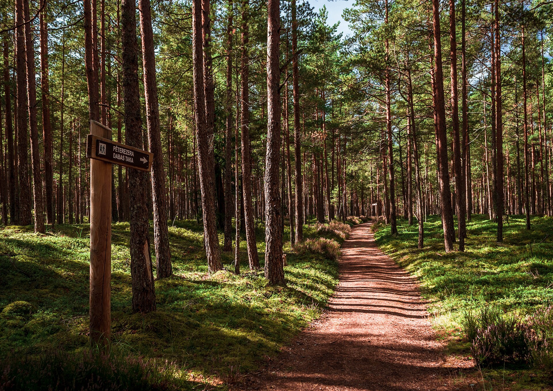
Lake Engure Nature Park is located in Latvia (Europe). It covers both land and sea. Established in 1998, it covers about 19,700 hectares.
Protections and designations
Ramsar site
Natura 2000 · habitats (SAC) · 2 sites
- Engures ezers LV0302800
- Rīgas līča rietumu piekraste LV0900400
Natura 2000 · birds (SPA) · 2 sites
- Engures ezers LV0302800
- Rīgas līča rietumu piekraste LV0900400
Protected as a nature park. International labels and designations: Ramsar site (“Lake Engure”) and Natura 2000 network (2 sites). Key dates: established in 1998, first Natura 2000 site under the Birds Directive in 2004 and first Natura 2000 site under the Habitats Directive in 2004.
In our collections
Timeline
-
1998
Established
-
2004
First Natura 2000 site under the Birds Directive 2 such sites designated up to 2008
-
2004
First Natura 2000 site under the Habitats Directive 2 such sites designated up to 2008
Sources: Wikidata (CC0) for establishment and international labels; EEA Natura 2000 database (CC-BY 4.0) for site designation dates.
Frequently asked questions
Where is Lake Engure Nature Park?
In Latvia (Europe). Representative point: 57.2578° N, 23.1469° E.
How large is Lake Engure Nature Park?
About 19,700 hectares (197 km²). It is the 2nd largest of the 11 nature parks in Latvia covered by Parkavela. About 7,500 ha are at sea.
When was Lake Engure Nature Park established?
In 1998.
What habitats and landscapes does Lake Engure Nature Park include?
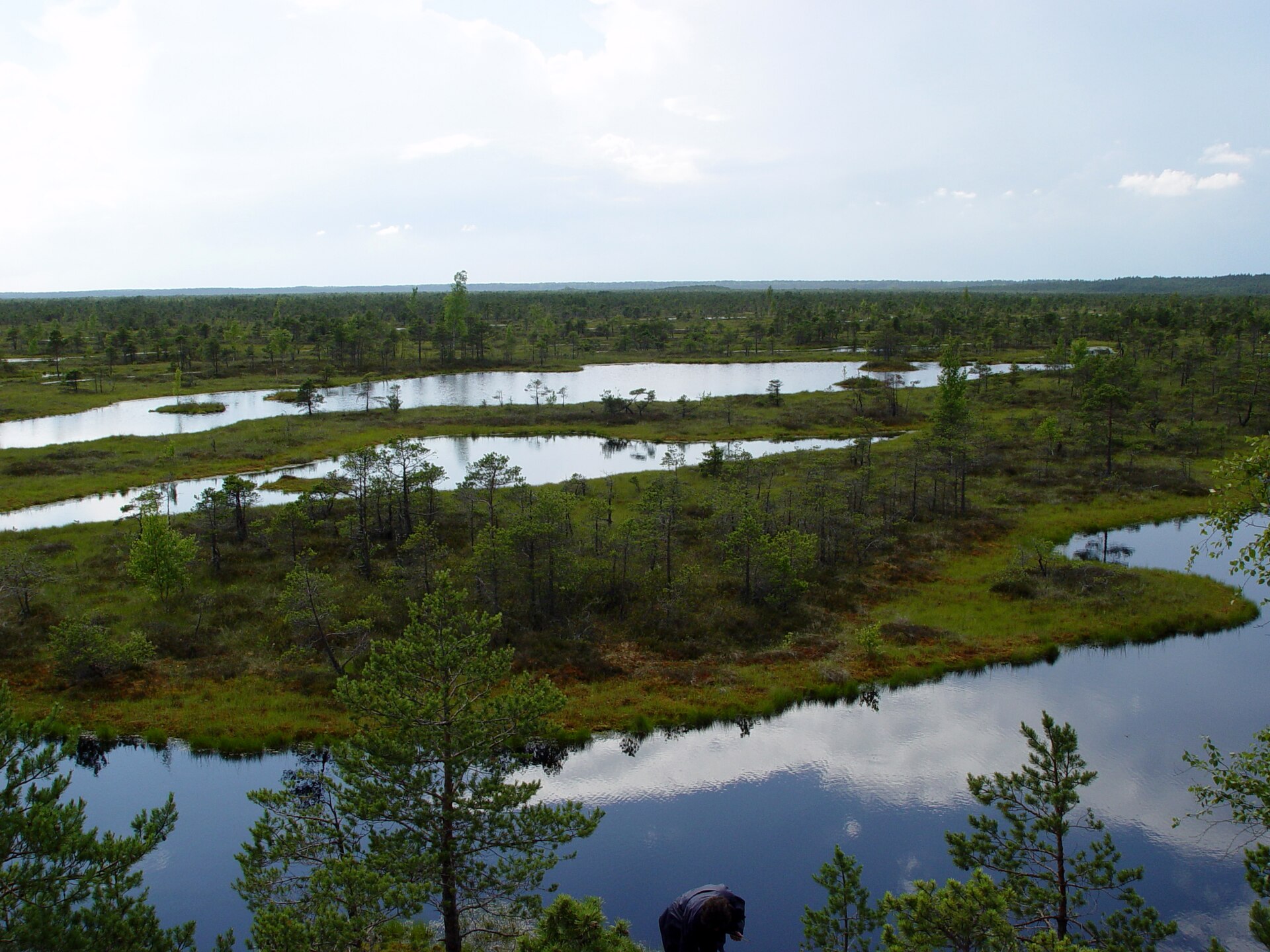
An area spanning land and sea, with forests and coasts.
Which international labels apply to Lake Engure Nature Park?
Ramsar site (“Lake Engure”) and Natura 2000 network (2 sites).
When is the best time to visit Lake Engure Nature Park?
Best time to visit: May and June, with average temperatures of 11 to 16 °C and moderate rainfall.
Is there snow in Lake Engure Nature Park?
Yes. According to NASA's MODIS satellites (2015–2025 average), snow covers most of the site in December and January, and until February on higher ground, with about 90 snow-covered days a year on average.
What is there to see in Lake Engure Nature Park?
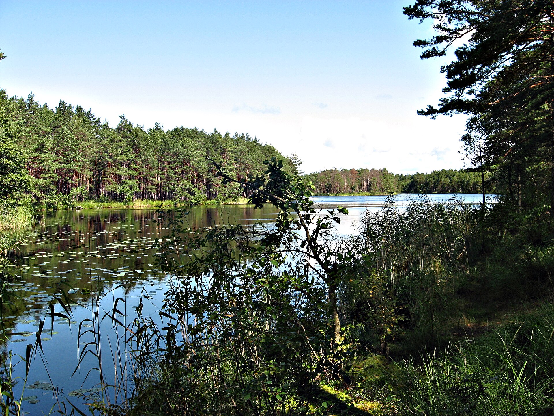
Engures ezers (lake or pond, 3 m) (Wikidata).
Are there historic monuments in Lake Engure Nature Park?
Yes. According to Wikidata, 2 monuments listed in the Latvian register of cultural monuments of national significance stand within the boundary. For example: “Zvejnieku sēta Lielkristi” in Bērzciems and “Zvejnieku sēta Skaras” in Bērzciems.
Can you swim in Lake Engure Nature Park?
2 monitored bathing sites lie in or within 1 km of the site; official 2025 classification: 1 excellent and 1 good (European Environment Agency). Swimming is only permitted at the sites and times authorised locally.
What is the nearest large city to Lake Engure Nature Park?
Nearest towns of over 50,000 people, as the crow flies: Jūrmala (37 km) and Riga (57 km). Nearest airport: Riga (RIX), about 52 km away.
How can I reach Lake Engure Nature Park by train?
The nearest railway station is Pūre, about 18 km from the site boundary.
Where can I get visitor information on site?
Mersrags Information Center.
Are there waymarked hiking trails in Lake Engure Nature Park?
Yes. Waymarked hiking routes listed in OpenStreetMap: 5, including E 9 (24 km) and 1836 (Piejūras ceļš). The “1836 (Piejūras ceļš)” route runs for about 18 km through the site.
Which species can be seen in Lake Engure Nature Park?
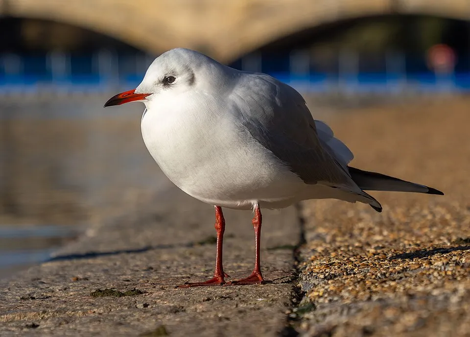
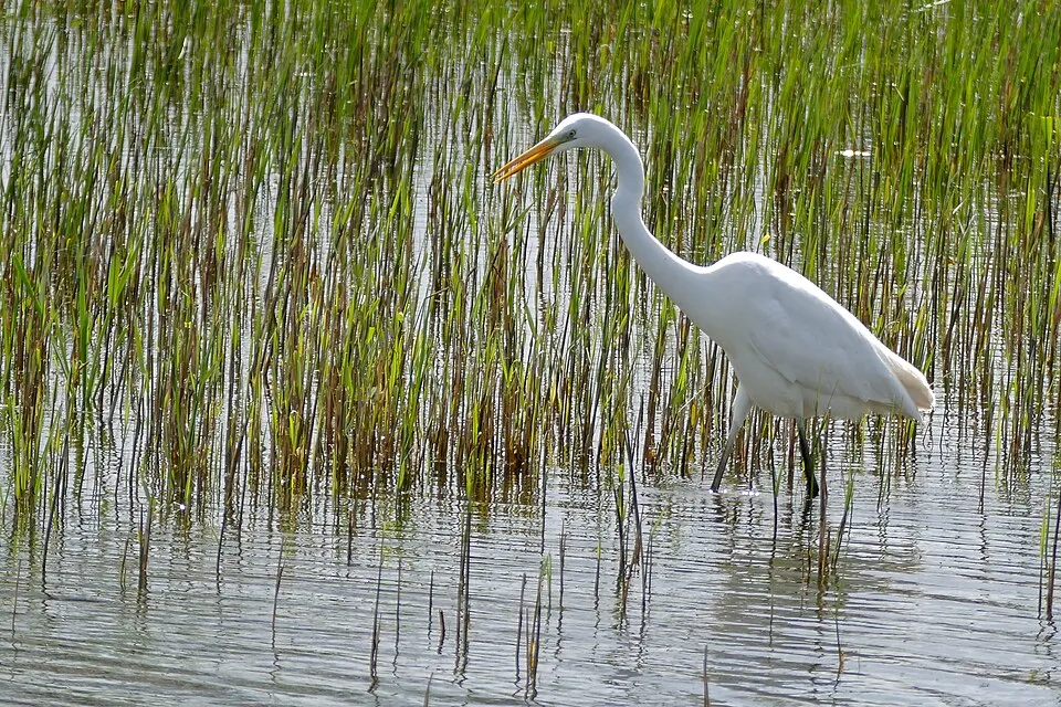
Among the species most often recorded on GBIF are Larus argentatus (European Herring Gull), Chroicocephalus ridibundus (Black-headed Gull), Ardea alba (Great Egret) and Cygnus olor (Mute Swan).
© OpenStreetMap
Download the boundary: GeoJSON · GPX Boundary © OpenStreetMap contributors (ODbL).
Geography
The representative point of the site lies at around 4 m above sea level. Over the 1996–2025 period, the mean annual temperature is about 7.8 °C and total precipitation reaches roughly 695 mm per year. The warmest month is usually July, the coolest February, and the wettest July. The site contains 5 lakes larger than 10 ha, totalling 21.6 km² of water; the largest, Engures ezers, covers 20.8 km² (HydroLAKES). Engures ezers (4,046 ha) is 2.1 m deep (Wikidata).
Area
- Area of the boundary
- 19,700 ha
- Elevation
- 4 m
- Snow cover
- ≈ 90 days a year
- Lakes over 10 ha
- 5 (21.6 km²)
- Coordinates
- 57.2578, 23.1469
Lakes: HydroLAKES (Messager et al. 2016, hydrosheds.org, CC BY 4.0) · depths: Wikidata (CC0)
Climate
● Mean temperature (°C) · ▮ Precipitation (mm)
Source: Copernicus ERA5-Land (C3S, doi:10.24381/cds.68d2bb30), monthly averages 1996–2025 interpolated to the representative point, temperatures adjusted for elevation.
Contains modified Copernicus Climate Change Service information 2026. Neither the European Commission nor ECMWF is responsible for any use that may be made of the Copernicus information or data it contains.
Snow cover measured by satellite
J
F
M
A
M
J
J
A
S
O
N
D
average share of the site under snow · snowiest parts · ≈ 90 days a year
Snow cover: MODIS/Terra MOD10CM v61 (Hall & Riggs, 2021, NASA NSIDC DAAC, doi:10.5067/MODIS/MOD10CM.061), imagery from NASA GIBS (ESDIS); 2015–2025 average, grid of about 5 km.
Natural habitats
According to CORINE Land Cover (2018), the land area is mainly made up of forests (40%), lakes and rivers (32%) and marshes and bogs (20%). Woodland is mostly coniferous. The sea covers about 38% of the site. The seabed reaches about 11 m deep (median depth 8 m; GEBCO bathymetry). The 2 Natura 2000 sites overlapping the area list 28 habitats of European interest (11 priority), the most extensive being reefs, hard oligo-mesotrophic waters with benthic vegetation of Chara spp. and alkaline fens.
Biodiversity
Based on occurrences aggregated by GBIF, several species are regularly recorded within the site. Among the most frequent are Larus argentatus (European Herring Gull), Chroicocephalus ridibundus (Black-headed Gull), Ardea alba (Great Egret) and Cygnus olor (Mute Swan). The full list of documented taxa is shown below. The overlapping Natura 2000 sites list 106 species of European interest: 66 birds, 6 mammals, 2 reptiles, 3 amphibians, 7 fish, 13 invertebrates and 9 plants.
Habitats of European interest
From the official forms of the 2 Natura 2000 sites overlapping the area (areas reported for each whole site).
- Reefs 3,605 ha
- Hard oligo-mesotrophic waters with benthic vegetation of Chara spp. 2,464 ha
- Alkaline fens 1,401 ha
- Wooded dunes of the Atlantic, Continental and Boreal region 1,178 ha
- Calcareous fens with Cladium mariscus and species of the Caricion davallianae priority 395 ha
- Western Taïga priority 366 ha
- Fennoscandian deciduous swamp woods priority 236 ha
- Alluvial forests with Alnus glutinosa and Fraxinus excelsior (Alno-Padion, Alnion incanae, Salicion albae) priority 76 ha
and 20 more
Species of European interest
Birds · 66
Boreal Owl (Aegolius funereus) resident, Razorbill (Alca torda) wintering, Common Kingfisher (Alcedo atthis) passage breeding, Eurasian Teal (Anas crecca) wintering, Greater white-fronted goose (Anser albifrons) passage, Taiga bean goose (Anser fabalis) passage, Tawny Pipit (Anthus campestris) breeding, Great Egret (Ardea alba) breeding, Short-eared Owl (Asio flammeus) breeding, Common Pochard (Aythya ferina) wintering, Tufted Duck (Aythya fuligula) wintering, Greater Scaup (Aythya marila) wintering and 54 more
Mammals · 6
Grey wolf (Canis lupus), Eurasian Beaver (Castor fiber), Eurasian otter (Lutra lutra), Eurasian Lynx (Lynx lynx), Pond bat (Myotis dasycneme), Northern birch mouse (Sicista betulina)
Amphibians · 3
Natterjack toad (Epidalea calamita), Moor frog (Rana arvalis), Great crested newt (Triturus cristatus)
Fish · 7
Spined loach (Cobitis taenia), Powan (Coregonus lavaretus complex), European bullhead (Cottus gobio), European river lamprey (Lampetra fluviatilis), European brook lamprey (Lampetra planeri), Weatherfish (Misgurnus fossilis), Rhodeus sericeus amarus
Invertebrates · 13
Green hawker (Aeshna viridis), Scarce heath (Coenonympha hero), Broadest Diver (Dytiscus latissimus), Scarce Fritillary (Euphydryas maturna), Water beetle (Graphoderus bilineatus), Dark whiteface (Leucorrhinia albifrons), Lilypad whiteface (Leucorrhinia caudalis), Yellow-spotted Whiteface (Leucorrhinia pectoralis), Woodland brown (Lopinga achine), Large copper (Lycaena dispar), Narrow-mouthed whorl snail (Vertigo angustior), Round-mouthed Whorl Snail (Vertigo genesii) and 1 more
Plants · 9
Dianthus arenarius subsp. arenarius, Leucobryum moss (Leucobryum glaucum), Linaria loeselii, Fen orchid (Liparis loeselii), Marsh clubmoss (Lycopodiella inundata), Interrupted clubmoss (Lycopodium annotinum), Stag's-horn Clubmoss (Lycopodium clavatum), Lycopodium dubium, Eastern pasqueflower (Pulsatilla patens)
Source: Natura 2000 standard data forms (EEA, CC-BY 4.0). Not exhaustive: sensitive species are not published.
Species to look out for


Observed species
Occurrences documented via GBIF; they are neither an exhaustive inventory nor proof of current presence.
- European Herring Gull · Larus argentatus · 178
- Black-headed Gull · Chroicocephalus ridibundus · 177
- Great Egret · Ardea alba · 177
- Mute Swan · Cygnus olor · 160
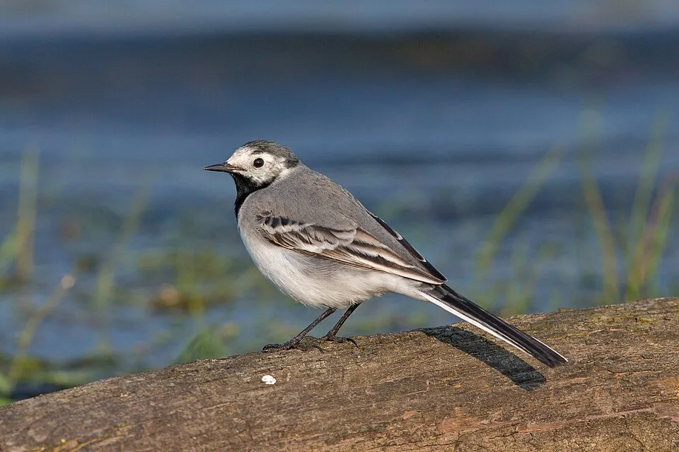
- White Wagtail · Motacilla alba · 131
- Mallard · Anas platyrhynchos · 129
- Common Tern · Sterna hirundo · 127
- Hooded Crow · Corvus cornix · 126
- Great Cormorant · Phalacrocorax carbo · 125
- Eurasian Chaffinch · Fringilla coelebs · 113
- Great tit · Parus major · 102
- Grey Heron · Ardea cinerea · 89
+18 more species
- Barn Swallow · Hirundo rustica · 88
- Western Marsh Harrier · Circus aeruginosus · 85
- Common Goldeneye · Bucephala clangula · 83
- Common Shelduck · Tadorna tadorna · 81
- Common Gull · Larus canus · 80
- Common Starling · Sturnus vulgaris · 76
- Willow Warbler · Phylloscopus trochilus · 70
- Common House Martin · Delichon urbicum · 68
- Eurasian blue tit · Cyanistes caeruleus · 66
- Eurasian Magpie · Pica pica · 64
- Common Merganser · Mergus merganser · 64
- Greylag Goose · Anser anser · 62
- Caspian Tern · Hydroprogne caspia · 61
- Common Chiffchaff · Phylloscopus collybita · 61
- Eurasian Teal · Anas crecca · 61
- Great Crested Grebe · Podiceps cristatus · 58
- Gadwall · Mareca strepera · 58
- Eurasian Wigeon · Mareca penelope · 55
Records: GBIF.org (CC-BY). Names: Wikidata (CC0), GBIF. Photos: Wikimedia Commons.
Conservation challenges
The primary purpose of the site is to preserve its natural habitats and the biodiversity they support. The species recorded (Biodiversity tab) reflect its ecological value. The designations it holds frame its management and the control of land use.
According to Global Forest Change data (University of Maryland, Global Forest Watch), about 244 ha of tree cover were lost within the boundary between 2001 and 2023 (1% of its area), peaking in 2012 and 2017. These losses include logging, storms and fires, and do not account for regrowth. According to CORINE Land Cover, land cover here remained almost unchanged between 1990 and 2018 (less than 0.5% of the area affected). At night, the area gives off virtually no artificial light detectable from space (NASA VIIRS Black Marble composite, 2016). According to the Natura 2000 forms, of 21 assessed habitats of European interest, 6 are in excellent condition and 1 in average or reduced condition. According to the Water Framework Directive assessment (2022 river basin management plans, data 2015–2020), only 41% of the 14 km of rivers assessed within the site are in good or high ecological status; the others mostly have moderate ecological status. Other assessed water bodies: lakes, 1 of 1 in good ecological status or better; coastal waters, 0 of 1 in good ecological status or better.
Pressure indicators
Tree cover lost
244 ha
2001–2023
20012023
Fires since 2016
0
No large fire mapped (fires over about 30 ha)
Light at night
< 1%
of the area gives off artificial light visible from space
DarkLit
Built-up land
< 1%
buildings, business areas, roads, quarries · farmland 1%
Land cover change
< 0.5%
of the area changed, 1990–2018 · CORINE
Rivers and lakes
41%
of the 14 km of assessed rivers in good or high ecological status · WFD 2022
Lakes: 1 of 1 good or better
Coastal waters: 0 of 1 good or better
assessments 2015–2020
Sources: Global Forest Change (Hansen et al., University of Maryland, via Global Forest Watch, CC-BY 4.0); EFFIS, European Commission / Copernicus; NASA Black Marble 2016 (public domain); CORINE Land Cover 2018 (Copernicus) or MODIS.
CORINE Land Cover Change 1990–2018: generated using European Union's Copernicus Land Monitoring Service information (EEA), aggregated by Parkavela; DOI 10.2909/f30f1000-7cf8-43bb-872c-5eb093911b24.
Ecological status of water bodies: European Environment Agency, WISE – Water Framework Directive, 3rd river basin management plans (2022), CC BY 4.0. Official national classification, not comparable between countries.
Practical information
Cities and airport
- Jūrmala
37 km as the crow flies - Riga
57 km as the crow flies - Airport: Riga (RIX)
52 km as the crow flies
Visitor information
- Mersrags Information Center
< 1 km from the site boundary
Hiking
5 waymarked routes listed, including:
E 9 (24 km)1836 (Piejūras ceļš)
By bike
EV10 / EV13 · 17 km
Signed cycle routes: this does not mean that cycling is allowed on footpaths.
Data © OpenStreetMap contributors (ODbL) · Wikidata (CC0)
Contains information from EuroVelo GPX tracks downloaded from www.EuroVelo.com on 2026-10-22, which is made available here under the Open Database License (ODbL). EuroVelo® is a registered trademark of the ECF. Routes © OpenStreetMap contributors (ODbL), via Waymarked Trails
Waymarked hiking routes
E9 E9 section 18: Kaltene - Mērsrags
1.1 km within the site ↗ 0 m↘ 0 m 2–4 m
Tracks © OpenStreetMap contributors (ODbL), clipped to the boundary; elevation gain and profiles computed on the longest section from Mapzen Terrain Tiles (≈ 30 m), indicative only.
Bathing
2 monitored bathing sites in or within 1 km of the site · 2025 classification
Excellent · 1
Good · 1
- Abragciems · sea · Excellent
- Mērsrags · sea · Good
Source: European Environment Agency, official bathing water classification (Directive 2006/7/EC, CC-BY 4.0). Swimming is only permitted at the sites and times authorised locally.
Access and visiting
The nearest railway station is Pūre, about 18 km from the site boundary. Nearest towns of over 50,000 people, as the crow flies: Jūrmala (37 km) and Riga (57 km). Nearest airport: Riga (RIX), about 52 km away. About 14,000 people live within 20 km of the site boundary, 5,300 of them within 10 km; some 460 people are estimated to live inside (GHSL estimate, 2020). This population has fallen by about 20% since 2000. Visitor information on site: Mersrags Information Center. Waymarked hiking routes listed in OpenStreetMap: 5, including E 9 (24 km) and 1836 (Piejūras ceļš). The EuroVelo 10 and EuroVelo 13 cycle routes, which share the same line here, cross the site for about 17 km (EuroVelo). To see: Engures ezers (lake or pond, 3 m). To plan a visit (access, opening periods, visitor rules), it is best to consult the official information from the managing body and the official website listed in this page's sources.
Source: OpenStreetMap (ODbL), Wikidata (CC0), October 2026.
Built heritage
According to Wikidata, 2 monuments listed in the Latvian register of cultural monuments of national significance stand within the boundary. Examples include “Zvejnieku sēta Lielkristi” in Bērzciems and “Zvejnieku sēta Skaras” in Bērzciems.
-
Zvejnieku sēta Lielkristi
Bērzciems · 19th c. -
Zvejnieku sēta Skaras
Bērzciems · 19th c.
Source: Wikidata (CC0), monuments in each country’s official heritage protection registers, at national or regional level. Each item links to its Wikidata entry.
When to visit
Best time to visit: May and June, with average temperatures of 11 to 16 °C and moderate rainfall. Average temperatures drop below 0 °C in January and February: frost is common. According to NASA's MODIS satellites (2015–2025 average), snow covers most of the site in December and January, and until February on higher ground, with about 90 snow-covered days a year on average. Day length ranges from about 6 h 41 min in December to 17 h 55 min in June. Wildlife records published on GBIF peak for birds (from May to August) and plants (July). These peaks also reflect when observers are most active.
Source: Copernicus ERA5-Land (C3S), monthly averages 1996–2025 at the representative point, temperatures adjusted for elevation.
Contains modified Copernicus Climate Change Service information 2026. Neither the European Commission nor ECMWF is responsible for any use that may be made of the Copernicus information or data it contains.
Wildlife records calendar
JFMAMJJASOND
Birds
Plants
Monthly records published on GBIF (CC-BY), relative to the busiest month; also reflects observer activity.
Gallery
© Evita wiki · CC BY-SA 4.0
© J. Sedols · CC BY 3.0
© Evita wiki · CC BY-SA 4.0
© Feens · CC BY-SA 4.0
© M.Strīķis · CC BY-SA 3.0
© M.Strīķis · CC BY-SA 3.0
Sources and licences
- Wikidata: Q6475758
- OpenStreetMap: relation 12635008
- Wikipedia: en.wikipedia.org/wiki/Lake_Engure_Nature_Park
- Natura 2000: LV0302800
References
- cds.climate.copernicus.eu: climate · CC-BY-4.0
- registry.opendata.aws: elevation of the reference point, detailed relief · PD
- land.copernicus.eu: land cover, land cover change, sea share · COPERNICUS
- doi.org: population around the site · CC-BY-4.0
- openstreetmap.org: official name, access and peaks · ODbL-1.0
- eea.europa.eu: bathing water quality, ecological status of waters · CC-BY-4.0
- en.eurovelo.com: EuroVelo cycle routes · ODbL-1.0
- cycling.waymarkedtrails.org: cycle routes · ODbL-1.0
- gebco.net: depths · PD
- opentopodata.org: elevations · PD
- wikidata.org: establishment date, protected heritage, nearby cities and airport, access and peaks, lake depths, places to see · CC0-1.0
- forest-fire.emergency.copernicus.eu: wildfires · COPERNICUS
- globalforestwatch.org: tree cover loss · CC-BY-4.0
- gbif.org: seasonality of sightings, invasive alien species, observed species · CC-BY-4.0
- hydrosheds.org: lakes · CC-BY-4.0
- natura2000.eea.europa.eu: Natura 2000 habitats and species · CC-BY-4.0
- earthobservatory.nasa.gov: night light · PD
- hiking.waymarkedtrails.org: route difficulty · ODbL-1.0
- nsidc.org: snow cover · PD
- wikidata.org: Wikipedia article · CC-BY-SA-4.0
Data © OpenStreetMap contributors (ODbL), Wikidata (CC0) and the sources cited.