Latvia · Terrestrial
Kuja Nature Park
Nature park of 10,788 hectares in Latvia, established in 2004.
Overview
Nature park of 10,788 hectares in Latvia, established in 2004.
Kuja Nature Park is located in Latvia (Europe). It is a predominantly terrestrial area. Established in 2004, it covers about 10,788 hectares.
Protections and designations
Natura 2000 · habitats (SAC)
- Kuja LV0304200
Natura 2000 · birds (SPA)
- Kuja LV0304200
Protected as a nature park. International labels and designations: Natura 2000 network (1 site: “Kuja”). Key dates: established in 2004, first Natura 2000 site under the Birds Directive in 2004 and first Natura 2000 site under the Habitats Directive in 2004.
In our collections
Timeline
-
2004
Established
-
2004
First Natura 2000 site under the Birds Directive
-
2004
First Natura 2000 site under the Habitats Directive
Sources: Wikidata (CC0) for establishment and international labels; EEA Natura 2000 database (CC-BY 4.0) for site designation dates.
Frequently asked questions
Where is Kuja Nature Park?
In Latvia (Europe). Representative point: 56.8703° N, 26.3897° E.
How large is Kuja Nature Park?
About 10,788 hectares (108 km²). It is the 4th largest of the 11 nature parks in Latvia covered by Parkavela.
When was Kuja Nature Park established?
In 2004.
What habitats and landscapes does Kuja Nature Park include?
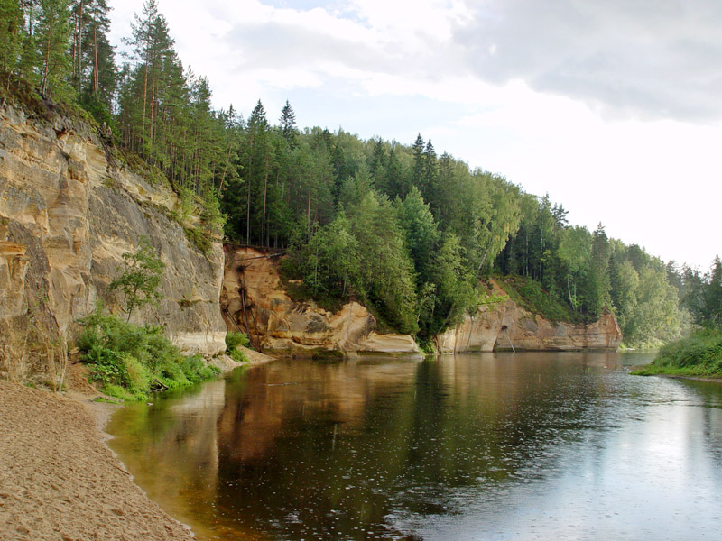
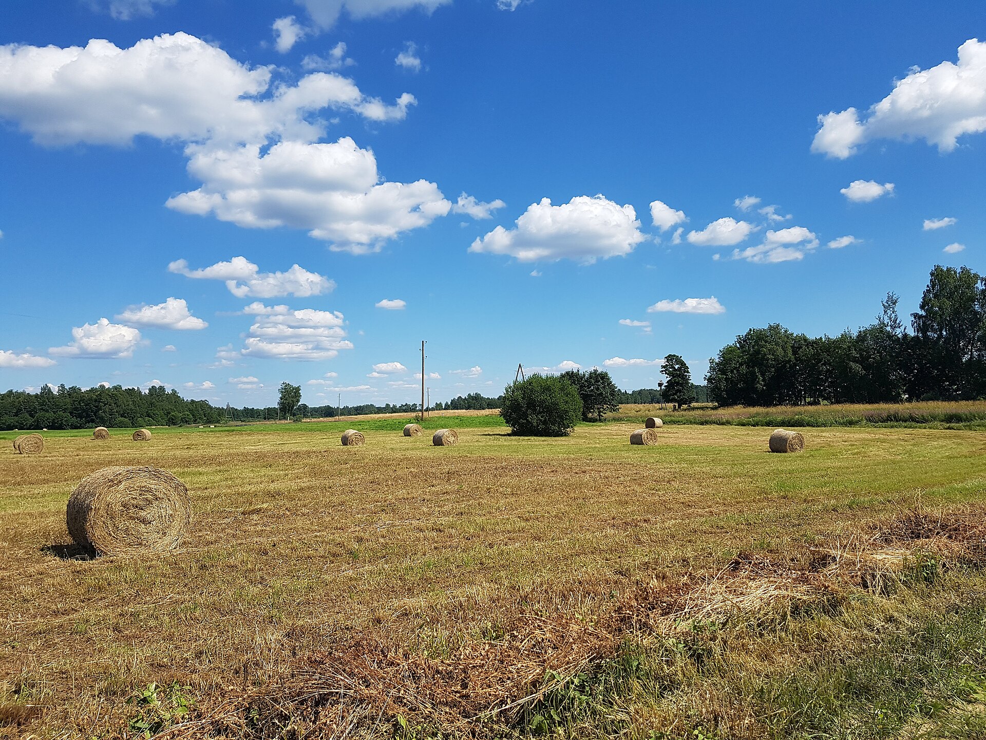
A terrestrial area, with forests.
Which international labels apply to Kuja Nature Park?
Natura 2000 network (1 site: “Kuja”).
When is the best time to visit Kuja Nature Park?
Mildest period: July and August, with average temperatures of 17 to 19 °C.
Is there snow in Kuja Nature Park?
Yes. According to NASA's MODIS satellites (2015–2025 average), snow covers most of the site from December to February, with about 95 snow-covered days a year on average.
What is there to see in Kuja Nature Park?
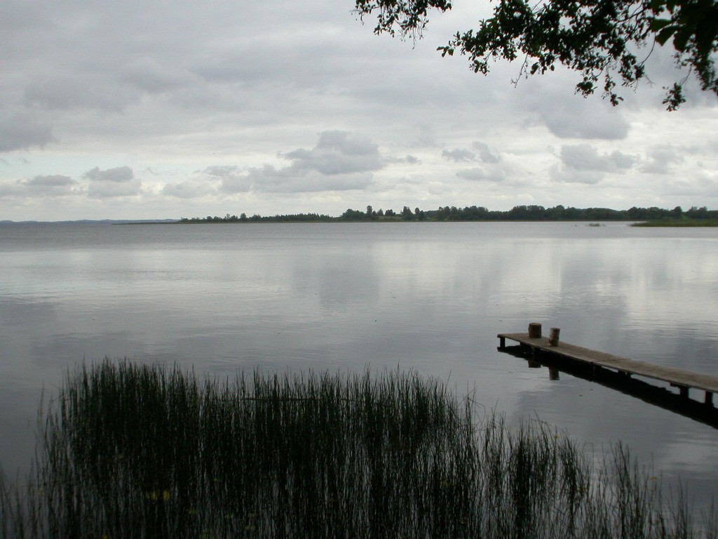
Ižezers (lake or pond) (Wikidata).
Are there historic monuments in Kuja Nature Park?
Yes. According to Wikidata, one monument listed in the Latvian register of cultural monuments of national significance stands within the boundary. For example: “Ižezera ezera mītne” in Sarkaņu pagasts.
What is the nearest airport to Kuja Nature Park?
Nearest airport: Riga (RIX), about 140 km away.
How can I reach Kuja Nature Park by train?
The nearest railway station is Madona, about 4 km from the site boundary.
Which species can be seen in Kuja Nature Park?
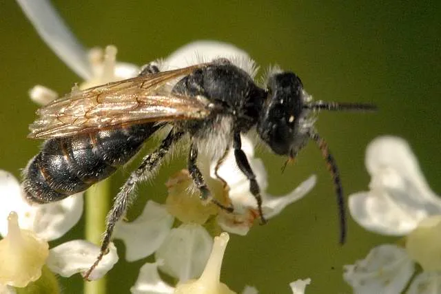
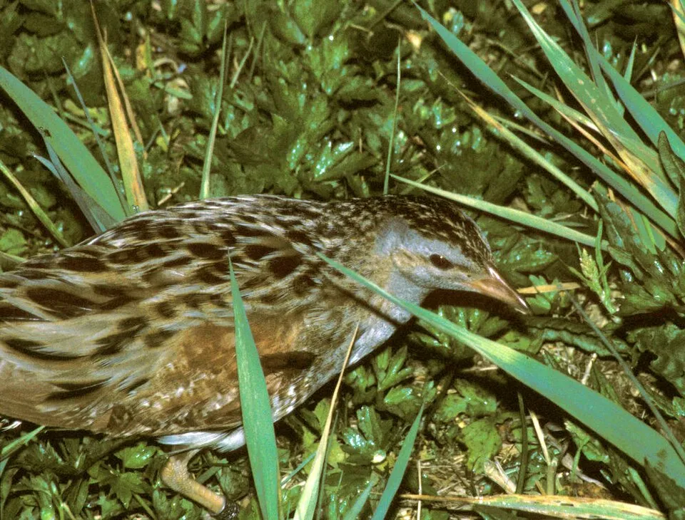
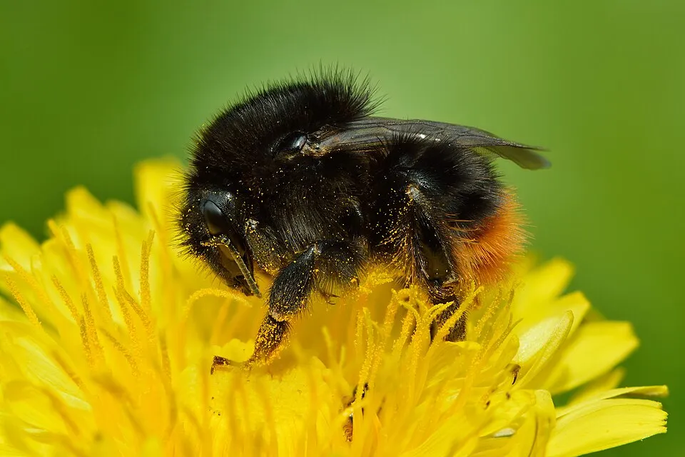
Among the species most often recorded on GBIF are Lasioglossum zonulum (Bull-headed Furrow Bee), Crex crex (Corn Crake), Anas platyrhynchos (Mallard) and Bombus ruderarius (Red-shanked Carder Bee).
© OpenStreetMap
Download the boundary: GeoJSON · GPX Boundary © OpenStreetMap contributors (ODbL).
Geography
The representative point of the site lies at around 96 m above sea level. Over the 1996–2025 period, the mean annual temperature is about 6.8 °C and total precipitation reaches roughly 723 mm per year. The warmest month is usually July, the coolest January, and the wettest June.
Area
- Area
- 10,788 ha
- Elevation
- 96 m
- Snow cover
- ≈ 95 days a year
- Coordinates
- 56.8703, 26.3897
Climate
● Mean temperature (°C) · ▮ Precipitation (mm)
Source: Copernicus ERA5-Land (C3S, doi:10.24381/cds.68d2bb30), monthly averages 1996–2025 interpolated to the representative point, temperatures adjusted for elevation.
Contains modified Copernicus Climate Change Service information 2026. Neither the European Commission nor ECMWF is responsible for any use that may be made of the Copernicus information or data it contains.
Snow cover measured by satellite
J
F
M
A
M
J
J
A
S
O
N
D
average share of the site under snow · snowiest parts · ≈ 95 days a year
Snow cover: MODIS/Terra MOD10CM v61 (Hall & Riggs, 2021, NASA NSIDC DAAC, doi:10.5067/MODIS/MOD10CM.061), imagery from NASA GIBS (ESDIS); 2015–2025 average, grid of about 5 km.
Natural habitats
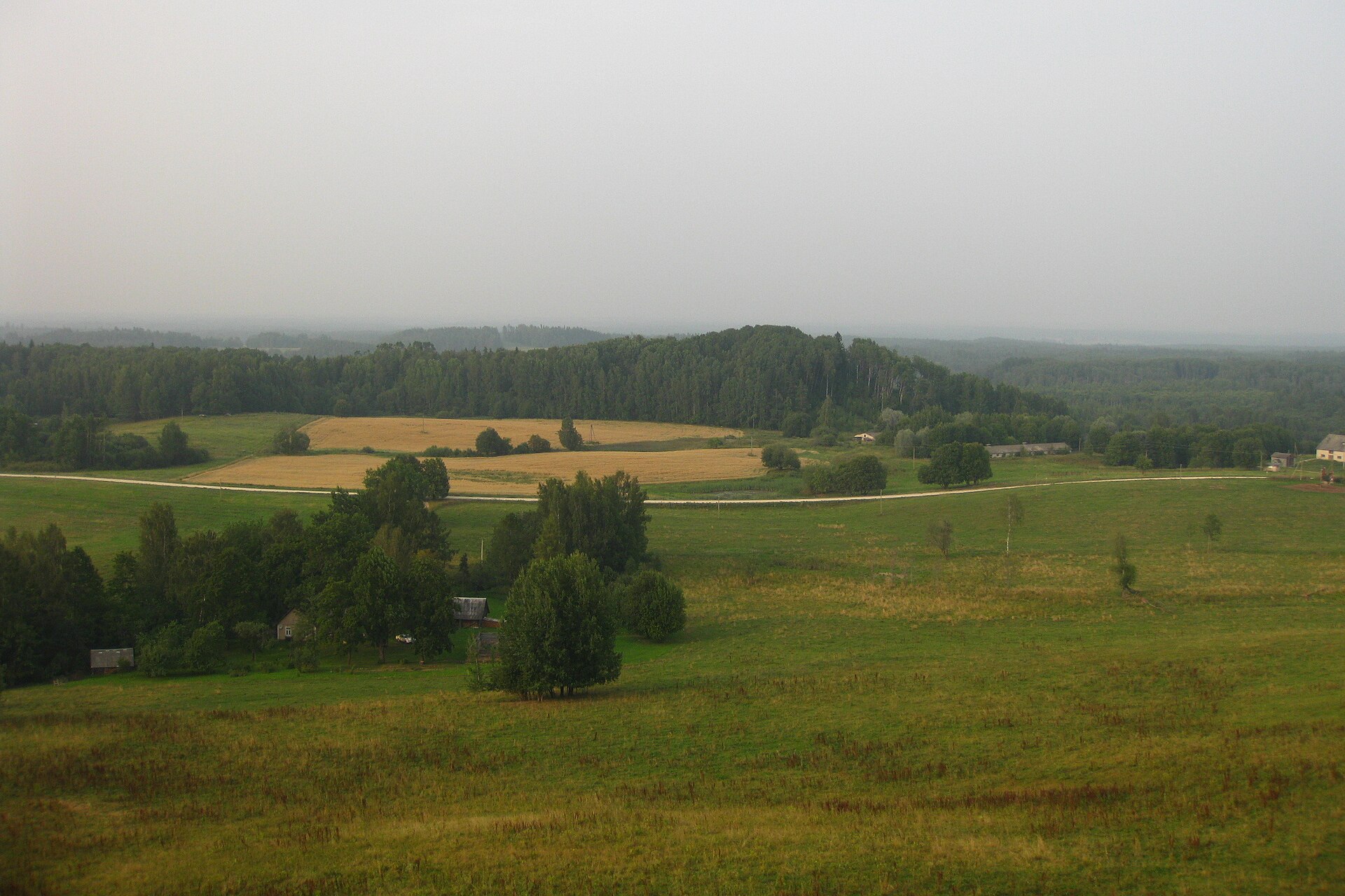
According to CORINE Land Cover (2018), the site is mainly made up of grassland and meadows (38%), forests (37%) and farmland (16%). Woodland is mostly broadleaved. The land is almost flat (mean slope under 2°). The Natura 2000 site overlapping the area lists 15 habitats of European interest (8 priority), the most extensive being northern boreal alluvial meadows, Fennoscandian lowland species-rich dry to mesic grasslands and western Taïga.
Biodiversity
Based on occurrences aggregated by GBIF, several species are regularly recorded within the site. Among the most frequent are Lasioglossum zonulum (Bull-headed Furrow Bee), Crex crex (Corn Crake), Anas platyrhynchos (Mallard) and Bombus ruderarius (Red-shanked Carder Bee). The full list of documented taxa is shown below. The overlapping Natura 2000 site lists 53 species of European interest: 31 birds, 11 mammals, 1 amphibian, 3 fish, 4 invertebrates and 3 plants.
Habitats of European interest
From the official form of the Natura 2000 site overlapping the area (areas reported for the whole site).
- Northern boreal alluvial meadows 637 ha
- Fennoscandian lowland species-rich dry to mesic grasslands priority 508 ha
- Western Taïga priority 330 ha
- Molinia meadows on calcareous, peaty or clayey-silt-laden soils (Molinion caeruleae) 328 ha
- Fennoscandian hemiboreal natural old broad-leaved deciduous forests (Quercus, Tilia, Acer, Fraxinus or Ulmus) rich in epiphytes priority 296 ha
- Lowland hay meadows (Alopecurus pratensis, Sanguisorba officinalis) 168 ha
- Alluvial forests with Alnus glutinosa and Fraxinus excelsior (Alno-Padion, Alnion incanae, Salicion albae) priority 81 ha
- Fennoscandian deciduous swamp woods priority 73 ha
and 7 more
Species of European interest
Birds · 31
Boreal Owl (Aegolius funereus) breeding, Common Kingfisher (Alcedo atthis) breeding, Short-eared Owl (Asio flammeus) breeding, Hazel Grouse (Bonasa bonasia) resident, Ruff (Calidris pugnax) breeding, European Nightjar (Caprimulgus europaeus) breeding, White stork (Ciconia ciconia) breeding, Black Stork (Ciconia nigra) breeding, Western Marsh Harrier (Circus aeruginosus) breeding, Hen Harrier (Circus cyaneus) breeding, Montagu's Harrier (Circus pygargus) breeding, Lesser Spotted Eagle (Clanga pomarina) breeding and 19 more
Mammals · 11
Grey wolf (Canis lupus), Eurasian Beaver (Castor fiber), Northern Bat (Eptesicus nilssonii), Mountain Hare (Lepus timidus), Eurasian otter (Lutra lutra), Eurasian Lynx (Lynx lynx), European pine marten (Martes martes), Nathusius's pipistrelle (Pipistrellus nathusii), Brown long-eared bat (Plecotus auritus), Brown bear (Ursus arctos), Parti-coloured bat (Vespertilio murinus)
Amphibians · 1
Fish · 3
Spined loach (Cobitis taenia), European bullhead (Cottus gobio), European brook lamprey (Lampetra planeri)
Invertebrates · 4
Cucujus cinnaberinus, Green snaketail (Ophiogomphus cecilia), Eastern Hermit Beetle (Osmoderma barnabita), Thick shelled river mussel (Unio crassus)
Plants · 3
Hairy agrimony (Agrimonia pilosa), Buxbaumia moss (Buxbaumia viridis), Interrupted clubmoss (Lycopodium annotinum)
Source: Natura 2000 standard data forms (EEA, CC-BY 4.0). Not exhaustive: sensitive species are not published.
Species to look out for


Observed species
Occurrences documented via GBIF; they are neither an exhaustive inventory nor proof of current presence.
- Bull-headed Furrow Bee · Lasioglossum zonulum · 5
- Corn Crake · Crex crex · 4
- Mallard · Anas platyrhynchos · 4
- Red-shanked Carder Bee · Bombus ruderarius · 3
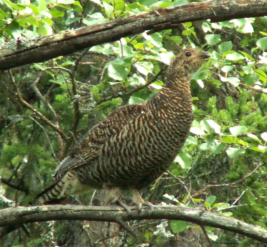
- Black Grouse · Lyrurus tetrix · 3
- Grey Partridge · Perdix perdix · 3
- Lesser spotted eagle · Aquila pomarina · 3
- Common Buzzard · Buteo buteo · 3
- Eurasian Golden Oriole · Oriolus oriolus · 3
- Common Blackbird · Turdus merula · 3
- Common Grasshopper Warbler · Locustella naevia · 3
- River warbler · Locustella fluviatilis · 3
+18 more species
- Common Cuckoo · Cuculus canorus · 3
- Broken-belted bumblebee · Bombus soroeensis · 2
- Bronze Furrow Bee · Halictus tumulorum · 2
- Six-banded Sweat Bee · Halictus sexcinctus · 2
- Common Crane · Grus grus · 2
- Great Spotted Woodpecker · Dendrocopos major · 2
- European honey buzzard · Pernis apivorus · 2
- Eurasian Sparrowhawk · Accipiter nisus · 2
- Blyth’s Reed Warbler · Acrocephalus dumetorum · 2
- Long-eared Owl · Asio otus · 2
- Glaucous sedge · Carex flacca · 2
- Jacob's Ladder · Polemonium caeruleum · 2
- Eastern Goat's-rue · Galega orientalis · 2
- Yellow Fox-and-cubs · Pilosella caespitosa · 2
- Red-backed Shrike · Lanius collurio · 2
- European Nightjar · Caprimulgus europaeus · 2
- Great tit · Parus major · 2
- Hartman's sedge · Carex hartmaniorum · 1
Records: GBIF.org (CC-BY). Names: Wikidata (CC0), GBIF. Photos: Wikimedia Commons.
Conservation challenges
The primary purpose of the site is to preserve its natural habitats and the biodiversity they support. The species recorded (Biodiversity tab) reflect its ecological value. The designations it holds frame its management and the control of land use.
According to Global Forest Change data (University of Maryland, Global Forest Watch), about 487 ha of tree cover were lost within the boundary between 2001 and 2023 (5% of its area), peaking in 2001 and 2009. These losses include logging, storms and fires, and do not account for regrowth. Apart from forest felling and regrowth (about 640 ha in total), land cover remained almost unchanged between 1990 and 2018 according to CORINE Land Cover. At night, the area gives off virtually no artificial light detectable from space (NASA VIIRS Black Marble composite, 2016). According to the Natura 2000 forms, of 15 assessed habitats of European interest, 2 are in excellent condition and 5 in average or reduced condition. According to the Water Framework Directive assessment (2022 river basin management plans, data 2015–2020), none of the 42 km of rivers assessed within the site reaches good ecological status; they mostly have moderate ecological status.
Pressure indicators
Tree cover lost
487 ha
2001–2023 · 5% of the area
20012023
Fires since 2016
0
No large fire mapped (fires over about 30 ha)
Light at night
0%
of the area gives off artificial light visible from space
DarkLit
Land cover change
< 0.5%
of the area changed, 1990–2018 · CORINE
forest felling and regrowth: 640 ha in total
Rivers and lakes
0%
of the 42 km of assessed rivers in good or high ecological status · WFD 2022
assessments 2015–2020
Sources: Global Forest Change (Hansen et al., University of Maryland, via Global Forest Watch, CC-BY 4.0); EFFIS, European Commission / Copernicus; NASA Black Marble 2016 (public domain); CORINE Land Cover 2018 (Copernicus) or MODIS.
CORINE Land Cover Change 1990–2018: generated using European Union's Copernicus Land Monitoring Service information (EEA), aggregated by Parkavela; DOI 10.2909/f30f1000-7cf8-43bb-872c-5eb093911b24.
Ecological status of water bodies: European Environment Agency, WISE – Water Framework Directive, 3rd river basin management plans (2022), CC BY 4.0. Official national classification, not comparable between countries.
Practical information
Cities and airport
- Airport: Riga (RIX)
140 km as the crow flies
Data © OpenStreetMap contributors (ODbL) · Wikidata (CC0)
Access and visiting
The nearest railway station is Madona, about 4 km from the site boundary. Nearest airport: Riga (RIX), about 140 km away. About 26,000 people live within 20 km of the site boundary, 13,000 of them within 10 km; some 440 people are estimated to live inside (GHSL estimate, 2020). This population has fallen by about 17% since 2000. To see: Ižezers (lake or pond). To plan a visit (access, opening periods, visitor rules), it is best to consult the official information from the managing body and the official website listed in this page's sources.
Source: OpenStreetMap (ODbL), Wikidata (CC0), October 2026.
Built heritage
According to Wikidata, one monument listed in the Latvian register of cultural monuments of national significance stands within the boundary. It is “Ižezera ezera mītne” in Sarkaņu pagasts.
-
Ižezera ezera mītne
Sarkaņu pagasts
Source: Wikidata (CC0), monuments in each country’s official heritage protection registers, at national or regional level. Each item links to its Wikidata entry.
When to visit
Mildest period: July and August, with average temperatures of 17 to 19 °C. Average temperatures drop below 0 °C from December to March: frost is common. According to NASA's MODIS satellites (2015–2025 average), snow covers most of the site from December to February, with about 95 snow-covered days a year on average. Day length ranges from about 6 h 47 min in December to 17 h 48 min in June. Wildlife records published on GBIF peak for birds (May). These peaks also reflect when observers are most active.
Source: Copernicus ERA5-Land (C3S), monthly averages 1996–2025 at the representative point, temperatures adjusted for elevation.
Contains modified Copernicus Climate Change Service information 2026. Neither the European Commission nor ECMWF is responsible for any use that may be made of the Copernicus information or data it contains.
Wildlife records calendar
JFMAMJJASOND
Birds
Monthly records published on GBIF (CC-BY), relative to the busiest month; also reflects observer activity.
Gallery
© Kaukokolkka · CC BY-SA 4.0
© J. Sedols · CC BY 3.0
© Kasparoviča · CC BY-SA 4.0
© liinis · CC BY-SA 3.0
© Martins Vabulis · CC BY-SA 4.0
© Kasparoviča · CC BY-SA 4.0
Sources and licences
- Wikidata: Q28055893
- Wikipedia: fr.wikipedia.org/wiki/Parc_naturel_de_la_Kuja
- Natura 2000: LV0304200
- WDPA: 181933
References
- cds.climate.copernicus.eu: climate · CC-BY-4.0
- registry.opendata.aws: elevation of the reference point, detailed relief · PD
- land.copernicus.eu: land cover, land cover change, sea share · COPERNICUS
- doi.org: population around the site · CC-BY-4.0
- wikidata.org: official area, establishment date, protected heritage, nearby cities and airport, access and peaks, lake depths, places to see · CC0-1.0
- eea.europa.eu: bathing water quality, ecological status of waters · CC-BY-4.0
- en.eurovelo.com: EuroVelo cycle routes · ODbL-1.0
- cycling.waymarkedtrails.org: cycle routes · ODbL-1.0
- opentopodata.org: elevations · PD
- forest-fire.emergency.copernicus.eu: wildfires · COPERNICUS
- globalforestwatch.org: tree cover loss · CC-BY-4.0
- gbif.org: seasonality of sightings, invasive alien species, observed species · CC-BY-4.0
- hydrosheds.org: lakes · CC-BY-4.0
- natura2000.eea.europa.eu: Natura 2000 habitats and species · CC-BY-4.0
- openstreetmap.org: official name, access and peaks, trail difficulty · ODbL-1.0
- earthobservatory.nasa.gov: night light · PD
- nsidc.org: snow cover · PD
- wikidata.org: Wikipedia article · CC-BY-SA-4.0
Data © OpenStreetMap contributors (ODbL), Wikidata (CC0) and the sources cited.