Austria · Terrestrial
Hohe Tauern National Park
National park of 185,600 hectares in Austria, established in 1981.
Overview
National park of 185,600 hectares in Austria, established in 1981.
Hohe Tauern National Park is located in Austria (Europe). It is a predominantly terrestrial area. Established in 1981, it covers about 185,600 hectares.
Protections and designations
Natura 2000 · habitats (SAC) · 3 sites
- Hohe Tauern, Kärnten I AT2101000
- Hohe Tauern, Salzburg AT3210001
- Hohe Tauern, Tirol AT3301000
Natura 2000 · birds (SPA) · 3 sites
- Hohe Tauern, Kärnten II AT2129000
- Hohe Tauern, Salzburg AT3210001
- Hohe Tauern, Tirol AT3301000
World Heritage tentative list
Other designations
Protected as a national park. International labels and designations: Natura 2000 network (4 sites). Key dates: established in 1981, first Natura 2000 site under the Birds Directive in 1996 and first Natura 2000 site under the Habitats Directive in 2003.
In our collections
Timeline
-
1981
Established
-
1996
First Natura 2000 site under the Birds Directive 3 such sites designated up to 2002
-
2003
First Natura 2000 site under the Habitats Directive 3 such sites designated up to 2015
Sources: Wikidata (CC0) for establishment and international labels; EEA Natura 2000 database (CC-BY 4.0) for site designation dates.
Frequently asked questions
Where is Hohe Tauern National Park?
In Austria (Europe). Representative point: 47.1356° N, 12.3253° E.
How large is Hohe Tauern National Park?
About 185,600 hectares (1,856 km²). It is the largest of the 6 national parks in Austria covered by Parkavela.
When was Hohe Tauern National Park established?
In 1981.
What habitats and landscapes does Hohe Tauern National Park include?
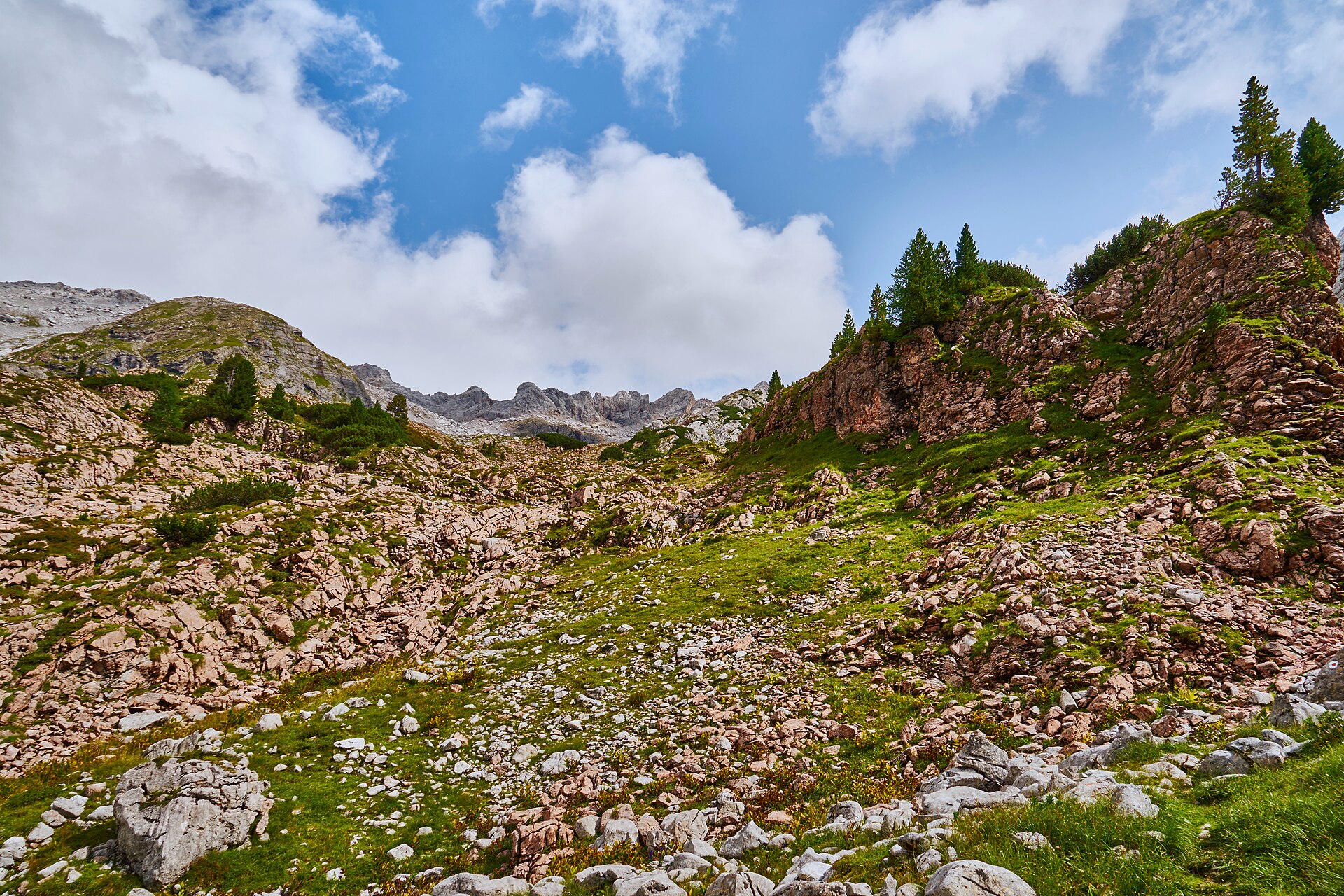
A terrestrial area, with mountains.
What rocks lie beneath Hohe Tauern National Park?
According to the European 1:1 million geological map (EGDI), the bedrock consists mainly of mica schists (56% of sampled points) and gneiss (25%). These are mostly metamorphic rocks. The geological units date mainly from the Paleozoic (50% of sampled points).
What is the highest point of Hohe Tauern National Park?
Großglockner, at 3,798 m (OpenStreetMap).
What are the main summits of Hohe Tauern National Park?
Großglockner (3,798 m), Kleinglockner (3,770 m), Pöschlturm (3,722 m), Hörtnaglturm (3,719 m) and Gerinturm (3,718 m) (OpenStreetMap).
Which international labels apply to Hohe Tauern National Park?
Natura 2000 network (4 sites).
When is the best time to visit Hohe Tauern National Park?
Mildest period: July and August, with average temperatures of 4 to 5 °C.
Is there snow in Hohe Tauern National Park?
Yes. According to NASA's MODIS satellites (2015–2025 average), snow covers most of the site from November to May, and until June on higher ground, with about 215 snow-covered days a year on average. Permanent snow remains on the summits even in midsummer.
What is there to see in Hohe Tauern National Park?
5 waterfalls, 75 lakes and ponds and 114 glaciers, including Krimmler Wasserfälle (1,090 m), Sandersee (2,072 m), Gradötzkees and Jungfernsprung (Wikidata).
Where can I stay in Hohe Tauern National Park?
45 mountain huts, including Erzherzog-Johann-Hütte (3,454 m), Zittelhaus (3,106 m) and Oberwalderhütte (2,973 m) (Wikidata).
Are there historic monuments in Hohe Tauern National Park?
Yes. According to Wikidata, 25 monuments listed as protected monuments in Austria stand within the boundary. For example: “Summit cross of Großglockner” in Heiligenblut am Großglockner, “Alte Prager Hütte” in Matrei in Osttirol and “Felsenkapelle Gschlößtal” in Matrei in Osttirol.
What is the nearest large city to Hohe Tauern National Park?
Nearest towns of over 50,000 people, as the crow flies: Innsbruck (53 km) and Villach (53 km). Nearest airport: Innsbruck (INN), about 56 km away.
How can I reach Hohe Tauern National Park by train?
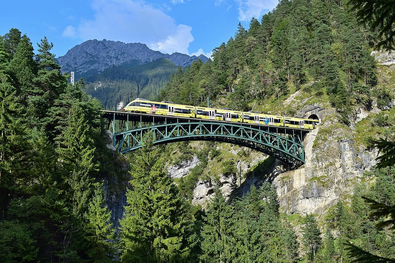
The nearest railway station is Mallnitz-Obervellach, less than 1 km from the site boundary.
Where can I get visitor information on site?
Besucherzentrum Kaiser-Franz-Josefs-Höhe, Nationalparkhaus Matrei in Osttirol and Informationszentrum Glocknerwinkel.
Are there waymarked hiking trails in Hohe Tauern National Park?
Yes. Waymarked hiking routes listed in OpenStreetMap: 283, including Alpe Adria Trail, Arnoweg (Die Keesberge I.), Arnoweg (Gras- und Nockberge) and Arnoweg (Die Keesberge II.). The “Zentralalpenweg 02” route runs for about 150 km through the site, with some 3,490 m of ascent on its longest section.
Which species can be seen in Hohe Tauern National Park?
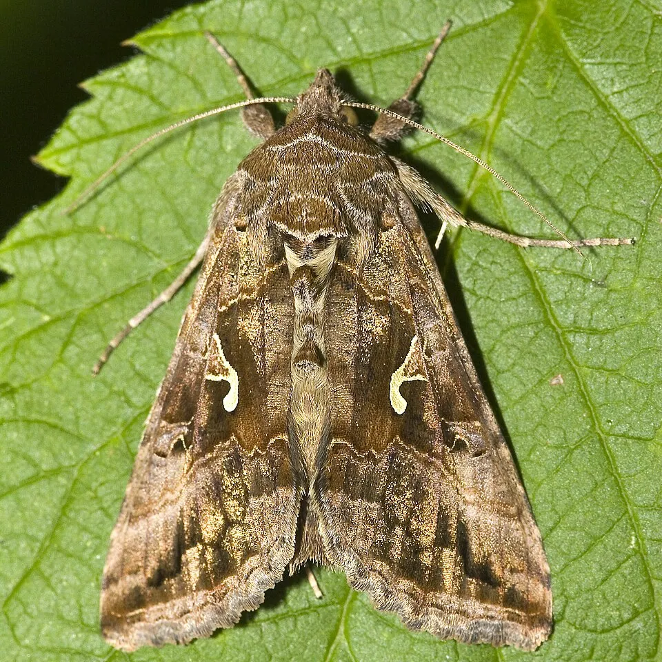
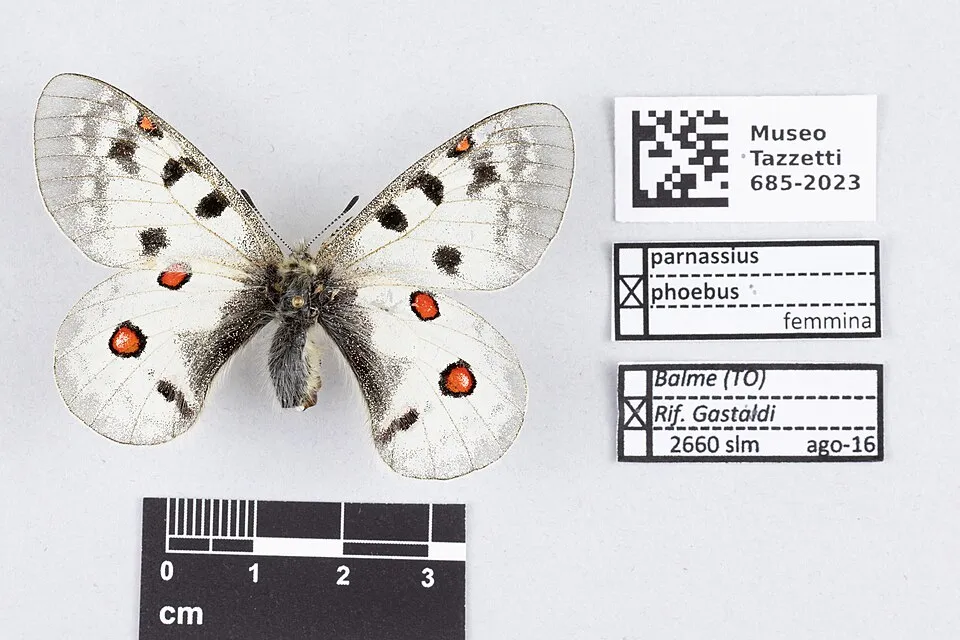
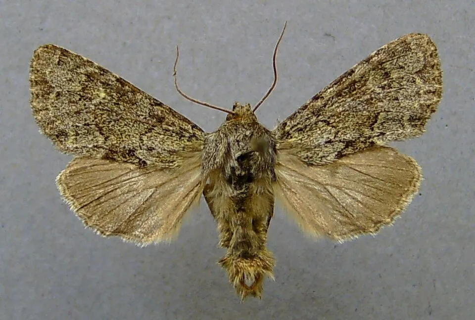
Among the species most often recorded on GBIF are Autographa gamma (Silver Y), Hada plebeja (The shears), Apamea maillardi and Parnassius phoebus (Small Apollo).
What is the official website of Hohe Tauern National Park?
© OpenStreetMap
Download the boundary: GeoJSON · GPX Boundary © OpenStreetMap contributors (ODbL).
Geography
The representative point of the site lies at around 2,949 m above sea level. Over the 1996–2025 period, the mean annual temperature is about -5.1 °C and total precipitation reaches roughly 1,572 mm per year. The warmest month is usually August, the coolest January, and the wettest July. According to the European 1:1 million geological map (EGDI), the bedrock consists mainly of mica schists (56% of sampled points) and gneiss (25%). These are mostly metamorphic rocks. The geological units date mainly from the Paleozoic (50% of sampled points). In 2016, 487 glaciers covered 143 km² within the site (Sentinel-2 glacier inventory of the Alps). The site contains 4 lakes larger than 10 ha as well as part of another lake (Tauernmoossee), totalling 1.0 km² of water; the largest, Kratzenbergsee, covers 21 ha (HydroLAKES).
Area
- Area
- 185,600 ha
- Elevation
- 2,949 m
- Median elevation
- 2,371 m
- Mean slope
- 27°
- Snow cover
- ≈ 215 days a year
- Lakes over 10 ha
- 4 (1.0 km²)
- Coordinates
- 47.1356, 12.3253
Terrain: Mapzen Terrain Tiles (SRTM, USGS; © offene Daten Österreichs – Digitales Geländemodell (DGM) Österreich, CC BY 3.0 AT) · Lakes: HydroLAKES (Messager et al. 2016, hydrosheds.org, CC BY 4.0) · depths: Wikidata (CC0)
Elevation bands
- 1,000–1,500 m 3%
- 1,500–2,000 m 17%
- 2,000–2,500 m 42%
- 2,500–3,000 m 33%
- above 3,000 m 5%
share of the site in each elevation band (smoothed terrain model: summits are rounded off) · Terrain: Mapzen Terrain Tiles (SRTM, USGS; © offene Daten Österreichs – Digitales Geländemodell (DGM) Österreich, CC BY 3.0 AT)
Bedrock
- Mica schists 56 %
- Gneiss 25 %
- Granites 6 %
- Phyllites and slates 6 %
- Marbles 6 %
Metamorphic rocks 94 % · Igneous rocks 6 % · Main age: Paleozoic (50%)
Source: EGDI 1:1M geological map (EuroGeoSurveys and national geological surveys), CC BY 4.0 · 16 sampled points within the site.
Main summits
- Großglockner3,798 m
- Kleinglockner3,770 m
- Pöschlturm3,722 m
- Hörtnaglturm3,719 m
- Gerinturm3,718 m
- Draschturm3,716 m
- Hofmannspitze3,711 m
- Glocknerhorn3,680 m
- Teufelshorn3,677 m
- Grögerschneid3,660 m
Data © OpenStreetMap contributors (ODbL)
Climate
● Mean temperature (°C) · ▮ Precipitation (mm)
Source: Copernicus ERA5-Land (C3S, doi:10.24381/cds.68d2bb30), monthly averages 1996–2025 interpolated to the representative point, temperatures adjusted for elevation.
Contains modified Copernicus Climate Change Service information 2026. Neither the European Commission nor ECMWF is responsible for any use that may be made of the Copernicus information or data it contains.
Snow cover measured by satellite
J
F
M
A
M
J
J
A
S
O
N
D
average share of the site under snow · snowiest parts · ≈ 215 days a year
Snow cover: MODIS/Terra MOD10CM v61 (Hall & Riggs, 2021, NASA NSIDC DAAC, doi:10.5067/MODIS/MOD10CM.061), imagery from NASA GIBS (ESDIS); 2015–2025 average, grid of about 5 km.
Natural habitats
According to CORINE Land Cover (2018), the site is mainly made up of bare rock and scree (35%), grassland and meadows (26%) and sparsely vegetated land (20%). Elevation ranges from about 1,300 m to 3,798 m (highest point: Großglockner). Median elevation is 2,371 m, and 38% of the site lies above 2,500 m (SRTM and DGM Österreich elevation models). The terrain is steep: 39% of slopes exceed 30° (mean slope 27°). The 4 Natura 2000 sites overlapping the area list 31 habitats of European interest (7 priority), the most extensive being siliceous alpine and boreal grasslands, siliceous scree of the montane to snow levels (Androsacetalia alpinae and Galeopsietalia ladani) and permanent glaciers.
Biodiversity
Based on occurrences aggregated by GBIF, several species are regularly recorded within the site. Among the most frequent are Autographa gamma (Silver Y), Hada plebeja (The shears), Apamea maillardi and Parnassius phoebus (Small Apollo). The full list of documented taxa is shown below. The overlapping Natura 2000 sites list 119 species of European interest: 95 birds, 13 mammals, 2 amphibians, 1 fish, 4 invertebrates and 4 plants.
Habitats of European interest
From the official forms of the 4 Natura 2000 sites overlapping the area (areas reported for each whole site).
- Siliceous alpine and boreal grasslands 37,265 ha
- Siliceous scree of the montane to snow levels (Androsacetalia alpinae and Galeopsietalia ladani) 23,873 ha
- Permanent glaciers 22,770 ha
- Siliceous rocky slopes with chasmophytic vegetation 12,426 ha
- Species-rich Nardus grasslands, on silicious substrates in mountain areas (and submountain areas in Continental Europe) priority 10,564 ha
- Alpine Larix decidua and/or Pinus cembra forests 6,935 ha
- Acidophilous Picea forests of the montane to alpine levels (Vaccinio-Piceetea) 6,577 ha
- Alpine and Boreal heaths 3,828 ha
and 23 more
Species of European interest
Birds · 95
Redpoll (Acanthis flammea) breeding, Marsh Warbler (Acrocephalus palustris) breeding, Common Sandpiper (Actitis hypoleucos) breeding, Boreal Owl (Aegolius funereus) breeding resident, Eurasian Skylark (Alauda arvensis) breeding, Rock Partridge (Alectoris graeca saxatilis) breeding resident, Water Pipit (Anthus spinoletta) breeding, Tree Pipit (Anthus trivialis) breeding, Common Swift (Apus apus) passage breeding, Golden Eagle (Aquila chrysaetos) breeding resident, Hazel Grouse (Bonasa bonasia) breeding resident, Eurasian Eagle-owl (Bubo bubo) resident and 83 more
Mammals · 13
Barbastelle (Barbastella barbastellus), Northern Bat (Eptesicus nilssoni), Northern Bat (Eptesicus nilssonii), Eurasian otter (Lutra lutra), Eurasian Lynx (Lynx lynx), Hazel dormouse (Muscardinus avellanarius), Brandt's Bat (Myotis brandtii), Daubenton's bat (Myotis daubentonii), Greater mouse-eared bat (Myotis myotis), Whiskered bat (Myotis mystacinus), Common pipistrelle (Pipistrellus pipistrellus), Lesser horseshoe bat (Rhinolophus hipposideros) and 1 more
Fish · 1
Invertebrates · 4
Marsh fritillary (Euphydryas aurinia), Hermit beetle (Osmoderma eremita), Apollo (Parnassius apollo), Large blue (Phengaris arion)
Plants · 4
Buxbaumia moss (Buxbaumia viridis), Lady's-slipper orchid (Cypripedium calceolus), Hamatocaulis moss (Hamatocaulis vernicosus), Carinthian earwort (Scapania carinthiaca)
Source: Natura 2000 standard data forms (EEA, CC-BY 4.0). Not exhaustive: sensitive species are not published.
Species to look out for

Observed species
Occurrences documented via GBIF; they are neither an exhaustive inventory nor proof of current presence.
- Silver Y · Autographa gamma · 351
- The shears · Hada plebeja · 327
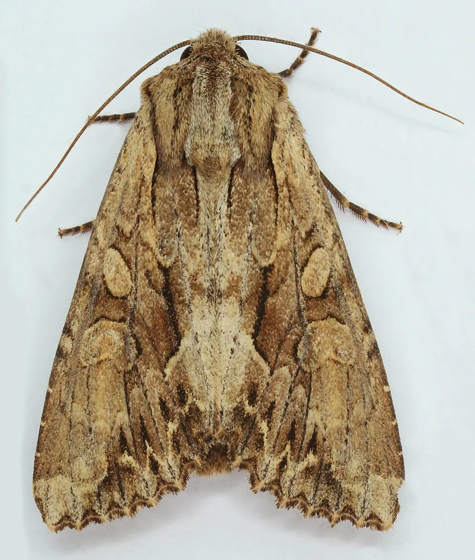
- Apamea maillardi · 297
- Small Apollo · Parnassius phoebus · 293
- Apamea zeta · 265
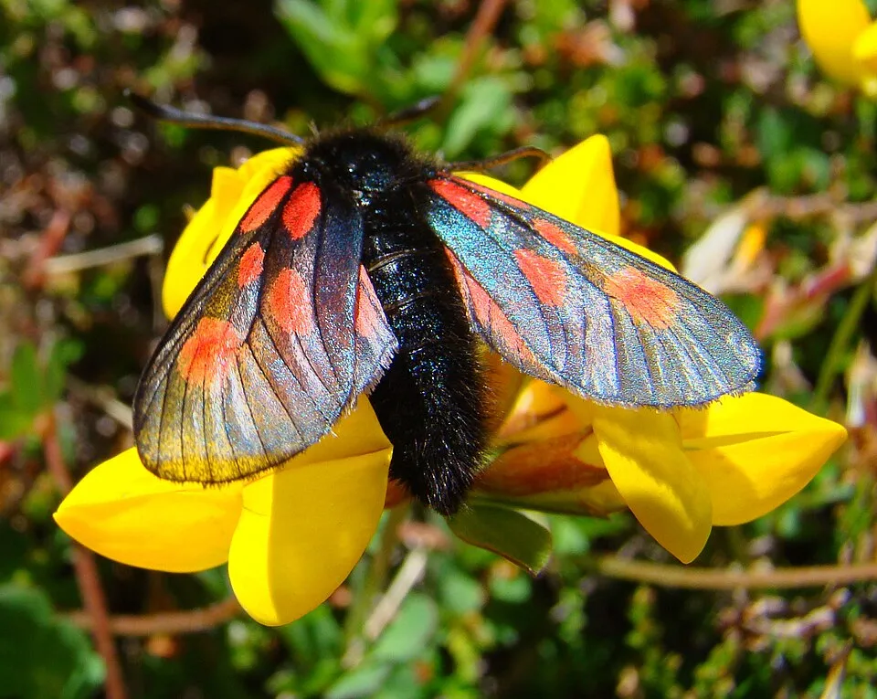
- Scotch Burnet · Zygaena exulans · 260
- Dark Arches · Apamea monoglypha · 219
- Chersotis ocellina · 214
- Large Yellow Underwing · Noctua pronuba · 204
- Ingrailed Clay · Diarsia mendica · 200
- Agrotis fatidica · 197
- Grey Mountain Carpet · Entephria caesiata · 192
+18 more species
- Standfussiana wiskotti · 185
- Dew Moth · Setina irrorella · 178
- Black Redstart · Phoenicurus ochruros · 177
- Glaucous shears · Papestra biren · 172
- Dark brocade · Mniotype adusta · 170
- Epipsilia grisescens · 168
- Syngrapha hochenwarthi · 163
- Golden Eagle · Aquila chrysaetos · 159
- Wood tiger · Parasemia plantaginis · 152
- Pearly heath · Coenonympha arcania · 152
- Antler Moth · Cerapteryx graminis · 150
- Bearded vulture · Gypaetus barbatus · 149
- Clouded-bordered brindle · Apamea crenata · 147
- Griffon Vulture · Gyps fulvus · 147
- Shepherd’s Fritillary · Boloria pales · 147
- Gold Spangle · Autographa bractea · 144
- Scotch Annulet · Gnophos obfuscata · 144
- Northern Raven · Corvus corax · 142
Records: GBIF.org (CC-BY). Names: Wikidata (CC0), GBIF. Photos: Wikimedia Commons.
Conservation challenges
The primary purpose of the site is to preserve its natural habitats and the biodiversity they support. The species recorded (Biodiversity tab) reflect its ecological value. The designations it holds frame its management and the control of land use.
According to Global Forest Change data (University of Maryland, Global Forest Watch), about 1,260 ha of tree cover were lost within the boundary between 2001 and 2023 (under 1% of its area), peaking in 2019 and 2020. These losses include logging, storms and fires, and do not account for regrowth. According to CORINE Land Cover, land cover here remained almost unchanged between 1990 and 2018 (less than 0.5% of the area affected). At night, the area gives off virtually no artificial light detectable from space (NASA VIIRS Black Marble composite, 2016). According to the Natura 2000 forms, of 28 assessed habitats of European interest, 24 are in excellent condition and the rest in good condition. According to the Water Framework Directive assessment (2022 river basin management plans, data 2016–2021), 97% of the 353 km of rivers assessed within the site are in good or high ecological status. Other assessed water bodies: lakes, 3 of 3 in good ecological status or better. Invasive alien species have been recorded within the site since 2000 (GBIF observations), one of them listed as of Union concern. Among them: Reynoutria sachalinensis (Giant Knotweed), Matricaria discoidea (Pineappleweed) and Cygnus olor (Mute Swan).
Pressure indicators
Tree cover lost
1,255 ha
2001–2023 · < 1% of the area
20012023
Fires since 2016
0
No large fire mapped (fires over about 30 ha)
Light at night
0%
of the area gives off artificial light visible from space
DarkLit
Land cover change
< 0.5%
of the area changed, 1990–2018 · CORINE
Rivers and lakes
97%
of the 353 km of assessed rivers in good or high ecological status · WFD 2022
Lakes: 3 of 3 good or better
assessments 2016–2021
Invasive alien species
3
incl. 1 of EU concern · since 2000
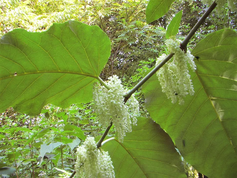 Giant KnotweedEU
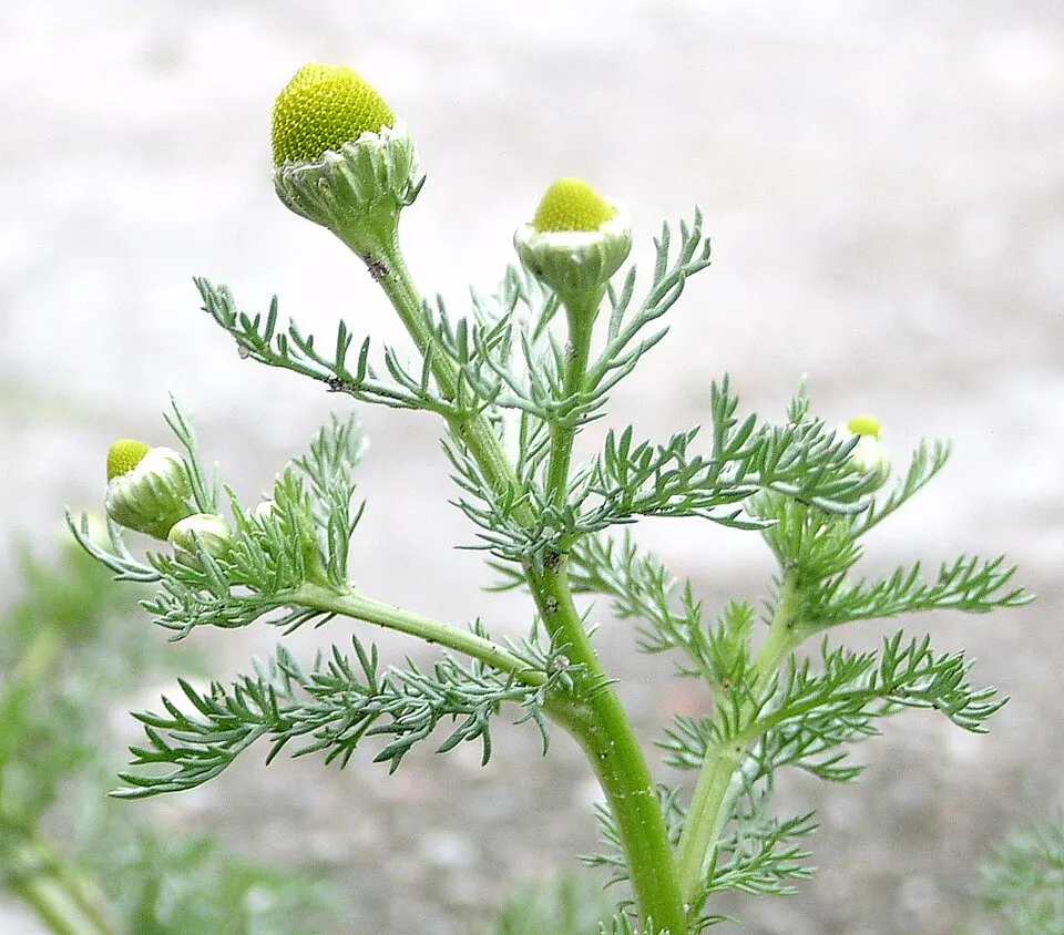 Pineappleweed
 Mute Swan
Photos: Giant Knotweed © Velocicaptor · Public domain; Pineappleweed © Krzysztof Ziarnek · CC BY-SA 3.0; Mute Swan © Geni · CC BY-SA 4.0
Sources: Global Forest Change (Hansen et al., University of Maryland, via Global Forest Watch, CC-BY 4.0); EFFIS, European Commission / Copernicus; NASA Black Marble 2016 (public domain); CORINE Land Cover 2018 (Copernicus) or MODIS.
CORINE Land Cover Change 1990–2018: generated using European Union's Copernicus Land Monitoring Service information (EEA), aggregated by Parkavela; DOI 10.2909/f30f1000-7cf8-43bb-872c-5eb093911b24.
Ecological status of water bodies: European Environment Agency, WISE – Water Framework Directive, 3rd river basin management plans (2022), CC BY 4.0. Official national classification, not comparable between countries.
Invasive alien species: Global Register of Introduced and Invasive Species (ISSG, CC BY 4.0); Union list, Regulation (EU) 1143/2014 (INBO, CC0); GBIF.org records (CC0 / CC BY 4.0), at least 2 per species.
Practical information
Cities and airport
- Innsbruck
53 km as the crow flies - Villach
53 km as the crow flies - Airport: Innsbruck (INN)
56 km as the crow flies
Visitor information
- Besucherzentrum Kaiser-Franz-Josefs-Höhe
within the site - Nationalparkhaus Matrei in Osttirol
2 km from the site boundary - Informationszentrum Glocknerwinkel
< 1 km from the site boundary - Bergführer Heiligenblut
< 1 km from the site boundary
Parking
8 public car parks listed within the site
Parkplatz HinterseeSchöneckFleckweide
Things to see
5 waterfalls · 75 lakes and ponds · 114 glaciers
- Krimmler Wasserfälle
waterfall · 1,090 m - Sandersee
lake or pond · 2,072 m - Gradötzkees
glacier - Jungfernsprung
waterfall - Stappitzer See
lake or pond · 1,273 m
Where to stay
45 mountain huts
- Erzherzog-Johann-Hütte
mountain hut · 3,454 m - Zittelhaus
mountain hut · 3,106 m - Oberwalderhütte
mountain hut · 2,973 m - Defreggerhaus
mountain hut · 2,963 m - Heinrich-Schwaiger-Haus
mountain hut · 2,802 m
Hiking
283 waymarked routes listed, including:
Alpe Adria TrailArnoweg (Die Keesberge I.)Arnoweg (Gras- und Nockberge)Arnoweg (Die Keesberge II.)ZentralalpenwegRupertiweg
Data © OpenStreetMap contributors (ODbL) · Wikidata (CC0)
Waymarked hiking routes
AATE01 Alpe Adria Trail E01
6.6 km within the site ↗ 97 m↘ 546 m 1,903–2,360 m
up to T3 · demanding mountain hiking
Arnoweg (Die Keesberge II.)
23.3 km within the site ↗ 375 m↘ 1,552 m 1,596–3,108 m
up to T6 · difficult alpine hiking
02 Zentralalpenweg 02
150.3 km within the site ↗ 3,490 m↘ 2,989 m 1,677–3,497 m
up to T6 · difficult alpine hiking
02B Zentralalpenweg 02B Variante Sonnblick - AltePragerHuette
32.4 km within the site ↗ 1,063 m↘ 1,092 m 2,022–2,824 m
KGW Kärntner Grenzweg
79.4 km within the site ↗ 2,103 m↘ 1,546 m 1,959–2,906 m
up to T6 · difficult alpine hiking
Tracks © OpenStreetMap contributors (ODbL), clipped to the boundary; elevation gain and profiles computed on the longest section from Mapzen Terrain Tiles (≈ 30 m), indicative only. Indicative difficulty (SAC scale, OpenStreetMap, via Waymarked Trails): check with the park.
Access and visiting
The nearest railway station is Mallnitz-Obervellach, less than 1 km from the site boundary. Nearest towns of over 50,000 people, as the crow flies: Innsbruck (53 km) and Villach (53 km). Nearest airport: Innsbruck (INN), about 56 km away. About 240,000 people live within 20 km of the site boundary, 110,000 of them within 10 km; some 3,000 people are estimated to live inside (GHSL estimate, 2020). Visitor information on site: Besucherzentrum Kaiser-Franz-Josefs-Höhe, Nationalparkhaus Matrei in Osttirol and Informationszentrum Glocknerwinkel. Public car parks listed within the site: 8, including Parkplatz Hintersee, Schöneck and Fleckweide. Waymarked hiking routes listed in OpenStreetMap: 283, including Alpe Adria Trail, Arnoweg (Die Keesberge I.), Arnoweg (Gras- und Nockberge) and Arnoweg (Die Keesberge II.). To see: 5 waterfalls, 75 lakes and ponds and 114 glaciers, including Krimmler Wasserfälle (1,090 m), Sandersee (2,072 m), Gradötzkees and Jungfernsprung. Where to stay: 45 mountain huts, including Erzherzog-Johann-Hütte (3,454 m), Zittelhaus (3,106 m) and Oberwalderhütte (2,973 m). To plan a visit (access, opening periods, visitor rules), it is best to consult the official information from the managing body and the official website listed in this page's sources.
Source: OpenStreetMap (ODbL), Wikidata (CC0), October 2026.
Built heritage
According to Wikidata, 25 monuments listed as protected monuments in Austria stand within the boundary. Among them are 2 religious buildings. Examples include “Summit cross of Großglockner” in Heiligenblut am Großglockner, “Alte Prager Hütte” in Matrei in Osttirol and “Felsenkapelle Gschlößtal” in Matrei in Osttirol.
-
Summit cross of Großglockner
Heiligenblut am Großglockner · 19th c. -
Alte Prager Hütte
Matrei in Osttirol · 19th c. -
Felsenkapelle Gschlößtal
Matrei in Osttirol -
Jagdhaus 1
St. Jakob in Defereggen -
Krimmler Tauernweg im Windbachtal
Krimml -
Mallnitzer Tauernhaus
Mallnitz -
Neue Prager Hütte
Matrei in Osttirol · 20th c. -
Rojacherhütte
Rauris · 19th c.
and 17 more
Source: Wikidata (CC0), monuments in each country’s official heritage protection registers, at national or regional level. Each item links to its Wikidata entry.
When to visit
Mildest period: July and August, with average temperatures of 4 to 5 °C. Average temperatures drop below 0 °C from October to May: frost is common. Precipitation peaks from June to August (up to 210 mm per month). These averages apply to the site's representative point (2,949 m); higher up it is markedly cooler and snow lasts longer. According to NASA's MODIS satellites (2015–2025 average), snow covers most of the site from November to May, and until June on higher ground, with about 215 snow-covered days a year on average. Permanent snow remains on the summits even in midsummer. Day length ranges from about 8 h 30 min in December to 15 h 53 min in June. Wildlife records published on GBIF peak for birds (July), plants (July), butterflies and moths (July), dragonflies (July and August) and mammals (July and August). These peaks also reflect when observers are most active.
Source: Copernicus ERA5-Land (C3S), monthly averages 1996–2025 at the representative point, temperatures adjusted for elevation.
Contains modified Copernicus Climate Change Service information 2026. Neither the European Commission nor ECMWF is responsible for any use that may be made of the Copernicus information or data it contains.
Wildlife records calendar
JFMAMJJASOND
Birds
Plants
Butterflies & moths
Dragonflies
Mammals
Monthly records published on GBIF (CC-BY), relative to the busiest month; also reflects observer activity.
Gallery
© Nationalpark Hohe Tauern · Public domain
© Uoaei1 · CC BY-SA 4.0
© C.Stadler/Bwag · CC BY-SA 4.0
© Alexander-93 · CC BY-SA 4.0
© Michael Schmid · CC BY-SA 3.0
© Mallnitzer · CC BY-SA 4.0
Sources and licences
- Wikidata: Q696014
- OpenStreetMap: relation 1766290
- Official website: https://hohetauern.at
- Wikipedia: en.wikipedia.org/wiki/Hohe_Tauern_National_Park
- WDPA: 555596205
References
- cds.climate.copernicus.eu: climate · CC-BY-4.0
- registry.opendata.aws: elevation of the reference point, detailed relief · CC-BY-3.0
- doi.org: glaciers, population around the site · CC-BY-4.0
- land.copernicus.eu: land cover, land cover change, sea share · COPERNICUS
- wikidata.org: official area, highest point, establishment date, protected heritage, nearby cities and airport, access and peaks, lake depths, places to see, official website · CC0-1.0
- eea.europa.eu: bathing water quality, ecological status of waters · CC-BY-4.0
- en.eurovelo.com: EuroVelo cycle routes · ODbL-1.0
- cycling.waymarkedtrails.org: cycle routes · ODbL-1.0
- opentopodata.org: elevations · PD
- forest-fire.emergency.copernicus.eu: wildfires · COPERNICUS
- globalforestwatch.org: tree cover loss · CC-BY-4.0
- gbif.org: seasonality of sightings, invasive alien species, observed species · CC-BY-4.0
- europe-geology.eu: geology · CC-BY-4.0
- hydrosheds.org: lakes · CC-BY-4.0
- natura2000.eea.europa.eu: Natura 2000 habitats and species · CC-BY-4.0
- openstreetmap.org: official name, access and peaks · ODbL-1.0
- earthobservatory.nasa.gov: night light · PD
- hiking.waymarkedtrails.org: route difficulty · ODbL-1.0
- nsidc.org: snow cover · PD
- wikidata.org: Wikipedia article · CC-BY-SA-4.0
Data © OpenStreetMap contributors (ODbL), Wikidata (CC0) and the sources cited.