
Mexico · Marine
Islas Marietas National Park
National park of 1,383 hectares in Mexico, established in 2005.
Overview
National park of 1,383 hectares in Mexico, established in 2005.
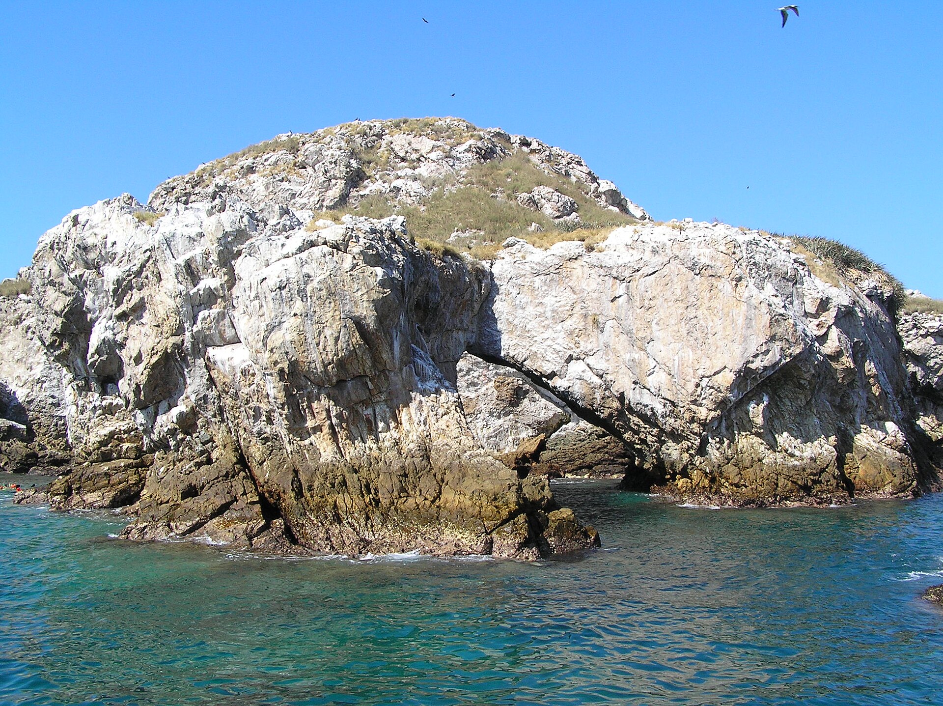
Islas Marietas National Park is located in Mexico (North America). It is a predominantly marine area. Established on 25 April 2005, it covers about 1,383 hectares.
Protections and designations
UNESCO World Heritage
UNESCO Biosphere Reserve
Ramsar site
Protected as a national park. International labels and designations: UNESCO World Heritage (“Islands and Protected Areas of the Gulf of California”), UNESCO Biosphere Reserve (“Islas Marietas”) and Ramsar site (“Marieta Islands”). Key dates: established in 2005 and World Heritage listing in 2005.
In our collections
Timeline
-
2005
Established
-
2005
Inscribed as a UNESCO World Heritage Site Islands and Protected Areas of the Gulf of California
Sources: Wikidata (CC0) for establishment and international labels; EEA Natura 2000 database (CC-BY 4.0) for site designation dates.
Frequently asked questions
Where is Islas Marietas National Park?
In Mexico (North America). Representative point: 20.6988° N, 105.5851° W.
How large is Islas Marietas National Park?
About 1,383 hectares (14 km²). It is the 35th largest of the 52 national parks in Mexico covered by Parkavela.
When was Islas Marietas National Park established?
On 25 April 2005.
What habitats and landscapes does Islas Marietas National Park include?
A marine area, with coral reefs.
Which international labels apply to Islas Marietas National Park?
UNESCO World Heritage (“Islands and Protected Areas of the Gulf of California”), UNESCO Biosphere Reserve (“Islas Marietas”) and Ramsar site (“Marieta Islands”).
When is the best time to visit Islas Marietas National Park?
Best time to visit: the dry season, from February to April, with less than 10 mm of rain per month.
What is the nearest large city to Islas Marietas National Park?
Nearest towns of over 50,000 people, as the crow flies: Puerto Vallarta (35 km). Nearest airport: Licenciado Gustavo Díaz Ordaz (PVR), about 31 km away.
Which species can be seen in Islas Marietas National Park?
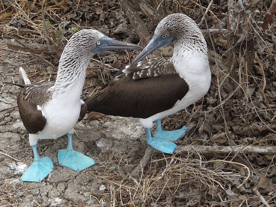
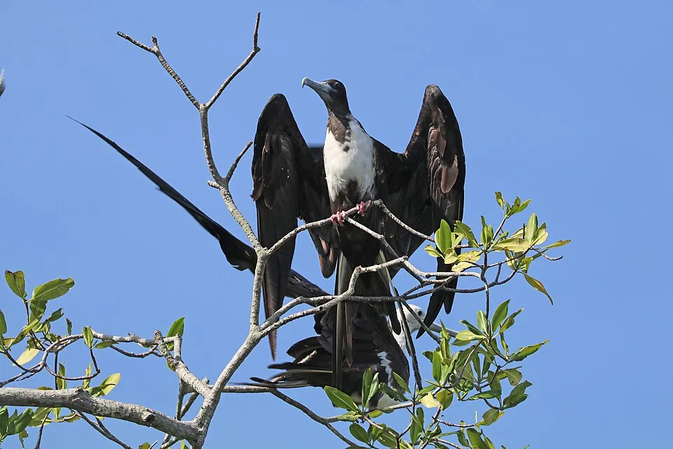
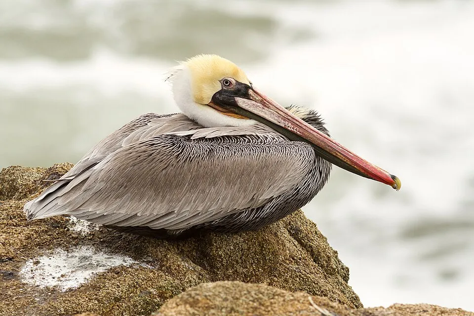
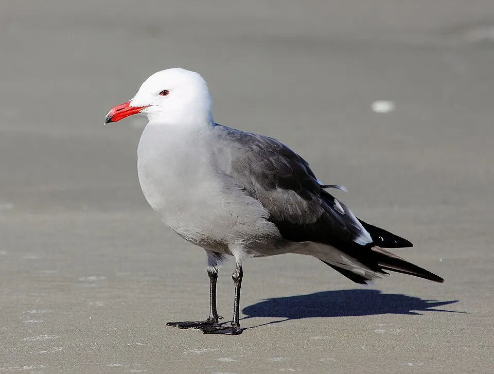
Among the species most often recorded on GBIF are Sula nebouxii (Blue-footed Booby), Fregata magnificens (Magnificent frigatebird), Pelecanus occidentalis (Brown pelican) and Larus heermanni (Heermann's Gull).
© OpenStreetMap
Download the boundary: GeoJSON · GPX Boundary © OpenStreetMap contributors (ODbL).
Geography
The representative point of the site lies at around 12 m above sea level. Over the 1996–2025 period, the mean annual temperature is about 25.6 °C and total precipitation reaches roughly 870 mm per year. The warmest month is usually August, the coolest March, and the wettest August.
Area
- Area
- 1,383 ha
- Elevation
- 12 m
- Coordinates
- 20.6988, -105.5851
Climate
● Mean temperature (°C) · ▮ Precipitation (mm)
Source: Copernicus ERA5 (C3S, doi:10.24381/cds.f17050d7), monthly averages 1996–2025 interpolated to the representative point, temperatures adjusted for elevation.
Contains modified Copernicus Climate Change Service information 2026. Neither the European Commission nor ECMWF is responsible for any use that may be made of the Copernicus information or data it contains.
Natural habitats
The site is almost entirely marine. The seabed reaches about 338 m deep (median depth 14 m; GEBCO bathymetry). Reef-building corals are documented in the area: 44 records published on GBIF.
Biodiversity
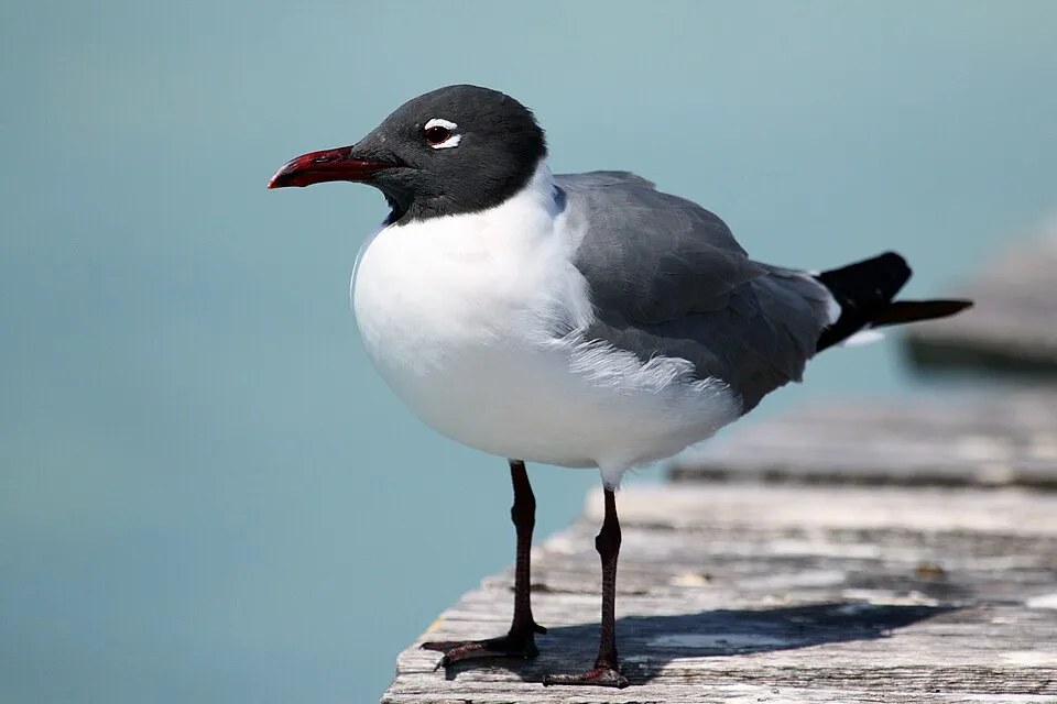
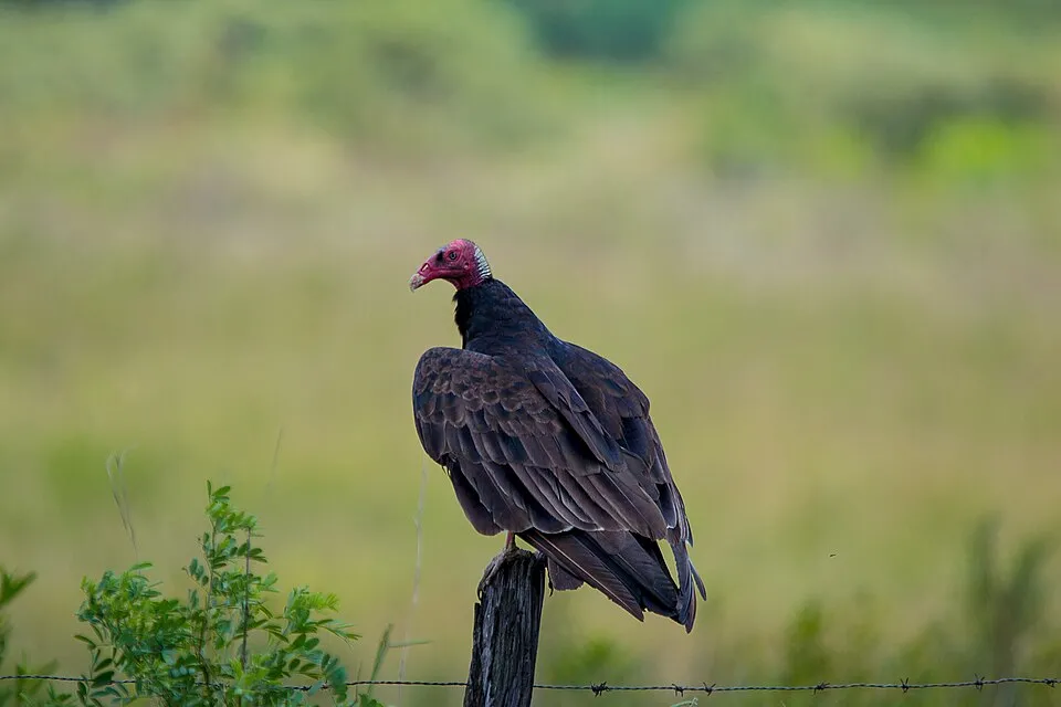
Based on occurrences aggregated by GBIF, several species are regularly recorded within the site. Among the most frequent are Sula nebouxii (Blue-footed Booby), Fregata magnificens (Magnificent frigatebird), Pelecanus occidentalis (Brown pelican) and Larus heermanni (Heermann's Gull). The full list of documented taxa is shown below.
Species to look out for
Observed species
Occurrences documented via GBIF; they are neither an exhaustive inventory nor proof of current presence.
- Blue-footed Booby · Sula nebouxii · 634
- Magnificent frigatebird · Fregata magnificens · 502
- Brown pelican · Pelecanus occidentalis · 434
- Heermann's Gull · Larus heermanni · 323
- Laughing Gull · Leucophaeus atricilla · 254
- Turkey Vulture · Cathartes aura · 253
- Black Vulture · Coragyps atratus · 249
- Great blue heron · Ardea herodias · 226
- Royal Tern · Thalasseus maximus · 189
- Snowy Egret · Egretta thula · 178
- Elegant Tern · Thalasseus elegans · 139
- Yellow-crowned Night Heron · Nyctanassa violacea · 126
+18 more species
- Neotropic Cormorant · Phalacrocorax brasilianus · 109
- Brown Noddy · Anous stolidus · 81
- Grey-breasted Martin · Progne chalybea · 77
- Little Blue Heron · Egretta caerulea · 67
- Bridled Tern · Onychoprion anaethetus · 59
- Black-bellied Whistling Duck · Dendrocygna autumnalis · 56
- Humpback whale · Megaptera novaeangliae · 39
- Peregrine Falcon · Falco peregrinus · 35
- Red-billed Tropicbird · Phaethon aethereus · 35
- Black Tern · Chlidonias niger · 32
- Wandering Tattler · Tringa incana · 31
- Great Egret · Ardea alba · 30
- Tropical Kingbird · Tyrannus melancholicus · 29
- Northern Rough-winged Swallow · Stelgidopteryx serripennis · 28
- Belted Kingfisher · Megaceryle alcyon · 26
- Lane's Leaf-toed Gecko · Phyllodactylus lanei · 26
- Zone-tailed Hawk · Buteo albonotatus · 25
- Great-tailed Grackle · Quiscalus mexicanus · 25
Records: GBIF.org (CC-BY). Names: Wikidata (CC0), GBIF. Photos: Wikimedia Commons.
Conservation challenges
The primary purpose of the site is to preserve its natural habitats and the biodiversity they support. The species recorded (Biodiversity tab) reflect its ecological value. The designations it holds frame its management and the control of land use.
Invasive alien species have been recorded within the site since 2000 (GBIF observations). Among them: Streptopelia decaocto (Eurasian Collared Dove), Passer domesticus (House Sparrow) and Columba livia (Rock Dove).
Pressure indicators
Invasive alien species
3
recorded since 2000
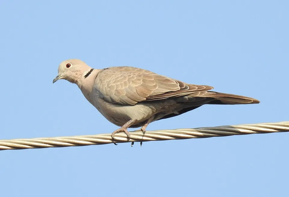 Eurasian Collared Dove
 House Sparrow
 Rock Dove
Photos: Eurasian Collared Dove © Dr. Raju Kasambe · CC BY-SA 4.0; House Sparrow © Diliff · CC BY-SA 3.0; Rock Dove © william_stephens · CC BY 4.0
Sources: Global Forest Change (Hansen et al., University of Maryland, via Global Forest Watch, CC-BY 4.0); EFFIS, European Commission / Copernicus; NASA Black Marble 2016 (public domain); CORINE Land Cover 2018 (Copernicus) or MODIS.
Invasive alien species: Global Register of Introduced and Invasive Species (ISSG, CC BY 4.0); Union list, Regulation (EU) 1143/2014 (INBO, CC0); GBIF.org records (CC0 / CC BY 4.0), at least 2 per species.
Practical information
Cities and airport
- Puerto Vallarta
35 km as the crow flies - Airport: Licenciado Gustavo Díaz Ordaz (PVR)
31 km as the crow flies
Data © OpenStreetMap contributors (ODbL) · Wikidata (CC0)
Access and visiting
Nearest towns of over 50,000 people, as the crow flies: Puerto Vallarta (35 km). Nearest airport: Licenciado Gustavo Díaz Ordaz (PVR), about 31 km away. About 11,000 people live within 20 km of the site boundary, 4,400 of them within 10 km (GHSL estimate, 2020). This population has grown by about 232% since 2000. To plan a visit (access, opening periods, visitor rules), it is best to consult the official information from the managing body and the official website listed in this page's sources.
Source: OpenStreetMap (ODbL), Wikidata (CC0), November 2026.
When to visit
Best time to visit: the dry season, from February to April, with less than 10 mm of rain per month. Precipitation peaks from May to September (up to 230 mm per month). Day length ranges from about 10 h 53 min in December to 13 h 23 min in June. Wildlife records published on GBIF peak for birds (February and March), plants (April) and mammals (from January to March). These peaks also reflect when observers are most active.
Source: Copernicus ERA5 (C3S), monthly averages 1996–2025 at the representative point, temperatures adjusted for elevation.
Contains modified Copernicus Climate Change Service information 2026. Neither the European Commission nor ECMWF is responsible for any use that may be made of the Copernicus information or data it contains.
Wildlife records calendar
JFMAMJJASOND
Birds
Plants
Mammals
Monthly records published on GBIF (CC-BY), relative to the busiest month; also reflects observer activity.
Gallery
© Marcin Klapczynski · CC BY-SA 3.0
© Christian Frausto Bernal from Tepic, Nayarit, MEXICO · CC BY-SA 2.0
© Cozcacua · CC BY-SA 3.0
© terri_bateman · CC BY 2.0
© Ferfive · CC BY 4.0
© Victoria Lemus · CC BY-SA 4.0
Sources and licences
References
- cds.climate.copernicus.eu: climate · CC-BY-4.0
- registry.opendata.aws: elevation of the reference point · PD
- lpdaac.usgs.gov: land cover · PD
- doi.org: population around the site · CC-BY-4.0
- naturalearthdata.com: sea share · PD
- wikidata.org: official area, establishment date, protected heritage, nearby cities and airport, access and peaks, places to see · CC0-1.0
- gbif.org: coral records, seasonality of sightings, invasive alien species, observed species · CC-BY-4.0
- gebco.net: depths · PD
- opentopodata.org: elevations · PD
- openstreetmap.org: official name, access and peaks · ODbL-1.0
Data © OpenStreetMap contributors (ODbL), Wikidata (CC0) and the sources cited.
