Bird
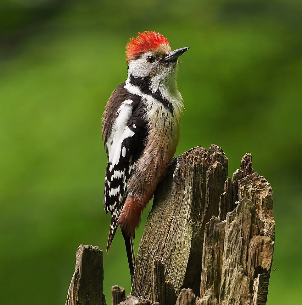
Middle Spotted Woodpecker
Dendrocoptes medius1,233 records © Frank Vassen from Brussels, Belgium · CC BY 2.0
Spain · Terrestrial
Nature park of 9,143 hectares in Spain, established in 1998.
Nature park of 9,143 hectares in Spain, established in 1998.
Izki Natural Park is a nature park in Spain (Europe). It is a predominantly terrestrial area. Established in 1998, it covers about 9,143 hectares.
Protected as a nature park. International labels and designations: Natura 2000 network (1 site: “Izki”). Key dates: first Natura 2000 site under the Birds Directive in 1997, established in 1998 and first Natura 2000 site under the Habitats Directive in 2004.
Sources: Wikidata (CC0) for establishment and international labels; EEA Natura 2000 database (CC-BY 4.0) for site designation dates.
In Spain (Europe). Representative point: 42.7060° N, 2.4940° W.
About 9,143 hectares (91 km²). It is the 44th largest of the 73 nature parks in Spain covered by Parkavela.
In 1998.
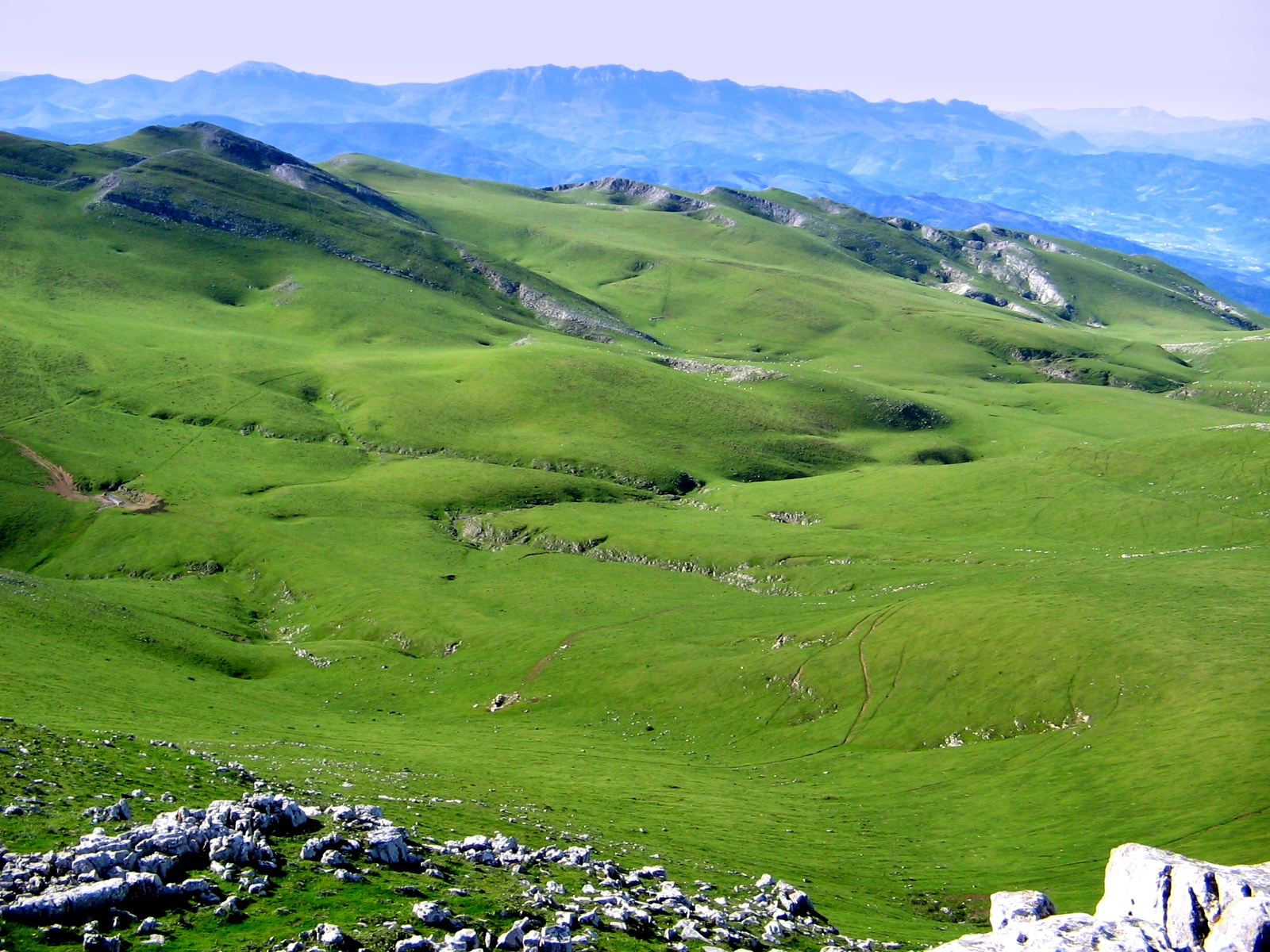
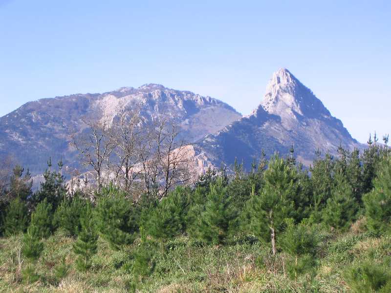
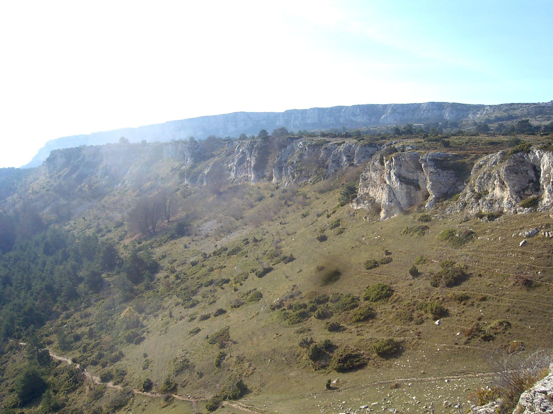
A terrestrial area, with forests and mountains.
According to the European 1:1 million geological map (EGDI), the bedrock consists mainly of marly limestones (81% of sampled points) and limestones (13%). These are mostly sedimentary rocks. The geological units date mainly from the Cretaceous (81% of sampled points).
Kapildui, at 1,176 m (OpenStreetMap).
Kapildui (1,176 m), El Toro (1,100 m), Santapezarra (1,063 m), San Kristobal (1,057 m) and El Buzón (1,045 m) (OpenStreetMap).
Natura 2000 network (1 site: “Izki”).
Nearest towns of over 50,000 people, as the crow flies: Logroño (21 km) and Barakaldo (69 km). Nearest airport: Vitoria (VIT), about 19 km away.
The nearest railway station is Alegría-Dulantzi, about 9 km from the site boundary.
Turismo bulegoa.
Yes. Waymarked hiking routes listed in OpenStreetMap: 16, including GR 1, GR 282, Asfalto naturalen meatze paisaien ibilbidea and Bernedo-Angostina-Quintana-Urturi. The “PR-A 80 · Izkiko mendi ibilbidea” route runs for about 18 km through the site, with some 570 m of ascent on its longest section.
Among the species most often recorded on GBIF are Dendrocoptes medius (Middle Spotted Woodpecker), Fringilla coelebs (Eurasian Chaffinch), Erithacus rubecula (European robin) and Turdus merula (Common Blackbird).
tourism.euskadi.eus/en/natural-areas/izki-natural-park/aa30-12375/fr
© OpenStreetMap
Download the boundary: GeoJSON · GPX Boundary © OpenStreetMap contributors (ODbL).
According to the European 1:1 million geological map (EGDI), the bedrock consists mainly of marly limestones (81% of sampled points) and limestones (13%). These are mostly sedimentary rocks. The geological units date mainly from the Cretaceous (81% of sampled points).
Terrain: Mapzen Terrain Tiles (SRTM, USGS)
share of the site in each elevation band (smoothed terrain model: summits are rounded off) · Terrain: Mapzen Terrain Tiles (SRTM, USGS)
Sedimentary rocks 100 % · Main age: Cretaceous (81%)
Source: EGDI 1:1M geological map (EuroGeoSurveys and national geological surveys), CC BY 4.0 · 16 sampled points within the site.
Data © OpenStreetMap contributors (ODbL)
According to CORINE Land Cover (2018), the site is mainly made up of forests (78%), heath and scrub (11%) and farmland (7%). Woodland is mostly broadleaved. Elevation ranges from about 640 m to 1,176 m (highest point: Kapildui). Median elevation is 773 m, and 100% of the site lies above 500 m (SRTM elevation model). The Natura 2000 site overlapping the area lists 27 habitats of European interest (8 priority), the most extensive being Galicio-Portuguese oak woods with Quercus robur and Quercus pyrenaica, Quercus faginea and Quercus canariensis Iberian woods and endemic oro-Mediterranean heaths with gorse.
Based on occurrences aggregated by GBIF, several species are regularly recorded within the site. Among the most frequent are Dendrocoptes medius (Middle Spotted Woodpecker), Fringilla coelebs (Eurasian Chaffinch), Erithacus rubecula (European robin) and Turdus merula (Common Blackbird). The full list of documented taxa is shown below. The overlapping Natura 2000 site lists 112 species of European interest: 69 birds, 24 mammals, 4 amphibians, 3 fish, 6 invertebrates and 6 plants.
From the official form of the Natura 2000 site overlapping the area (areas reported for the whole site).
and 19 more
Eurasian Goshawk (Accipiter gentilis) resident, Great Reed Warbler (Acrocephalus arundinaceus) passage, Common Sandpiper (Actitis hypoleucos) resident passage, Common Kingfisher (Alcedo atthis) resident, Northern Pintail (Anas acuta) passage wintering, Eurasian Teal (Anas crecca) wintering, Mallard (Anas platyrhynchos) wintering passage resident, Greylag Goose (Anser anser) passage, Tawny Pipit (Anthus campestris) breeding, Water Pipit (Anthus spinoletta) wintering breeding, Golden Eagle (Aquila chrysaetos) resident, Grey Heron (Ardea cinerea) wintering passage resident and 57 more
Barbastelle (Barbastella barbastellus), Serotine bat (Eptesicus serotinus), European wildcat (Felis silvestris), Eurasian otter (Lutra lutra), Common bent-wing bat (Miniopterus schreibersii), European Mink (Mustela lutreola), Western Polecat (Mustela putorius), Alcathoe Whiskered Bat (Myotis alcathoe), Bechstein's bat (Myotis bechsteinii), Daubenton's bat (Myotis daubentonii), Geoffroy's bat (Myotis emarginatus), Greater mouse-eared bat (Myotis myotis) and 12 more
Midwife toad (Alytes obstetricans), Natterjack toad (Epidalea calamita), European Treefrog (Hyla molleri), Agile frog (Rana dalmatina)
Bermejuela (Achondrostoma arcasii), Ebro Barbel (Luciobarbus graellsii), Ebro Nase (Parachondrostoma miegii)
White-clawed Crayfish (Austropotamobius pallipes), Greater Capricorn Beetle (Cerambyx cerdo), Southern damselfly (Coenagrion mercuriale), Marsh fritillary (Euphydryas aurinia), Stag beetle (Lucanus cervus), Rosalia longicorn (Rosalia alpina)
Narcissus asturiensis, Petticoat daffodil (Narcissus bulbocodium), Large-flowered Daffodil (Narcissus pseudonarcissus subsp. nobilis), Angel's-tears (Narcissus triandrus), Butcher's-broom (Ruscus aculeatus), Summer lady's-tresses (Spiranthes aestivalis)
Source: Natura 2000 standard data forms (EEA, CC-BY 4.0). Not exhaustive: sensitive species are not published.
Bird
1,233 records © Frank Vassen from Brussels, Belgium · CC BY 2.0




Occurrences documented via GBIF; they are neither an exhaustive inventory nor proof of current presence.
Records: GBIF.org (CC-BY). Names: Wikidata (CC0), GBIF. Photos: Wikimedia Commons.
The primary purpose of the site is to preserve its natural habitats and the biodiversity they support. The species recorded (Biodiversity tab) reflect its ecological value. The designations it holds frame its management and the control of land use.
According to Global Forest Change data (University of Maryland, Global Forest Watch), about 77 ha of tree cover were lost within the boundary between 2001 and 2023 (under 1% of its area), peaking in 2015 and 2022. These losses include logging, storms and fires, and do not account for regrowth. Apart from forest felling and regrowth (about 110 ha in total), land cover remained almost unchanged between 1990 and 2018 according to CORINE Land Cover. At night, the area gives off virtually no artificial light detectable from space (NASA VIIRS Black Marble composite, 2016). According to the Natura 2000 forms, of 27 assessed habitats of European interest, 3 are in excellent condition and 7 in average or reduced condition. According to the Water Framework Directive assessment (2022 river basin management plans, data 2018), 100% of the 24 km of rivers assessed within the site are in good or high ecological status. One invasive alien species has been recorded within the site since 2000 (GBIF observations), listed as of Union concern: Pacifastacus leniusculus (Signal crayfish).
77 ha
2001–2023 · < 1% of the area
0
No large fire mapped (fires over about 30 ha)
< 1%
of the area gives off artificial light visible from space
< 1%
buildings, business areas, roads, quarries · farmland 7%
< 0.5%
of the area changed, 1990–2018 · CORINE
forest felling and regrowth: 110 ha in total
100%
of the 24 km of assessed rivers in good or high ecological status · WFD 2022
assessments 2018
1
incl. 1 of EU concern · since 2000
Sources: Global Forest Change (Hansen et al., University of Maryland, via Global Forest Watch, CC-BY 4.0); EFFIS, European Commission / Copernicus; NASA Black Marble 2016 (public domain); CORINE Land Cover 2018 (Copernicus) or MODIS.
CORINE Land Cover Change 1990–2018: generated using European Union's Copernicus Land Monitoring Service information (EEA), aggregated by Parkavela; DOI 10.2909/f30f1000-7cf8-43bb-872c-5eb093911b24.
Ecological status of water bodies: European Environment Agency, WISE – Water Framework Directive, 3rd river basin management plans (2022), CC BY 4.0. Official national classification, not comparable between countries.
Invasive alien species: Global Register of Introduced and Invasive Species (ISSG, CC BY 4.0); Union list, Regulation (EU) 1143/2014 (INBO, CC0); GBIF.org records (CC0 / CC BY 4.0), at least 2 per species.
16 waymarked routes listed, including:
Signed cycle routes: this does not mean that cycling is allowed on footpaths.
Data © OpenStreetMap contributors (ODbL) · Wikidata (CC0)
Routes © OpenStreetMap contributors (ODbL), via Waymarked Trails
9.6 km within the site ↗ 353 m↘ 296 m 639–912 m
Tracks © OpenStreetMap contributors (ODbL), clipped to the boundary; elevation gain and profiles computed on the longest section from Mapzen Terrain Tiles (≈ 30 m), indicative only. Indicative difficulty (SAC scale, OpenStreetMap, via Waymarked Trails): check with the park.
The nearest railway station is Alegría-Dulantzi, about 9 km from the site boundary. Nearest towns of over 50,000 people, as the crow flies: Logroño (21 km) and Barakaldo (69 km). Nearest airport: Vitoria (VIT), about 19 km away. About 310,000 people live within 20 km of the site boundary, 11,000 of them within 10 km; some 300 people are estimated to live inside (GHSL estimate, 2020). This population has grown by about 22% since 2000. Visitor information on site: Turismo bulegoa. Waymarked hiking routes listed in OpenStreetMap: 16, including GR 1, GR 282, Asfalto naturalen meatze paisaien ibilbidea and Bernedo-Angostina-Quintana-Urturi. A signed cycle route crosses the site: “VVVN Voie Verte ferroviaire Basco-Navarraise” (OpenStreetMap). To plan a visit (access, opening periods, visitor rules), it is best to consult the official information from the managing body and the official website listed in this page's sources.
Source: OpenStreetMap (ODbL), Wikidata (CC0), October 2026.
Monthly records published on GBIF (CC-BY), relative to the busiest month; also reflects observer activity.
Data © OpenStreetMap contributors (ODbL), Wikidata (CC0) and the sources cited.