
Spain · Terrestrial
Urkiola Natural Park
Nature park of 5,768 hectares in Spain, established in 1989.
Overview
Nature park of 5,768 hectares in Spain, established in 1989.
Urkiola Natural Park is a nature park in Spain (Europe). It is a predominantly terrestrial area. Established on 29 December 1989, it covers about 5,768 hectares. The site is managed by Biscay Foral Council.
Protections and designations
Natura 2000 · habitats (SAC)
- Urkiola ES2130009
Protected as a nature park. International labels and designations: Natura 2000 network (1 site: “Urkiola”). Key dates: established in 1989 and first Natura 2000 site under the Habitats Directive in 2004.
In our collections
Timeline
-
1989
Established
-
2004
First Natura 2000 site under the Habitats Directive
Sources: Wikidata (CC0) for establishment and international labels; EEA Natura 2000 database (CC-BY 4.0) for site designation dates.
Frequently asked questions
Where is Urkiola Natural Park?
In Spain (Europe). Representative point: 43.1167° N, 2.6667° W.
How large is Urkiola Natural Park?
About 5,768 hectares (58 km²). It is the 54th largest of the 73 nature parks in Spain covered by Parkavela.
When was Urkiola Natural Park established?
On 29 December 1989.
What habitats and landscapes does Urkiola Natural Park include?
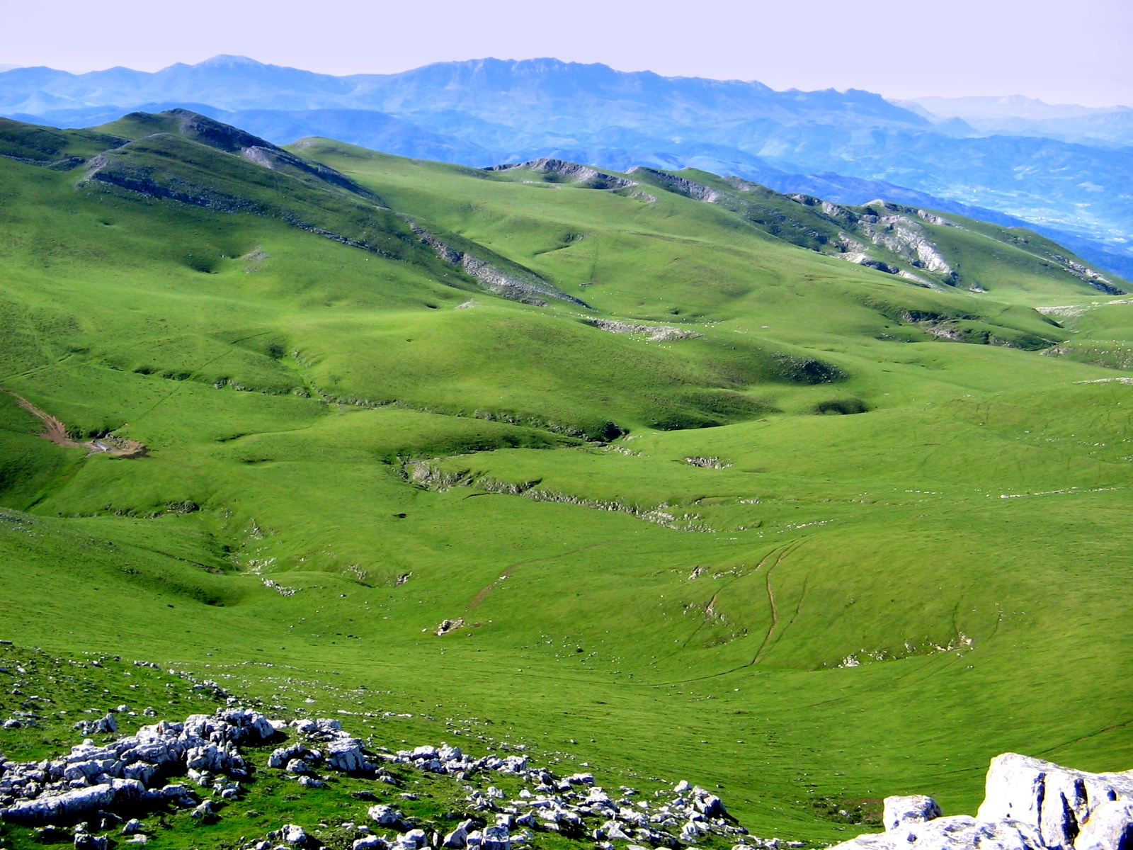
A terrestrial area, with forests and mountains.
What rocks lie beneath Urkiola Natural Park?
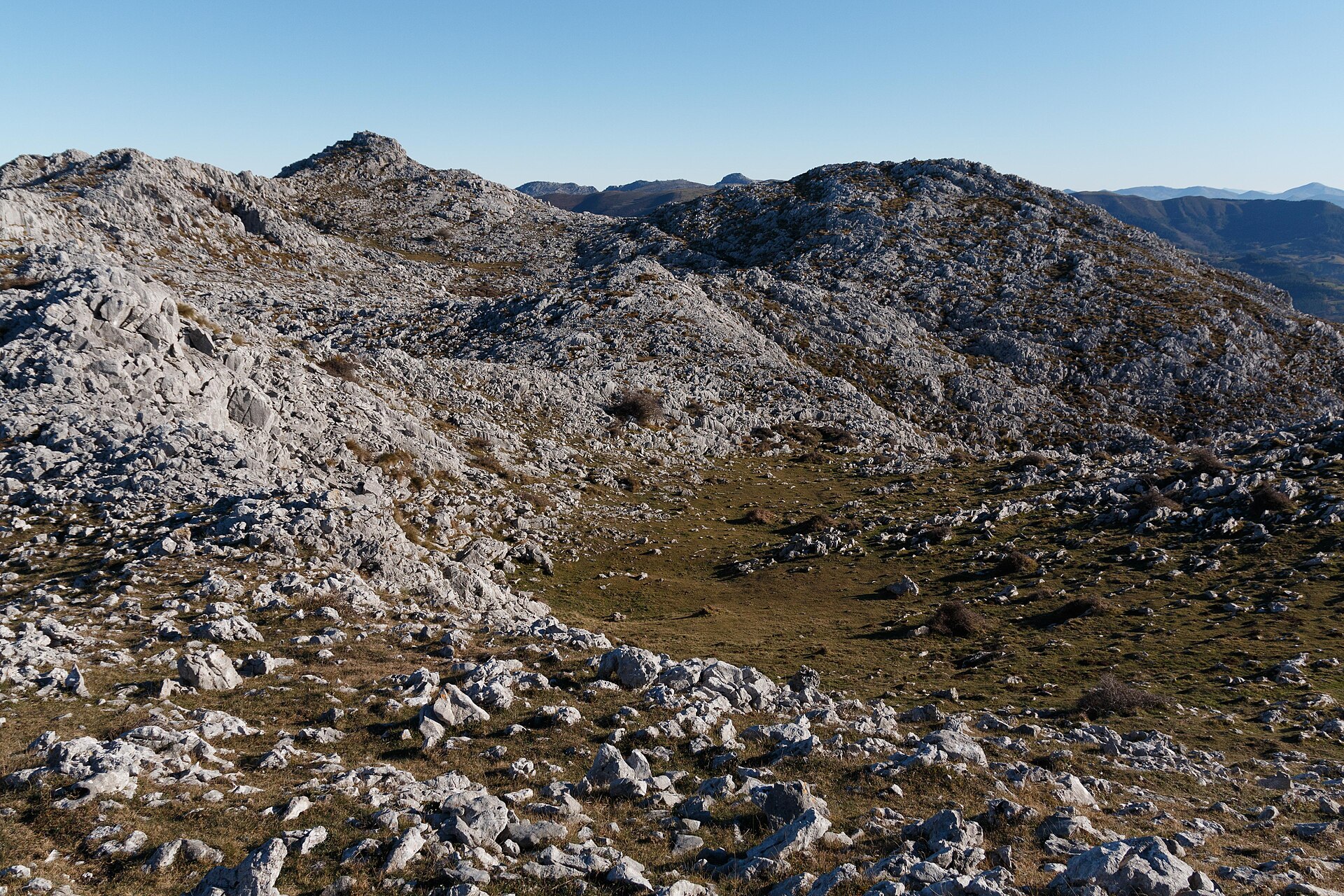
According to the European 1:1 million geological map (EGDI), the bedrock consists mainly of marly limestones (100% of sampled points). These are mostly sedimentary rocks. The geological units date mainly from the Cretaceous (100% of sampled points).
What is the highest point of Urkiola Natural Park?
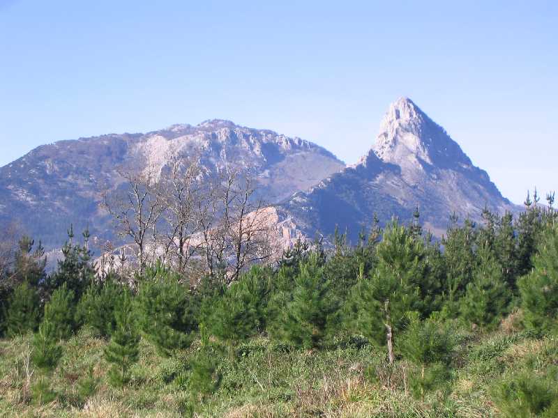
Anboto, at 1,330 m (OpenStreetMap).
What are the main summits of Urkiola Natural Park?
Anboto (1,330 m), Elgoin (1,245 m), Agindui (1,243 m), Kurutzeta (1,215 m) and Oriol (1,128 m) (OpenStreetMap).
Which international labels apply to Urkiola Natural Park?
Natura 2000 network (1 site: “Urkiola”).
What is there to see in Urkiola Natural Park?
Cueva de Askondo (Wikidata).
What is the nearest large city to Urkiola Natural Park?
Nearest towns of over 50,000 people, as the crow flies: Barakaldo (23 km) and Logroño (65 km). Nearest airport: Bilbao (BIO), about 18 km away.
How can I reach Urkiola Natural Park by train?
The nearest railway station is Arrigorriaga, about 12 km from the site boundary.
Where can I get visitor information on site?
Oficina de Turismo.
Are there waymarked hiking trails in Urkiola Natural Park?
Yes. Waymarked hiking routes listed in OpenStreetMap: 15, including GR 12, GR 123, GR 229 and GR 282. The GR 12 · Traversée d'Euskal Herria route runs for about 14 km through the site, with some 570 m of ascent on its longest section.
Which species can be seen in Urkiola Natural Park?
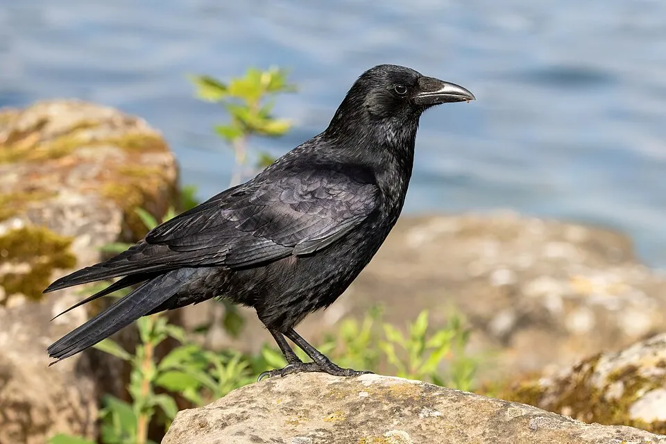
Among the species most often recorded on GBIF are Gyps fulvus (Griffon Vulture), Erithacus rubecula (European robin), Corvus corone (Carrion crow) and Turdus merula (Common Blackbird).
Who manages Urkiola Natural Park?
Biscay Foral Council.
What is the official website of Urkiola Natural Park?
© OpenStreetMap
Download the boundary: GeoJSON · GPX Boundary © OpenStreetMap contributors (ODbL).
Geography
According to the European 1:1 million geological map (EGDI), the bedrock consists mainly of marly limestones (100% of sampled points). These are mostly sedimentary rocks. The geological units date mainly from the Cretaceous (100% of sampled points).
Area
- Area
- 5,768 ha
- Median elevation
- 687 m
- Mean slope
- 21°
- Coordinates
- 43.1167, -2.6667
Terrain: Mapzen Terrain Tiles (SRTM, USGS)
Elevation bands
- below 500 m 16%
- 500–1,000 m 80%
- 1,000–1,500 m 3%
share of the site in each elevation band (smoothed terrain model: summits are rounded off) · Terrain: Mapzen Terrain Tiles (SRTM, USGS)
Bedrock
- Marly limestones 100 %
Sedimentary rocks 100 % · Main age: Cretaceous (100%)
Source: EGDI 1:1M geological map (EuroGeoSurveys and national geological surveys), CC BY 4.0 · 16 sampled points within the site.
Natural habitats
According to CORINE Land Cover (2018), the site is mainly made up of forests (59%), sparsely vegetated land (18%) and heath and scrub (11%). Woodland is mostly broadleaved. Elevation ranges from about 430 m to 1,330 m (highest point: Anboto). Median elevation is 687 m, and 84% of the site lies above 500 m (SRTM elevation model). The terrain is steep: 22% of slopes exceed 30° (mean slope 21°). The Natura 2000 site overlapping the area lists 16 habitats of European interest (3 priority), the most extensive being calcareous rocky slopes with chasmophytic vegetation, Atlantic acidophilous beech forests with Ilex and sometimes also Taxus in the shrublayer (Quercion robori-petraeae or Ilici-Fagenion) and alpine and subalpine calcareous grasslands.
Biodiversity
Based on occurrences aggregated by GBIF, several species are regularly recorded within the site. Among the most frequent are Gyps fulvus (Griffon Vulture), Erithacus rubecula (European robin), Corvus corone (Carrion crow) and Turdus merula (Common Blackbird). The full list of documented taxa is shown below. The overlapping Natura 2000 site lists 38 species of European interest: 19 birds, 13 mammals, 4 invertebrates and 2 plants.
Habitats of European interest
From the official form of the Natura 2000 site overlapping the area (areas reported for the whole site).
- Calcareous rocky slopes with chasmophytic vegetation 688 ha
- Atlantic acidophilous beech forests with Ilex and sometimes also Taxus in the shrublayer (Quercion robori-petraeae or Ilici-Fagenion) 513 ha
- Alpine and subalpine calcareous grasslands 411 ha
- Quercus ilex and Quercus rotundifolia forests 386 ha
- Endemic oro-Mediterranean heaths with gorse 323 ha
- Species-rich Nardus grasslands, on silicious substrates in mountain areas (and submountain areas in Continental Europe) priority 281 ha
- European dry heaths 197 ha
- Semi-natural dry grasslands and scrubland facies on calcareous substrates (Festuco-Brometalia) (* important orchid sites) 131 ha
and 8 more
Species of European interest
Birds · 19
Eurasian Goshawk (Accipiter gentilis) resident, Common Kingfisher (Alcedo atthis) passage, Water Pipit (Anthus spinoletta) breeding, Golden Eagle (Aquila chrysaetos) resident, European Nightjar (Caprimulgus europaeus) breeding, White-throated Dipper (Cinclus cinclus) resident, Short-toed Snake Eagle (Circaetus gallicus) breeding, Hen Harrier (Circus cyaneus) breeding, Black Woodpecker (Dryocopus martius) resident, Peregrine Falcon (Falco peregrinus) resident, Eurasian Hobby (Falco subbuteo) breeding, Bearded vulture (Gypaetus barbatus) passage resident and 7 more
Mammals · 13
Barbastelle (Barbastella barbastellus), Serotine bat (Eptesicus serotinus), European wildcat (Felis silvestris), European pine marten (Martes martes), Western Polecat (Mustela putorius), Whiskered bat (Myotis mystacinus), Natterer's bat (Myotis nattereri), Lesser noctule (Nyctalus leisleri), Kuhl's pipistrelle (Pipistrellus kuhlii), Common pipistrelle (Pipistrellus pipistrellus), Brown long-eared bat (Plecotus auritus), Grey long-eared bat (Plecotus austriacus) and 1 more
Invertebrates · 4
White-clawed Crayfish (Austropotamobius pallipes), Quimper snail (Elona quimperiana), Marsh fritillary (Euphydryas aurinia), Stag beetle (Lucanus cervus)
Plants · 2
Narcissus asturiensis, Large-flowered Daffodil (Narcissus pseudonarcissus subsp. nobilis)
Source: Natura 2000 standard data forms (EEA, CC-BY 4.0). Not exhaustive: sensitive species are not published.
Species to look out for




Observed species
Occurrences documented via GBIF; they are neither an exhaustive inventory nor proof of current presence.
- Griffon Vulture · Gyps fulvus · 578
- European robin · Erithacus rubecula · 468
- Carrion crow · Corvus corone · 460
- Common Blackbird · Turdus merula · 429
- Eurasian Chaffinch · Fringilla coelebs · 404
- Great tit · Parus major · 378
- Red-billed Chough · Pyrrhocorax pyrrhocorax · 364
- Black Redstart · Phoenicurus ochruros · 311
- Eurasian Wren · Troglodytes troglodytes · 310
- Alpine Chough · Pyrrhocorax graculus · 281
- Common Firecrest · Regulus ignicapilla · 253
- Coal tit · Periparus ater · 250
Records: GBIF.org (CC-BY). Names: Wikidata (CC0), GBIF. Photos: Wikimedia Commons.
Conservation challenges
The primary purpose of the site is to preserve its natural habitats and the biodiversity they support. The species recorded (Biodiversity tab) reflect its ecological value. The designations it holds frame its management and the control of land use.
According to Global Forest Change data (University of Maryland, Global Forest Watch), about 599 ha of tree cover were lost within the boundary between 2001 and 2023 (10% of its area), peaking in 2004. These losses include logging, storms and fires, and do not account for regrowth. According to the European CORINE Land Cover inventory (Copernicus), land cover changed on about 35 ha of the site between 1990 and 2018 (under 1% of its area). Forest felling and regrowth add about 1,640 ha in total over the period. Since 2016, the European EFFIS system (Copernicus) has mapped 2 fires here, burning about 11 ha within the boundary; the largest, in October 2026 (near Dima), covered 6 ha. At night, 9% of the area gives off artificial light detectable from space (NASA VIIRS Black Marble composite, 2016). According to the Natura 2000 forms, of 14 assessed habitats of European interest, 7 are in excellent condition and 3 in average or reduced condition. According to the Water Framework Directive assessment (2022 river basin management plans, data 2015–2019), of the 2 rivers assessed within the site, 1 has good ecological status and 1 moderate ecological status. Invasive alien species have been recorded within the site since 2000 (GBIF observations), one of them listed as of Union concern. Among them: Pacifastacus leniusculus (Signal crayfish) and Acacia dealbata (Silver Wattle).
Pressure indicators
Tree cover lost
599 ha
2001–2023 · 10% of the area
20012023
Fires since 2016
11 ha
burned within the boundary (2 mapped fires)
- 2026 · Dima · 6 ha
- 2026 · Dima · 5 ha
Light at night
9%
of the area gives off artificial light visible from space
DarkLit
Land cover change
35 ha
changed cover, 1990–2018 · CORINE · < 1% of the area
forest felling and regrowth: 1,640 ha in total
Rivers and lakes
46%
of the 7 km of assessed rivers in good or high ecological status · WFD 2022
assessments 2015–2019
Invasive alien species
2
incl. 1 of EU concern · since 2000
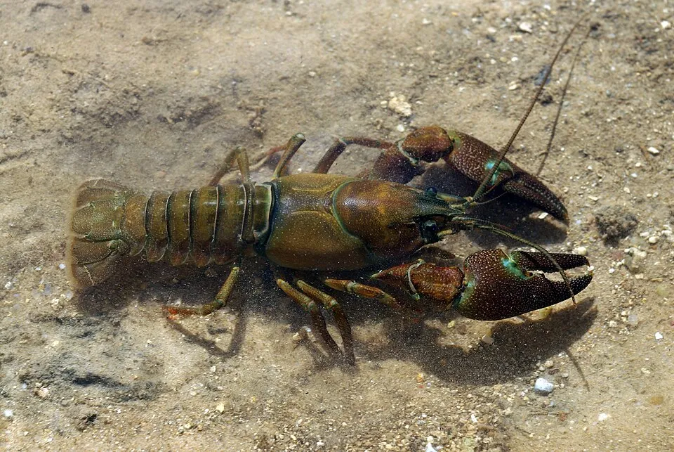 Signal crayfish
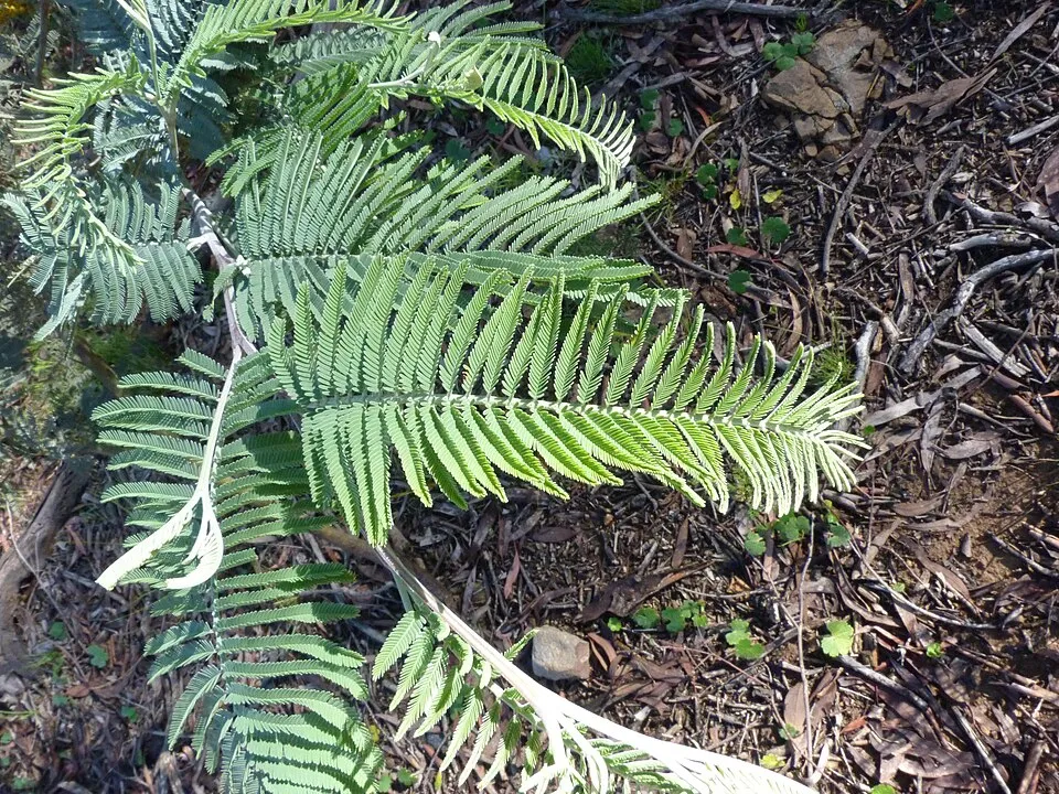 Silver Wattle
Photos: Signal crayfish © David Perez · CC BY 3.0; Silver Wattle © Donald Hobern from Copenhagen, Denmark · CC BY 2.0
Sources: Global Forest Change (Hansen et al., University of Maryland, via Global Forest Watch, CC-BY 4.0); EFFIS, European Commission / Copernicus; NASA Black Marble 2016 (public domain); CORINE Land Cover 2018 (Copernicus) or MODIS.
CORINE Land Cover Change 1990–2018: generated using European Union's Copernicus Land Monitoring Service information (EEA), aggregated by Parkavela; DOI 10.2909/f30f1000-7cf8-43bb-872c-5eb093911b24.
Ecological status of water bodies: European Environment Agency, WISE – Water Framework Directive, 3rd river basin management plans (2022), CC BY 4.0. Official national classification, not comparable between countries.
Invasive alien species: Global Register of Introduced and Invasive Species (ISSG, CC BY 4.0); Union list, Regulation (EU) 1143/2014 (INBO, CC0); GBIF.org records (CC0 / CC BY 4.0), at least 2 per species.
Practical information
Cities and airport
- Barakaldo
23 km as the crow flies - Logroño
65 km as the crow flies - Airport: Bilbao (BIO)
18 km as the crow flies
Visitor information
- Oficina de Turismo
2 km from the site boundary
Hiking
15 waymarked routes listed, including:
GR 12GR 123GR 229GR 282GR 38Vuelta a Aramaio
Trail difficulty
- T1 · easy hiking · 35% · 20 km
- T2 · mountain hiking · 35% · 18 km
- T3–T6 · demanding or alpine hiking · 30% · 17 km
55 km graded out of 174 km of paths
SAC scale (T1–T6) © OpenStreetMap contributors (ODbL): indicative only, check with the park.
Data © OpenStreetMap contributors (ODbL) · Wikidata (CC0)
Waymarked hiking routes
PR-BI 80 Saibiko magaletik
3.5 km within the site ↗ 167 m↘ 138 m 746–897 m
up to T2 · mountain hiking
Tracks © OpenStreetMap contributors (ODbL), clipped to the boundary; elevation gain and profiles computed on the longest section from Mapzen Terrain Tiles (≈ 30 m), indicative only. Indicative difficulty (SAC scale, OpenStreetMap, via Waymarked Trails): check with the park.
Access and visiting
The nearest railway station is Arrigorriaga, about 12 km from the site boundary. Nearest towns of over 50,000 people, as the crow flies: Barakaldo (23 km) and Logroño (65 km). Nearest airport: Bilbao (BIO), about 18 km away. About 730,000 people live within 20 km of the site boundary, 130,000 of them within 10 km; some 370 people are estimated to live inside (GHSL estimate, 2020). Visitor information on site: Oficina de Turismo. Waymarked hiking routes listed in OpenStreetMap: 15, including GR 12, GR 123, GR 229 and GR 282. Of the roughly 50 km of paths with a difficulty grade in OpenStreetMap, 35% are easy hiking (T1), 35% mountain hiking (T2) and 30% demanding or alpine hiking (T3–T6). This is indicative only: check with the park. To see: Cueva de Askondo. To plan a visit (access, opening periods, visitor rules), it is best to consult the official information from the managing body (Biscay Foral Council) and the official website listed in this page's sources.
Source: OpenStreetMap (ODbL), Wikidata (CC0), October 2026.
Wildlife records calendar
JFMAMJJASOND
Birds
Plants
Butterflies & moths
Monthly records published on GBIF (CC-BY), relative to the busiest month; also reflects observer activity.
Gallery
© Txo · Public domain
© Etxaburu (Etxaburu) · CC0-1.0
© Txo · Public domain
© Txo Mi discusión en castellano · Public domain
© Txo · Public domain
© Basotxerri · CC BY-SA 4.0
Sources and licences
- Wikidata: Q3121058
- OpenStreetMap: relation 6775454
- Official website: http://www.urkiola.net/
- Wikipedia: en.wikipedia.org/wiki/Urkiola_Natural_Park
- WDPA: 349528
References
- land.copernicus.eu: land cover, land cover change, sea share · COPERNICUS
- doi.org: population around the site · CC-BY-4.0
- wikidata.org: official area, establishment date, protected heritage, managing body, official name, nearby cities and airport, access and peaks, lake depths, places to see, official website · CC0-1.0
- eea.europa.eu: bathing water quality, ecological status of waters · CC-BY-4.0
- en.eurovelo.com: EuroVelo cycle routes · ODbL-1.0
- cycling.waymarkedtrails.org: cycle routes · ODbL-1.0
- opentopodata.org: elevations · PD
- forest-fire.emergency.copernicus.eu: wildfires · COPERNICUS
- globalforestwatch.org: tree cover loss · CC-BY-4.0
- gbif.org: seasonality of sightings, invasive alien species, observed species · CC-BY-4.0
- europe-geology.eu: geology · CC-BY-4.0
- hydrosheds.org: lakes · CC-BY-4.0
- natura2000.eea.europa.eu: Natura 2000 habitats and species · CC-BY-4.0
- earthobservatory.nasa.gov: night light · PD
- openstreetmap.org: access and peaks, trail difficulty, wheelchair access · ODbL-1.0
- registry.opendata.aws: detailed relief · PD
- hiking.waymarkedtrails.org: route difficulty · ODbL-1.0
- nsidc.org: snow cover · PD
- wikidata.org: Wikipedia article · CC-BY-SA-4.0
Data © OpenStreetMap contributors (ODbL), Wikidata (CC0) and the sources cited.