France · Terrestrial
Mercantour National Park
National park of 67,900 hectares in France, established in 1979.
Overview
National park of 67,900 hectares in France, established in 1979.
Mercantour National Park is located in France (Europe). It is a predominantly terrestrial area. Established on 18 August 1979, it covers about 67,900 hectares.
Protections and designations
Natura 2000 · habitats (SAC)
- Le Mercantour FR9301559
Natura 2000 · birds (SPA)
- Le Mercantour FR9310035
Protected as a national park. International labels and designations: Natura 2000 network (2 sites). Key dates: established in 1979, first Natura 2000 site under the Birds Directive in 2005 and first Natura 2000 site under the Habitats Directive in 2014.
In our collections
Timeline
-
1979
Established
-
2005
First Natura 2000 site under the Birds Directive
-
2014
First Natura 2000 site under the Habitats Directive
Sources: Wikidata (CC0) for establishment and international labels; EEA Natura 2000 database (CC-BY 4.0) for site designation dates.
Frequently asked questions
Where is Mercantour National Park?
In France (Europe). Representative point: 44.1670° N, 7.0610° E.
How large is Mercantour National Park?
About 67,900 hectares (679 km²). It is the 7th largest of the 13 national parks in France covered by Parkavela.
When was Mercantour National Park established?
On 18 August 1979.
What habitats and landscapes does Mercantour National Park include?
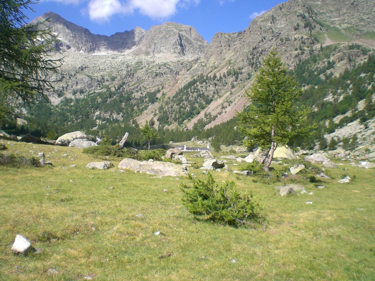
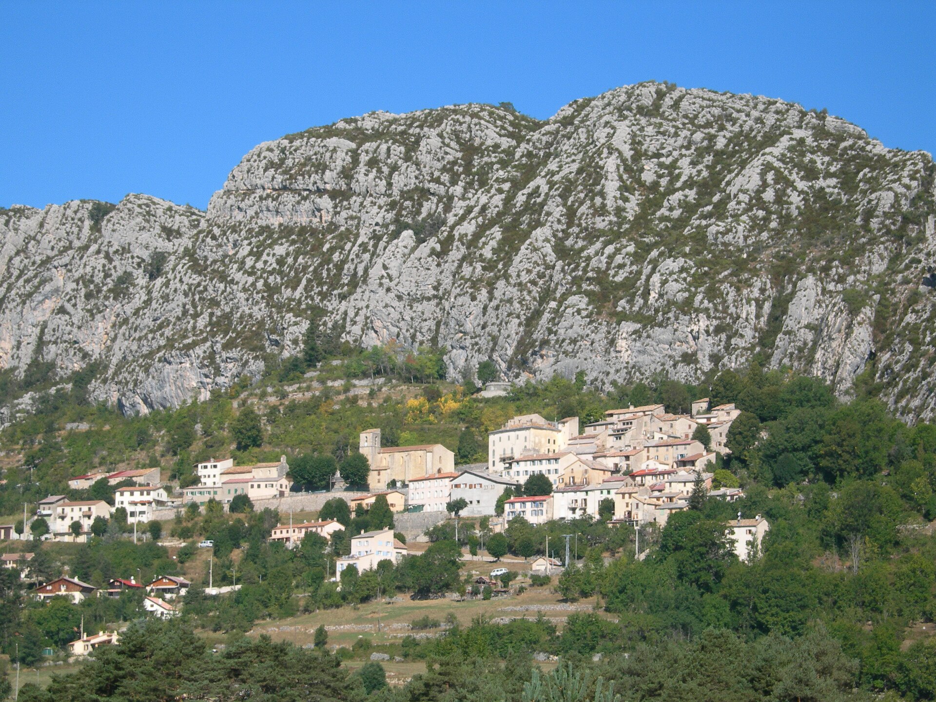
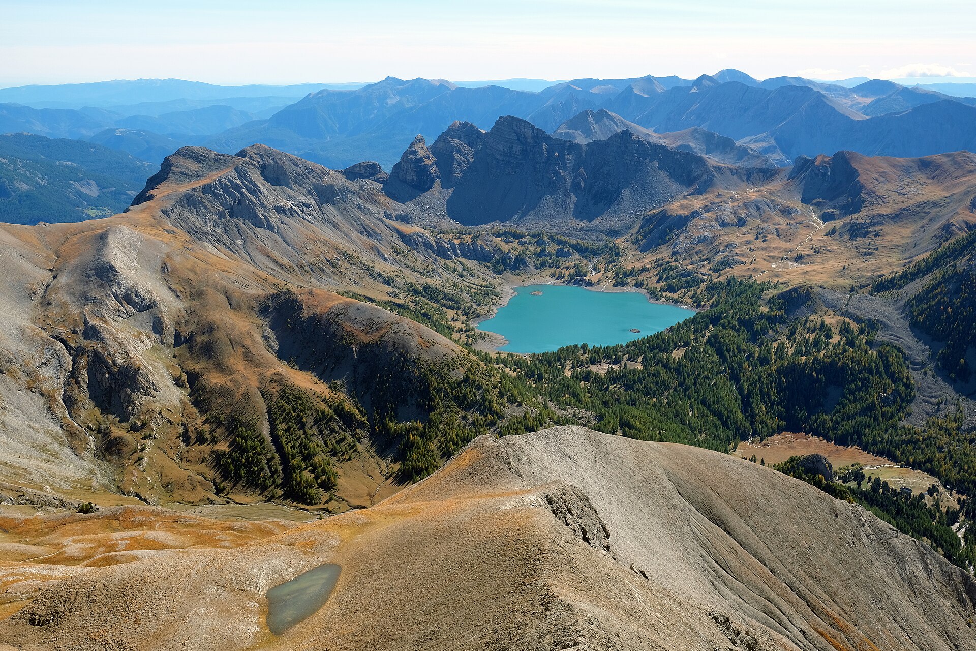
A terrestrial area, with mountains.
What rocks lie beneath Mercantour National Park?
According to the BRGM's simplified lithological map, the bedrock consists mainly of limestones, marls and gypsum (33% of sampled points), sandstones (33%) and gneiss (33%). These are mostly sedimentary rocks.
What is the highest point of Mercantour National Park?
Cime du Gélas, at 3,143 m (OpenStreetMap).
What are the main summits of Mercantour National Park?
Cime du Gélas (3,143 m), Cime sud du Gélas (3,134 m), Cime de Chafrion (3,073 m), Cime de la Malédie (3,061 m) and Mont Pelat (3,050 m) (OpenStreetMap).
Which international labels apply to Mercantour National Park?
Natura 2000 network (2 sites).
When is the best time to visit Mercantour National Park?
Best time to visit: from July to September, with average temperatures of 11 to 16 °C and moderate rainfall.
Is there snow in Mercantour National Park?
Yes. According to NASA's MODIS satellites (2015–2025 average), snow covers most of the site from December to April, and until May on higher ground, with about 135 snow-covered days a year on average.
What is there to see in Mercantour National Park?
19 viewpoints, 32 waterfalls, 113 lakes and ponds, 1 natural arch and 8 caves, including Cime de la Bonette (2,860 m), Cascade de Messeloris, Lac du Trou de l'Aigle (2,638 m) and Arc de Tortisse (OpenStreetMap).
Where can I stay in Mercantour National Park?
27 mountain huts and 4 campsites, including Refuge des Lacs de Vens (2,380 m), Camping à la Ferme du Seuillet and Cabane de Pra Joli (2,337 m) (OpenStreetMap).
Are there historic monuments in Mercantour National Park?
Yes. According to the French Ministry of Culture's Mérimée database, one historic monument (classé) stands within the boundary. For example: “Gravures rupestres de la vallée des Merveilles et de la région du Mont Bégo” in Tende.
What is the nearest large city to Mercantour National Park?
Nearest towns of over 50,000 people, as the crow flies: Nice (25 km) and Sanremo (27 km). Nearest airport: Nice Côte d'Azur (NCE), about 31 km away.
How can I reach Mercantour National Park by train?
The nearest railway station is Breil sur Roya, about 3 km from the site boundary.
Where can I get visitor information on site?
Point d'information touristique d'Entraunes and Place San-Menth.
Are there waymarked hiking trails in Mercantour National Park?
Yes. Waymarked hiking routes listed in OpenStreetMap: 73, including Via Alpina and Via Alpina Blue. The “VA-D56 · Via Alpina Blue D56” route runs for about 19 km through the site, with some 1,280 m of ascent on its longest section.
Which species can be seen in Mercantour National Park?
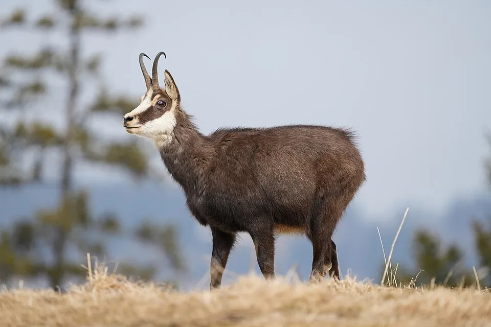
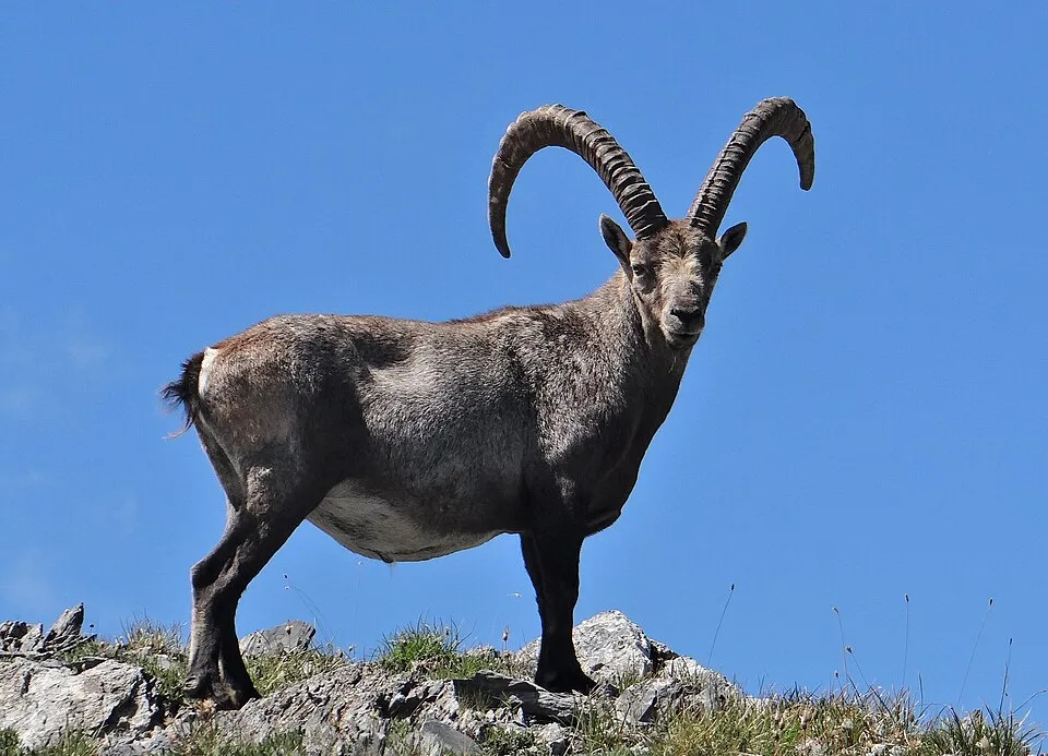
Among the species most often recorded on GBIF are Rupicapra rupicapra (Chamois), Marmota marmota (Alpine marmot), Fringilla coelebs (Eurasian Chaffinch) and Capra ibex (Alpine Ibex).
What is the official website of Mercantour National Park?
© OpenStreetMap
Download the boundary: GeoJSON · GPX Boundary © OpenStreetMap contributors (ODbL).
Geography
The representative point of the site lies at around 1,580 m above sea level. Over the 1996–2025 period, the mean annual temperature is about 6.4 °C and total precipitation reaches roughly 1,222 mm per year. The warmest month is usually July, the coolest January, and the wettest May. According to the BRGM's simplified lithological map, the bedrock consists mainly of limestones, marls and gypsum (33% of sampled points), sandstones (33%) and gneiss (33%). These are mostly sedimentary rocks. The site contains 3 lakes larger than 10 ha, totalling 40 ha of water (HydroLAKES). lac Autier (2.2 ha) is 8 m deep (Wikidata).
Area
- Area
- 67,900 ha
- Elevation
- 1,580 m
- Median elevation
- 2,194 m
- Mean slope
- 25°
- Snow cover
- ≈ 135 days a year
- Lakes over 10 ha
- 3 (40 ha)
- Coordinates
- 44.167, 7.061
Terrain: Mapzen Terrain Tiles (SRTM, USGS) · Lakes: HydroLAKES (Messager et al. 2016, hydrosheds.org, CC BY 4.0) · depths: Wikidata (CC0)
Elevation bands
- 500–1,000 m 1%
- 1,000–1,500 m 7%
- 1,500–2,000 m 24%
- 2,000–2,500 m 51%
- 2,500–3,000 m 17%
share of the site in each elevation band (smoothed terrain model: summits are rounded off) · Terrain: Mapzen Terrain Tiles (SRTM, USGS)
Bedrock
- Limestones, marls and gypsum 33 %
- Sandstones 33 %
- Gneiss 33 %
Sedimentary rocks 67 % · Metamorphic rocks 33 %
Source: BRGM, simplified lithological map at 1:1,000,000 (Licence Ouverte), 12 points sampled within the boundary.
Main summits
- Cime du Gélas3,143 m
- Cime sud du Gélas3,134 m
- Cime de Chafrion3,073 m
- Cime de la Malédie3,061 m
- Mont Pelat3,050 m
- Mont Ténibre3,031 m
- Le Cimet3,020 m
- Cime Asquasciati3,010 m
- Grand Cimon de Rabuons2,998 m
- Roche Rousse2,996 m
Data © OpenStreetMap contributors (ODbL)
Climate
● Mean temperature (°C) · ▮ Precipitation (mm)
Source: Copernicus ERA5-Land (C3S, doi:10.24381/cds.68d2bb30), monthly averages 1996–2025 interpolated to the representative point, temperatures adjusted for elevation.
Contains modified Copernicus Climate Change Service information 2026. Neither the European Commission nor ECMWF is responsible for any use that may be made of the Copernicus information or data it contains.
Snow cover measured by satellite
J
F
M
A
M
J
J
A
S
O
N
D
average share of the site under snow · snowiest parts · ≈ 135 days a year
Snow cover: MODIS/Terra MOD10CM v61 (Hall & Riggs, 2021, NASA NSIDC DAAC, doi:10.5067/MODIS/MOD10CM.061), imagery from NASA GIBS (ESDIS); 2015–2025 average, grid of about 5 km.
Natural habitats
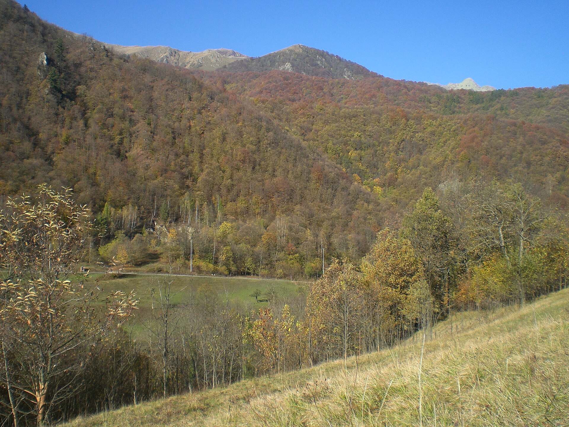
According to CORINE Land Cover (2018), the site is mainly made up of bare rock and scree (25%), grassland and meadows (24%) and forests (22%). Woodland is mostly coniferous. Elevation ranges from about 1,600 m to 3,143 m (highest point: Cime du Gélas). Median elevation is 2,194 m, and 17% of the site lies above 2,500 m (SRTM elevation model). The terrain is steep: 35% of slopes exceed 30° (mean slope 25°). The 2 Natura 2000 sites overlapping the area list 27 habitats of European interest (6 priority), the most extensive being alpine and subalpine calcareous grasslands, calcareous and calcshist screes of the montane to alpine levels (Thlaspietea rotundifolii) and alpine Larix decidua and/or Pinus cembra forests.
Biodiversity
Based on occurrences aggregated by GBIF, several species are regularly recorded within the site. Among the most frequent are Rupicapra rupicapra (Chamois), Marmota marmota (Alpine marmot), Fringilla coelebs (Eurasian Chaffinch) and Capra ibex (Alpine Ibex). The full list of documented taxa is shown below. The overlapping Natura 2000 sites list 53 species of European interest: 28 birds, 10 mammals, 1 amphibian, 7 invertebrates and 7 plants.
Habitats of European interest
From the official forms of the 2 Natura 2000 sites overlapping the area (areas reported for each whole site).
- Alpine and subalpine calcareous grasslands 7,179 ha
- Calcareous and calcshist screes of the montane to alpine levels (Thlaspietea rotundifolii) 6,610 ha
- Alpine Larix decidua and/or Pinus cembra forests 4,967 ha
- Alpine and Boreal heaths 4,894 ha
- Siliceous scree of the montane to snow levels (Androsacetalia alpinae and Galeopsietalia ladani) 4,553 ha
- Species-rich Nardus grasslands, on silicious substrates in mountain areas (and submountain areas in Continental Europe) priority 3,056 ha
- Acidophilous Picea forests of the montane to alpine levels (Vaccinio-Piceetea) 1,142 ha
- Siliceous alpine and boreal grasslands 652 ha
and 19 more
Species of European interest
Birds · 28
Boreal Owl (Aegolius funereus) resident, Cinereous Vulture (Aegypius monachus) passage, Rock Partridge (Alectoris graeca saxatilis) resident, Tawny Pipit (Anthus campestris) breeding passage, Golden Eagle (Aquila chrysaetos) resident, Grey Heron (Ardea cinerea) passage, Hazel Grouse (Bonasa bonasia) resident, Eurasian Eagle-owl (Bubo bubo) resident, European Nightjar (Caprimulgus europaeus) breeding, Short-toed Snake Eagle (Circaetus gallicus) breeding passage, Hen Harrier (Circus cyaneus) wintering, Montagu's Harrier (Circus pygargus) passage and 16 more
Mammals · 10
Barbastelle (Barbastella barbastellus), Grey wolf (Canis lupus), Eurasian Lynx (Lynx lynx), Common bent-wing bat (Miniopterus schreibersii), Bechstein's bat (Myotis bechsteinii), Lesser mouse-eared myotis (Myotis blythii), Geoffroy's bat (Myotis emarginatus), Greater mouse-eared bat (Myotis myotis), Greater Horseshoe Bat (Rhinolophus ferrumequinum), Lesser horseshoe bat (Rhinolophus hipposideros)
Amphibians · 1
Invertebrates · 7
Greater Capricorn Beetle (Cerambyx cerdo), Southern damselfly (Coenagrion mercuriale), Eastern Eggar (Eriogaster catax), Marsh fritillary (Euphydryas aurinia), Jersey Tiger (Euplagia quadripunctaria), Spanish Moon Moth (Graellsia isabellae), Stag beetle (Lucanus cervus)
Plants · 7
Aquilegia bertolonii, Buxbaumia moss (Buxbaumia viridis), Alpine Sea Holly (Eryngium alpinum), Gentiana ligustica, Orthotrichum rogeri, Riccia breidleri, Saxifraga florulenta
Source: Natura 2000 standard data forms (EEA, CC-BY 4.0). Not exhaustive: sensitive species are not published.
Species to look out for
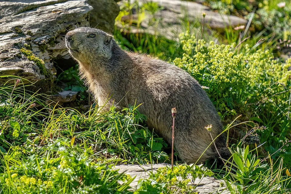
Mammal
Alpine marmot
Marmota marmota3,657 records © Photography captured by Giles Laurent · CC BY-SA 4.0

Observed species
Occurrences documented via GBIF; they are neither an exhaustive inventory nor proof of current presence.
- Chamois · Rupicapra rupicapra · 5940
- Alpine marmot · Marmota marmota · 3657
- Eurasian Chaffinch · Fringilla coelebs · 3621
- Alpine Ibex · Capra ibex · 3091
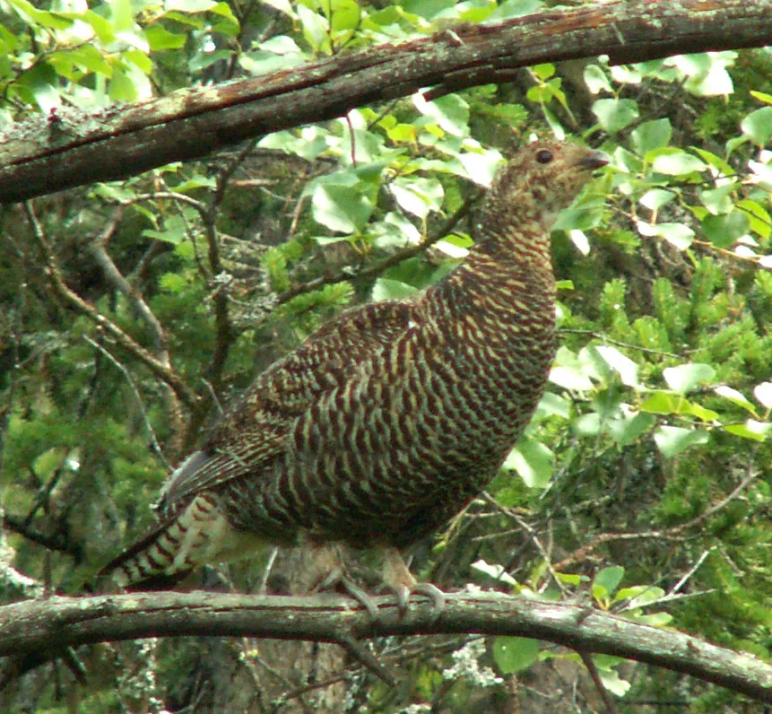
- Black Grouse · Lyrurus tetrix · 2875
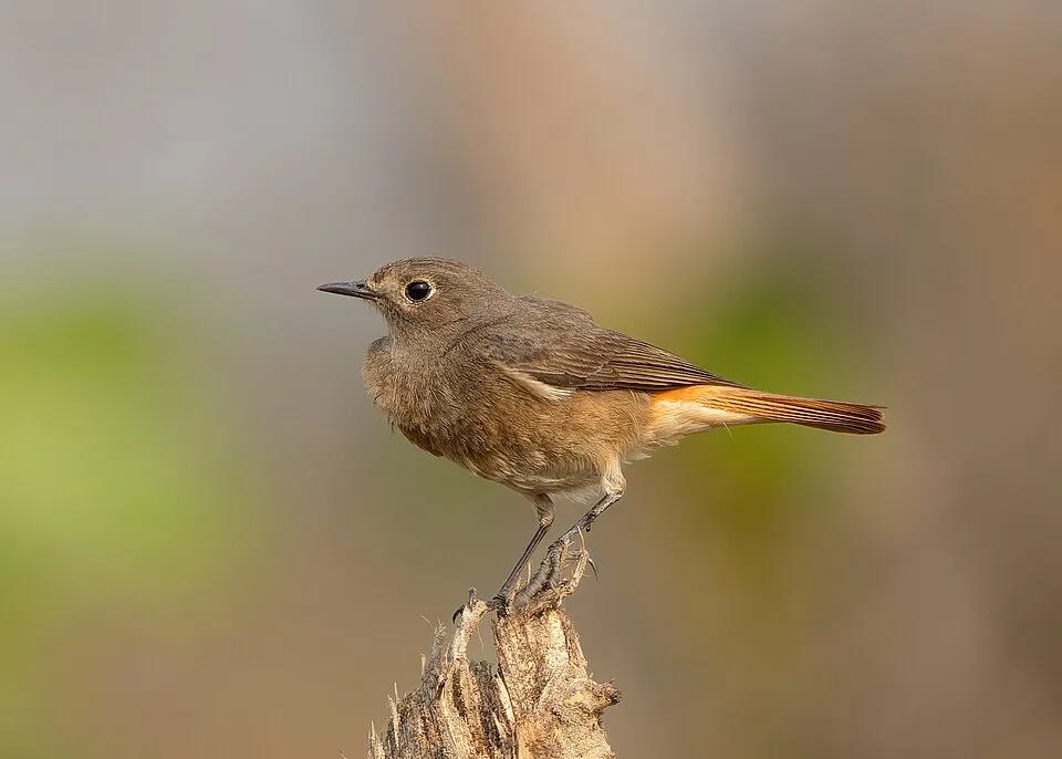
- Black Redstart · Phoenicurus ochruros · 2677
- Northern Wheatear · Oenanthe oenanthe · 2656
- Alpine bluegrass · Poa alpina · 2644
- Red deer · Cervus elaphus · 2639
- Coal tit · Periparus ater · 2463
- Silver-edged primrose · Primula marginata · 2436
- Violet fescue · Festuca violacea · 2093
+18 more species
- Roe deer · Capreolus capreolus · 2025
- Helictotrichon sedenense · 1958
- Carex sempervirens · 1929
- Rock Partridge · Alectoris graeca · 1878
- Alpine Bird's-Foot Trefoil · Lotus alpinus · 1874
- European Larch · Larix decidua · 1847
- Serpent-grass · Bistorta vivipara · 1787
- Alpine Plantain · Plantago alpina · 1786
- Water Pipit · Anthus spinoletta · 1659
- European robin · Erithacus rubecula · 1632
- Griffon Vulture · Gyps fulvus · 1608
- Mat-grass · Nardus stricta · 1595
- Alpine Forget-me-not · Myosotis alpestris · 1579
- Cobweb House-leek · Sempervivum arachnoideum · 1557
- Campanula scheuchzeri · 1554
- Golden Eagle · Aquila chrysaetos · 1541
- Mistle Thrush · Turdus viscivorus · 1486
- Red clover · Trifolium pratense · 1446
Records: GBIF.org (CC-BY). Names: Wikidata (CC0), GBIF. Photos: Wikimedia Commons.
Conservation challenges
The primary purpose of the site is to preserve its natural habitats and the biodiversity they support. The species recorded (Biodiversity tab) reflect its ecological value. The designations it holds frame its management and the control of land use.
According to Global Forest Change data (University of Maryland, Global Forest Watch), about 70 ha of tree cover were lost within the boundary between 2001 and 2023 (under 1% of its area), peaking in 2009 and 2021. These losses include logging, storms and fires, and do not account for regrowth. According to CORINE Land Cover, land cover here remained almost unchanged between 1990 and 2018 (less than 0.5% of the area affected). At night, the area gives off virtually no artificial light detectable from space (NASA VIIRS Black Marble composite, 2016). According to the Natura 2000 forms, of 27 assessed habitats of European interest, 11 are in excellent condition and 3 in average or reduced condition. According to the Water Framework Directive assessment (2022 river basin management plans, data 2012–2017), 87% of the 183 km of rivers assessed within the site are in good or high ecological status. Other assessed water bodies: lakes, 3 of 3 in good ecological status or better. Since 2000, 15 invasive alien species have been recorded within the site (GBIF observations), 2 of them listed as of Union concern under EU Regulation 1143/2014. Among them: Ailanthus altissima (Tree-of-heaven), Vespa velutina (Asian hornet) and Robinia pseudoacacia (Black locust).
Pressure indicators
Tree cover lost
70 ha
2001–2023 · < 1% of the area
20012023
Fires since 2016
0
No large fire mapped (fires over about 30 ha)
Light at night
< 1%
of the area gives off artificial light visible from space
DarkLit
Land cover change
< 0.5%
of the area changed, 1990–2018 · CORINE
Rivers and lakes
87%
of the 183 km of assessed rivers in good or high ecological status · WFD 2022
Lakes: 3 of 3 good or better
assessments 2012–2017
Invasive alien species
15
incl. 2 of EU concern · since 2000
 Tree-of-heavenEU
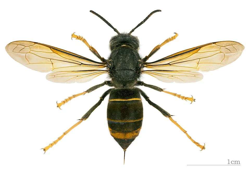 Asian hornetEU
 Black locust
 Common Laburnum
Asian Lady Beetle
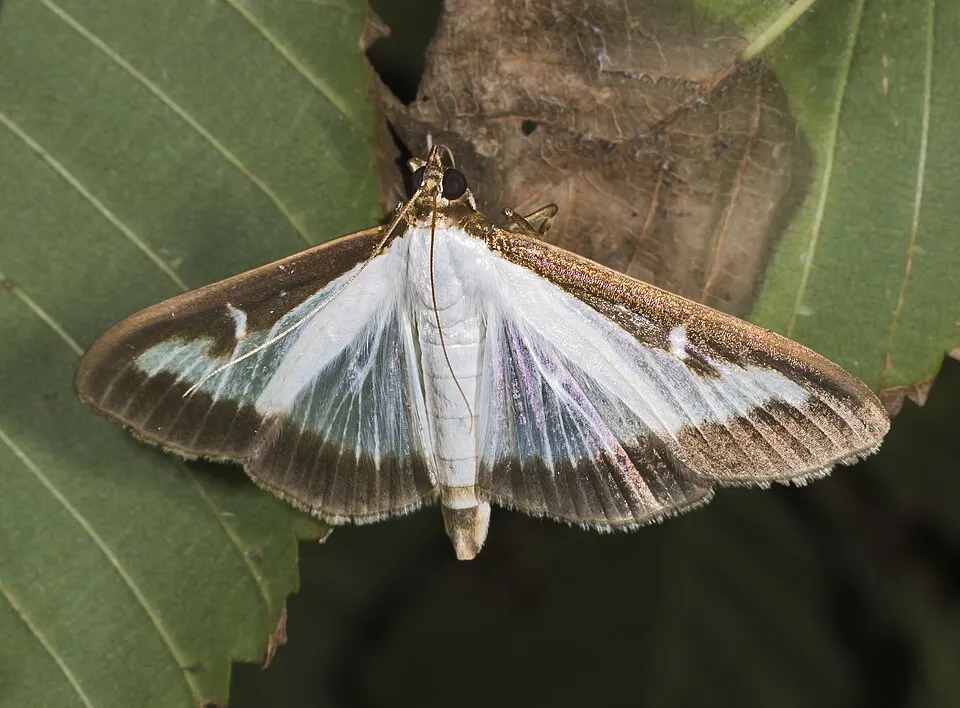 Box Tree Moth
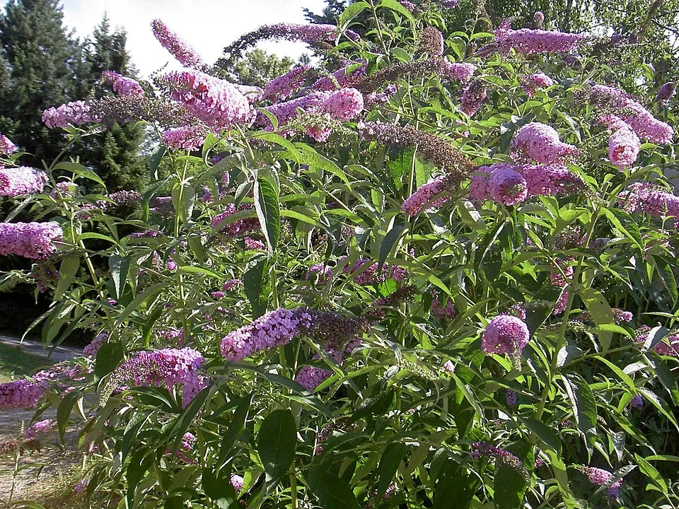 Butterfly-bush
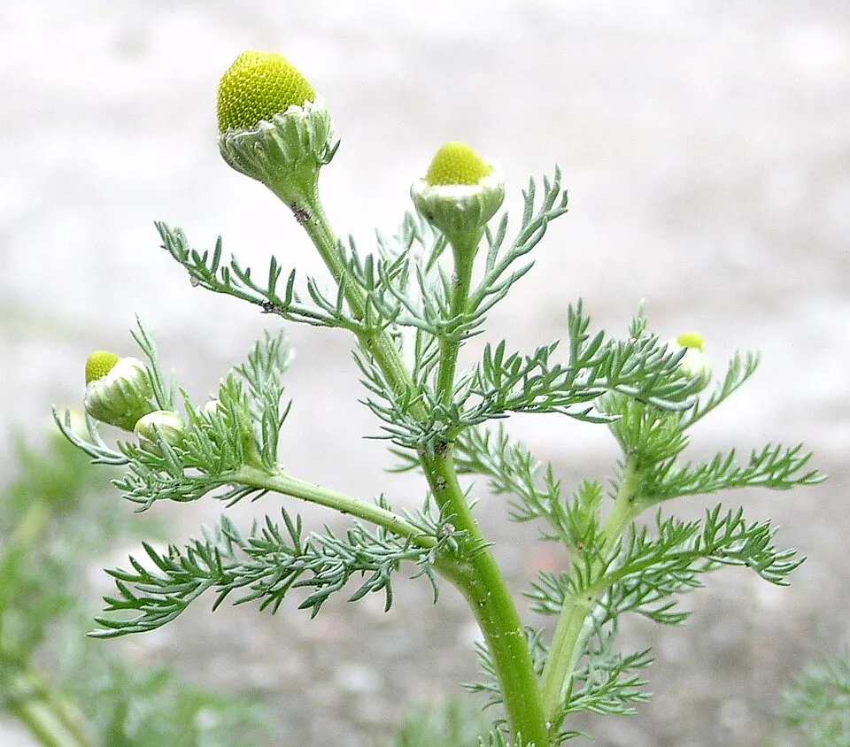 Pineappleweed
Photos: Tree-of-heaven © Darkone · CC BY-SA 2.5; Asian hornet © Didier Descouens · CC BY-SA 4.0; Black locust © This Photo was taken by Wolfgang Moroder. Feel free to use my photos, but please mention me as the author and send me a message. This image is not in the public domain. Please respect the copyright protection. It may only be used according… · CC BY-SA 3.0; Common Laburnum © Enrico Blasutto · CC BY-SA 4.0; Box Tree Moth © Didier Descouens · CC BY-SA 3.0; Butterfly-bush © --IKAl 15:22, 23 July 2007 (UTC) · CC BY-SA 2.5; Pineappleweed © Krzysztof Ziarnek · CC BY-SA 3.0
Sources: Global Forest Change (Hansen et al., University of Maryland, via Global Forest Watch, CC-BY 4.0); EFFIS, European Commission / Copernicus; NASA Black Marble 2016 (public domain); CORINE Land Cover 2018 (Copernicus) or MODIS.
CORINE Land Cover Change 1990–2018: generated using European Union's Copernicus Land Monitoring Service information (EEA), aggregated by Parkavela; DOI 10.2909/f30f1000-7cf8-43bb-872c-5eb093911b24.
Ecological status of water bodies: European Environment Agency, WISE – Water Framework Directive, 3rd river basin management plans (2022), CC BY 4.0. Official national classification, not comparable between countries.
Invasive alien species: Global Register of Introduced and Invasive Species (ISSG, CC BY 4.0); Union list, Regulation (EU) 1143/2014 (INBO, CC0); GBIF.org records (CC0 / CC BY 4.0), at least 2 per species.
Practical information
Cities and airport
- Nice
25 km as the crow flies - Sanremo
27 km as the crow flies - Airport: Nice Côte d'Azur (NCE)
31 km as the crow flies
Visitor information
- Point d'information touristique d'Entraunes
1 km from the site boundary - Place San-Menth
3 km from the site boundary
Parking
42 public car parks listed within the site
Point de stationnementParking du LausParking 2710Col de Raspaillon
Things to see
19 viewpoints · 32 waterfalls · 113 lakes and ponds · 1 natural arch · 8 caves
- Cime de la Bonette
viewpoint · 2,860 m - Cascade de Messeloris
waterfall - Lac du Trou de l'Aigle
lake or pond · 2,638 m - Arc de Tortisse
natural arch - Gouffre de Châteauvieux
cave
Where to stay
27 mountain huts · 4 campsites
- Refuge des Lacs de Vens
Staffed hut · 2,380 m · 45 beds - Camping à la Ferme du Seuillet
campsite - Cabane de Pra Joli
Unstaffed hut · 2,337 m · 2 beds - Zone de bivouac du Refuge des Merveilles
campsite - Cabane Pastorale de l'Encombrette
Unstaffed hut · 2,315 m · 2 beds
Hiking
73 waymarked routes listed, including:
Via AlpinaVia Alpina Blue
Trail difficulty
- T1 · easy hiking · 40% · 242 km
- T2 · mountain hiking · 45% · 285 km
- T3–T6 · demanding or alpine hiking · 15% · 104 km
631 km graded out of 1,098 km of paths
SAC scale (T1–T6) © OpenStreetMap contributors (ODbL): indicative only, check with the park.
By bike
VRGA Route des Grandes Alpes à vélo · 44 km1 Collection d'itinéraires cyclables Alpi Marittime-Mercantour · 43 km
+ 3 local loops
Signed cycle routes: this does not mean that cycling is allowed on footpaths.
Data © OpenStreetMap contributors (ODbL) · Wikidata (CC0)
Routes © OpenStreetMap contributors (ODbL), via Waymarked Trails
Waymarked hiking routes
Via Alpina Stage 114: Camp d'Argent - Sospel
14 km within the site ↗ 987 m↘ 384 m 1,120–1,925 m
Via Alpina Stage 113: Refuge des Merveilles - Camp d’Argent
11.7 km within the site ↗ 541 m↘ 791 m 1,818–2,424 m
up to T1 · hiking
Via Alpina Stage 112 Refuge de Nice ou Victor de Cessole - Refuge Merveilles
9.3 km within the site ↗ 604 m↘ 697 m 2,114–2,681 m
up to T3 · demanding mountain hiking
VA-D53 Via Alpina Blue D53
16.1 km within the site ↗ 1,016 m↘ 1,019 m 1,868–2,667 m
up to T2 · mountain hiking
VA-D56 Via Alpina Blue D56
19.3 km within the site ↗ 1,280 m↘ 887 m 1,475–2,546 m
up to T1 · hiking
VA-D57 Via Alpina Blue D57
1 km within the site ↗ 0 m↘ 155 m 1,739–1,895 m
up to T1 · hiking
Tracks © OpenStreetMap contributors (ODbL), clipped to the boundary; elevation gain and profiles computed on the longest section from Mapzen Terrain Tiles (≈ 30 m), indicative only. Indicative difficulty (SAC scale, OpenStreetMap, via Waymarked Trails): check with the park.
Access and visiting
The nearest railway station is Breil sur Roya, about 3 km from the site boundary. Nearest towns of over 50,000 people, as the crow flies: Nice (25 km) and Sanremo (27 km). Nearest airport: Nice Côte d'Azur (NCE), about 31 km away. About 240,000 people live within 20 km of the site boundary, 37,000 of them within 10 km; some 1,100 people are estimated to live inside (GHSL estimate, 2020). This population has grown by about 6% since 2000. Visitor information on site: Point d'information touristique d'Entraunes and Place San-Menth. Public car parks listed within the site: 42, including Point de stationnement, Parking du Laus and Parking 2710. Waymarked hiking routes listed in OpenStreetMap: 73, including Via Alpina and Via Alpina Blue. Of the roughly 630 km of paths with a difficulty grade in OpenStreetMap, 40% are easy hiking (T1), 45% mountain hiking (T2) and 15% demanding or alpine hiking (T3–T6). This is indicative only: check with the park. The site is crossed by 2 signed cycle routes: “VRGA Route des Grandes Alpes à vélo” and “1 Collection d'itinéraires cyclables Alpi Marittime-Mercantour” (OpenStreetMap). To see: 19 viewpoints, 32 waterfalls, 113 lakes and ponds, 1 natural arch and 8 caves, including Cime de la Bonette (2,860 m), Cascade de Messeloris, Lac du Trou de l'Aigle (2,638 m) and Arc de Tortisse. Where to stay: 27 mountain huts and 4 campsites, including Refuge des Lacs de Vens (2,380 m), Camping à la Ferme du Seuillet and Cabane de Pra Joli (2,337 m). To plan a visit (access, opening periods, visitor rules), it is best to consult the official information from the managing body and the official website listed in this page's sources.
Source: OpenStreetMap (ODbL), Wikidata (CC0), October 2026.
Built heritage
According to the French Ministry of Culture's Mérimée database, one historic monument (classé) stands within the boundary. It is “Gravures rupestres de la vallée des Merveilles et de la région du Mont Bégo” in Tende.
Source: Mérimée database, French Ministry of Culture (Licence Ouverte 2.0). Each record links to the Plateforme ouverte du patrimoine (POP).
When to visit
Best time to visit: from July to September, with average temperatures of 11 to 16 °C and moderate rainfall. Average temperatures drop below 0 °C from December to February: frost is common. These averages apply to the site's representative point (1,580 m); higher up it is markedly cooler and snow lasts longer. According to NASA's MODIS satellites (2015–2025 average), snow covers most of the site from December to April, and until May on higher ground, with about 135 snow-covered days a year on average. Day length ranges from about 8 h 53 min in December to 15 h 29 min in June. Wildlife records published on GBIF peak for birds (from May to July), plants (July), butterflies and moths (July), dragonflies (July and August) and mammals (from June to August). These peaks also reflect when observers are most active.
Source: Copernicus ERA5-Land (C3S), monthly averages 1996–2025 at the representative point, temperatures adjusted for elevation.
Contains modified Copernicus Climate Change Service information 2026. Neither the European Commission nor ECMWF is responsible for any use that may be made of the Copernicus information or data it contains.
Wildlife records calendar
JFMAMJJASOND
Birds
Plants
Butterflies & moths
Dragonflies
Mammals
Monthly records published on GBIF (CC-BY), relative to the busiest month; also reflects observer activity.
Gallery
© kallerna · CC BY-SA 4.0
© Abubakr Hussain · CC BY-SA 2.5
© JeanClaude06 · CC BY-SA 4.0
© Edward O · CC BY-SA 3.0
© cris06 · CC BY-SA 3.0
© kallerna · CC BY-SA 4.0
Sources and licences
- Wikidata: Q1535042
- OpenStreetMap: relation 1024511
- Official website: http://www.mercantour-parcnational.fr/
- Wikipedia: en.wikipedia.org/wiki/Mercantour_National_Park
- Natura 2000: FR9301559
- WDPA: 664
References
- mercantour-parcnational.fr: official area · LO-2.0
- cds.climate.copernicus.eu: climate · CC-BY-4.0
- registry.opendata.aws: elevation of the reference point, detailed relief · PD
- land.copernicus.eu: land cover, land cover change, sea share · COPERNICUS
- doi.org: population around the site · CC-BY-4.0
- eea.europa.eu: bathing water quality, ecological status of waters · CC-BY-4.0
- en.eurovelo.com: EuroVelo cycle routes · ODbL-1.0
- cycling.waymarkedtrails.org: cycle routes · ODbL-1.0
- opentopodata.org: elevations · PD
- wikidata.org: establishment date, nearby cities and airport, access and peaks, lake depths, places to see, official website · CC0-1.0
- forest-fire.emergency.copernicus.eu: wildfires · COPERNICUS
- globalforestwatch.org: tree cover loss · CC-BY-4.0
- gbif.org: seasonality of sightings, invasive alien species, observed species · CC-BY-4.0
- infoterre.brgm.fr: geology · LO-2.0
- pop.culture.gouv.fr: protected heritage · LO-2.0
- hydrosheds.org: lakes · CC-BY-4.0
- natura2000.eea.europa.eu: Natura 2000 habitats and species · CC-BY-4.0
- openstreetmap.org: official name, access and peaks, places to see, trail difficulty, wheelchair access · ODbL-1.0
- earthobservatory.nasa.gov: night light · PD
- hiking.waymarkedtrails.org: route difficulty · ODbL-1.0
- nsidc.org: snow cover · PD
- wikidata.org: Wikipedia article · CC-BY-SA-4.0
Data © OpenStreetMap contributors (ODbL), Wikidata (CC0) and the sources cited.