Italy · Terrestrial
Maritime Alps Nature Park
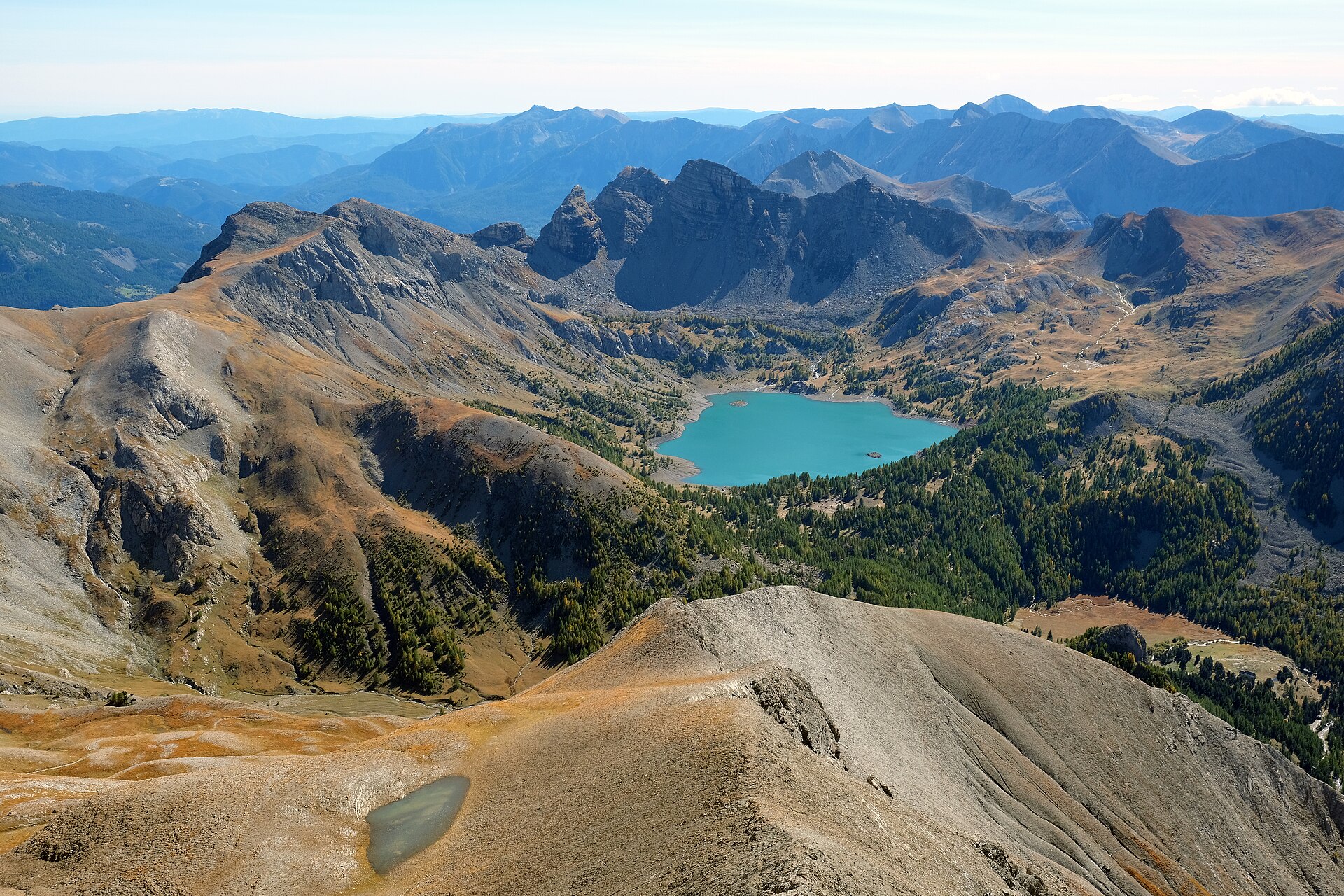
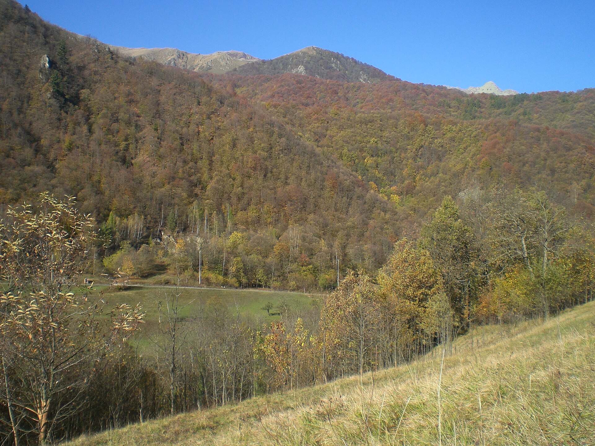
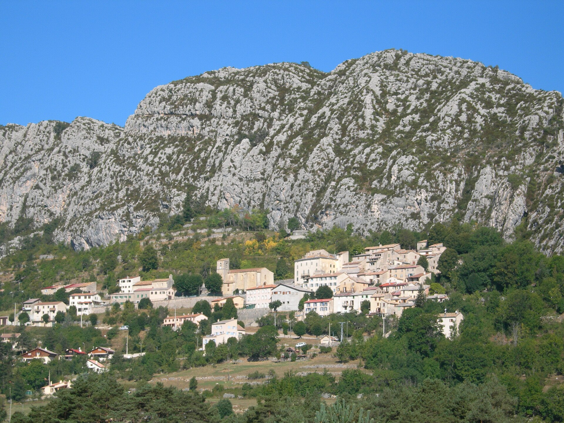
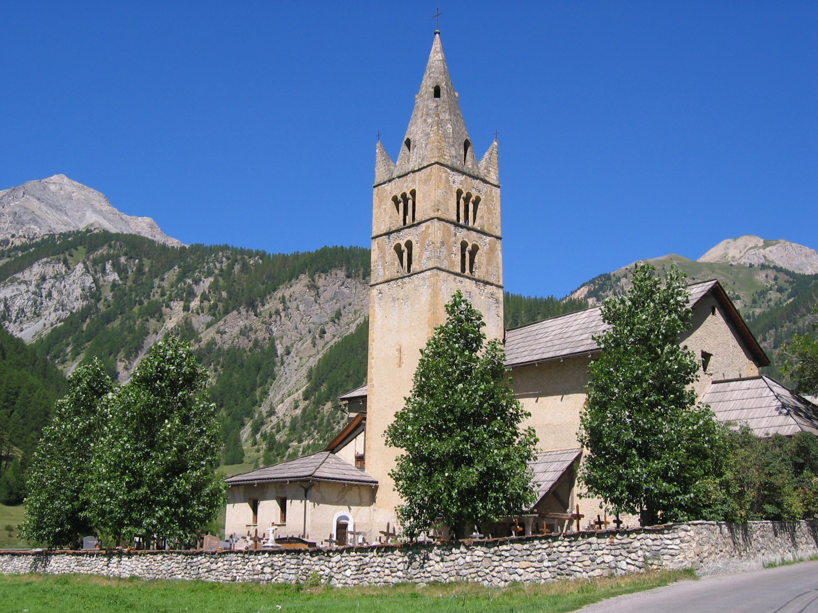
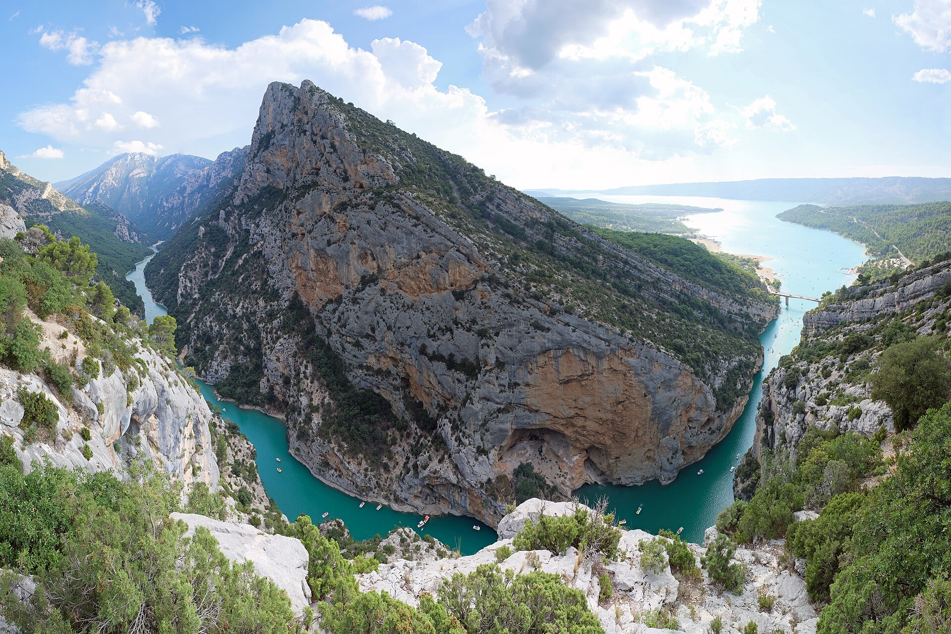
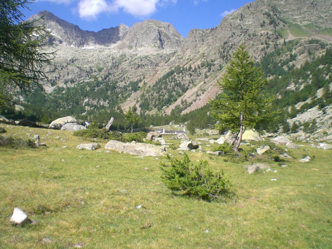
Regional nature park of 27,832 hectares in Italy, established in 1980.
Overview
Regional nature park of 27,832 hectares in Italy, established in 1980.
Maritime Alps Nature Park is a regional nature park in Italy (Europe). It is a predominantly terrestrial area. Established in 1980, it covers about 27,832 hectares.
Protections and designations
Natura 2000 · habitats (SAC)
- Alpi Marittime IT1160056
Natura 2000 · birds (SPA)
- Alpi Marittime IT1160056
Protected as a regional nature park. International labels and designations: Natura 2000 network (1 site: “Alpi Marittime”). Key dates: established in 1980 and first Natura 2000 site under the Birds Directive in 2006.
In our collections
Timeline
-
1980
Established
-
2006
First Natura 2000 site under the Birds Directive
Sources: Wikidata (CC0) for establishment and international labels; EEA Natura 2000 database (CC-BY 4.0) for site designation dates.
Frequently asked questions
Where is Maritime Alps Nature Park?
In Italy (Europe). Representative point: 44.2031° N, 7.3511° E.
How large is Maritime Alps Nature Park?
About 27,832 hectares (278 km²). It is the 17th largest of the 128 regional parks in Italy covered by Parkavela.
When was Maritime Alps Nature Park established?
In 1980.
What habitats and landscapes does Maritime Alps Nature Park include?
A terrestrial area, with mountains.
What rocks lie beneath Maritime Alps Nature Park?
According to the BRGM's simplified lithological map, the bedrock consists mainly of gneiss (100% of sampled points). These are mostly metamorphic rocks.
What is the highest point of Maritime Alps Nature Park?
Cima Sud Argentera, at 3,297 m (OpenStreetMap).
What are the main summits of Maritime Alps Nature Park?
Cima Sud Argentera (3,297 m), Cima Nord Argentera (3,286 m), Monte Stella (3,262 m), Punta Gelas di Lourousa (3,261 m) and Cima Genova (3,191 m) (OpenStreetMap).
Which international labels apply to Maritime Alps Nature Park?
Natura 2000 network (1 site: “Alpi Marittime”).
When is the best time to visit Maritime Alps Nature Park?
Best time to visit: July and August, with average temperatures of 13 to 14 °C and moderate rainfall.
Is there snow in Maritime Alps Nature Park?
Yes. According to NASA's MODIS satellites (2015–2025 average), snow covers most of the site from December to April, and until May on higher ground, with about 145 snow-covered days a year on average.
What is there to see in Maritime Alps Nature Park?
5 viewpoints, 2 waterfalls, 50 lakes and ponds and 1 cave, including Gias "La Mera", Cascata superiore, Lago di Nasta (2,809 m) and Scavo Traforo Ciriegia-Mercantour (OpenStreetMap).
Where can I stay in Maritime Alps Nature Park?
17 mountain huts and 7 campsites, including Bivacco Moncalieri (2,710 m), Area Camper Centro Alpino di Sant’Anna di Valdieri and Rifugio Pagarì (2,627 m) (OpenStreetMap).
What is the nearest large city to Maritime Alps Nature Park?
Nearest towns of over 50,000 people, as the crow flies: Cuneo (16 km) and Sanremo (42 km). Nearest airport: Cuneo (CUF), about 33 km away.
How can I reach Maritime Alps Nature Park by train?
The nearest railway station is Vievola, about 6 km from the site boundary.
Where can I get visitor information on site?
Sede operativa Parco naturale Alpi Marittine.
Are there waymarked hiking trails in Maritime Alps Nature Park?
Yes. Waymarked hiking routes listed in OpenStreetMap: 118, including GR 52 and Via Alpina. The “VA-R142 · Via Alpina Red R142” route runs for about 16 km through the site, with some 1,030 m of ascent on its longest section.
Which species can be seen in Maritime Alps Nature Park?
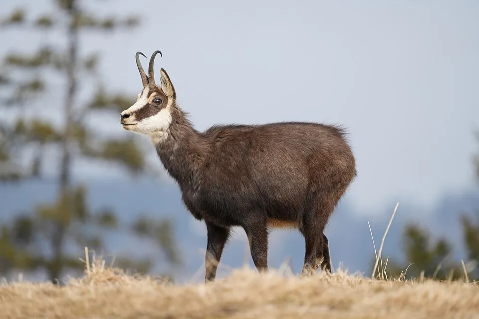
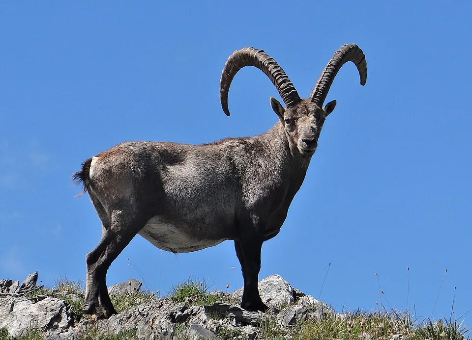
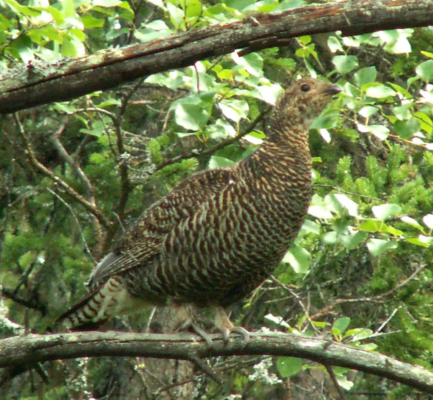
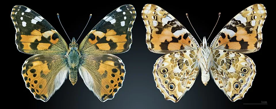
Among the species most often recorded on GBIF are Rupicapra rupicapra (Chamois), Capra ibex (Alpine Ibex), Lyrurus tetrix (Black Grouse) and Vanessa cardui (Painted Lady).
What is the official website of Maritime Alps Nature Park?
© OpenStreetMap
Download the boundary: GeoJSON · GPX Boundary © OpenStreetMap contributors (ODbL).
Geography
The representative point of the site lies at around 1,948 m above sea level. Over the 1996–2025 period, the mean annual temperature is about 4.4 °C and total precipitation reaches roughly 1,200 mm per year. The warmest month is usually July, the coolest January, and the wettest November. According to the BRGM's simplified lithological map, the bedrock consists mainly of gneiss (100% of sampled points). These are mostly metamorphic rocks. In 2015, 6 glaciers covered 26 ha within the site (Sentinel-2 glacier inventory of the Alps). The site contains 2 lakes larger than 10 ha, totalling 72 ha of water; the largest, lago del Chiotas, covers 44 ha (HydroLAKES). lago del Chiotas is 120 m deep (Wikidata).
Area
- Area
- 27,832 ha
- Elevation
- 1,948 m
- Median elevation
- 2,052 m
- Mean slope
- 32°
- Snow cover
- ≈ 145 days a year
- Lakes over 10 ha
- 2 (72 ha)
- Coordinates
- 44.2031, 7.3511
Terrain: Mapzen Terrain Tiles (SRTM, USGS) · Lakes: HydroLAKES (Messager et al. 2016, hydrosheds.org, CC BY 4.0) · depths: Wikidata (CC0)
Elevation bands
- 500–1,000 m 2%
- 1,000–1,500 m 13%
- 1,500–2,000 m 31%
- 2,000–2,500 m 38%
- 2,500–3,000 m 16%
share of the site in each elevation band (smoothed terrain model: summits are rounded off) · Terrain: Mapzen Terrain Tiles (SRTM, USGS)
Bedrock
- Gneiss 100 %
Metamorphic rocks 100 %
Source: BRGM, simplified lithological map at 1:1,000,000 (Licence Ouverte), 1 points sampled within the boundary.
Main summits
- Cima Sud Argentera3,297 m
- Cima Nord Argentera3,286 m
- Monte Stella3,262 m
- Punta Gelas di Lourousa3,261 m
- Cima Genova3,191 m
- Cima di Nasta3,108 m
- Cima Est di Nasta3,106 m
- Monte Matto Cima Centrale3,097 m
- Monte Matto Cima Est3,088 m
- Balcon du Gélas3,085 m
Data © OpenStreetMap contributors (ODbL)
Climate
● Mean temperature (°C) · ▮ Precipitation (mm)
Source: Copernicus ERA5-Land (C3S, doi:10.24381/cds.68d2bb30), monthly averages 1996–2025 interpolated to the representative point, temperatures adjusted for elevation.
Contains modified Copernicus Climate Change Service information 2026. Neither the European Commission nor ECMWF is responsible for any use that may be made of the Copernicus information or data it contains.
Snow cover measured by satellite
J
F
M
A
M
J
J
A
S
O
N
D
average share of the site under snow · snowiest parts · ≈ 145 days a year
Snow cover: MODIS/Terra MOD10CM v61 (Hall & Riggs, 2021, NASA NSIDC DAAC, doi:10.5067/MODIS/MOD10CM.061), imagery from NASA GIBS (ESDIS); 2015–2025 average, grid of about 5 km.
Natural habitats
According to CORINE Land Cover (2018), the site is mainly made up of sparsely vegetated land (45%), forests (18%) and heath and scrub (18%). Elevation ranges from about 920 m to 3,297 m (highest point: Cima Sud Argentera). Median elevation is 2,052 m, and 16% of the site lies above 2,500 m (SRTM elevation model). The terrain is steep: 59% of slopes exceed 30° (mean slope 32°). The Natura 2000 site overlapping the area lists 35 habitats of European interest (6 priority), the most extensive being siliceous rocky slopes with chasmophytic vegetation, siliceous scree of the montane to snow levels (Androsacetalia alpinae and Galeopsietalia ladani) and siliceous alpine and boreal grasslands.
Biodiversity
Based on occurrences aggregated by GBIF, several species are regularly recorded within the site. Among the most frequent are Rupicapra rupicapra (Chamois), Capra ibex (Alpine Ibex), Lyrurus tetrix (Black Grouse) and Vanessa cardui (Painted Lady). The full list of documented taxa is shown below. The overlapping Natura 2000 site lists 126 species of European interest: 76 birds, 23 mammals, 4 reptiles, 2 amphibians, 2 fish, 9 invertebrates and 10 plants.
Habitats of European interest
From the official form of the Natura 2000 site overlapping the area (areas reported for the whole site).
- Siliceous rocky slopes with chasmophytic vegetation 6,627 ha
- Siliceous scree of the montane to snow levels (Androsacetalia alpinae and Galeopsietalia ladani) 4,362 ha
- Siliceous alpine and boreal grasslands 3,629 ha
- Alpine and Boreal heaths 1,947 ha
- Alpine Larix decidua and/or Pinus cembra forests 954 ha
- Asperulo-Fagetum beech forests 885 ha
- Semi-natural dry grasslands and scrubland facies on calcareous substrates (Festuco-Brometalia) (* important orchid sites) 816 ha
- Alpine and subalpine calcareous grasslands 772 ha
and 27 more
Species of European interest
Birds · 76
Eurasian Goshawk (Accipiter gentilis) resident, Eurasian Sparrowhawk (Accipiter nisus) breeding resident, Boreal Owl (Aegolius funereus) breeding resident, Common Kingfisher (Alcedo atthis) passage, Rock Partridge (Alectoris graeca saxatilis) breeding resident, Eurasian Teal (Anas crecca) wintering, Mallard (Anas platyrhynchos) breeding, Tawny Pipit (Anthus campestris) breeding, Water Pipit (Anthus spinoletta) breeding, Tree Pipit (Anthus trivialis) breeding, Golden Eagle (Aquila chrysaetos) resident breeding, Grey Heron (Ardea cinerea) resident and 64 more
Mammals · 23
Barbastelle (Barbastella barbastellus), Grey wolf (Canis lupus), Alpine Ibex (Capra ibex), Northern Bat (Eptesicus nilssonii), Serotine bat (Eptesicus serotinus), Mountain Hare (Lepus timidus), European pine marten (Martes martes), Hazel dormouse (Muscardinus avellanarius), Bechstein's bat (Myotis bechsteinii), Lesser mouse-eared myotis (Myotis blythii), Daubenton's bat (Myotis daubentonii), Geoffroy's bat (Myotis emarginatus) and 11 more
Reptiles · 4
Smooth snake (Coronella austriaca), Western Whip Snake (Hierophis viridiflavus), Western green lizard (Lacerta bilineata), Common wall lizard (Podarcis muralis)
Amphibians · 2
Common frog (Rana temporaria), North-west Italian cave salamander (Speleomantes strinatii)
Invertebrates · 9
Jersey Tiger (Euplagia quadripunctaria), Stag beetle (Lucanus cervus), Large Blue (Maculinea arion), Hermit beetle (Osmoderma eremita), Southern Swallowtail (Papilio alexanor), Apollo (Parnassius apollo), Clouded apollo (Parnassius mnemosyne), Willowherb Hawkmoth (Proserpinus proserpina), Rosalia longicorn (Rosalia alpina)
Plants · 10
Aquilegia alpina, Mountain arnica (Arnica montana), Apennines Genepì (Artemisia eriantha), Artemisia petrosa eriantha, Cladonia (cladina) subsp., Gentiana ligustica, Great Yellow Gentian (Gentiana lutea), Leucobryum moss (Leucobryum glaucum), Saxifraga florulenta, Sphagnum Mosses (Sphagnum spp.)
Source: Natura 2000 standard data forms (EEA, CC-BY 4.0). Not exhaustive: sensitive species are not published.
Species to look out for
Bird
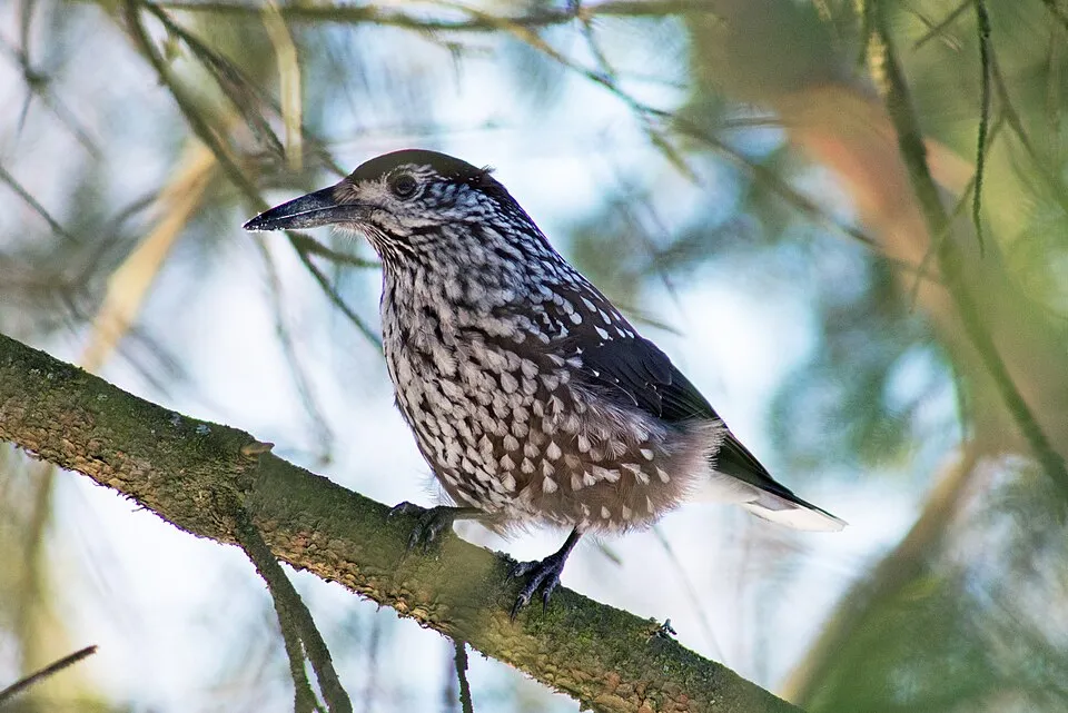
Northern Nutcracker
Nucifraga caryocatactes107 records © Jyrki Salmi from Finland · CC BY-SA 2.0
Observed species
Occurrences documented via GBIF; they are neither an exhaustive inventory nor proof of current presence.
- Chamois · Rupicapra rupicapra · 198
- Alpine Ibex · Capra ibex · 195
- Fragilaria capucina · 164
- Black Grouse · Lyrurus tetrix · 145
- Painted Lady · Vanessa cardui · 128
- Achnanthes minutissima · 118
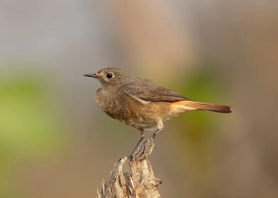
- Black Redstart · Phoenicurus ochruros · 115
- Northern Nutcracker · Nucifraga caryocatactes · 107
- Alpine marmot · Marmota marmota · 105
- Gomphonema parvulum · 98
- Apollo · Parnassius apollo · 96
- Eurasian Chaffinch · Fringilla coelebs · 91
+18 more species
- Coal tit · Periparus ater · 90
- Mythimna sicula · 88
- Small white · Pieris rapae · 85
- Almond-eyed Ringlet · Erebia alberganus · 85
- Large Ringlet · Erebia euryale · 83
- Small tortoiseshell · Aglais urticae · 77
- Rock Partridge · Alectoris graeca · 77
- Alpine Chough · Pyrrhocorax graculus · 76
- Large wall brown · Lasiommata maera · 74
- Silver-studded Blue · Plebejus argus · 74
- Cymbella minuta · 74
- Diatoma mesodon · 72
- Silver-washed fritillary · Argynnis paphia · 71
- Cymbella silesiaca · 71
- Northern Wheatear · Oenanthe oenanthe · 70
- Clossiana euphrosyne · 62
- Trechus putzeysi · 60
- Eunotia arcus · 60
Records: GBIF.org (CC-BY). Names: Wikidata (CC0), GBIF. Photos: Wikimedia Commons.
Conservation challenges
The primary purpose of the site is to preserve its natural habitats and the biodiversity they support. The species recorded (Biodiversity tab) reflect its ecological value. The designations it holds frame its management and the control of land use.
According to Global Forest Change data (University of Maryland, Global Forest Watch), about 27 ha of tree cover were lost within the boundary between 2001 and 2023, peaking in 2002 and 2009. These losses include logging, storms and fires, and do not account for regrowth. According to the European CORINE Land Cover inventory (Copernicus), land cover changed on about 389 ha of the site between 1990 and 2018 (1% of its area): forest grew by 389 ha, mostly at the expense of farmland, while farmland shrank by 221 ha, mostly giving way to forest. Forest felling and regrowth add about 1,930 ha in total over the period. At night, the area gives off virtually no artificial light detectable from space (NASA VIIRS Black Marble composite, 2016). According to the Natura 2000 forms, of 33 assessed habitats of European interest, 7 are in excellent condition and 3 in average or reduced condition. Invasive alien species have been recorded within the site since 2000 (GBIF observations). Among them: Harmonia axyridis (Asian Lady Beetle), Cameraria ohridella (Horse-chestnut leaf miner) and Rosa rugosa (Japanese rose).
Pressure indicators
Tree cover lost
27 ha
2001–2023 · < 1% of the area
20012023
Fires since 2016
0
No large fire mapped (fires over about 30 ha)
Light at night
< 1%
of the area gives off artificial light visible from space
DarkLit
Built-up land
< 1%
buildings, business areas, roads, quarries
Land cover change
389 ha
changed cover, 1990–2018 · CORINE · 1% of the area
- +389 ha · forest
- −221 ha · farmland
forest felling and regrowth: 1,930 ha in total
Invasive alien species
3
recorded since 2000
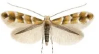 Horse-chestnut leaf miner
 Japanese rose
Photos: Horse-chestnut leaf miner © Carlos Lopez-Vaamonde, David Agassiz, Sylvie Augustin, Jurate De Prins, Willy De Prins, Stanislav Gomboc, Povilas Ivinskis, Ole Karsholt, Athanasios Koutroumpas, Fotini Koutroumpa, Zdeněk Laštůvka, Eduardo Marabuto, Elisenda Olivella, Luka… · CC BY 3.0; Japanese rose © Vihljun · Public domain
Sources: Global Forest Change (Hansen et al., University of Maryland, via Global Forest Watch, CC-BY 4.0); EFFIS, European Commission / Copernicus; NASA Black Marble 2016 (public domain); CORINE Land Cover 2018 (Copernicus) or MODIS.
CORINE Land Cover Change 1990–2018: generated using European Union's Copernicus Land Monitoring Service information (EEA), aggregated by Parkavela; DOI 10.2909/f30f1000-7cf8-43bb-872c-5eb093911b24.
Invasive alien species: Global Register of Introduced and Invasive Species (ISSG, CC BY 4.0); Union list, Regulation (EU) 1143/2014 (INBO, CC0); GBIF.org records (CC0 / CC BY 4.0), at least 2 per species.
Practical information
Cities and airport
- Cuneo
16 km as the crow flies - Sanremo
42 km as the crow flies - Airport: Cuneo (CUF)
33 km as the crow flies
Visitor information
- Sede operativa Parco naturale Alpi Marittine
within the site
Things to see
5 viewpoints · 2 waterfalls · 50 lakes and ponds · 1 cave
- Gias "La Mera"
viewpoint - Cascata superiore
waterfall - Lago di Nasta
lake or pond · 2,809 m - Scavo Traforo Ciriegia-Mercantour
cave - Lo Gorgas
viewpoint
Where to stay
17 mountain huts · 7 campsites
- Bivacco Moncalieri
Unstaffed hut · 2,710 m - Area Camper Centro Alpino di Sant’Anna di Valdieri
campsite - Rifugio Pagarì
Staffed hut · 2,627 m - Area camper Terme Valdieri
campsite - Rifugio Bozano
Staffed hut · 2,453 m
Hiking
118 waymarked routes listed, including:
GR 52Via Alpina
Data © OpenStreetMap contributors (ODbL) · Wikidata (CC0)
Waymarked hiking routes
VA-R141 Via Alpina Red R141
5.2 km within the site ↗ 306 m↘ 337 m 2,266–2,526 m
up to T2 · mountain hiking
VA-R142 Via Alpina Red R142
15.7 km within the site ↗ 1,032 m↘ 1,004 m 1,364–2,366 m
up to T2 · mountain hiking
VA-R143 Via Alpina Red R143
14.3 km within the site ↗ 1,338 m↘ 812 m 1,792–2,567 m
up to T2 · mountain hiking
VA-R144 Via Alpina Red R144
3.9 km within the site ↗ 644 m↘ 8 m 1,806–2,454 m
up to T1 · hiking
GR 52 Entraunes - Col de Salèse
11.7 km within the site ↗ 530 m↘ 667 m 2,120–2,524 m
up to T2 · mountain hiking
SI Unnamed route
15.4 km within the site ↗ 659 m↘ 1,277 m 1,365–2,562 m
up to T2 · mountain hiking
M22 Unnamed route
8.4 km within the site ↗ 585 m↘ 573 m 1,005–1,525 m
up to T3 · demanding mountain hiking
Tracks © OpenStreetMap contributors (ODbL), clipped to the boundary; elevation gain and profiles computed on the longest section from Mapzen Terrain Tiles (≈ 30 m), indicative only. Indicative difficulty (SAC scale, OpenStreetMap, via Waymarked Trails): check with the park.
Access and visiting
The nearest railway station is Vievola, about 6 km from the site boundary. Nearest towns of over 50,000 people, as the crow flies: Cuneo (16 km) and Sanremo (42 km). Nearest airport: Cuneo (CUF), about 33 km away. About 150,000 people live within 20 km of the site boundary, 34,000 of them within 10 km; some 100 people are estimated to live inside (GHSL estimate, 2020). This population has grown by about 10% since 2000. Visitor information on site: Sede operativa Parco naturale Alpi Marittine. Waymarked hiking routes listed in OpenStreetMap: 118, including GR 52 and Via Alpina. To see: 5 viewpoints, 2 waterfalls, 50 lakes and ponds and 1 cave, including Gias "La Mera", Cascata superiore, Lago di Nasta (2,809 m) and Scavo Traforo Ciriegia-Mercantour. Where to stay: 17 mountain huts and 7 campsites, including Bivacco Moncalieri (2,710 m), Area Camper Centro Alpino di Sant’Anna di Valdieri and Rifugio Pagarì (2,627 m). To plan a visit (access, opening periods, visitor rules), it is best to consult the official information from the managing body and the official website listed in this page's sources.
Source: OpenStreetMap (ODbL), Wikidata (CC0), October 2026.
Built heritage
2 historic monuments
-
Giardino botanico Valderia
Valdieri -
Ecomuseo della Segale
Valdieri
Source: Wikidata (CC0), monuments in each country’s official heritage protection registers, at national or regional level. Each item links to its Wikidata entry.
When to visit
Best time to visit: July and August, with average temperatures of 13 to 14 °C and moderate rainfall. Average temperatures drop below 0 °C from December to March: frost is common. Precipitation peaks in November (up to 140 mm per month). These averages apply to the site's representative point (1,948 m); higher up it is markedly cooler and snow lasts longer. According to NASA's MODIS satellites (2015–2025 average), snow covers most of the site from December to April, and until May on higher ground, with about 145 snow-covered days a year on average. Day length ranges from about 8 h 53 min in December to 15 h 29 min in June. Wildlife records published on GBIF peak for birds (May), plants (July), butterflies and moths (July), dragonflies (August) and mammals (July and August). These peaks also reflect when observers are most active.
Source: Copernicus ERA5-Land (C3S), monthly averages 1996–2025 at the representative point, temperatures adjusted for elevation.
Contains modified Copernicus Climate Change Service information 2026. Neither the European Commission nor ECMWF is responsible for any use that may be made of the Copernicus information or data it contains.
Wildlife records calendar
JFMAMJJASOND
Birds
Plants
Butterflies & moths
Dragonflies
Mammals
Monthly records published on GBIF (CC-BY), relative to the busiest month; also reflects observer activity.
Gallery
© Luigi.tuby · CC BY-SA 3.0
© Nem80 · CC BY-SA 3.0
© Patrick Rouzet · CC BY-SA 3.0
© Luca Bergamasco · CC BY 3.0
© Patrick Rouzet · CC BY-SA 3.0
© Nem80 · CC BY-SA 3.0
Sources and licences
- Wikidata: Q3364595
- OpenStreetMap: relation 14783762
- Official website: http://www.parcoalpimarittime.it/
- Wikipedia: en.wikipedia.org/wiki/Maritime_Alps_Natural_Park
- WDPA: 6022
References
- cds.climate.copernicus.eu: climate · CC-BY-4.0
- registry.opendata.aws: elevation of the reference point, detailed relief · PD
- doi.org: glaciers, population around the site · CC-BY-4.0
- land.copernicus.eu: land cover, land cover change, sea share · COPERNICUS
- wikidata.org: official area, establishment date, protected heritage, official name, nearby cities and airport, access and peaks, lake depths, places to see, official website · CC0-1.0
- eea.europa.eu: bathing water quality, ecological status of waters · CC-BY-4.0
- en.eurovelo.com: EuroVelo cycle routes · ODbL-1.0
- cycling.waymarkedtrails.org: cycle routes · ODbL-1.0
- opentopodata.org: elevations · PD
- forest-fire.emergency.copernicus.eu: wildfires · COPERNICUS
- globalforestwatch.org: tree cover loss · CC-BY-4.0
- gbif.org: seasonality of sightings, invasive alien species, observed species · CC-BY-4.0
- infoterre.brgm.fr: geology · LO-2.0
- hydrosheds.org: lakes · CC-BY-4.0
- natura2000.eea.europa.eu: Natura 2000 habitats and species · CC-BY-4.0
- earthobservatory.nasa.gov: night light · PD
- openstreetmap.org: access and peaks, places to see · ODbL-1.0
- hiking.waymarkedtrails.org: route difficulty · ODbL-1.0
- nsidc.org: snow cover · PD
- wikidata.org: Wikipedia article · CC-BY-SA-4.0
Data © OpenStreetMap contributors (ODbL), Wikidata (CC0) and the sources cited.