Latvia · Terrestrial
Silene Nature Park
Nature park of 3,780 hectares in Latvia.
Overview
Nature park of 3,780 hectares in Latvia.
Silene Nature Park is located in Latvia (Europe). It is a predominantly terrestrial area. It covers about 3,780 hectares.
Protections and designations
Natura 2000 · habitats (SAC)
- Silene LV0300400
Natura 2000 · birds (SPA)
- Silene LV0300400
Protected as a nature park. International labels and designations: Natura 2000 network (1 site: “Silene”). Key dates: first Natura 2000 site under the Birds Directive in 2004 and first Natura 2000 site under the Habitats Directive in 2004.
In our collections
Timeline
-
2004
First Natura 2000 site under the Birds Directive
-
2004
First Natura 2000 site under the Habitats Directive
Sources: Wikidata (CC0) for establishment and international labels; EEA Natura 2000 database (CC-BY 4.0) for site designation dates.
Frequently asked questions
Where is Silene Nature Park?
In Latvia (Europe). Representative point: 55.7228° N, 26.8014° E.
How large is Silene Nature Park?
About 3,780 hectares (38 km²). It is the 7th largest of the 11 nature parks in Latvia covered by Parkavela.
What habitats and landscapes does Silene Nature Park include?
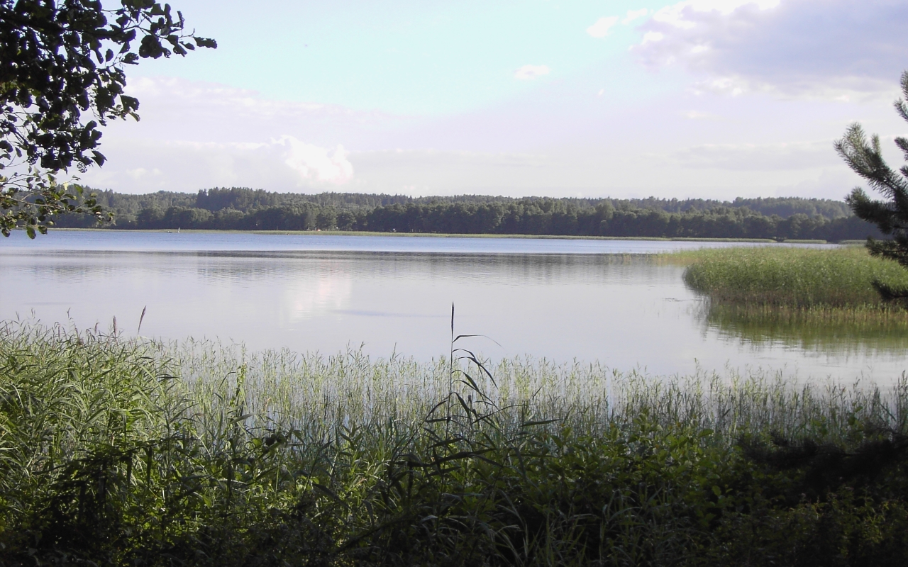
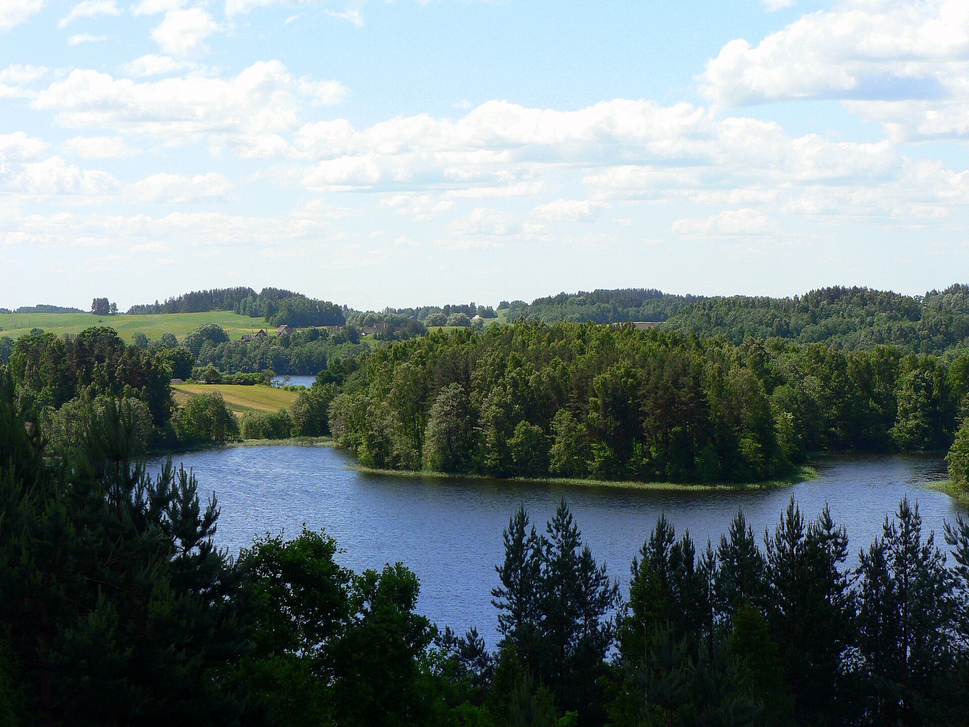
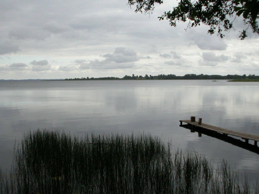
A terrestrial area, with forests and freshwater.
Which international labels apply to Silene Nature Park?
Natura 2000 network (1 site: “Silene”).
When is the best time to visit Silene Nature Park?
Mildest period: July and August, with average temperatures of 17 to 19 °C.
Is there snow in Silene Nature Park?
Yes. According to NASA's MODIS satellites (2015–2025 average), snow covers most of the site from December to February, with about 95 snow-covered days a year on average.
Are there historic monuments in Silene Nature Park?
Yes. According to Wikidata, one monument listed in the Latvian register of cultural monuments of national significance stands within the boundary. For example: “Robežnieku pilskalns ar apmetni” in Demenes pagasts.
What is the nearest large city to Silene Nature Park?
Nearest towns of over 50,000 people, as the crow flies: Daugavpils (19 km). Nearest airport: Riga (RIX), about 211 km away.
How can I reach Silene Nature Park by train?
The nearest railway station is Turmantas, about 12 km from the site boundary.
Are there waymarked hiking trails in Silene Nature Park?
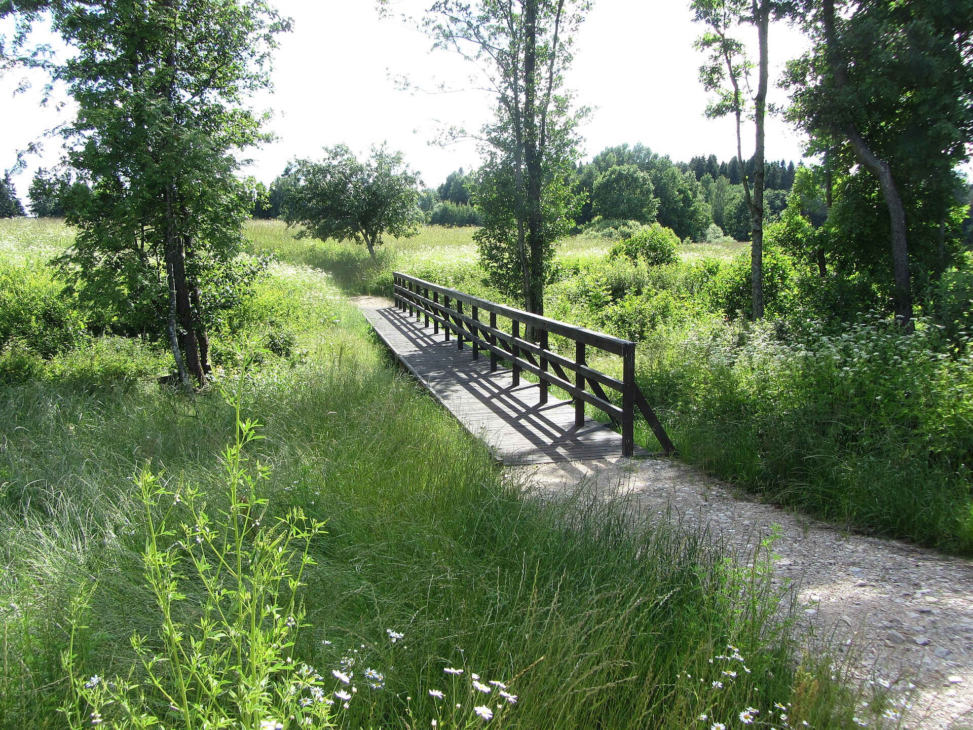
Yes. Waymarked hiking routes listed in OpenStreetMap: 2, including Ezertaka. The “Ezertaka: Klepinu ezers-Silene-Ilgas-Riču ezera Pērkules krauja” route runs for about 11 km through the site.
Which species can be seen in Silene Nature Park?
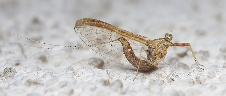
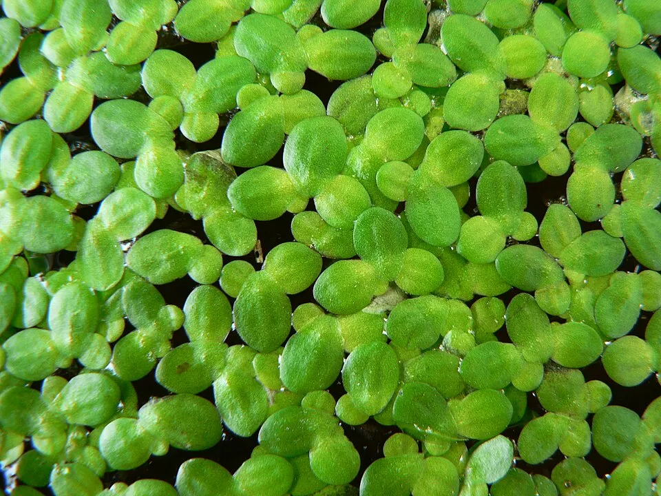
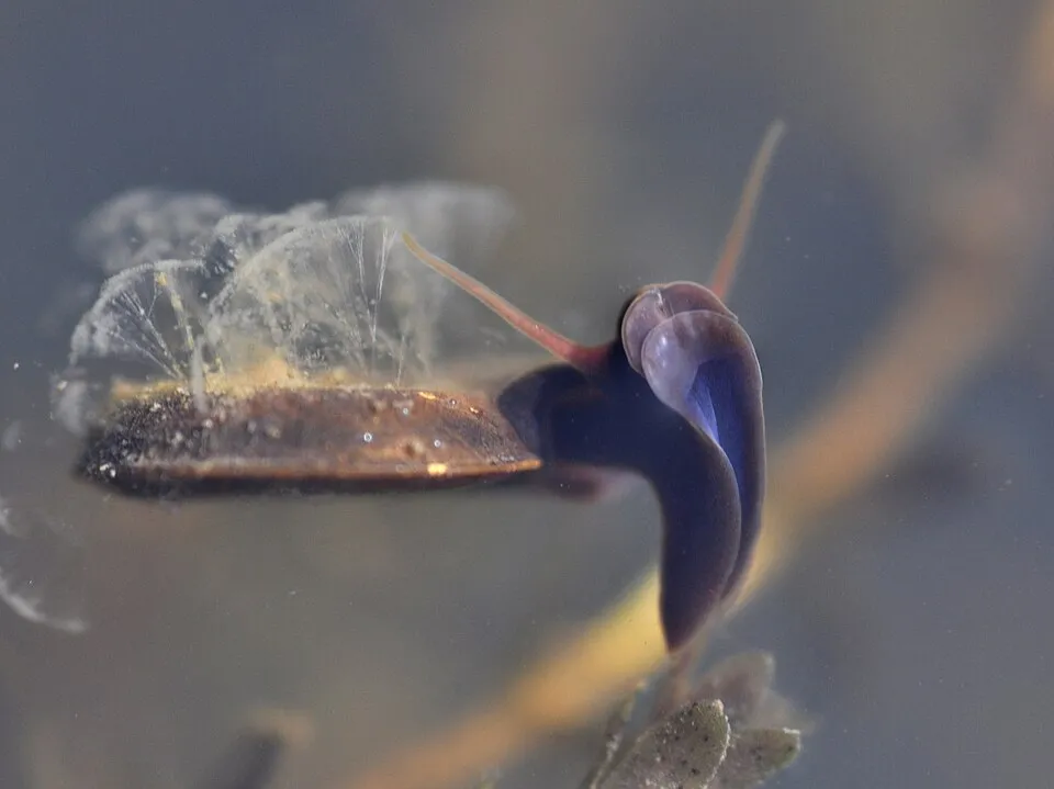
Among the species most often recorded on GBIF are Emys orbicularis (European Pond Turtle), Cloeon dipterum (Pond Olive), Lemna minor (Common duckweed) and Planorbis planorbis (Ram's Horn Snail).
© OpenStreetMap
Download the boundary: GeoJSON · GPX Boundary © OpenStreetMap contributors (ODbL).
Geography
The representative point of the site lies at around 157 m above sea level. Over the 1996–2025 period, the mean annual temperature is about 7.0 °C and total precipitation reaches roughly 743 mm per year. The warmest month is usually July, the coolest January, and the wettest July. The site contains 5 lakes larger than 10 ha as well as part of another lake (Riči), totalling 8.5 km² of water, mostly in lakes straddling the boundary (HydroLAKES). Riči (1,283 ha) is 51.9 m deep (Wikidata).
Area
- Area of the boundary
- 3,780 ha
- Elevation
- 157 m
- Snow cover
- ≈ 95 days a year
- Lakes over 10 ha
- 5 (8.5 km²)
- Coordinates
- 55.7228, 26.8014
Lakes: HydroLAKES (Messager et al. 2016, hydrosheds.org, CC BY 4.0) · depths: Wikidata (CC0)
Climate
● Mean temperature (°C) · ▮ Precipitation (mm)
Source: Copernicus ERA5-Land (C3S, doi:10.24381/cds.68d2bb30), monthly averages 1996–2025 interpolated to the representative point, temperatures adjusted for elevation.
Contains modified Copernicus Climate Change Service information 2026. Neither the European Commission nor ECMWF is responsible for any use that may be made of the Copernicus information or data it contains.
Snow cover measured by satellite
J
F
M
A
M
J
J
A
S
O
N
D
average share of the site under snow · snowiest parts · ≈ 95 days a year
Snow cover: MODIS/Terra MOD10CM v61 (Hall & Riggs, 2021, NASA NSIDC DAAC, doi:10.5067/MODIS/MOD10CM.061), imagery from NASA GIBS (ESDIS); 2015–2025 average, grid of about 5 km.
Natural habitats
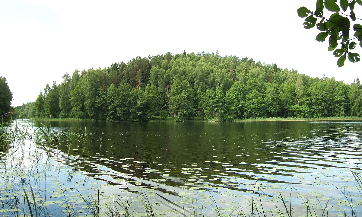
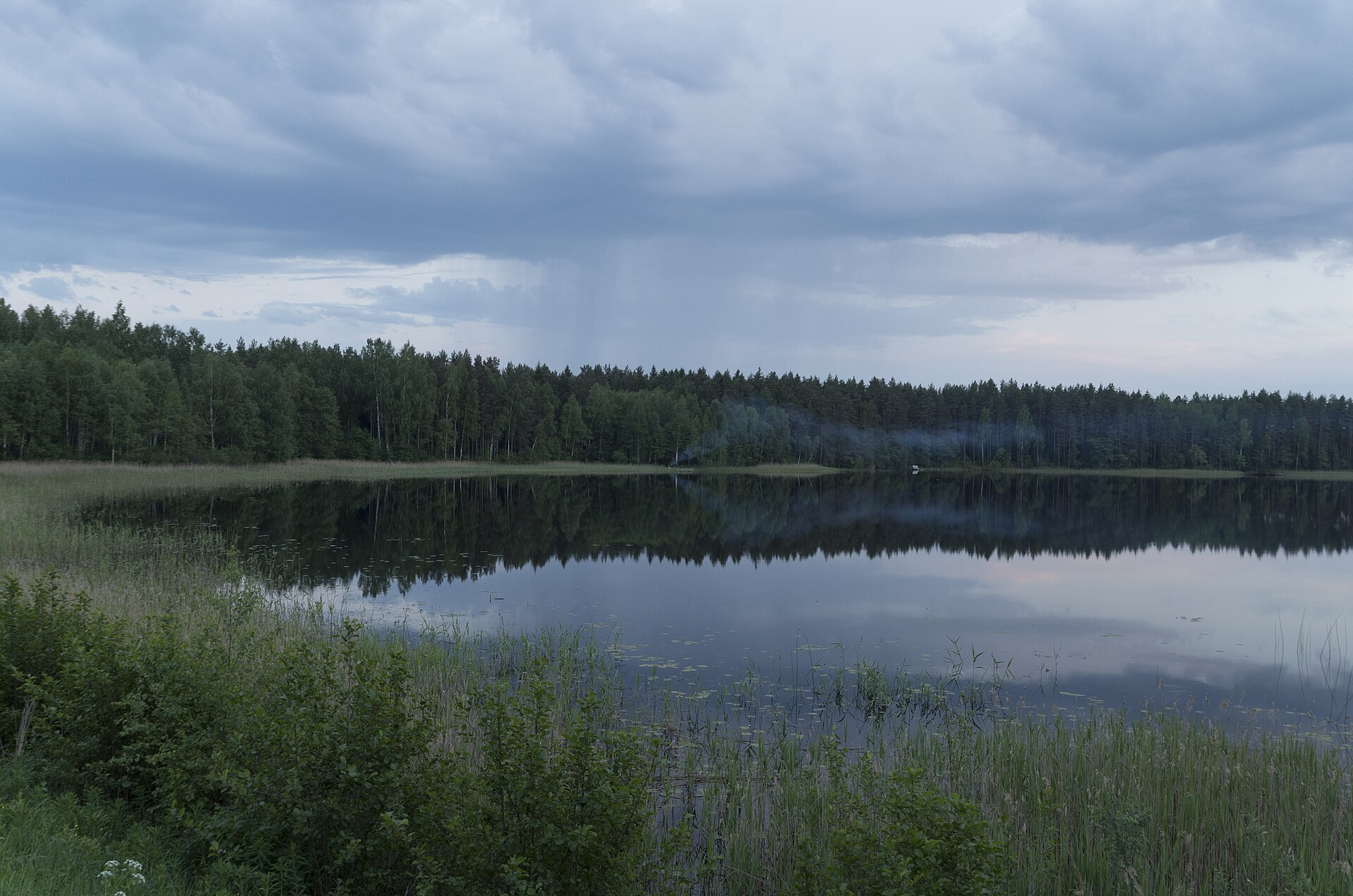
According to CORINE Land Cover (2018), the site is mainly made up of forests (58%), lakes and rivers (25%) and heath and scrub (9%). Woodland mixes broadleaved and coniferous trees. The land is almost flat (mean slope under 2°). The Natura 2000 site overlapping the area lists 17 habitats of European interest (9 priority), the most extensive being oligotrophic to mesotrophic standing waters with vegetation of the Littorelletea uniflorae and/or of the Isoëto-Nanojuncetea, natural eutrophic lakes with Magnopotamion or Hydrocharition-type vegetation and Fennoscandian deciduous swamp woods.
Biodiversity
Based on occurrences aggregated by GBIF, several species are regularly recorded within the site. Among the most frequent are Emys orbicularis (European Pond Turtle), Cloeon dipterum (Pond Olive), Lemna minor (Common duckweed) and Planorbis planorbis (Ram's Horn Snail). The full list of documented taxa is shown below. The overlapping Natura 2000 site lists 85 species of European interest: 30 birds, 16 mammals, 2 reptiles, 7 amphibians, 4 fish, 16 invertebrates and 10 plants.
Habitats of European interest
From the official form of the Natura 2000 site overlapping the area (areas reported for the whole site).
- Oligotrophic to mesotrophic standing waters with vegetation of the Littorelletea uniflorae and/or of the Isoëto-Nanojuncetea 646 ha
- Natural eutrophic lakes with Magnopotamion or Hydrocharition-type vegetation 360 ha
- Fennoscandian deciduous swamp woods priority 249 ha
- Western Taïga priority 198 ha
- Bog woodland priority 177 ha
- Transition mires and quaking bogs 49 ha
- Alluvial forests with Alnus glutinosa and Fraxinus excelsior (Alno-Padion, Alnion incanae, Salicion albae) priority 40 ha
- Fennoscandian herb-rich forests with Picea abies 22 ha
and 9 more
Species of European interest
Birds · 30
Boreal Owl (Aegolius funereus) breeding, Common Pochard (Aythya ferina) passage, Hazel Grouse (Bonasa bonasia) resident, Eurasian Bittern (Botaurus stellaris) breeding, European Nightjar (Caprimulgus europaeus) breeding, White stork (Ciconia ciconia) breeding, Black Stork (Ciconia nigra) breeding, Western Marsh Harrier (Circus aeruginosus) breeding, Lesser Spotted Eagle (Clanga pomarina) breeding, Corn Crake (Crex crex) breeding, White-backed Woodpecker (Dendrocopos leucotos) resident, Black Woodpecker (Dryocopus martius) resident and 18 more
Mammals · 16
Eurasian Beaver (Castor fiber), Forest dormouse (Dryomys nitedula), Northern Bat (Eptesicus nilssonii), Mountain Hare (Lepus timidus), Eurasian otter (Lutra lutra), European pine marten (Martes martes), Hazel dormouse (Muscardinus avellanarius), Pond bat (Myotis dasycneme), Daubenton's bat (Myotis daubentonii), Common noctule (Nyctalus noctula), Nathusius's pipistrelle (Pipistrellus nathusii), Common pipistrelle (Pipistrellus pipistrellus) and 4 more
Reptiles · 2
European Pond Turtle (Emys orbicularis), Sand lizard (Lacerta agilis)
Amphibians · 7
European fire-bellied toad (Bombina bombina), Green Toad (Bufotes viridis), Common Spadefoot (Pelobates fuscus), Pool frog (Pelophylax lessonae), Moor frog (Rana arvalis), Common frog (Rana temporaria), Great crested newt (Triturus cristatus)
Fish · 4
Spined loach (Cobitis taenia), Vendace (Coregonus albula), European bullhead (Cottus gobio), Weatherfish (Misgurnus fossilis)
Invertebrates · 16
Boros schneideri, Scarce heath (Coenonympha hero), Broadest Diver (Dytiscus latissimus), Marsh fritillary (Euphydryas aurinia), Roman Snail (Helix pomatia), Dark whiteface (Leucorrhinia albifrons), Lilypad whiteface (Leucorrhinia caudalis), Yellow-spotted Whiteface (Leucorrhinia pectoralis), Woodland brown (Lopinga achine), Large copper (Lycaena dispar), Eastern Hermit Beetle (Osmoderma barnabita), Oxyporus mannerheimii and 4 more
Plants · 10
Hairy agrimony (Agrimonia pilosa), Parasite cup lichen (Cladonia parasitica), Trailing ground-pine (Diphasiastrum complanatum), Hamatocaulis moss (Hamatocaulis vernicosus), Fir Clubmoss (Huperzia selago), Fen orchid (Liparis loeselii), Interrupted clubmoss (Lycopodium annotinum), Stag's-horn Clubmoss (Lycopodium clavatum), Slender Naiad (Najas flexilis), Eastern pasqueflower (Pulsatilla patens)
Source: Natura 2000 standard data forms (EEA, CC-BY 4.0). Not exhaustive: sensitive species are not published.
Species to look out for


Observed species
Occurrences documented via GBIF; they are neither an exhaustive inventory nor proof of current presence.
- European Pond Turtle · Emys orbicularis · 71
- Pond Olive · Cloeon dipterum · 26
- Common duckweed · Lemna minor · 24
- Ram's Horn Snail · Planorbis planorbis · 24
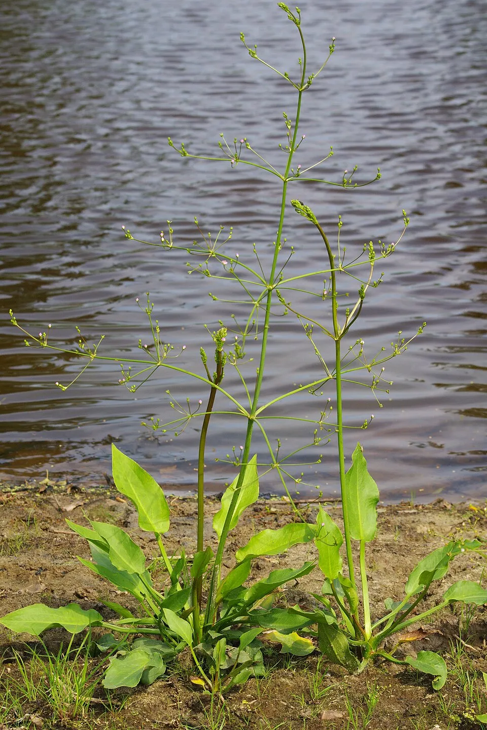
- Water-plantain · Alisma plantago-aquatica · 22
- Soft rush · Juncus effusus · 21
- Lesser pond-sedge · Carex acutiformis · 21
- Greater duckweed · Spirodela polyrhiza · 21
- Bulrush · Typha latifolia · 21
- Water horsetail · Equisetum fluviatile · 20
- Flat Valve Snail · Valvata cristata · 20
- Plea minutissima · 18
+18 more species
- Floating Sweet-grass · Glyceria fluitans · 18
- Small China-mark · Cataclysta lemnata · 17
- Microvelia reticulata · 17
- Small pondweed · Potamogeton berchtoldii · 16
- Slender sedge · Carex lasiocarpa · 15
- Saucer Bug · Ilyocoris cimicoides · 15
- Marsh-bedstraw · Galium palustre · 14
- Splendid feather moss · Hylocomium splendens · 13
- Wood club-rush · Scirpus sylvaticus · 13
- Water violet · Hottonia palustris · 13
- Gypsywort · Lycopus europaeus · 13
- Compact Rush · Juncus conglomeratus · 12
- Sharp-flowered rush · Juncus acutiflorus · 12
- Bittersweet · Solanum dulcamara · 12
- Lesser spearwort · Ranunculus flammula · 12
- Shining ram's-horn snail · Segmentina nitida · 12
- Least bur-reed · Sparganium natans · 11
- Fragile Stonewort · Chara globularis · 11
Records: GBIF.org (CC-BY). Names: Wikidata (CC0), GBIF. Photos: Wikimedia Commons.
Conservation challenges
The primary purpose of the site is to preserve its natural habitats and the biodiversity they support. The species recorded (Biodiversity tab) reflect its ecological value. The designations it holds frame its management and the control of land use.
According to Global Forest Change data (University of Maryland, Global Forest Watch), about 116 ha of tree cover were lost within the boundary between 2001 and 2023 (3% of its area), peaking in 2006 and 2020. These losses include logging, storms and fires, and do not account for regrowth. According to CORINE Land Cover, land cover here remained almost unchanged between 1990 and 2018 (less than 0.5% of the area affected). At night, the area gives off virtually no artificial light detectable from space (NASA VIIRS Black Marble composite, 2016). According to the Natura 2000 forms, of 17 assessed habitats of European interest, 1 is in excellent condition and 8 in average or reduced condition. According to the Water Framework Directive assessment (2022 river basin management plans, data 2015–2020), water bodies assessed within the site: lakes, 3 of 4 in good ecological status or better. One invasive alien species has been recorded within the site since 2000 (GBIF observations), listed as of Union concern: Reynoutria sachalinensis (Giant Knotweed).
Pressure indicators
Tree cover lost
116 ha
2001–2023
20012023
Fires since 2016
0
No large fire mapped (fires over about 30 ha)
Light at night
0%
of the area gives off artificial light visible from space
DarkLit
Land cover change
< 0.5%
of the area changed, 1990–2018 · CORINE
Rivers and lakes
Lakes: 3 of 4 good or better
assessments 2015–2020
Invasive alien species
1
incl. 1 of EU concern · since 2000
Sources: Global Forest Change (Hansen et al., University of Maryland, via Global Forest Watch, CC-BY 4.0); EFFIS, European Commission / Copernicus; NASA Black Marble 2016 (public domain); CORINE Land Cover 2018 (Copernicus) or MODIS.
CORINE Land Cover Change 1990–2018: generated using European Union's Copernicus Land Monitoring Service information (EEA), aggregated by Parkavela; DOI 10.2909/f30f1000-7cf8-43bb-872c-5eb093911b24.
Ecological status of water bodies: European Environment Agency, WISE – Water Framework Directive, 3rd river basin management plans (2022), CC BY 4.0. Official national classification, not comparable between countries.
Invasive alien species: Global Register of Introduced and Invasive Species (ISSG, CC BY 4.0); Union list, Regulation (EU) 1143/2014 (INBO, CC0); GBIF.org records (CC0 / CC BY 4.0), at least 2 per species.
Practical information
Cities and airport
- Daugavpils
19 km as the crow flies - Airport: Riga (RIX)
211 km as the crow flies
Hiking
2 waymarked routes listed, including:
Ezertaka
Data © OpenStreetMap contributors (ODbL) · Wikidata (CC0)
Waymarked hiking routes
Ezertaka: Klepinu ezers-Silene-Ilgas-Riču ezera Pērkules krauja
10.6 km within the site ↗ 42 m↘ 50 m 146–171 m
Tracks © OpenStreetMap contributors (ODbL), clipped to the boundary; elevation gain and profiles computed on the longest section from Mapzen Terrain Tiles (≈ 30 m), indicative only.
Access and visiting
The nearest railway station is Turmantas, about 12 km from the site boundary. Nearest towns of over 50,000 people, as the crow flies: Daugavpils (19 km). Nearest airport: Riga (RIX), about 211 km away. About 94,000 people live within 20 km of the site boundary, 4,800 of them within 10 km; some 110 people are estimated to live inside (GHSL estimate, 2020). This population has fallen by about 32% since 2000. Waymarked hiking routes listed in OpenStreetMap: 2, including Ezertaka. To plan a visit (access, opening periods, visitor rules), it is best to consult the official information from the managing body and the official website listed in this page's sources.
Source: OpenStreetMap (ODbL), Wikidata (CC0), October 2026.
Built heritage
According to Wikidata, one monument listed in the Latvian register of cultural monuments of national significance stands within the boundary. It is “Robežnieku pilskalns ar apmetni” in Demenes pagasts.
-
Robežnieku pilskalns ar apmetni
Demenes pagasts
Source: Wikidata (CC0), monuments in each country’s official heritage protection registers, at national or regional level. Each item links to its Wikidata entry.
When to visit
Mildest period: July and August, with average temperatures of 17 to 19 °C. Average temperatures drop below 0 °C from December to February: frost is common. Precipitation peaks in July (up to 100 mm per month). According to NASA's MODIS satellites (2015–2025 average), snow covers most of the site from December to February, with about 95 snow-covered days a year on average. Day length ranges from about 7 h 02 min in December to 17 h 30 min in June. Wildlife records published on GBIF peak for plants (July) and butterflies and moths (June). These peaks also reflect when observers are most active.
Source: Copernicus ERA5-Land (C3S), monthly averages 1996–2025 at the representative point, temperatures adjusted for elevation.
Contains modified Copernicus Climate Change Service information 2026. Neither the European Commission nor ECMWF is responsible for any use that may be made of the Copernicus information or data it contains.
Wildlife records calendar
JFMAMJJASOND
Plants
Butterflies & moths
Monthly records published on GBIF (CC-BY), relative to the busiest month; also reflects observer activity.
Gallery
© Dāvis Kļaviņš · CC BY-SA 2.0
© Turtolt · CC BY-SA 4.0
Sources and licences
References
- cds.climate.copernicus.eu: climate · CC-BY-4.0
- registry.opendata.aws: elevation of the reference point, detailed relief · PD
- land.copernicus.eu: land cover, land cover change, sea share · COPERNICUS
- doi.org: population around the site · CC-BY-4.0
- openstreetmap.org: official name, access and peaks, trail difficulty · ODbL-1.0
- eea.europa.eu: bathing water quality, ecological status of waters · CC-BY-4.0
- en.eurovelo.com: EuroVelo cycle routes · ODbL-1.0
- cycling.waymarkedtrails.org: cycle routes · ODbL-1.0
- opentopodata.org: elevations · PD
- forest-fire.emergency.copernicus.eu: wildfires · COPERNICUS
- globalforestwatch.org: tree cover loss · CC-BY-4.0
- gbif.org: seasonality of sightings, invasive alien species, observed species · CC-BY-4.0
- wikidata.org: protected heritage, nearby cities and airport, access and peaks, lake depths, places to see · CC0-1.0
- hydrosheds.org: lakes · CC-BY-4.0
- natura2000.eea.europa.eu: Natura 2000 habitats and species · CC-BY-4.0
- earthobservatory.nasa.gov: night light · PD
- hiking.waymarkedtrails.org: route difficulty · ODbL-1.0
- nsidc.org: snow cover · PD
Data © OpenStreetMap contributors (ODbL), Wikidata (CC0) and the sources cited.