Slovenia · Mixed
Strunjan Landscape Park
Nature park of 429 hectares in Slovenia.
Overview
Nature park of 429 hectares in Slovenia.
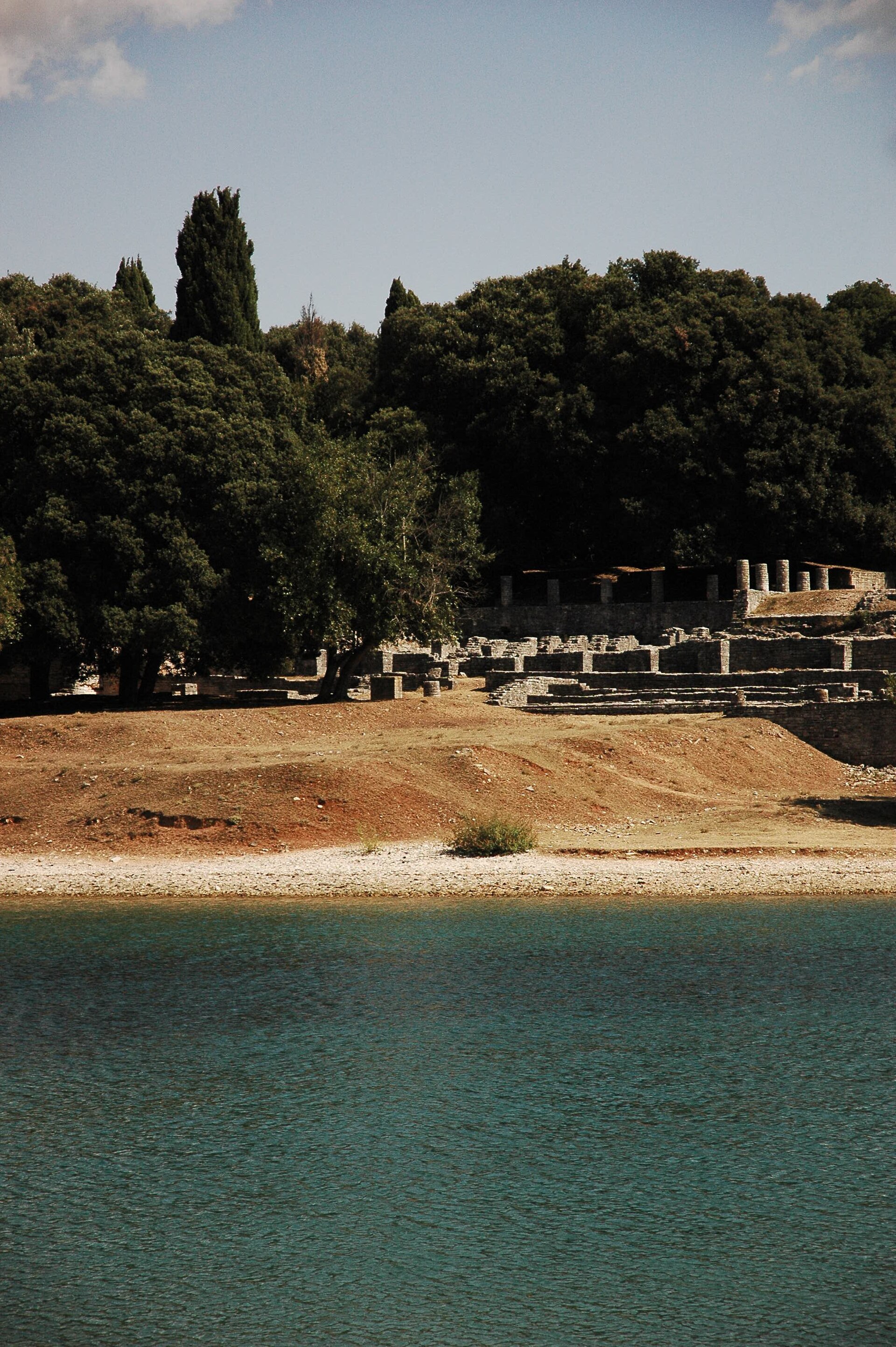
Strunjan Landscape Park is a nature park in Slovenia (Europe). It covers both land and sea. It covers about 429 hectares.
Protections and designations
Natura 2000 · habitats (SAC) · 2 sites
- Med Izolo in Strunjanom - klif SI3000249
- Strunjanske soline s Stjužo SI3000238
Natura 2000 · birds (SPA)
- Strunjan SI5000031
Protected as a nature park. International labels and designations: Natura 2000 network (3 sites). Key dates: first Natura 2000 site under the Habitats Directive in 2012 and first Natura 2000 site under the Birds Directive in 2013.
In our collections
Timeline
-
2012
First Natura 2000 site under the Habitats Directive 2 such sites designated up to 2012
-
2013
First Natura 2000 site under the Birds Directive
Sources: Wikidata (CC0) for establishment and international labels; EEA Natura 2000 database (CC-BY 4.0) for site designation dates.
Frequently asked questions
Where is Strunjan Landscape Park?
In Slovenia (Europe). Representative point: 45.5333° N, 13.6120° E.
How large is Strunjan Landscape Park?
About 429 hectares (4 km²). It is the 7th largest of the 8 nature parks in Slovenia covered by Parkavela. About 200 ha are at sea.
What habitats and landscapes does Strunjan Landscape Park include?
An area spanning land and sea, with coasts.
What is the highest point of Strunjan Landscape Park?
Ronek, at 116 m (OpenStreetMap).
Which international labels apply to Strunjan Landscape Park?
Natura 2000 network (3 sites).
When is the best time to visit Strunjan Landscape Park?
Best time to visit: from April to August, with average temperatures of 12 to 24 °C and moderate rainfall.
Are there historic monuments in Strunjan Landscape Park?
Yes. According to Wikidata, 11 monuments listed in the Slovenian register of cultural heritage stand within the boundary. For example: “Church of the Apparition of the Virgin Mary” in Občina Piran, “Archaeological site of San Basso” in Občina Piran and “Domačija Strunjan 101” in Občina Piran.
Can you swim in Strunjan Landscape Park?
6 monitored bathing sites lie in or within 1 km of the site; official 2025 classification: 6 excellent (European Environment Agency). Swimming is only permitted at the sites and times authorised locally.
What is the nearest large city to Strunjan Landscape Park?
Nearest towns of over 50,000 people, as the crow flies: Trieste (16 km) and Free Territory of Trieste (18 km). Nearest airport: Trieste – Friuli Venezia Giulia (TRS), about 32 km away.
How can I reach Strunjan Landscape Park by train?
The nearest railway station is Koper / Capodistria, about 8 km from the site boundary.
Where can I get visitor information on site?
Recepcija Hotela, Turistični informacijski center and Turistična agencija Laguna.
Are there waymarked hiking trails in Strunjan Landscape Park?
Yes. Waymarked hiking routes listed in OpenStreetMap: 5, including E 12 (50 km) and E 6 (315 km).
Which species can be seen in Strunjan Landscape Park?
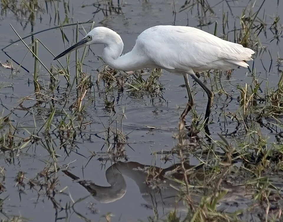
Among the species most often recorded on GBIF are Larus michahellis (Yellow-legged Gull), Egretta garzetta (Little Egret), Anas platyrhynchos (Mallard) and Corvus cornix (Hooded Crow).
© OpenStreetMap
Download the boundary: GeoJSON · GPX Boundary © OpenStreetMap contributors (ODbL).
Geography
The representative point of the site lies at around 38 m above sea level. Over the 1996–2025 period, the mean annual temperature is about 14.3 °C and total precipitation reaches roughly 1,234 mm per year. The warmest month is usually July, the coolest January, and the wettest November.
Area
- Area
- 429 ha
- Elevation
- 38 m
- Mean slope
- 9°
- Coordinates
- 45.5333, 13.612
Terrain: Mapzen Terrain Tiles (SRTM, USGS)
Climate
● Mean temperature (°C) · ▮ Precipitation (mm)
Source: Copernicus ERA5-Land (C3S, doi:10.24381/cds.68d2bb30), monthly averages 1996–2025 interpolated to the representative point, temperatures adjusted for elevation.
Contains modified Copernicus Climate Change Service information 2026. Neither the European Commission nor ECMWF is responsible for any use that may be made of the Copernicus information or data it contains.
Natural habitats
According to CORINE Land Cover (2018), the land area is mainly made up of farmland (75%), forests (16%) and salt marshes and salt pans (8%). The sea covers about 44% of the site. The seabed reaches about 12 m deep (median depth 7 m; GEBCO bathymetry). Elevation ranges from sea level to 116 m (highest point: Ronek). The 3 Natura 2000 sites overlapping the area list 8 habitats of European interest (1 priority), the most extensive being vegetated sea cliffs of the Mediterranean coasts with endemic Limonium spp, mudflats and sandflats not covered by seawater at low tide and coastal lagoons.
Biodiversity
Based on occurrences aggregated by GBIF, several species are regularly recorded within the site. Among the most frequent are Larus michahellis (Yellow-legged Gull), Egretta garzetta (Little Egret), Anas platyrhynchos (Mallard) and Corvus cornix (Hooded Crow). The full list of documented taxa is shown below. The overlapping Natura 2000 sites list 6 species of European interest: 4 birds, 1 fish and 1 invertebrate.
Habitats of European interest
From the official forms of the 3 Natura 2000 sites overlapping the area (areas reported for each whole site).
- Vegetated sea cliffs of the Mediterranean coasts with endemic Limonium spp. 20 ha
- Mudflats and sandflats not covered by seawater at low tide 14 ha
- Coastal lagoons priority 12 ha
- Reefs 7 ha
- Salicornia and other annuals colonizing mud and sand 5 ha
- Annual vegetation of drift lines 4 ha
- Mediterranean and thermo-Atlantic halophilous scrubs (Sarcocornetea fruticosi) 3 ha
- Estuaries 2 ha
Species of European interest
Birds · 4
Little Egret (Egretta garzetta) passage, Mediterranean gull (Larus melanocephalus) passage, European Shag (Phalacrocorax aristotelis desmarestii) passage wintering, Sandwich Tern (Thalasseus sandvicensis) wintering
Invertebrates · 1
Source: Natura 2000 standard data forms (EEA, CC-BY 4.0). Not exhaustive: sensitive species are not published.
Species to look out for


Bird
Hooded Crow
Corvus cornix94 records © Ricardo Tulio Gandelman from Rio de Janeiro, Brazil · CC BY 2.0

Observed species
Occurrences documented via GBIF; they are neither an exhaustive inventory nor proof of current presence.
- Yellow-legged Gull · Larus michahellis · 124
- Little Egret · Egretta garzetta · 110
- Mallard · Anas platyrhynchos · 96
- Hooded Crow · Corvus cornix · 94
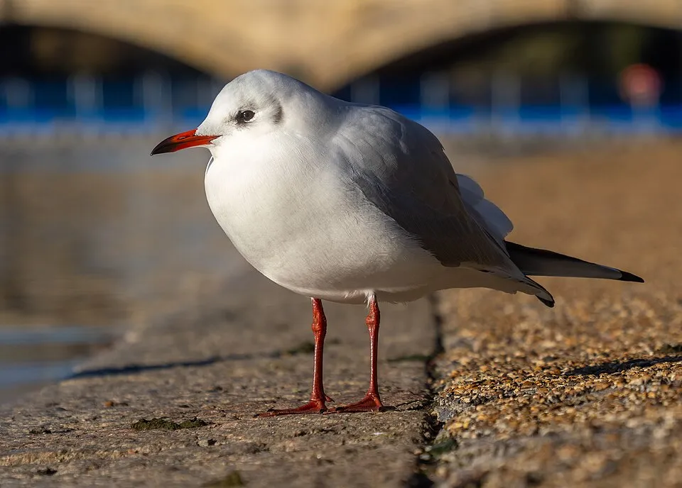
- Black-headed Gull · Chroicocephalus ridibundus · 94
- Mute Swan · Cygnus olor · 87
- Eurasian Magpie · Pica pica · 72
- Common Wood Pigeon · Columba palumbus · 66
- White Wagtail · Motacilla alba · 65
- Common Kingfisher · Alcedo atthis · 62
- European shag · Phalacrocorax aristotelis · 62
- Common Blackbird · Turdus merula · 56
+18 more species
- Eurasian Collared Dove · Streptopelia decaocto · 56
- Common Sandpiper · Actitis hypoleucos · 53
- Great Cormorant · Phalacrocorax carbo · 48
- Black-winged Stilt · Himantopus himantopus · 47
- Grey Heron · Ardea cinerea · 47
- Common Starling · Sturnus vulgaris · 47
- House Sparrow · Passer domesticus · 45
- European smoketree · Cotinus coggygria · 44
- Mediterranean Gull · Ichthyaetus melanocephalus · 44
- European robin · Erithacus rubecula · 40
- Sandwich Tern · Thalasseus sandvicensis · 35
- Barn Swallow · Hirundo rustica · 35
- Great tit · Parus major · 35
- Little Grebe · Tachybaptus ruficollis · 34
- Eurasian Chaffinch · Fringilla coelebs · 33
- Great Egret · Ardea alba · 32
- Eurasian Teal · Anas crecca · 30
- Eurasian Jay · Garrulus glandarius · 29
Records: GBIF.org (CC-BY). Names: Wikidata (CC0), GBIF. Photos: Wikimedia Commons.
Conservation challenges
The primary purpose of the site is to preserve its natural habitats and the biodiversity they support. The species recorded (Biodiversity tab) reflect its ecological value. The designations it holds frame its management and the control of land use.
According to CORINE Land Cover, land cover here remained almost unchanged between 1990 and 2018 (less than 0.5% of the area affected). At night, 50% of the area gives off artificial light detectable from space (NASA VIIRS Black Marble composite, 2016). According to the Natura 2000 forms, of 8 assessed habitats of European interest, 1 is in excellent condition and 1 in average or reduced condition. According to the Water Framework Directive assessment (2022 river basin management plans, data 2014–2019), water bodies assessed within the site: coastal waters, 1 of 1 in good ecological status or better. Since 2000, 8 invasive alien species have been recorded within the site (GBIF observations), 2 of them listed as of Union concern under EU Regulation 1143/2014. Among them: Ailanthus altissima (Tree-of-heaven), Broussonetia papyrifera (Paper mulberry) and Cygnus olor (Mute Swan).
Pressure indicators
Fires since 2016
0
No large fire mapped (fires over about 30 ha)
Light at night
50%
of the area gives off artificial light visible from space
DarkLit
Land cover change
< 0.5%
of the area changed, 1990–2018 · CORINE
Rivers and lakes
Coastal waters: 1 of 1 good or better
assessments 2014–2019
Invasive alien species
8
incl. 2 of EU concern · since 2000
 Tree-of-heavenEU
 Paper mulberryEU
Mute Swan
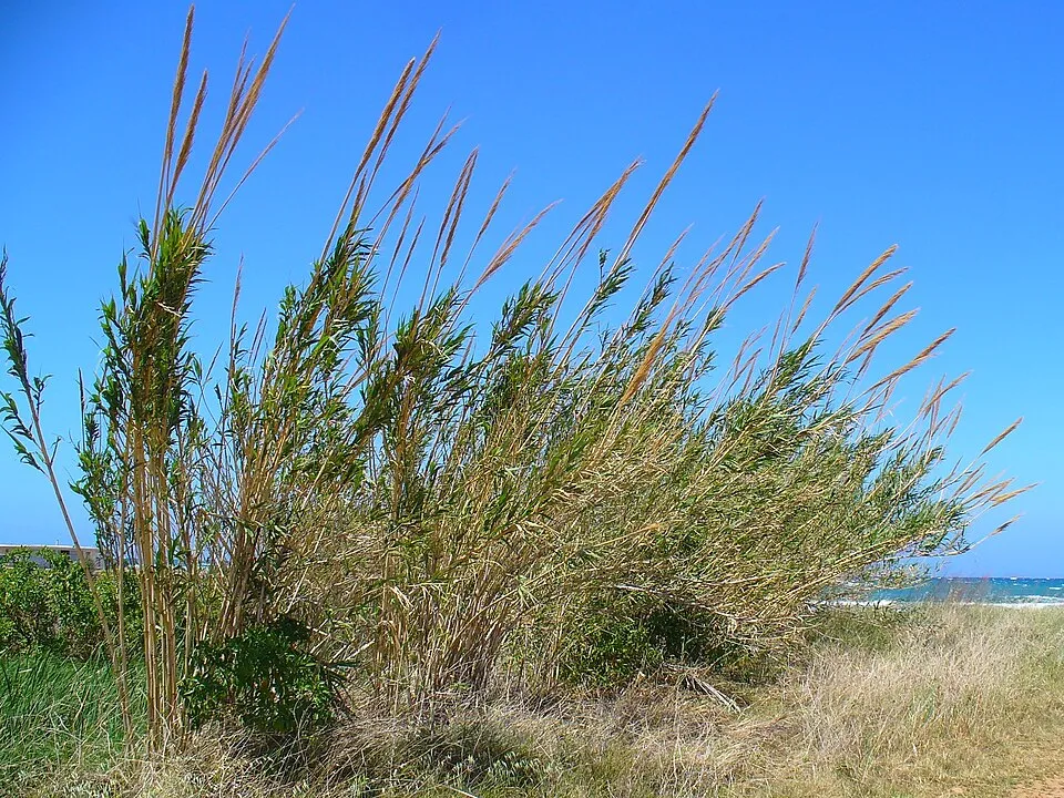 Giant Reed
 Pacific Oyster
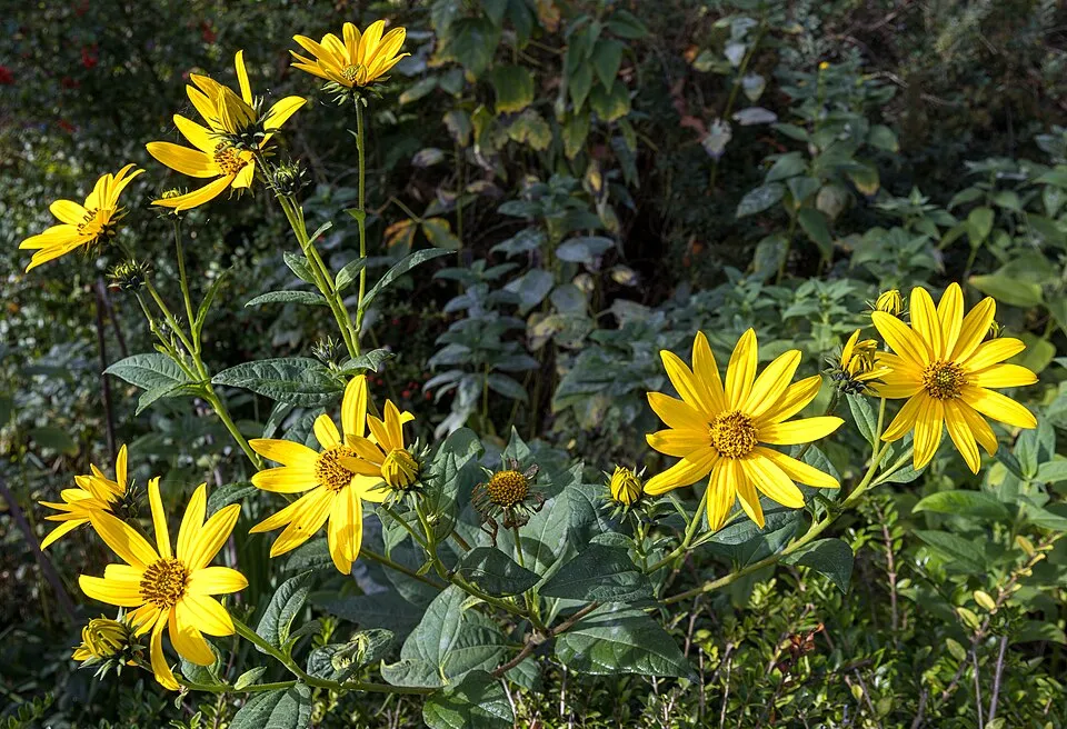 Jerusalem artichoke
 Chinese Mugwort
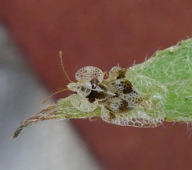 Sycamore Lace Bug
Photos: Tree-of-heaven © Darkone · CC BY-SA 2.5; Paper mulberry © Didier Descouens · CC BY-SA 4.0; Mute Swan © Geni · CC BY-SA 4.0; Giant Reed © H. Zell · CC BY-SA 3.0; Pacific Oyster © Mariottini et al. (2024) · CC BY 4.0; Jerusalem artichoke © JackyM59 · CC BY-SA 4.0; Chinese Mugwort © Oceancetaceen - Alice Chodura · CC BY-SA 3.0; Sycamore Lace Bug © Norbert Marwan · CC BY-SA 4.0
Sources: Global Forest Change (Hansen et al., University of Maryland, via Global Forest Watch, CC-BY 4.0); EFFIS, European Commission / Copernicus; NASA Black Marble 2016 (public domain); CORINE Land Cover 2018 (Copernicus) or MODIS.
CORINE Land Cover Change 1990–2018: generated using European Union's Copernicus Land Monitoring Service information (EEA), aggregated by Parkavela; DOI 10.2909/f30f1000-7cf8-43bb-872c-5eb093911b24.
Ecological status of water bodies: European Environment Agency, WISE – Water Framework Directive, 3rd river basin management plans (2022), CC BY 4.0. Official national classification, not comparable between countries.
Invasive alien species: Global Register of Introduced and Invasive Species (ISSG, CC BY 4.0); Union list, Regulation (EU) 1143/2014 (INBO, CC0); GBIF.org records (CC0 / CC BY 4.0), at least 2 per species.
Practical information
Cities and airport
- Trieste
16 km as the crow flies - Free Territory of Trieste
18 km as the crow flies - Airport: Trieste – Friuli Venezia Giulia (TRS)
32 km as the crow flies
Visitor information
- Recepcija Hotela
< 1 km from the site boundary - Turistični informacijski center
1 km from the site boundary - Turistična agencija Laguna
1 km from the site boundary - Tourist Information Centre
1 km from the site boundary
Hiking
5 waymarked routes listed, including:
E 12 (50 km)E 6 (315 km)
By bike
+ 3 local loops
Signed cycle routes: this does not mean that cycling is allowed on footpaths.
Data © OpenStreetMap contributors (ODbL) · Wikidata (CC0)
Routes © OpenStreetMap contributors (ODbL), via Waymarked Trails
Bathing
6 monitored bathing sites in or within 1 km of the site · 2025 classification
Excellent · 6
- Kopalno Območje Fiesa · sea · Excellent
- Kopalno Območje Rikorvo–simonov Zaliv · sea · Excellent
- Naravno Kopališče Delfin · sea · Excellent
- Naravno Kopališče Salinera · sea · Excellent
- Obmorsko Kopališče Terme Krka-Talaso Strunjan · sea · Excellent
- Plaža Simonov Zaliv · sea · Excellent
Source: European Environment Agency, official bathing water classification (Directive 2006/7/EC, CC-BY 4.0). Swimming is only permitted at the sites and times authorised locally.
Access and visiting
The nearest railway station is Koper / Capodistria, about 8 km from the site boundary. Nearest towns of over 50,000 people, as the crow flies: Trieste (16 km) and Free Territory of Trieste (18 km). Nearest airport: Trieste – Friuli Venezia Giulia (TRS), about 32 km away. About 320,000 people live within 20 km of the site boundary, 83,000 of them within 10 km (GHSL estimate, 2020). Visitor information on site: Recepcija Hotela, Turistični informacijski center and Turistična agencija Laguna. Waymarked hiking routes listed in OpenStreetMap: 5, including E 12 (50 km) and E 6 (315 km). To plan a visit (access, opening periods, visitor rules), it is best to consult the official information from the managing body and the official website listed in this page's sources.
Source: OpenStreetMap (ODbL), Wikidata (CC0), October 2026.
Built heritage
According to Wikidata, 11 monuments listed in the Slovenian register of cultural heritage stand within the boundary. Among them are 6 houses and civic buildings, 2 religious buildings and 1 prehistoric or archaeological site. Examples include “Church of the Apparition of the Virgin Mary” in Občina Piran, “Archaeological site of San Basso” in Občina Piran and “Domačija Strunjan 101” in Občina Piran.
6 houses and civic buildings2 religious buildings1 prehistoric or archaeological site
-
Church of the Apparition of the Virgin Mary
Občina Piran -
Archaeological site of San Basso
Občina Piran -
Domačija Strunjan 101
Občina Piran -
Veleposestvo Strunjan 95
Občina Piran -
Frančiškanski samostan Piran
Občina Piran -
Domačija Strunjan 114
Občina Piran -
Vrt ob vili Tartini
Občina Piran -
Domačija Strunjan 79
Občina Piran
and 3 more
Source: Wikidata (CC0), monuments in each country’s official heritage protection registers, at national or regional level. Each item links to its Wikidata entry.
When to visit
Best time to visit: from April to August, with average temperatures of 12 to 24 °C and moderate rainfall. Precipitation peaks from September to November (up to 160 mm per month). Day length ranges from about 8 h 43 min in December to 15 h 40 min in June. Wildlife records published on GBIF peak for plants (from June to August) and butterflies and moths (August). These peaks also reflect when observers are most active.
Source: Copernicus ERA5-Land (C3S), monthly averages 1996–2025 at the representative point, temperatures adjusted for elevation.
Contains modified Copernicus Climate Change Service information 2026. Neither the European Commission nor ECMWF is responsible for any use that may be made of the Copernicus information or data it contains.
Wildlife records calendar
JFMAMJJASOND
Birds
Plants
Butterflies & moths
Monthly records published on GBIF (CC-BY), relative to the busiest month; also reflects observer activity.
Gallery
© Zorka Sojka · CC BY-SA 4.0
© Rok · CC BY-SA 2.0
© Peterlin · CC BY-SA 2.5
© jinpal song · CC BY 2.0
© Vid Pogacnik · CC BY-SA 4.0
© Leonvince · CC BY-SA 3.0
Sources and licences
- Wikidata: Q19911743
- Wikipedia: de.wikipedia.org/wiki/Strunjan-Landschaftsschutzpark
- WDPA: 196471
References
- cds.climate.copernicus.eu: climate · CC-BY-4.0
- registry.opendata.aws: elevation of the reference point, detailed relief · PD
- land.copernicus.eu: land cover, land cover change, sea share · COPERNICUS
- doi.org: population around the site · CC-BY-4.0
- wikidata.org: official area, protected heritage, nearby cities and airport, access and peaks, lake depths, places to see · CC0-1.0
- eea.europa.eu: bathing water quality, ecological status of waters · CC-BY-4.0
- en.eurovelo.com: EuroVelo cycle routes · ODbL-1.0
- cycling.waymarkedtrails.org: cycle routes · ODbL-1.0
- gebco.net: depths · PD
- opentopodata.org: elevations · PD
- forest-fire.emergency.copernicus.eu: wildfires · COPERNICUS
- globalforestwatch.org: tree cover loss · CC-BY-4.0
- gbif.org: seasonality of sightings, invasive alien species, observed species · CC-BY-4.0
- hydrosheds.org: lakes · CC-BY-4.0
- natura2000.eea.europa.eu: Natura 2000 habitats and species · CC-BY-4.0
- openstreetmap.org: official name, access and peaks, trail difficulty, wheelchair access · ODbL-1.0
- earthobservatory.nasa.gov: night light · PD
- nsidc.org: snow cover · PD
- wikidata.org: Wikipedia article · CC-BY-SA-4.0
Data © OpenStreetMap contributors (ODbL), Wikidata (CC0) and the sources cited.