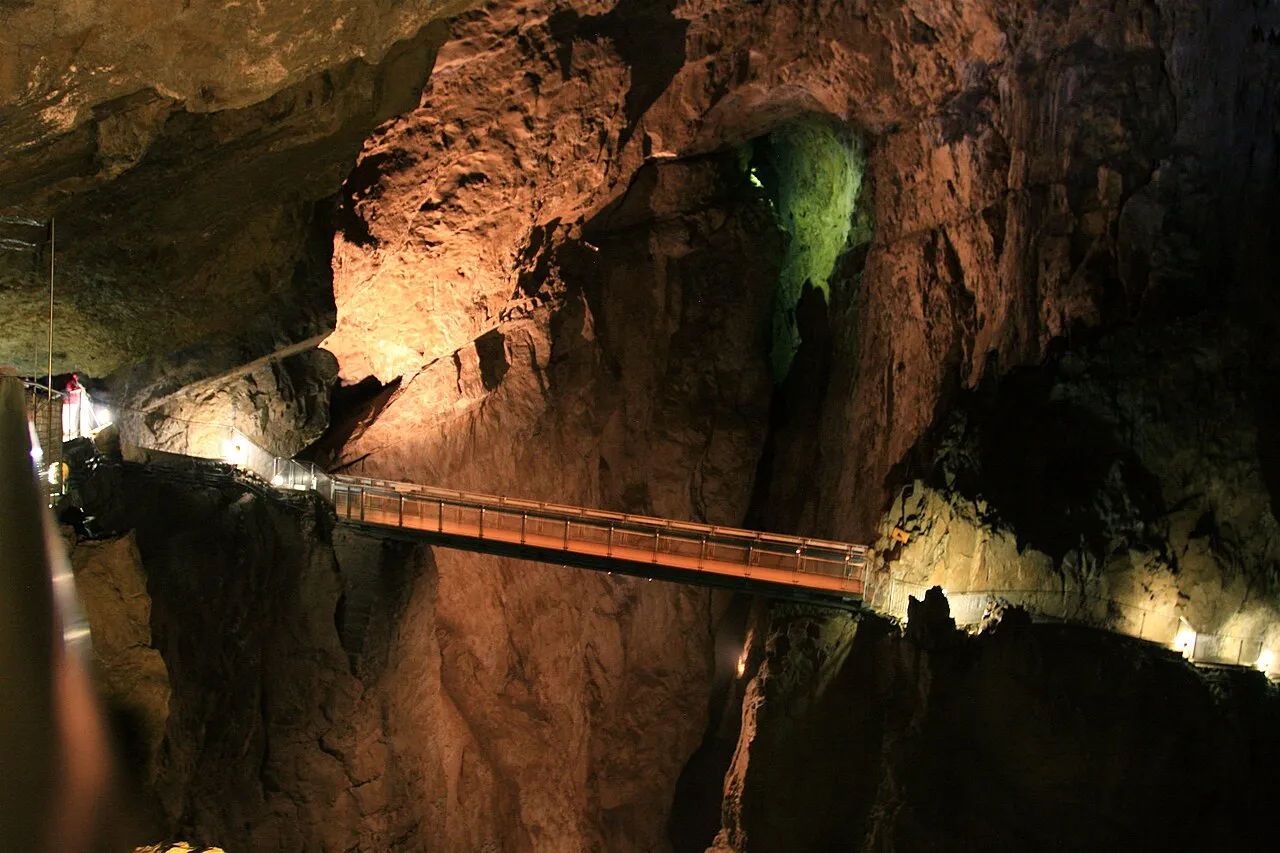

Slovenia · Terrestrial
Škocjan Caves Regional Park
Nature park of 401 hectares in Slovenia, established in 1980.
Overview
Nature park of 401 hectares in Slovenia, established in 1980.
Škocjan Caves Regional Park is a nature park in Slovenia (Europe). It is a predominantly terrestrial area. Established in 1980, it covers about 401 hectares.
Protections and designations
UNESCO World Heritage
Ramsar site
Natura 2000 · habitats (SAC)
- Kras SI3000276
Natura 2000 · birds (SPA)
- Kras SI5000023
Protected as a nature park. International labels and designations: UNESCO World Heritage (“Škocjan Caves”), Ramsar site (“Škocjan Caves”) and Natura 2000 network (2 sites). Key dates: established in 1980, World Heritage listing in 1986, Ramsar Site in 1999, first Natura 2000 site under the Birds Directive in 2004 and first Natura 2000 site under the Habitats Directive in 2012.
In our collections
Timeline
-
1980
Established
-
1986
Inscribed as a UNESCO World Heritage Site Škocjan Caves
-
1999
Ramsar Site (wetland of international importance) Škocjan Caves
-
2004
First Natura 2000 site under the Birds Directive
-
2012
First Natura 2000 site under the Habitats Directive
Sources: Wikidata (CC0) for establishment and international labels; EEA Natura 2000 database (CC-BY 4.0) for site designation dates.
Frequently asked questions
Where is Škocjan Caves Regional Park?
In Slovenia (Europe). Representative point: 45.6632° N, 13.9893° E.
How large is Škocjan Caves Regional Park?
About 401 hectares (4 km²). It is the 8th largest of the 8 nature parks in Slovenia covered by Parkavela.
When was Škocjan Caves Regional Park established?
In 1980.
What habitats and landscapes does Škocjan Caves Regional Park include?
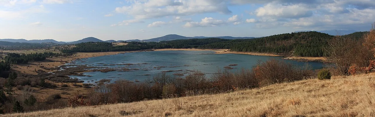
A terrestrial area, with forests.
What is the highest point of Škocjan Caves Regional Park?
Preval, at 475 m (OpenStreetMap).
What are the main summits of Škocjan Caves Regional Park?
Preval (475 m), Kozara (426 m) and Tabor (383 m) (OpenStreetMap).
Which international labels apply to Škocjan Caves Regional Park?
UNESCO World Heritage (“Škocjan Caves”), Ramsar site (“Škocjan Caves”) and Natura 2000 network (2 sites).
When is the best time to visit Škocjan Caves Regional Park?
Best time to visit: from April to August, with average temperatures of 10 to 22 °C and moderate rainfall.
What is there to see in Škocjan Caves Regional Park?
3 caves, including Škocjanske jame (378 m), Mušja jama and Arheološko najdišče Tominčeva jama (Wikidata).
Are there historic monuments in Škocjan Caves Regional Park?
Yes. According to Wikidata, 38 monuments listed in the Slovenian register of cultural heritage stand within the boundary, 38 of them of national significance. For example: “Cerkev sv. Kancijana” in Občina Divača, “Školj Castle” in Občina Divača and “Arheološko najdišče Czoernigova jama” in Občina Divača.
What is the nearest large city to Škocjan Caves Regional Park?
Nearest towns of over 50,000 people, as the crow flies: Trieste (16 km) and Free Territory of Trieste (17 km). Nearest airport: Ljubljana Jože Pučnik (LJU), about 70 km away.
How can I reach Škocjan Caves Regional Park by train?
The nearest railway station is Divača, less than 1 km from the site boundary.
Where can I get visitor information on site?
Turistično društvo Škocjan and Turistično kulturno športno društvo Urbanščica.
Are there waymarked hiking trails in Škocjan Caves Regional Park?
Yes. Waymarked hiking routes listed in OpenStreetMap: 5, including Via Alpina and Slovenska planinska pot.
Which species can be seen in Škocjan Caves Regional Park?
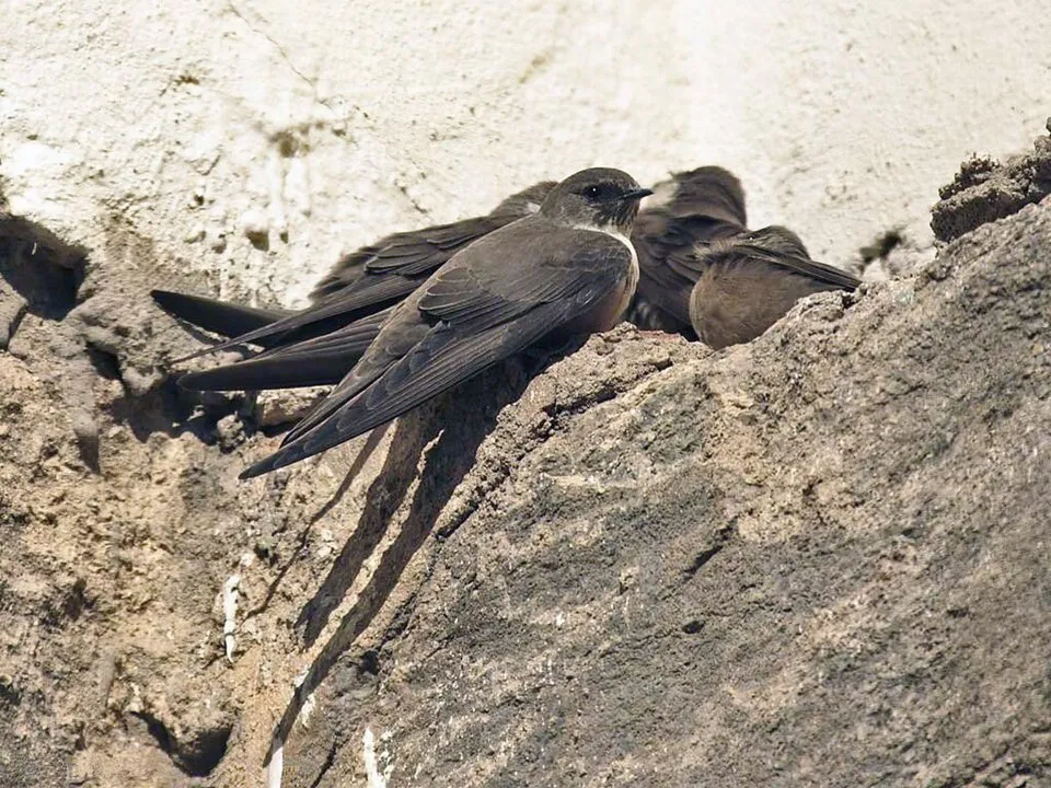
Among the species most often recorded on GBIF are Tachymarptis melba (Alpine Swift), Ptyonoprogne rupestris (Eurasian Crag Martin), Fringilla coelebs (Eurasian Chaffinch) and Turdus merula (Common Blackbird).
What is the official website of Škocjan Caves Regional Park?
© OpenStreetMap
Download the boundary: GeoJSON · GPX Boundary © OpenStreetMap contributors (ODbL).
Geography
The representative point of the site lies at around 426 m above sea level. Over the 1996–2025 period, the mean annual temperature is about 11.5 °C and total precipitation reaches roughly 1,492 mm per year. The warmest month is usually July, the coolest January, and the wettest November.
Area
- Area
- 401 ha
- Elevation
- 426 m
- Mean slope
- 9°
- Coordinates
- 45.6632, 13.9893
Terrain: Mapzen Terrain Tiles (SRTM, USGS)
Climate
● Mean temperature (°C) · ▮ Precipitation (mm)
Source: Copernicus ERA5-Land (C3S, doi:10.24381/cds.68d2bb30), monthly averages 1996–2025 interpolated to the representative point, temperatures adjusted for elevation.
Contains modified Copernicus Climate Change Service information 2026. Neither the European Commission nor ECMWF is responsible for any use that may be made of the Copernicus information or data it contains.
Natural habitats
According to CORINE Land Cover (2018), the site is mainly made up of forests (72%), farmland (17%) and heath and scrub (9%). Woodland mixes broadleaved and coniferous trees. Elevation ranges from about 340 m to 475 m (highest point: Preval). The 2 Natura 2000 sites overlapping the area list 8 habitats of European interest (2 priority), the most extensive being rupicolous calcareous or basophilic grasslands of the Alysso-Sedion albi, eastern sub-Mediterranean dry grasslands (Scorzoneratalia villosae) and Juniperus communis formations on heaths or calcareous grasslands.
Biodiversity
Based on occurrences aggregated by GBIF, several species are regularly recorded within the site. Among the most frequent are Tachymarptis melba (Alpine Swift), Ptyonoprogne rupestris (Eurasian Crag Martin), Fringilla coelebs (Eurasian Chaffinch) and Turdus merula (Common Blackbird). The full list of documented taxa is shown below. The overlapping Natura 2000 sites list 42 species of European interest: 17 birds, 8 mammals, 3 amphibians, 11 invertebrates and 3 plants.
Habitats of European interest
From the official forms of the 2 Natura 2000 sites overlapping the area (areas reported for each whole site).
- Rupicolous calcareous or basophilic grasslands of the Alysso-Sedion albi priority 11,047 ha
- Eastern sub-Mediterranean dry grasslands (Scorzoneratalia villosae) 10,110 ha
- Juniperus communis formations on heaths or calcareous grasslands 2,615 ha
- Illyrian Fagus sylvatica forests (Aremonio-Fagion) 1,126 ha
- Medio-European calcareous scree of hill and montane levels priority 78 ha
- Calcareous rocky slopes with chasmophytic vegetation 60 ha
- Quercus ilex and Quercus rotundifolia forests 1 ha
- Caves not open to the public
Species of European interest
Birds · 17
Eurasian Skylark (Alauda arvensis) breeding, Rock Partridge (Alectoris graeca) breeding, Tawny Pipit (Anthus campestris) breeding, Golden Eagle (Aquila chrysaetos) breeding, Eurasian Eagle-owl (Bubo bubo) breeding, European Nightjar (Caprimulgus europaeus) breeding, Short-toed Snake Eagle (Circaetus gallicus) breeding, Corn Bunting (Emberiza calandra) breeding, Ortolan Bunting (Emberiza hortulana) breeding, Peregrine Falcon (Falco peregrinus) breeding, Griffon Vulture (Gyps fulvus) breeding passage, Red-backed Shrike (Lanius collurio) breeding and 5 more
Mammals · 8
Common bent-wing bat (Miniopterus schreibersii), Lesser mouse-eared myotis (Myotis blythii), Long-fingered bat (Myotis capaccinii), Geoffroy's bat (Myotis emarginatus), Greater mouse-eared bat (Myotis myotis), Mediterranean Horseshoe Bat (Rhinolophus euryale), Greater Horseshoe Bat (Rhinolophus ferrumequinum), Lesser horseshoe bat (Rhinolophus hipposideros)
Amphibians · 3
Yellow-bellied toad (Bombina variegata), Olm (Proteus anguinus), Italian crested newt (Triturus carnifex)
Invertebrates · 11
White-clawed Crayfish (Austropotamobius pallipes), Greater Capricorn Beetle (Cerambyx cerdo), False ringlet (Coenonympha oedippus), Erannis ankeraria, Eastern Eggar (Eriogaster catax), Marsh fritillary (Euphydryas aurinia), Jersey Tiger (Euplagia quadripunctaria), Leptodirus hochenwartii, Stag beetle (Lucanus cervus), Morimus asper funereus, Narrow-mouthed whorl snail (Vertigo angustior)
Plants · 3
Adriatic lizard orchid (Himantoglossum adriaticum), Klasea lycopifolia, Moehringia tommasinii
Source: Natura 2000 standard data forms (EEA, CC-BY 4.0). Not exhaustive: sensitive species are not published.
Species to look out for



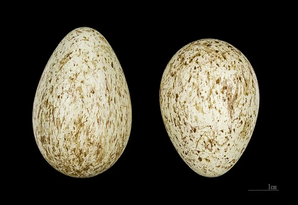
Observed species
Occurrences documented via GBIF; they are neither an exhaustive inventory nor proof of current presence.
- Alpine Swift · Tachymarptis melba · 88
- Rock Dove · Columba livia · 82
- Eurasian Crag Martin · Ptyonoprogne rupestris · 63
- Eurasian Chaffinch · Fringilla coelebs · 61
- Common Blackbird · Turdus merula · 58
- Northern Raven · Corvus corax · 54
- Great tit · Parus major · 53
- European robin · Erithacus rubecula · 41
- Common Buzzard · Buteo buteo · 39
- Eurasian Nuthatch · Sitta europaea · 39
- European Serin · Serinus serinus · 38
- House Sparrow · Passer domesticus · 36
+18 more species
- Eurasian Jay · Garrulus glandarius · 34
- White Wagtail · Motacilla alba · 33
- European Goldfinch · Carduelis carduelis · 31
- Barn Swallow · Hirundo rustica · 30
- Marsh Tit · Poecile palustris · 27
- Eurasian Blackcap · Sylvia atricapilla · 27
- Common Chiffchaff · Phylloscopus collybita · 27
- Great Spotted Woodpecker · Dendrocopos major · 26
- Hart's tonguefern · Asplenium scolopendrium · 25
- Black Redstart · Phoenicurus ochruros · 25
- Common Swift · Apus apus · 22
- Eurasian blue tit · Cyanistes caeruleus · 21
- Grey Wagtail · Motacilla cinerea · 17
- Common Kestrel · Falco tinnunculus · 17
- European Green Woodpecker · Picus viridis · 15
- Cornelian cherry · Cornus mas · 15
- Coal tit · Periparus ater · 14
- Rock Bunting · Emberiza cia · 14
Records: GBIF.org (CC-BY). Names: Wikidata (CC0), GBIF. Photos: Wikimedia Commons.
Conservation challenges
The primary purpose of the site is to preserve its natural habitats and the biodiversity they support. The species recorded (Biodiversity tab) reflect its ecological value. The designations it holds frame its management and the control of land use.
According to CORINE Land Cover, land cover here remained almost unchanged between 1990 and 2018 (less than 0.5% of the area affected). At night, 6% of the area gives off artificial light detectable from space (NASA VIIRS Black Marble composite, 2016). According to the Natura 2000 forms, of 8 assessed habitats of European interest, 1 is in excellent condition and 3 in average or reduced condition. According to the Water Framework Directive assessment (2022 river basin management plans, data 2014–2019), the only river assessed within the site has good ecological status. Invasive alien species have been recorded within the site since 2000 (GBIF observations), one of them listed as of Union concern. Among them: Impatiens glandulifera (Himalayan Balsam) and Carassius auratus (Goldfish).
Pressure indicators
Tree cover lost
5 ha
2001–2023 · 1% of the area
20012023
Fires since 2016
0
No large fire mapped (fires over about 30 ha)
Light at night
6%
of the area gives off artificial light visible from space
DarkLit
Land cover change
< 0.5%
of the area changed, 1990–2018 · CORINE
Rivers and lakes
100%
of the 3 km of assessed rivers in good or high ecological status · WFD 2022
assessments 2014–2019
Invasive alien species
2
incl. 1 of EU concern · since 2000
 Himalayan BalsamEU
 Goldfish
Photos: Himalayan Balsam © Guptaele · CC BY-SA 4.0; Goldfish © RubySS · Public domain
Sources: Global Forest Change (Hansen et al., University of Maryland, via Global Forest Watch, CC-BY 4.0); EFFIS, European Commission / Copernicus; NASA Black Marble 2016 (public domain); CORINE Land Cover 2018 (Copernicus) or MODIS.
CORINE Land Cover Change 1990–2018: generated using European Union's Copernicus Land Monitoring Service information (EEA), aggregated by Parkavela; DOI 10.2909/f30f1000-7cf8-43bb-872c-5eb093911b24.
Ecological status of water bodies: European Environment Agency, WISE – Water Framework Directive, 3rd river basin management plans (2022), CC BY 4.0. Official national classification, not comparable between countries.
Invasive alien species: Global Register of Introduced and Invasive Species (ISSG, CC BY 4.0); Union list, Regulation (EU) 1143/2014 (INBO, CC0); GBIF.org records (CC0 / CC BY 4.0), at least 2 per species.
Practical information
Cities and airport
- Trieste
16 km as the crow flies - Free Territory of Trieste
17 km as the crow flies - Airport: Ljubljana Jože Pučnik (LJU)
70 km as the crow flies
Visitor information
- Turistično društvo Škocjan
within the site - Turistično kulturno športno društvo Urbanščica
< 1 km from the site boundary
Things to see
3 caves
- Škocjanske jame
cave · 378 m - Mušja jama
cave - Arheološko najdišče Tominčeva jama
cave
Hiking
5 waymarked routes listed, including:
Via AlpinaSlovenska planinska pot
Data © OpenStreetMap contributors (ODbL) · Wikidata (CC0)
Waymarked hiking routes
Tracks © OpenStreetMap contributors (ODbL), clipped to the boundary; elevation gain and profiles computed on the longest section from Mapzen Terrain Tiles (≈ 30 m), indicative only. Indicative difficulty (SAC scale, OpenStreetMap, via Waymarked Trails): check with the park.
Access and visiting
The nearest railway station is Divača, less than 1 km from the site boundary. Nearest towns of over 50,000 people, as the crow flies: Trieste (16 km) and Free Territory of Trieste (17 km). Nearest airport: Ljubljana Jože Pučnik (LJU), about 70 km away. About 280,000 people live within 20 km of the site boundary, 19,000 of them within 10 km (GHSL estimate, 2020). Visitor information on site: Turistično društvo Škocjan and Turistično kulturno športno društvo Urbanščica. Waymarked hiking routes listed in OpenStreetMap: 5, including Via Alpina and Slovenska planinska pot. To see: 3 caves, including Škocjanske jame (378 m), Mušja jama and Arheološko najdišče Tominčeva jama. To plan a visit (access, opening periods, visitor rules), it is best to consult the official information from the managing body and the official website listed in this page's sources.
Source: OpenStreetMap (ODbL), Wikidata (CC0), October 2026.
Built heritage
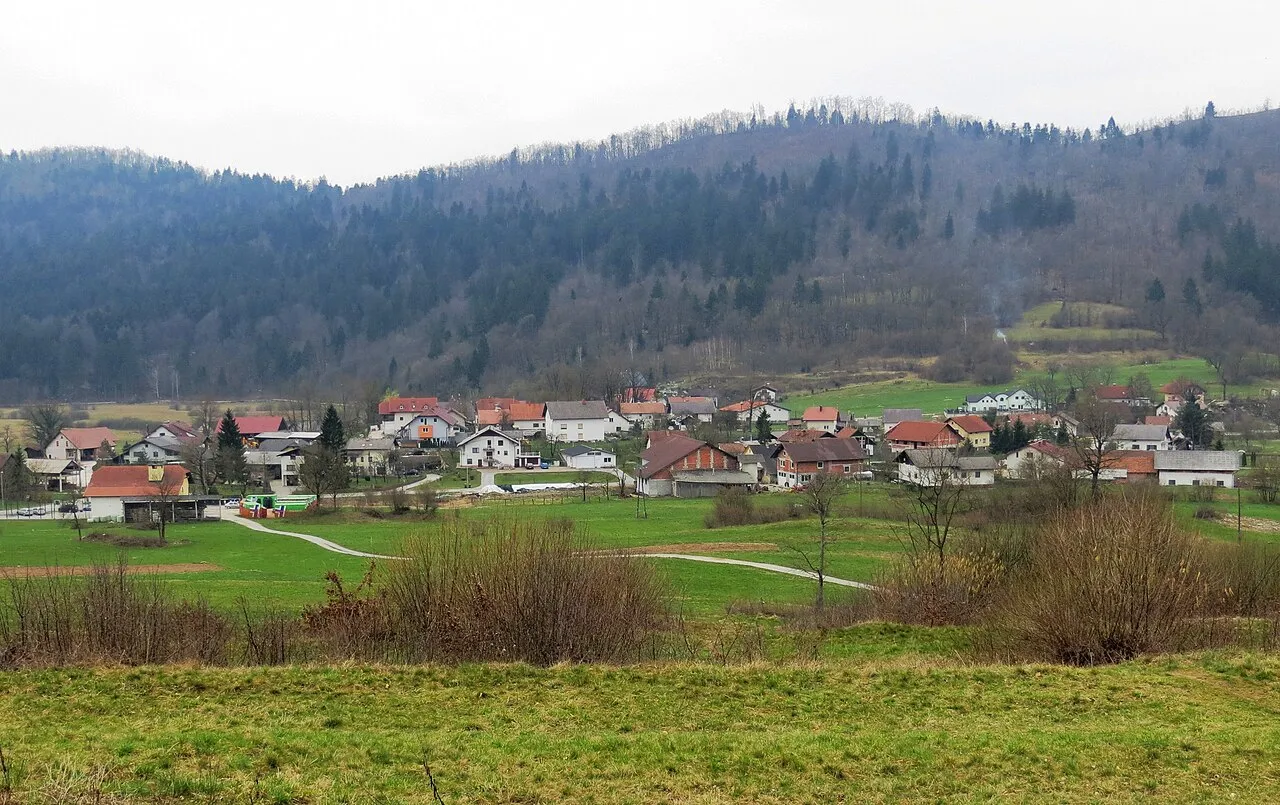
According to Wikidata, 38 monuments listed in the Slovenian register of cultural heritage stand within the boundary, 38 of them of national significance. Among them are 16 prehistoric and archaeological sites, 6 houses and civic buildings and 2 religious buildings. Nationally designated items include “Cerkev sv. Kancijana” in Občina Divača, “Školj Castle” in Občina Divača and “Arheološko najdišče Czoernigova jama” in Občina Divača.
16 prehistoric and archaeological sites6 houses and civic buildings2 religious buildings1 castle or fortification1 bridge, lighthouse, mill or working building
-
Cerkev sv. Kancijana
National
Občina Divača -
Školj Castle
National
Občina Divača -
Arheološko najdišče Czoernigova jama
National
Občina Divača -
Domačija Betanja 2
National
Občina Divača -
Kamniti komunski vodnjak
National
Občina Divača -
Izhod iz jame z napisom Francu I.
National
Občina Divača -
Pokopališče Škocjan pri Divači
National
Občina Divača -
Arheološko najdišče Gradišče
National
Občina Divača
and 30 more
Source: Wikidata (CC0), monuments in each country’s official heritage protection registers, at national or regional level. Each item links to its Wikidata entry.
When to visit
Best time to visit: from April to August, with average temperatures of 10 to 22 °C and moderate rainfall. Precipitation peaks in November (up to 180 mm per month). Day length ranges from about 8 h 42 min in December to 15 h 41 min in June. Wildlife records published on GBIF peak for birds (from May to July), plants (May) and butterflies and moths (July). These peaks also reflect when observers are most active.
Source: Copernicus ERA5-Land (C3S), monthly averages 1996–2025 at the representative point, temperatures adjusted for elevation.
Contains modified Copernicus Climate Change Service information 2026. Neither the European Commission nor ECMWF is responsible for any use that may be made of the Copernicus information or data it contains.
Wildlife records calendar
JFMAMJJASOND
Birds
Plants
Butterflies & moths
Monthly records published on GBIF (CC-BY), relative to the busiest month; also reflects observer activity.
Gallery
© TravelingOtter · CC BY 2.0
© Mircea_Ardelean · Public domain
© Paul Asman and Jill Lenoble · CC BY 2.0
© various · Public domain
© xiquinhosilva · CC BY 2.0
© xiquinhosilva · CC BY 2.0
Sources and licences
- Wikidata: Q8082803
- Official website: https://www.park-skocjanske-jame.si
- Wikipedia: en.wikipedia.org/wiki/Škocjan_Caves_Regional_Park
- WDPA: 11140
References
- cds.climate.copernicus.eu: climate · CC-BY-4.0
- registry.opendata.aws: elevation of the reference point, detailed relief · PD
- land.copernicus.eu: land cover, land cover change, sea share · COPERNICUS
- doi.org: population around the site · CC-BY-4.0
- wikidata.org: official area, establishment date, protected heritage, nearby cities and airport, access and peaks, lake depths, places to see, official website · CC0-1.0
- eea.europa.eu: bathing water quality, ecological status of waters · CC-BY-4.0
- en.eurovelo.com: EuroVelo cycle routes · ODbL-1.0
- cycling.waymarkedtrails.org: cycle routes · ODbL-1.0
- opentopodata.org: elevations · PD
- forest-fire.emergency.copernicus.eu: wildfires · COPERNICUS
- globalforestwatch.org: tree cover loss · CC-BY-4.0
- gbif.org: seasonality of sightings, invasive alien species, observed species · CC-BY-4.0
- hydrosheds.org: lakes · CC-BY-4.0
- natura2000.eea.europa.eu: Natura 2000 habitats and species · CC-BY-4.0
- openstreetmap.org: official name, access and peaks · ODbL-1.0
- earthobservatory.nasa.gov: night light · PD
- hiking.waymarkedtrails.org: route difficulty · ODbL-1.0
- nsidc.org: snow cover · PD
- wikidata.org: Wikipedia article · CC-BY-SA-4.0
Data © OpenStreetMap contributors (ODbL), Wikidata (CC0) and the sources cited.