
Slovenia · Terrestrial
Notranjska Regional Park
Nature park of 22,284 hectares in Slovenia.
Overview
Nature park of 22,284 hectares in Slovenia.
Notranjska Regional Park is a nature park in Slovenia (Europe). It is a predominantly terrestrial area. It covers about 22,284 hectares.
Protections and designations
Ramsar site
Natura 2000 · habitats (SAC) · 4 sites
- Bezuljak SI3000310
- Kozje stene pri Slivnici SI3000151
- Krimsko hribovje - Menišija SI3000256
- Notranjski trikotnik SI3000232
Natura 2000 · birds (SPA) · 3 sites
- Cerkniško jezero SI5000015
- Planinsko polje SI5000016
- Snežnik - Pivka SI5000002
Protected as a nature park. International labels and designations: Ramsar site (“Lake Cerknica”) and Natura 2000 network (7 sites). Key dates: first Natura 2000 site under the Birds Directive in 2004, Ramsar Site in 2006 and first Natura 2000 site under the Habitats Directive in 2012.
In our collections
Timeline
-
2004
First Natura 2000 site under the Birds Directive 3 such sites designated up to 2004
-
2006
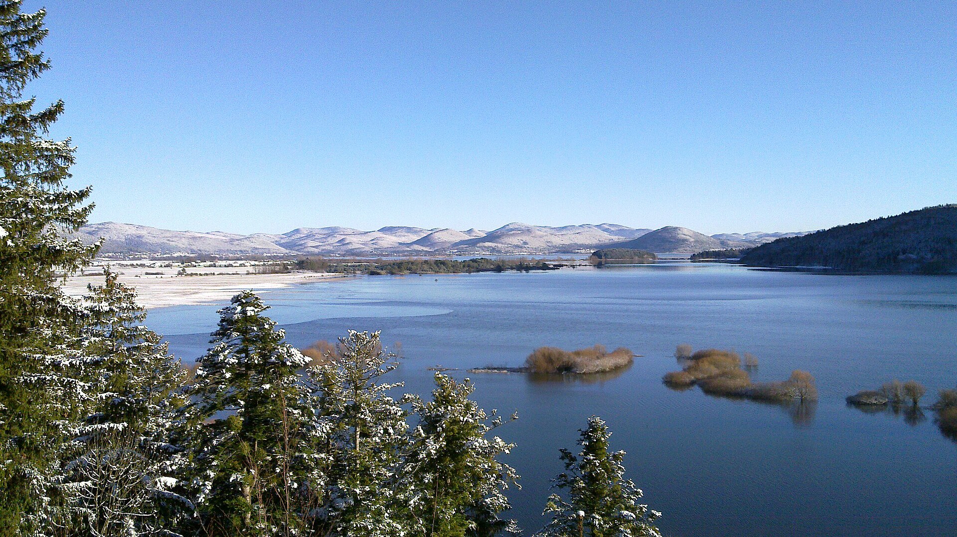
Ramsar Site (wetland of international importance) Lake Cerknica
-
2012
First Natura 2000 site under the Habitats Directive 3 such sites designated up to 2012
Sources: Wikidata (CC0) for establishment and international labels; EEA Natura 2000 database (CC-BY 4.0) for site designation dates.
Frequently asked questions
Where is Notranjska Regional Park?
In Slovenia (Europe). Representative point: 45.7963° N, 14.3626° E.
How large is Notranjska Regional Park?
About 22,284 hectares (223 km²). It is the largest of the 8 nature parks in Slovenia covered by Parkavela.
What habitats and landscapes does Notranjska Regional Park include?
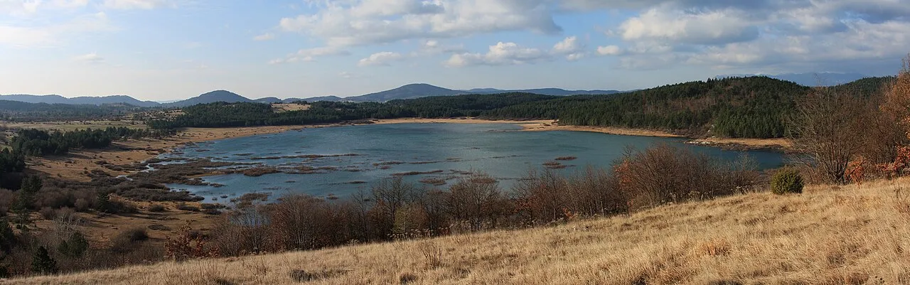
A terrestrial area, with forests and mountains.
What is the highest point of Notranjska Regional Park?
Veliki Javornik, at 1,268 m (OpenStreetMap).
What are the main summits of Notranjska Regional Park?
Veliki Javornik (1,268 m), Velika Slivnica (1,114 m), Kalun (1,106 m), Čela (1,036 m) and Medvednica (1,024 m) (OpenStreetMap).
Which international labels apply to Notranjska Regional Park?
Ramsar site (“Lake Cerknica”) and Natura 2000 network (7 sites).
When is the best time to visit Notranjska Regional Park?
Best time to visit: from May to October, with average temperatures of 10 to 20 °C and moderate rainfall.
Is there snow in Notranjska Regional Park?
Yes. According to NASA's MODIS satellites (2015–2025 average), snow covers most of the site in January, with about 50 snow-covered days a year on average.
What is there to see in Notranjska Regional Park?
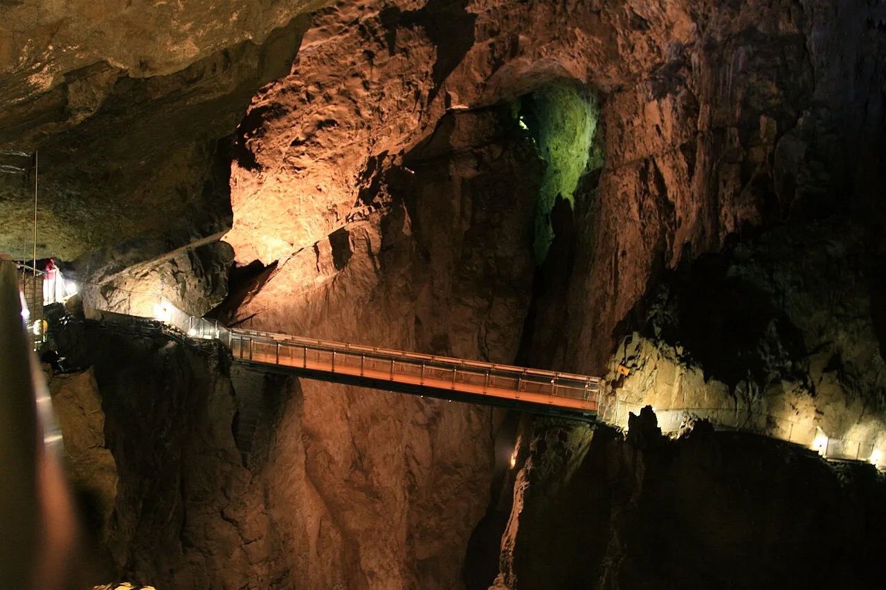
4 caves, including Tkalca jama, Nova Križna jama, Zelške jame and Veselova jama (Wikidata).
Where can I stay in Notranjska Regional Park?
Mountain hut Dom na Slivnici (1,078 m) (Wikidata).
Are there historic monuments in Notranjska Regional Park?
Yes. According to Wikidata, 13 monuments listed in the Slovenian register of cultural heritage stand within the boundary. For example: “Nativity of the Virgin Mary Parish Church” in Občina Cerknica, “Haasberg Castle” in Občina Postojna and “Domačija Goričice 7” in Občina Cerknica.
What is the nearest large city to Notranjska Regional Park?
Nearest towns of over 50,000 people, as the crow flies: Ljubljana (19 km) and Trieste (41 km). Nearest airport: Ljubljana Jože Pučnik (LJU), about 38 km away.
How can I reach Notranjska Regional Park by train?
Rakek railway station lies within the site.
Where can I get visitor information on site?
Turistično informacijski center Cerknica, Križna jama - info and Center za obiskovalce Cerkniško jezero.
Are there waymarked hiking trails in Notranjska Regional Park?
Yes. Waymarked hiking routes listed in OpenStreetMap: 32, including E 7, 149 ~ Pot kurirjev in vezistov NOV Slovenije, 150 ~ Pot kurirjev in vezistov NOV Slovenije and Velika Krpanova pot. The “Postojna via Snežnik to Prezid” route runs for about 27 km through the site, with some 510 m of ascent on its longest section.
Which species can be seen in Notranjska Regional Park?
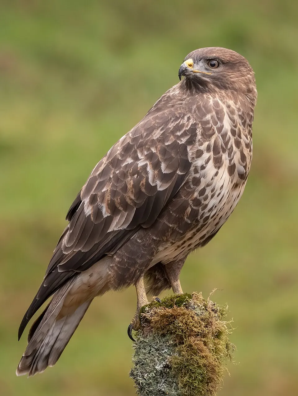
Among the species most often recorded on GBIF are Turdus merula (Common Blackbird), Corvus cornix (Hooded Crow), Buteo buteo (Common Buzzard) and Ardea cinerea (Grey Heron).
What is the official website of Notranjska Regional Park?
© OpenStreetMap
Download the boundary: GeoJSON · GPX Boundary © OpenStreetMap contributors (ODbL).
Geography
The representative point of the site lies at around 571 m above sea level. Over the 1996–2025 period, the mean annual temperature is about 10.1 °C and total precipitation reaches roughly 1,488 mm per year. The warmest month is usually July, the coolest January, and the wettest September.
Area
- Area
- 22,284 ha
- Elevation
- 571 m
- Median elevation
- 633 m
- Mean slope
- 9°
- Snow cover
- ≈ 50 days a year
- Coordinates
- 45.7963, 14.3626
Terrain: Mapzen Terrain Tiles (SRTM, USGS)
Main summits
- Veliki Javornik1,268 m
- Velika Slivnica1,114 m
- Kalun1,106 m
- Čela1,036 m
- Medvednica1,024 m
- Suhi vrh988 m
- Vinji vrh984 m
- Debeli vrh959 m
- Zadela959 m
- Ulaški vrh958 m
Data © OpenStreetMap contributors (ODbL)
Climate
● Mean temperature (°C) · ▮ Precipitation (mm)
Source: Copernicus ERA5-Land (C3S, doi:10.24381/cds.68d2bb30), monthly averages 1996–2025 interpolated to the representative point, temperatures adjusted for elevation.
Contains modified Copernicus Climate Change Service information 2026. Neither the European Commission nor ECMWF is responsible for any use that may be made of the Copernicus information or data it contains.
Snow cover measured by satellite
J
F
M
A
M
J
J
A
S
O
N
D
average share of the site under snow · snowiest parts · ≈ 50 days a year
Snow cover: MODIS/Terra MOD10CM v61 (Hall & Riggs, 2021, NASA NSIDC DAAC, doi:10.5067/MODIS/MOD10CM.061), imagery from NASA GIBS (ESDIS); 2015–2025 average, grid of about 5 km.
Natural habitats
According to CORINE Land Cover (2018), the site is mainly made up of forests (64%), farmland (14%) and marshes and bogs (8%). Woodland mixes broadleaved and coniferous trees. Elevation ranges from about 530 m to 1,268 m (highest point: Veliki Javornik). Median elevation is 633 m, and 99% of the site lies above 500 m (SRTM elevation model). The 7 Natura 2000 sites overlapping the area list 18 habitats of European interest (2 priority), the most extensive being Illyrian Fagus sylvatica forests (Aremonio-Fagion), hydrophilous tall herb fringe communities of plains and of the montane to alpine levels and turloughs.
Biodiversity
Based on occurrences aggregated by GBIF, several species are regularly recorded within the site. Among the most frequent are Turdus merula (Common Blackbird), Corvus cornix (Hooded Crow), Buteo buteo (Common Buzzard) and Ardea cinerea (Grey Heron). The full list of documented taxa is shown below. The overlapping Natura 2000 sites list 87 species of European interest: 56 birds, 11 mammals, 3 amphibians, 1 fish, 11 invertebrates and 5 plants.
Habitats of European interest
From the official forms of the 7 Natura 2000 sites overlapping the area (areas reported for each whole site).
- Illyrian Fagus sylvatica forests (Aremonio-Fagion) 16,970 ha
- Hydrophilous tall herb fringe communities of plains and of the montane to alpine levels 3,914 ha
- Turloughs priority 2,774 ha
- Semi-natural dry grasslands and scrubland facies on calcareous substrates (Festuco-Brometalia) (* important orchid sites) 1,327 ha
- Calcareous rocky slopes with chasmophytic vegetation 784 ha
- Molinia meadows on calcareous, peaty or clayey-silt-laden soils (Molinion caeruleae) 585 ha
- Lowland hay meadows (Alopecurus pratensis, Sanguisorba officinalis) 490 ha
- Alkaline fens 145 ha
and 10 more
Species of European interest
Birds · 56
Great Reed Warbler (Acrocephalus arundinaceus) breeding, Sedge warbler (Acrocephalus schoenobaenus) breeding, Boreal Owl (Aegolius funereus) breeding, Eurasian Skylark (Alauda arvensis) breeding, Rock Partridge (Alectoris graeca) breeding, Tawny Pipit (Anthus campestris) breeding, Golden Eagle (Aquila chrysaetos) breeding, Great Egret (Ardea alba) passage, Purple Heron (Ardea purpurea) passage, Ferruginous Duck (Aythya nyroca) passage breeding, Hazel Grouse (Bonasa bonasia) breeding, Eurasian Bittern (Botaurus stellaris) breeding and 44 more
Mammals · 11
Barbastelle (Barbastella barbastellus), Grey wolf (Canis lupus), Eurasian otter (Lutra lutra), Eurasian Lynx (Lynx lynx), Common bent-wing bat (Miniopterus schreibersii), Bechstein's bat (Myotis bechsteinii), Long-fingered bat (Myotis capaccinii), Geoffroy's bat (Myotis emarginatus), Greater mouse-eared bat (Myotis myotis), Lesser horseshoe bat (Rhinolophus hipposideros), Brown bear (Ursus arctos)
Amphibians · 3
Yellow-bellied toad (Bombina variegata), Olm (Proteus anguinus), Italian crested newt (Triturus carnifex)
Fish · 1
Sava Sculpin (Cottus metae)
Invertebrates · 11
Lesser Ramshorn Snail (Anisus vorticulus), Stone crayfish (Austropotamobius torrentium), Carabus variolosus, Balkan goldenring (Cordulegaster heros), Jersey Tiger (Euplagia quadripunctaria), Leptodirus hochenwartii, Stag beetle (Lucanus cervus), Scarce large blue (Maculinea teleius), Morimus asper funereus, Rosalia longicorn (Rosalia alpina), Narrow-mouthed whorl snail (Vertigo angustior)
Plants · 5
Buxbaumia moss (Buxbaumia viridis), Marsh gladiolus (Gladiolus palustris), Hamatocaulis moss (Hamatocaulis vernicosus), Carniolan Primrose (Primula carniolica), Dalmatian Scilla (Scilla litardierei)
Source: Natura 2000 standard data forms (EEA, CC-BY 4.0). Not exhaustive: sensitive species are not published.
Species to look out for

Bird
Hooded Crow
Corvus cornix540 records © Ricardo Tulio Gandelman from Rio de Janeiro, Brazil · CC BY 2.0



Observed species
Occurrences documented via GBIF; they are neither an exhaustive inventory nor proof of current presence.
- Common Blackbird · Turdus merula · 544
- Hooded Crow · Corvus cornix · 540
- Common Buzzard · Buteo buteo · 531
- Grey Heron · Ardea cinerea · 523
- Great tit · Parus major · 493
- Eurasian Chaffinch · Fringilla coelebs · 488
- European Goldfinch · Carduelis carduelis · 484
- Great Egret · Ardea alba · 484
- Eurasian Magpie · Pica pica · 440
- Eurasian Blackcap · Sylvia atricapilla · 429
- Mallard · Anas platyrhynchos · 421
- Common Chiffchaff · Phylloscopus collybita · 414
+18 more species
- Barn Swallow · Hirundo rustica · 399
- European robin · Erithacus rubecula · 381
- Common Starling · Sturnus vulgaris · 373
- Mute Swan · Cygnus olor · 357
- White Wagtail · Motacilla alba · 348
- Common House Martin · Delichon urbicum · 331
- Western Yellow Wagtail · Motacilla flava · 331
- Common Kestrel · Falco tinnunculus · 326
- Common Coot · Fulica atra · 316
- Eurasian Jay · Garrulus glandarius · 305
- Great Spotted Woodpecker · Dendrocopos major · 287
- House Sparrow · Passer domesticus · 275
- White stork · Ciconia ciconia · 267
- Great Crested Grebe · Podiceps cristatus · 266
- Black Redstart · Phoenicurus ochruros · 265
- Eurasian blue tit · Cyanistes caeruleus · 263
- Great Cormorant · Phalacrocorax carbo · 253
- Red-backed Shrike · Lanius collurio · 252
Records: GBIF.org (CC-BY). Names: Wikidata (CC0), GBIF. Photos: Wikimedia Commons.
Conservation challenges
The primary purpose of the site is to preserve its natural habitats and the biodiversity they support. The species recorded (Biodiversity tab) reflect its ecological value. The designations it holds frame its management and the control of land use.
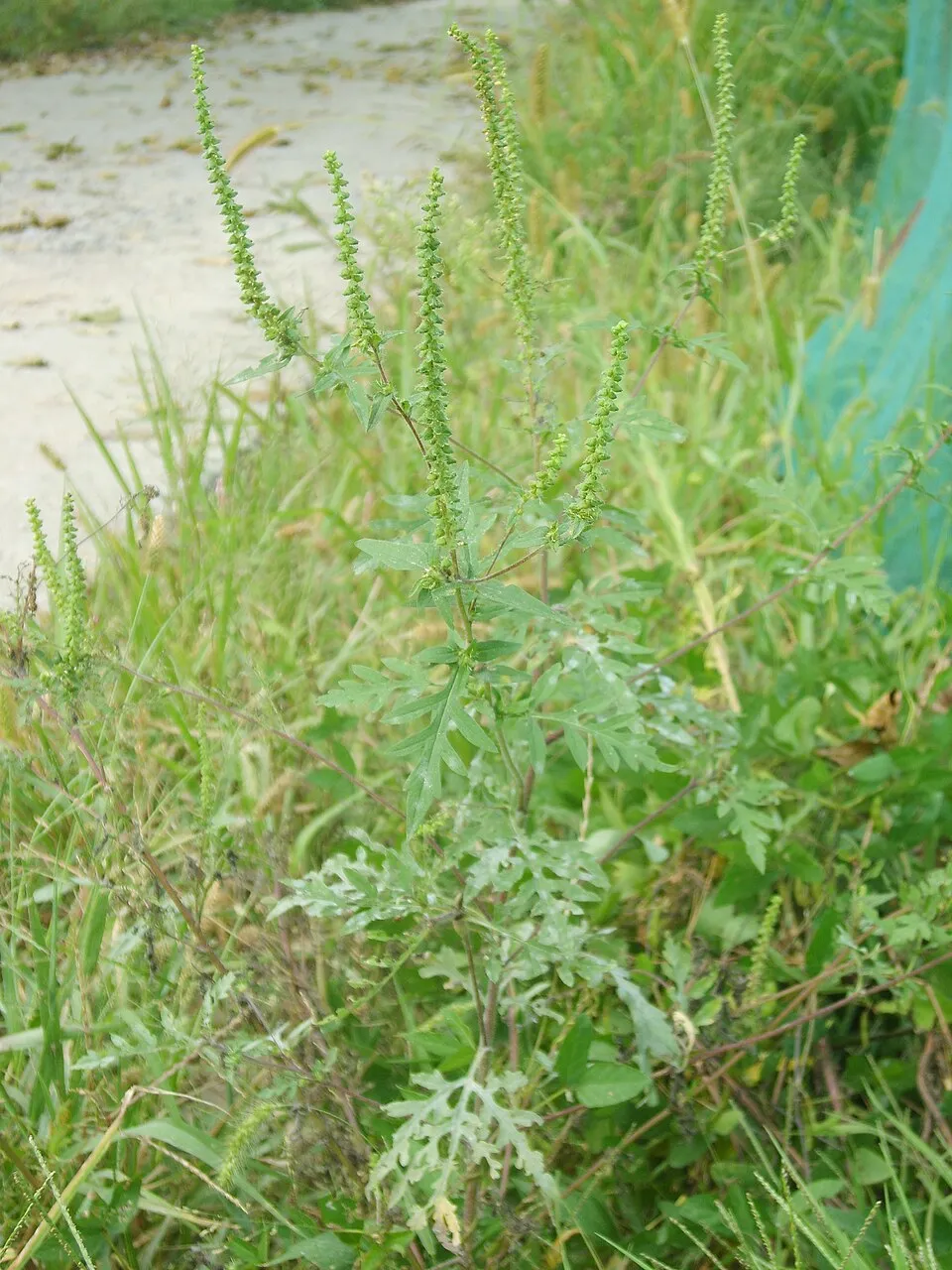
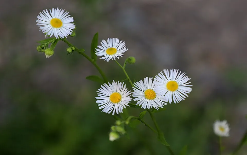
According to Global Forest Change data (University of Maryland, Global Forest Watch), about 760 ha of tree cover were lost within the boundary between 2001 and 2023 (3% of its area), peaking in 2014 and 2016. These losses include logging, storms and fires, and do not account for regrowth. According to the European CORINE Land Cover inventory (Copernicus), land cover changed on about 139 ha of the site between 1990 and 2018 (under 1% of its area): wetlands grew by 121 ha, mostly at the expense of open water, while open water shrank by 121 ha, mostly giving way to wetlands. Forest felling and regrowth add about 560 ha in total over the period. At night, 2% of the area gives off artificial light detectable from space (NASA VIIRS Black Marble composite, 2016): it ranks among the darkest places in the atlas for this country. Built-up and developed land (buildings, business areas, roads, quarries) covers 3% of the area, and farmland 14% (CORINE Land Cover). According to the Natura 2000 forms, of 17 assessed habitats of European interest, 2 are in excellent condition and 5 in average or reduced condition. According to the Water Framework Directive assessment (2022 river basin management plans, data 2014–2019), only 11% of the 22 km of rivers assessed within the site are in good or high ecological status; the others mostly have moderate ecological status. Other assessed water bodies: lakes, 1 of 1 in good ecological status or better. Since 2000, 20 invasive alien species have been recorded within the site (GBIF observations), 3 of them listed as of Union concern under EU Regulation 1143/2014. Among them: Impatiens glandulifera (Himalayan Balsam), Asclepias syriaca (Common milkweed) and Ailanthus altissima (Tree-of-heaven).
Pressure indicators
Tree cover lost
760 ha
2001–2023 · 3% of the area
20012023
Fires since 2016
0
No large fire mapped (fires over about 30 ha)
Light at night
2%
of the area gives off artificial light visible from space
DarkLit
Built-up land
3%
buildings, business areas, roads, quarries · farmland 14%
Land cover change
139 ha
changed cover, 1990–2018 · CORINE · < 1% of the area
- +121 ha · wetlands
- −121 ha · water bodies
forest felling and regrowth: 560 ha in total
Rivers and lakes
11%
of the 22 km of assessed rivers in good or high ecological status · WFD 2022
Lakes: 1 of 1 good or better
assessments 2014–2019
Invasive alien species
20
incl. 3 of EU concern · since 2000
 Himalayan BalsamEU
Common milkweedEU
 Tree-of-heavenEU
 Mute Swan
 Annual ragweed
 Eastern daisy fleabane
 Canada Horseweed
 Small balsam
Photos: Himalayan Balsam © Guptaele · CC BY-SA 4.0; Tree-of-heaven © Darkone · CC BY-SA 2.5; Mute Swan © Geni · CC BY-SA 4.0; Annual ragweed © Dalgial · CC BY-SA 3.0; Eastern daisy fleabane © W. Bulach · CC BY-SA 4.0; Canada Horseweed © Andrey Zharkikh from Salt Lake City, USA · CC BY 2.0; Small balsam © André Karwath aka Aka · CC BY-SA 2.5
Sources: Global Forest Change (Hansen et al., University of Maryland, via Global Forest Watch, CC-BY 4.0); EFFIS, European Commission / Copernicus; NASA Black Marble 2016 (public domain); CORINE Land Cover 2018 (Copernicus) or MODIS.
CORINE Land Cover Change 1990–2018: generated using European Union's Copernicus Land Monitoring Service information (EEA), aggregated by Parkavela; DOI 10.2909/f30f1000-7cf8-43bb-872c-5eb093911b24.
Ecological status of water bodies: European Environment Agency, WISE – Water Framework Directive, 3rd river basin management plans (2022), CC BY 4.0. Official national classification, not comparable between countries.
Invasive alien species: Global Register of Introduced and Invasive Species (ISSG, CC BY 4.0); Union list, Regulation (EU) 1143/2014 (INBO, CC0); GBIF.org records (CC0 / CC BY 4.0), at least 2 per species.
Practical information
Cities and airport
- Ljubljana
19 km as the crow flies - Trieste
41 km as the crow flies - Airport: Ljubljana Jože Pučnik (LJU)
38 km as the crow flies
Visitor information
- Turistično informacijski center Cerknica
within the site - Križna jama - info
within the site - Center za obiskovalce Cerkniško jezero
within the site - Jamarsko društvo Planina
1 km from the site boundary
Hiking
32 waymarked routes listed, including:
E 7149 ~ Pot kurirjev in vezistov NOV Slovenije150 ~ Pot kurirjev in vezistov NOV SlovenijeVelika Krpanova potPostojna via Snežnik to PrezidNotranjska planinska pot
By bike
EV9 · 9 km G8 · 2 kmR13 R13 (Cerknica-Stari trg pri Ložu-Ilirska Bistrica) · 2 km
Signed cycle routes: this does not mean that cycling is allowed on footpaths.
Wheelchair access
- Center za obiskovalce Cerkniško jezero
visitor information
accessible toilets: 2
Reported by OpenStreetMap contributors (ODbL); check with the park before visiting.
Data © OpenStreetMap contributors (ODbL) · Wikidata (CC0)
Contains information from EuroVelo GPX tracks downloaded from www.EuroVelo.com on 2026-10-22, which is made available here under the Open Database License (ODbL). EuroVelo® is a registered trademark of the ECF. Routes © OpenStreetMap contributors (ODbL), via Waymarked Trails
Waymarked hiking routes
E7 European long distance path E7 - part Slovenia
17 km within the site ↗ 354 m↘ 423 m 753–958 m
Naravoslovna učna pot Menišija
5.4 km within the site ↗ 164 m↘ 146 m 581–735 m
Tracks © OpenStreetMap contributors (ODbL), clipped to the boundary; elevation gain and profiles computed on the longest section from Mapzen Terrain Tiles (≈ 30 m), indicative only. Indicative difficulty (SAC scale, OpenStreetMap, via Waymarked Trails): check with the park.
Access and visiting
Rakek railway station lies within the site. Nearest towns of over 50,000 people, as the crow flies: Ljubljana (19 km) and Trieste (41 km). Nearest airport: Ljubljana Jože Pučnik (LJU), about 38 km away. About 300,000 people live within 20 km of the site boundary, 68,000 of them within 10 km; some 12,000 people are estimated to live inside (GHSL estimate, 2020). This population has grown by about 19% since 2000. Visitor information on site: Turistično informacijski center Cerknica, Križna jama - info and Center za obiskovalce Cerkniško jezero. Waymarked hiking routes listed in OpenStreetMap: 32, including E 7, 149 ~ Pot kurirjev in vezistov NOV Slovenije, 150 ~ Pot kurirjev in vezistov NOV Slovenije and Velika Krpanova pot. The EuroVelo 9 cycle route (Baltic – Adriatic) crosses the site for about 9 km; 2 other signed cycle routes also pass through: “G8” and “R13 R13 (Cerknica-Stari trg pri Ložu-Ilirska Bistrica)” (EuroVelo, OpenStreetMap). OpenStreetMap contributors list one wheelchair-accessible place: Center za obiskovalce Cerkniško jezero; check with the park before visiting. To see: 4 caves, including Tkalca jama, Nova Križna jama, Zelške jame and Veselova jama. Where to stay: mountain hut Dom na Slivnici (1,078 m). To plan a visit (access, opening periods, visitor rules), it is best to consult the official information from the managing body and the official website listed in this page's sources.
Source: OpenStreetMap (ODbL), Wikidata (CC0), October 2026.
Built heritage
According to Wikidata, 13 monuments listed in the Slovenian register of cultural heritage stand within the boundary. Among them are 7 houses and civic buildings, 3 religious buildings and 1 prehistoric or archaeological site. Examples include “Nativity of the Virgin Mary Parish Church” in Občina Cerknica, “Haasberg Castle” in Občina Postojna and “Domačija Goričice 7” in Občina Cerknica.
7 houses and civic buildings3 religious buildings1 prehistoric or archaeological site
-
Nativity of the Virgin Mary Parish Church
Občina Cerknica -
Haasberg Castle
Občina Postojna -
Domačija Goričice 7
Občina Cerknica -
Pristava sv. Marije Magdalene
Občina Cerknica -
Holy Cross Church
Občina Loška dolina -
Domačija Grahovo 62
Občina Cerknica -
Tabor
Občina Cerknica -
St. Lawrence's Church
Občina Cerknica
and 5 more
Source: Wikidata (CC0), monuments in each country’s official heritage protection registers, at national or regional level. Each item links to its Wikidata entry.
When to visit
Best time to visit: from May to October, with average temperatures of 10 to 20 °C and moderate rainfall. According to NASA's MODIS satellites (2015–2025 average), snow covers most of the site in January, with about 50 snow-covered days a year on average. Day length ranges from about 8 h 41 min in December to 15 h 42 min in June. Wildlife records published on GBIF peak for birds (May), plants (June and July), butterflies and moths (July), dragonflies (July) and mammals (from July to September). These peaks also reflect when observers are most active.
Source: Copernicus ERA5-Land (C3S), monthly averages 1996–2025 at the representative point, temperatures adjusted for elevation.
Contains modified Copernicus Climate Change Service information 2026. Neither the European Commission nor ECMWF is responsible for any use that may be made of the Copernicus information or data it contains.
Wildlife records calendar
JFMAMJJASOND
Birds
Plants
Butterflies & moths
Dragonflies
Mammals
Monthly records published on GBIF (CC-BY), relative to the busiest month; also reflects observer activity.
Gallery
© Marko Samastur from Ljubljana, Slovenia · CC BY 2.0
© Doremo · CC BY-SA 4.0
© Matej Frančeškin · CC BY 4.0
© Ajznponar · CC0-1.0
© Ajznponar · CC0-1.0
© Matej Frančeškin · CC BY 4.0
Sources and licences
- Wikidata: Q20523298
- OpenStreetMap: relation 11560568
- Official website: https://notranjski-park.si/
- Wikipedia: de.wikipedia.org/wiki/Notranjska-Regionalpark
- WDPA: 178735
References
- cds.climate.copernicus.eu: climate · CC-BY-4.0
- registry.opendata.aws: elevation of the reference point, detailed relief · PD
- land.copernicus.eu: land cover, land cover change, sea share · COPERNICUS
- doi.org: population around the site · CC-BY-4.0
- wikidata.org: official area, protected heritage, nearby cities and airport, access and peaks, lake depths, places to see, official website · CC0-1.0
- eea.europa.eu: bathing water quality, ecological status of waters · CC-BY-4.0
- en.eurovelo.com: EuroVelo cycle routes · ODbL-1.0
- cycling.waymarkedtrails.org: cycle routes · ODbL-1.0
- opentopodata.org: elevations · PD
- forest-fire.emergency.copernicus.eu: wildfires · COPERNICUS
- globalforestwatch.org: tree cover loss · CC-BY-4.0
- gbif.org: seasonality of sightings, invasive alien species, observed species · CC-BY-4.0
- hydrosheds.org: lakes · CC-BY-4.0
- natura2000.eea.europa.eu: Natura 2000 habitats and species · CC-BY-4.0
- openstreetmap.org: official name, access and peaks, trail difficulty, wheelchair access · ODbL-1.0
- earthobservatory.nasa.gov: night light · PD
- hiking.waymarkedtrails.org: route difficulty · ODbL-1.0
- nsidc.org: snow cover · PD
- wikidata.org: Wikipedia article · CC-BY-SA-4.0
Data © OpenStreetMap contributors (ODbL), Wikidata (CC0) and the sources cited.