
Slovenia · Terrestrial
Sečovlje Salina Landscape Park
Nature park of 610 hectares in Slovenia.
Overview
Nature park of 610 hectares in Slovenia.
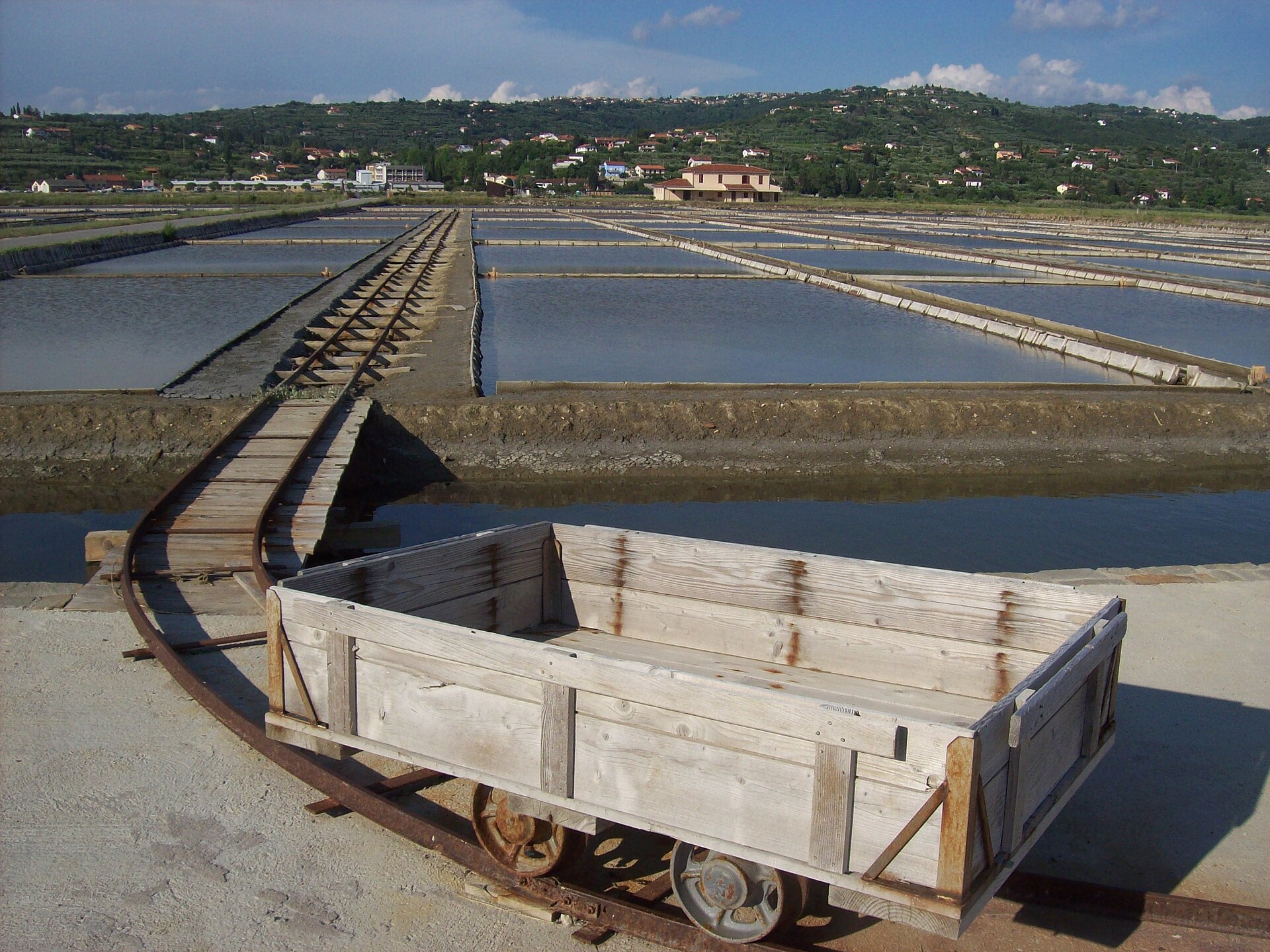
Sečovlje Salina Landscape Park is a nature park in Slovenia (Europe). It is a predominantly terrestrial area. It covers about 610 hectares.
Protections and designations
Ramsar site
Natura 2000 · habitats (SAC)
- Sečoveljske soline in estuarij Dragonje SI3000240
Natura 2000 · birds (SPA)
- Sečoveljske soline SI5000018
Other designations
Protected as a nature park. International labels and designations: Ramsar site (“Sečovlje Saltworks”) and Natura 2000 network (2 sites). Key dates: Ramsar Site in 1993, first Natura 2000 site under the Birds Directive in 2004 and first Natura 2000 site under the Habitats Directive in 2012.
In our collections
Timeline
-
1993
Ramsar Site (wetland of international importance) Sečovlje Saltworks
-
2004
First Natura 2000 site under the Birds Directive
-
2012
First Natura 2000 site under the Habitats Directive
Sources: Wikidata (CC0) for establishment and international labels; EEA Natura 2000 database (CC-BY 4.0) for site designation dates.
Frequently asked questions
Where is Sečovlje Salina Landscape Park?
In Slovenia (Europe). Representative point: 45.4919° N, 13.6085° E.
How large is Sečovlje Salina Landscape Park?
About 610 hectares (6 km²). It is the 6th largest of the 8 nature parks in Slovenia covered by Parkavela. About 100 ha are at sea.
What habitats and landscapes does Sečovlje Salina Landscape Park include?
A terrestrial area, with wetlands and coasts.
Which international labels apply to Sečovlje Salina Landscape Park?
Ramsar site (“Sečovlje Saltworks”) and Natura 2000 network (2 sites).
When is the best time to visit Sečovlje Salina Landscape Park?
Best time to visit: from April to August, with average temperatures of 12 to 25 °C and moderate rainfall.
Are there historic monuments in Sečovlje Salina Landscape Park?
Yes. According to Wikidata, 2 monuments listed in the Slovenian register of cultural heritage stand within the boundary, 1 of them of national significance. For example: “Muzej solinarstva v Sečoveljskih solinah” in Občina Piran.
Can you swim in Sečovlje Salina Landscape Park?
2 monitored bathing sites lie in or within 1 km of the site; official 2025 classification: 2 excellent (European Environment Agency). Swimming is only permitted at the sites and times authorised locally.
What is the nearest large city to Sečovlje Salina Landscape Park?
Nearest towns of over 50,000 people, as the crow flies: Trieste (22 km) and Free Territory of Trieste (24 km). Nearest airport: Trieste – Friuli Venezia Giulia (TRS), about 37 km away.
How can I reach Sečovlje Salina Landscape Park by train?
The nearest railway station is Koper / Capodistria, about 11 km from the site boundary.
Where can I get visitor information on site?
Vhod KPSS na Leri and Turistične informacije.
Which species can be seen in Sečovlje Salina Landscape Park?
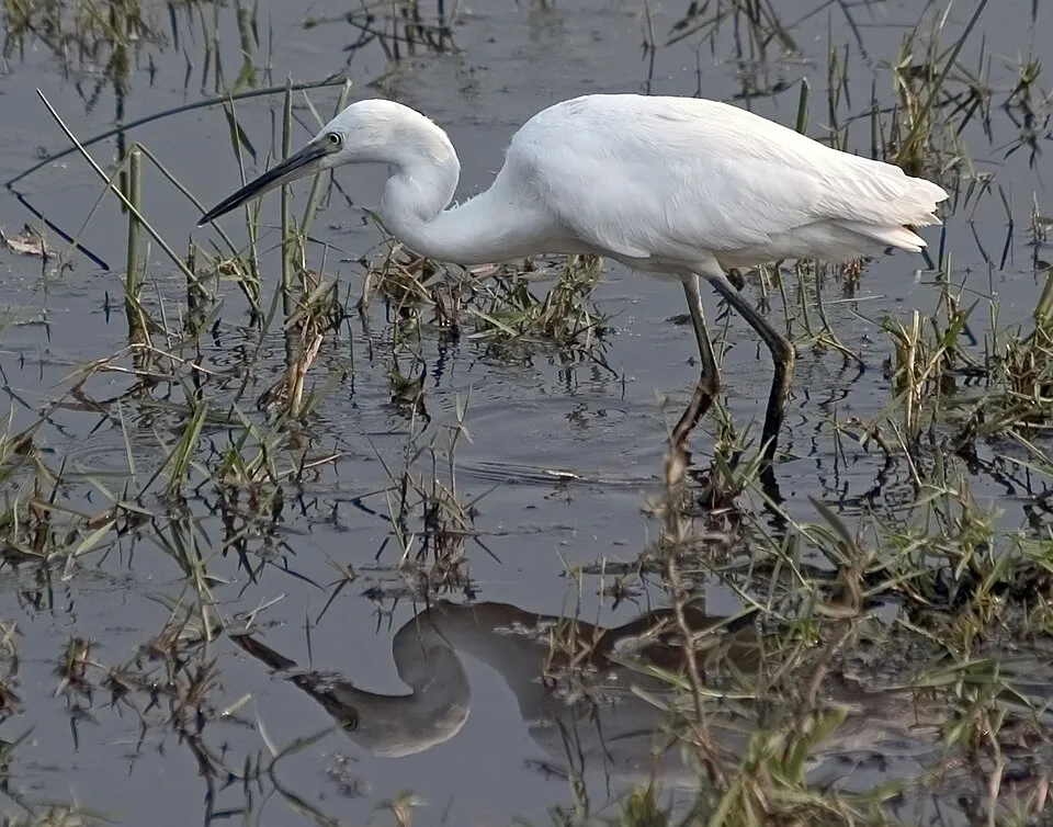
Among the species most often recorded on GBIF are Anas platyrhynchos (Mallard), Egretta garzetta (Little Egret), Himantopus himantopus (Black-winged Stilt) and Larus michahellis (Yellow-legged Gull).
What is the official website of Sečovlje Salina Landscape Park?
© OpenStreetMap
Download the boundary: GeoJSON · GPX Boundary © OpenStreetMap contributors (ODbL).
Geography
Over the 1996–2025 period, the mean annual temperature is about 14.7 °C and total precipitation reaches roughly 1,173 mm per year. The warmest month is usually July, the coolest January, and the wettest November.
Area
- Area of the boundary
- 610 ha
- Coordinates
- 45.4919, 13.6085
Climate
● Mean temperature (°C) · ▮ Precipitation (mm)
Source: Copernicus ERA5-Land (C3S, doi:10.24381/cds.68d2bb30), monthly averages 1996–2025 interpolated to the representative point, temperatures adjusted for elevation.
Contains modified Copernicus Climate Change Service information 2026. Neither the European Commission nor ECMWF is responsible for any use that may be made of the Copernicus information or data it contains.
Natural habitats
According to CORINE Land Cover (2018), the site is mainly made up of salt marshes and tidal flats (81%) and marine waters (15%). The site borders the coast. The 2 Natura 2000 sites overlapping the area list 6 habitats of European interest, the most extensive being mudflats and sandflats not covered by seawater at low tide, Salicornia and other annuals colonizing mud and sand and Spartina swards (Spartinion maritimae).
Biodiversity
Based on occurrences aggregated by GBIF, several species are regularly recorded within the site. Among the most frequent are Anas platyrhynchos (Mallard), Egretta garzetta (Little Egret), Himantopus himantopus (Black-winged Stilt) and Larus michahellis (Yellow-legged Gull). The full list of documented taxa is shown below. The overlapping Natura 2000 sites list 19 species of European interest: 16 birds, 1 reptile, 1 fish and 1 invertebrate.
Habitats of European interest
From the official forms of the 2 Natura 2000 sites overlapping the area (areas reported for each whole site).
- Mudflats and sandflats not covered by seawater at low tide 68 ha
- Salicornia and other annuals colonizing mud and sand 68 ha
- Spartina swards (Spartinion maritimae) 68 ha
- Mediterranean salt meadows (Juncetalia maritimi) 68 ha
- Mediterranean and thermo-Atlantic halophilous scrubs (Sarcocornetea fruticosi) 68 ha
- Estuaries 13 ha
Species of European interest
Birds · 16
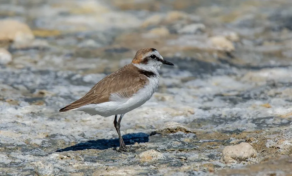
Tawny Pipit (Anthus campestris) breeding, Great Egret (Ardea alba) wintering, Kentish Plover (Charadrius alexandrinus) breeding, Little Egret (Egretta garzetta) passage, Black-throated loon (Gavia arctica) wintering, Common Crane (Grus grus) passage, Black-winged Stilt (Himantopus himantopus) breeding, Caspian Gull (Larus cachinnans) breeding passage, Mediterranean gull (Larus melanocephalus) passage, European Shag (Phalacrocorax aristotelis desmarestii) passage wintering, Greater Flamingo (Phoenicopterus roseus) wintering, European Golden Plover (Pluvialis apricaria) passage and 4 more
Reptiles · 1
European Pond Turtle (Emys orbicularis)
Invertebrates · 1
Source: Natura 2000 standard data forms (EEA, CC-BY 4.0). Not exhaustive: sensitive species are not published.
Species to look out for

Observed species
Occurrences documented via GBIF; they are neither an exhaustive inventory nor proof of current presence.
- Mallard · Anas platyrhynchos · 1173
- Little Egret · Egretta garzetta · 1006
- Black-winged Stilt · Himantopus himantopus · 853
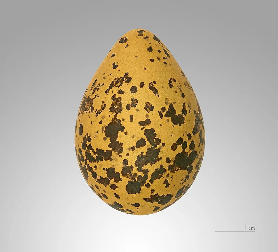
- Yellow-legged Gull · Larus michahellis · 824
- Kentish Plover · Charadrius alexandrinus · 692
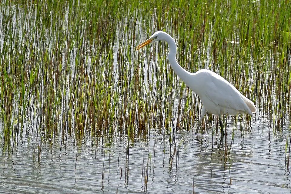
- Great Egret · Ardea alba · 681
- Common Shelduck · Tadorna tadorna · 653
- Black-headed Gull · Chroicocephalus ridibundus · 639
- Pied Avocet · Recurvirostra avosetta · 521
- Grey Heron · Ardea cinerea · 510
- Common Greenshank · Tringa nebularia · 451
- Mute Swan · Cygnus olor · 449
+18 more species
- Common Tern · Sterna hirundo · 412
- Great Cormorant · Phalacrocorax carbo · 410
- Common Sandpiper · Actitis hypoleucos · 372
- Little Tern · Sternula albifrons · 364
- White Wagtail · Motacilla alba · 364
- Eurasian Teal · Anas crecca · 338
- Common Kingfisher · Alcedo atthis · 271
- Northern Shoveler · Spatula clypeata · 252
- Wood Sandpiper · Tringa glareola · 219
- Dunlin · Calidris alpina · 200
- Western Yellow Wagtail · Motacilla flava · 191
- Common House Martin · Delichon urbicum · 186
- Common Redshank · Tringa totanus · 185
- Water Pipit · Anthus spinoletta · 184
- Ruff · Calidris pugnax · 178
- Barn Swallow · Hirundo rustica · 176
- Meadow Pipit · Anthus pratensis · 166
- Eurasian Wigeon · Mareca penelope · 148
Records: GBIF.org (CC-BY). Names: Wikidata (CC0), GBIF. Photos: Wikimedia Commons.
Conservation challenges
The primary purpose of the site is to preserve its natural habitats and the biodiversity they support. The species recorded (Biodiversity tab) reflect its ecological value. The designations it holds frame its management and the control of land use.
According to CORINE Land Cover, land cover here remained almost unchanged between 1990 and 2018 (less than 0.5% of the area affected). At night, 79% of the area gives off artificial light detectable from space (NASA VIIRS Black Marble composite, 2016). Built-up and developed land (buildings, business areas, roads, quarries) covers 4% of the area (CORINE Land Cover). According to the Natura 2000 forms, of 6 assessed habitats of European interest, 1 is in excellent condition and 1 in average or reduced condition. According to the Water Framework Directive assessment (2022 river basin management plans, data 2014–2019), water bodies assessed within the site: coastal waters, 1 of 1 in good ecological status or better.
Pressure indicators
Fires since 2016
0
No large fire mapped (fires over about 30 ha)
Light at night
79%
of the area gives off artificial light visible from space
DarkLit
Built-up land
4%
buildings, business areas, roads, quarries
Land cover change
< 0.5%
of the area changed, 1990–2018 · CORINE
Rivers and lakes
Coastal waters: 1 of 1 good or better
assessments 2014–2019
Invasive alien species
2
recorded since 2000
 Mute Swan
 Canada Horseweed
Photos: Mute Swan © Geni · CC BY-SA 4.0; Canada Horseweed © Andrey Zharkikh from Salt Lake City, USA · CC BY 2.0
Sources: Global Forest Change (Hansen et al., University of Maryland, via Global Forest Watch, CC-BY 4.0); EFFIS, European Commission / Copernicus; NASA Black Marble 2016 (public domain); CORINE Land Cover 2018 (Copernicus) or MODIS.
CORINE Land Cover Change 1990–2018: generated using European Union's Copernicus Land Monitoring Service information (EEA), aggregated by Parkavela; DOI 10.2909/f30f1000-7cf8-43bb-872c-5eb093911b24.
Ecological status of water bodies: European Environment Agency, WISE – Water Framework Directive, 3rd river basin management plans (2022), CC BY 4.0. Official national classification, not comparable between countries.
Invasive alien species: Global Register of Introduced and Invasive Species (ISSG, CC BY 4.0); Union list, Regulation (EU) 1143/2014 (INBO, CC0); GBIF.org records (CC0 / CC BY 4.0), at least 2 per species.
Practical information
Cities and airport
- Trieste
22 km as the crow flies - Free Territory of Trieste
24 km as the crow flies - Airport: Trieste – Friuli Venezia Giulia (TRS)
37 km as the crow flies
Visitor information
- Vhod KPSS na Leri
< 1 km from the site boundary - Turistične informacije
2 km from the site boundary
Data © OpenStreetMap contributors (ODbL) · Wikidata (CC0)
Bathing
2 monitored bathing sites in or within 1 km of the site · 2025 classification
Excellent · 2
- Kopalno Območje Rt Seča · sea · Excellent
- Naravno Kopališče Avtokamp Lucija · sea · Excellent
Source: European Environment Agency, official bathing water classification (Directive 2006/7/EC, CC-BY 4.0). Swimming is only permitted at the sites and times authorised locally.
Access and visiting
The nearest railway station is Koper / Capodistria, about 11 km from the site boundary. Nearest towns of over 50,000 people, as the crow flies: Trieste (22 km) and Free Territory of Trieste (24 km). Nearest airport: Trieste – Friuli Venezia Giulia (TRS), about 37 km away. About 150,000 people live within 20 km of the site boundary, 68,000 of them within 10 km; some 340 people are estimated to live inside (GHSL estimate, 2020). This population has grown by about 11% since 2000. Visitor information on site: Vhod KPSS na Leri and Turistične informacije. To plan a visit (access, opening periods, visitor rules), it is best to consult the official information from the managing body and the official website listed in this page's sources.
Source: OpenStreetMap (ODbL), Wikidata (CC0), October 2026.
Built heritage
According to Wikidata, 2 monuments listed in the Slovenian register of cultural heritage stand within the boundary, 1 of them of national significance. Nationally designated items include “Muzej solinarstva v Sečoveljskih solinah” in Občina Piran.
-
Muzej solinarstva v Sečoveljskih solinah
National
Občina Piran -
Sečovlje Saltworks
Občina Piran
Source: Wikidata (CC0), monuments in each country’s official heritage protection registers, at national or regional level. Each item links to its Wikidata entry.
When to visit
Best time to visit: from April to August, with average temperatures of 12 to 25 °C and moderate rainfall. Precipitation peaks from September to November (up to 160 mm per month). Day length ranges from about 8 h 43 min in December to 15 h 40 min in June. Wildlife records published on GBIF peak for birds (April and May), plants (June) and butterflies and moths (from May to August). These peaks also reflect when observers are most active.
Source: Copernicus ERA5-Land (C3S), monthly averages 1996–2025 at the representative point, temperatures adjusted for elevation.
Contains modified Copernicus Climate Change Service information 2026. Neither the European Commission nor ECMWF is responsible for any use that may be made of the Copernicus information or data it contains.
Wildlife records calendar
JFMAMJJASOND
Birds
Plants
Butterflies & moths
Monthly records published on GBIF (CC-BY), relative to the busiest month; also reflects observer activity.
Gallery
© Jarba · CC BY 3.0
© Yerpo · CC BY-SA 3.0
© Andrej Solic from Piran, Slovenija · CC BY 2.0
© Isiwal · CC BY-SA 4.0
© Martin Holland from Augsburg, Germany · CC BY 2.0
© Yerpo · CC BY-SA 3.0
Sources and licences
- Wikidata: Q7459696
- Official website: http://www.kpss.si/en/intro
- Wikipedia: en.wikipedia.org/wiki/Sečovlje_Saltpans_Natural_Park
References
- cds.climate.copernicus.eu: climate · CC-BY-4.0
- registry.opendata.aws: elevation of the reference point, detailed relief · PD
- land.copernicus.eu: land cover, land cover change, sea share · COPERNICUS
- doi.org: population around the site · CC-BY-4.0
- openstreetmap.org: official name, access and peaks, trail difficulty, wheelchair access · ODbL-1.0
- eea.europa.eu: bathing water quality, ecological status of waters · CC-BY-4.0
- en.eurovelo.com: EuroVelo cycle routes · ODbL-1.0
- cycling.waymarkedtrails.org: cycle routes · ODbL-1.0
- opentopodata.org: elevations · PD
- forest-fire.emergency.copernicus.eu: wildfires · COPERNICUS
- globalforestwatch.org: tree cover loss · CC-BY-4.0
- gbif.org: seasonality of sightings, invasive alien species, observed species · CC-BY-4.0
- wikidata.org: protected heritage, nearby cities and airport, access and peaks, lake depths, places to see, official website · CC0-1.0
- hydrosheds.org: lakes · CC-BY-4.0
- natura2000.eea.europa.eu: Natura 2000 habitats and species · CC-BY-4.0
- earthobservatory.nasa.gov: night light · PD
- nsidc.org: snow cover · PD
- wikidata.org: Wikipedia article · CC-BY-SA-4.0
Data © OpenStreetMap contributors (ODbL), Wikidata (CC0) and the sources cited.