Canada · Mixed
Ukkusiksalik National Park
National park of 2,088,586 hectares in Canada, established in 2014.
Overview
National park of 2,088,586 hectares in Canada, established in 2014.
Ukkusiksalik National Park is located in Canada (North America). It covers both land and sea. Established on 31 July 2014, it covers about 2,088,586 hectares. The site is managed by Parks Canada.
In our collections
Frequently asked questions
Where is Ukkusiksalik National Park?
In Canada (North America). Representative point: 65.4986° N, 87.8953° W.
How large is Ukkusiksalik National Park?
About 2,088,586 hectares (20,886 km²). It is the 6th largest of the 47 national parks in Canada covered by Parkavela. About 332,700 ha are at sea.
When was Ukkusiksalik National Park established?
On 31 July 2014.
What habitats and landscapes does Ukkusiksalik National Park include?
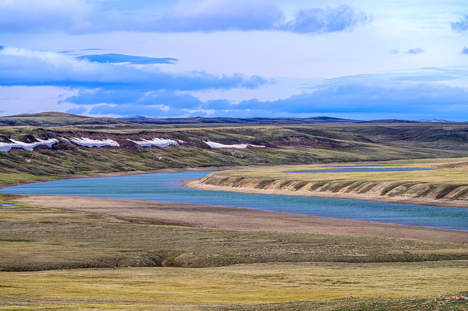
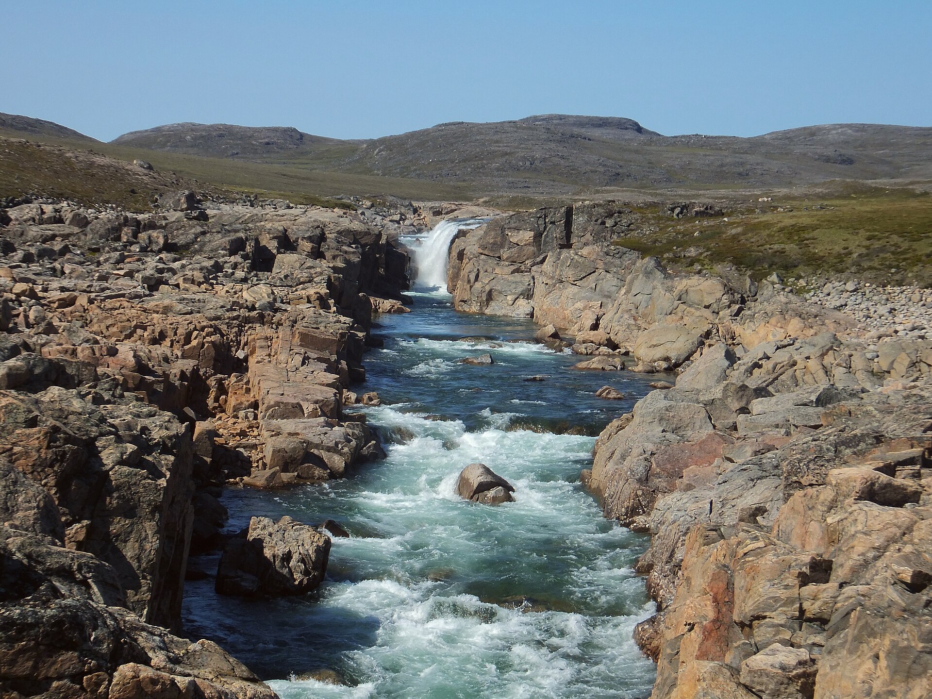
An area spanning land and sea, with coasts.
What is the highest point of Ukkusiksalik National Park?
Local H.P., at 630 m (OpenStreetMap).
When is the best time to visit Ukkusiksalik National Park?
Mildest period: July, with average temperatures of 11 to 12 °C.
Is there snow in Ukkusiksalik National Park?
Yes. According to NASA's MODIS satellites (2015–2025 average), snow covers most of the site from October to May, and until June on higher ground, with about 255 snow-covered days a year on average. In midwinter, too dark for satellite measurements, snow cover is estimated from the neighbouring months.
What is there to see in Ukkusiksalik National Park?
4 lakes and ponds, including Alda Lake (81 m), Ford Lake, Brown Lake and Nallaurjuk Lake (Wikidata).
Which species can be seen in Ukkusiksalik National Park?
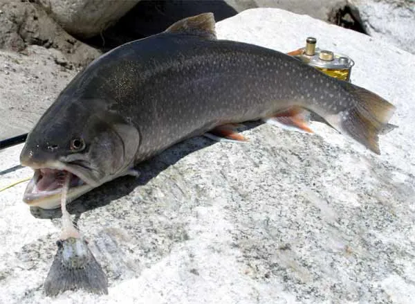
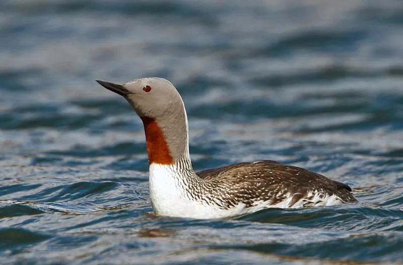
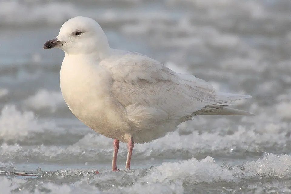
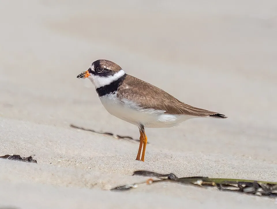
Among the species most often recorded on GBIF are Salvelinus alpinus (Arctic char), Gavia stellata (Red-throated Diver), Larus glaucoides (Iceland Gull) and Charadrius semipalmatus (Semipalmated Plover).
Who manages Ukkusiksalik National Park?
Parks Canada.
What is the official website of Ukkusiksalik National Park?
© OpenStreetMap
Download the boundary: GeoJSON · GPX Boundary © OpenStreetMap contributors (ODbL).
Geography
The representative point of the site lies at around 84 m above sea level. Over the 1996–2025 period, the mean annual temperature is about -10.6 °C and total precipitation reaches roughly 371 mm per year. The warmest month is usually July, the coolest January, and the wettest August.
Area
- Area
- 2,088,586 ha
- Elevation
- 84 m
- Median elevation
- 249 m
- Snow cover
- ≈ 255 days a year
- Coordinates
- 65.4986, -87.8953
Terrain: Mapzen Terrain Tiles (SRTM, USGS)
Climate
● Mean temperature (°C) · ▮ Precipitation (mm)
Source: Copernicus ERA5-Land (C3S, doi:10.24381/cds.68d2bb30), monthly averages 1996–2025 interpolated to the representative point, temperatures adjusted for elevation.
Contains modified Copernicus Climate Change Service information 2026. Neither the European Commission nor ECMWF is responsible for any use that may be made of the Copernicus information or data it contains.
Snow cover measured by satellite
J
F
M
A
M
J
J
A
S
O
N
D
average share of the site under snow · snowiest parts · ≈ 255 days a year
Snow cover: MODIS/Terra MOD10CM v61 (Hall & Riggs, 2021, NASA NSIDC DAAC, doi:10.5067/MODIS/MOD10CM.061), imagery from NASA GIBS (ESDIS); 2015–2025 average, grid of about 5 km.
Natural habitats
According to the global MODIS land cover (NASA, 2024), the land area is mainly made up of grassland and meadows (99%). The sea covers about 16% of the site. The seabed reaches about 14 m deep (median depth 14 m; GEBCO bathymetry). Elevation ranges from sea level to 630 m (highest point: Local H.P.).
Biodiversity
Based on occurrences aggregated by GBIF, several species are regularly recorded within the site. Among the most frequent are Salvelinus alpinus (Arctic char), Gavia stellata (Red-throated Diver), Larus glaucoides (Iceland Gull) and Charadrius semipalmatus (Semipalmated Plover). The full list of documented taxa is shown below.
Species to look out for

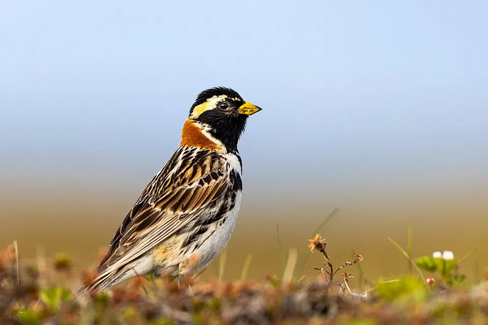
Bird
Lapland Longspur
Calcarius lapponicus27 records © Alaska Region U.S. Fish & Wildlife Service from Anchorage, United States · Public domain
Observed species
Occurrences documented via GBIF; they are neither an exhaustive inventory nor proof of current presence.
- Arctic char · Salvelinus alpinus · 43
- Red-throated Diver · Gavia stellata · 33
- Iceland Gull · Larus glaucoides · 31
- Semipalmated Plover · Charadrius semipalmatus · 29
- Snow Bunting · Plectrophenax nivalis · 29
- Lapland Longspur · Calcarius lapponicus · 27
- Common Eider · Somateria mollissima · 27
- American Herring Gull · Larus smithsonianus · 26
- Glaucous Gull · Larus hyperboreus · 25
- Pacific Diver · Gavia pacifica · 23
- Black Guillemot · Cepphus grylle · 22
- Long-tailed Duck · Clangula hyemalis · 20
+18 more species
- Sandhill crane · Grus canadensis · 19
- Red-breasted Merganser · Mergus serrator · 19
- American Pipit · Anthus rubescens · 16
- Peregrine Falcon · Falco peregrinus · 14
- Baird's Sandpiper · Calidris bairdii · 12
- Northern Raven · Corvus corax · 12
- Canada Goose · Branta canadensis · 12
- Elegant peat moss · Sphagnum concinnum · 12
- Horned Lark · Eremophila alpestris · 12
- Rock Ptarmigan · Lagopus muta · 8
- Goiter Moss · Brideliella wahlenbergii · 7
- Yellow-billed Diver · Gavia adamsii · 7
- Sphagnum · Sphagnum squarrosum · 7
- Parasitic Jaeger · Stercorarius parasiticus · 6
- Arctic saucer lichen · Ochrolechia frigida · 6
- Rusty hook moss · Scorpidium revolvens · 6
- Darkbrown sedge · Carex atrofusca · 6
- Alpine chickweed · Cerastium alpinum · 6
Records: GBIF.org (CC-BY). Names: Wikidata (CC0), GBIF. Photos: Wikimedia Commons.
Conservation challenges
The primary purpose of the site is to preserve its natural habitats and the biodiversity they support. The species recorded (Biodiversity tab) reflect its ecological value. Its status as a national park sets the regulatory framework for its protection.
At night, the area gives off virtually no artificial light detectable from space (NASA VIIRS Black Marble composite, 2016).
Pressure indicators
Tree cover lost
2 ha
2001–2023 · < 1% of the area
20012023
Light at night
0%
of the area gives off artificial light visible from space
DarkLit
Sources: Global Forest Change (Hansen et al., University of Maryland, via Global Forest Watch, CC-BY 4.0); EFFIS, European Commission / Copernicus; NASA Black Marble 2016 (public domain); CORINE Land Cover 2018 (Copernicus) or MODIS.
Practical information
Things to see
4 lakes and ponds
- Alda Lake
lake or pond · 81 m - Ford Lake
lake or pond - Brown Lake
lake or pond - Nallaurjuk Lake
lake or pond
Data © OpenStreetMap contributors (ODbL)
Access and visiting
To see: 4 lakes and ponds, including Alda Lake (81 m), Ford Lake, Brown Lake and Nallaurjuk Lake. To plan a visit (access, opening periods, visitor rules), it is best to consult the official information from the managing body (Parks Canada) and the official website listed in this page's sources.
Source: OpenStreetMap (ODbL), Wikidata (CC0), October 2026.
When to visit
Mildest period: July, with average temperatures of 11 to 12 °C. Average temperatures drop below 0 °C from October to May: frost is common. According to NASA's MODIS satellites (2015–2025 average), snow covers most of the site from October to May, and until June on higher ground, with about 255 snow-covered days a year on average. In midwinter, too dark for satellite measurements, snow cover is estimated from the neighbouring months. Day length ranges from about 3 h 18 min in December to 22 h 36 min in June. Wildlife records published on GBIF peak for birds (July) and plants (August). These peaks also reflect when observers are most active.
Source: Copernicus ERA5-Land (C3S), monthly averages 1996–2025 at the representative point, temperatures adjusted for elevation.
Contains modified Copernicus Climate Change Service information 2026. Neither the European Commission nor ECMWF is responsible for any use that may be made of the Copernicus information or data it contains.
Wildlife records calendar
JFMAMJJASOND
Birds
Plants
Monthly records published on GBIF (CC-BY), relative to the busiest month; also reflects observer activity.
Gallery
© Paul Gierszewski (Gierszep) · CC BY-SA 4.0
© Ansgar Walk · CC BY-SA 2.5
© Paul Gierszewski (Gierszep) · CC BY-SA 4.0
© Magicpiano · CC BY-SA 2.5
© Magicpiano · CC BY-SA 2.5
© Paul Gierszewski (Gierszep) · CC BY-SA 4.0
Sources and licences
- Wikidata: Q862318
- OpenStreetMap: relation 9636416
- Official website: https://www.pc.gc.ca/fr/pn-np/nu/ukkusiksalik
- Wikipedia: en.wikipedia.org/wiki/Ukkusiksalik_National_Park
- WDPA: 555516422
References
- cds.climate.copernicus.eu: climate · CC-BY-4.0
- registry.opendata.aws: elevation of the reference point · PD
- lpdaac.usgs.gov: land cover · PD
- doi.org: population around the site · CC-BY-4.0
- naturalearthdata.com: sea share · PD
- wikidata.org: official area, establishment date, protected heritage, managing body, official name, nearby cities and airport, access and peaks, lake depths, places to see, official website · CC0-1.0
- en.eurovelo.com: EuroVelo cycle routes · ODbL-1.0
- cycling.waymarkedtrails.org: cycle routes · ODbL-1.0
- gebco.net: depths · PD
- opentopodata.org: elevations · CC-BY-4.0
- globalforestwatch.org: tree cover loss · CC-BY-4.0
- gbif.org: seasonality of sightings, invasive alien species, observed species · CC-BY-4.0
- earthobservatory.nasa.gov: night light · PD
- openstreetmap.org: access and peaks · ODbL-1.0
- registry.opendata.aws: detailed relief · CC-BY-4.0
- nsidc.org: snow cover · PD
- wikidata.org: Wikipedia article · CC-BY-SA-4.0
Data © OpenStreetMap contributors (ODbL), Wikidata (CC0) and the sources cited.