Italy · Terrestrial
Vena del Gesso Romagnola Regional Park
Regional nature park of 2,042 hectares in Italy, established in 2005.
Overview
Regional nature park of 2,042 hectares in Italy, established in 2005.
Vena del Gesso Romagnola Regional Park is a regional nature park in Italy (Europe). It is a predominantly terrestrial area. Established on 21 February 2005, it covers about 2,042 hectares.
Protections and designations
UNESCO World Heritage
Natura 2000 · habitats (SAC) · 2 sites
- Calanchi pliocenici dell'Appennino faentino IT4070025
- Vena del Gesso Romagnola IT4070011
Natura 2000 · birds (SPA) · 2 sites
- Calanchi pliocenici dell'Appennino faentino IT4070025
- Vena del Gesso Romagnola IT4070011
Protected as a regional nature park. International labels and designations: UNESCO World Heritage (“Evaporitic Karst and Caves of Northern Apennines”) and Natura 2000 network (2 sites). Key dates: first Natura 2000 site under the Birds Directive in 2004, established in 2005 and World Heritage listing in 2023.
In our collections
Timeline
-
2004
First Natura 2000 site under the Birds Directive
-
2005
Established
-
2023
Inscribed as a UNESCO World Heritage Site Evaporitic Karst and Caves of Northern Apennines
Sources: Wikidata (CC0) for establishment and international labels; EEA Natura 2000 database (CC-BY 4.0) for site designation dates.
Frequently asked questions
Where is Vena del Gesso Romagnola Regional Park?
In Italy (Europe). Representative point: 44.2560° N, 11.6546° E.
How large is Vena del Gesso Romagnola Regional Park?
About 2,042 hectares (20 km²). It is the 90th largest of the 128 regional parks in Italy covered by Parkavela.
When was Vena del Gesso Romagnola Regional Park established?
On 21 February 2005.
What habitats and landscapes does Vena del Gesso Romagnola Regional Park include?
A terrestrial area, where land cover is dominated by farmland (63%).
What rocks lie beneath Vena del Gesso Romagnola Regional Park?
According to the European 1:1 million geological map (EGDI), the bedrock consists mainly of marly limestones (50% of sampled points), unconsolidated deposits (25%) and carbonate rocks (17%). These are mostly sedimentary rocks. The geological units date mainly from the Neogene (75% of sampled points).
What is the highest point of Vena del Gesso Romagnola Regional Park?
Roncosole, at 561 m (OpenStreetMap).
What are the main summits of Vena del Gesso Romagnola Regional Park?
Roncosole (561 m), Monte Mauro (517 m), Monte la Pieve (508 m), Monte della Volpe (490 m) and Monte dell'Acqua Salata (487 m) (OpenStreetMap).
Which international labels apply to Vena del Gesso Romagnola Regional Park?
UNESCO World Heritage (“Evaporitic Karst and Caves of Northern Apennines”) and Natura 2000 network (2 sites).
When is the best time to visit Vena del Gesso Romagnola Regional Park?
Best time to visit: from April to October, with average temperatures of 12 to 25 °C and moderate rainfall.
What is there to see in Vena del Gesso Romagnola Regional Park?
21 viewpoints, 1 waterfall, 2 lakes and ponds, 159 caves and 1 bird hide, including Laghetto di Rianeggio, Pozzo a sud di Ca' Siepe (419 m), Laghi Azzurri and Grotta 1 di Ca' Budrio (418 m) (OpenStreetMap).
Where can I stay in Vena del Gesso Romagnola Regional Park?
3 mountain huts and 1 campsite, including Ca' Budrio Rifugio Speleologico (434 m), Rifugio Ca' Carnè (377 m) and Capanno Lucio Cavara (OpenStreetMap).
Are there historic monuments in Vena del Gesso Romagnola Regional Park?
Yes. According to Wikidata, 24 monuments protected as Italian national cultural heritage stand within the boundary. For example: “Chiesa della Natività di Maria” in Casola Valsenio, “Castello Monte Mauro” in Brisighella and “Palazzo Baronale” in Borgo Tossignano.
What is the nearest large city to Vena del Gesso Romagnola Regional Park?
Nearest towns of over 50,000 people, as the crow flies: Imola (9 km) and Faenza (10 km). Nearest airport: Forlì-Ravenna (FRL), about 23 km away.
How can I reach Vena del Gesso Romagnola Regional Park by train?
The nearest railway station is Brisighella, less than 1 km from the site boundary.
Where can I get visitor information on site?
Pro loco Tossignano, Informazione Turistica Brisighella and Pro-loco Borgo Rivola.
Are there waymarked hiking trails in Vena del Gesso Romagnola Regional Park?
Yes. Waymarked hiking routes listed in OpenStreetMap: 31, including Il Cammino di Sant'Antonio, Grande Circuito della Romagna, Viae Misericordiae and Sentiero Ariano Bentivoglio. The “CSA · Il Cammino di Sant'Antonio: Tappa 12” route runs for about 20 km through the site, with some 420 m of ascent on its longest section.
Which species can be seen in Vena del Gesso Romagnola Regional Park?
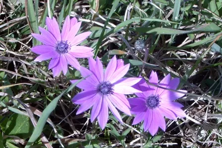
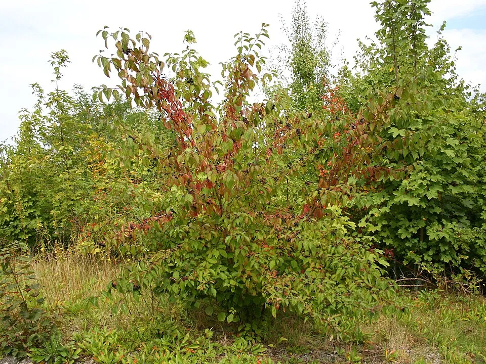
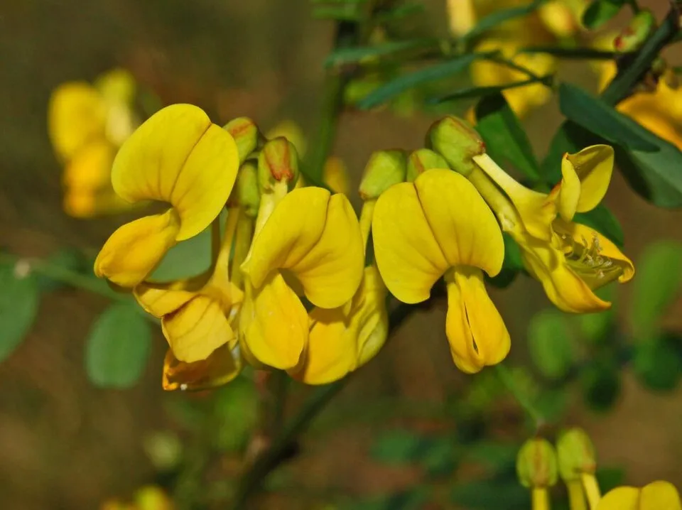
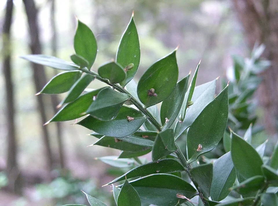
Among the species most often recorded on GBIF are Anemone hortensis (Broad-leaved anemone), Cornus sanguinea (Dogwood), Hippocrepis emerus (Scorpion Senna) and Ruscus aculeatus (Butcher's-broom).
What is the official website of Vena del Gesso Romagnola Regional Park?
© OpenStreetMap
Download the boundary: GeoJSON · GPX Boundary © OpenStreetMap contributors (ODbL).
Geography
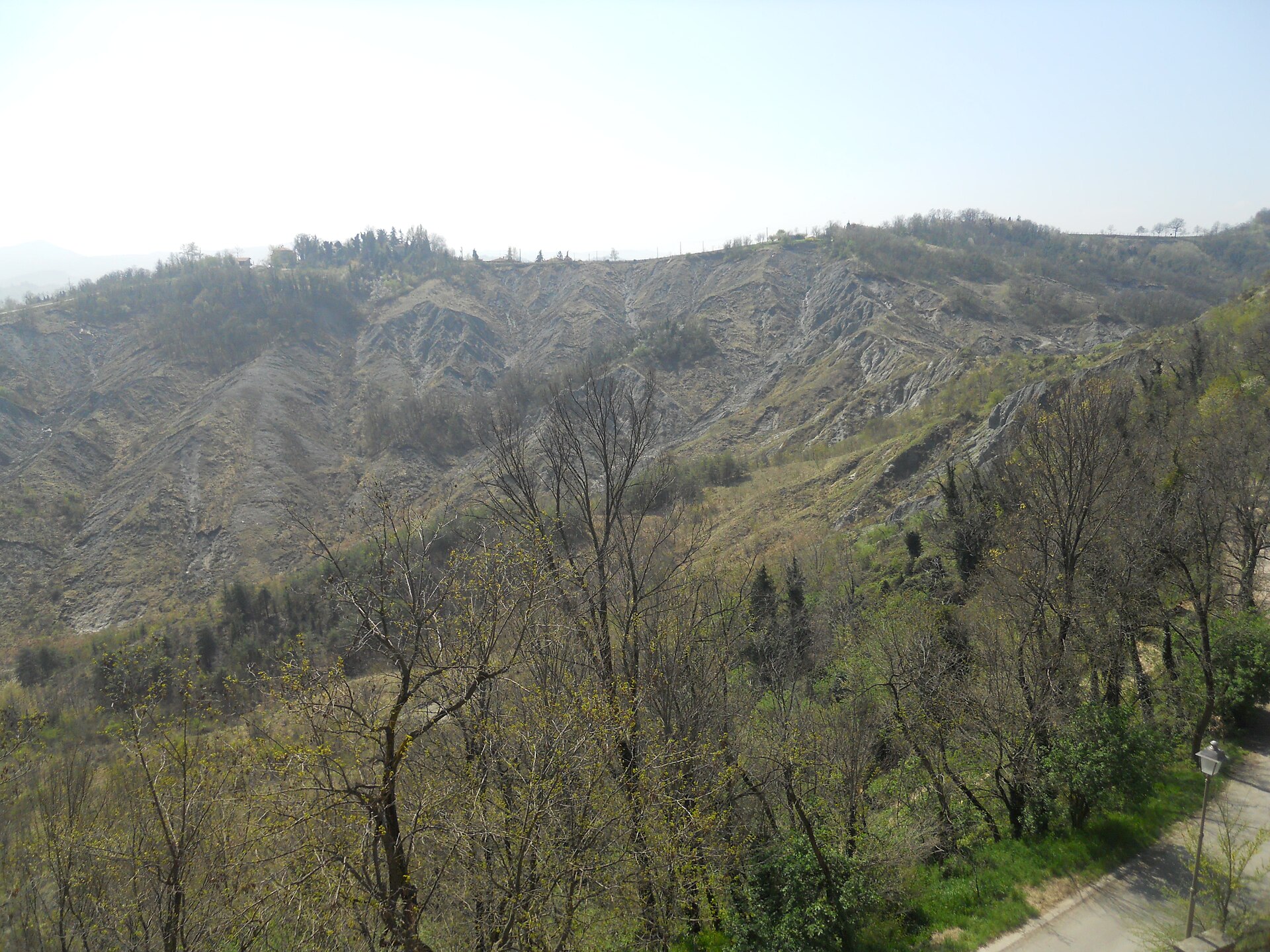
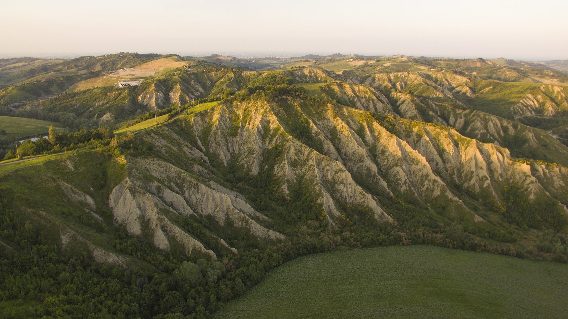
The representative point of the site lies at around 247 m above sea level. Over the 1996–2025 period, the mean annual temperature is about 13.6 °C and total precipitation reaches roughly 925 mm per year. The warmest month is usually July, the coolest January, and the wettest November. According to the European 1:1 million geological map (EGDI), the bedrock consists mainly of marly limestones (50% of sampled points), unconsolidated deposits (25%) and carbonate rocks (17%). These are mostly sedimentary rocks. The geological units date mainly from the Neogene (75% of sampled points).
Area
- Area
- 2,042 ha
- Elevation
- 247 m
- Median elevation
- 228 m
- Mean slope
- 13°
- Coordinates
- 44.256, 11.6546
Terrain: Mapzen Terrain Tiles (SRTM, USGS)
Bedrock
- Marly limestones 50 %
- Unconsolidated deposits 25 %
- Carbonate rocks 17 %
- Sandstones 8 %
Sedimentary rocks 100 % · Main age: Neogene (75%)
Source: EGDI 1:1M geological map (EuroGeoSurveys and national geological surveys), CC BY 4.0 · 12 sampled points within the site.
Main summits
- Roncosole561 m
- Monte Mauro517 m
- Monte la Pieve508 m
- Monte della Volpe490 m
- Monte dell'Acqua Salata487 m
- Monte di Rontana484 m
- Monte Albano475 m
- Monte del Casino474 m
- Monte Tondo436 m
- Monte Spugi425 m
Data © OpenStreetMap contributors (ODbL)
Climate
● Mean temperature (°C) · ▮ Precipitation (mm)
Source: Copernicus ERA5-Land (C3S, doi:10.24381/cds.68d2bb30), monthly averages 1996–2025 interpolated to the representative point, temperatures adjusted for elevation.
Contains modified Copernicus Climate Change Service information 2026. Neither the European Commission nor ECMWF is responsible for any use that may be made of the Copernicus information or data it contains.
Natural habitats
According to CORINE Land Cover (2018), the site is mainly made up of farmland (63%), forests (17%) and heath and scrub (16%). Elevation ranges from about 100 m to 561 m (highest point: Roncosole). The 2 Natura 2000 sites overlapping the area list 21 habitats of European interest (7 priority), the most extensive being semi-natural dry grasslands and scrubland facies on calcareous substrates (Festuco-Brometalia) (* important orchid sites), pseudo-steppe with grasses and annuals of the Thero-Brachypodietea and Juniperus communis formations on heaths or calcareous grasslands.
Biodiversity
Based on occurrences aggregated by GBIF, several species are regularly recorded within the site. Among the most frequent are Anemone hortensis (Broad-leaved anemone), Cornus sanguinea (Dogwood), Hippocrepis emerus (Scorpion Senna) and Ruscus aculeatus (Butcher's-broom). The full list of documented taxa is shown below. The overlapping Natura 2000 sites list 109 species of European interest: 55 birds, 24 mammals, 6 reptiles, 7 amphibians, 5 fish, 9 invertebrates and 3 plants.
Habitats of European interest
From the official forms of the 2 Natura 2000 sites overlapping the area (areas reported for each whole site).
- Semi-natural dry grasslands and scrubland facies on calcareous substrates (Festuco-Brometalia) (* important orchid sites) 663 ha
- Pseudo-steppe with grasses and annuals of the Thero-Brachypodietea priority 401 ha
- Juniperus communis formations on heaths or calcareous grasslands 190 ha
- Eastern white oak woods priority 92 ha
- Rupicolous calcareous or basophilic grasslands of the Alysso-Sedion albi priority 65 ha
- Calcareous rocky slopes with chasmophytic vegetation 55 ha
- Castanea sativa woods 51 ha
- Salix alba and Populus alba galleries 49 ha
and 13 more
Species of European interest
Birds · 55
Common Kingfisher (Alcedo atthis) resident passage wintering breeding, Tawny Pipit (Anthus campestris) passage breeding, Tree Pipit (Anthus trivialis) passage, Common Swift (Apus apus) breeding passage, Eurasian Eagle-owl (Bubo bubo) breeding resident wintering passage, Greater Short-toed Lark (Calandrella brachydactyla) passage, European Nightjar (Caprimulgus europaeus) passage breeding, Short-toed Snake Eagle (Circaetus gallicus) passage, Montagu's Harrier (Circus pygargus) resident passage breeding, Common Quail (Coturnix coturnix) passage breeding, Corn Crake (Crex crex) passage, Common Cuckoo (Cuculus canorus) breeding passage and 43 more
Mammals · 24
Grey wolf (Canis lupus), Serotine bat (Eptesicus serotinus), European wildcat (Felis silvestris), Savi's Pipistrelle (Hypsugo savii), Crested porcupine (Hystrix cristata), Common bent-wing bat (Miniopterus schreibersii), Hazel dormouse (Muscardinus avellanarius), Western Polecat (Mustela putorius), Bechstein's bat (Myotis bechsteinii), Lesser mouse-eared myotis (Myotis blythii), Daubenton's bat (Myotis daubentonii), Geoffroy's bat (Myotis emarginatus) and 12 more
Reptiles · 6
European Pond Turtle (Emys orbicularis), Western Whip Snake (Hierophis viridiflavus), Western green lizard (Lacerta bilineata), Common wall lizard (Podarcis muralis), Italian wall lizard (Podarcis siculus), Aesculapian Snake (Zamenis longissimus)
Amphibians · 7
Apennine Yellow-bellied Toad (Bombina pachypus), Green Toad (Bufotes viridis complex), Italian Tree Frog (Hyla intermedia), Edible frog (Pelophylax esculentus), Agile frog (Rana dalmatina), Italian stream frog (Rana italica), Italian crested newt (Triturus carnifex)
Fish · 5
Brook barbel (Barbus caninus), Italian Barbel (Barbus plebejus), Italian Spined Loach (Cobitis bilineata), South European Nase (Protochondrostoma genei), Italian Riffle Dace (Telestes muticellus)
Invertebrates · 9
White-clawed Crayfish (Austropotamobius pallipes), Greater Capricorn Beetle (Cerambyx cerdo), Southern damselfly (Coenagrion mercuriale), Jersey Tiger (Euplagia quadripunctaria), Stag beetle (Lucanus cervus), Large Blue (Maculinea arion), Hermit beetle (Osmoderma eremita), Orange-spotted Emerald (Oxygastra curtisii), Italian Festoon (Zerynthia cassandra)
Plants · 3
Snowdrop (Galanthus nivalis), Adriatic lizard orchid (Himantoglossum adriaticum), Butcher's-broom (Ruscus aculeatus)
Source: Natura 2000 standard data forms (EEA, CC-BY 4.0). Not exhaustive: sensitive species are not published.
Species to look out for

Observed species
Occurrences documented via GBIF; they are neither an exhaustive inventory nor proof of current presence.
- Broad-leaved anemone · Anemone hortensis · 35
- Dogwood · Cornus sanguinea · 21
- Scorpion Senna · Hippocrepis emerus · 16
- Butcher's-broom · Ruscus aculeatus · 15
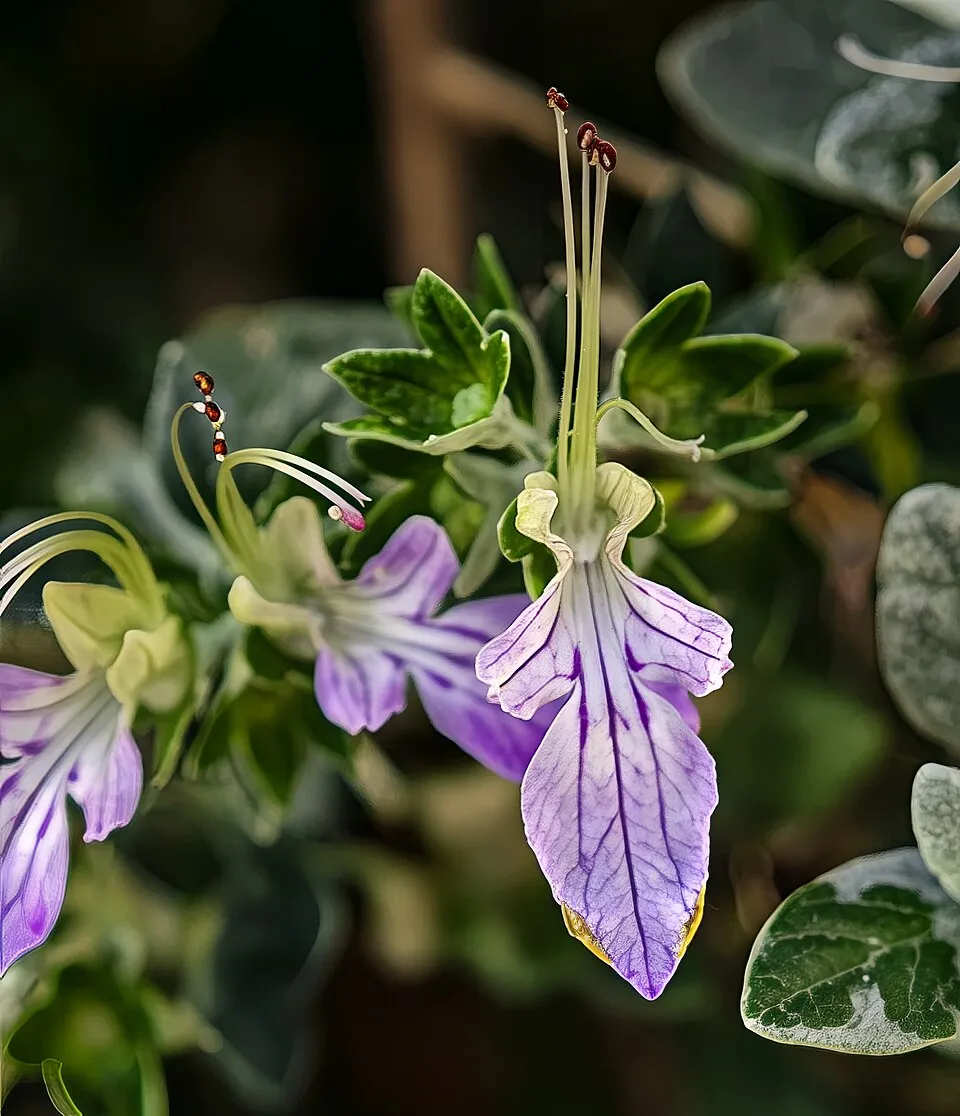
- Shrubby germander · Teucrium fruticans · 14
- Spindle · Euonymus europaeus · 14
- Wayfaring-tree · Viburnum lantana · 13
- Goldilocks aster · Galatella linosyris · 13
- Pyramidal orchid · Anacamptis pyramidalis · 11
- Laurustinus · Viburnum tinus · 11
- Manna Ash · Fraxinus ornus · 11
- Winter daffodil · Sternbergia lutea · 11
+18 more species
- Mediterranean Buckthorn · Rhamnus alaternus · 11
- Kryptonesticus eremita · 11
- Eurasian Blackcap · Sylvia atricapilla · 10
- Salsify · Tragopogon porrifolius · 10
- Half-light Orbweaver · Metellina merianae · 9
- Cladonia foliacea · 9
- Dwarf Elder · Sambucus ebulus · 9
- Cyprus turpentine · Pistacia terebinthus · 9
- Lemon balm · Melissa officinalis · 9
- Paper mulberry · Broussonetia papyrifera · 9
- Common Blackbird · Turdus merula · 8
- European robin · Erithacus rubecula · 8
- Blackthorn · Prunus spinosa · 8
- Mediterranean hartwort · Tordylium apulum · 8
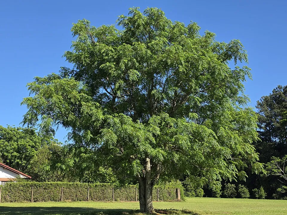
- Tree-of-heaven · Ailanthus altissima · 8
- Honesty · Lunaria annua · 8
- Psora saviczii · 8
- Common Ivy · Hedera helix · 8
Records: GBIF.org (CC-BY). Names: Wikidata (CC0), GBIF. Photos: Wikimedia Commons.
Conservation challenges
The primary purpose of the site is to preserve its natural habitats and the biodiversity they support. The species recorded (Biodiversity tab) reflect its ecological value. The designations it holds frame its management and the control of land use.
According to Global Forest Change data (University of Maryland, Global Forest Watch), about 38 ha of tree cover were lost within the boundary between 2001 and 2023 (2% of its area), peaking in 2018 and 2023. These losses include logging, storms and fires, and do not account for regrowth. According to the European CORINE Land Cover inventory (Copernicus), land cover changed on about 151 ha of the site between 1990 and 2018 (2% of its area): farmland shrank by 151 ha, mostly giving way to forest, while forest grew by 117 ha, mostly at the expense of farmland. At night, 12% of the area gives off artificial light detectable from space (NASA VIIRS Black Marble composite, 2016). Built-up and developed land (buildings, business areas, roads, quarries) covers 2% of the area, and farmland 63% (CORINE Land Cover). According to the Natura 2000 forms, of 20 assessed habitats of European interest, 5 are in excellent condition and 1 in average or reduced condition. According to the Water Framework Directive assessment (2022 river basin management plans, data 2015–2019), only 18% of the 12 km of rivers assessed within the site are in good or high ecological status; the others mostly have moderate ecological status. Invasive alien species have been recorded within the site since 2000 (GBIF observations), several of them listed as of Union concern. Among them: Broussonetia papyrifera (Paper mulberry), Ailanthus altissima (Tree-of-heaven) and Elaeagnus angustifolia (Russian olive).
Pressure indicators
Tree cover lost
38 ha
2001–2023 · 2% of the area
20012023
Fires since 2016
0
No large fire mapped (fires over about 30 ha)
Light at night
12%
of the area gives off artificial light visible from space
DarkLit
Built-up land
2%
buildings, business areas, roads, quarries · farmland 63%
Land cover change
151 ha
changed cover, 1990–2018 · CORINE · 2% of the area
- −151 ha · farmland
- +117 ha · forest
Rivers and lakes
18%
of the 12 km of assessed rivers in good or high ecological status · WFD 2022
assessments 2015–2019
Invasive alien species
4
incl. 2 of EU concern · since 2000
 Paper mulberry
 Tree-of-heaven
 Russian olive
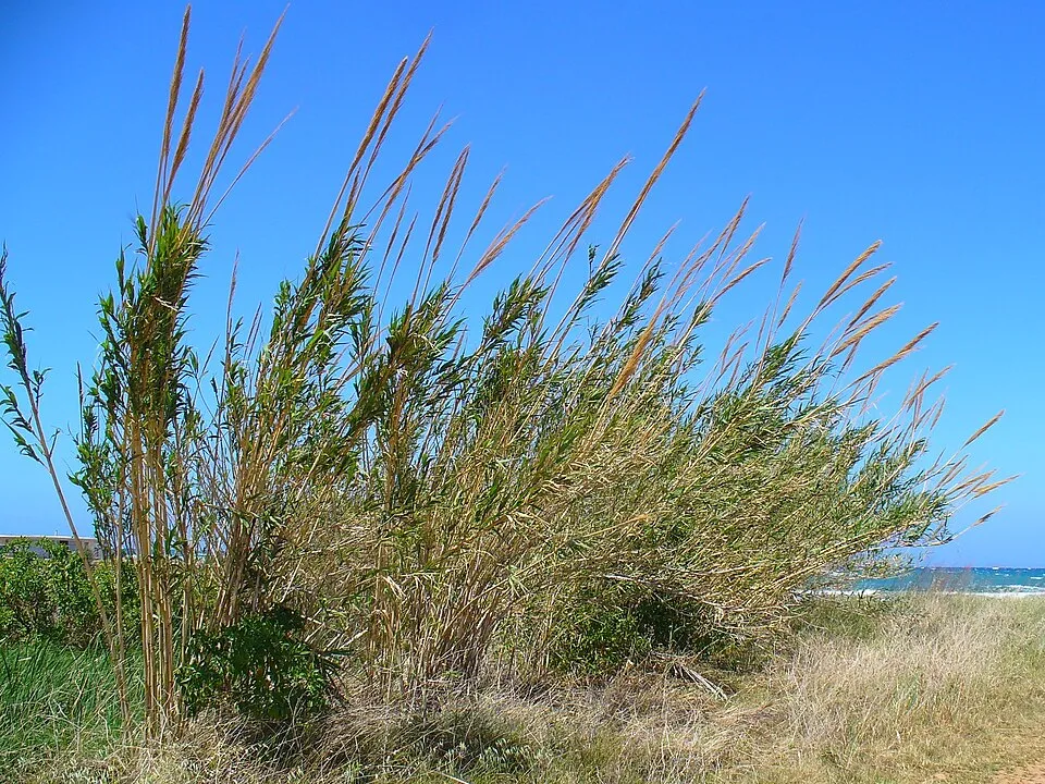 Giant Reed
Photos: Paper mulberry © Didier Descouens · CC BY-SA 4.0; Tree-of-heaven © Darkone · CC BY-SA 2.5; Russian olive © Horacio Cambeiro · CC BY-SA 4.0; Giant Reed © H. Zell · CC BY-SA 3.0
Sources: Global Forest Change (Hansen et al., University of Maryland, via Global Forest Watch, CC-BY 4.0); EFFIS, European Commission / Copernicus; NASA Black Marble 2016 (public domain); CORINE Land Cover 2018 (Copernicus) or MODIS.
CORINE Land Cover Change 1990–2018: generated using European Union's Copernicus Land Monitoring Service information (EEA), aggregated by Parkavela; DOI 10.2909/f30f1000-7cf8-43bb-872c-5eb093911b24.
Ecological status of water bodies: European Environment Agency, WISE – Water Framework Directive, 3rd river basin management plans (2022), CC BY 4.0. Official national classification, not comparable between countries.
Invasive alien species: Global Register of Introduced and Invasive Species (ISSG, CC BY 4.0); Union list, Regulation (EU) 1143/2014 (INBO, CC0); GBIF.org records (CC0 / CC BY 4.0), at least 2 per species.
Practical information
Cities and airport
- Imola
9 km as the crow flies - Faenza
10 km as the crow flies - Airport: Forlì-Ravenna (FRL)
23 km as the crow flies
Visitor information
- Pro loco Tossignano
within the site - Informazione Turistica Brisighella
within the site - Pro-loco Borgo Rivola
< 1 km from the site boundary - Informazioni ed Accoglienza Turistica
1 km from the site boundary
Things to see
21 viewpoints · 1 waterfall · 2 lakes and ponds · 159 caves · 1 bird hide
- Laghetto di Rianeggio
lake or pond - Pozzo a sud di Ca' Siepe
cave · 419 m - Laghi Azzurri
lake or pond - Grotta 1 di Ca' Budrio
cave · 418 m - Grotta 2 di Ca' Budrio
cave · 395 m
Where to stay
3 mountain huts · 1 campsite
- Ca' Budrio Rifugio Speleologico
Staffed hut · 434 m - Rifugio Ca' Carnè
Staffed hut · 377 m - Capanno Lucio Cavara
Unstaffed hut
Hiking
31 waymarked routes listed, including:
Il Cammino di Sant'AntonioGrande Circuito della RomagnaViae MisericordiaeSentiero Ariano BentivoglioCammino di Dante
By bike
Ciclovia dei Gessi · 19 kmBO12 Ciclovia del Santerno · 6 km
Signed cycle routes: this does not mean that cycling is allowed on footpaths.
Data © OpenStreetMap contributors (ODbL) · Wikidata (CC0)
Routes © OpenStreetMap contributors (ODbL), via Waymarked Trails
Waymarked hiking routes
CSA Il Cammino di Sant'Antonio: Tappa 12
20 km within the site ↗ 415 m↘ 340 m 97–461 m
Grande Circuito della Romagna: Tappa 1
8.6 km within the site ↗ 223 m↘ 621 m 130–547 m
Viae Misericordiae: Tappa 6
6.3 km within the site ↗ 201 m↘ 124 m 120–319 m
505 Sentiero Ariano Bentivoglio
5.2 km within the site ↗ 42 m↘ 244 m 196–443 m
CD4 Cammino di Dante - Tappa 4
4.7 km within the site ↗ 304 m↘ 43 m 140–441 m
CG Corolla delle Ginestre
19.9 km within the site ↗ 498 m↘ 122 m 157–547 m
Tracks © OpenStreetMap contributors (ODbL), clipped to the boundary; elevation gain and profiles computed on the longest section from Mapzen Terrain Tiles (≈ 30 m), indicative only.
Access and visiting
The nearest railway station is Brisighella, less than 1 km from the site boundary. Nearest towns of over 50,000 people, as the crow flies: Imola (9 km) and Faenza (10 km). Nearest airport: Forlì-Ravenna (FRL), about 23 km away. About 300,000 people live within 20 km of the site boundary, 110,000 of them within 10 km; some 4,100 people are estimated to live inside (GHSL estimate, 2020). This population has grown by about 8% since 2000. Visitor information on site: Pro loco Tossignano, Informazione Turistica Brisighella and Pro-loco Borgo Rivola. Waymarked hiking routes listed in OpenStreetMap: 31, including Il Cammino di Sant'Antonio, Grande Circuito della Romagna, Viae Misericordiae and Sentiero Ariano Bentivoglio. The site is crossed by 2 signed cycle routes: “Ciclovia dei Gessi” and “BO12 Ciclovia del Santerno” (OpenStreetMap). To see: 21 viewpoints, 1 waterfall, 2 lakes and ponds, 159 caves and 1 bird hide, including Laghetto di Rianeggio, Pozzo a sud di Ca' Siepe (419 m), Laghi Azzurri and Grotta 1 di Ca' Budrio (418 m). Where to stay: 3 mountain huts and 1 campsite, including Ca' Budrio Rifugio Speleologico (434 m), Rifugio Ca' Carnè (377 m) and Capanno Lucio Cavara. To plan a visit (access, opening periods, visitor rules), it is best to consult the official information from the managing body and the official website listed in this page's sources.
Source: OpenStreetMap (ODbL), Wikidata (CC0), October 2026.
Built heritage
According to Wikidata, 24 monuments protected as Italian national cultural heritage stand within the boundary. Among them are 10 religious buildings, 6 castles and fortifications and 4 houses and civic buildings. Examples include “Chiesa della Natività di Maria” in Casola Valsenio, “Castello Monte Mauro” in Brisighella and “Palazzo Baronale” in Borgo Tossignano.
10 religious buildings6 castles and fortifications4 houses and civic buildings2 bridges, lighthouses, mills and working buildings
-
Chiesa della Natività di Maria
Casola Valsenio -
Castello Monte Mauro
Brisighella · 13th c. -
Palazzo Baronale
Borgo Tossignano · 16th c. -
Parco museo geologico di Cava Monticino
Brisighella -
Visitor Centre Casa del Fiume
Borgo Tossignano -
Chiesa di San Bartolomeo
Brisighella -
Castello di Rontana
Brisighella · 13th c. -
Rocca Manfrediana
Brisighella · 16th c.
and 16 more
Source: Wikidata (CC0), monuments in each country’s official heritage protection registers, at national or regional level. Each item links to its Wikidata entry.
When to visit
Best time to visit: from April to October, with average temperatures of 12 to 25 °C and moderate rainfall. Day length ranges from about 8 h 52 min in December to 15 h 30 min in June. Wildlife records published on GBIF peak for birds (January), plants (from April to June) and butterflies and moths (May). These peaks also reflect when observers are most active.
Source: Copernicus ERA5-Land (C3S), monthly averages 1996–2025 at the representative point, temperatures adjusted for elevation.
Contains modified Copernicus Climate Change Service information 2026. Neither the European Commission nor ECMWF is responsible for any use that may be made of the Copernicus information or data it contains.
Wildlife records calendar
JFMAMJJASOND
Birds
Plants
Butterflies & moths
Monthly records published on GBIF (CC-BY), relative to the busiest month; also reflects observer activity.
Gallery
© Giosbriff · CC BY-SA 4.0
© Urban38 · CC BY-SA 4.0
© Sentruper · Public domain
© Dadonene89 · CC BY-SA 4.0
© Coyote III · CC BY-SA 4.0
© Giosbriff · CC BY-SA 4.0
Sources and licences
- Wikidata: Q3895428
- OpenStreetMap: relation 3562535
- Official website: https://www.parchiromagna.it/parco.vena.gesso.romagnola/
- Wikipedia: it.wikipedia.org/wiki/Parco_regionale_della_Vena_del_Gesso_Romagnola
- WDPA: 390481
References
- cds.climate.copernicus.eu: climate · CC-BY-4.0
- registry.opendata.aws: elevation of the reference point, detailed relief · PD
- land.copernicus.eu: land cover, land cover change, sea share · COPERNICUS
- doi.org: population around the site · CC-BY-4.0
- wikidata.org: official area, highest point, establishment date, protected heritage, official name, nearby cities and airport, access and peaks, lake depths, places to see, official website · CC0-1.0
- eea.europa.eu: bathing water quality, ecological status of waters · CC-BY-4.0
- en.eurovelo.com: EuroVelo cycle routes · ODbL-1.0
- cycling.waymarkedtrails.org: cycle routes · ODbL-1.0
- opentopodata.org: elevations · PD
- forest-fire.emergency.copernicus.eu: wildfires · COPERNICUS
- globalforestwatch.org: tree cover loss · CC-BY-4.0
- gbif.org: seasonality of sightings, invasive alien species, observed species · CC-BY-4.0
- europe-geology.eu: geology · CC-BY-4.0
- hydrosheds.org: lakes · CC-BY-4.0
- natura2000.eea.europa.eu: Natura 2000 habitats and species · CC-BY-4.0
- earthobservatory.nasa.gov: night light · PD
- openstreetmap.org: access and peaks, places to see · ODbL-1.0
- hiking.waymarkedtrails.org: route difficulty · ODbL-1.0
- nsidc.org: snow cover · PD
- wikidata.org: Wikipedia article · CC-BY-SA-4.0
Data © OpenStreetMap contributors (ODbL), Wikidata (CC0) and the sources cited.