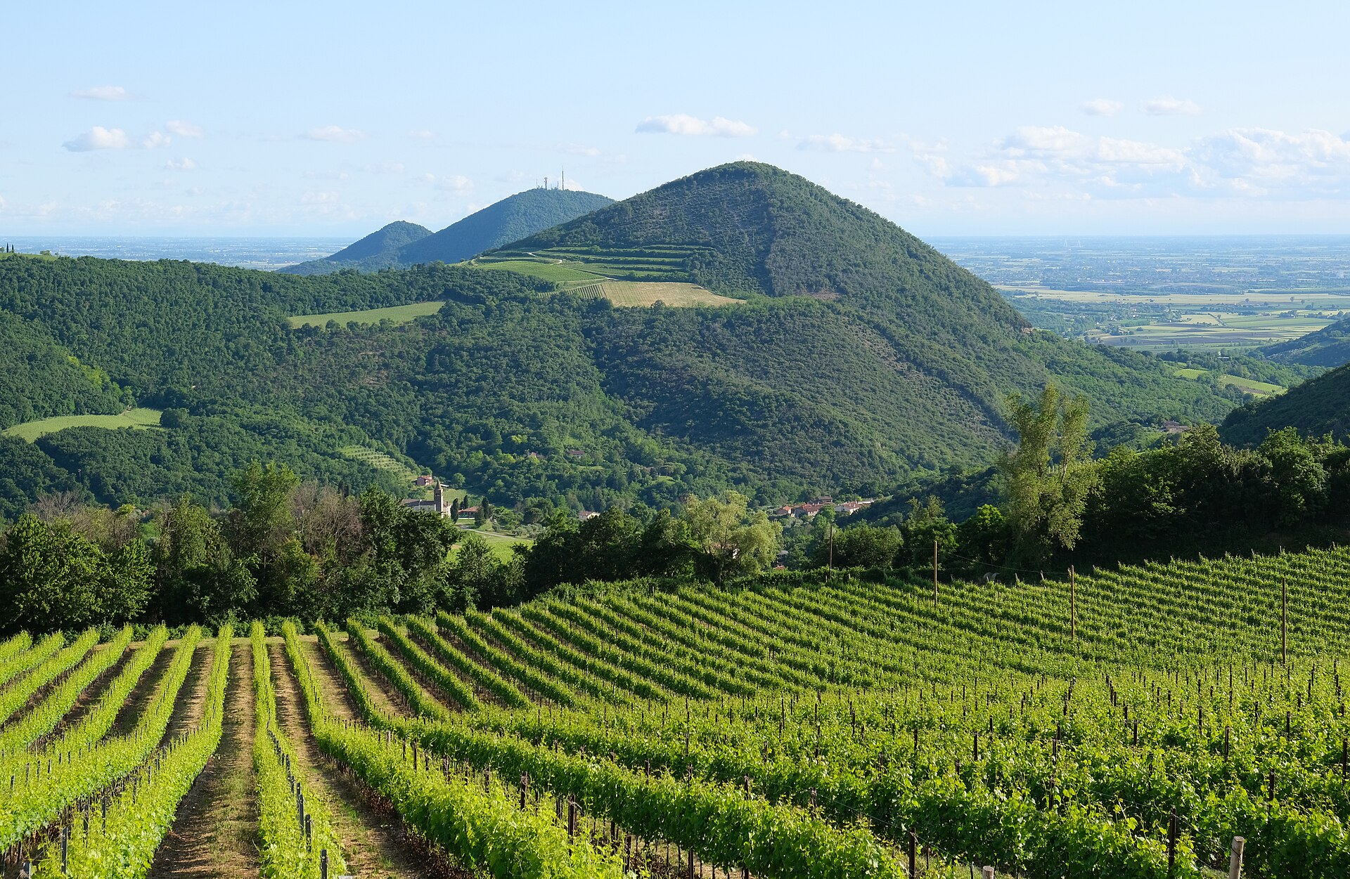
Italy · Mixed
Emilia-Romagna Po Delta Regional Park
Regional nature park of 20,220 hectares in Italy, established in 1988.
Overview
Regional nature park of 20,220 hectares in Italy, established in 1988.
Emilia-Romagna Po Delta Regional Park is a regional nature park in Italy (Europe). It covers both land and sea. Established on 2 July 1988, it covers about 20,220 hectares.
Protections and designations
Ramsar site
Natura 2000 · habitats (SAC) · 18 sites
- Bardello IT4070002
- Bosco della Mesola, Bosco Panfilia, Bosco di Santa Giustina, Valle Falce, La Goara IT4060015
- Bosco di Volano IT4060007
- Dune di San Giuseppe IT4060012
- Ortazzo, Ortazzino, Foce del Torrente Bevano IT4070009
- Pialassa dei Piomboni, Pineta di Punta Marina IT4070006
- and 12 more
Natura 2000 · birds (SPA) · 18 sites
- Bardello IT4070002
- Bosco della Mesola, Bosco Panfilia, Bosco di Santa Giustina, Valle Falce, La Goara IT4060015
- Bosco di Volano IT4060007
- Dune di San Giuseppe IT4060012
- Ortazzo, Ortazzino, Foce del Torrente Bevano IT4070009
- Pialassa dei Piomboni, Pineta di Punta Marina IT4070006
- and 12 more
Protected as a regional nature park. International labels and designations: Ramsar site (“Cervia salt pans”, “Ortazzo e Ortazzino”) and Natura 2000 network (18 sites). Key dates: established in 1988 and first Natura 2000 site under the Birds Directive in 1988.
In our collections
Timeline
-
1988
Established
-
1988
First Natura 2000 site under the Birds Directive 17 such sites designated up to 2009
Sources: Wikidata (CC0) for establishment and international labels; EEA Natura 2000 database (CC-BY 4.0) for site designation dates.
Frequently asked questions
Where is Emilia-Romagna Po Delta Regional Park?
In Italy (Europe). Representative point: 44.5909° N, 11.8093° E.
How large is Emilia-Romagna Po Delta Regional Park?
About 20,220 hectares (202 km²). It is the 24th largest of the 128 regional parks in Italy covered by Parkavela. About 5,900 ha are at sea.
When was Emilia-Romagna Po Delta Regional Park established?
On 2 July 1988.
What habitats and landscapes does Emilia-Romagna Po Delta Regional Park include?
An area spanning land and sea, with coasts.
What rocks lie beneath Emilia-Romagna Po Delta Regional Park?
According to the European 1:1 million geological map (EGDI), the bedrock consists mainly of unconsolidated deposits (100% of sampled points). These are mostly sedimentary rocks. The geological units date mainly from the Quaternary (100% of sampled points).
Which international labels apply to Emilia-Romagna Po Delta Regional Park?
Ramsar site (“Cervia salt pans”, “Ortazzo e Ortazzino”) and Natura 2000 network (18 sites).
When is the best time to visit Emilia-Romagna Po Delta Regional Park?
Best time to visit: May and June, with average temperatures of 18 to 24 °C and moderate rainfall.
What is there to see in Emilia-Romagna Po Delta Regional Park?
15 viewpoints, 41 lakes and ponds and 26 bird hides, including Valli di Comacchio, Chiaro Bassa del Cavallo, Torre di avvistamento and Chiaro Bassa del Prete (OpenStreetMap).
Where can I stay in Emilia-Romagna Po Delta Regional Park?
1 mountain hut and 28 campsites, including Capanna Sociale Casetto Bassarone (8 m), Agriturismo Bio Camping and Ancora Blu (OpenStreetMap).
Are there historic monuments in Emilia-Romagna Po Delta Regional Park?
Yes. According to Wikidata, 93 monuments protected as Italian national cultural heritage stand within the boundary. For example: “Abbazia di Pomposa” in Codigoro, “Casa delle Aie” in Cervia and “Ecomuseo del sale e del mare di Cervia” in Cervia.
Can you swim in Emilia-Romagna Po Delta Regional Park?
46 monitored bathing sites lie in or within 1 km of the site; official 2025 classification: 41 excellent, 3 good and 2 sufficient (European Environment Agency). Swimming is only permitted at the sites and times authorised locally.
What is the nearest large city to Emilia-Romagna Po Delta Regional Park?
Nearest towns of over 50,000 people, as the crow flies: Ravenna (2 km) and Cesena (13 km). Nearest airport: Forlì-Ravenna (FRL), about 16 km away.
How can I reach Emilia-Romagna Po Delta Regional Park by train?
Lido di Classe-Lido di Savio railway station lies within the site.
Where can I get visitor information on site?
Centro Visite Cubo Magico Bevanella, Proloco Marina Romea and Ufficio turistico.
Are there waymarked hiking trails in Emilia-Romagna Po Delta Regional Park?
Yes. Waymarked hiking routes listed in OpenStreetMap: 10, including Via Romea, Viae Sancti Romualdi and Viae Misericordiae. The “VR · Via Romea - Tratto Emilia-Romagna” route runs for about 41 km through the site.
Which species can be seen in Emilia-Romagna Po Delta Regional Park?
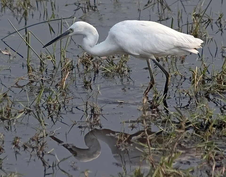
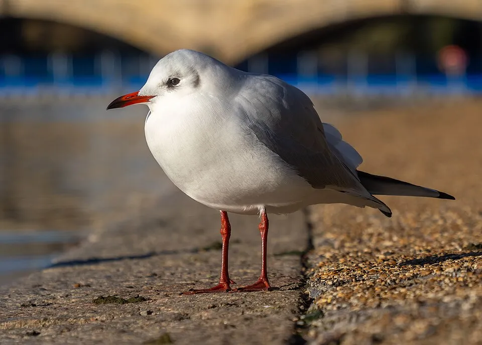
Among the species most often recorded on GBIF are Egretta garzetta (Little Egret), Larus michahellis (Yellow-legged Gull), Chroicocephalus ridibundus (Black-headed Gull) and Anas platyrhynchos (Mallard).
What is the official website of Emilia-Romagna Po Delta Regional Park?
© OpenStreetMap
Download the boundary: GeoJSON · GPX Boundary © OpenStreetMap contributors (ODbL).
Geography
The representative point of the site lies at around 1 m above sea level. Over the 1996–2025 period, the mean annual temperature is about 14.8 °C and total precipitation reaches roughly 748 mm per year. The warmest month is usually July, the coolest January, and the wettest November. According to the European 1:1 million geological map (EGDI), the bedrock consists mainly of unconsolidated deposits (100% of sampled points). These are mostly sedimentary rocks. The geological units date mainly from the Quaternary (100% of sampled points). The site contains 37 lakes larger than 10 ha, totalling 155 km² of water; the largest, Valli di Comacchio, covers 104 km² (HydroLAKES).
Area
- Area
- 20,220 ha
- Elevation
- 1 m
- Lakes over 10 ha
- 37 (155 km²)
- Coordinates
- 44.5909, 11.8093
Lakes: HydroLAKES (Messager et al. 2016, hydrosheds.org, CC BY 4.0) · depths: Wikidata (CC0)
Bedrock
- Unconsolidated deposits 100 %
Sedimentary rocks 100 % · Main age: Quaternary (100%)
Source: EGDI 1:1M geological map (EuroGeoSurveys and national geological surveys), CC BY 4.0 · 9 sampled points within the site.
Climate
● Mean temperature (°C) · ▮ Precipitation (mm)
Source: Copernicus ERA5-Land (C3S, doi:10.24381/cds.68d2bb30), monthly averages 1996–2025 interpolated to the representative point, temperatures adjusted for elevation.
Contains modified Copernicus Climate Change Service information 2026. Neither the European Commission nor ECMWF is responsible for any use that may be made of the Copernicus information or data it contains.
Natural habitats
According to CORINE Land Cover (2018), the land area is mainly made up of farmland (58%), salt marshes and salt pans (15%) and forests (13%). The sea covers about 29% of the site. The 18 Natura 2000 sites overlapping the area list 35 habitats of European interest (8 priority), the most extensive being coastal lagoons, wooded dunes with Pinus pinea and/or Pinus pinaster and riparian mixed forests of Quercus robur, Ulmus laevis and Ulmus minor, Fraxinus excelsior or Fraxinus angustifolia, along the great rivers (Ulmenion minoris).
Biodiversity
Based on occurrences aggregated by GBIF, several species are regularly recorded within the site. Among the most frequent are Egretta garzetta (Little Egret), Larus michahellis (Yellow-legged Gull), Chroicocephalus ridibundus (Black-headed Gull) and Anas platyrhynchos (Mallard). The full list of documented taxa is shown below. The overlapping Natura 2000 sites list 301 species of European interest: 235 birds, 22 mammals, 9 reptiles, 7 amphibians, 11 fish, 12 invertebrates and 5 plants.
Habitats of European interest
From the official forms of the 18 Natura 2000 sites overlapping the area (areas reported for each whole site).
- Coastal lagoons priority 18,357 ha
- Wooded dunes with Pinus pinea and/or Pinus pinaster priority 1,809 ha
- Riparian mixed forests of Quercus robur, Ulmus laevis and Ulmus minor, Fraxinus excelsior or Fraxinus angustifolia, along the great rivers (Ulmenion minoris) 1,159 ha
- Mediterranean salt meadows (Juncetalia maritimi) 1,028 ha
- Natural eutrophic lakes with Magnopotamion or Hydrocharition-type vegetation 847 ha
- Mediterranean and thermo-Atlantic halophilous scrubs (Sarcocornetea fruticosi) 688 ha
- Quercus ilex and Quercus rotundifolia forests 663 ha
- Mudflats and sandflats not covered by seawater at low tide 396 ha
and 27 more
Species of European interest
Birds · 235
Eurasian Sparrowhawk (Accipiter nisus) breeding wintering passage resident, Great Reed Warbler (Acrocephalus arundinaceus) breeding passage, Moustached Warbler (Acrocephalus melanopogon) breeding wintering passage resident, Marsh Warbler (Acrocephalus palustris) breeding passage, Sedge warbler (Acrocephalus schoenobaenus) passage breeding, Eurasian Reed Warbler (Acrocephalus scirpaceus) breeding passage, Common Sandpiper (Actitis hypoleucos) wintering passage resident breeding, Long-tailed Tit (Aegithalos caudatus) wintering breeding passage, Eurasian Skylark (Alauda arvensis) wintering breeding passage resident, Common Kingfisher (Alcedo atthis) passage wintering breeding resident, Northern Pintail (Anas acuta) passage wintering, Eurasian Teal (Anas crecca) passage wintering resident breeding and 223 more
Mammals · 22
Barbastelle (Barbastella barbastellus), Serotine bat (Eptesicus serotinus), Risso's Dolphin (Grampus griseus), Savi's Pipistrelle (Hypsugo savii), Western Polecat (Mustela putorius), Bechstein's bat (Myotis bechsteinii), Lesser mouse-eared myotis (Myotis blythii), Daubenton's bat (Myotis daubentonii), Geoffroy's bat (Myotis emarginatus), Greater mouse-eared bat (Myotis myotis), Whiskered bat (Myotis mystacinus), Natterer's bat (Myotis nattereri) and 10 more
Reptiles · 9
Loggerhead sea turtle (Caretta caretta), European Pond Turtle (Emys orbicularis), Western Whip Snake (Hierophis viridiflavus), Western green lizard (Lacerta bilineata), Dice snake (Natrix tessellata), Common wall lizard (Podarcis muralis), Italian wall lizard (Podarcis siculus), Hermann's tortoise (Testudo hermanni), Aesculapian Snake (Zamenis longissimus)
Amphibians · 7
Green Toad (Bufotes viridis complex), Italian Tree Frog (Hyla intermedia), Italian Spadefoot (Pelobates fuscus insubricus), Edible frog (Pelophylax esculentus), Agile frog (Rana dalmatina), Italian agile frog (Rana latastei), Italian crested newt (Triturus carnifex)
Fish · 11
Adriatic sturgeon (Acipenser naccarii), Twait shad (Alosa fallax), Mediterranean killifish (Aphanius fasciatus), Italian Barbel (Barbus plebejus), Italian nase (Chondrostoma soetta), Italian Spined Loach (Cobitis bilineata), Adriatic dwarf goby (Knipowitschia panizzae), Sea lamprey (Petromyzon marinus), Canestrini's goby (Pomatoschistus canestrinii), South European Nase (Protochondrostoma genei), Danube Roach (Rutilus pigus)
Invertebrates · 12
Greater Capricorn Beetle (Cerambyx cerdo), Eastern Eggar (Eriogaster catax), Jersey Tiger (Euplagia quadripunctaria), Water beetle (Graphoderus bilineatus), Stag beetle (Lucanus cervus), Large copper (Lycaena dispar), Hermit beetle (Osmoderma eremita), Willowherb Hawkmoth (Proserpinus proserpina), Unio elongatulus, Narrow-mouthed whorl snail (Vertigo angustior), Italian Festoon (Zerynthia cassandra), Southern Festoon (Zerynthia polyxena)
Plants · 5
Cladonia convoluta, Adriatic lizard orchid (Himantoglossum adriaticum), Seashore mallow (Kosteletzkya pentacarpos), Butcher's-broom (Ruscus aculeatus), Venice salicorne (Salicornia veneta)
Source: Natura 2000 standard data forms (EEA, CC-BY 4.0). Not exhaustive: sensitive species are not published.
Species to look out for


Bird
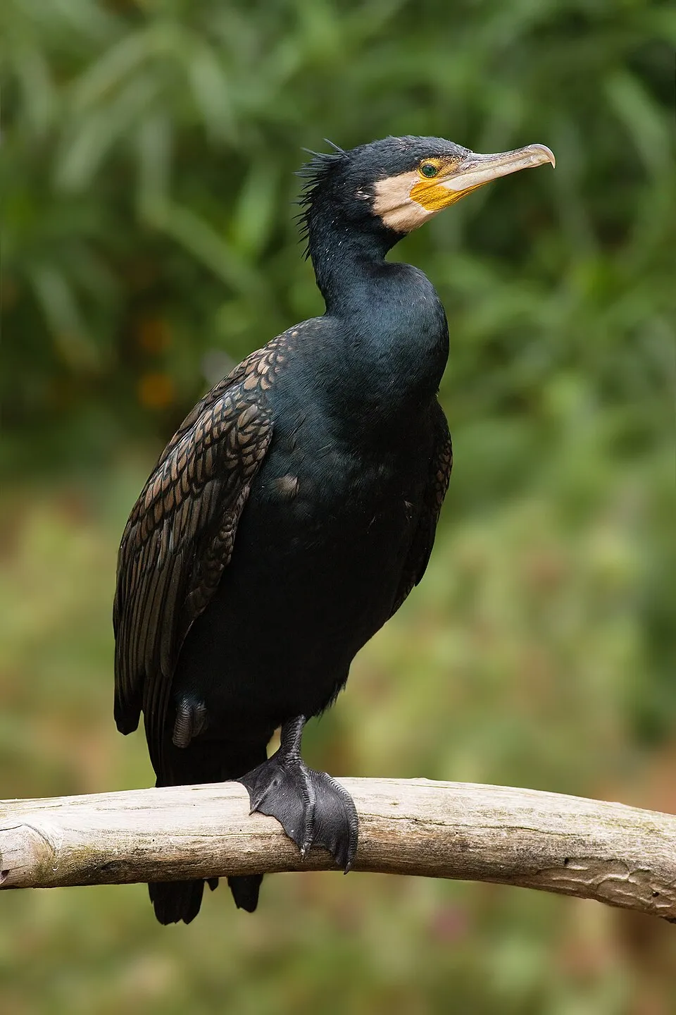
Great Cormorant
Phalacrocorax carbo1,652 records © JJ Harrison (https://www.jjharrison.com.au/) · CC BY-SA 3.0

Observed species
Occurrences documented via GBIF; they are neither an exhaustive inventory nor proof of current presence.
- Little Egret · Egretta garzetta · 1835
- Yellow-legged Gull · Larus michahellis · 1737
- Black-headed Gull · Chroicocephalus ridibundus · 1734
- Mallard · Anas platyrhynchos · 1653
- Great Cormorant · Phalacrocorax carbo · 1652
- Grey Heron · Ardea cinerea · 1561
- Greater Flamingo · Phoenicopterus roseus · 1538
- Pygmy Cormorant · Microcarbo pygmaeus · 1445
- Eurasian Magpie · Pica pica · 1289
- Common Wood Pigeon · Columba palumbus · 1256
- Great Egret · Ardea alba · 1229
- Common Coot · Fulica atra · 1223
+18 more species
- Common Shelduck · Tadorna tadorna · 1154
- Black-winged Stilt · Himantopus himantopus · 1081
- Great Crested Grebe · Podiceps cristatus · 1065
- Common Moorhen · Gallinula chloropus · 1045
- Barn Swallow · Hirundo rustica · 1023
- Pied Avocet · Recurvirostra avosetta · 884
- Common Pheasant · Phasianus colchicus · 869
- Common Starling · Sturnus vulgaris · 847
- Western Marsh Harrier · Circus aeruginosus · 843
- Hooded Crow · Corvus cornix · 811
- Eurasian Collared Dove · Streptopelia decaocto · 808
- Common Tern · Sterna hirundo · 777
- Common Greenshank · Tringa nebularia · 766
- Little Grebe · Tachybaptus ruficollis · 756
- Italian Sparrow · Passer italiae · 754
- Zitting Cisticola · Cisticola juncidis · 747
- Common Blackbird · Turdus merula · 738
- Cetti's Warbler · Cettia cetti · 737
Records: GBIF.org (CC-BY). Names: Wikidata (CC0), GBIF. Photos: Wikimedia Commons.
Conservation challenges
The primary purpose of the site is to preserve its natural habitats and the biodiversity they support. The species recorded (Biodiversity tab) reflect its ecological value. The designations it holds frame its management and the control of land use.
According to Global Forest Change data (University of Maryland, Global Forest Watch), about 174 ha of tree cover were lost within the boundary between 2001 and 2023 (under 1% of its area), peaking in 2012 and 2018. These losses include logging, storms and fires, and do not account for regrowth. According to the European CORINE Land Cover inventory (Copernicus), land cover changed on about 380 ha of the site between 1990 and 2018 (under 1% of its area). At night, 37% of the area gives off artificial light detectable from space (NASA VIIRS Black Marble composite, 2016). Built-up and developed land (buildings, business areas, roads, quarries) covers 4% of the area, and farmland 41% (CORINE Land Cover). According to the Natura 2000 forms, of 34 assessed habitats of European interest, 26 are in excellent condition and 1 in average or reduced condition. According to the Water Framework Directive assessment (2022 river basin management plans, data 2014–2019), none of the 178 km of rivers assessed within the site reaches good ecological potential; they mostly have moderate ecological potential. Other assessed water bodies: lagoons and estuaries, 0 of 7 in good ecological status or better; coastal waters, 1 of 2 in good ecological status or better. Since 2000, 43 invasive alien species have been recorded within the site (GBIF observations), 10 of them listed as of Union concern under EU Regulation 1143/2014. Among them: Threskiornis aethiopicus (African Sacred Ibis), Alopochen aegyptiaca (Egyptian Goose) and Myocastor coypus (Coypu).
Pressure indicators
Tree cover lost
174 ha
2001–2023 · < 1% of the area
20012023
Fires since 2016
0
No large fire mapped (fires over about 30 ha)
Light at night
37%
of the area gives off artificial light visible from space
DarkLit
Built-up land
4%
buildings, business areas, roads, quarries · farmland 41%
Land cover change
380 ha
changed cover, 1990–2018 · CORINE · < 1% of the area
Rivers and lakes
0%
of the 178 km of assessed rivers at good or high ecological potential (mostly heavily modified water bodies) · WFD 2022
Lagoons and estuaries: 0 of 7 good or better
Coastal waters: 1 of 2 good or better
assessments 2014–2019
Invasive alien species
43
incl. 10 of EU concern · since 2000
 African Sacred IbisEU
 Egyptian GooseEU
 CoypuEU
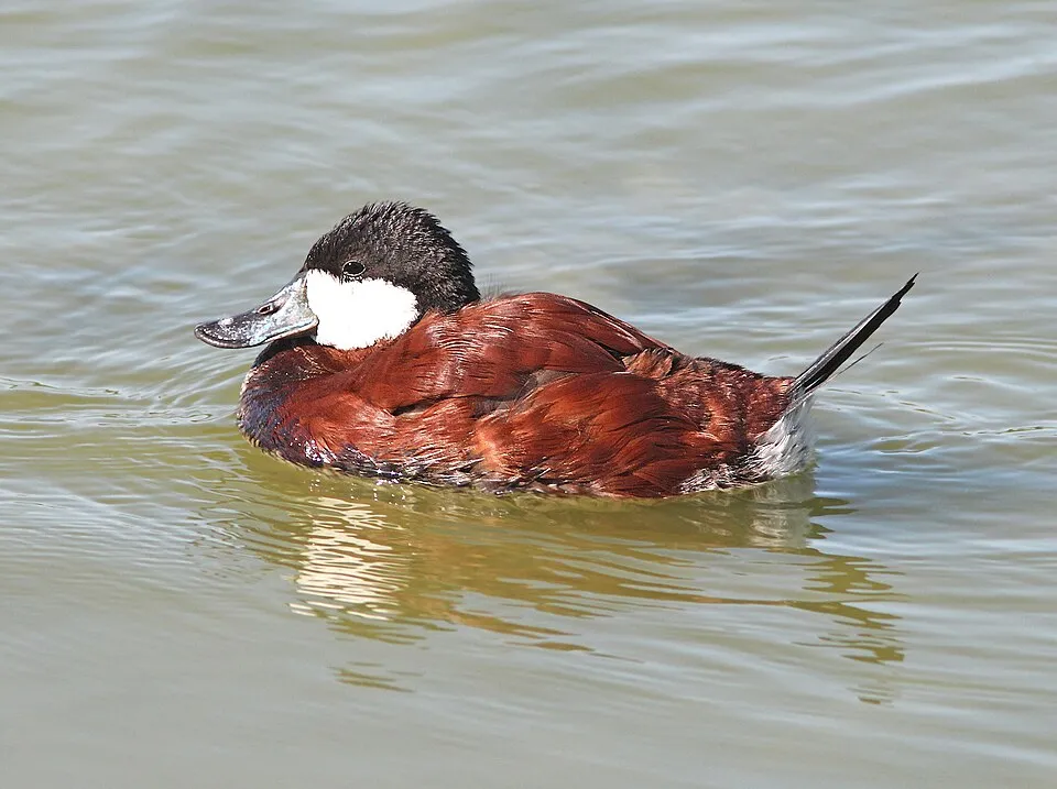 Ruddy DuckEU
 Tree-of-heavenEU
 Paper mulberryEU
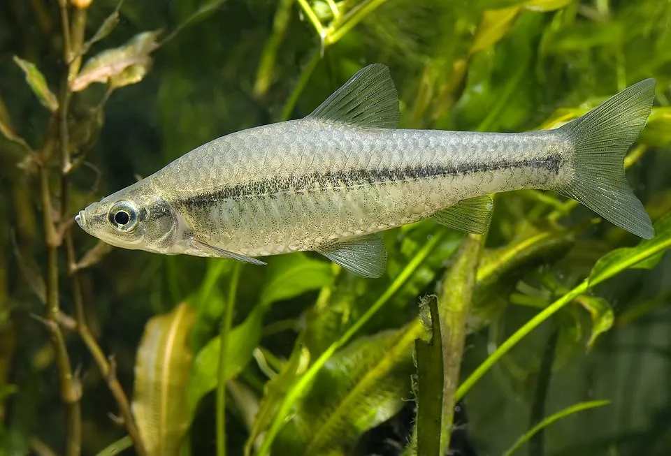 Topmouth gudgeonEU
 PumpkinseedEU
Photos: African Sacred Ibis © Steve Garvie from Dunfermline, Fife, Scotland · CC BY-SA 2.0; Egyptian Goose © Rhododendrites · CC BY-SA 4.0; Coypu © Philippe Amelant · CC BY-SA 3.0; Ruddy Duck © ALAN SCHMIERER · CC0-1.0; Tree-of-heaven © Darkone · CC BY-SA 2.5; Paper mulberry © Didier Descouens · CC BY-SA 4.0; Topmouth gudgeon © Seotaro, edited by Lycaon · CC BY-SA 3.0; Pumpkinseed © Cephas · CC BY-SA 3.0
Sources: Global Forest Change (Hansen et al., University of Maryland, via Global Forest Watch, CC-BY 4.0); EFFIS, European Commission / Copernicus; NASA Black Marble 2016 (public domain); CORINE Land Cover 2018 (Copernicus) or MODIS.
CORINE Land Cover Change 1990–2018: generated using European Union's Copernicus Land Monitoring Service information (EEA), aggregated by Parkavela; DOI 10.2909/f30f1000-7cf8-43bb-872c-5eb093911b24.
Ecological status of water bodies: European Environment Agency, WISE – Water Framework Directive, 3rd river basin management plans (2022), CC BY 4.0. Official national classification, not comparable between countries.
Invasive alien species: Global Register of Introduced and Invasive Species (ISSG, CC BY 4.0); Union list, Regulation (EU) 1143/2014 (INBO, CC0); GBIF.org records (CC0 / CC BY 4.0), at least 2 per species.
Practical information
Cities and airport
- Ravenna
2 km as the crow flies - Cesena
13 km as the crow flies - Airport: Forlì-Ravenna (FRL)
16 km as the crow flies
Visitor information
- Centro Visite Cubo Magico Bevanella
within the site - Proloco Marina Romea
within the site - Ufficio turistico
within the site - Riserva naturale Bosco della Mesola
within the site
Things to see
15 viewpoints · 41 lakes and ponds · 26 bird hides
- Valli di Comacchio
viewpoint - Chiaro Bassa del Cavallo
lake or pond - Torre di avvistamento
bird hide - Chiaro Bassa del Prete
lake or pond - Chiaro Gondolini
lake or pond
Where to stay
1 mountain hut · 28 campsites
- Capanna Sociale Casetto Bassarone
Unstaffed hut · 8 m - Agriturismo Bio Camping
campsite - Ancora Blu
campsite - Area di sosta camper "Mare e Parco"
campsite - Area sosta Bosco della Mesola
campsite
Hiking
10 waymarked routes listed, including:
Via RomeaViae Sancti RomualdiViae Misericordiae
By bike
BI-6 Ciclovia Adriatica · 24 kmBI-2 Ciclovia del Po · 18 kmFE20 Ciclovia Destra Po · 18 kmCanale Destra Reno e Foce Reno · 59 km
+ 10 local loops
Signed cycle routes: this does not mean that cycling is allowed on footpaths.
Data © OpenStreetMap contributors (ODbL) · Wikidata (CC0)
Routes © OpenStreetMap contributors (ODbL), via Waymarked Trails
Waymarked hiking routes
106 Sentiero Primaro "Daniele Zagani"
20.9 km within the site ↗ 0 m↘ 0 m -2–2 m
Tracks © OpenStreetMap contributors (ODbL), clipped to the boundary; elevation gain and profiles computed on the longest section from Mapzen Terrain Tiles (≈ 30 m), indicative only.
Bathing
46 monitored bathing sites in or within 1 km of the site · 2025 classification
Excellent · 41
Good · 3
Sufficient · 2
- 1,4 Km S Foce Fiumi Uniti · sea · Excellent
- 50 M S Porto Marina di Cervia · sea · Excellent
- Bassona - Nord Foce Bevano · sea · Excellent
- Bassona - Sud Foce Bevano · sea · Excellent
- Bellocchio · sea · Excellent
- Canale Tagliata Nord · sea · Excellent
- Canale Tagliata Sud · sea · Excellent
- Casalborsetti - 100 M N Foce Canale Destra Reno · sea · Excellent
- Casalborsetti - 80 M S Foce Canale Destra Reno · sea · Excellent
- Casalborsetti - Camping · sea · Excellent
and 36 more
Source: European Environment Agency, official bathing water classification (Directive 2006/7/EC, CC-BY 4.0). Swimming is only permitted at the sites and times authorised locally.
Access and visiting
Lido di Classe-Lido di Savio railway station lies within the site. Nearest towns of over 50,000 people, as the crow flies: Ravenna (2 km) and Cesena (13 km). Nearest airport: Forlì-Ravenna (FRL), about 16 km away. About 900,000 people live within 20 km of the site boundary, 380,000 of them within 10 km; some 42,000 people are estimated to live inside (GHSL estimate, 2020). This population has grown by about 11% since 2000. Visitor information on site: Centro Visite Cubo Magico Bevanella, Proloco Marina Romea and Ufficio turistico. Waymarked hiking routes listed in OpenStreetMap: 10, including Via Romea, Viae Sancti Romualdi and Viae Misericordiae. The site is crossed by 6 signed cycle routes, including “BI-6 Ciclovia Adriatica” and “BI-2 Ciclovia del Po” (OpenStreetMap). To see: 15 viewpoints, 41 lakes and ponds and 26 bird hides, including Valli di Comacchio, Chiaro Bassa del Cavallo, Torre di avvistamento and Chiaro Bassa del Prete. Where to stay: 1 mountain hut and 28 campsites, including Capanna Sociale Casetto Bassarone (8 m), Agriturismo Bio Camping and Ancora Blu. To plan a visit (access, opening periods, visitor rules), it is best to consult the official information from the managing body and the official website listed in this page's sources.
Source: OpenStreetMap (ODbL), Wikidata (CC0), October 2026.
Built heritage
According to Wikidata, 93 monuments protected as Italian national cultural heritage stand within the boundary. Among them are 18 houses and civic buildings, 17 religious buildings and 17 bridges, lighthouses, mills and working buildings. Examples include “Abbazia di Pomposa” in Codigoro, “Casa delle Aie” in Cervia and “Ecomuseo del sale e del mare di Cervia” in Cervia.
18 houses and civic buildings17 religious buildings17 bridges, lighthouses, mills and working buildings14 castles and fortifications4 prehistoric and archaeological sites
-
Abbazia di Pomposa
Codigoro · 9th c., 11th c. -
Casa delle Aie
Cervia · 18th c. -
Ecomuseo del sale e del mare di Cervia
Cervia -
Capanno Garibaldi
Ravenna · 19th c. -
Antica Pescheria
Comacchio · 19th c. -
Area archeologica di S. Maria in Padovetere
Comacchio -
Basilica of Sant'Apollinare in Classe
Ravenna · 6th c. -
Casone Donnabona
Comacchio
and 85 more
Source: Wikidata (CC0), monuments in each country’s official heritage protection registers, at national or regional level. Each item links to its Wikidata entry.
When to visit
Best time to visit: May and June, with average temperatures of 18 to 24 °C and moderate rainfall. Day length ranges from about 8 h 50 min in December to 15 h 32 min in June. Wildlife records published on GBIF peak for birds (December and January), plants (May and June), butterflies and moths (August and September), dragonflies (from May to July) and mammals (April and May). These peaks also reflect when observers are most active.
Source: Copernicus ERA5-Land (C3S), monthly averages 1996–2025 at the representative point, temperatures adjusted for elevation.
Contains modified Copernicus Climate Change Service information 2026. Neither the European Commission nor ECMWF is responsible for any use that may be made of the Copernicus information or data it contains.
Wildlife records calendar
JFMAMJJASOND
Birds
Plants
Butterflies & moths
Dragonflies
Mammals
Monthly records published on GBIF (CC-BY), relative to the busiest month; also reflects observer activity.
Gallery
© Mychela · CC BY-SA 4.0
© Luukas · Public domain
© Paolo Monti · CC BY-SA 4.0
© Fantasma88 · Public domain
© JESSYJEY88 · CC BY-SA 4.0
© Vanni Lazzari · CC BY-SA 4.0
Sources and licences
- Wikidata: Q3364763
- OpenStreetMap: relation 3565893
- Official website: http://www.parcodeltapo.it/
- Wikipedia: fr.wikipedia.org/wiki/Parc_régional_du_delta_du_Pô_d'Émilie-Romagne
- WDPA: 6004
References
- cds.climate.copernicus.eu: climate · CC-BY-4.0
- registry.opendata.aws: elevation of the reference point, detailed relief · PD
- land.copernicus.eu: land cover, land cover change, sea share · COPERNICUS
- doi.org: population around the site · CC-BY-4.0
- wikidata.org: official area, establishment date, protected heritage, official name, nearby cities and airport, access and peaks, lake depths, places to see, official website · CC0-1.0
- eea.europa.eu: bathing water quality, ecological status of waters · CC-BY-4.0
- en.eurovelo.com: EuroVelo cycle routes · ODbL-1.0
- cycling.waymarkedtrails.org: cycle routes · ODbL-1.0
- gebco.net: depths · PD
- opentopodata.org: elevations · PD
- forest-fire.emergency.copernicus.eu: wildfires · COPERNICUS
- globalforestwatch.org: tree cover loss · CC-BY-4.0
- gbif.org: seasonality of sightings, invasive alien species, observed species · CC-BY-4.0
- europe-geology.eu: geology · CC-BY-4.0
- hydrosheds.org: lakes · CC-BY-4.0
- natura2000.eea.europa.eu: Natura 2000 habitats and species · CC-BY-4.0
- earthobservatory.nasa.gov: night light · PD
- openstreetmap.org: access and peaks, places to see · ODbL-1.0
- hiking.waymarkedtrails.org: route difficulty · ODbL-1.0
- nsidc.org: snow cover · PD
- wikidata.org: Wikipedia article · CC-BY-SA-4.0
Data © OpenStreetMap contributors (ODbL), Wikidata (CC0) and the sources cited.