Czechia · Terrestrial
České středohoří Protected Landscape Area
Protected landscape area of 106,892 hectares in Czechia, established in 1976.
Overview
Protected landscape area of 106,892 hectares in Czechia, established in 1976.
České středohoří Protected Landscape Area is located in Czechia (Europe). It is a predominantly terrestrial area. Established on 12 April 1976, it covers about 106,892 hectares.
Protections and designations
Natura 2000 · habitats (SAC) · 36 sites
- Babinské louky CZ0424034
- Bezejmenný přítok Trojhorského potoka CZ0423198
- Bílé stráně u Litoměřic CZ0424129
- Binov - Bobří soutěska CZ0510441
- Bohyňská lada, Chmelník, Lotarův vrch CZ0420451
- Borečský vrch CZ0422075
- and 30 more
Designated as a protected landscape area. International labels and designations: Natura 2000 network (36 sites). Key dates: established in 1976 and first Natura 2000 site under the Habitats Directive in 2008.
In our collections
Timeline
-
1976
Established
-
2008
First Natura 2000 site under the Habitats Directive 34 such sites designated up to 2012
Sources: Wikidata (CC0) for establishment and international labels; EEA Natura 2000 database (CC-BY 4.0) for site designation dates.
Frequently asked questions
Where is České středohoří Protected Landscape Area?
In Czechia (Europe). Representative point: 50.6514° N, 14.2258° E.
How large is České středohoří Protected Landscape Area?
About 106,892 hectares (1,069 km²). It is the 2nd largest of the 27 protected landscape areas in Czechia covered by Parkavela.
When was České středohoří Protected Landscape Area established?
On 12 April 1976.
What habitats and landscapes does České středohoří Protected Landscape Area include?
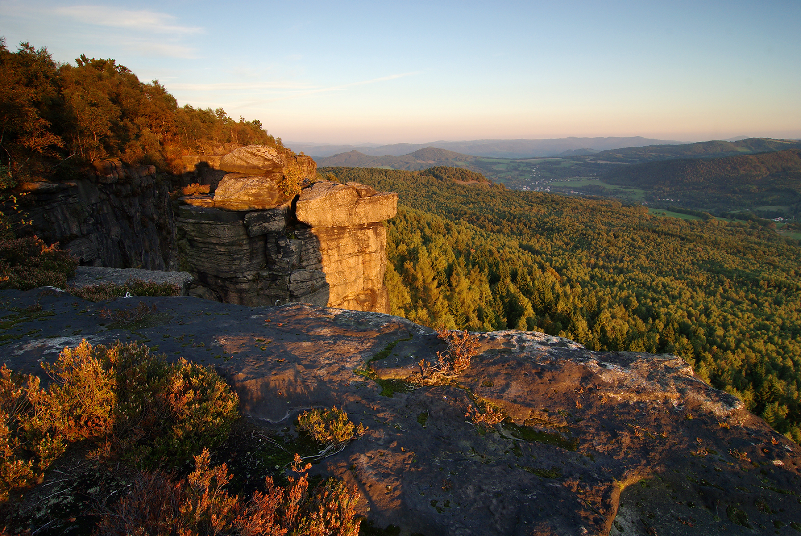
A terrestrial area, with forests.
What rocks lie beneath České středohoří Protected Landscape Area?
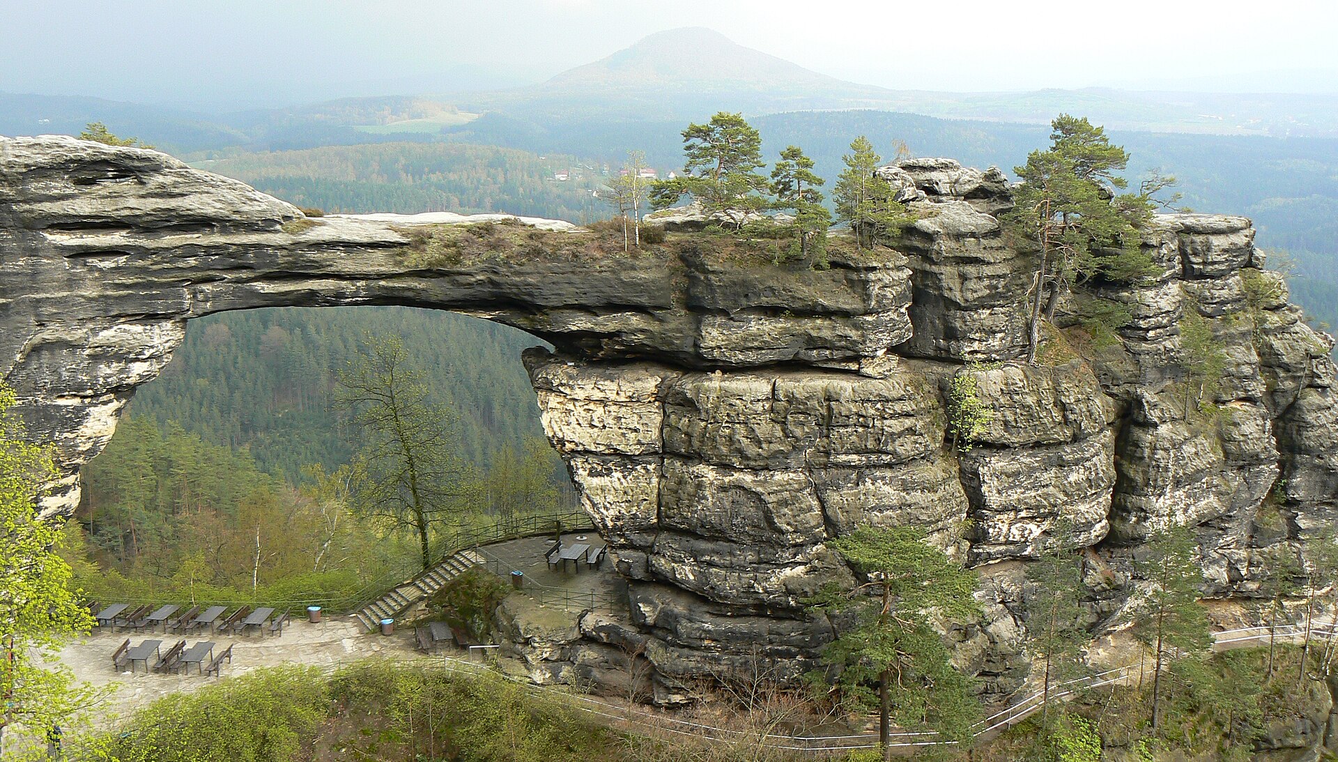
According to the European 1:1 million geological map (EGDI), the bedrock consists mainly of marly limestones (40% of sampled points), sandstones (20%) and basalts (13%). These are mostly sedimentary rocks. The geological units date mainly from the Cretaceous (60% of sampled points).
What is the highest point of České středohoří Protected Landscape Area?
Milešovka, at 837 m (OpenStreetMap).
What are the main summits of České středohoří Protected Landscape Area?
Milešovka (837 m), Hradišťany (753 m), Kloč (737 m), Sedlo (727 m) and Kleč (721 m) (OpenStreetMap).
Which international labels apply to České středohoří Protected Landscape Area?
Natura 2000 network (36 sites).
When is the best time to visit České středohoří Protected Landscape Area?
Mildest period: from June to August, with average temperatures of 17 to 19 °C.
Is there snow in České středohoří Protected Landscape Area?
Yes. According to NASA's MODIS satellites (2015–2025 average), snow covers most of the site in January, with about 35 snow-covered days a year on average.
What is there to see in České středohoří Protected Landscape Area?
23 waterfalls and 1 lake or pond, including Bobří vodopád, Žernosecké jezero, Vaňovský vodopád and Budovský vodopád (Wikidata).
Where can I stay in České středohoří Protected Landscape Area?
Mountain hut Horská chata Milešovka (Wikidata).
Are there historic monuments in České středohoří Protected Landscape Area?
Yes. According to Wikidata, 832 monuments listed in the Czech central register of cultural monuments stand within the boundary, 4 of them national cultural monuments. For example: “Benešov nad Ploučnicí Castle” in Benešov nad Ploučnicí, “Poutní areál Horní Police” in Horní Police and “Ploskovice Castle” in Ploskovice.
Can you swim in České středohoří Protected Landscape Area?
One monitored bathing site lies in or within 1 km of the site; official 2025 classification: 1 excellent (European Environment Agency). Swimming is only permitted at the sites and times authorised locally.
What is the nearest large city to České středohoří Protected Landscape Area?
Nearest towns of over 50,000 people, as the crow flies: Ústí nad Labem (0.2 km) and Most (6 km). Nearest airport: Václav Havel Airport Prague (PRG), about 44 km away.
How can I reach České středohoří Protected Landscape Area by train?
Lovosice zastávka railway station lies within the site.
Where can I get visitor information on site?
Informační centrum, Městské informační centrum hlavní nádraží and Railway Information.
Are there waymarked hiking trails in České středohoří Protected Landscape Area?
Yes. Waymarked hiking routes listed in OpenStreetMap: 133, including [Č] Ústí n. Labem, Větruše, [Č] Úštěk (žst.), [Č] Holany and Via Czechia. The “0309 · [Č] Úštěk (žst.) - Ploskovice (žst.)” route runs for about 22 km through the site, with some 430 m of ascent on its longest section.
Which species can be seen in České středohoří Protected Landscape Area?
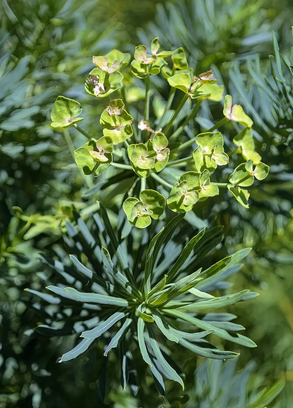
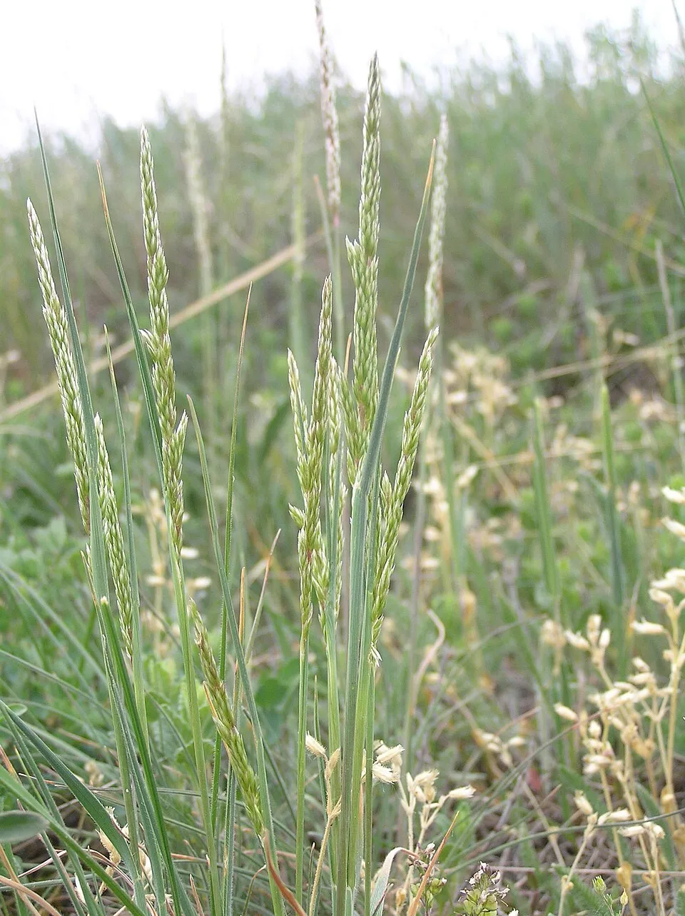
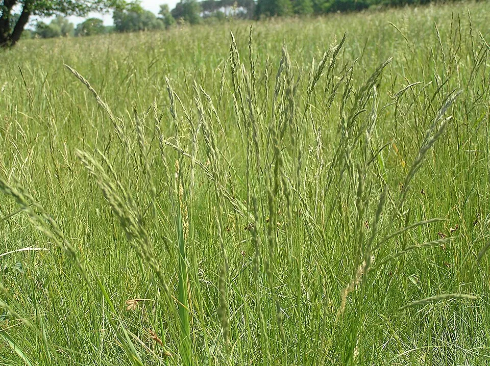
Among the species most often recorded on GBIF are Euphorbia cyparissias (Cypress Spurge), Koeleria macrantha (Crested hair-grass), Festuca rupicola (Furrowed fescue) and Festuca valesiaca (Volga fescue).
What is the official website of České středohoří Protected Landscape Area?
© OpenStreetMap
Download the boundary: GeoJSON · GPX Boundary © OpenStreetMap contributors (ODbL).
Geography
The representative point of the site lies at around 352 m above sea level. Over the 1996–2025 period, the mean annual temperature is about 8.7 °C and total precipitation reaches roughly 710 mm per year. The warmest month is usually July, the coolest January, and the wettest July. According to the European 1:1 million geological map (EGDI), the bedrock consists mainly of marly limestones (40% of sampled points), sandstones (20%) and basalts (13%). These are mostly sedimentary rocks. The geological units date mainly from the Cretaceous (60% of sampled points). The site contains 2 lakes larger than 10 ha, totalling 1.5 km² of water; the largest, Žernosecké jezero, covers 1.0 km² (HydroLAKES).
Area
- Area
- 106,892 ha
- Elevation
- 352 m
- Median elevation
- 364 m
- Mean slope
- 7°
- Snow cover
- ≈ 35 days a year
- Lakes over 10 ha
- 2 (1.5 km²)
- Coordinates
- 50.6514, 14.2258
Terrain: Mapzen Terrain Tiles (SRTM, USGS) · Lakes: HydroLAKES (Messager et al. 2016, hydrosheds.org, CC BY 4.0) · depths: Wikidata (CC0)
Bedrock
- Marly limestones 40 %
- Sandstones 20 %
- Basalts 13 %
- Volcanic tuffs 13 %
- Amphibolites 7 %
- Clays and silts 7 %
Sedimentary rocks 67 % · Igneous rocks 27 % · Metamorphic rocks 7 % · Main age: Cretaceous (60%)
Source: EGDI 1:1M geological map (EuroGeoSurveys and national geological surveys), CC BY 4.0 · 15 sampled points within the site.
Main summits
- Milešovka837 m
- Hradišťany753 m
- Kloč737 m
- Sedlo727 m
- Kleč721 m
- Kletečná706 m
- Lipská hora688 m
- Buková hora686 m
- Kočičí vrch681 m
- Bukový vrch680 m
Data © OpenStreetMap contributors (ODbL)
Climate
● Mean temperature (°C) · ▮ Precipitation (mm)
Source: Copernicus ERA5-Land (C3S, doi:10.24381/cds.68d2bb30), monthly averages 1996–2025 interpolated to the representative point, temperatures adjusted for elevation.
Contains modified Copernicus Climate Change Service information 2026. Neither the European Commission nor ECMWF is responsible for any use that may be made of the Copernicus information or data it contains.
Snow cover measured by satellite
J
F
M
A
M
J
J
A
S
O
N
D
average share of the site under snow · snowiest parts · ≈ 35 days a year
Snow cover: MODIS/Terra MOD10CM v61 (Hall & Riggs, 2021, NASA NSIDC DAAC, doi:10.5067/MODIS/MOD10CM.061), imagery from NASA GIBS (ESDIS); 2015–2025 average, grid of about 5 km.
Natural habitats
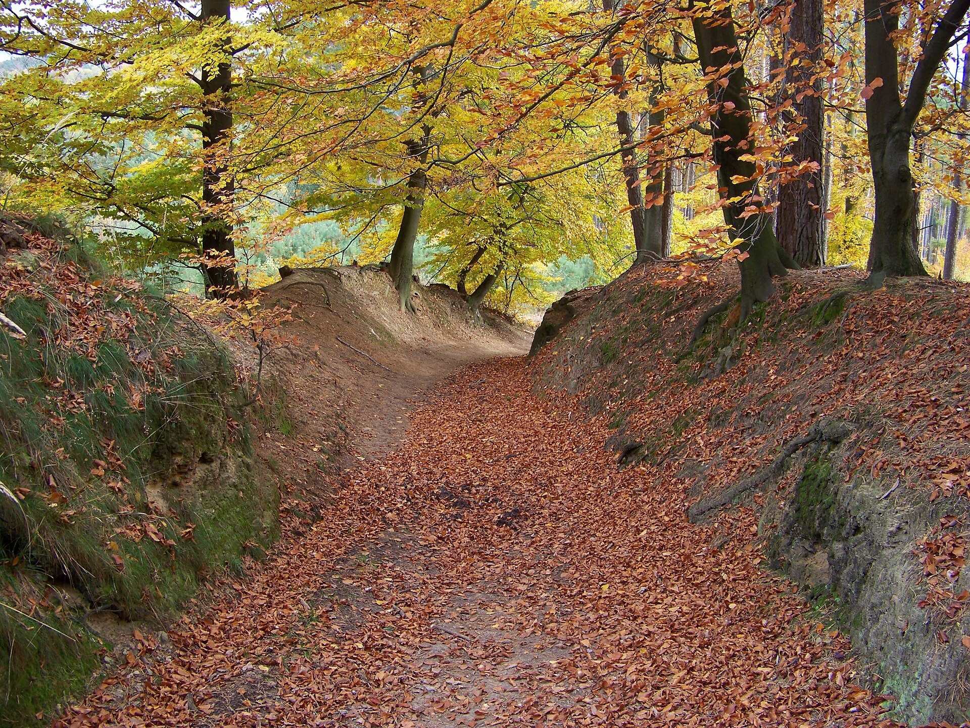
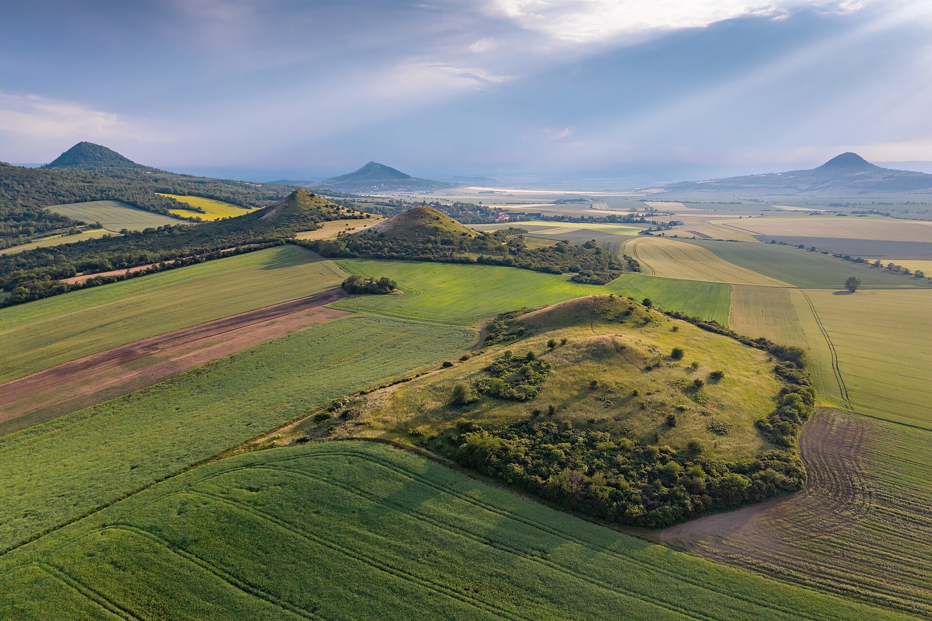
According to CORINE Land Cover (2018), the site is mainly made up of farmland (39%), forests (32%) and grassland and meadows (22%). Woodland mixes broadleaved and coniferous trees. Elevation ranges from about 140 m to 837 m (highest point: Milešovka). The 36 Natura 2000 sites overlapping the area list 21 habitats of European interest (7 priority), the most extensive being Tilio-Acerion forests of slopes, screes and ravines, Galio-Carpinetum oak-hornbeam forests and semi-natural dry grasslands and scrubland facies on calcareous substrates (Festuco-Brometalia) (* important orchid sites).
Biodiversity
Based on occurrences aggregated by GBIF, several species are regularly recorded within the site. Among the most frequent are Euphorbia cyparissias (Cypress Spurge), Koeleria macrantha (Crested hair-grass), Festuca rupicola (Furrowed fescue) and Festuca valesiaca (Volga fescue). The full list of documented taxa is shown below. The overlapping Natura 2000 sites list 16 species of European interest: 4 mammals, 2 amphibians, 1 fish, 5 invertebrates and 4 plants.
Habitats of European interest
From the official forms of the 36 Natura 2000 sites overlapping the area (areas reported for each whole site).
- Tilio-Acerion forests of slopes, screes and ravines priority 1,247 ha
- Galio-Carpinetum oak-hornbeam forests 720 ha
- Semi-natural dry grasslands and scrubland facies on calcareous substrates (Festuco-Brometalia) (* important orchid sites) 262 ha
- Lowland hay meadows (Alopecurus pratensis, Sanguisorba officinalis) 160 ha
- Alluvial forests with Alnus glutinosa and Fraxinus excelsior (Alno-Padion, Alnion incanae, Salicion albae) priority 149 ha
- Euro-Siberian steppic woods with Quercus spp. priority 64 ha
- Water courses of plain to montane levels with the Ranunculion fluitantis and Callitricho-Batrachion vegetation 60 ha
- Luzulo-Fagetum beech forests 28 ha
and 13 more
Species of European interest
Mammals · 4
Eurasian Beaver (Castor fiber), Eurasian otter (Lutra lutra), Greater mouse-eared bat (Myotis myotis), European ground squirrel (Spermophilus citellus)
Amphibians · 2
European fire-bellied toad (Bombina bombina), Great crested newt (Triturus cristatus)
Fish · 1
Invertebrates · 5
Stone crayfish (Austropotamobius torrentium), Jersey Tiger (Euplagia quadripunctaria), Yellow-spotted Whiteface (Leucorrhinia pectoralis), Eastern Hermit Beetle (Osmoderma barnabita), Eurasian Toothed Grasshopper (Stenobothrus eurasius)
Plants · 4
Adenophora lilifolia, Lady's-slipper orchid (Cypripedium calceolus), Eastern pasqueflower (Pulsatilla patens), Stipa zalesskii
Source: Natura 2000 standard data forms (EEA, CC-BY 4.0). Not exhaustive: sensitive species are not published.
Species to look out for


Observed species
Occurrences documented via GBIF; they are neither an exhaustive inventory nor proof of current presence.
- Cypress Spurge · Euphorbia cyparissias · 1329
- Crested hair-grass · Koeleria macrantha · 731
- Furrowed fescue · Festuca rupicola · 717
- Volga fescue · Festuca valesiaca · 710
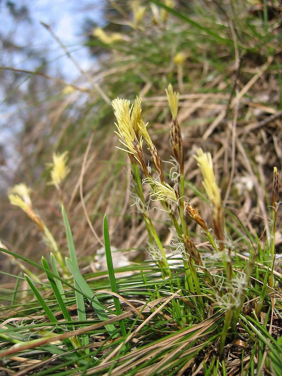
- Dwarf Sedge · Carex humilis · 658
- Wall germander · Teucrium chamaedrys · 634
- Carthusian Pink · Dianthus carthusianorum · 626
- Heath false brome · Brachypodium pinnatum · 575
- Wood bluegrass · Poa nemoralis · 555
- Lady's Bedstraw · Galium verum · 536
- Meadow clary · Salvia pratensis · 528
- Field eryngo · Eryngium campestre · 519
+18 more species
- Green Strawberry · Fragaria viridis · 516
- Erysimum crepidifolium · 515
- Corymbflower tansy · Tanacetum corymbosum · 510
- Spotted knapweed · Centaurea stoebe · 509
- European ash · Fraxinus excelsior · 502
- Sessile Oak · Quercus petraea · 482
- Great tit · Parus major · 479
- Common Blackbird · Turdus merula · 464
- Abbotswood potentilla · Potentilla cinerea · 463
- Field sagewort · Artemisia campestris · 460
- Cream pincushions · Scabiosa ochroleuca · 457
- Cowslip · Primula veris · 455
- White mullein · Verbascum lychnitis · 451
- Field Bindweed · Convolvulus arvensis · 450
- Perforate St John's-wort · Hypericum perforatum · 450
- Spring vetch · Lathyrus vernus · 450
- Narrow-leaved meadow-grass · Poa angustifolia · 445
- Viper's Bugloss · Echium vulgare · 444
Records: GBIF.org (CC-BY). Names: Wikidata (CC0), GBIF. Photos: Wikimedia Commons.
Conservation challenges
The primary purpose of the site is to preserve its natural habitats and the biodiversity they support. The species recorded (Biodiversity tab) reflect its ecological value. The designations it holds frame its management and the control of land use.
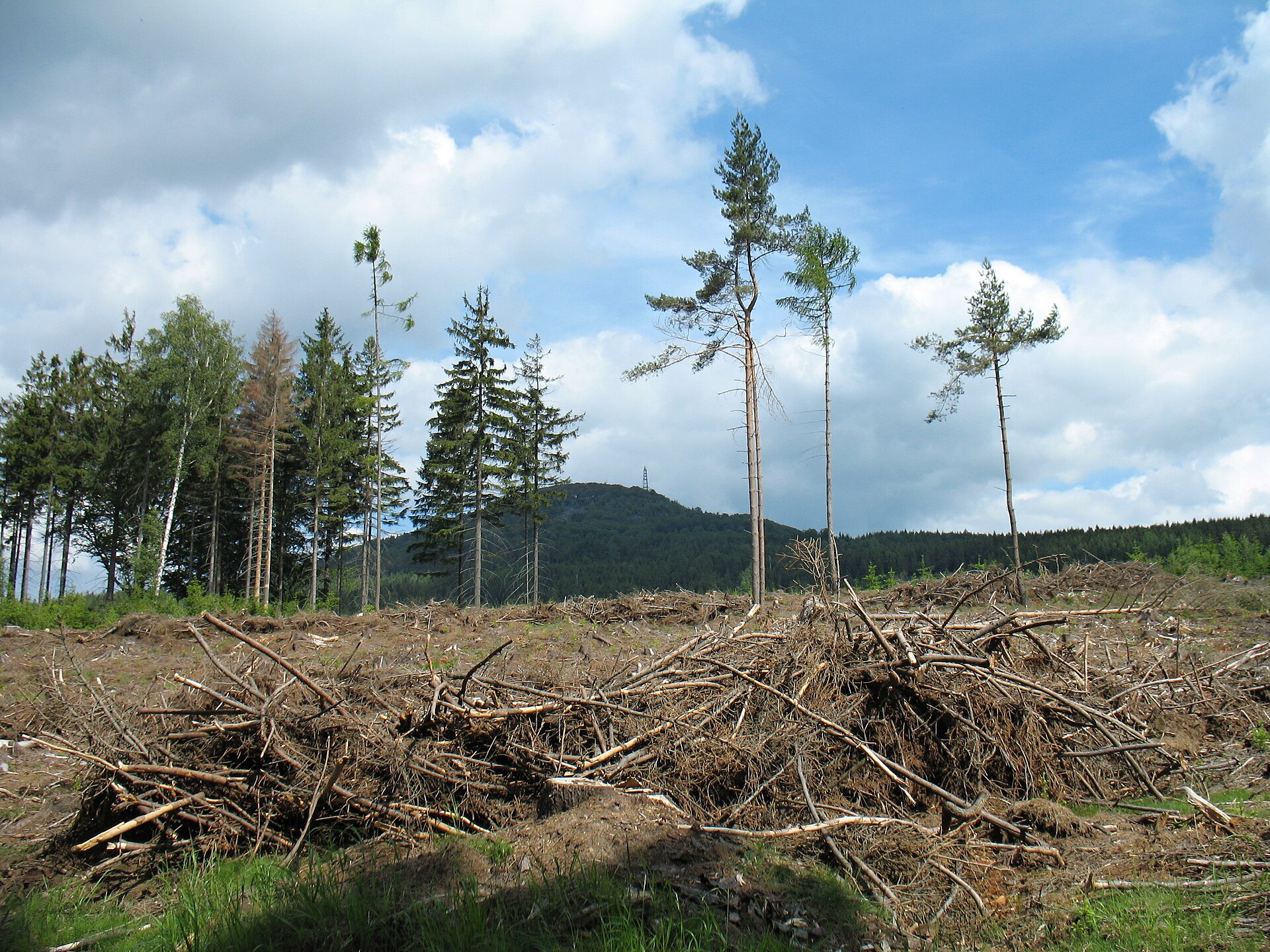
According to Global Forest Change data (University of Maryland, Global Forest Watch), about 4,530 ha of tree cover were lost within the boundary between 2001 and 2023 (4% of its area), peaking in 2020 and 2021. These losses include logging, storms and fires, and do not account for regrowth. According to the European CORINE Land Cover inventory (Copernicus), land cover changed on about 557 ha of the site between 1990 and 2018 (under 1% of its area). At night, 11% of the area gives off artificial light detectable from space (NASA VIIRS Black Marble composite, 2016). Built-up and developed land (buildings, business areas, roads, quarries) covers 5% of the area, and farmland 39% (CORINE Land Cover). According to the Natura 2000 forms, of 21 assessed habitats of European interest, 14 are in excellent condition and the rest in good condition. According to the Water Framework Directive assessment (2022 river basin management plans, data 2015–2018), none of the 163 km of rivers assessed within the site reaches good ecological status; they mostly have poor ecological status. Since 2000, 64 invasive alien species have been recorded within the site (GBIF observations), 8 of them listed as of Union concern under EU Regulation 1143/2014. Among them: Alopochen aegyptiaca (Egyptian Goose), Impatiens glandulifera (Himalayan Balsam) and Reynoutria japonica (Japanese Knotweed).
Pressure indicators
Tree cover lost
4,532 ha
2001–2023 · 4% of the area
20012023
Fires since 2016
0
No large fire mapped (fires over about 30 ha)
Light at night
11%
of the area gives off artificial light visible from space
DarkLit
Built-up land
5%
buildings, business areas, roads, quarries · farmland 39%
Land cover change
557 ha
changed cover, 1990–2018 · CORINE · < 1% of the area
Rivers and lakes
0%
of the 163 km of assessed rivers in good or high ecological status · WFD 2022
assessments 2015–2018
Invasive alien species
64
incl. 8 of EU concern · since 2000
 Egyptian GooseEU
 Himalayan BalsamEU
 Japanese KnotweedEU
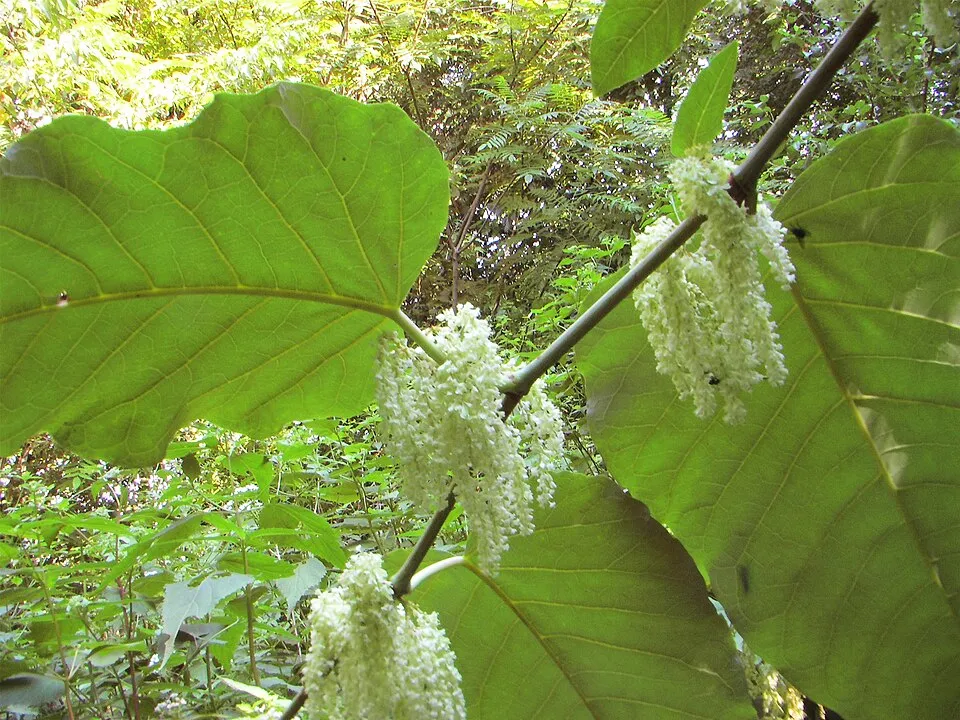 Giant KnotweedEU
 Tree-of-heavenEU
Common milkweedEU
 Paper mulberryEU
 CoypuEU
Photos: Egyptian Goose © Rhododendrites · CC BY-SA 4.0; Himalayan Balsam © Guptaele · CC BY-SA 4.0; Japanese Knotweed © W.carter · CC0-1.0; Giant Knotweed © Velocicaptor · Public domain; Tree-of-heaven © Darkone · CC BY-SA 2.5; Paper mulberry © Didier Descouens · CC BY-SA 4.0; Coypu © Philippe Amelant · CC BY-SA 3.0
Sources: Global Forest Change (Hansen et al., University of Maryland, via Global Forest Watch, CC-BY 4.0); EFFIS, European Commission / Copernicus; NASA Black Marble 2016 (public domain); CORINE Land Cover 2018 (Copernicus) or MODIS.
CORINE Land Cover Change 1990–2018: generated using European Union's Copernicus Land Monitoring Service information (EEA), aggregated by Parkavela; DOI 10.2909/f30f1000-7cf8-43bb-872c-5eb093911b24.
Ecological status of water bodies: European Environment Agency, WISE – Water Framework Directive, 3rd river basin management plans (2022), CC BY 4.0. Official national classification, not comparable between countries.
Invasive alien species: Global Register of Introduced and Invasive Species (ISSG, CC BY 4.0); Union list, Regulation (EU) 1143/2014 (INBO, CC0); GBIF.org records (CC0 / CC BY 4.0), at least 2 per species.
Practical information
Cities and airport
- Ústí nad Labem
< 1 km as the crow flies - Most
6 km as the crow flies - Airport: Václav Havel Airport Prague (PRG)
44 km as the crow flies
Visitor information
- Informační centrum
< 1 km from the site boundary - Městské informační centrum hlavní nádraží
within the site - Railway Information
within the site - Turistické informační centrum Knihovna
within the site
Things to see
23 waterfalls · 1 lake or pond
- Bobří vodopád
waterfall - Žernosecké jezero
lake or pond - Vaňovský vodopád
waterfall - Budovský vodopád
waterfall - Vodopády u Františkova
waterfall
Hiking
133 waymarked routes listed, including:
[Č] Ústí n. Labem, Větruše[Č] Úštěk (žst.)[Č] HolanyVia Czechia[M] Lovosice[Ž] Malé Žernoseky
By bike
EV7 · 49 km 15 15 Ploučnice · 30 km231 231 Měrunice - Žebrácký roh · 21 km232 232 Louny - Měrunice · 19 km211 211 Rožany - Dubá · 12 km
+ 3 local loops
Signed cycle routes: this does not mean that cycling is allowed on footpaths.
Data © OpenStreetMap contributors (ODbL) · Wikidata (CC0)
Contains information from EuroVelo GPX tracks downloaded from www.EuroVelo.com on 2026-10-22, which is made available here under the Open Database License (ODbL). EuroVelo® is a registered trademark of the ECF. Routes © OpenStreetMap contributors (ODbL), via Waymarked Trails
Waymarked hiking routes
0301 [Č] Ústí n. Labem, Větruše - Milešovka (rozc.)
17.3 km within the site ↗ 859 m↘ 310 m 206–761 m
0309 [Č] Úštěk (žst.) - Ploskovice (žst.)
21.8 km within the site ↗ 428 m↘ 408 m 209–517 m
VIA-CZE-103 Via Czechia - Severní (3. Labské pískovce a České Švýcarsko)
3.9 km within the site ↗ 146 m↘ 87 m 125–272 m
VIA-CZE-401 Via Czechia - Středozemím (1. Šluknovsko a Lužické hory)
5.9 km within the site ↗ 144 m↘ 57 m 300–450 m
[Ž] Litochovice nad Labem žst - Střekov hrad
20.2 km within the site ↗ 548 m↘ 601 m 138–491 m
Tracks © OpenStreetMap contributors (ODbL), clipped to the boundary; elevation gain and profiles computed on the longest section from Mapzen Terrain Tiles (≈ 30 m), indicative only.
Bathing
1 monitored bathing site in or within 1 km of the site · 2025 classification
Excellent · 1
- Rybník Chmelař · river · Excellent
Source: European Environment Agency, official bathing water classification (Directive 2006/7/EC, CC-BY 4.0). Swimming is only permitted at the sites and times authorised locally.
Access and visiting
Lovosice zastávka railway station lies within the site. Nearest towns of over 50,000 people, as the crow flies: Ústí nad Labem (0.2 km) and Most (6 km). Nearest airport: Václav Havel Airport Prague (PRG), about 44 km away. About 680,000 people live within 20 km of the site boundary, 410,000 of them within 10 km; some 150,000 people are estimated to live inside (GHSL estimate, 2020). Visitor information on site: Informační centrum, Městské informační centrum hlavní nádraží and Railway Information. Waymarked hiking routes listed in OpenStreetMap: 133, including [Č] Ústí n. Labem, Větruše, [Č] Úštěk (žst.), [Č] Holany and Via Czechia. The EuroVelo 7 cycle route (Sun Route) crosses the site for about 49 km, mostly developed and signed; 9 other signed cycle routes also pass through, including “15 15 Ploučnice” and “231 231 Měrunice - Žebrácký roh” (EuroVelo, OpenStreetMap). To see: 23 waterfalls and 1 lake or pond, including Bobří vodopád, Žernosecké jezero, Vaňovský vodopád and Budovský vodopád. Where to stay: mountain hut Horská chata Milešovka. To plan a visit (access, opening periods, visitor rules), it is best to consult the official information from the managing body and the official website listed in this page's sources.
Source: OpenStreetMap (ODbL), Wikidata (CC0), October 2026.
Built heritage
According to Wikidata, 832 monuments listed in the Czech central register of cultural monuments stand within the boundary, 4 of them national cultural monuments. Among them are 418 houses and civic buildings, 172 religious buildings and 55 castles and fortifications. Nationally designated items include “Benešov nad Ploučnicí Castle” in Benešov nad Ploučnicí, “Poutní areál Horní Police” in Horní Police and “Ploskovice Castle” in Ploskovice.
418 houses and civic buildings172 religious buildings55 castles and fortifications20 bridges, lighthouses, mills and working buildings2 prehistoric and archaeological sites
-
Benešov nad Ploučnicí Castle
National
Benešov nad Ploučnicí -
Poutní areál Horní Police
National
Horní Police -
Ploskovice Castle
National
Ploskovice · 18th c. -
Town hall in Litoměřice
National
Litoměřice-Město · 14th c. -
Barokní kamenný kříž na rozcestí v Borči
Velemín -
Bílý Újezd
Bílý Újezd -
Archeologická lokalita zaniklého středověkého města Děčína
Děčín -
Barokní mlýn na Pokratickém potoce v Litoměřicích
Předměstí
and 824 more
Source: Wikidata (CC0), monuments in each country’s official heritage protection registers, at national or regional level. Each item links to its Wikidata entry.
When to visit
Mildest period: from June to August, with average temperatures of 17 to 19 °C. Average temperatures drop below 0 °C in January: frost is common. According to NASA's MODIS satellites (2015–2025 average), snow covers most of the site in January, with about 35 snow-covered days a year on average. Day length ranges from about 8 h 00 min in December to 16 h 27 min in June. Wildlife records published on GBIF peak for birds (April and May), plants (June and July), butterflies and moths (July), dragonflies (July and August) and mammals (July and August). These peaks also reflect when observers are most active.
Source: Copernicus ERA5-Land (C3S), monthly averages 1996–2025 at the representative point, temperatures adjusted for elevation.
Contains modified Copernicus Climate Change Service information 2026. Neither the European Commission nor ECMWF is responsible for any use that may be made of the Copernicus information or data it contains.
Wildlife records calendar
JFMAMJJASOND
Birds
Plants
Butterflies & moths
Dragonflies
Mammals
Monthly records published on GBIF (CC-BY), relative to the busiest month; also reflects observer activity.
Gallery
© Crutch1973, Radomianin · CC BY-SA 4.0
© Marek Šašek · CC BY-SA 4.0
© Zákupák · Public domain
© Crutch1973 · CC BY-SA 4.0
© Zákupák · Public domain
© MartinVeselka · CC BY-SA 4.0
Sources and licences
- Wikidata: Q13221609
- OpenStreetMap: relation 1903864
- Official website: https://ceskestredohori.aopk.gov.cz
- WDPA: 344533
References
- cds.climate.copernicus.eu: climate · CC-BY-4.0
- registry.opendata.aws: elevation of the reference point, detailed relief · PD
- land.copernicus.eu: land cover, land cover change, sea share · COPERNICUS
- doi.org: population around the site · CC-BY-4.0
- wikidata.org: official area, establishment date, protected heritage, nearby cities and airport, access and peaks, lake depths, places to see, official website · CC0-1.0
- eea.europa.eu: bathing water quality, ecological status of waters · CC-BY-4.0
- en.eurovelo.com: EuroVelo cycle routes · ODbL-1.0
- cycling.waymarkedtrails.org: cycle routes · ODbL-1.0
- opentopodata.org: elevations · PD
- forest-fire.emergency.copernicus.eu: wildfires · COPERNICUS
- globalforestwatch.org: tree cover loss · CC-BY-4.0
- gbif.org: seasonality of sightings, invasive alien species, observed species · CC-BY-4.0
- europe-geology.eu: geology · CC-BY-4.0
- hydrosheds.org: lakes · CC-BY-4.0
- natura2000.eea.europa.eu: Natura 2000 habitats and species · CC-BY-4.0
- openstreetmap.org: official name, access and peaks, trail difficulty, wheelchair access · ODbL-1.0
- earthobservatory.nasa.gov: night light · PD
- hiking.waymarkedtrails.org: route difficulty · ODbL-1.0
- nsidc.org: snow cover · PD
Data © OpenStreetMap contributors (ODbL), Wikidata (CC0) and the sources cited.