Poland · Terrestrial
Cisów-Orłowiny Landscape Park
Landscape park of 20,693 hectares in Poland, established in 1988.
Overview
Landscape park of 20,693 hectares in Poland, established in 1988.
Cisów-Orłowiny Landscape Park is located in Poland (Europe). It is a predominantly terrestrial area. Established on 10 June 1988, it covers about 20,693 hectares.
Protections and designations
Natura 2000 · habitats (SAC)
- Lasy Cisowsko-Orłowińskie PLH260040
Protected as a landscape park. International labels and designations: Natura 2000 network (1 site: “Lasy Cisowsko-Orłowińskie”). Key dates: established in 1988 and first Natura 2000 site under the Habitats Directive in 2011.
In our collections
Timeline
-
1988
Established
-
2011
First Natura 2000 site under the Habitats Directive
Sources: Wikidata (CC0) for establishment and international labels; EEA Natura 2000 database (CC-BY 4.0) for site designation dates.
Frequently asked questions
Where is Cisów-Orłowiny Landscape Park?
In Poland (Europe). Representative point: 50.7493° N, 20.9188° E.
How large is Cisów-Orłowiny Landscape Park?
About 20,693 hectares (207 km²). It is the 44th largest of the 121 landscape parks in Poland covered by Parkavela.
When was Cisów-Orłowiny Landscape Park established?
On 10 June 1988.
What habitats and landscapes does Cisów-Orłowiny Landscape Park include?
A terrestrial area, with forests.
What rocks lie beneath Cisów-Orłowiny Landscape Park?
According to the European 1:1 million geological map (EGDI), the bedrock consists mainly of glacial deposits (43% of sampled points), sands and gravels (29%) and sandstones (14%). These are mostly sedimentary rocks. The geological units date mainly from the Quaternary (79% of sampled points).
What is the highest point of Cisów-Orłowiny Landscape Park?
Kiełki, at 452 m (OpenStreetMap).
What are the main summits of Cisów-Orłowiny Landscape Park?
Kiełki (452 m), Słowiec (438 m), Włochy (427 m), Stołowa (423 m) and Zamczysko (422 m) (OpenStreetMap).
Which international labels apply to Cisów-Orłowiny Landscape Park?
Natura 2000 network (1 site: “Lasy Cisowsko-Orłowińskie”).
When is the best time to visit Cisów-Orłowiny Landscape Park?
Mildest period: from June to August, with average temperatures of 17 to 19 °C.
Is there snow in Cisów-Orłowiny Landscape Park?
Yes. According to NASA's MODIS satellites (2015–2025 average), snow covers most of the site in January, with about 50 snow-covered days a year on average.
What is there to see in Cisów-Orłowiny Landscape Park?
2 viewpoints (OpenStreetMap).
Are there historic monuments in Cisów-Orłowiny Landscape Park?
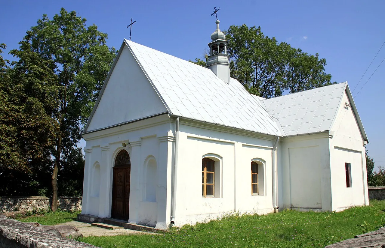
Yes. According to Wikidata, 10 monuments listed in the Polish register of monuments stand within the boundary. For example: “Cmentarz parafialny nowy” in Cisów, “Park (pozostałości)” in Rembów and “Dwór w Rembowie” in Rembów.
Can you swim in Cisów-Orłowiny Landscape Park?
One monitored bathing site lies in or within 1 km of the site; official 2025 classification: 1 poor (European Environment Agency). Swimming is only permitted at the sites and times authorised locally.
What is the nearest large city to Cisów-Orłowiny Landscape Park?
Nearest towns of over 50,000 people, as the crow flies: Kielce (14 km) and Ostrowiec Świętokrzyski (30 km). Nearest airport: Warsaw Radom (RDO), about 66 km away.
How can I reach Cisów-Orłowiny Landscape Park by train?
The nearest railway station is Nida, about 11 km from the site boundary.
Where can I get visitor information on site?
Punkt Informacji Turystycznej.
Are there waymarked hiking trails in Cisów-Orłowiny Landscape Park?
Yes. Waymarked hiking routes listed in OpenStreetMap: 6, including Świętokrzyska Droga św. Jakuba, Szlak im. Edmunda Padechowicza and Szydłów. The “Szlak im. Edmunda Padechowicza” route runs for about 19 km through the site, with some 340 m of ascent on its longest section.
Which species can be seen in Cisów-Orłowiny Landscape Park?
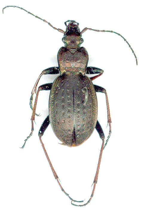
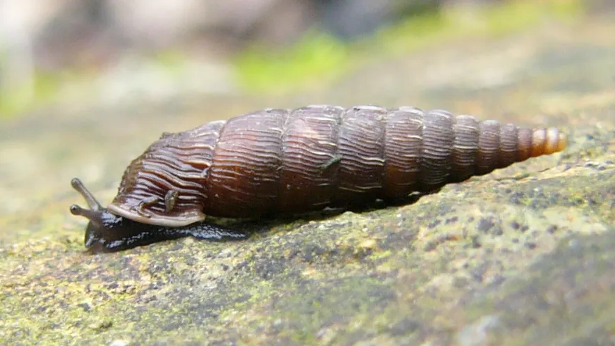
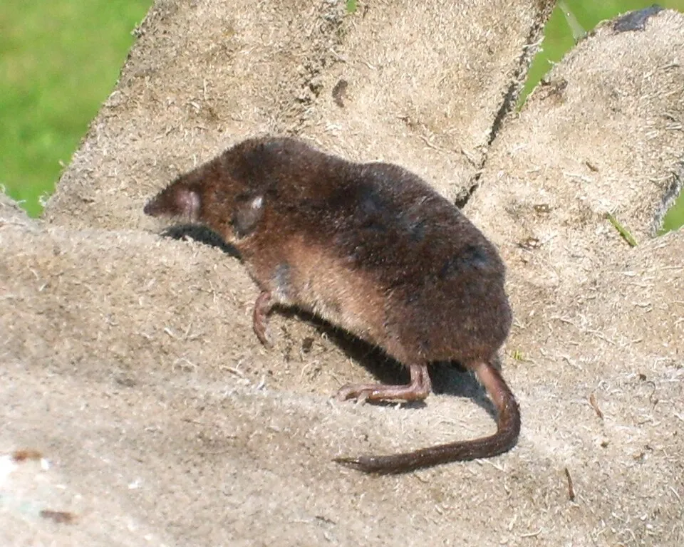
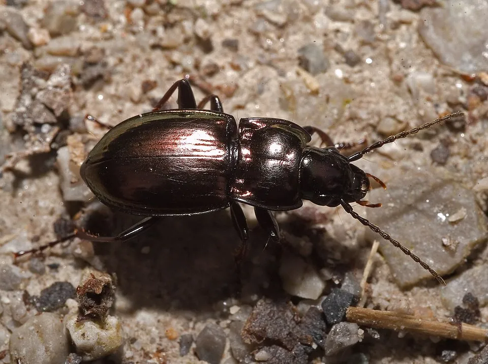
Among the species most often recorded on GBIF are Carabus linnei, Laciniaria plicata (Single-lipped door snail), Microtus arvalis (Common vole) and Sorex araneus (Common shrew).
© OpenStreetMap
Download the boundary: GeoJSON · GPX Boundary © OpenStreetMap contributors (ODbL).
Geography
The representative point of the site lies at around 348 m above sea level. Over the 1996–2025 period, the mean annual temperature is about 8.4 °C and total precipitation reaches roughly 740 mm per year. The warmest month is usually July, the coolest January, and the wettest July. According to the European 1:1 million geological map (EGDI), the bedrock consists mainly of glacial deposits (43% of sampled points), sands and gravels (29%) and sandstones (14%). These are mostly sedimentary rocks. The geological units date mainly from the Quaternary (79% of sampled points).
Area
- Area
- 20,693 ha
- Elevation
- 348 m
- Snow cover
- ≈ 50 days a year
- Coordinates
- 50.7493, 20.9188
Bedrock
- Glacial deposits 43 %
- Sands and gravels 29 %
- Sandstones 14 %
- Mudstones 7 %
- Clays and silts 7 %
Sedimentary rocks 100 % · Main age: Quaternary (79%)
Source: EGDI 1:1M geological map (EuroGeoSurveys and national geological surveys), CC BY 4.0 · 14 sampled points within the site.
Main summits
- Kiełki452 m
- Słowiec438 m
- Włochy427 m
- Stołowa423 m
- Zamczysko422 m
- Kamionka422 m
- Perlikowa419 m
- Wysokówka412 m
- Świński Ryj396 m
- Małzna378 m
Data © OpenStreetMap contributors (ODbL)
Climate
● Mean temperature (°C) · ▮ Precipitation (mm)
Source: Copernicus ERA5-Land (C3S, doi:10.24381/cds.68d2bb30), monthly averages 1996–2025 interpolated to the representative point, temperatures adjusted for elevation.
Contains modified Copernicus Climate Change Service information 2026. Neither the European Commission nor ECMWF is responsible for any use that may be made of the Copernicus information or data it contains.
Snow cover measured by satellite
J
F
M
A
M
J
J
A
S
O
N
D
average share of the site under snow · snowiest parts · ≈ 50 days a year
Snow cover: MODIS/Terra MOD10CM v61 (Hall & Riggs, 2021, NASA NSIDC DAAC, doi:10.5067/MODIS/MOD10CM.061), imagery from NASA GIBS (ESDIS); 2015–2025 average, grid of about 5 km.
Natural habitats
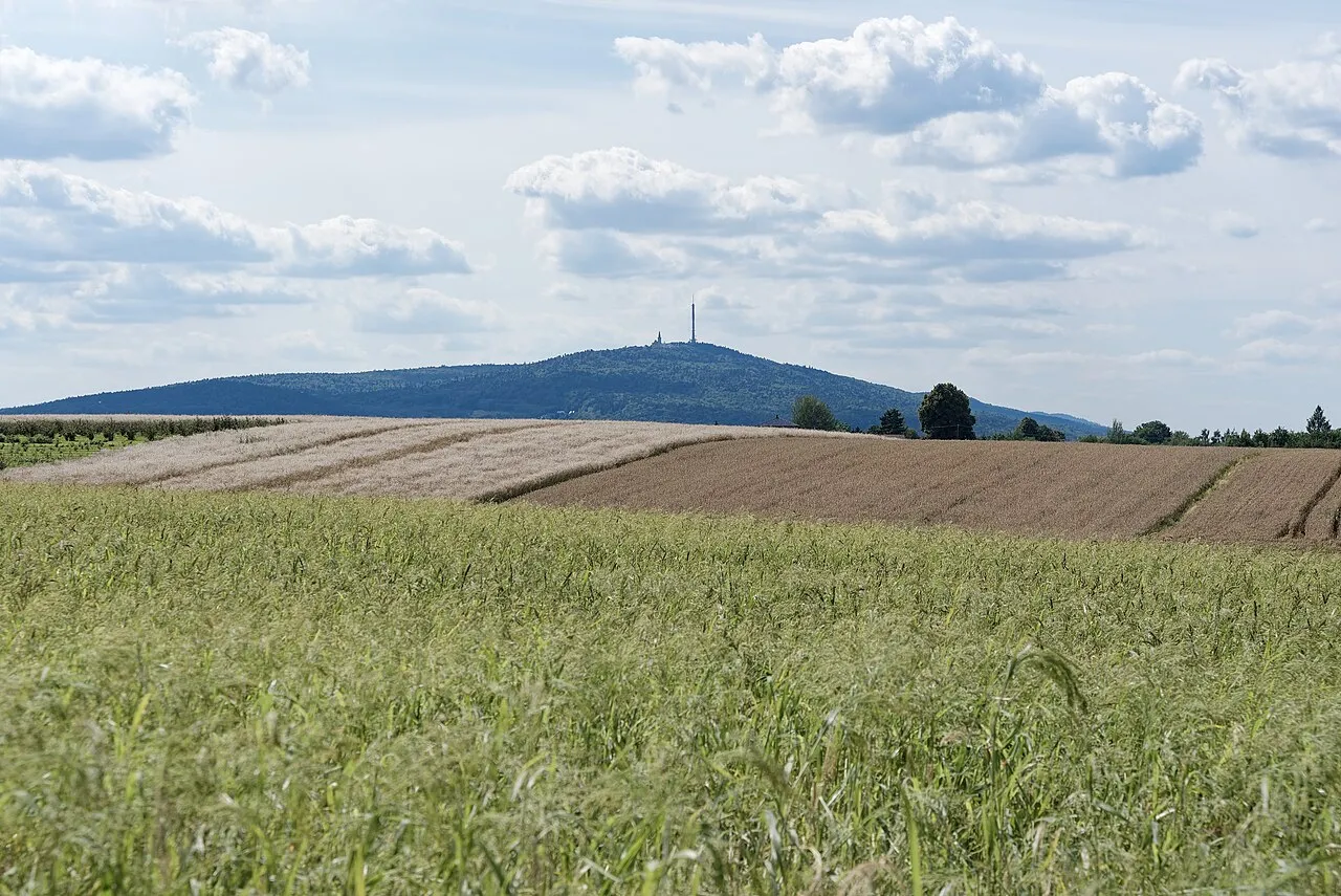
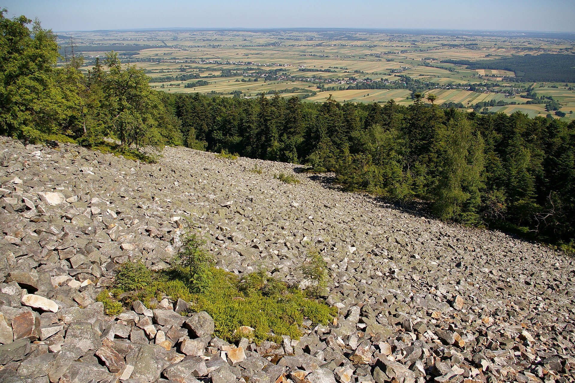
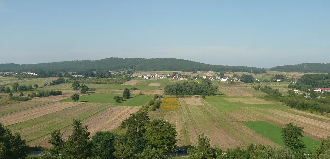
According to CORINE Land Cover (2018), the site is mainly made up of forests (69%) and farmland (24%). Woodland is mostly coniferous. Elevation ranges from about 240 m to 452 m (highest point: Kiełki). The Natura 2000 site overlapping the area lists 15 habitats of European interest (4 priority), the most extensive being Asperulo-Fagetum beech forests, Holy Cross fir forest (Abietetum polonicum) and central European lichen Scots pine forests.
Biodiversity
Based on occurrences aggregated by GBIF, several species are regularly recorded within the site. Among the most frequent are Carabus linnei, Laciniaria plicata (Single-lipped door snail), Microtus arvalis (Common vole) and Sorex araneus (Common shrew). The full list of documented taxa is shown below. The overlapping Natura 2000 site lists 14 species of European interest: 3 mammals, 2 amphibians, 2 fish and 7 invertebrates.
Habitats of European interest
From the official form of the Natura 2000 site overlapping the area (areas reported for the whole site).
- Asperulo-Fagetum beech forests 921 ha
- Holy Cross fir forest (Abietetum polonicum) 833 ha
- Central European lichen Scots pine forests 624 ha
- Luzulo-Fagetum beech forests 474 ha
- Alluvial forests with Alnus glutinosa and Fraxinus excelsior (Alno-Padion, Alnion incanae, Salicion albae) priority 266 ha
- Galio-Carpinetum oak-hornbeam forests 185 ha
- Bog woodland priority 168 ha
- Inland dunes with open Corynephorus and Agrostis grasslands 104 ha
and 7 more
Species of European interest
Mammals · 3
Eurasian Beaver (Castor fiber), Eurasian otter (Lutra lutra), Greater mouse-eared bat (Myotis myotis)
Amphibians · 2
European fire-bellied toad (Bombina bombina), Great crested newt (Triturus cristatus)
Invertebrates · 7
Marsh fritillary (Euphydryas aurinia), Yellow-spotted Whiteface (Leucorrhinia pectoralis), Large copper (Lycaena dispar), Violet Copper (Lycaena helle), Scarce large blue (Maculinea teleius), Green snaketail (Ophiogomphus cecilia), Thick shelled river mussel (Unio crassus)
Source: Natura 2000 standard data forms (EEA, CC-BY 4.0). Not exhaustive: sensitive species are not published.
Species to look out for

Mammal
Common vole
Microtus arvalis1,036 records © Dieter TD, first upload in de wikipedia on 13:31, 28. Apr 2005 by Dieter TD · CC BY-SA 3.0
Observed species
Occurrences documented via GBIF; they are neither an exhaustive inventory nor proof of current presence.
- Carabus linnei · 1955
- Single-lipped door snail · Laciniaria plicata · 1940
- Common vole · Microtus arvalis · 1036
- Common shrew · Sorex araneus · 909
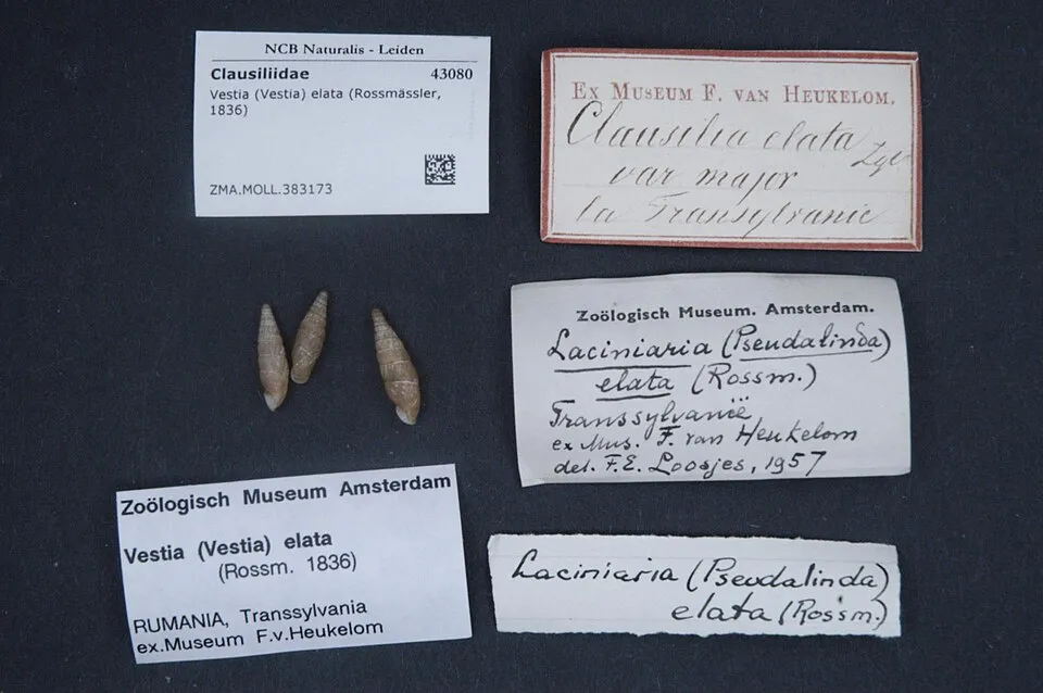
- Transylvanian Doorsnail · Vestia elata · 858
- Pterostichus burmeisteri · 764
- Neobisium erythrodactylum · 743
- House mouse · Mus musculus · 731
- Violet Ground Beetle · Carabus violaceus · 594
- Trachytes aegrota · 532
- Trachytes irenae · 512
- Bronzed Blackclock · Pterostichus oblongopunctatus · 465
+18 more species
- Abax ovalis · 370
- Neobisium sylvaticum · 369
- Common Neobisid · Neobisium carcinoides · 324
- Zercon triangularis · 295
- Coal-runner · Pterostichus melanarius · 284
- A mole flea · Ctenophthalmus bisoctodentatus · 261
- Sharp-ribbed door snail · Clausilia cruciata · 257
- Carabus coriaceus · 233
- Snail Hunter · Cychrus caraboides · 201
- Oodinychus karawaiewi · 187
- Ventricose door snail · Macrogastra ventricosa · 184
- Yellow-legged Clearwing · Synanthedon vespiformis · 178
- Thames door snail · Alinda biplicata · 176
- Striped field mouse · Apodemus agrarius · 174
- Common Shorebug · Saldula saltatoria · 172
- Urodiaspis tecta · 165
- Sellnickochthonius zelawaiensis · 156
- Brachychthonius berlesei · 136
Records: GBIF.org (CC-BY). Names: Wikidata (CC0), GBIF. Photos: Wikimedia Commons.
Conservation challenges
The primary purpose of the site is to preserve its natural habitats and the biodiversity they support. The species recorded (Biodiversity tab) reflect its ecological value. The designations it holds frame its management and the control of land use.
According to Global Forest Change data (University of Maryland, Global Forest Watch), about 1,550 ha of tree cover were lost within the boundary between 2001 and 2023 (7% of its area), peaking in 2018 and 2019. These losses include logging, storms and fires, and do not account for regrowth. According to the European CORINE Land Cover inventory (Copernicus), land cover changed on about 206 ha of the site between 1990 and 2018 (under 1% of its area): farmland shrank by 206 ha, mostly giving way to forest, while forest grew by 206 ha, mostly at the expense of farmland. Forest felling and regrowth add about 440 ha in total over the period. At night, the area gives off virtually no artificial light detectable from space (NASA VIIRS Black Marble composite, 2016). According to the Natura 2000 forms, of 15 assessed habitats of European interest, 4 are in excellent condition and 5 in average or reduced condition. According to the Water Framework Directive assessment (2022 river basin management plans, data 2014–2019), none of the 84 km of rivers assessed within the site reaches good ecological status; they mostly have moderate ecological status.
Pressure indicators
Tree cover lost
1,550 ha
2001–2023 · 7% of the area
20012023
Fires since 2016
0
No large fire mapped (fires over about 30 ha)
Light at night
0%
of the area gives off artificial light visible from space
DarkLit
Built-up land
< 1%
buildings, business areas, roads, quarries · farmland 24%
Land cover change
206 ha
changed cover, 1990–2018 · CORINE · < 1% of the area
- −206 ha · farmland
- +206 ha · forest
forest felling and regrowth: 440 ha in total
Rivers and lakes
0%
of the 84 km of assessed rivers in good or high ecological status · WFD 2022
assessments 2014–2019
Invasive alien species
1
recorded since 2000
Sources: Global Forest Change (Hansen et al., University of Maryland, via Global Forest Watch, CC-BY 4.0); EFFIS, European Commission / Copernicus; NASA Black Marble 2016 (public domain); CORINE Land Cover 2018 (Copernicus) or MODIS.
CORINE Land Cover Change 1990–2018: generated using European Union's Copernicus Land Monitoring Service information (EEA), aggregated by Parkavela; DOI 10.2909/f30f1000-7cf8-43bb-872c-5eb093911b24.
Ecological status of water bodies: European Environment Agency, WISE – Water Framework Directive, 3rd river basin management plans (2022), CC BY 4.0. Official national classification, not comparable between countries.
Invasive alien species: Global Register of Introduced and Invasive Species (ISSG, CC BY 4.0); Union list, Regulation (EU) 1143/2014 (INBO, CC0); GBIF.org records (CC0 / CC BY 4.0), at least 2 per species.
Practical information
Cities and airport
- Kielce
14 km as the crow flies - Ostrowiec Świętokrzyski
30 km as the crow flies - Airport: Warsaw Radom (RDO)
66 km as the crow flies
Visitor information
- Punkt Informacji Turystycznej
1 km from the site boundary
Things to see
2 viewpoints
Hiking
6 waymarked routes listed, including:
Świętokrzyska Droga św. JakubaSzlak im. Edmunda PadechowiczaSzydłów
By bike
EV11 · 27 km GV Green Velo - East of Poland Cycling Trail · 10 kmSAO Szlak Architektury Obronnej · 3 km
EV11: route still largely undeveloped
+ 6 local loops
Signed cycle routes: this does not mean that cycling is allowed on footpaths.
Data © OpenStreetMap contributors (ODbL) · Wikidata (CC0)
Contains information from EuroVelo GPX tracks downloaded from www.EuroVelo.com on 2026-10-22, which is made available here under the Open Database License (ODbL). EuroVelo® is a registered trademark of the ECF. Routes © OpenStreetMap contributors (ODbL), via Waymarked Trails
Waymarked hiking routes
Tracks © OpenStreetMap contributors (ODbL), clipped to the boundary; elevation gain and profiles computed on the longest section from Mapzen Terrain Tiles (≈ 30 m), indicative only.
Bathing
1 monitored bathing site in or within 1 km of the site · 2025 classification
Poor · 1
- Borków · lake · Poor
Source: European Environment Agency, official bathing water classification (Directive 2006/7/EC, CC-BY 4.0). Swimming is only permitted at the sites and times authorised locally.
Access and visiting
The nearest railway station is Nida, about 11 km from the site boundary. Nearest towns of over 50,000 people, as the crow flies: Kielce (14 km) and Ostrowiec Świętokrzyski (30 km). Nearest airport: Warsaw Radom (RDO), about 66 km away. About 410,000 people live within 20 km of the site boundary, 83,000 of them within 10 km; some 5,700 people are estimated to live inside (GHSL estimate, 2020). Visitor information on site: Punkt Informacji Turystycznej. Waymarked hiking routes listed in OpenStreetMap: 6, including Świętokrzyska Droga św. Jakuba, Szlak im. Edmunda Padechowicza and Szydłów. The EuroVelo 11 cycle route (East Europe Route) crosses the site for about 27 km, on a route still largely undeveloped; 2 other signed cycle routes also pass through: “GV Green Velo - East of Poland Cycling Trail” and “SAO Szlak Architektury Obronnej” (EuroVelo, OpenStreetMap). To see: 2 viewpoints. To plan a visit (access, opening periods, visitor rules), it is best to consult the official information from the managing body and the official website listed in this page's sources.
Source: OpenStreetMap (ODbL), Wikidata (CC0), October 2026.
Built heritage
According to Wikidata, 10 monuments listed in the Polish register of monuments stand within the boundary. Among them are 5 religious buildings and 2 houses and civic buildings. Examples include “Cmentarz parafialny nowy” in Cisów, “Park (pozostałości)” in Rembów and “Dwór w Rembowie” in Rembów.
5 religious buildings2 houses and civic buildings
-
Cmentarz parafialny nowy
Cisów -
Park (pozostałości)
Rembów -
Dwór w Rembowie
Rembów · 17th c. -
Old parish cemetery in Cisów
Cisów -
Rembów Castle
Rembów · 14th c. -
Zespół dworski w Rembowie
Rembów -
Cmentarz przykościelny w Bardzie
Bardo -
Church of the Visitation in Bardo
Bardo
and 2 more
Source: Wikidata (CC0), monuments in each country’s official heritage protection registers, at national or regional level. Each item links to its Wikidata entry.
When to visit
Mildest period: from June to August, with average temperatures of 17 to 19 °C. Average temperatures drop below 0 °C from December to February: frost is common. Precipitation peaks in July (up to 110 mm per month). According to NASA's MODIS satellites (2015–2025 average), snow covers most of the site in January, with about 50 snow-covered days a year on average. Day length ranges from about 7 h 59 min in December to 16 h 28 min in June. Wildlife records published on GBIF peak for birds (May), plants (June and July), butterflies and moths (July) and mammals (August). These peaks also reflect when observers are most active.
Source: Copernicus ERA5-Land (C3S), monthly averages 1996–2025 at the representative point, temperatures adjusted for elevation.
Contains modified Copernicus Climate Change Service information 2026. Neither the European Commission nor ECMWF is responsible for any use that may be made of the Copernicus information or data it contains.
Wildlife records calendar
JFMAMJJASOND
Birds
Plants
Butterflies & moths
Mammals
Monthly records published on GBIF (CC-BY), relative to the busiest month; also reflects observer activity.
Gallery
© WiktorN.PL · CC BY-SA 3.0
© Zbigniew.czernik · CC BY 3.0
© L.zurawski · CC BY 4.0
© Earth Science and Remote Sensing Unit, Lyndon B. Johnson Space Center · Public domain
© Earth Science and Remote Sensing Unit, Lyndon B. Johnson Space Center · Public domain
© Earth Science and Remote Sensing Unit, NASA Johnson Space Center · Public domain
Sources and licences
- Wikidata: Q5122347
- OpenStreetMap: relation 4522204
- Wikipedia: en.wikipedia.org/wiki/Cisów-Orłowiny_Landscape_Park
- WDPA: 106894
References
- cds.climate.copernicus.eu: climate · CC-BY-4.0
- registry.opendata.aws: elevation of the reference point, detailed relief · PD
- land.copernicus.eu: land cover, land cover change, sea share · COPERNICUS
- doi.org: population around the site · CC-BY-4.0
- wikidata.org: official area, establishment date, protected heritage, official name, nearby cities and airport, access and peaks, lake depths, places to see · CC0-1.0
- eea.europa.eu: bathing water quality, ecological status of waters · CC-BY-4.0
- en.eurovelo.com: EuroVelo cycle routes · ODbL-1.0
- cycling.waymarkedtrails.org: cycle routes · ODbL-1.0
- opentopodata.org: elevations · PD
- forest-fire.emergency.copernicus.eu: wildfires · COPERNICUS
- globalforestwatch.org: tree cover loss · CC-BY-4.0
- gbif.org: seasonality of sightings, invasive alien species, observed species · CC-BY-4.0
- europe-geology.eu: geology · CC-BY-4.0
- hydrosheds.org: lakes · CC-BY-4.0
- natura2000.eea.europa.eu: Natura 2000 habitats and species · CC-BY-4.0
- earthobservatory.nasa.gov: night light · PD
- openstreetmap.org: access and peaks, places to see, trail difficulty · ODbL-1.0
- hiking.waymarkedtrails.org: route difficulty · ODbL-1.0
- nsidc.org: snow cover · PD
- wikidata.org: Wikipedia article · CC-BY-SA-4.0
Data © OpenStreetMap contributors (ODbL), Wikidata (CC0) and the sources cited.