Ecuador · Terrestrial
Galápagos National Park
National park of 774,500 hectares in Ecuador, established in 1959.
Overview
National park of 774,500 hectares in Ecuador, established in 1959.
Galápagos National Park is located in Ecuador (South America). It is a predominantly terrestrial area. Established in 1959, it covers about 774,500 hectares.
Protections and designations
UNESCO World Heritage
Ramsar site
Protected as a national park. International labels and designations: UNESCO World Heritage (“Galápagos Islands”, “Galapagos Islands”) and Ramsar site (“Humedales del Sur de Isabela”). Key dates: established in 1959 and World Heritage listing in 1978.
In our collections
Timeline
-
1959
Established
-
1978
Inscribed as a UNESCO World Heritage Site Galápagos Islands
Sources: Wikidata (CC0) for establishment and international labels; EEA Natura 2000 database (CC-BY 4.0) for site designation dates.
Frequently asked questions
Where is Galápagos National Park?
In Ecuador (South America). Representative point: 1.4116° S, 89.6370° W.
How large is Galápagos National Park?
About 774,500 hectares (7,745 km²). It is the 2nd largest of the 14 national parks in Ecuador covered by Parkavela. About 59,200 ha are at sea.
When was Galápagos National Park established?
In 1959.
What habitats and landscapes does Galápagos National Park include?
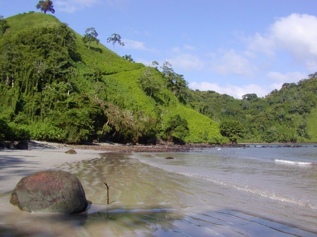
A terrestrial area, with coasts.
What is the highest point of Galápagos National Park?
Volcán Wolf, at 1,707 m (OpenStreetMap).
What are the main summits of Galápagos National Park?
Volcán Wolf (1,707 m), Volcán Cerro Azul (1,640 m), Volcán Sierra Negra (1,490 m), Volcán La Cumbre (1,476 m) and Volcán Darwin (1,330 m) (OpenStreetMap).
Which international labels apply to Galápagos National Park?
UNESCO World Heritage (“Galápagos Islands”, “Galapagos Islands”) and Ramsar site (“Humedales del Sur de Isabela”).
When is the best time to visit Galápagos National Park?
Best time to visit: the dry season, from June to October, with less than 10 mm of rain per month.
What is there to see in Galápagos National Park?
Laguna El Junco (lake or pond, 659 m) (Wikidata).
What is the nearest airport to Galápagos National Park?
Nearest airport: Seymour (GPS), less than 1 km away.
Where can I get visitor information on site?
ITur and Eco Fisching.
Which species can be seen in Galápagos National Park?
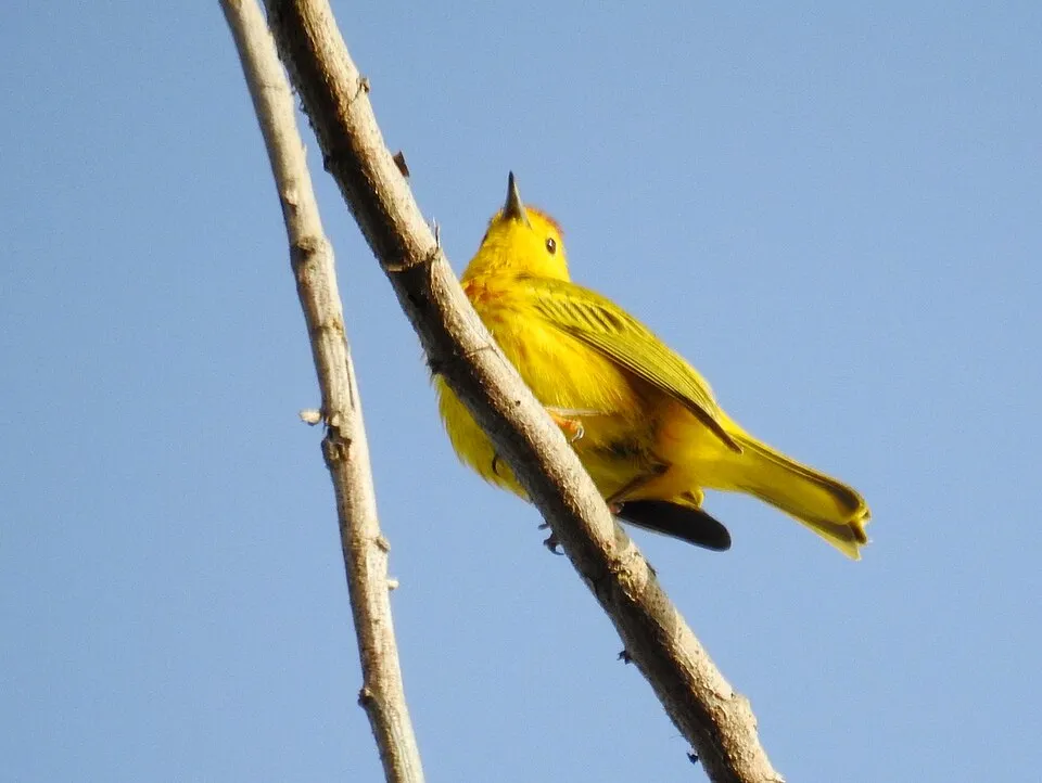
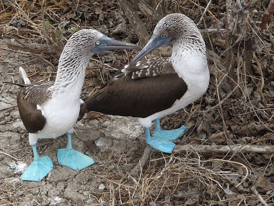
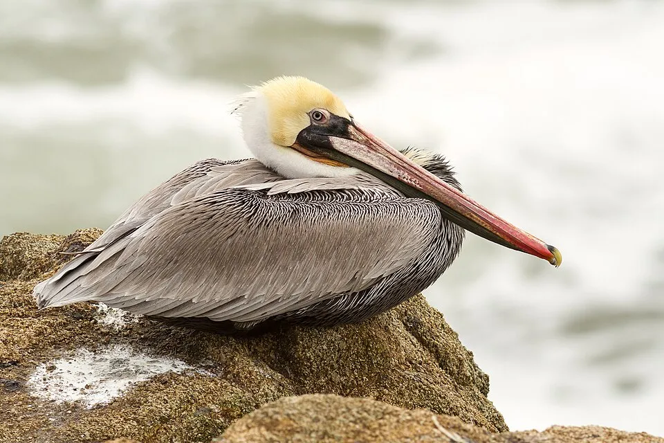
Among the species most often recorded on GBIF are Setophaga petechia (Mangrove Warbler), Sula nebouxii (Blue-footed Booby), Pelecanus occidentalis (Brown pelican) and Geospiza fuliginosa (Small ground finch).
© OpenStreetMap
Download the boundary: GeoJSON · GPX Boundary © OpenStreetMap contributors (ODbL).
Geography
The representative point of the site lies at around 2 m above sea level. Over the 1996–2025 period, the mean annual temperature is about 23.3 °C and total precipitation reaches roughly 292 mm per year. The warmest month is usually March, the coolest September, and the wettest March.
Area
- Area
- 774,500 ha
- Elevation
- 2 m
- Median elevation
- 139 m
- Coordinates
- -1.4116, -89.637
Terrain: Mapzen Terrain Tiles (SRTM, USGS)
Elevation bands
- below 500 m 83%
- 500–1,000 m 14%
- 1,000–1,500 m 3%
- 1,500–2,000 m 1%
share of the site in each elevation band (smoothed terrain model: summits are rounded off) · Terrain: Mapzen Terrain Tiles (SRTM, USGS)
Main summits
- Volcán Wolf1,707 m
- Volcán Cerro Azul1,640 m
- Volcán Sierra Negra1,490 m
- Volcán La Cumbre1,476 m
- Volcán Darwin1,330 m
- Volcán Alcedo1,130 m
- Volcán Santiago907 m
- Cerro Crocker864 m
- Volcán Chico860 m
- Ecuador790 m
Data © OpenStreetMap contributors (ODbL)
Climate
● Mean temperature (°C) · ▮ Precipitation (mm)
Source: Copernicus ERA5 (C3S, doi:10.24381/cds.f17050d7), monthly averages 1996–2025 interpolated to the representative point, temperatures adjusted for elevation.
Contains modified Copernicus Climate Change Service information 2026. Neither the European Commission nor ECMWF is responsible for any use that may be made of the Copernicus information or data it contains.
Natural habitats
According to the global MODIS land cover (NASA, 2024), the site is mainly made up of grassland and meadows (49%), bare rock and scree (39%) and heath and scrub (10%). The site borders the coast. Elevation ranges from sea level to 1,707 m (highest point: Volcán Wolf). Median elevation is 139 m, and 17% of the site lies above 500 m (SRTM elevation model).
Biodiversity
Based on occurrences aggregated by GBIF, several species are regularly recorded within the site. Among the most frequent are Setophaga petechia (Mangrove Warbler), Sula nebouxii (Blue-footed Booby), Pelecanus occidentalis (Brown pelican) and Geospiza fuliginosa (Small ground finch). The full list of documented taxa is shown below.
Species to look out for
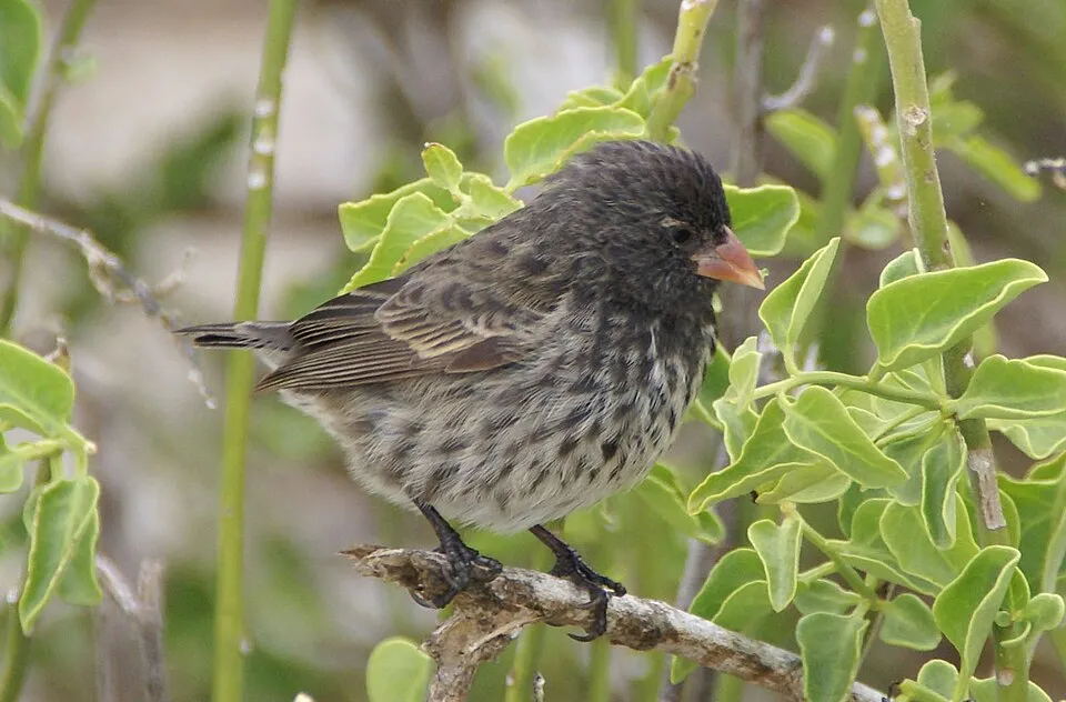
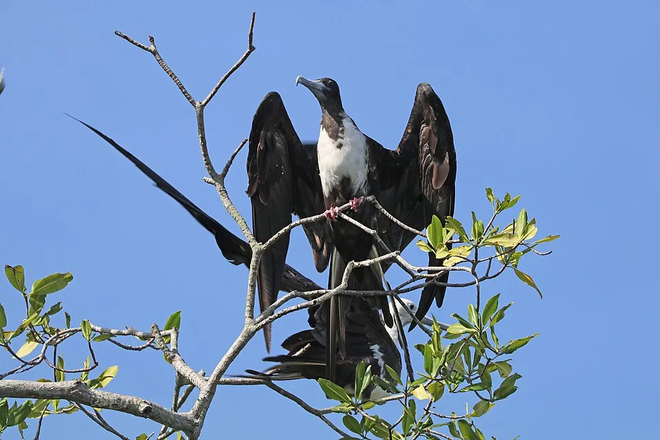
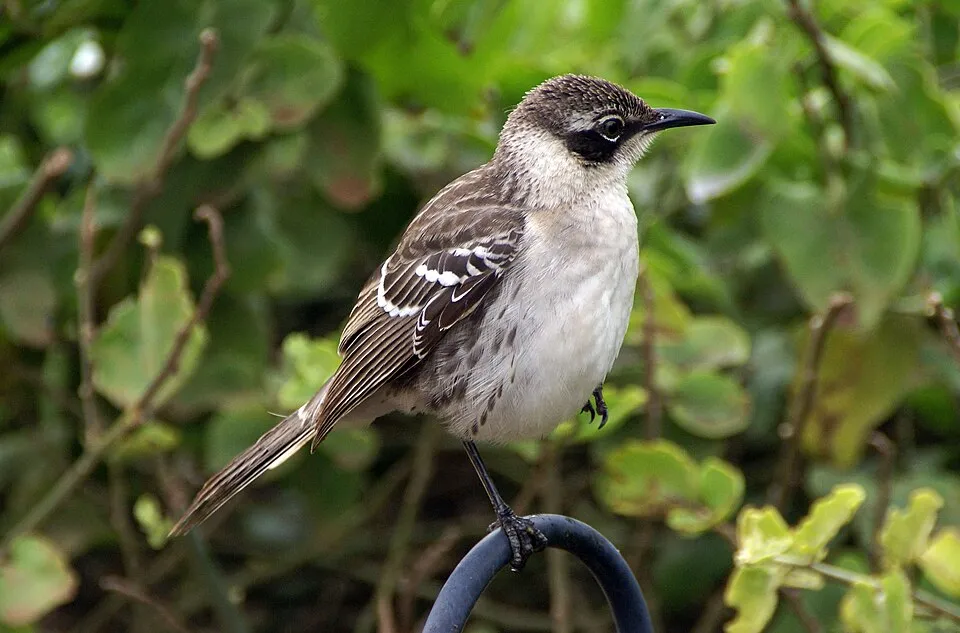
Observed species
Occurrences documented via GBIF; they are neither an exhaustive inventory nor proof of current presence.
- Mangrove Warbler · Setophaga petechia · 19483
- Blue-footed Booby · Sula nebouxii · 18086
- Brown pelican · Pelecanus occidentalis · 17898
- Small ground finch · Geospiza fuliginosa · 16670
- Magnificent frigatebird · Fregata magnificens · 15575
- Galapagos mockingbird · Mimus parvulus · 11178
- Medium Ground Finch · Geospiza fortis · 10712
- Brown Noddy · Anous stolidus · 10369
- Lava Heron · Butorides sundevalli · 9987
- Galapagos Flycatcher · Myiarchus magnirostris · 8915
- Smooth-billed Ani · Crotophaga ani · 8835
- Galapagos Dove · Zenaida galapagoensis · 8402
+18 more species
- Nazca Booby · Sula granti · 8230
- Lava Gull · Leucophaeus fuliginosus · 7944
- White-cheeked Pintail · Anas bahamensis · 7604
- Elliot's Storm Petrel · Oceanites gracilis · 7539
- Galápagos Shearwater · Puffinus subalaris · 7428
- Great Frigatebird · Fregata minor · 7164
- Ruddy Turnstone · Arenaria interpres · 7111
- Hudsonian Whimbrel · Numenius hudsonicus · 6833
- Swallow-tailed Gull · Creagrus furcatus · 6521
- Western Cattle Egret · Bubulcus ibis · 6358
- Great blue heron · Ardea herodias · 6089
- Small Tree Finch · Camarhynchus parvulus · 5737
- Galápagos Penguin · Spheniscus mendiculus · 5608
- American Oystercatcher · Haematopus palliatus · 5493
- American Flamingo · Phoenicopterus ruber · 5438
- Wandering Tattler · Tringa incana · 5388
- Galapagos Hawk · Buteo galapagoensis · 5258
- Semipalmated Plover · Charadrius semipalmatus · 5168
Records: GBIF.org (CC-BY). Names: Wikidata (CC0), GBIF. Photos: Wikimedia Commons.
Conservation challenges
The primary purpose of the site is to preserve its natural habitats and the biodiversity they support. The species recorded (Biodiversity tab) reflect its ecological value. The designations it holds frame its management and the control of land use.
According to Global Forest Change data (University of Maryland, Global Forest Watch), about 3,370 ha of tree cover were lost within the boundary between 2001 and 2023 (under 1% of its area), peaking in 2006 and 2009. These losses include logging, storms and fires, and do not account for regrowth. At night, the area gives off virtually no artificial light detectable from space (NASA VIIRS Black Marble composite, 2016).
Pressure indicators
Tree cover lost
3,369 ha
2001–2023 · < 1% of the area
20012023
Light at night
< 1%
of the area gives off artificial light visible from space
DarkLit
Sources: Global Forest Change (Hansen et al., University of Maryland, via Global Forest Watch, CC-BY 4.0); EFFIS, European Commission / Copernicus; NASA Black Marble 2016 (public domain); CORINE Land Cover 2018 (Copernicus) or MODIS.
Practical information
Cities and airport
- Airport: Seymour (GPS)
< 1 km as the crow flies
Visitor information
- ITur
within the site - Eco Fisching
within the site
Parking
35 public car parks listed within the site
Rancho El ChatoMedia LunaPlaya Puerto Chino
Data © OpenStreetMap contributors (ODbL) · Wikidata (CC0)
Access and visiting
Nearest airport: Seymour (GPS), less than 1 km away. Fewer than 5,000 people live within 20 km of the site boundary, a very sparsely populated area; some 34,000 people are estimated to live inside (GHSL estimate, 2020). Visitor information on site: ITur and Eco Fisching. Public car parks listed within the site: 35, including Rancho El Chato, Media Luna and Playa Puerto Chino. To see: Laguna El Junco (lake or pond, 659 m). To plan a visit (access, opening periods, visitor rules), it is best to consult the official information from the managing body and the official website listed in this page's sources.
Source: OpenStreetMap (ODbL), Wikidata (CC0), November 2026.
When to visit
Best time to visit: the dry season, from June to October, with less than 10 mm of rain per month. Precipitation peaks in January and in March (up to 70 mm per month). These averages apply to the site's representative point (2 m); higher up it is markedly cooler. Wildlife records published on GBIF peak for butterflies and moths (from December to June), dragonflies (from May to July) and mammals (July and August). These peaks also reflect when observers are most active.
Source: Copernicus ERA5 (C3S), monthly averages 1996–2025 at the representative point, temperatures adjusted for elevation.
Contains modified Copernicus Climate Change Service information 2026. Neither the European Commission nor ECMWF is responsible for any use that may be made of the Copernicus information or data it contains.
Wildlife records calendar
JFMAMJJASOND
Birds
Plants
Butterflies & moths
Dragonflies
Mammals
Monthly records published on GBIF (CC-BY), relative to the busiest month; also reflects observer activity.
Gallery
© putneymark · CC BY-SA 2.0
© Andrew Katsis · CC BY 4.0
© Murray Foubister · CC BY-SA 2.0
© MasterfulNerd · CC BY-SA 4.0
© David Adam Kess · CC BY-SA 3.0
© Ljuba brank · CC BY-SA 3.0
Sources and licences
- Wikidata: Q112375
- OpenStreetMap: relation 447664
- Wikipedia: en.wikipedia.org/wiki/Galápagos_National_Park
- WDPA: 187
References
- cds.climate.copernicus.eu: climate · CC-BY-4.0
- registry.opendata.aws: elevation of the reference point, detailed relief · PD
- lpdaac.usgs.gov: land cover · PD
- doi.org: population around the site · CC-BY-4.0
- naturalearthdata.com: sea share · PD
- wikidata.org: official area, establishment date, nearby cities and airport, access and peaks, lake depths, places to see · CC0-1.0
- en.eurovelo.com: EuroVelo cycle routes · ODbL-1.0
- cycling.waymarkedtrails.org: cycle routes · ODbL-1.0
- opentopodata.org: elevations · PD
- globalforestwatch.org: tree cover loss · CC-BY-4.0
- gbif.org: seasonality of sightings, observed species · CC-BY-4.0
- openstreetmap.org: official name, access and peaks · ODbL-1.0
- earthobservatory.nasa.gov: night light · PD
- nsidc.org: snow cover · PD
- wikidata.org: Wikipedia article · CC-BY-SA-4.0
Data © OpenStreetMap contributors (ODbL), Wikidata (CC0) and the sources cited.