Spain · Terrestrial
Hoces del Cabriel Natural Park
Nature park of 31,446 hectares in Spain, established in 2005.
Overview
Nature park of 31,446 hectares in Spain, established in 2005.
Hoces del Cabriel Natural Park is a nature park in Spain (Europe). It is a predominantly terrestrial area. Established in 2005, it covers about 31,446 hectares.
Protections and designations
UNESCO Biosphere Reserve
Natura 2000 · habitats (SAC)
- Hoces del Cabriel ES5233010
Natura 2000 · birds (SPA)
- Hoces del Cabriel (ZEPA) ES0000472
Protected as a nature park. International labels and designations: UNESCO Biosphere Reserve (“Valle del Cabriel Biosphere Reserve”) and Natura 2000 network (2 sites). Key dates: first Natura 2000 site under the Birds Directive in 2000, established in 2005 and first Natura 2000 site under the Habitats Directive in 2014.
In our collections
Timeline
-
2000
First Natura 2000 site under the Birds Directive
-
2005
Established
-
2014
First Natura 2000 site under the Habitats Directive
Sources: Wikidata (CC0) for establishment and international labels; EEA Natura 2000 database (CC-BY 4.0) for site designation dates.
Frequently asked questions
Where is Hoces del Cabriel Natural Park?
In Spain (Europe). Representative point: 39.3847° N, 1.4603° W.
How large is Hoces del Cabriel Natural Park?
About 31,446 hectares (314 km²). It is the 22nd largest of the 73 nature parks in Spain covered by Parkavela.
When was Hoces del Cabriel Natural Park established?
In 2005.
What habitats and landscapes does Hoces del Cabriel Natural Park include?
A terrestrial area, with forests and mountains.
What rocks lie beneath Hoces del Cabriel Natural Park?
According to the European 1:1 million geological map (EGDI), the bedrock consists mainly of conglomerates and breccias (58% of sampled points) and carbonate rocks (17%). These are mostly sedimentary rocks. The geological units date mainly from the Neogene (75% of sampled points).
What is the highest point of Hoces del Cabriel Natural Park?
Moluengo, at 1,040 m (OpenStreetMap).
What are the main summits of Hoces del Cabriel Natural Park?
Moluengo (1,040 m), Cerro de Collejas (917 m), La Peraleja (846 m), Puntal de los Caracoles (844 m) and Puntal Merino (800 m) (OpenStreetMap).
Which international labels apply to Hoces del Cabriel Natural Park?
UNESCO Biosphere Reserve (“Valle del Cabriel Biosphere Reserve”) and Natura 2000 network (2 sites).
Are there historic monuments in Hoces del Cabriel Natural Park?
Yes. According to Wikidata, 3 monuments listed as Bien de Interés Cultural stand within the boundary. For example: “Castillo de Sardineros” in Requena, “Solana de las Pilillas” in Requena and “Torre de telegrafía óptica de Villargordo del Cabriel” in Villargordo del Cabriel.
What is the nearest large city to Hoces del Cabriel Natural Park?
Nearest towns of over 50,000 people, as the crow flies: Albacete (53 km) and Torrent (57 km). Nearest airport: Valencia (VLC), about 57 km away.
How can I reach Hoces del Cabriel Natural Park by train?
The nearest railway station is Requena - Utiel, about 14 km from the site boundary.
Are there waymarked hiking trails in Hoces del Cabriel Natural Park?
Yes. Waymarked hiking routes listed in OpenStreetMap: 5, including GR 238, Camí Natural Turia, Hoces del Cabriel and Baños de Fuente Podrida. The GR 238 · De Juan Vich a Casas del Río route runs for about 49 km through the site, with some 310 m of ascent on its longest section.
Which species can be seen in Hoces del Cabriel Natural Park?
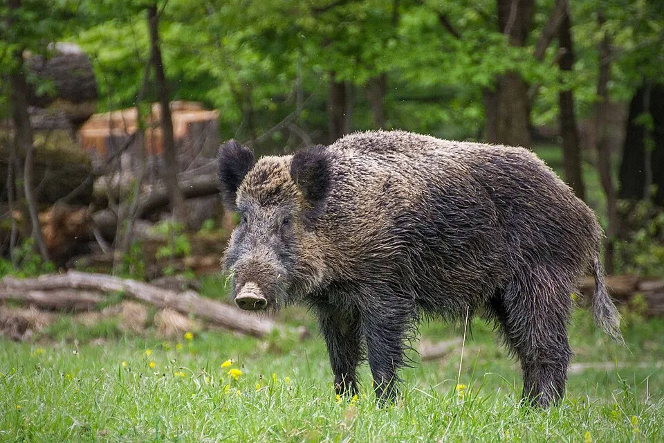
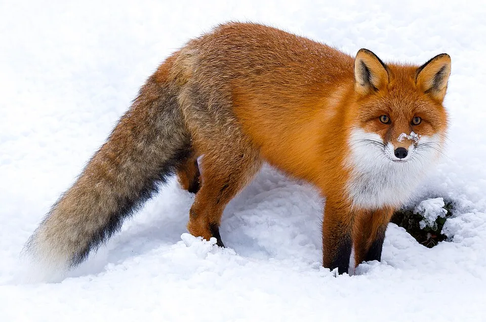
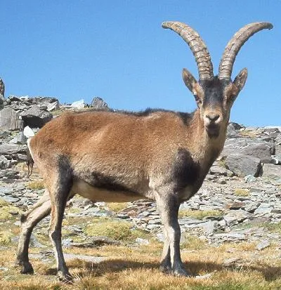
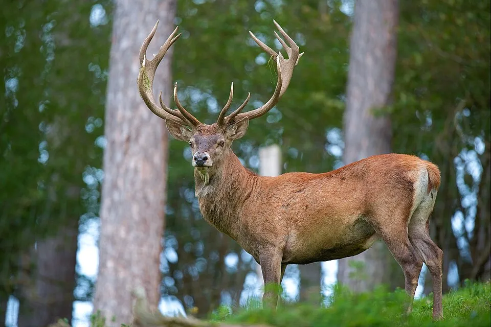
Among the species most often recorded on GBIF are Sus scrofa (Wild boar), Vulpes vulpes (Red fox), Capra pyrenaica (Spanish Ibex) and Cervus elaphus (Red deer).
© OpenStreetMap
Download the boundary: GeoJSON · GPX Boundary © OpenStreetMap contributors (ODbL).
Geography
According to the European 1:1 million geological map (EGDI), the bedrock consists mainly of conglomerates and breccias (58% of sampled points) and carbonate rocks (17%). These are mostly sedimentary rocks. The geological units date mainly from the Neogene (75% of sampled points).
Area
- Area
- 31,446 ha
- Median elevation
- 575 m
- Mean slope
- 8°
- Coordinates
- 39.3847, -1.4603
Terrain: Mapzen Terrain Tiles (SRTM, USGS)
Elevation bands
- below 500 m 23%
- 500–1,000 m 77%
share of the site in each elevation band (smoothed terrain model: summits are rounded off) · Terrain: Mapzen Terrain Tiles (SRTM, USGS)
Bedrock
- Conglomerates and breccias 58 %
- Carbonate rocks 17 %
- Marly limestones 8 %
- Sands and gravels 8 %
- Dolomites 8 %
Sedimentary rocks 100 % · Main age: Neogene (75%)
Source: EGDI 1:1M geological map (EuroGeoSurveys and national geological surveys), CC BY 4.0 · 12 sampled points within the site.
Main summits
- Moluengo1,040 m
- Cerro de Collejas917 m
- La Peraleja846 m
- Puntal de los Caracoles844 m
- Puntal Merino800 m
- Alto de Contreras752 m
- Cerro de la Cabeza737 m
- Cerro del Purgatorio729 m
- Torre de la Moneda727 m
- Peñón Hundido700 m
Data © OpenStreetMap contributors (ODbL)
Natural habitats
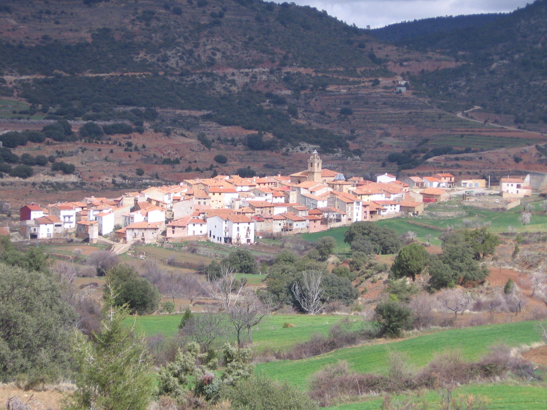
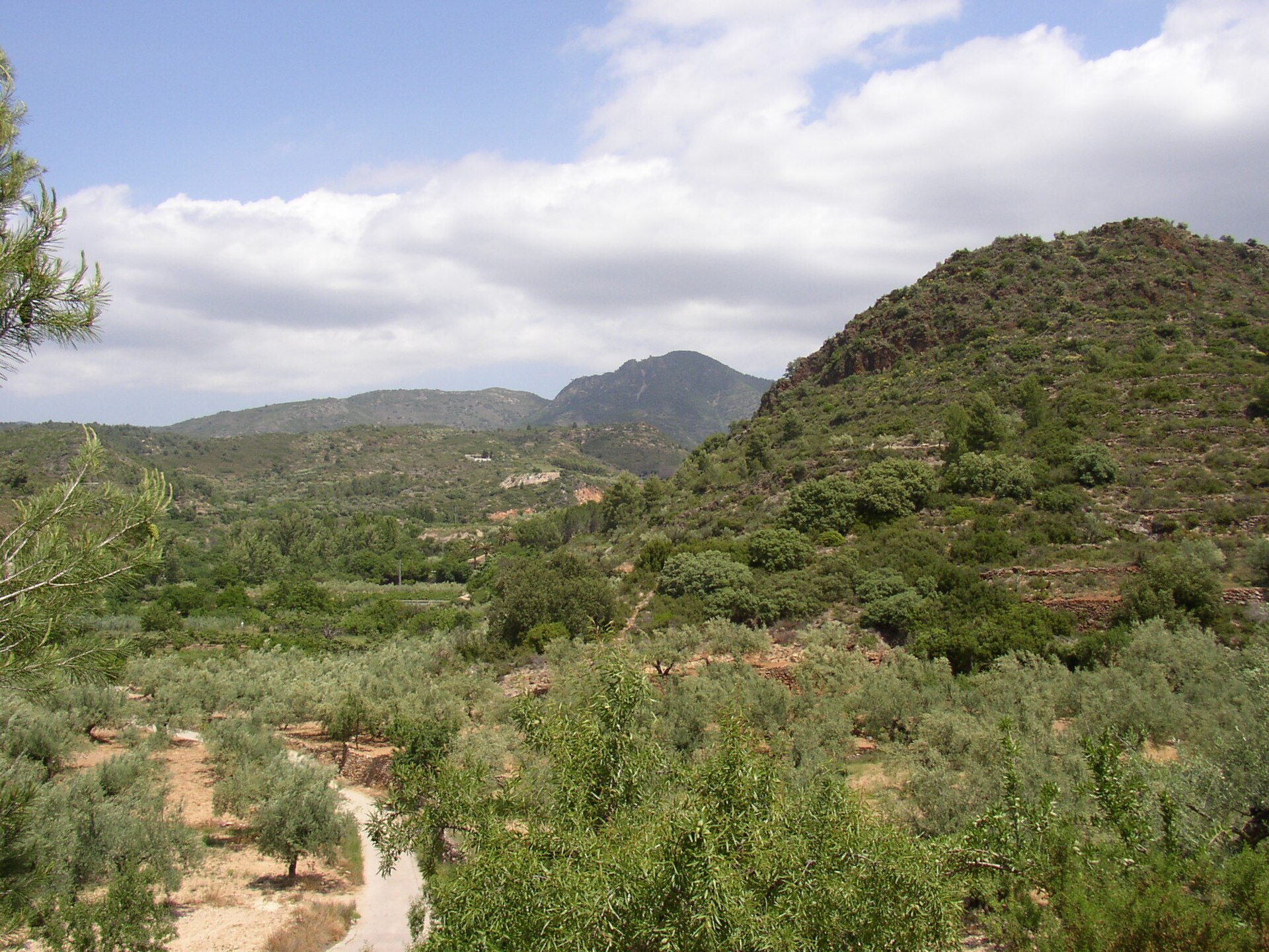
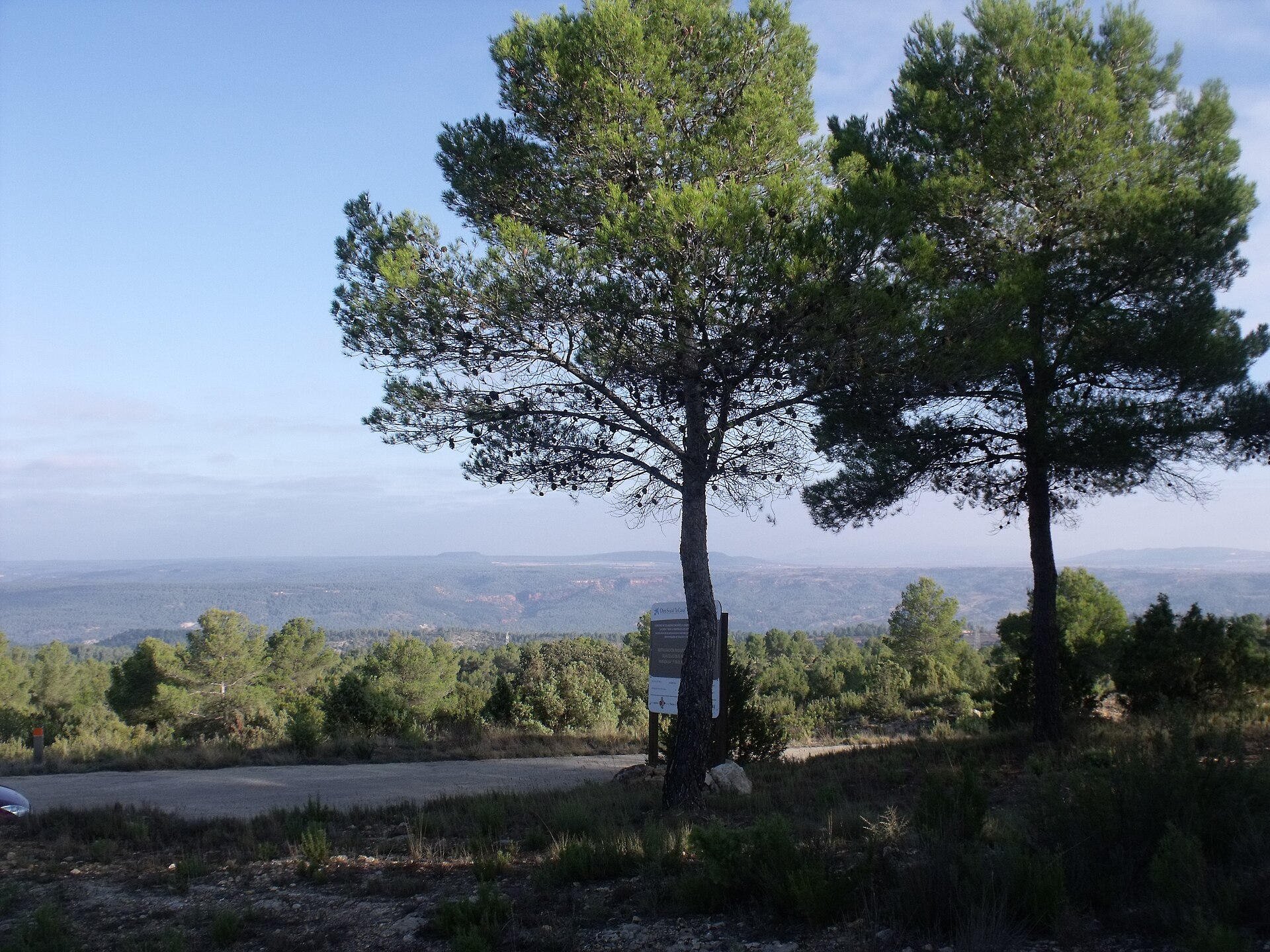
According to CORINE Land Cover (2018), the site is mainly made up of forests (64%), farmland (15%) and heath and scrub (10%). Woodland is mostly coniferous. Elevation ranges from about 370 m to 1,040 m (highest point: Moluengo). Median elevation is 575 m, and 77% of the site lies above 500 m (SRTM elevation model). The 2 Natura 2000 sites overlapping the area list 11 habitats of European interest (3 priority), the most extensive being arborescent matorral with Juniperus spp, pseudo-steppe with grasses and annuals of the Thero-Brachypodietea and Iberian gypsum vegetation (Gypsophiletalia).
Biodiversity
Based on occurrences aggregated by GBIF, several species are regularly recorded within the site. Among the most frequent are Sus scrofa (Wild boar), Vulpes vulpes (Red fox), Capra pyrenaica (Spanish Ibex) and Cervus elaphus (Red deer). The full list of documented taxa is shown below. The overlapping Natura 2000 sites list 23 species of European interest: 18 birds, 2 mammals, 1 reptile, 1 fish and 1 invertebrate.
Habitats of European interest
From the official forms of the 2 Natura 2000 sites overlapping the area (areas reported for each whole site).
- Arborescent matorral with Juniperus spp. 13,522 ha
- Pseudo-steppe with grasses and annuals of the Thero-Brachypodietea priority 4,507 ha
- Iberian gypsum vegetation (Gypsophiletalia) priority 2,254 ha
- Salix alba and Populus alba galleries 1,352 ha
- Endemic oro-Mediterranean heaths with gorse 1,352 ha
- Calcareous rocky slopes with chasmophytic vegetation 1,352 ha
- Petrifying springs with tufa formation (Cratoneurion) priority 451 ha
- Natural eutrophic lakes with Magnopotamion or Hydrocharition-type vegetation 451 ha
and 3 more
Species of European interest
Birds · 18
Common Kingfisher (Alcedo atthis) resident, Tawny Pipit (Anthus campestris) breeding, Golden Eagle (Aquila chrysaetos) resident, Bonelli's Eagle (Aquila fasciata) resident, Eurasian Eagle-owl (Bubo bubo) resident, Eurasian Stone-curlew (Burhinus oedicnemus) resident, Greater Short-toed Lark (Calandrella brachydactyla) breeding, European Nightjar (Caprimulgus europaeus) resident, Short-toed Snake Eagle (Circaetus gallicus) breeding, Peregrine Falcon (Falco peregrinus) resident, Thekla's Lark (Galerida theklae) resident, Booted Eagle (Hieraaetus pennatus) breeding and 6 more
Reptiles · 1
Fish · 1
Júcar Nase (Parachondrostoma arrigonis)
Invertebrates · 1
Source: Natura 2000 standard data forms (EEA, CC-BY 4.0). Not exhaustive: sensitive species are not published.
Species to look out for
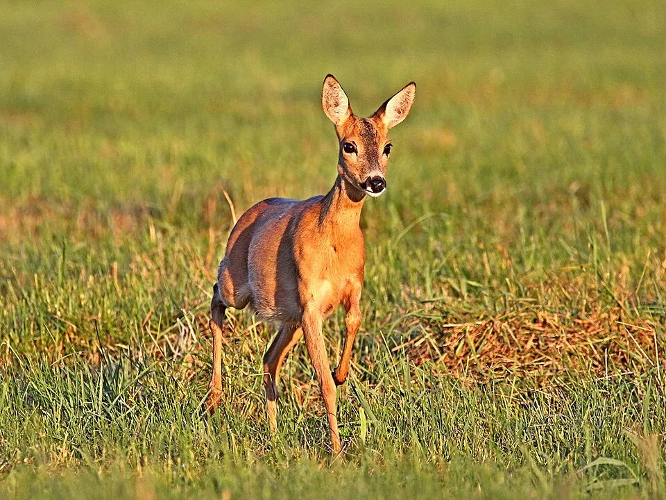

Observed species
Occurrences documented via GBIF; they are neither an exhaustive inventory nor proof of current presence.
- Wild boar · Sus scrofa · 438
- Red fox · Vulpes vulpes · 353
- Spanish Ibex · Capra pyrenaica · 324
- Red deer · Cervus elaphus · 304
- Roe deer · Capreolus capreolus · 272
- Fallow Deer · Dama dama · 132
- Griffon Vulture · Gyps fulvus · 88
- Great tit · Parus major · 72
- Common Blackbird · Turdus merula · 70
- Eurasian Chaffinch · Fringilla coelebs · 68
- Common Wood Pigeon · Columba palumbus · 52
- European Crested Tit · Lophophanes cristatus · 46
Records: GBIF.org (CC-BY). Names: Wikidata (CC0), GBIF. Photos: Wikimedia Commons.
Conservation challenges
The primary purpose of the site is to preserve its natural habitats and the biodiversity they support. The species recorded (Biodiversity tab) reflect its ecological value. The designations it holds frame its management and the control of land use.
According to Global Forest Change data (University of Maryland, Global Forest Watch), about 196 ha of tree cover were lost within the boundary between 2001 and 2023 (under 1% of its area), peaking in 2022 and 2023. These losses include logging, storms and fires, and do not account for regrowth. According to the European CORINE Land Cover inventory (Copernicus), land cover changed on about 164 ha of the site between 1990 and 2018 (under 1% of its area). Since 2016, the European EFFIS system (Copernicus) has mapped 2 fires here, burning about 1,309 ha within the boundary; the largest, in July 2022 (near Venta del Moro), covered 1,295 ha. At night, the area gives off virtually no artificial light detectable from space (NASA VIIRS Black Marble composite, 2016). According to the Natura 2000 forms, of 11 assessed habitats of European interest, 1 is in excellent condition and 2 in average or reduced condition. According to the Water Framework Directive assessment (2022 river basin management plans, data 2014–2019), only 29% of the 65 km of rivers assessed within the site are in good or high ecological status; the others mostly have moderate ecological status. One invasive alien species has been recorded within the site since 2000 (GBIF observations), listed as of Union concern: Ailanthus altissima (Tree-of-heaven).
Pressure indicators
Tree cover lost
196 ha
2001–2023 · < 1% of the area
20012023
Fires since 2016
1,309 ha
burned within the boundary (2 mapped fires)
- 2022 · Venta del Moro · 1,295 ha
- 2021 · Requena · 14 ha
Light at night
< 1%
of the area gives off artificial light visible from space
DarkLit
Land cover change
164 ha
changed cover, 1990–2018 · CORINE · < 1% of the area
Rivers and lakes
29%
of the 65 km of assessed rivers in good or high ecological status · WFD 2022
assessments 2014–2019
Invasive alien species
1
incl. 1 of EU concern · since 2000
Sources: Global Forest Change (Hansen et al., University of Maryland, via Global Forest Watch, CC-BY 4.0); EFFIS, European Commission / Copernicus; NASA Black Marble 2016 (public domain); CORINE Land Cover 2018 (Copernicus) or MODIS.
CORINE Land Cover Change 1990–2018: generated using European Union's Copernicus Land Monitoring Service information (EEA), aggregated by Parkavela; DOI 10.2909/f30f1000-7cf8-43bb-872c-5eb093911b24.
Ecological status of water bodies: European Environment Agency, WISE – Water Framework Directive, 3rd river basin management plans (2022), CC BY 4.0. Official national classification, not comparable between countries.
Invasive alien species: Global Register of Introduced and Invasive Species (ISSG, CC BY 4.0); Union list, Regulation (EU) 1143/2014 (INBO, CC0); GBIF.org records (CC0 / CC BY 4.0), at least 2 per species.
Practical information
Cities and airport
- Albacete
53 km as the crow flies - Torrent
57 km as the crow flies - Airport: Valencia (VLC)
57 km as the crow flies
Hiking
5 waymarked routes listed, including:
GR 238Camí Natural TuriaHoces del CabrielBaños de Fuente Podrida
Data © OpenStreetMap contributors (ODbL) · Wikidata (CC0)
Waymarked hiking routes
Camí Natural Turia - Cabriel
13.4 km within the site ↗ 449 m↘ 17 m 509–954 m
Tracks © OpenStreetMap contributors (ODbL), clipped to the boundary; elevation gain and profiles computed on the longest section from Mapzen Terrain Tiles (≈ 30 m), indicative only.
Access and visiting
The nearest railway station is Requena - Utiel, about 14 km from the site boundary. Nearest towns of over 50,000 people, as the crow flies: Albacete (53 km) and Torrent (57 km). Nearest airport: Valencia (VLC), about 57 km away. About 66,000 people live within 20 km of the site boundary, 18,000 of them within 10 km; some 380 people are estimated to live inside (GHSL estimate, 2020). This population has grown by about 9% since 2000. Waymarked hiking routes listed in OpenStreetMap: 5, including GR 238, Camí Natural Turia, Hoces del Cabriel and Baños de Fuente Podrida. To plan a visit (access, opening periods, visitor rules), it is best to consult the official information from the managing body and the official website listed in this page's sources.
Source: OpenStreetMap (ODbL), Wikidata (CC0), October 2026.
Built heritage
According to Wikidata, 3 monuments listed as Bien de Interés Cultural stand within the boundary. Examples include “Castillo de Sardineros” in Requena, “Solana de las Pilillas” in Requena and “Torre de telegrafía óptica de Villargordo del Cabriel” in Villargordo del Cabriel.
2 castles and fortifications1 prehistoric or archaeological site
-
Castillo de Sardineros
Requena -
Solana de las Pilillas
Requena -
Torre de telegrafía óptica de Villargordo del Cabriel
Villargordo del Cabriel
Source: Wikidata (CC0), monuments in each country’s official heritage protection registers, at national or regional level. Each item links to its Wikidata entry.
Wildlife records calendar
JFMAMJJASOND
Birds
Plants
Butterflies & moths
Dragonflies
Mammals
Monthly records published on GBIF (CC-BY), relative to the busiest month; also reflects observer activity.
Gallery
© 19Tarrestnom65 · CC BY-SA 4.0
© 19Tarrestnom65 · CC BY-SA 4.0
© Antonio L from Mota del Cuervo, España · CC BY-SA 2.0
© Discasto · CC BY-SA 4.0
© Malopez 21 · CC BY-SA 4.0
© Joalmar1911 · CC BY-SA 4.0
Sources and licences
- Wikidata: Q11697969
- OpenStreetMap: relation 10284996
- Wikipedia: fr.wikipedia.org/wiki/Parc_naturel_des_gorges_du_Cabriel
- WDPA: 389024
References
- land.copernicus.eu: land cover, land cover change, sea share · COPERNICUS
- doi.org: population around the site · CC-BY-4.0
- wikidata.org: official area, establishment date, protected heritage, nearby cities and airport, access and peaks, lake depths, places to see · CC0-1.0
- eea.europa.eu: bathing water quality, ecological status of waters · CC-BY-4.0
- en.eurovelo.com: EuroVelo cycle routes · ODbL-1.0
- cycling.waymarkedtrails.org: cycle routes · ODbL-1.0
- opentopodata.org: elevations · PD
- forest-fire.emergency.copernicus.eu: wildfires · COPERNICUS
- globalforestwatch.org: tree cover loss · CC-BY-4.0
- gbif.org: seasonality of sightings, invasive alien species, observed species · CC-BY-4.0
- europe-geology.eu: geology · CC-BY-4.0
- hydrosheds.org: lakes · CC-BY-4.0
- natura2000.eea.europa.eu: Natura 2000 habitats and species · CC-BY-4.0
- openstreetmap.org: official name, access and peaks, trail difficulty · ODbL-1.0
- earthobservatory.nasa.gov: night light · PD
- registry.opendata.aws: detailed relief · PD
- hiking.waymarkedtrails.org: route difficulty · ODbL-1.0
- nsidc.org: snow cover · PD
- wikidata.org: Wikipedia article · CC-BY-SA-4.0
Data © OpenStreetMap contributors (ODbL), Wikidata (CC0) and the sources cited.