
Spain · Terrestrial
Albufera Natural Park
Nature park of 21,120 hectares in Spain, established in 1986.
Overview
Nature park of 21,120 hectares in Spain, established in 1986.
Albufera Natural Park is a nature park in Spain (Europe). It is a predominantly terrestrial area. Established on 8 July 1986, it covers about 21,120 hectares. The site is managed by Generalitat Valenciana.
Protections and designations
Ramsar site
Natura 2000 · habitats (SAC)
- L'Albufera ES0000023
Natura 2000 · birds (SPA)
- l'Albufera (ZEPA) ES0000471
Protected as a nature park. International labels and designations: Ramsar site and Natura 2000 network (2 sites). Key dates: established in 1986 and first Natura 2000 site under the Birds Directive in 1988.
In our collections
Timeline
-
1986
Established
-
1988
First Natura 2000 site under the Birds Directive
Sources: Wikidata (CC0) for establishment and international labels; EEA Natura 2000 database (CC-BY 4.0) for site designation dates.
Frequently asked questions
Where is Albufera Natural Park?
In Spain (Europe). Representative point: 39.2957° N, 0.3335° W.
How large is Albufera Natural Park?
About 21,120 hectares (211 km²). It is the 28th largest of the 73 nature parks in Spain covered by Parkavela. About 3,000 ha are at sea.
When was Albufera Natural Park established?
On 8 July 1986.
What habitats and landscapes does Albufera Natural Park include?
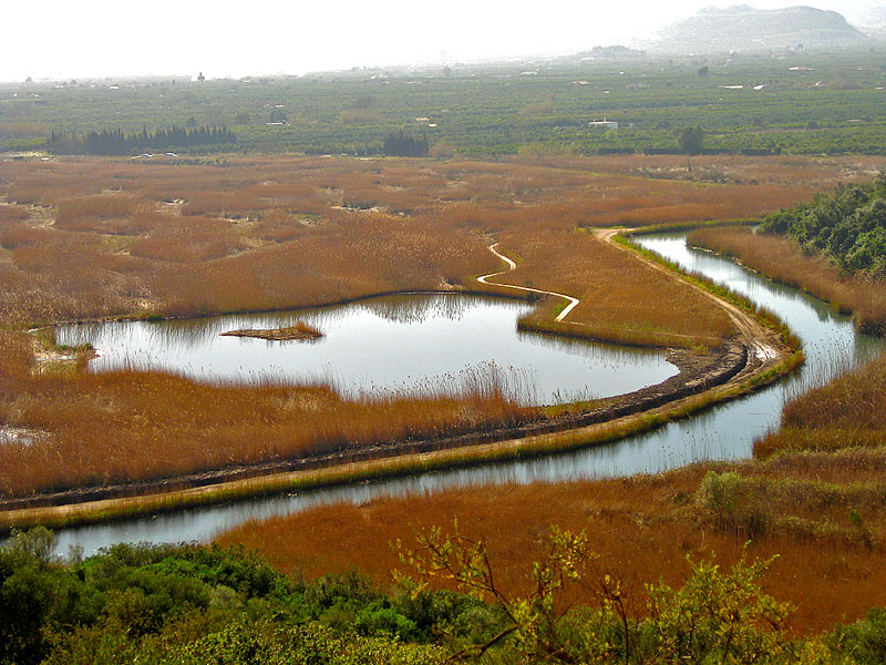
A terrestrial area, with coasts.
What rocks lie beneath Albufera Natural Park?
According to the European 1:1 million geological map (EGDI), the bedrock consists mainly of sands and gravels (100% of sampled points). These are mostly sedimentary rocks. The geological units date mainly from the Quaternary (100% of sampled points).
Which international labels apply to Albufera Natural Park?
Ramsar site and Natura 2000 network (2 sites).
What is there to see in Albufera Natural Park?
2 lakes and ponds, including El Recatí and Lago de la Plana (1 m) (Wikidata).
Are there historic monuments in Albufera Natural Park?
Yes. According to Wikidata, 2 monuments listed as Bien de Interés Cultural stand within the boundary. For example: “Creu de la Llonga” in Sueca and “Torre de Trullàs” in Sollana.
Can you swim in Albufera Natural Park?
21 monitored bathing sites lie in or within 1 km of the site; official 2025 classification: 14 excellent, 3 good, 1 sufficient and 3 poor (European Environment Agency). Swimming is only permitted at the sites and times authorised locally.
What is the nearest large city to Albufera Natural Park?
Nearest towns of over 50,000 people, as the crow flies: Valencia (3 km) and Torrent (8 km). Nearest airport: Valencia (VLC), about 12 km away.
How can I reach Albufera Natural Park by train?
The nearest railway station is el Romaní, less than 1 km from the site boundary.
Where can I get visitor information on site?
Centre d'Interpretació Racó de l'Olla - Parc Natural de l'Albufera, Tourist Info Cullera and Oficina Municipal de Turisme.
Are there waymarked hiking trails in Albufera Natural Park?
Yes. Waymarked hiking routes listed in OpenStreetMap: 3, including Camino de Santiago de Levante, El Camí and Senda de la Lloma. The “CC-C · El Camí IT5TR6 El Camí del Sud: de Dénia a Castelló de la Plana” route runs for about 33 km through the site.
Which species can be seen in Albufera Natural Park?
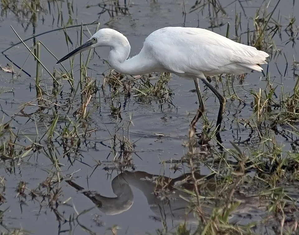
Among the species most often recorded on GBIF are Larus fuscus (Lesser Black-backed Gull), Anas platyrhynchos (Mallard), Egretta garzetta (Little Egret) and Ardea cinerea (Grey Heron).
Who manages Albufera Natural Park?
Generalitat Valenciana.
What is the official website of Albufera Natural Park?
© OpenStreetMap
Download the boundary: GeoJSON · GPX Boundary © OpenStreetMap contributors (ODbL).
Geography
According to the European 1:1 million geological map (EGDI), the bedrock consists mainly of sands and gravels (100% of sampled points). These are mostly sedimentary rocks. The geological units date mainly from the Quaternary (100% of sampled points). The site contains 2 lakes larger than 10 ha, totalling 22.8 km² of water; the largest, Albufera de Valencia, covers 22.7 km² (HydroLAKES).
Area
- Area
- 21,120 ha
- Lakes over 10 ha
- 2 (22.8 km²)
- Coordinates
- 39.2957, -0.3335
Lakes: HydroLAKES (Messager et al. 2016, hydrosheds.org, CC BY 4.0) · depths: Wikidata (CC0)
Bedrock
- Sands and gravels 100 %
Sedimentary rocks 100 % · Main age: Quaternary (100%)
Source: EGDI 1:1M geological map (EuroGeoSurveys and national geological surveys), CC BY 4.0 · 14 sampled points within the site.
Natural habitats
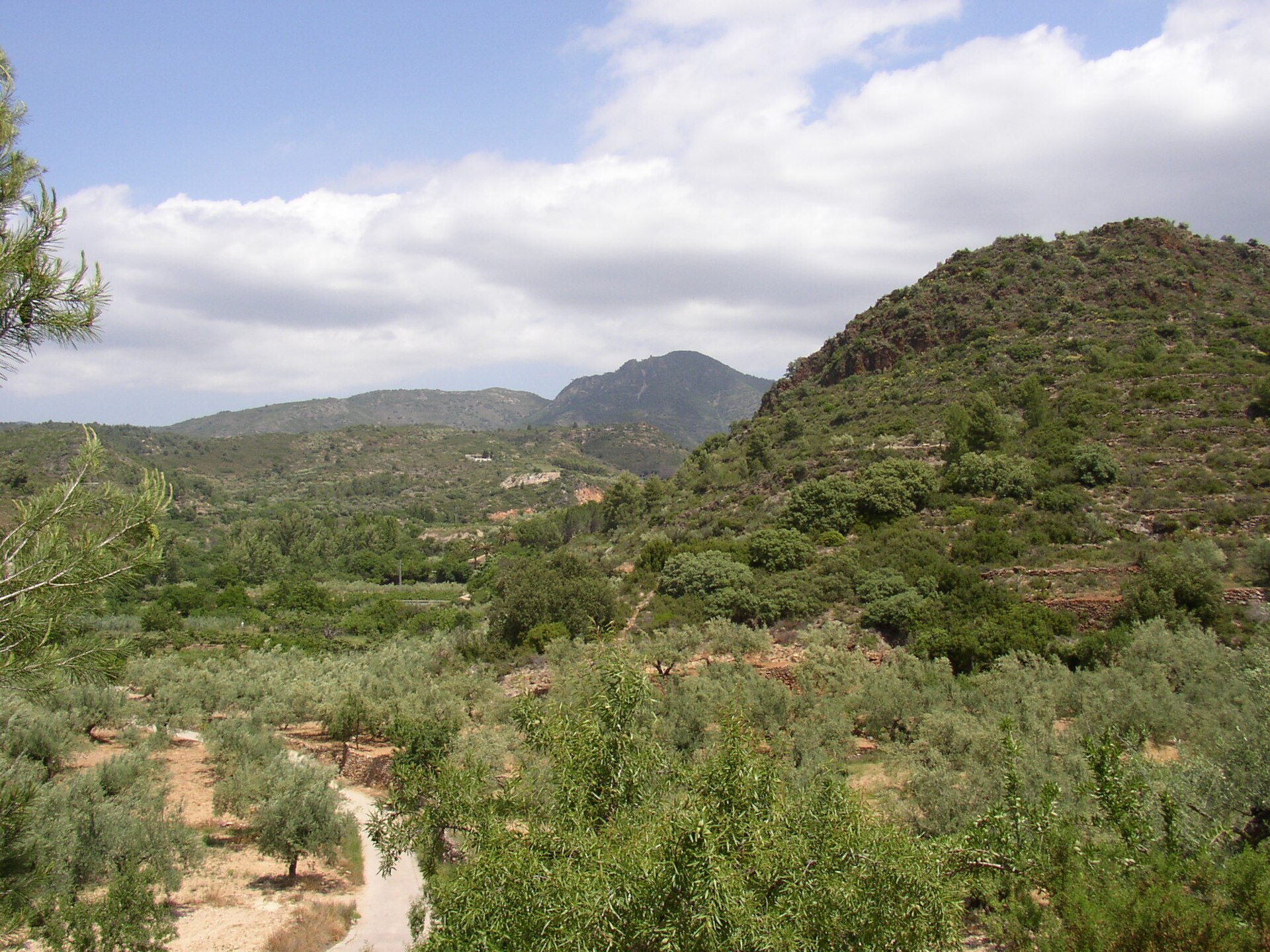
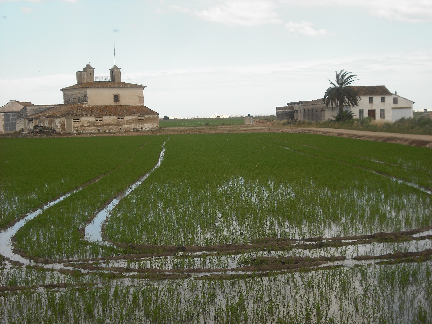
According to CORINE Land Cover (2018), the site is mainly made up of farmland (76%) and marine waters (14%). The site borders the coast. The 2 Natura 2000 sites overlapping the area list 21 habitats of European interest (7 priority), the most extensive being coastal lagoons, hard oligo-mesotrophic waters with benthic vegetation of Chara spp. and sandbanks which are slightly covered by sea water all the time.
Biodiversity
Based on occurrences aggregated by GBIF, several species are regularly recorded within the site. Among the most frequent are Larus fuscus (Lesser Black-backed Gull), Anas platyrhynchos (Mallard), Egretta garzetta (Little Egret) and Ardea cinerea (Grey Heron). The full list of documented taxa is shown below. The overlapping Natura 2000 sites list 103 species of European interest: 91 birds, 4 mammals, 2 reptiles, 3 fish and 3 plants.
Habitats of European interest
From the official forms of the 2 Natura 2000 sites overlapping the area (areas reported for each whole site).
- Coastal lagoons priority 11,915 ha
- Hard oligo-mesotrophic waters with benthic vegetation of Chara spp. 11,037 ha
- Sandbanks which are slightly covered by sea water all the time 6,115 ha
- Posidonia beds (Posidonion oceanicae) priority 3,667 ha
- Wooded dunes with Pinus pinea and/or Pinus pinaster priority 1,464 ha
- Thermo-Mediterranean and pre-desert scrub 1,136 ha
- Mediterranean and thermo-Atlantic halophilous scrubs (Sarcocornetea fruticosi) 586 ha
- Coastal dunes with Juniperus spp. priority 568 ha
and 13 more
Species of European interest
Birds · 91
Great Reed Warbler (Acrocephalus arundinaceus) breeding, Moustached Warbler (Acrocephalus melanopogon) resident, Common Sandpiper (Actitis hypoleucos) wintering, Common Kingfisher (Alcedo atthis) breeding wintering resident, Northern Pintail (Anas acuta) wintering, Eurasian Teal (Anas crecca) wintering, Mallard (Anas platyrhynchos) breeding wintering, Greylag Goose (Anser anser) wintering, Great Egret (Ardea alba) wintering, Grey Heron (Ardea cinerea) breeding wintering, Purple Heron (Ardea purpurea) breeding passage, Squacco Heron (Ardeola ralloides) passage breeding and 79 more
Mammals · 4
Common bent-wing bat (Miniopterus schreibersii), Long-fingered bat (Myotis capaccinii), Greater Horseshoe Bat (Rhinolophus ferrumequinum), Mehely's Horseshoe Bat (Rhinolophus mehelyi)
Reptiles · 2
European Pond Turtle (Emys orbicularis), Iberian pond turtle (Mauremys leprosa)
Fish · 3
Spanish toothcarp (Aphanius iberus), Lamprehuela (Cobitis paludica), Valencia toothcarp (Valencia hispanica)
Plants · 3
Seashore mallow (Kosteletzkya pentacarpos), Lusitanian Water Clover (Marsilea batardae), Water Shamrock (Marsilea quadrifolia)
Source: Natura 2000 standard data forms (EEA, CC-BY 4.0). Not exhaustive: sensitive species are not published.
Species to look out for


Bird
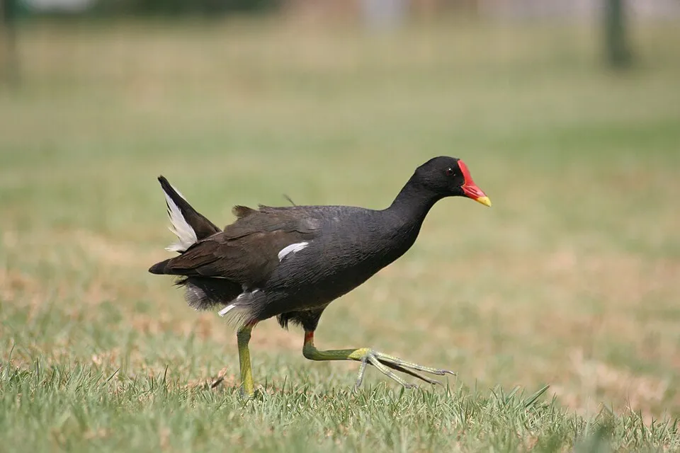
Common Moorhen
Gallinula chloropus8,330 records © Monkey Boy from Johannesburg, South Africa · CC BY-SA 2.0
Observed species
Occurrences documented via GBIF; they are neither an exhaustive inventory nor proof of current presence.
- Lesser Black-backed Gull · Larus fuscus · 16978
- Mallard · Anas platyrhynchos · 11541
- Little Egret · Egretta garzetta · 9797
- Grey Heron · Ardea cinerea · 9492
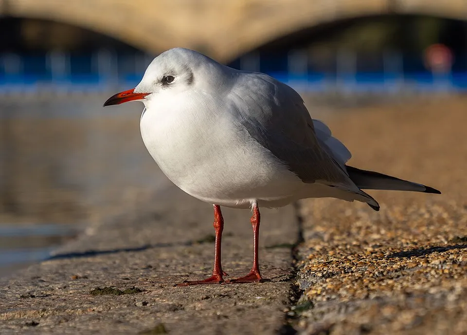
- Black-headed Gull · Chroicocephalus ridibundus · 9261
- Common Moorhen · Gallinula chloropus · 8330
- Black-winged Stilt · Himantopus himantopus · 7961
- Western Marsh Harrier · Circus aeruginosus · 7584
- Greater Flamingo · Phoenicopterus roseus · 7555
- Glossy Ibis · Plegadis falcinellus · 7374
- House Sparrow · Passer domesticus · 7250
- Yellow-legged Gull · Larus michahellis · 6962
Records: GBIF.org (CC-BY). Names: Wikidata (CC0), GBIF. Photos: Wikimedia Commons.
Conservation challenges
The primary purpose of the site is to preserve its natural habitats and the biodiversity they support. The species recorded (Biodiversity tab) reflect its ecological value. The designations it holds frame its management and the control of land use.
According to Global Forest Change data (University of Maryland, Global Forest Watch), about 24 ha of tree cover were lost within the boundary between 2001 and 2023 (under 1% of its area), peaking in 2006 and 2023. These losses include logging, storms and fires, and do not account for regrowth. According to the European CORINE Land Cover inventory (Copernicus), land cover changed on about 263 ha of the site between 1990 and 2018 (1% of its area): farmland shrank by 228 ha, mostly giving way to built-up land. Since 2016, the European EFFIS system (Copernicus) has mapped 4 fires here, burning about 64 ha within the boundary; the largest, in August 2026 (near Valencia), covered 29 ha. At night, 72% of the area gives off artificial light detectable from space (NASA VIIRS Black Marble composite, 2016). Built-up and developed land (buildings, business areas, roads, quarries) covers 5% of the area, and farmland 76% (CORINE Land Cover). According to the Natura 2000 forms, of 20 assessed habitats of European interest, 6 are in excellent condition and 3 in average or reduced condition. According to the Water Framework Directive assessment (2022 river basin management plans, data 2014–2019), both rivers assessed within the site have moderate ecological potential. Other assessed water bodies: lakes, 1 of 2 in good ecological status or better; coastal waters, 2 of 2 in good ecological status or better. Since 2000, 17 invasive alien species have been recorded within the site (GBIF observations), 6 of them listed as of Union concern under EU Regulation 1143/2014. Among them: Threskiornis aethiopicus (African Sacred Ibis), Procambarus clarkii (Red swamp crayfish) and Obama nungara (Obama Flatworm).
Pressure indicators
Tree cover lost
24 ha
2001–2023 · < 1% of the area
20012023
Fires since 2016
64 ha
burned within the boundary (4 mapped fires)
- 2026 · Valencia · 29 ha
- 2024 · Valencia · 21 ha
- 2023 · Valencia · 8 ha
Light at night
72%
of the area gives off artificial light visible from space
DarkLit
Built-up land
5%
buildings, business areas, roads, quarries · farmland 76%
Land cover change
263 ha
changed cover, 1990–2018 · CORINE · 1% of the area
- −228 ha · farmland
Rivers and lakes
0%
of the 11 km of assessed rivers at good or high ecological potential (mostly heavily modified water bodies) · WFD 2022
Lakes: 1 of 2 good or better
Coastal waters: 2 of 2 good or better
assessments 2014–2019
Invasive alien species
17
incl. 6 of EU concern · since 2000
 African Sacred IbisEU
 Red swamp crayfishEU
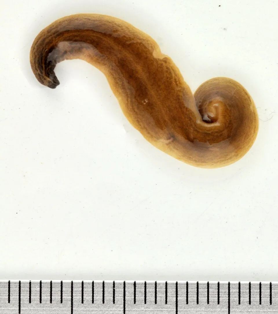 Obama FlatwormEU
 Paper mulberryEU
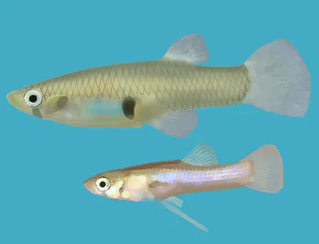 Eastern mosquitofishEU
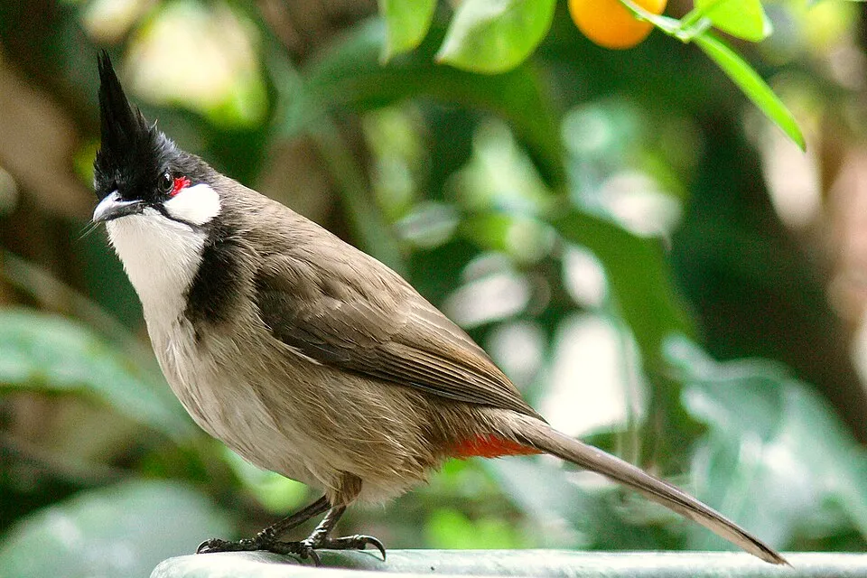 Red-whiskered BulbulEU
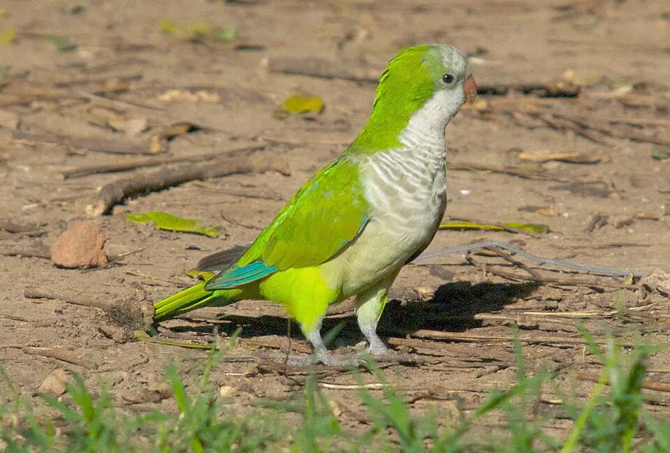 Monk Parakeet
 Bermuda buttercup
Photos: African Sacred Ibis © Steve Garvie from Dunfermline, Fife, Scotland · CC BY-SA 2.0; Red swamp crayfish © MikeMurphy · Public domain; Obama Flatworm © Jean-Lou Justine · CC BY-SA 3.0; Paper mulberry © Didier Descouens · CC BY-SA 4.0; Eastern mosquitofish © Osado · CC BY-SA 3.0; Red-whiskered Bulbul © myjkccd · Public domain; Monk Parakeet © Kevin Jones · CC BY 2.0; Bermuda buttercup © MathKnight and Zachi Evenor אביר המתמטיקה וצחי אבנור · CC BY-SA 4.0
Sources: Global Forest Change (Hansen et al., University of Maryland, via Global Forest Watch, CC-BY 4.0); EFFIS, European Commission / Copernicus; NASA Black Marble 2016 (public domain); CORINE Land Cover 2018 (Copernicus) or MODIS.
CORINE Land Cover Change 1990–2018: generated using European Union's Copernicus Land Monitoring Service information (EEA), aggregated by Parkavela; DOI 10.2909/f30f1000-7cf8-43bb-872c-5eb093911b24.
Ecological status of water bodies: European Environment Agency, WISE – Water Framework Directive, 3rd river basin management plans (2022), CC BY 4.0. Official national classification, not comparable between countries.
Invasive alien species: Global Register of Introduced and Invasive Species (ISSG, CC BY 4.0); Union list, Regulation (EU) 1143/2014 (INBO, CC0); GBIF.org records (CC0 / CC BY 4.0), at least 2 per species.
Practical information
Cities and airport
- Valencia
3 km as the crow flies - Torrent
8 km as the crow flies - Airport: Valencia (VLC)
12 km as the crow flies
Visitor information
- Centre d'Interpretació Racó de l'Olla - Parc Natural de l'Albufera
within the site - Tourist Info Cullera
< 1 km from the site boundary - Oficina Municipal de Turisme
2 km from the site boundary
Hiking
3 waymarked routes listed, including:
Camino de Santiago de LevanteEl CamíSenda de la Lloma
By bike
EV8 · 27 km CidCT Camí del Cid cicloturista · 3 kmVia Augusta de la Comunitat Valenciana · 8 kmCR-500 Valencia - El Saler - Sueca · 6 km
Signed cycle routes: this does not mean that cycling is allowed on footpaths.
Wheelchair access
accessible toilets: 2
Reported by OpenStreetMap contributors (ODbL); check with the park before visiting.
Data © OpenStreetMap contributors (ODbL) · Wikidata (CC0)
Contains information from EuroVelo GPX tracks downloaded from www.EuroVelo.com on 2026-10-22, which is made available here under the Open Database License (ODbL). EuroVelo® is a registered trademark of the ECF. Routes © OpenStreetMap contributors (ODbL), via Waymarked Trails
Waymarked hiking routes
CC-C El Camí IT5TR6 El Camí del Sud: de Dénia a Castelló de la Plana
33.1 km within the site ↗ 6 m↘ 10 m -4–13 m
Tracks © OpenStreetMap contributors (ODbL), clipped to the boundary; elevation gain and profiles computed on the longest section from Mapzen Terrain Tiles (≈ 30 m), indicative only.
Bathing
21 monitored bathing sites in or within 1 km of the site · 2025 classification
Excellent · 14
Good · 3
Sufficient · 1
Poor · 3
- Playa de Cap Blanc Pm1 · sea · Excellent
- Playa de l'Arbre del Gos Pm1 · sea · Excellent
- Playa de la Devesa Pm1 · sea · Excellent
- Playa de la Garrofera Pm1 · sea · Excellent
- Playa de Pinedo Pm1 · sea · Excellent
- Playa del Dossel Pm1 · sea · Excellent
- Playa del Far Pm1 · sea · Excellent
- Playa del Recati Pm1 · sea · Excellent
- Playa del Recati Pm2 · sea · Excellent
- Playa del Saler Pm1 · sea · Excellent
and 11 more
Source: European Environment Agency, official bathing water classification (Directive 2006/7/EC, CC-BY 4.0). Swimming is only permitted at the sites and times authorised locally.
Access and visiting
The nearest railway station is el Romaní, less than 1 km from the site boundary. Nearest towns of over 50,000 people, as the crow flies: Valencia (3 km) and Torrent (8 km). Nearest airport: Valencia (VLC), about 12 km away. About 1.9 million people live within 20 km of the site boundary, 1.4 million of them within 10 km; some 29,000 people are estimated to live inside (GHSL estimate, 2020). This population has grown by about 14% since 2000. Visitor information on site: Centre d'Interpretació Racó de l'Olla - Parc Natural de l'Albufera, Tourist Info Cullera and Oficina Municipal de Turisme. Waymarked hiking routes listed in OpenStreetMap: 3, including Camino de Santiago de Levante, El Camí and Senda de la Lloma. The EuroVelo 8 cycle route (Mediterranean Route) crosses the site for about 27 km, mostly developed and signed; 3 other signed cycle routes also pass through, including “CidCT Camí del Cid cicloturista” and “Via Augusta de la Comunitat Valenciana” (EuroVelo, OpenStreetMap). OpenStreetMap contributors list 2 wheelchair-accessible places: Mirador de la Gola de Pujol and Itinerari històric de la Gola del Pujol; check with the park before visiting. To see: 2 lakes and ponds, including El Recatí and Lago de la Plana (1 m). To plan a visit (access, opening periods, visitor rules), it is best to consult the official information from the managing body (Generalitat Valenciana) and the official website listed in this page's sources.
Source: OpenStreetMap (ODbL), Wikidata (CC0), October 2026.
Built heritage
According to Wikidata, 2 monuments listed as Bien de Interés Cultural stand within the boundary. Examples include “Creu de la Llonga” in Sueca and “Torre de Trullàs” in Sollana.
1 religious building1 castle or fortification
-
Creu de la Llonga
Sueca -
Torre de Trullàs
Sollana
Source: Wikidata (CC0), monuments in each country’s official heritage protection registers, at national or regional level. Each item links to its Wikidata entry.
Wildlife records calendar
JFMAMJJASOND
Birds
Plants
Butterflies & moths
Dragonflies
Mammals
Monthly records published on GBIF (CC-BY), relative to the busiest month; also reflects observer activity.
Gallery
© Enrique Íñiguez Rodríguez (Qoan) · CC BY-SA 3.0
© Mario Modesto Mata · CC BY 3.0
© Marcela Escandell · CC BY-SA 3.0
© Agustín J Peña Irala · CC BY-SA 3.0
© Diego Delso · CC BY-SA 4.0
© Alvaro1984 18 · CC BY-SA 3.0
Sources and licences
- Wikidata: Q2367959
- Official website: http://albufera.valencia.es/
- Wikipedia: en.wikipedia.org/wiki/Albufera_Natural_Park
- WDPA: 15485
References
- land.copernicus.eu: land cover, land cover change, sea share · COPERNICUS
- doi.org: population around the site · CC-BY-4.0
- wikidata.org: official area, establishment date, protected heritage, managing body, official name, nearby cities and airport, access and peaks, lake depths, places to see, official website · CC0-1.0
- eea.europa.eu: bathing water quality, ecological status of waters · CC-BY-4.0
- en.eurovelo.com: EuroVelo cycle routes · ODbL-1.0
- cycling.waymarkedtrails.org: cycle routes · ODbL-1.0
- opentopodata.org: elevations · PD
- forest-fire.emergency.copernicus.eu: wildfires · COPERNICUS
- globalforestwatch.org: tree cover loss · CC-BY-4.0
- gbif.org: seasonality of sightings, invasive alien species, observed species · CC-BY-4.0
- europe-geology.eu: geology · CC-BY-4.0
- hydrosheds.org: lakes · CC-BY-4.0
- natura2000.eea.europa.eu: Natura 2000 habitats and species · CC-BY-4.0
- earthobservatory.nasa.gov: night light · PD
- openstreetmap.org: access and peaks, trail difficulty, wheelchair access · ODbL-1.0
- registry.opendata.aws: detailed relief · PD
- hiking.waymarkedtrails.org: route difficulty · ODbL-1.0
- nsidc.org: snow cover · PD
- wikidata.org: Wikipedia article · CC-BY-SA-4.0
Data © OpenStreetMap contributors (ODbL), Wikidata (CC0) and the sources cited.