Spain · Terrestrial
Pego-Oliva Marsh Natural Park
Nature park of 1,255 hectares in Spain, established in 1995.
Overview
Nature park of 1,255 hectares in Spain, established in 1995.
Pego-Oliva Marsh Natural Park is a nature park in Spain (Europe). It is a predominantly terrestrial area. Established on 9 January 1995, it covers about 1,255 hectares.
Protections and designations
Ramsar site
Natura 2000 · habitats (SAC)
- Marjal de Pego-Oliva ES0000147
Natura 2000 · birds (SPA)
- Marjal de Pego-Oliva (ZEPA) ES0000487
Protected as a nature park. International labels and designations: Ramsar site (“Marjal de Pego-Oliva Natural Park”) and Natura 2000 network (2 sites). Key dates: established in 1995, first Natura 2000 site under the Birds Directive in 1995 and first Natura 2000 site under the Habitats Directive in 2014.
In our collections
Timeline
-
1995
Established
-
1995
First Natura 2000 site under the Birds Directive
-
2014
First Natura 2000 site under the Habitats Directive
Sources: Wikidata (CC0) for establishment and international labels; EEA Natura 2000 database (CC-BY 4.0) for site designation dates.
Frequently asked questions
Where is Pego-Oliva Marsh Natural Park?
In Spain (Europe). Representative point: 38.8667° N, 0.0500° W.
How large is Pego-Oliva Marsh Natural Park?
About 1,255 hectares (13 km²). It is the 71st largest of the 73 nature parks in Spain covered by Parkavela.
When was Pego-Oliva Marsh Natural Park established?
On 9 January 1995.
What habitats and landscapes does Pego-Oliva Marsh Natural Park include?
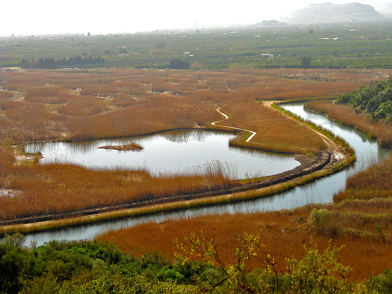
A terrestrial area, with wetlands.
What rocks lie beneath Pego-Oliva Marsh Natural Park?
According to the European 1:1 million geological map (EGDI), recent unconsolidated deposits – sands and gravels (67% of sampled points) – cover most of the site; among the consolidated rocks: marly limestones (33%). These are mostly sedimentary rocks. The geological units date mainly from the Quaternary (67% of sampled points).
Which international labels apply to Pego-Oliva Marsh Natural Park?
Ramsar site (“Marjal de Pego-Oliva Natural Park”) and Natura 2000 network (2 sites).
What is the nearest large city to Pego-Oliva Marsh Natural Park?
Nearest towns of over 50,000 people, as the crow flies: Benidorm (35 km) and Valencia (67 km). Nearest airport: Valencia (VLC), about 74 km away.
How can I reach Pego-Oliva Marsh Natural Park by train?
The nearest railway station is Gandia, about 12 km from the site boundary.
Where can I get visitor information on site?
Tourist Info Pego i les Valls.
Which species can be seen in Pego-Oliva Marsh Natural Park?
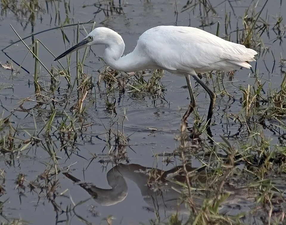
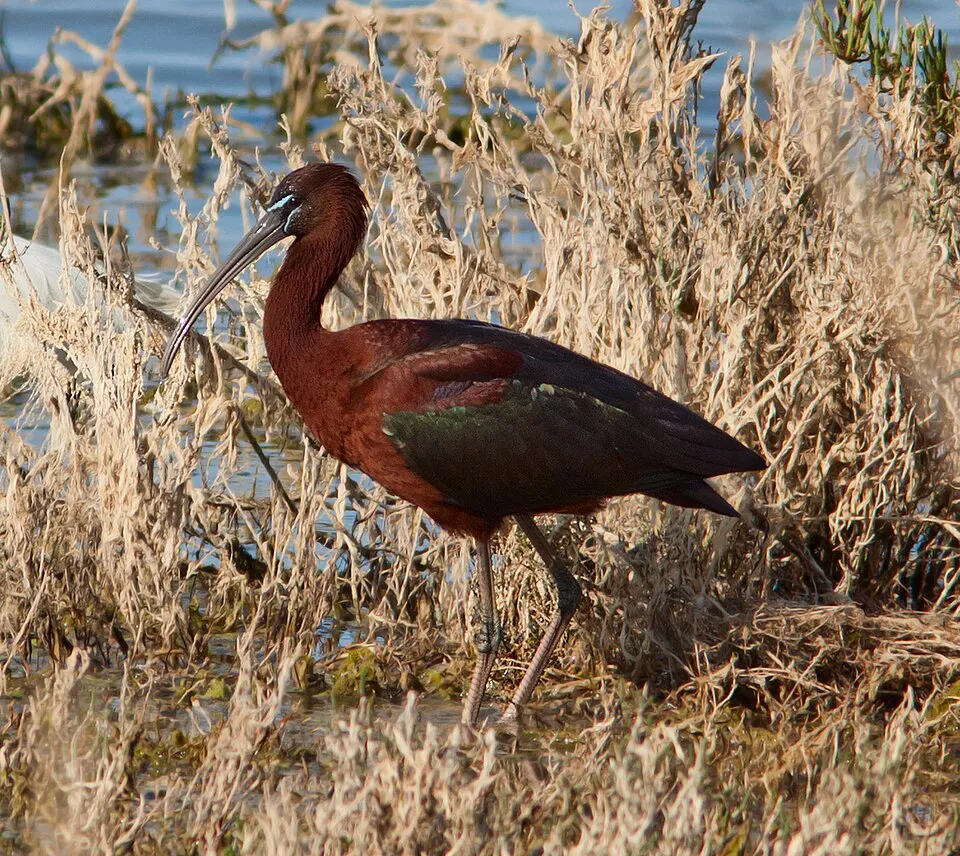
Among the species most often recorded on GBIF are Egretta garzetta (Little Egret), Ardea cinerea (Grey Heron), Plegadis falcinellus (Glossy Ibis) and Gallinula chloropus (Common Moorhen).
© OpenStreetMap
Download the boundary: GeoJSON · GPX Boundary © OpenStreetMap contributors (ODbL).
Geography
According to the European 1:1 million geological map (EGDI), recent unconsolidated deposits – sands and gravels (67% of sampled points) – cover most of the site; among the consolidated rocks: marly limestones (33%). These are mostly sedimentary rocks. The geological units date mainly from the Quaternary (67% of sampled points).
Area
- Area
- 1,255 ha
- Coordinates
- 38.8667, -0.05
Bedrock
- Sands and gravels 67 %
- Marly limestones 33 %
Sedimentary rocks 100 % · Main age: Quaternary (67%)
Source: EGDI 1:1M geological map (EuroGeoSurveys and national geological surveys), CC BY 4.0 · 12 sampled points within the site.
Natural habitats
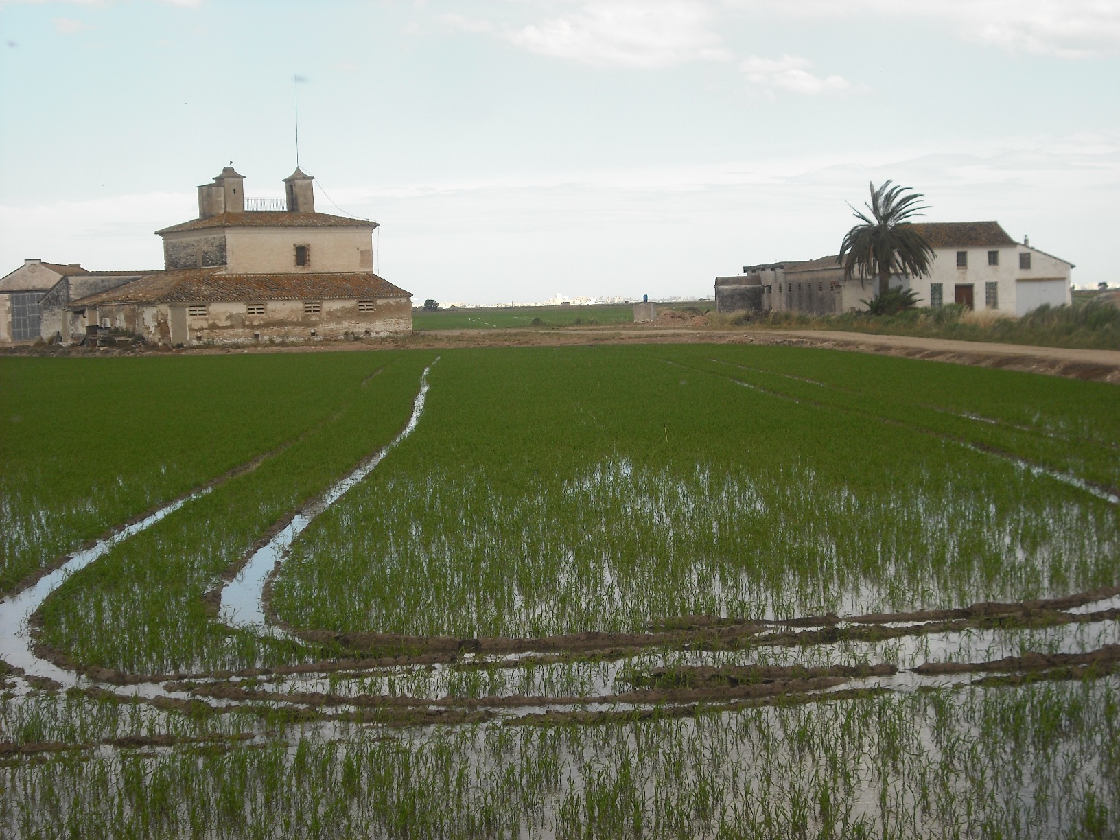
According to CORINE Land Cover (2018), the site is mainly made up of farmland (53%), marshes and bogs (38%) and Mediterranean scrub (6%). The land is almost flat (mean slope under 2°). The 2 Natura 2000 sites overlapping the area list 10 habitats of European interest (3 priority), the most extensive being Mediterranean tall humid grasslands of the Molinio-Holoschoenion, Mediterranean salt meadows (Juncetalia maritimi) and Thermo-Mediterranean and pre-desert scrub.
Biodiversity
Based on occurrences aggregated by GBIF, several species are regularly recorded within the site. Among the most frequent are Egretta garzetta (Little Egret), Ardea cinerea (Grey Heron), Plegadis falcinellus (Glossy Ibis) and Gallinula chloropus (Common Moorhen). The full list of documented taxa is shown below. The overlapping Natura 2000 sites list 83 species of European interest: 80 birds, 2 fish and 1 plant.
Habitats of European interest
From the official forms of the 2 Natura 2000 sites overlapping the area (areas reported for each whole site).
- Mediterranean tall humid grasslands of the Molinio-Holoschoenion 301 ha
- Mediterranean salt meadows (Juncetalia maritimi) 301 ha
- Thermo-Mediterranean and pre-desert scrub 251 ha
- Pseudo-steppe with grasses and annuals of the Thero-Brachypodietea priority 125 ha
- Constantly flowing Mediterranean rivers with Paspalo-Agrostidion species and hanging curtains of Salix and Populus alba 50 ha
- Natural eutrophic lakes with Magnopotamion or Hydrocharition-type vegetation 50 ha
- Rupicolous calcareous or basophilic grasslands of the Alysso-Sedion albi priority 50 ha
- Natural dystrophic lakes and ponds 25 ha
and 2 more
Species of European interest
Birds · 80
Moustached Warbler (Acrocephalus melanopogon) resident, Common Sandpiper (Actitis hypoleucos) passage wintering, Common Kingfisher (Alcedo atthis) resident, Northern Pintail (Anas acuta) wintering, Eurasian Teal (Anas crecca) wintering, Mallard (Anas platyrhynchos) resident breeding wintering, Greylag Goose (Anser anser) wintering, Great Egret (Ardea alba) wintering, Grey Heron (Ardea cinerea) wintering breeding, Purple Heron (Ardea purpurea) breeding wintering, Squacco Heron (Ardeola ralloides) breeding, Ruddy Turnstone (Arenaria interpres) wintering and 68 more
Plants · 1
Source: Natura 2000 standard data forms (EEA, CC-BY 4.0). Not exhaustive: sensitive species are not published.
Species to look out for

Bird
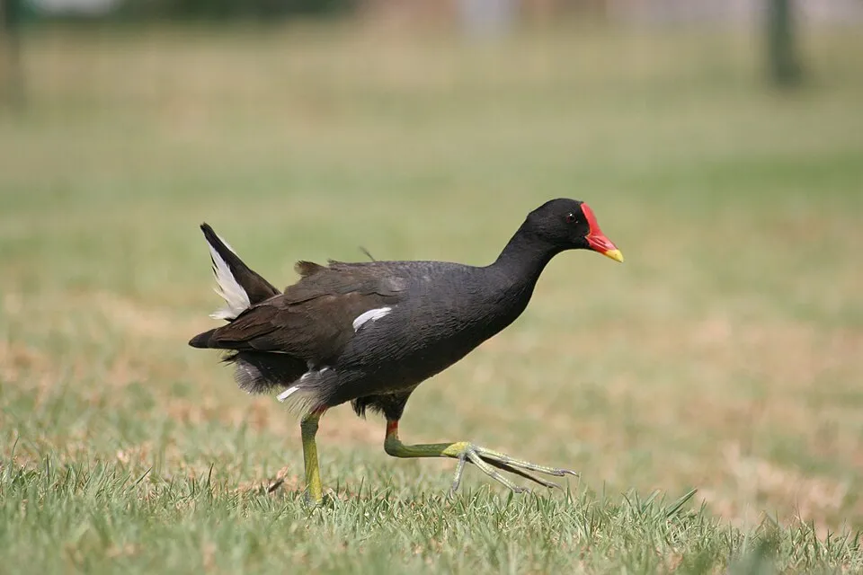
Common Moorhen
Gallinula chloropus894 records © Monkey Boy from Johannesburg, South Africa · CC BY-SA 2.0


Observed species
Occurrences documented via GBIF; they are neither an exhaustive inventory nor proof of current presence.
- Little Egret · Egretta garzetta · 1070
- Grey Heron · Ardea cinerea · 947
- Glossy Ibis · Plegadis falcinellus · 904
- Common Moorhen · Gallinula chloropus · 894
- Western Marsh Harrier · Circus aeruginosus · 842
- House Sparrow · Passer domesticus · 822
- Mallard · Anas platyrhynchos · 762
- Zitting Cisticola · Cisticola juncidis · 727
- Cetti's Warbler · Cettia cetti · 687
- Western Cattle Egret · Bubulcus ibis · 663
- Barn Swallow · Hirundo rustica · 663
- White Wagtail · Motacilla alba · 628
Records: GBIF.org (CC-BY). Names: Wikidata (CC0), GBIF. Photos: Wikimedia Commons.
Conservation challenges
The primary purpose of the site is to preserve its natural habitats and the biodiversity they support. The species recorded (Biodiversity tab) reflect its ecological value. The designations it holds frame its management and the control of land use.
According to the European CORINE Land Cover inventory (Copernicus), land cover changed on about 73 ha of the site between 1990 and 2018 (6% of its area): farmland grew by 73 ha, mostly at the expense of wetlands, while wetlands shrank by 73 ha, mostly giving way to farmland. At night, 100% of the area gives off artificial light detectable from space (NASA VIIRS Black Marble composite, 2016). Built-up and developed land (buildings, business areas, roads, quarries) covers 2% of the area, and farmland 53% (CORINE Land Cover). According to the Natura 2000 forms, all 10 assessed habitats of European interest are in good condition. According to the Water Framework Directive assessment (2022 river basin management plans, data 2014–2019), 60% of the 8 km of rivers assessed within the site are in good or high ecological status. Other assessed water bodies: lakes, 1 of 1 in good ecological status or better. Invasive alien species have been recorded within the site since 2000 (GBIF observations), one of them listed as of Union concern. Among them: Threskiornis aethiopicus (African Sacred Ibis) and Oxalis pes-caprae (Bermuda buttercup).
Pressure indicators
Fires since 2016
0
No large fire mapped (fires over about 30 ha)
Light at night
100%
of the area gives off artificial light visible from space
DarkLit
Built-up land
2%
buildings, business areas, roads, quarries · farmland 53%
Land cover change
73 ha
changed cover, 1990–2018 · CORINE · 6% of the area
- +73 ha · farmland
- −73 ha · wetlands
Rivers and lakes
60%
of the 8 km of assessed rivers in good or high ecological status · WFD 2022
Lakes: 1 of 1 good or better
assessments 2014–2019
Invasive alien species
2
incl. 1 of EU concern · since 2000
 African Sacred Ibis
 Bermuda buttercup
Photos: African Sacred Ibis © Steve Garvie from Dunfermline, Fife, Scotland · CC BY-SA 2.0; Bermuda buttercup © MathKnight and Zachi Evenor אביר המתמטיקה וצחי אבנור · CC BY-SA 4.0
Sources: Global Forest Change (Hansen et al., University of Maryland, via Global Forest Watch, CC-BY 4.0); EFFIS, European Commission / Copernicus; NASA Black Marble 2016 (public domain); CORINE Land Cover 2018 (Copernicus) or MODIS.
CORINE Land Cover Change 1990–2018: generated using European Union's Copernicus Land Monitoring Service information (EEA), aggregated by Parkavela; DOI 10.2909/f30f1000-7cf8-43bb-872c-5eb093911b24.
Ecological status of water bodies: European Environment Agency, WISE – Water Framework Directive, 3rd river basin management plans (2022), CC BY 4.0. Official national classification, not comparable between countries.
Invasive alien species: Global Register of Introduced and Invasive Species (ISSG, CC BY 4.0); Union list, Regulation (EU) 1143/2014 (INBO, CC0); GBIF.org records (CC0 / CC BY 4.0), at least 2 per species.
Practical information
Cities and airport
- Benidorm
35 km as the crow flies - Valencia
67 km as the crow flies - Airport: Valencia (VLC)
74 km as the crow flies
Visitor information
- Tourist Info Pego i les Valls
3 km from the site boundary
Data © OpenStreetMap contributors (ODbL) · Wikidata (CC0)
Access and visiting
The nearest railway station is Gandia, about 12 km from the site boundary. Nearest towns of over 50,000 people, as the crow flies: Benidorm (35 km) and Valencia (67 km). Nearest airport: Valencia (VLC), about 74 km away. About 260,000 people live within 20 km of the site boundary, 95,000 of them within 10 km; some 390 people are estimated to live inside (GHSL estimate, 2020). This population has grown by about 19% since 2000. Visitor information on site: Tourist Info Pego i les Valls. To plan a visit (access, opening periods, visitor rules), it is best to consult the official information from the managing body and the official website listed in this page's sources.
Source: OpenStreetMap (ODbL), Wikidata (CC0), October 2026.
Wildlife records calendar
JFMAMJJASOND
Birds
Plants
Butterflies & moths
Dragonflies
Monthly records published on GBIF (CC-BY), relative to the busiest month; also reflects observer activity.
Gallery
© Espencat · Public domain
© Werner Wilmes · CC BY 2.0
© Kent Wang from London, United Kingdom · CC BY-SA 2.0
© Estela.PM · CC BY-SA 4.0
© Katja Schulz from Washington, D. C., USA · CC BY 2.0
© Kent Wang from London, United Kingdom · CC BY-SA 2.0
Sources and licences
- Wikidata: Q11940161
- OpenStreetMap: relation 2995720
- WDPA: 348926
References
- land.copernicus.eu: land cover, land cover change, sea share · COPERNICUS
- doi.org: population around the site · CC-BY-4.0
- wikidata.org: official area, establishment date, protected heritage, nearby cities and airport, access and peaks, lake depths, places to see · CC0-1.0
- eea.europa.eu: bathing water quality, ecological status of waters · CC-BY-4.0
- en.eurovelo.com: EuroVelo cycle routes · ODbL-1.0
- cycling.waymarkedtrails.org: cycle routes · ODbL-1.0
- opentopodata.org: elevations · PD
- forest-fire.emergency.copernicus.eu: wildfires · COPERNICUS
- globalforestwatch.org: tree cover loss · CC-BY-4.0
- gbif.org: seasonality of sightings, invasive alien species, observed species · CC-BY-4.0
- europe-geology.eu: geology · CC-BY-4.0
- hydrosheds.org: lakes · CC-BY-4.0
- natura2000.eea.europa.eu: Natura 2000 habitats and species · CC-BY-4.0
- openstreetmap.org: official name, access and peaks, trail difficulty · ODbL-1.0
- earthobservatory.nasa.gov: night light · PD
- registry.opendata.aws: detailed relief · PD
- nsidc.org: snow cover · PD
Data © OpenStreetMap contributors (ODbL), Wikidata (CC0) and the sources cited.