France · Marine
Iroise National Nature Reserve
Nature reserve of 39 hectares in France, established in 1992.
Overview
Nature reserve of 39 hectares in France, established in 1992.
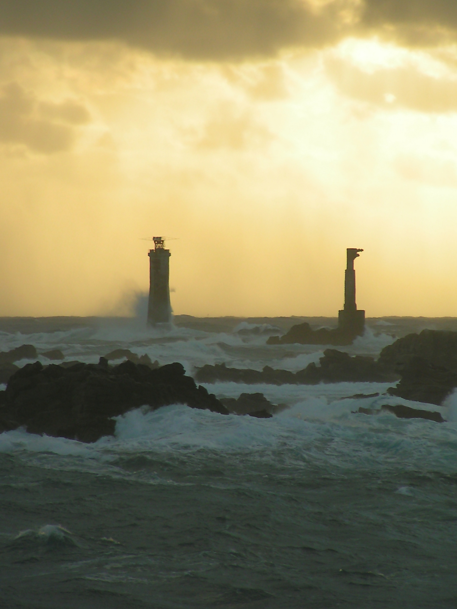
Iroise National Nature Reserve is located in France (Europe). It is a predominantly marine area. Established on 12 October 1992, it covers about 39 hectares. The site is managed by French Agency for Biodiversity.
Protections and designations
Natura 2000 · habitats (SAC)
- Ouessant-Molène FR5300018
Natura 2000 · birds (SPA)
- Ouessant-Molène FR5310072
Protected as a nature reserve. International labels and designations: Natura 2000 network (2 sites). Key dates: established in 1992, first Natura 2000 site under the Birds Directive in 2004 and first Natura 2000 site under the Habitats Directive in 2014.
In our collections
Timeline
-
1992
Established
-
2004
First Natura 2000 site under the Birds Directive
-
2014
First Natura 2000 site under the Habitats Directive
Sources: Wikidata (CC0) for establishment and international labels; EEA Natura 2000 database (CC-BY 4.0) for site designation dates.
Frequently asked questions
Where is Iroise National Nature Reserve?
In France (Europe). Representative point: 48.4006° N, 4.9762° W.
How large is Iroise National Nature Reserve?
About 39 hectares. It is the 105th largest of the 121 nature reserves in France covered by Parkavela.
When was Iroise National Nature Reserve established?
On 12 October 1992.
What habitats and landscapes does Iroise National Nature Reserve include?
A marine area, with wetlands and coasts.
Which international labels apply to Iroise National Nature Reserve?
Natura 2000 network (2 sites).
When is the best time to visit Iroise National Nature Reserve?
Best time to visit: from April to August, with average temperatures of 10 to 17 °C and moderate rainfall.
What is there to see in Iroise National Nature Reserve?
Al Lenn (lake or pond) (OpenStreetMap).
What is the nearest large city to Iroise National Nature Reserve?
Nearest towns of over 50,000 people, as the crow flies: Brest (33 km) and Quimper (75 km). Nearest airport: Brest Bretagne (BES), about 39 km away.
Which species can be seen in Iroise National Nature Reserve?
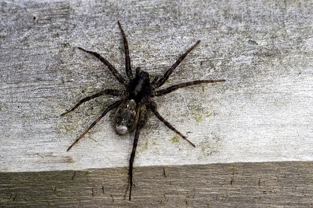
Among the species most often recorded on GBIF are Pachygnatha degeeri (Degeer's Thickjaw), Pardosa nigriceps (Wolf spider), Pardosa pullata (Common Wolf Spider) and Tiso vagans.
Who manages Iroise National Nature Reserve?
French Agency for Biodiversity.
What is the official website of Iroise National Nature Reserve?
parc-marin-iroise.fr/Richesses-naturelles/Archipel-de-Molene
© OpenStreetMap
Download the boundary: GeoJSON · GPX Boundary © OpenStreetMap contributors (ODbL).
Geography
Over the 1996–2025 period, the mean annual temperature is about 12.7 °C and total precipitation reaches roughly 973 mm per year. The warmest month is usually August, the coolest February, and the wettest October.
Area
- Area
- 39.4 ha
- Coordinates
- 48.4006, -4.9762
Climate
● Mean temperature (°C) · ▮ Precipitation (mm)
Source: Copernicus ERA5 (C3S, doi:10.24381/cds.f17050d7), monthly averages 1996–2025 interpolated to the representative point, temperatures adjusted for elevation.
Contains modified Copernicus Climate Change Service information 2026. Neither the European Commission nor ECMWF is responsible for any use that may be made of the Copernicus information or data it contains.
Natural habitats
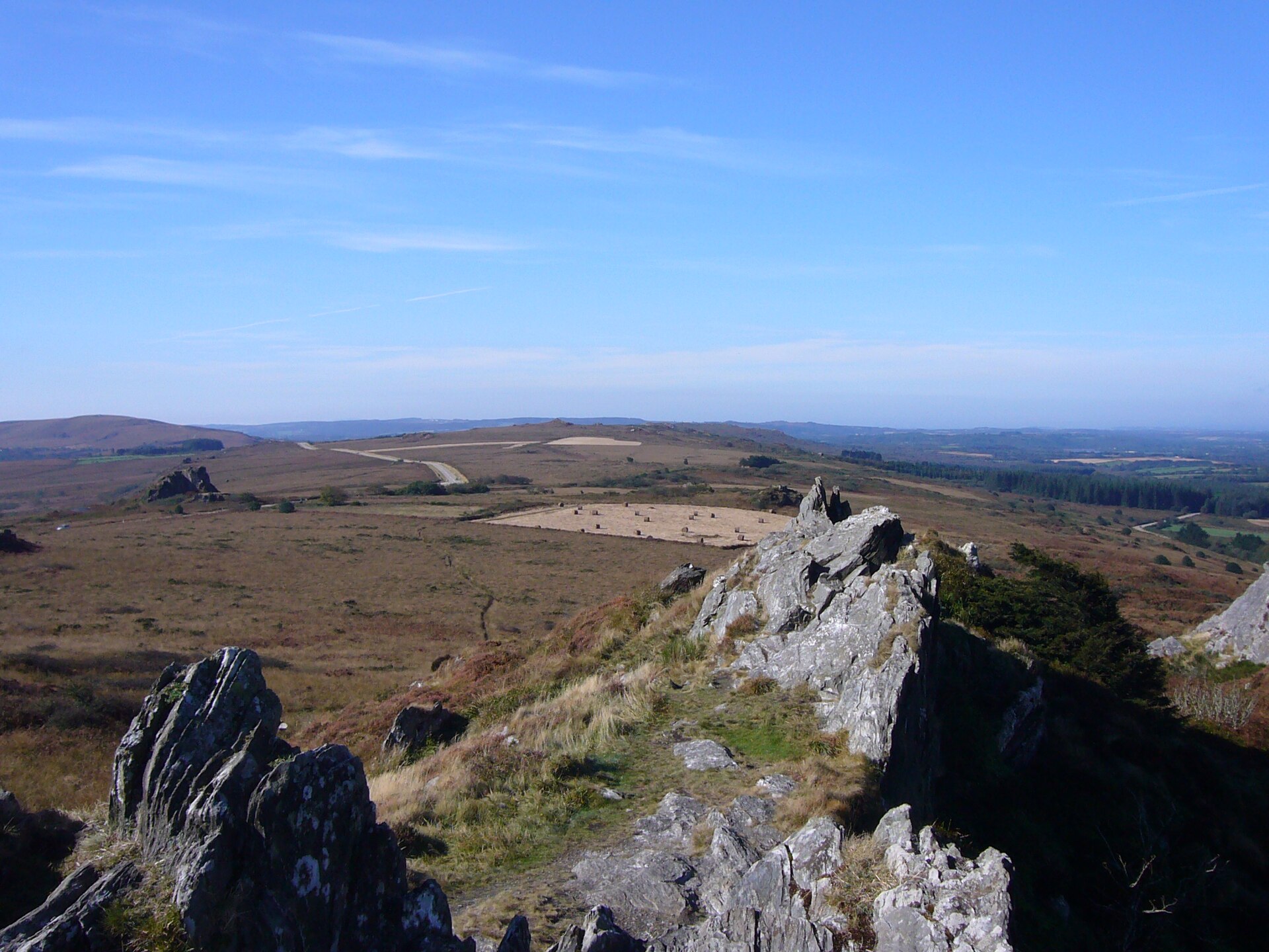
The site is almost entirely marine. The seabed reaches about 7 m deep (median depth 3 m; GEBCO bathymetry). The 2 Natura 2000 sites overlapping the area list 16 habitats of European interest (3 priority), the most extensive being reefs, sandbanks which are slightly covered by sea water all the time and European dry heaths.
Biodiversity
Based on occurrences aggregated by GBIF, several species are regularly recorded within the site. Among the most frequent are Pachygnatha degeeri (Degeer's Thickjaw), Pardosa nigriceps (Wolf spider), Pardosa pullata (Common Wolf Spider) and Tiso vagans. The full list of documented taxa is shown below. The overlapping Natura 2000 sites list 55 species of European interest: 47 birds, 6 mammals and 2 plants.
Habitats of European interest
From the official forms of the 2 Natura 2000 sites overlapping the area (areas reported for each whole site).
- Reefs 46,333 ha
- Sandbanks which are slightly covered by sea water all the time 23,167 ha
- European dry heaths 176 ha
- Vegetated sea cliffs of the Atlantic and Baltic Coasts 135 ha
- Fixed coastal dunes with herbaceous vegetation (‘grey dunes’) priority 18 ha
- Alkaline fens 8 ha
- Annual vegetation of drift lines 4 ha
- Coastal lagoons priority 2 ha
and 8 more
Species of European interest
Birds · 47
Razorbill (Alca torda) passage wintering, Sooty Shearwater (Ardenna grisea) passage, Ruddy Turnstone (Arenaria interpres) wintering passage, Sanderling (Calidris alba) wintering, Purple Sandpiper (Calidris maritima) passage wintering, Scopoli's Shearwater (Calonectris diomedea) passage, Great Skua (Catharacta skua) passage, Common Ringed Plover (Charadrius hiaticula) passage wintering breeding, Western Marsh Harrier (Circus aeruginosus) breeding passage, Little Egret (Egretta garzetta) passage, Peregrine Falcon (Falco peregrinus) wintering breeding passage, Atlantic Puffin (Fratercula arctica) passage breeding and 35 more
Mammals · 6
Barbastelle (Barbastella barbastellus), Grey Seal (Halichoerus grypus), Eurasian otter (Lutra lutra), Harbour porpoise (Phocoena phocoena), Greater Horseshoe Bat (Rhinolophus ferrumequinum), Common bottlenose dolphin (Tursiops truncatus)
Source: Natura 2000 standard data forms (EEA, CC-BY 4.0). Not exhaustive: sensitive species are not published.
Species to look out for

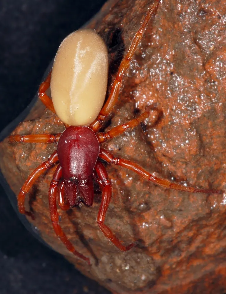
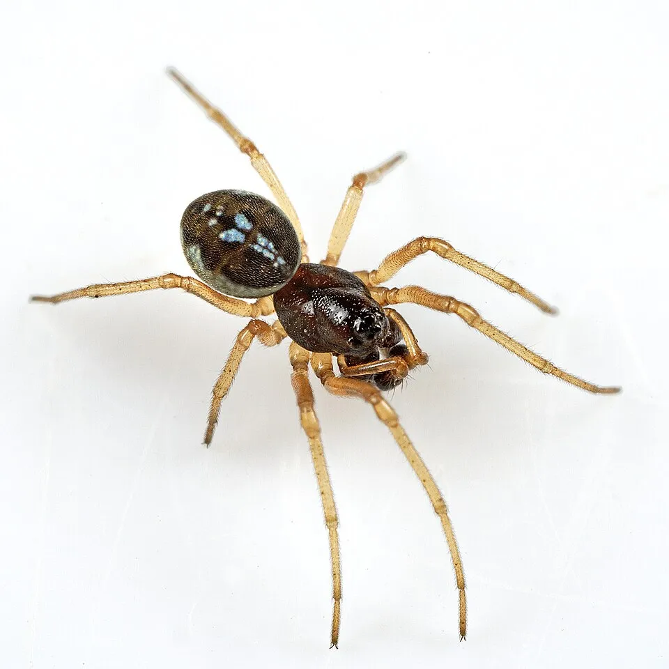
Arachnid
Woodlouse Spider [Dysdera erythrina]
Dysdera erythrina30 records © Fritz Geller-Grimm · CC BY-SA 3.0

Observed species
Occurrences documented via GBIF; they are neither an exhaustive inventory nor proof of current presence.
- Degeer's Thickjaw · Pachygnatha degeeri · 54
- Wolf spider · Pardosa nigriceps · 32
- Common Wolf Spider · Pardosa pullata · 32
- Tiso vagans · 31
- Woodlouse Spider [Dysdera erythrina] · Dysdera erythrina · 30
- European Herring Gull · Larus argentatus · 27
- Trochosa terricola · 26
- Crab spider · Xysticus kochi · 26
- Pardosa proxima · 25
- Agroeca inopina · 23
- Peponocranium ludicrum · 21
- Ceratinella brevis · 21
+18 more species
- Haplodrassus signifer · 19
- Sneak Spider · Harpactea hombergi · 18
- Ozyptila atomaria · 18
- Common Fox Spider · Alopecosa pulverulenta · 16
- Diplostyla concolor · 15
- Stemonyphantes lineatus · 15
- Segestria senoculata · 14
- Xysticus erraticus · 13
- Stone Ground-spider · Drassodes lapidosus · 12
- Black lace-weaver · Amaurobius ferox · 12
- Ozyptila sanctuaria · 12
- Southern Crablet · Ozyptila claveata · 12
- Argenna subnigra · 11
- Ant-Spider · Myrmarachne formicaria · 11
- Zelotes latreillei · 10
- Heath Grasper · Haplodrassus dalmatensis · 10
- Periscope Dwarf Spider · Walckenaeria acuminata · 10
- Sand wolf spider · Arctosa perita · 10
Records: GBIF.org (CC-BY). Names: Wikidata (CC0), GBIF. Photos: Wikimedia Commons.
Conservation challenges
The primary purpose of the site is to preserve its natural habitats and the biodiversity they support. The species recorded (Biodiversity tab) reflect its ecological value. The designations it holds frame its management and the control of land use.
According to the Natura 2000 forms, of 5 assessed habitats of European interest, 3 are in excellent condition and the rest in good condition. According to the Water Framework Directive assessment (2022 river basin management plans, data 2012–2017), water bodies assessed within the site: coastal waters, 1 of 1 in good ecological status or better.
Pressure indicators
Rivers and lakes
Coastal waters: 1 of 1 good or better
assessments 2012–2017
Sources: Global Forest Change (Hansen et al., University of Maryland, via Global Forest Watch, CC-BY 4.0); EFFIS, European Commission / Copernicus; NASA Black Marble 2016 (public domain); CORINE Land Cover 2018 (Copernicus) or MODIS.
Ecological status of water bodies: European Environment Agency, WISE – Water Framework Directive, 3rd river basin management plans (2022), CC BY 4.0. Official national classification, not comparable between countries.
Practical information
Cities and airport
- Brest
33 km as the crow flies - Quimper
75 km as the crow flies - Airport: Brest Bretagne (BES)
39 km as the crow flies
Data © OpenStreetMap contributors (ODbL) · Wikidata (CC0)
Access and visiting
Nearest towns of over 50,000 people, as the crow flies: Brest (33 km) and Quimper (75 km). Nearest airport: Brest Bretagne (BES), about 39 km away. About 23,000 people live within 20 km of the site boundary, 910 of them within 10 km (GHSL estimate, 2020). This population has grown by about 34% since 2000. To see: Al Lenn (lake or pond). To plan a visit (access, opening periods, visitor rules), it is best to consult the official information from the managing body (French Agency for Biodiversity) and the official website listed in this page's sources.
Source: OpenStreetMap (ODbL), Wikidata (CC0), October 2026.
When to visit
Best time to visit: from April to August, with average temperatures of 10 to 17 °C and moderate rainfall. Precipitation peaks from October to December (up to 130 mm per month). Day length ranges from about 8 h 20 min in December to 16 h 05 min in June. Wildlife records published on GBIF peak for birds (October), plants (September) and mammals (July and August). These peaks also reflect when observers are most active.
Source: Copernicus ERA5 (C3S), monthly averages 1996–2025 at the representative point, temperatures adjusted for elevation.
Contains modified Copernicus Climate Change Service information 2026. Neither the European Commission nor ECMWF is responsible for any use that may be made of the Copernicus information or data it contains.
Wildlife records calendar
JFMAMJJASOND
Birds
Plants
Mammals
Monthly records published on GBIF (CC-BY), relative to the busiest month; also reflects observer activity.
Gallery
© Ccarnot · CC BY-SA 3.0
© Julien Carnot · CC BY-SA 3.0
© Carsten Steger · CC BY-SA 4.0
© Jymm · Public domain
© Julien Carnot · CC BY-SA 2.0
© Julien Carnot · CC BY-SA 3.0
Sources and licences
- Wikidata: Q2385242
- OpenStreetMap: relation 1066659
- Official website: http://www.parc-marin-iroise.fr/Richesses-naturelles/Archipel-de-Molene/
- Wikipedia: en.wikipedia.org/wiki/Iroise_National_Nature_Reserve
- WDPA: 62713
References
- cds.climate.copernicus.eu: climate · CC-BY-4.0
- registry.opendata.aws: elevation of the reference point · PD
- land.copernicus.eu: land cover, land cover change, sea share · COPERNICUS
- doi.org: population around the site · CC-BY-4.0
- wikidata.org: official area, establishment date, managing body, official name, nearby cities and airport, access and peaks, places to see, official website · CC0-1.0
- eea.europa.eu: bathing water quality, ecological status of waters · CC-BY-4.0
- gebco.net: depths · PD
- opentopodata.org: elevations · PD
- gbif.org: seasonality of sightings, invasive alien species, observed species · CC-BY-4.0
- pop.culture.gouv.fr: protected heritage · LO-2.0
- natura2000.eea.europa.eu: Natura 2000 habitats and species · CC-BY-4.0
- openstreetmap.org: access and peaks, places to see · ODbL-1.0
- wikidata.org: Wikipedia article · CC-BY-SA-4.0
Data © OpenStreetMap contributors (ODbL), Wikidata (CC0) and the sources cited.