
Hungary · Terrestrial
Körös-Maros National Park
National park of 51,333 hectares in Hungary, established in 1997.
Overview
National park of 51,333 hectares in Hungary, established in 1997.
Körös-Maros National Park is located in Hungary (Europe). It is a predominantly terrestrial area. Established in 1997, it covers about 51,333 hectares.
Protections and designations
Ramsar site
Natura 2000 · habitats (SAC) · 4 sites
- Bélmegyeri Fás-puszta HUKM20013
- Cserebökény HUKM20027
- Gyula-szabadkígyósi gyepek HUKM20010
- Hódmezővásárhely környéki és csanádi-háti puszták HUKM20001
Natura 2000 · birds (SPA) · 3 sites
- Cserebökényi-puszták HUKM10005
- Hódmezővásárhely környéki és csanádi-háti puszták HUKM10004
- Kígyósi-puszta HUKM10001
Protected as a national park. International labels and designations: Ramsar site (“Lake Fehér at Kardoskút”) and Natura 2000 network (7 sites). Key dates: established in 1997, first Natura 2000 site under the Birds Directive in 2004 and first Natura 2000 site under the Habitats Directive in 2010.
In our collections
Timeline
-
1997
Established
-
2004
First Natura 2000 site under the Birds Directive 3 such sites designated up to 2004
-
2010
First Natura 2000 site under the Habitats Directive 4 such sites designated up to 2010
Sources: Wikidata (CC0) for establishment and international labels; EEA Natura 2000 database (CC-BY 4.0) for site designation dates.
Frequently asked questions
Where is Körös-Maros National Park?
In Hungary (Europe). Representative point: 46.5731° N, 21.1172° E.
How large is Körös-Maros National Park?
About 51,333 hectares (513 km²). It is the 3rd largest of the 8 national parks in Hungary covered by Parkavela.
When was Körös-Maros National Park established?
In 1997.
What habitats and landscapes does Körös-Maros National Park include?
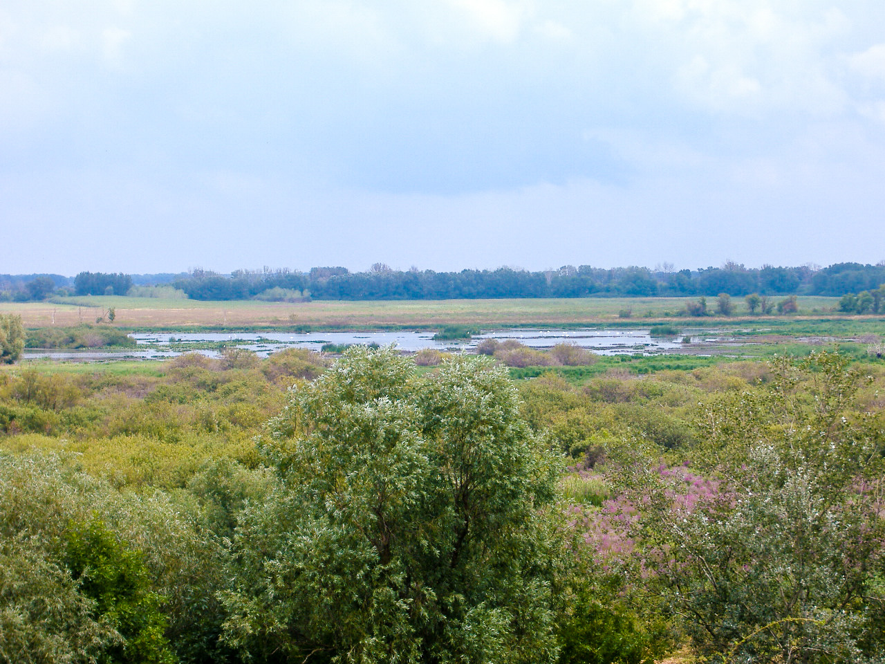
A terrestrial area, where land cover is dominated by grassland and meadows (69%).
Which international labels apply to Körös-Maros National Park?
Ramsar site (“Lake Fehér at Kardoskút”) and Natura 2000 network (7 sites).
When is the best time to visit Körös-Maros National Park?
Best time to visit: from April to October, with average temperatures of 12 to 24 °C and moderate rainfall.
What is there to see in Körös-Maros National Park?
Kardoskúti Fehér-tó (lake or pond, 85 m) (Wikidata).
What is the nearest large city to Körös-Maros National Park?
Nearest towns of over 50,000 people, as the crow flies: Békéscsaba (9 km) and Szeged (34 km). Nearest airport: Debrecen (DEB), about 66 km away.
How can I reach Körös-Maros National Park by train?
Szabadkígyós railway station lies within the site.
Are there waymarked hiking trails in Körös-Maros National Park?
Yes. Waymarked hiking routes listed in OpenStreetMap: 4, including E 4, Alföldi Kéktúra, P (Fehérháti and Z (Fáspuszta.
Which species can be seen in Körös-Maros National Park?
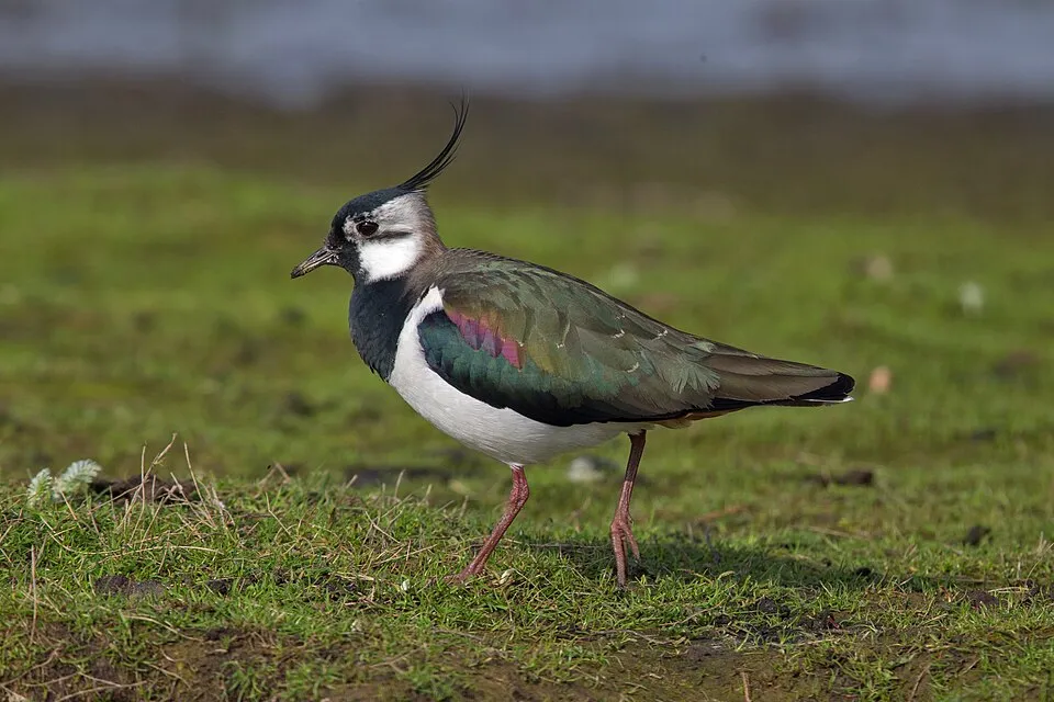
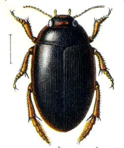
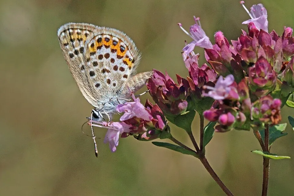
Among the species most often recorded on GBIF are Grus grus (Common Crane), Vanellus vanellus (Northern Lapwing), Agabus uliginosus and Plebejus argus (Silver-studded Blue).
What is the official website of Körös-Maros National Park?
© OpenStreetMap
Download the boundary: GeoJSON · GPX Boundary © OpenStreetMap contributors (ODbL).
Geography
The representative point of the site lies at around 86 m above sea level. Over the 1996–2025 period, the mean annual temperature is about 12.2 °C and total precipitation reaches roughly 664 mm per year. The warmest month is usually July, the coolest January, and the wettest June.
Area
- Area
- 51,333 ha
- Elevation
- 86 m
- Coordinates
- 46.5731, 21.1172
Climate
● Mean temperature (°C) · ▮ Precipitation (mm)
Source: Copernicus ERA5-Land (C3S, doi:10.24381/cds.68d2bb30), monthly averages 1996–2025 interpolated to the representative point, temperatures adjusted for elevation.
Contains modified Copernicus Climate Change Service information 2026. Neither the European Commission nor ECMWF is responsible for any use that may be made of the Copernicus information or data it contains.
Snow cover measured by satellite
J
F
M
A
M
J
J
A
S
O
N
D
average share of the site under snow · snowiest parts · ≈ 10 days a year
Snow cover: MODIS/Terra MOD10CM v61 (Hall & Riggs, 2021, NASA NSIDC DAAC, doi:10.5067/MODIS/MOD10CM.061), imagery from NASA GIBS (ESDIS); 2015–2025 average, grid of about 5 km.
Natural habitats
According to CORINE Land Cover (2018), the site is mainly made up of grassland and meadows (69%) and farmland (24%). The land is almost flat (mean slope under 2°). The 7 Natura 2000 sites overlapping the area list 5 habitats of European interest (3 priority), the most extensive being Pannonic salt steppes and salt marshes, Pannonic loess steppic grasslands and alluvial meadows of river valleys of the Cnidion dubii.
Biodiversity
Based on occurrences aggregated by GBIF, several species are regularly recorded within the site. Among the most frequent are Grus grus (Common Crane), Vanellus vanellus (Northern Lapwing), Agabus uliginosus and Plebejus argus (Silver-studded Blue). The full list of documented taxa is shown below. The overlapping Natura 2000 sites list 93 species of European interest: 55 birds, 11 mammals, 2 reptiles, 7 amphibians, 3 fish, 13 invertebrates and 2 plants.
Habitats of European interest
From the official forms of the 7 Natura 2000 sites overlapping the area (areas reported for each whole site).
- Pannonic salt steppes and salt marshes priority 21,338 ha
- Pannonic loess steppic grasslands priority 2,342 ha
- Alluvial meadows of river valleys of the Cnidion dubii 222 ha
- Riparian mixed forests of Quercus robur, Ulmus laevis and Ulmus minor, Fraxinus excelsior or Fraxinus angustifolia, along the great rivers (Ulmenion minoris) 66 ha
- Euro-Siberian steppic woods with Quercus spp. priority 53 ha
Species of European interest
Birds · 55
Eurasian Teal (Anas crecca) passage, Mallard (Anas platyrhynchos) breeding passage, Anas strepera strepera breeding, Greater white-fronted goose (Anser albifrons) passage, Greylag Goose (Anser anser) passage breeding, Tawny Pipit (Anthus campestris) breeding, Eastern Imperial Eagle (Aquila heliaca) passage resident, Great Egret (Ardea alba) passage breeding, Purple Heron (Ardea purpurea) breeding, Squacco Heron (Ardeola ralloides) passage, Short-eared Owl (Asio flammeus) breeding passage, Common Pochard (Aythya ferina) breeding and 43 more
Mammals · 11
Barbastelle (Barbastella barbastellus), Eurasian otter (Lutra lutra), Hazel dormouse (Muscardinus avellanarius), Steppe Polecat (Mustela eversmanii), Bechstein's bat (Myotis bechsteinii), Lesser mouse-eared myotis (Myotis blythii), Pond bat (Myotis dasycneme), Geoffroy's bat (Myotis emarginatus), Greater mouse-eared bat (Myotis myotis), Greater Horseshoe Bat (Rhinolophus ferrumequinum), European ground squirrel (Spermophilus citellus)
Reptiles · 2
European Pond Turtle (Emys orbicularis), Sand lizard (Lacerta agilis)
Amphibians · 7
European fire-bellied toad (Bombina bombina), European green toad (Bufo viridis), Common tree frog (Hyla arborea), Common Spadefoot (Pelobates fuscus), Edible frog (Rana esculenta), Pool frog (Rana lessonae), Danube Crested Newt (Triturus dobrogicus)
Fish · 3
Spined loach (Cobitis taenia), Weatherfish (Misgurnus fossilis), Rhodeus sericeus amarus
Invertebrates · 13
Bolbelasmus unicornis, Catopta thrips, Greater Capricorn Beetle (Cerambyx cerdo), Cucujus cinnaberinus, Dioszeghyana schmidtii, Eastern Eggar (Eriogaster catax), Fisher's estuarine moth (Gortyna borelii lunata), Roman Snail (Helix pomatia), Hygromia kovacsi, Keeled Plump Bush-cricket (Isophya costata), Stag beetle (Lucanus cervus), Large copper (Lycaena dispar) and 1 more
Plants · 2
Cirsium brachycephalum, Water Shamrock (Marsilea quadrifolia)
Source: Natura 2000 standard data forms (EEA, CC-BY 4.0). Not exhaustive: sensitive species are not published.
Species to look out for
Observed species
Occurrences documented via GBIF; they are neither an exhaustive inventory nor proof of current presence.
- Common Crane · Grus grus · 31
- Northern Lapwing · Vanellus vanellus · 31
- Agabus uliginosus · 31
- Silver-studded Blue · Plebejus argus · 30
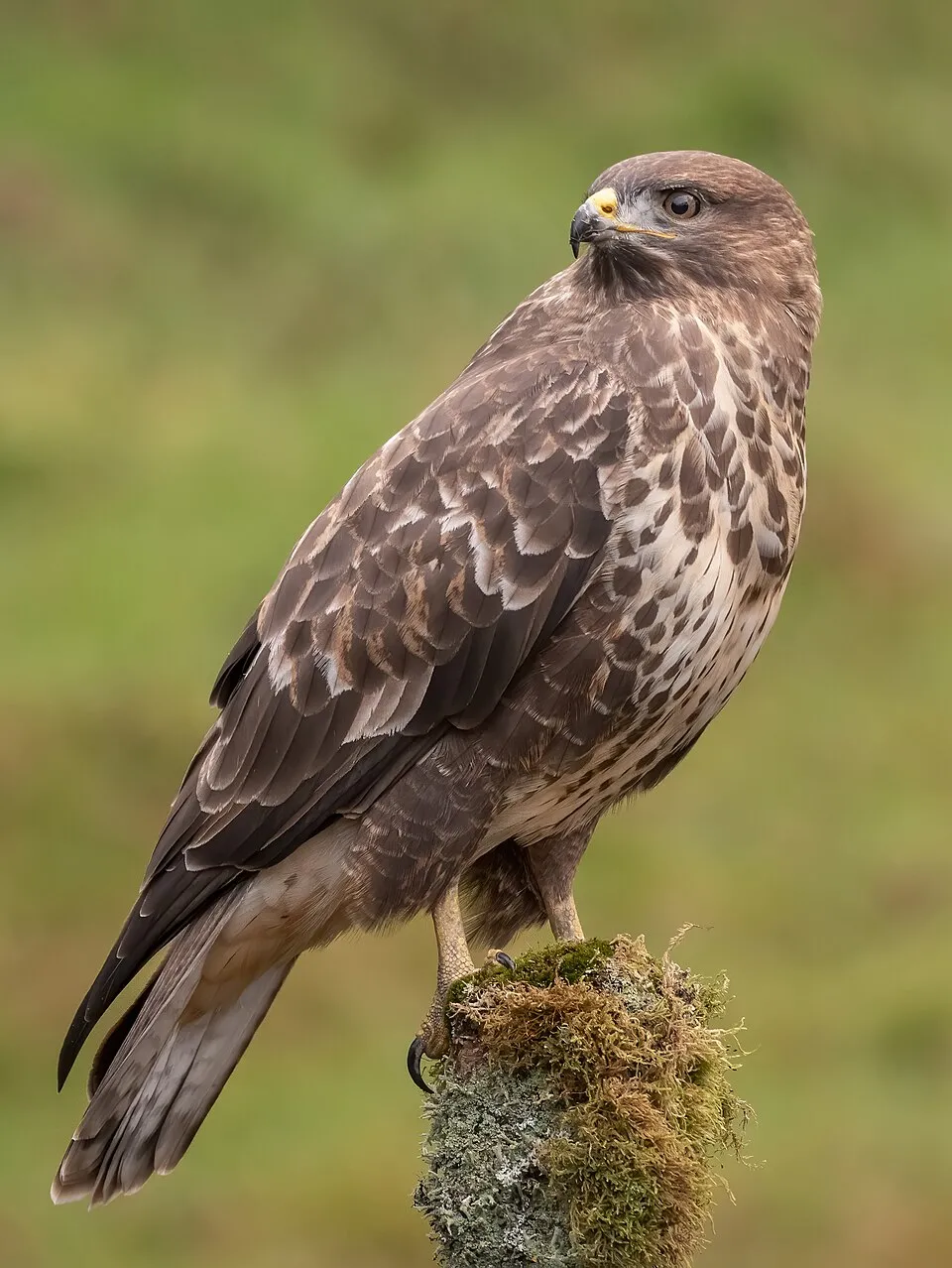
- Common Buzzard · Buteo buteo · 28
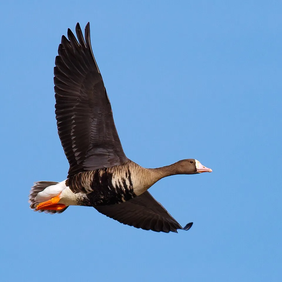
- Greater white-fronted goose · Anser albifrons · 27
- Common Kestrel · Falco tinnunculus · 25
- Hen Harrier · Circus cyaneus · 21
- Hooded Crow · Corvus cornix · 19
- Western Marsh Harrier · Circus aeruginosus · 18
- Mallard · Anas platyrhynchos · 18
- Common Starling · Sturnus vulgaris · 18
+18 more species
- Eastern Imperial Eagle · Aquila heliaca · 17
- Eurasian Curlew · Numenius arquata · 17
- Corn Bunting · Emberiza calandra · 15
- European Golden Plover · Pluvialis apricaria · 14
- Great Egret · Ardea alba · 14
- White-tailed Eagle · Haliaeetus albicilla · 13
- Common blue · Polyommatus icarus · 13
- Small Heath · Coenonympha pamphilus · 12
- Rough-legged Buzzard · Buteo lagopus · 12
- European Goldfinch · Carduelis carduelis · 12
- Greylag Goose · Anser anser · 12
- Eurasian Magpie · Pica pica · 12
- Ruff · Calidris pugnax · 12
- Rook · Corvus frugilegus · 11
- Reed Bunting · Emberiza schoeniclus · 11
- Black-headed Gull · Chroicocephalus ridibundus · 11
- Brown argus · Aricia agestis · 10
- Eurasian Teal · Anas crecca · 10
Records: GBIF.org (CC-BY). Names: Wikidata (CC0), GBIF. Photos: Wikimedia Commons.
Conservation challenges
The primary purpose of the site is to preserve its natural habitats and the biodiversity they support. The species recorded (Biodiversity tab) reflect its ecological value. The designations it holds frame its management and the control of land use.
According to Global Forest Change data (University of Maryland, Global Forest Watch), about 26 ha of tree cover were lost within the boundary between 2001 and 2023, peaking in 2006 and 2007. These losses include logging, storms and fires, and do not account for regrowth. According to the European CORINE Land Cover inventory (Copernicus), land cover changed on about 188 ha of the site between 1990 and 2018 (1% of its area): farmland shrank by 188 ha, mostly giving way to open natural land, while open natural land grew by 152 ha, mostly at the expense of farmland. Since 2016, the European EFFIS system (Copernicus) has mapped 3 fires here, burning about 282 ha within the boundary; the largest, in July 2021 (near Székkutas), covered 238 ha. At night, the area gives off virtually no artificial light detectable from space (NASA VIIRS Black Marble composite, 2016). According to the Natura 2000 forms, all 5 assessed habitats of European interest are in good condition. According to the Water Framework Directive assessment (2022 river basin management plans, data 2013–2019), only 39% of the 7 km of rivers assessed within the site are in good or high ecological potential; the others mostly have moderate ecological potential. Other assessed water bodies: lakes, 1 of 1 in good ecological status or better.
Pressure indicators
Tree cover lost
26 ha
2001–2023 · < 1% of the area
20012023
Fires since 2016
282 ha
burned within the boundary (3 mapped fires)
- 2021 · Székkutas · 238 ha
- 2021 · Szabadkígyós · 37 ha
- 2026 · Hódmezővásárhely · 7 ha
Light at night
0%
of the area gives off artificial light visible from space
DarkLit
Land cover change
188 ha
changed cover, 1990–2018 · CORINE · 1% of the area
- −188 ha · farmland
- +152 ha · open natural land
Rivers and lakes
39%
of the 7 km of assessed rivers at good or high ecological potential (mostly heavily modified water bodies) · WFD 2022
Lakes: 1 of 1 good or better
assessments 2013–2019
Sources: Global Forest Change (Hansen et al., University of Maryland, via Global Forest Watch, CC-BY 4.0); EFFIS, European Commission / Copernicus; NASA Black Marble 2016 (public domain); CORINE Land Cover 2018 (Copernicus) or MODIS.
CORINE Land Cover Change 1990–2018: generated using European Union's Copernicus Land Monitoring Service information (EEA), aggregated by Parkavela; DOI 10.2909/f30f1000-7cf8-43bb-872c-5eb093911b24.
Ecological status of water bodies: European Environment Agency, WISE – Water Framework Directive, 3rd river basin management plans (2022), CC BY 4.0. Official national classification, not comparable between countries.
Practical information
Cities and airport
- Békéscsaba
9 km as the crow flies - Szeged
34 km as the crow flies - Airport: Debrecen (DEB)
66 km as the crow flies
Parking
2 public car parks listed within the site
Hiking
4 waymarked routes listed, including:
E 4Alföldi KéktúraP (FehérhátiZ (Fáspuszta
Data © OpenStreetMap contributors (ODbL) · Wikidata (CC0)
Waymarked hiking routes
P (Fehérháti - Hosszú-fok - Sárgagát - Bélmegyer)
2.8 km within the site ↗ 0 m↘ 0 m 80–87 m
Tracks © OpenStreetMap contributors (ODbL), clipped to the boundary; elevation gain and profiles computed on the longest section from Mapzen Terrain Tiles (≈ 30 m), indicative only.
Access and visiting
Szabadkígyós railway station lies within the site. Nearest towns of over 50,000 people, as the crow flies: Békéscsaba (9 km) and Szeged (34 km). Nearest airport: Debrecen (DEB), about 66 km away. About 410,000 people live within 20 km of the site boundary, 180,000 of them within 10 km; some 550 people are estimated to live inside (GHSL estimate, 2020). This population has fallen by about 16% since 2000. Public car parks listed within the site: 2. Waymarked hiking routes listed in OpenStreetMap: 4, including E 4, Alföldi Kéktúra, P (Fehérháti and Z (Fáspuszta. To see: Kardoskúti Fehér-tó (lake or pond, 85 m). To plan a visit (access, opening periods, visitor rules), it is best to consult the official information from the managing body and the official website listed in this page's sources.
Source: OpenStreetMap (ODbL), Wikidata (CC0), October 2026.
When to visit
Best time to visit: from April to October, with average temperatures of 12 to 24 °C and moderate rainfall. Snow only makes brief appearances in winter (about 10 days a year on average, MODIS satellites 2015–2025). Day length ranges from about 8 h 35 min in December to 15 h 48 min in June. Wildlife records published on GBIF peak for birds (April), plants (April), butterflies and moths (July) and dragonflies (May and June). These peaks also reflect when observers are most active.
Source: Copernicus ERA5-Land (C3S), monthly averages 1996–2025 at the representative point, temperatures adjusted for elevation.
Contains modified Copernicus Climate Change Service information 2026. Neither the European Commission nor ECMWF is responsible for any use that may be made of the Copernicus information or data it contains.
Wildlife records calendar
JFMAMJJASOND
Birds
Plants
Butterflies & moths
Dragonflies
Monthly records published on GBIF (CC-BY), relative to the busiest month; also reflects observer activity.
Gallery
© László Szalai (Beyond silence) · Public domain
© Batomi · CC BY-SA 3.0
© Civertan · CC BY-SA 2.5
© Beata66 · CC BY-SA 2.5
© Turovszki Krisztián · Public domain
© Laszlo Kulisics · CC BY-SA 3.0
Sources and licences
- Wikidata: Q897349
- OpenStreetMap: relation 9581763
- Official website: http://www.kmnp.hu/
- Wikipedia: en.wikipedia.org/wiki/Körös-Maros_National_Park
- WDPA: 178326
References
- cds.climate.copernicus.eu: climate · CC-BY-4.0
- registry.opendata.aws: elevation of the reference point, detailed relief · PD
- land.copernicus.eu: land cover, land cover change, sea share · COPERNICUS
- doi.org: population around the site · CC-BY-4.0
- wikidata.org: official area, establishment date, protected heritage, nearby cities and airport, access and peaks, lake depths, places to see, official website · CC0-1.0
- eea.europa.eu: bathing water quality, ecological status of waters · CC-BY-4.0
- en.eurovelo.com: EuroVelo cycle routes · ODbL-1.0
- cycling.waymarkedtrails.org: cycle routes · ODbL-1.0
- opentopodata.org: elevations · PD
- forest-fire.emergency.copernicus.eu: wildfires · COPERNICUS
- globalforestwatch.org: tree cover loss · CC-BY-4.0
- gbif.org: seasonality of sightings, invasive alien species, observed species · CC-BY-4.0
- europe-geology.eu: geology · CC-BY-4.0
- hydrosheds.org: lakes · CC-BY-4.0
- natura2000.eea.europa.eu: Natura 2000 habitats and species · CC-BY-4.0
- openstreetmap.org: official name, access and peaks, trail difficulty · ODbL-1.0
- earthobservatory.nasa.gov: night light · PD
- hiking.waymarkedtrails.org: route difficulty · ODbL-1.0
- nsidc.org: snow cover · PD
- wikidata.org: Wikipedia article · CC-BY-SA-4.0
Data © OpenStreetMap contributors (ODbL), Wikidata (CC0) and the sources cited.