
France · Terrestrial
Marais de Lavours National Nature Reserve
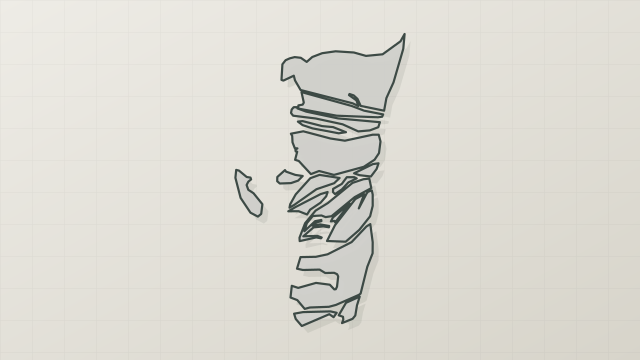
Nature reserve of 473 hectares in France, established in 1984.
Overview
Nature reserve of 473 hectares in France, established in 1984.
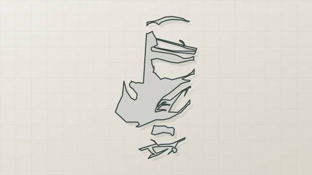
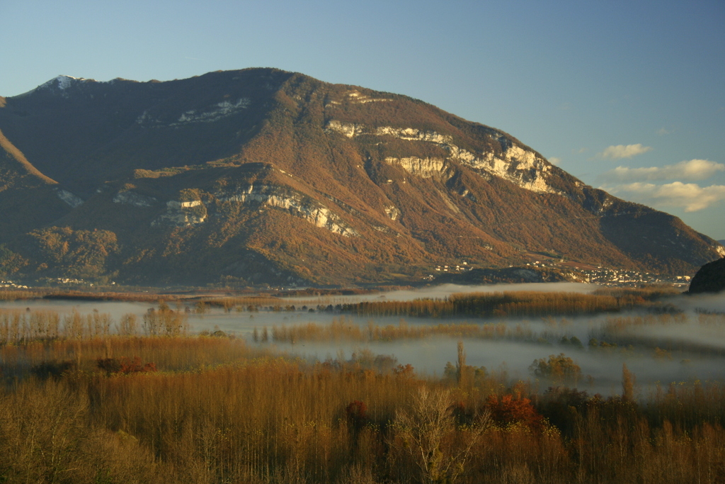
Marais de Lavours National Nature Reserve is located in France (Europe). It is a predominantly terrestrial area. Established in 1984, it covers about 473 hectares.
Protections and designations
Natura 2000 · habitats (SAC)
- Marais de Lavours FR8201637
Natura 2000 · birds (SPA)
- Marais de Lavours FR8210016
Protected as a nature reserve. International labels and designations: Natura 2000 network (2 sites). Key dates: established in 1984, first Natura 2000 site under the Birds Directive in 2004 and first Natura 2000 site under the Habitats Directive in 2008.
In our collections
Timeline
-
1984
Established
-
2004
First Natura 2000 site under the Birds Directive
-
2008
First Natura 2000 site under the Habitats Directive
Sources: Wikidata (CC0) for establishment and international labels; EEA Natura 2000 database (CC-BY 4.0) for site designation dates.
Frequently asked questions
Where is Marais de Lavours National Nature Reserve?
In France (Europe). Representative point: 45.8272° N, 5.7593° E.
How large is Marais de Lavours National Nature Reserve?
About 473 hectares (5 km²). It is the 51st largest of the 121 nature reserves in France covered by Parkavela.
When was Marais de Lavours National Nature Reserve established?
In 1984.
What habitats and landscapes does Marais de Lavours National Nature Reserve include?
A terrestrial area, with wetlands.
What rocks lie beneath Marais de Lavours National Nature Reserve?
According to the BRGM's simplified lithological map, the bedrock consists mainly of sands (100% of sampled points). These are mostly sedimentary rocks.
Which international labels apply to Marais de Lavours National Nature Reserve?
Natura 2000 network (2 sites).
When is the best time to visit Marais de Lavours National Nature Reserve?
Best time to visit: from April to October, with average temperatures of 12 to 22 °C and moderate rainfall.
What is there to see in Marais de Lavours National Nature Reserve?
2 lakes and ponds and 2 bird hides, including Étang Tendret and Étangs FRAPNA (OpenStreetMap).
What is the nearest large city to Marais de Lavours National Nature Reserve?
Nearest towns of over 50,000 people, as the crow flies: Annecy (28 km) and Chambéry (29 km). Nearest airport: Chambéry (CMF), about 21 km away.
How can I reach Marais de Lavours National Nature Reserve by train?
The nearest railway station is Culoz, less than 1 km from the site boundary.
Where can I get visitor information on site?
Bureau d'information touristique de la maison de Chanaz.
Are there waymarked hiking trails in Marais de Lavours National Nature Reserve?
Yes. Waymarked hiking routes listed in OpenStreetMap: 1.
Which species can be seen in Marais de Lavours National Nature Reserve?
Among the species most often recorded on GBIF are Carex elata (Tufted Sedge), Mentha aquatica (Water mint), Lysimachia vulgaris (Yellow Loosestrife) and Phragmites australis (Common reed).
What is the official website of Marais de Lavours National Nature Reserve?
© OpenStreetMap
Download the boundary: GeoJSON · GPX Boundary © OpenStreetMap contributors (ODbL).
Geography
The representative point of the site lies at around 229 m above sea level. Over the 1996–2025 period, the mean annual temperature is about 12.6 °C and total precipitation reaches roughly 1,513 mm per year. The warmest month is usually July, the coolest January, and the wettest May. According to the BRGM's simplified lithological map, the bedrock consists mainly of sands (100% of sampled points). These are mostly sedimentary rocks.
Area
- Area
- 473 ha
- Elevation
- 229 m
- Coordinates
- 45.8272, 5.7593
Bedrock
- Sands 100 %
Sedimentary rocks 100 %
Source: BRGM, simplified lithological map at 1:1,000,000 (Licence Ouverte), 16 points sampled within the boundary.
Climate
● Mean temperature (°C) · ▮ Precipitation (mm)
Source: Copernicus ERA5-Land (C3S, doi:10.24381/cds.68d2bb30), monthly averages 1996–2025 interpolated to the representative point, temperatures adjusted for elevation.
Contains modified Copernicus Climate Change Service information 2026. Neither the European Commission nor ECMWF is responsible for any use that may be made of the Copernicus information or data it contains.
Natural habitats
According to CORINE Land Cover (2018), the site is mainly made up of marshes and bogs (86%), farmland (6%) and forests (5%). The land is almost flat (mean slope under 2°). The 2 Natura 2000 sites overlapping the area list 11 habitats of European interest (2 priority), the most extensive being Molinia meadows on calcareous, peaty or clayey-silt-laden soils (Molinion caeruleae), alkaline fens and calcareous fens with Cladium mariscus and species of the Caricion davallianae.
Biodiversity
Based on occurrences aggregated by GBIF, several species are regularly recorded within the site. Among the most frequent are Carex elata (Tufted Sedge), Mentha aquatica (Water mint), Lysimachia vulgaris (Yellow Loosestrife) and Phragmites australis (Common reed). The full list of documented taxa is shown below. The overlapping Natura 2000 sites list 47 species of European interest: 21 birds, 10 mammals, 1 amphibian, 2 fish, 11 invertebrates and 2 plants.
Habitats of European interest
From the official forms of the 2 Natura 2000 sites overlapping the area (areas reported for each whole site).
- Molinia meadows on calcareous, peaty or clayey-silt-laden soils (Molinion caeruleae) 106 ha
- Alkaline fens 106 ha
- Calcareous fens with Cladium mariscus and species of the Caricion davallianae priority 63 ha
- Alluvial forests with Alnus glutinosa and Fraxinus excelsior (Alno-Padion, Alnion incanae, Salicion albae) priority 42 ha
- Sub-Atlantic and medio-European oak or oak-hornbeam forests of the Carpinion betuli 25 ha
- Natural eutrophic lakes with Magnopotamion or Hydrocharition-type vegetation 8 ha
- Oligotrophic to mesotrophic standing waters with vegetation of the Littorelletea uniflorae and/or of the Isoëto-Nanojuncetea 2 ha
- Depressions on peat substrates of the Rhynchosporion 1 ha
and 3 more
Species of European interest
Birds · 21
Common Kingfisher (Alcedo atthis) resident, Eurasian Teal (Anas crecca) wintering, Mallard (Anas platyrhynchos) resident wintering, Common Pochard (Aythya ferina) wintering, Tufted Duck (Aythya fuligula) wintering, Eurasian Bittern (Botaurus stellaris) wintering, White stork (Ciconia ciconia) passage, Short-toed Snake Eagle (Circaetus gallicus) breeding, Western Marsh Harrier (Circus aeruginosus) passage breeding, Hen Harrier (Circus cyaneus) wintering passage breeding, Corn Crake (Crex crex) breeding, Bluethroat (Cyanecula svecica) breeding and 9 more
Mammals · 10
Barbastelle (Barbastella barbastellus), Eurasian Beaver (Castor fiber), Common bent-wing bat (Miniopterus schreibersii), Bechstein's bat (Myotis bechsteinii), Lesser mouse-eared myotis (Myotis blythii), Geoffroy's bat (Myotis emarginatus), Greater mouse-eared bat (Myotis myotis), Mediterranean Horseshoe Bat (Rhinolophus euryale), Greater Horseshoe Bat (Rhinolophus ferrumequinum), Lesser horseshoe bat (Rhinolophus hipposideros)
Amphibians · 1
Invertebrates · 11
Southern damselfly (Coenagrion mercuriale), False ringlet (Coenonympha oedippus), Lilypad whiteface (Leucorrhinia caudalis), Yellow-spotted Whiteface (Leucorrhinia pectoralis), Stag beetle (Lucanus cervus), Large copper (Lycaena dispar), Dusky Large Blue (Maculinea nausithous), Scarce large blue (Maculinea teleius), Hermit beetle (Osmoderma eremita), Orange-spotted Emerald (Oxygastra curtisii), Desmoulin's whorl snail (Vertigo moulinsiana)
Source: Natura 2000 standard data forms (EEA, CC-BY 4.0). Not exhaustive: sensitive species are not published.
Species to look out for

Plant
Water mint
Mentha aquatica116 records © Kristian Peters -- Fabelfroh 09:40, 12 March 2007 (UTC) · CC BY-SA 3.0


Observed species
Occurrences documented via GBIF; they are neither an exhaustive inventory nor proof of current presence.
- Tufted Sedge · Carex elata · 139
- Water mint · Mentha aquatica · 116
- Yellow Loosestrife · Lysimachia vulgaris · 99
- Common reed · Phragmites australis · 97
- Great Burnet · Sanguisorba officinalis · 95
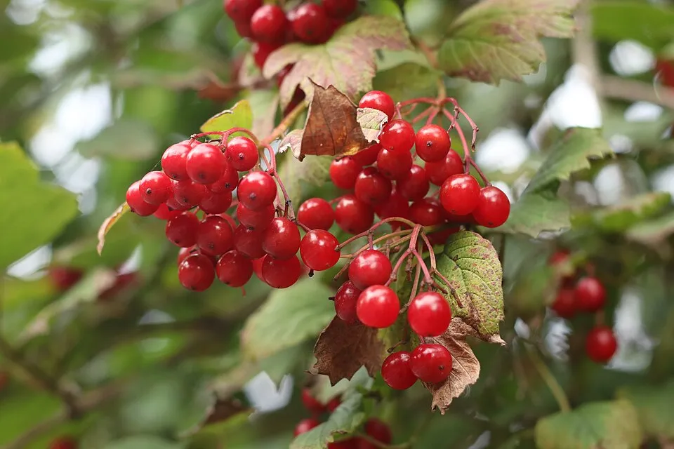
- Guelder-rose · Viburnum opulus · 90
- Carnation sedge · Carex panicea · 87
- Tormentil · Potentilla erecta · 87
- Himalayan Balsam · Impatiens glandulifera · 86
- Giant goldenrod · Solidago gigantea · 86
- Purple moor-grass · Molinia caerulea · 77
- Purple-loosestrife · Lythrum salicaria · 75
+18 more species
- Common meadow-rue · Thalictrum flavum · 75
- Marsh pennywort · Hydrocotyle vulgaris · 72
- Common Alder · Alnus glutinosa · 71
- Parsley water-dropwort · Oenanthe lachenalii · 71
- Gypsywort · Lycopus europaeus · 70
- Blunt-flowered rush · Juncus subnodulosus · 69
- Hogfennel · Thysselinum palustre · 66
- Jointed Rush · Juncus articulatus · 62
- Yellow Iris · Iris pseudacorus · 61
- Slender Spike-rush · Eleocharis uniglumis · 59
- Devil's-bit Scabious · Succisa pratensis · 57
- Saw-wort · Serratula tinctoria · 54
- Marsh helleborine · Epipactis palustris · 53
- Fen Ragwort · Jacobaea paludosa · 52
- Black bog-rush · Schoenus nigricans · 52
- Eurasian Wren · Troglodytes troglodytes · 51
- Lesser spearwort · Ranunculus flammula · 50
- Eurasian Blackcap · Sylvia atricapilla · 49
Records: GBIF.org (CC-BY). Names: Wikidata (CC0), GBIF. Photos: Wikimedia Commons.
Conservation challenges
The primary purpose of the site is to preserve its natural habitats and the biodiversity they support. The species recorded (Biodiversity tab) reflect its ecological value. The designations it holds frame its management and the control of land use.
According to CORINE Land Cover, land cover here remained almost unchanged between 1990 and 2018 (less than 0.5% of the area affected). At night, 28% of the area gives off artificial light detectable from space (NASA VIIRS Black Marble composite, 2016). Built-up and developed land (buildings, business areas, roads, quarries) covers 3% of the area, and farmland 6% (CORINE Land Cover). According to the Natura 2000 forms, of 11 assessed habitats of European interest, 5 are in excellent condition and 1 in average or reduced condition. Since 2000, 10 invasive alien species have been recorded within the site (GBIF observations), 3 of them listed as of Union concern under EU Regulation 1143/2014. Among them: Impatiens glandulifera (Himalayan Balsam), Myocastor coypus (Coypu) and Ameiurus melas (Black bullhead).
Pressure indicators
Tree cover lost
3 ha
2001–2023 · < 1% of the area
20012023
Fires since 2016
0
No large fire mapped (fires over about 30 ha)
Light at night
28%
of the area gives off artificial light visible from space
DarkLit
Built-up land
3%
buildings, business areas, roads, quarries · farmland 6%
Land cover change
< 0.5%
of the area changed, 1990–2018 · CORINE
Invasive alien species
10
incl. 3 of EU concern · since 2000
 Himalayan BalsamEU
 CoypuEU
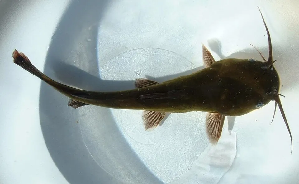 Black bullheadEU
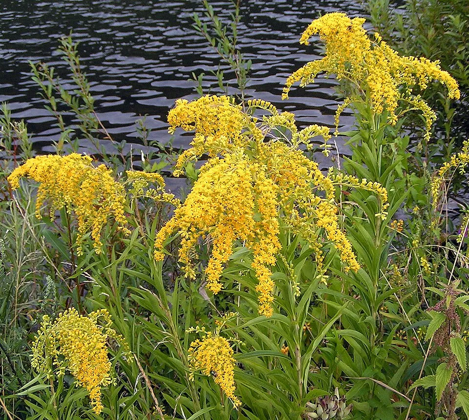 Giant goldenrod
Xyleborus germanus
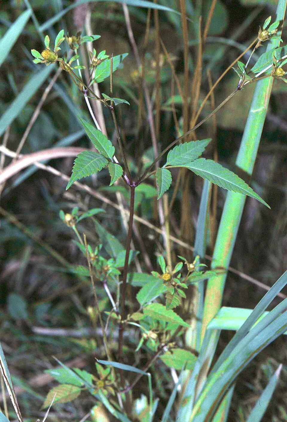 Beggarticks
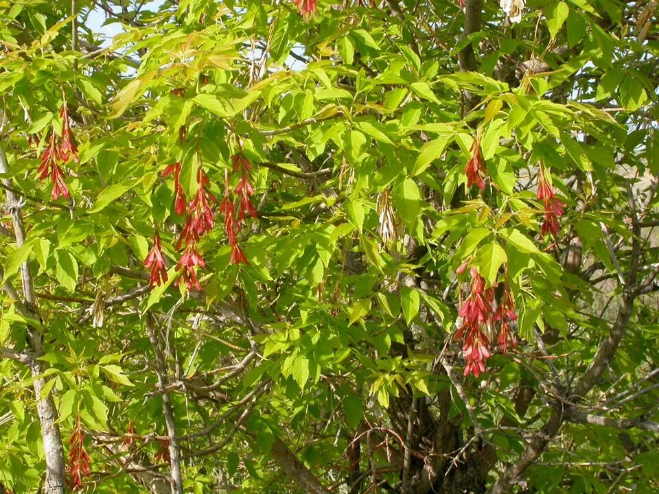 Ashleaf maple
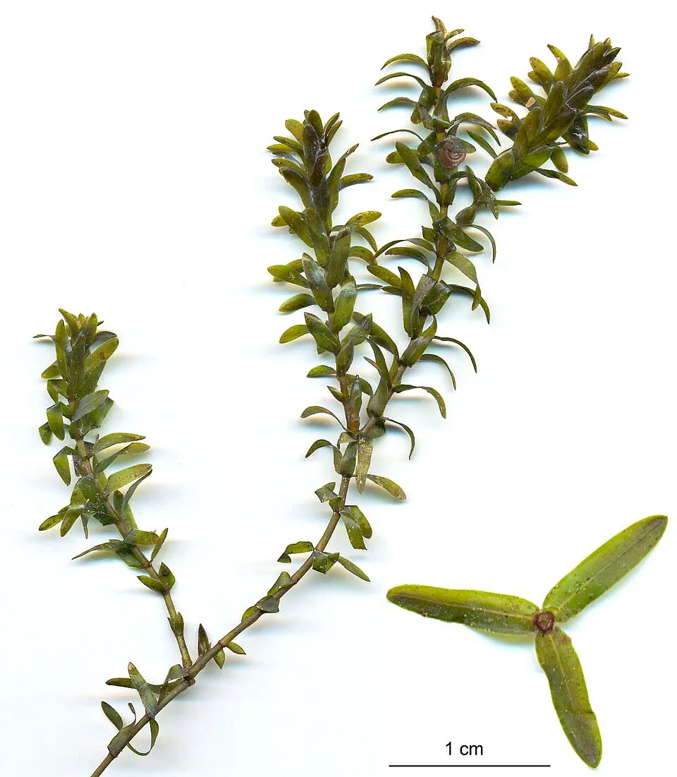 Canadian pondweed
Photos: Himalayan Balsam © Guptaele · CC BY-SA 4.0; Coypu © Philippe Amelant · CC BY-SA 3.0; Black bullhead © Jeffdelonge · CC BY-SA 3.0; Giant goldenrod © Pethan · CC BY-SA 3.0; Beggarticks © Fornax · CC BY-SA 3.0; Ashleaf maple © Matt Lavin from Bozeman, Montana, USA · CC BY-SA 2.0; Canadian pondweed © Christian Fischer · CC BY-SA 3.0
Sources: Global Forest Change (Hansen et al., University of Maryland, via Global Forest Watch, CC-BY 4.0); EFFIS, European Commission / Copernicus; NASA Black Marble 2016 (public domain); CORINE Land Cover 2018 (Copernicus) or MODIS.
CORINE Land Cover Change 1990–2018: generated using European Union's Copernicus Land Monitoring Service information (EEA), aggregated by Parkavela; DOI 10.2909/f30f1000-7cf8-43bb-872c-5eb093911b24.
Invasive alien species: Global Register of Introduced and Invasive Species (ISSG, CC BY 4.0); Union list, Regulation (EU) 1143/2014 (INBO, CC0); GBIF.org records (CC0 / CC BY 4.0), at least 2 per species.
Practical information
Cities and airport
- Annecy
28 km as the crow flies - Chambéry
29 km as the crow flies - Airport: Chambéry (CMF)
21 km as the crow flies
Visitor information
- Bureau d'information touristique de la maison de Chanaz
3 km from the site boundary
Things to see
2 lakes and ponds · 2 bird hides
- Étang Tendret
lake or pond - Étangs FRAPNA
lake or pond
Hiking
1 waymarked routes listed
Data © OpenStreetMap contributors (ODbL) · Wikidata (CC0)
Waymarked hiking routes
Tracks © OpenStreetMap contributors (ODbL), clipped to the boundary; elevation gain and profiles computed on the longest section from Mapzen Terrain Tiles (≈ 30 m), indicative only. Indicative difficulty (SAC scale, OpenStreetMap, via Waymarked Trails): check with the park.
Access and visiting
The nearest railway station is Culoz, less than 1 km from the site boundary. Nearest towns of over 50,000 people, as the crow flies: Annecy (28 km) and Chambéry (29 km). Nearest airport: Chambéry (CMF), about 21 km away. About 160,000 people live within 20 km of the site boundary, 35,000 of them within 10 km (GHSL estimate, 2020). This population has grown by about 27% since 2000. Visitor information on site: Bureau d'information touristique de la maison de Chanaz. Waymarked hiking routes listed in OpenStreetMap: 1. To see: 2 lakes and ponds and 2 bird hides, including Étang Tendret and Étangs FRAPNA. To plan a visit (access, opening periods, visitor rules), it is best to consult the official information from the managing body and the official website listed in this page's sources.
Source: OpenStreetMap (ODbL), Wikidata (CC0), October 2026.
When to visit
Best time to visit: from April to October, with average temperatures of 12 to 22 °C and moderate rainfall. Day length ranges from about 8 h 41 min in December to 15 h 42 min in June. Wildlife records published on GBIF peak for birds (from April to June), plants (June), butterflies and moths (May and June) and dragonflies (from May to July). These peaks also reflect when observers are most active.
Source: Copernicus ERA5-Land (C3S), monthly averages 1996–2025 at the representative point, temperatures adjusted for elevation.
Contains modified Copernicus Climate Change Service information 2026. Neither the European Commission nor ECMWF is responsible for any use that may be made of the Copernicus information or data it contains.
Wildlife records calendar
JFMAMJJASOND
Birds
Plants
Butterflies & moths
Dragonflies
Monthly records published on GBIF (CC-BY), relative to the busiest month; also reflects observer activity.
Gallery
© Delorme · CC BY-SA 3.0
© Chabe01 · CC BY-SA 4.0
© Chabe01 · CC BY-SA 4.0
© Pmau · CC BY-SA 4.0
© Chabe01 · CC BY-SA 4.0
© Chabe01 · CC BY-SA 4.0
Sources and licences
- Wikidata: Q3457470
- OpenStreetMap: relation 1046953
- Official website: http://www.reserve-lavours.com/
- Wikipedia: en.wikipedia.org/wiki/Marais_de_Lavours_National_Nature_Reserve
- WDPA: 15151
References
- cds.climate.copernicus.eu: climate · CC-BY-4.0
- registry.opendata.aws: elevation of the reference point, detailed relief · PD
- land.copernicus.eu: land cover, land cover change, sea share · COPERNICUS
- doi.org: population around the site · CC-BY-4.0
- wikidata.org: official area, establishment date, nearby cities and airport, access and peaks, lake depths, places to see, official website · CC0-1.0
- eea.europa.eu: bathing water quality, ecological status of waters · CC-BY-4.0
- en.eurovelo.com: EuroVelo cycle routes · ODbL-1.0
- cycling.waymarkedtrails.org: cycle routes · ODbL-1.0
- opentopodata.org: elevations · PD
- forest-fire.emergency.copernicus.eu: wildfires · COPERNICUS
- globalforestwatch.org: tree cover loss · CC-BY-4.0
- gbif.org: seasonality of sightings, invasive alien species, observed species · CC-BY-4.0
- infoterre.brgm.fr: geology · LO-2.0
- pop.culture.gouv.fr: protected heritage · LO-2.0
- hydrosheds.org: lakes · CC-BY-4.0
- natura2000.eea.europa.eu: Natura 2000 habitats and species · CC-BY-4.0
- openstreetmap.org: official name, access and peaks, places to see · ODbL-1.0
- earthobservatory.nasa.gov: night light · PD
- hiking.waymarkedtrails.org: route difficulty · ODbL-1.0
- nsidc.org: snow cover · PD
- wikidata.org: Wikipedia article · CC-BY-SA-4.0
Data © OpenStreetMap contributors (ODbL), Wikidata (CC0) and the sources cited.