Fish
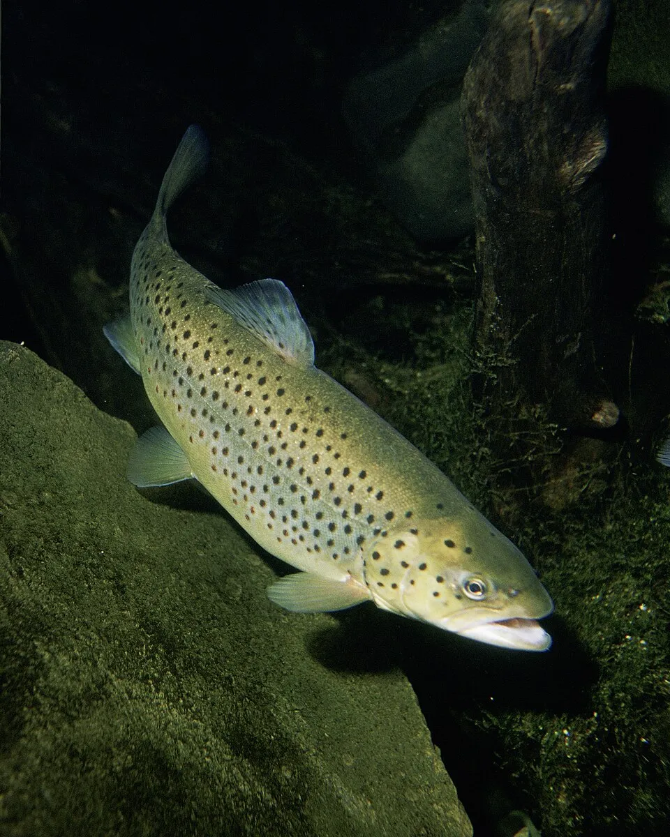
Brown Trout
Salmo trutta14,320 records © Eric Engbretson for U.S. Fish and Wildlife Service · Public domain
France · Terrestrial
Regional nature park of 256,902 hectares in France, established in 1975.
Regional nature park of 256,902 hectares in France, established in 1975.
Normandie-Maine Regional Natural Park is a regional nature park in France (Europe). It is a predominantly terrestrial area. Established in 1975, it covers about 256,902 hectares.
Protected as a regional nature park. International labels and designations: Natura 2000 network (17 sites). Key dates: established in 1975, first Natura 2000 site under the Habitats Directive in 2004 and first Natura 2000 site under the Birds Directive in 2006.
Sources: Wikidata (CC0) for establishment and international labels; EEA Natura 2000 database (CC-BY 4.0) for site designation dates.
In France (Europe). Representative point: 48.4156° N, 0.2627° W.
About 256,902 hectares (2,569 km²). It is the 12th largest of the 59 regional parks in France covered by Parkavela.
In 1975.
A terrestrial area, where land cover is dominated by grassland and meadows (45%).
According to the BRGM's simplified lithological map, the bedrock consists mainly of shales and sandstones (69% of sampled points), granites (15%) and limestones, marls and gypsum (15%). These are mostly metamorphic rocks.
Mont des Avaloirs, at 416 m (OpenStreetMap).
Mont des Avaloirs (416 m), Signal d'Ecouves (413 m), Corniche de Pail (382 m), Butte Chaumont (378 m) and Signal de Villepail (355 m) (OpenStreetMap).
Natura 2000 network (17 sites).
Best time to visit: from May to October, with average temperatures of 12 to 19 °C and moderate rainfall.
33 viewpoints, 3 waterfalls, 68 lakes and ponds and 2 caves, including Belvédère de Perseigne (341 m), Bassin Incendie, Grotte de Courtaliéru and Belvédère des Toyères (OpenStreetMap).
41 campsites, including Aire CAMPING-CAR PARK d'Ambrières-les-Vallées, La Varenne, Aire de repos Le Rudson and Aire de stationnement dans la Petite Cité de Caractère de Lassay-les-Châteaux. (OpenStreetMap).
Yes. According to the French Ministry of Culture's Mérimée database, 93 historic monuments stand within the boundary, 31 of them with the highest level of protection (classé). For example: “Allée couverte de la Bertinière” in La Sauvagère, “Cathédrale Notre-Dame” in Sées and “Château de Bois-Thibaut (restes)” in Lassay-les-Châteaux.
2 monitored bathing sites lie in or within 1 km of the site; official 2025 classification: 2 excellent (European Environment Agency). Swimming is only permitted at the sites and times authorised locally.
Nearest towns of over 50,000 people, as the crow flies: Le Mans (25 km) and Caen (57 km). Nearest airport: Caen – Carpiquet (CFR), about 56 km away.
Rouessé-Vassé railway station lies within the site.
Station de Trail, Office de tourisme de Sillé le Guillaume and Maison du lac et de la forêt.
Yes. Waymarked hiking routes listed in OpenStreetMap: 108, including de Verneuil à Bagnoles-de-l'Orne, De la Manche aux Pyrénées, de Bagnoles-de-l'Orne à Saint-Pois and Saint-Cénéri. The “de Verneuil à Bagnoles-de-l'Orne” route runs for about 83 km through the site, with some 700 m of ascent on its longest section.
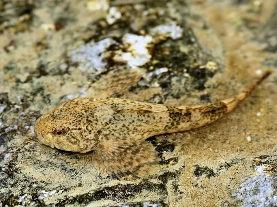
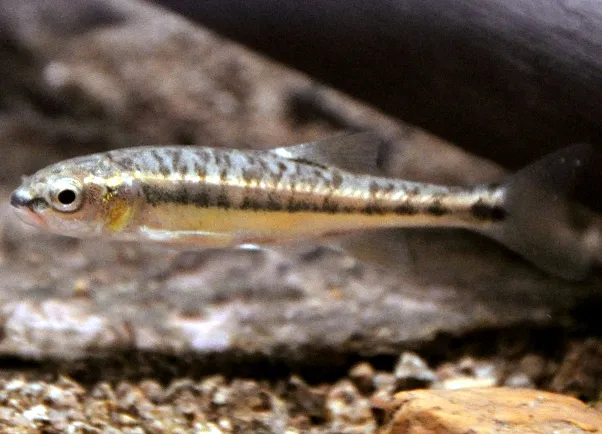
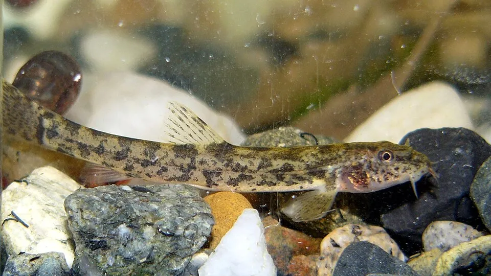
Among the species most often recorded on GBIF are Salmo trutta (Brown Trout), Cottus gobio (European bullhead), Phoxinus phoxinus (Common minnow) and Barbatula barbatula (Stone loach).
© OpenStreetMap
Download the boundary: GeoJSON · GPX Boundary © OpenStreetMap contributors (ODbL).
The representative point of the site lies at around 226 m above sea level. Over the 1996–2025 period, the mean annual temperature is about 11.0 °C and total precipitation reaches roughly 799 mm per year. The warmest month is usually August, the coolest January, and the wettest December. According to the BRGM's simplified lithological map, the bedrock consists mainly of shales and sandstones (69% of sampled points), granites (15%) and limestones, marls and gypsum (15%). These are mostly metamorphic rocks. The site contains 6 lakes larger than 10 ha, totalling 1.2 km² of water (HydroLAKES).
Lakes: HydroLAKES (Messager et al. 2016, hydrosheds.org, CC BY 4.0) · depths: Wikidata (CC0)
Metamorphic rocks 69 % · Igneous rocks 15 % · Sedimentary rocks 15 %
Source: BRGM, simplified lithological map at 1:1,000,000 (Licence Ouverte), 13 points sampled within the boundary.
Data © OpenStreetMap contributors (ODbL)
● Mean temperature (°C) · ▮ Precipitation (mm)
Source: Copernicus ERA5-Land (C3S, doi:10.24381/cds.68d2bb30), monthly averages 1996–2025 interpolated to the representative point, temperatures adjusted for elevation.
Contains modified Copernicus Climate Change Service information 2026. Neither the European Commission nor ECMWF is responsible for any use that may be made of the Copernicus information or data it contains.
According to CORINE Land Cover (2018), the site is mainly made up of grassland and meadows (45%), farmland (35%) and forests (17%). Elevation ranges from about 120 m to 416 m (highest point: Mont des Avaloirs). The 17 Natura 2000 sites overlapping the area list 30 habitats of European interest (6 priority), the most extensive being Atlantic acidophilous beech forests with Ilex and sometimes also Taxus in the shrublayer (Quercion robori-petraeae or Ilici-Fagenion), lowland hay meadows (Alopecurus pratensis, Sanguisorba officinalis) and Asperulo-Fagetum beech forests.
Based on occurrences aggregated by GBIF, several species are regularly recorded within the site. Among the most frequent are Salmo trutta (Brown Trout), Cottus gobio (European bullhead), Phoxinus phoxinus (Common minnow) and Barbatula barbatula (Stone loach). The full list of documented taxa is shown below. The overlapping Natura 2000 sites list 54 species of European interest: 12 birds, 13 mammals, 5 reptiles, 7 amphibians, 4 fish, 12 invertebrates and 1 plant.
From the official forms of the 17 Natura 2000 sites overlapping the area (areas reported for each whole site).
and 22 more
Water Pipit (Anthus spinoletta) wintering, Short-eared Owl (Asio flammeus) wintering, European Nightjar (Caprimulgus europaeus) breeding, Hen Harrier (Circus cyaneus) breeding wintering resident, Black Woodpecker (Dryocopus martius) resident, Merlin (Falco columbarius) wintering, Red-backed Shrike (Lanius collurio) breeding, Middle spotted woodpecker (Leiopicus medius) breeding, Woodlark (Lullula arborea) breeding, European honey buzzard (Pernis apivorus) breeding, European Golden Plover (Pluvialis apricaria) wintering, Dartford Warbler (Sylvia undata) resident
Barbastelle (Barbastella barbastellus), Eptesicus serotinus serotinus, Eurasian otter (Lutra lutra), Bechstein's bat (Myotis bechsteinii), Daubenton's bat (Myotis daubentonii), Geoffroy's bat (Myotis emarginatus), Greater mouse-eared bat (Myotis myotis), Myotis mystacinus mystacinus, Myotis nattereri nattereri, Leisler's Noctule. (Nyctalus leisleri leisleri), Common Pipistrelle (Pipistrellus pipistrellus pipistrellus), Greater Horseshoe Bat (Rhinolophus ferrumequinum) and 1 more
Smooth snake (Coronella austriaca), Elaphe longissima longissima, Sand lizard (Lacerta agilis), Green lizard (Lacerta viridis), Common wall lizard (Podarcis muralis)
Midwife toad (Alytes obstetricans), Common tree frog (Hyla arborea), Agile frog (Rana dalmatina), Agile Frog (Rana dalmatina bonaparte), Great crested newt (Triturus cristatus), Marbled newt (Triturus marmoratus), Triturus marmoratus marmoratus
European bullhead (Cottus gobio), Common Bullhead (Cottus perifretum), European brook lamprey (Lampetra planeri), European bitterling (Rhodeus amarus)
White-clawed Crayfish (Austropotamobius pallipes), Greater Capricorn Beetle (Cerambyx cerdo), Southern damselfly (Coenagrion mercuriale), Marsh fritillary (Euphydryas aurinia), Jersey Tiger (Euplagia quadripunctaria), Stag beetle (Lucanus cervus), Freshwater pearl mussel (Margaritifera margaritifera), Hermit beetle (Osmoderma eremita), Orange-spotted Emerald (Oxygastra curtisii), Thick shelled river mussel (Unio crassus), Narrow-mouthed whorl snail (Vertigo angustior), Desmoulin's whorl snail (Vertigo moulinsiana)
Source: Natura 2000 standard data forms (EEA, CC-BY 4.0). Not exhaustive: sensitive species are not published.
Fish
14,320 records © Eric Engbretson for U.S. Fish and Wildlife Service · Public domain
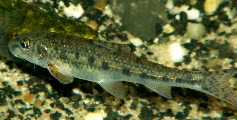
Occurrences documented via GBIF; they are neither an exhaustive inventory nor proof of current presence.
Records: GBIF.org (CC-BY). Names: Wikidata (CC0), GBIF. Photos: Wikimedia Commons.
The primary purpose of the site is to preserve its natural habitats and the biodiversity they support. The species recorded (Biodiversity tab) reflect its ecological value. The designations it holds frame its management and the control of land use.
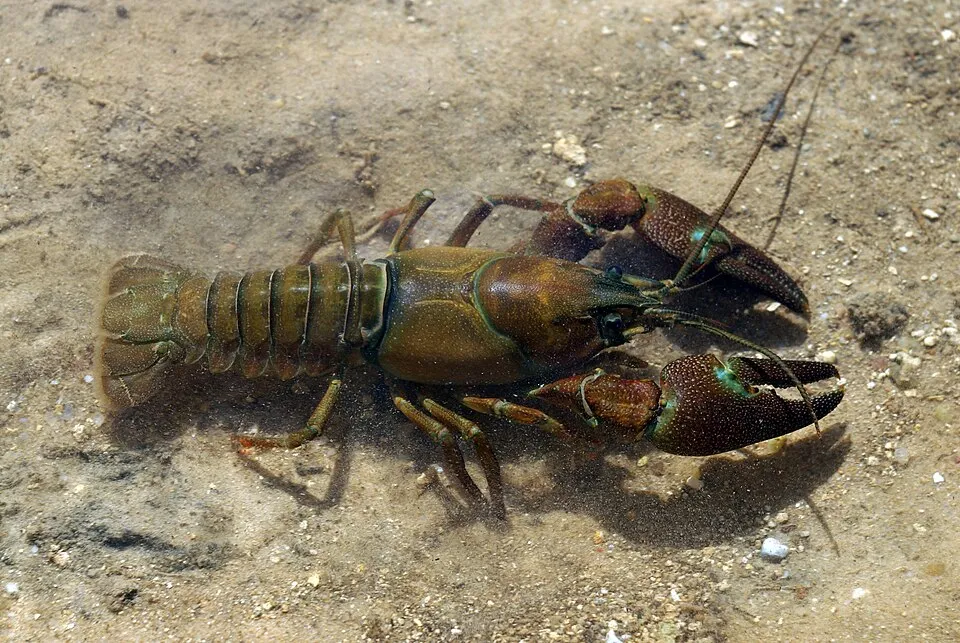
According to Global Forest Change data (University of Maryland, Global Forest Watch), about 2,230 ha of tree cover were lost within the boundary between 2001 and 2023 (under 1% of its area), peaking in 2010 and 2021. These losses include logging, storms and fires, and do not account for regrowth. Apart from forest felling and regrowth (about 6,700 ha in total), land cover remained almost unchanged between 1990 and 2018 according to CORINE Land Cover; only some 487 ha were built over. At night, 2% of the area gives off artificial light detectable from space (NASA VIIRS Black Marble composite, 2016). Built-up and developed land (buildings, business areas, roads, quarries) covers 2% of the area, and farmland 35% (CORINE Land Cover). According to the Natura 2000 forms, of 30 assessed habitats of European interest, 1 is in excellent condition and 5 in average or reduced condition. According to the Water Framework Directive assessment (2022 river basin management plans, data 2012–2017), only 49% of the 2,077 km of rivers assessed within the site are in good or high ecological status; the others mostly have moderate ecological status. Other assessed water bodies: lakes, 0 of 1 in good ecological status or better. Since 2000, 71 invasive alien species have been recorded within the site (GBIF observations), 19 of them listed as of Union concern under EU Regulation 1143/2014. Among them: Pacifastacus leniusculus (Signal crayfish), Myocastor coypus (Coypu) and Vespa velutina (Asian hornet).
2,228 ha
2001–2023 · < 1% of the area
0
No large fire mapped (fires over about 30 ha)
2%
of the area gives off artificial light visible from space
2%
buildings, business areas, roads, quarries · farmland 35%
< 0.5%
of the area changed, 1990–2018 · CORINE
forest felling and regrowth: 6,700 ha in total
49%
of the 2,077 km of assessed rivers in good or high ecological status · WFD 2022
Lakes: 0 of 1 good or better
assessments 2012–2017
71
incl. 19 of EU concern · since 2000
Signal crayfishEU
 CoypuEU
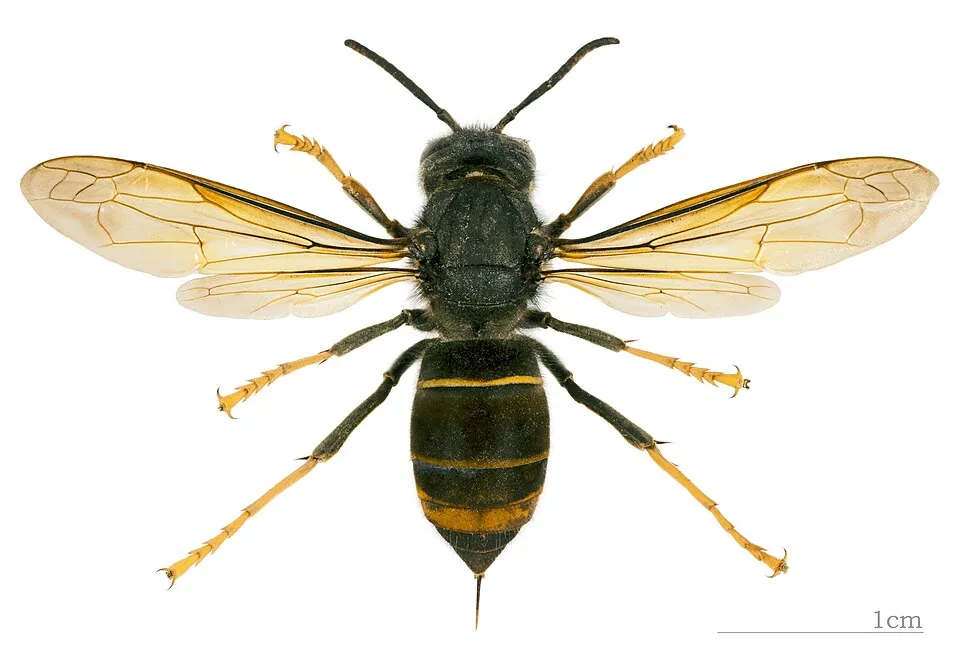 Asian hornetEU
 Japanese KnotweedEU
 Chilean gunneraEU
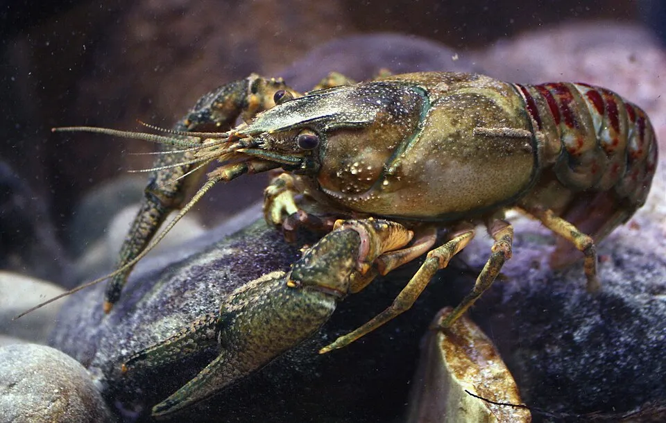 Spinycheek crayfishEU
 Red swamp crayfishEU
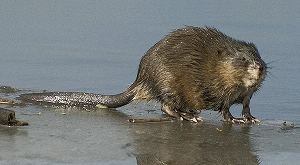 MuskratEU
Photos: Signal crayfish © David Perez · CC BY 3.0; Coypu © Philippe Amelant · CC BY-SA 3.0; Asian hornet © Didier Descouens · CC BY-SA 4.0; Japanese Knotweed © W.carter · CC0-1.0; Chilean gunnera © Margaret Donald · CC BY-SA 2.0; Spinycheek crayfish © Astacoides · CC BY-SA 3.0; Red swamp crayfish © MikeMurphy · Public domain; Muskrat © David Menke · Public domain
Sources: Global Forest Change (Hansen et al., University of Maryland, via Global Forest Watch, CC-BY 4.0); EFFIS, European Commission / Copernicus; NASA Black Marble 2016 (public domain); CORINE Land Cover 2018 (Copernicus) or MODIS.
CORINE Land Cover Change 1990–2018: generated using European Union's Copernicus Land Monitoring Service information (EEA), aggregated by Parkavela; DOI 10.2909/f30f1000-7cf8-43bb-872c-5eb093911b24.
Ecological status of water bodies: European Environment Agency, WISE – Water Framework Directive, 3rd river basin management plans (2022), CC BY 4.0. Official national classification, not comparable between countries.
Invasive alien species: Global Register of Introduced and Invasive Species (ISSG, CC BY 4.0); Union list, Regulation (EU) 1143/2014 (INBO, CC0); GBIF.org records (CC0 / CC BY 4.0), at least 2 per species.
33 viewpoints · 3 waterfalls · 68 lakes and ponds · 2 caves
41 campsites
108 waymarked routes listed, including:
+ 28 local loops
Signed cycle routes: this does not mean that cycling is allowed on footpaths.
Reported by OpenStreetMap contributors (ODbL); check with the park before visiting.
Data © OpenStreetMap contributors (ODbL) · Wikidata (CC0)
Routes © OpenStreetMap contributors (ODbL), via Waymarked Trails
12 km within the site ↗ 193 m↘ 239 m 179–280 m
33.3 km within the site ↗ 557 m↘ 607 m 102–249 m
38.6 km within the site ↗ 653 m↘ 438 m 119–412 m
25.1 km within the site ↗ 520 m↘ 374 m 201–412 m
Tracks © OpenStreetMap contributors (ODbL), clipped to the boundary; elevation gain and profiles computed on the longest section from Mapzen Terrain Tiles (≈ 30 m), indicative only.
2 monitored bathing sites in or within 1 km of the site · 2025 classification
Source: European Environment Agency, official bathing water classification (Directive 2006/7/EC, CC-BY 4.0). Swimming is only permitted at the sites and times authorised locally.
Rouessé-Vassé railway station lies within the site. Nearest towns of over 50,000 people, as the crow flies: Le Mans (25 km) and Caen (57 km). Nearest airport: Caen – Carpiquet (CFR), about 56 km away. About 430,000 people live within 20 km of the site boundary, 230,000 of them within 10 km; some 94,000 people are estimated to live inside (GHSL estimate, 2020). Visitor information on site: Station de Trail, Office de tourisme de Sillé le Guillaume and Maison du lac et de la forêt. Waymarked hiking routes listed in OpenStreetMap: 108, including de Verneuil à Bagnoles-de-l'Orne, De la Manche aux Pyrénées, de Bagnoles-de-l'Orne à Saint-Pois and Saint-Cénéri. The site is crossed by 8 signed cycle routes, including “V40 La Véloscénie” and “V43 La Vélo Francette” (OpenStreetMap). OpenStreetMap contributors list one wheelchair-accessible place: Office de tourisme de Sillé le Guillaume; check with the park before visiting. To see: 33 viewpoints, 3 waterfalls, 68 lakes and ponds and 2 caves, including Belvédère de Perseigne (341 m), Bassin Incendie, Grotte de Courtaliéru and Belvédère des Toyères. Where to stay: 41 campsites, including Aire CAMPING-CAR PARK d'Ambrières-les-Vallées, La Varenne, Aire de repos Le Rudson and Aire de stationnement dans la Petite Cité de Caractère de Lassay-les-Châteaux. To plan a visit (access, opening periods, visitor rules), it is best to consult the official information from the managing body and the official website listed in this page's sources.
Source: OpenStreetMap (ODbL), Wikidata (CC0), October 2026.
According to the French Ministry of Culture's Mérimée database, 93 historic monuments stand within the boundary, 31 of them with the highest level of protection (classé). Among them are 34 religious buildings, 27 houses and civic buildings and 22 castles and fortifications. Notable classé monuments include “Allée couverte de la Bertinière” in La Sauvagère, “Cathédrale Notre-Dame” in Sées and “Château de Bois-Thibaut (restes)” in Lassay-les-Châteaux.
and 85 more
Source: Mérimée database, French Ministry of Culture (Licence Ouverte 2.0). Each record links to the Plateforme ouverte du patrimoine (POP).
Best time to visit: from May to October, with average temperatures of 12 to 19 °C and moderate rainfall. Day length ranges from about 8 h 20 min in December to 16 h 05 min in June. Wildlife records published on GBIF peak for birds (April and May), plants (from May to July), butterflies and moths (June and July), dragonflies (June and July) and mammals (July). These peaks also reflect when observers are most active.
Source: Copernicus ERA5-Land (C3S), monthly averages 1996–2025 at the representative point, temperatures adjusted for elevation.
Contains modified Copernicus Climate Change Service information 2026. Neither the European Commission nor ECMWF is responsible for any use that may be made of the Copernicus information or data it contains.
Monthly records published on GBIF (CC-BY), relative to the busiest month; also reflects observer activity.
Data © OpenStreetMap contributors (ODbL), Wikidata (CC0) and the sources cited.