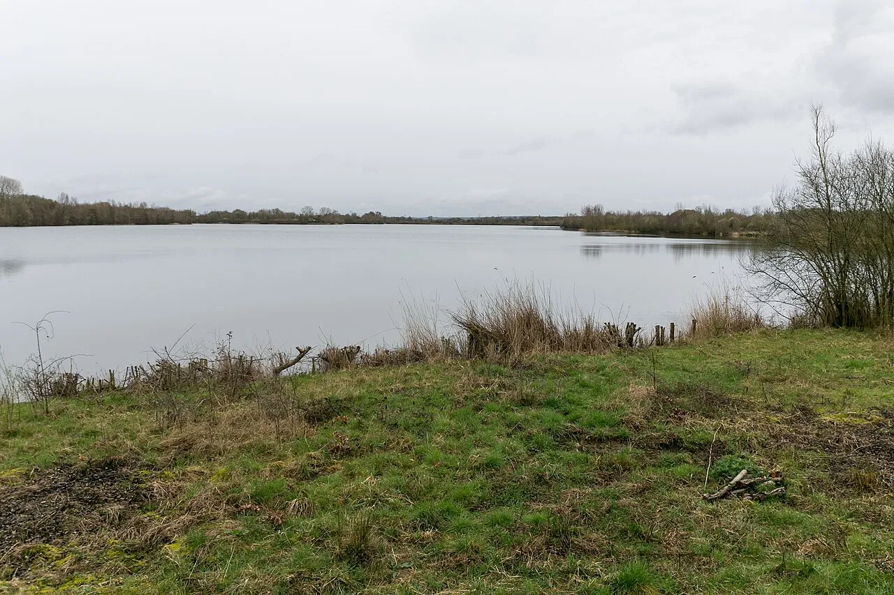

AI-generated illustration (Magnific) · typical landscape, not a photo of this place
Overview
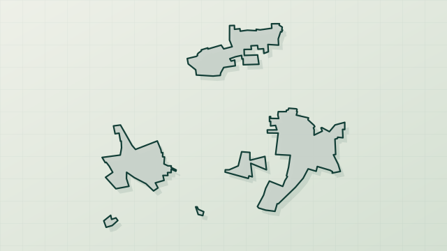
Protected area of 260 hectares in France.
Plaine de Douces is a protected area in France (Europe). It is a predominantly terrestrial area. It covers about 260 hectares.
Frequently asked questions
Where is Plaine de Douces?
In France (Europe). Representative point: 47.1772° N, 0.2281° W.
How large is Plaine de Douces?
About 260 hectares (3 km²). It is the 10th largest of the 32 other protected areas in France covered by Parkavela.
What habitats and landscapes does Plaine de Douces include?
A terrestrial area, where land cover is dominated by farmland (100%).
What rocks lie beneath Plaine de Douces?
According to the BRGM's simplified lithological map, the bedrock consists mainly of limestones, marls and gypsum (100% of sampled points). These are mostly sedimentary rocks.
When is the best time to visit Plaine de Douces?
Best time to visit: from April to September, with average temperatures of 11 to 21 °C and moderate rainfall.
What is the nearest large city to Plaine de Douces?
Nearest towns of over 50,000 people, as the crow flies: Angers (40 km) and Cholet (50 km). Nearest airport: Poitiers – Biard (PIS), about 76 km away.
How can I reach Plaine de Douces by train?
The nearest railway station is Montreuil-Bellay, about 7 km from the site boundary.
Are there waymarked hiking trails in Plaine de Douces?
Yes. Waymarked hiking routes listed in OpenStreetMap: 1.
Which species can be seen in Plaine de Douces?
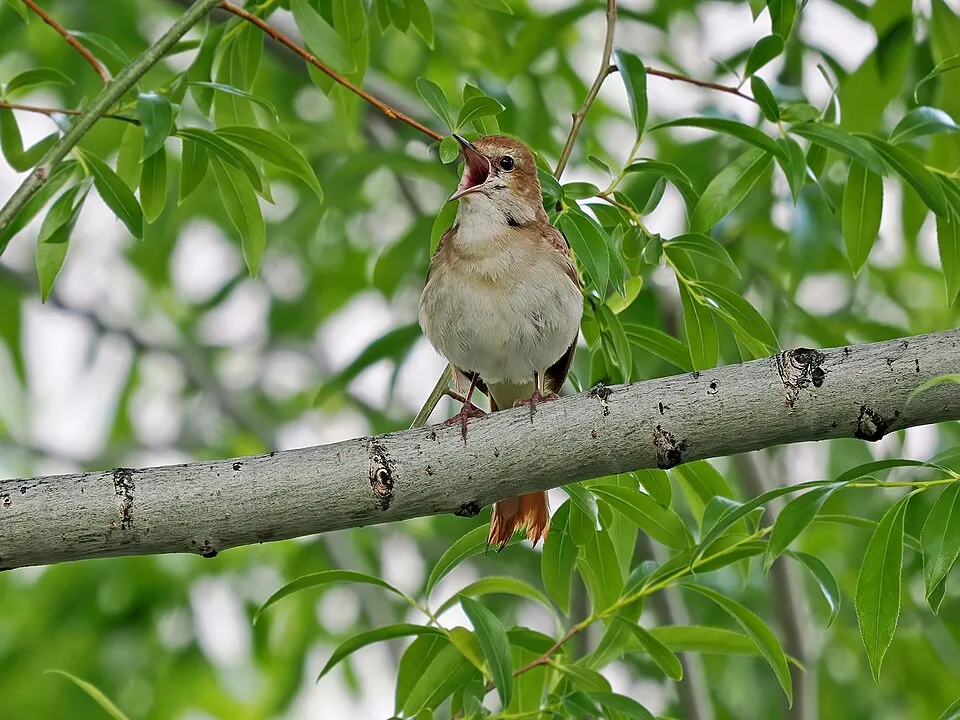
Among the species most often recorded on GBIF are Alauda arvensis (Eurasian Skylark), Luscinia megarhynchos (Common Nightingale), Hippolais polyglotta (Melodious warbler) and Psammitis ninnii.
© OpenStreetMap
Download the boundary: GeoJSON · GPX Boundary © OpenStreetMap contributors (ODbL).
Geography
The representative point of the site lies at around 70 m above sea level. Over the 1996–2025 period, the mean annual temperature is about 12.5 °C and total precipitation reaches roughly 690 mm per year. The warmest month is usually August, the coolest January, and the wettest October. According to the BRGM's simplified lithological map, the bedrock consists mainly of limestones, marls and gypsum (100% of sampled points). These are mostly sedimentary rocks.
Area
- Area of the boundary
- 260 ha
- Elevation
- 70 m
- Coordinates
- 47.1772, -0.2281
Bedrock
- Limestones, marls and gypsum 100 %
Sedimentary rocks 100 %
Source: BRGM, simplified lithological map at 1:1,000,000 (Licence Ouverte), 16 points sampled within the boundary.
Climate
● Mean temperature (°C) · ▮ Precipitation (mm)
Source: Copernicus ERA5-Land (C3S, doi:10.24381/cds.68d2bb30), monthly averages 1996–2025 interpolated to the representative point, temperatures adjusted for elevation.
Contains modified Copernicus Climate Change Service information 2026. Neither the European Commission nor ECMWF is responsible for any use that may be made of the Copernicus information or data it contains.
Natural habitats
According to CORINE Land Cover (2018), the site is mainly made up of farmland (100%). The land is almost flat (mean slope under 2°).
Biodiversity
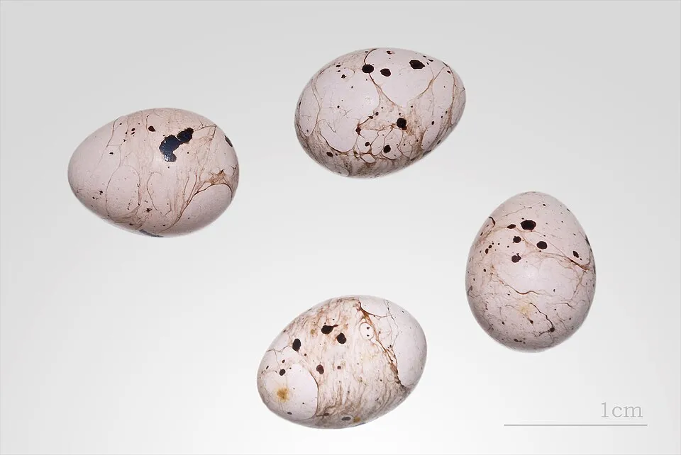
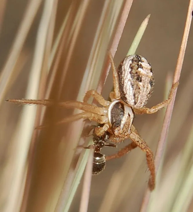
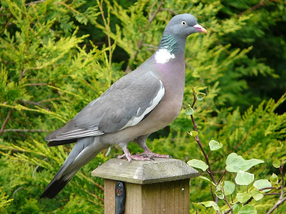
Based on occurrences aggregated by GBIF, several species are regularly recorded within the site. Among the most frequent are Alauda arvensis (Eurasian Skylark), Luscinia megarhynchos (Common Nightingale), Hippolais polyglotta (Melodious warbler) and Psammitis ninnii. The full list of documented taxa is shown below.
Species to look out for
Observed species
Occurrences documented via GBIF; they are neither an exhaustive inventory nor proof of current presence.
- Eurasian Skylark · Alauda arvensis · 13
- Common Nightingale · Luscinia megarhynchos · 8
- Melodious warbler · Hippolais polyglotta · 7
- Psammitis ninnii · 6
- Common Wood Pigeon · Columba palumbus · 6
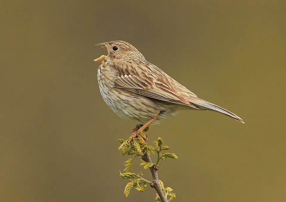
- Corn Bunting · Emberiza calandra · 6
- Zelotes atrocaeruleus · 4
- Evarcha arcuata · 4
- Eurasian Stone-curlew · Burhinus oedicnemus · 4
- Eurasian Chaffinch · Fringilla coelebs · 4
- Spiny Restharrow · Ononis spinosa · 4
- Agyneta rurestris · 4
+18 more species
- Stone Ground-spider · Drassodes lapidosus · 3
- Pardosa bifasciata · 3
- Alopecosa cuneata · 3
- Phrurolithus nigrinus · 3
- Nursery-web spider · Pisaura mirabilis · 3
- Neoscona adianta · 3
- Xysticus erraticus · 3
- Pellenes tripunctatus · 3
- Eurasian Blackcap · Sylvia atricapilla · 3
- European turtle dove · Streptopelia turtur · 3
- Early spider-orchid · Ophrys sphegodes · 3
- Pale smartweed · Persicaria lapathifolia · 3
- Festuca ambigua · 3
- Aulonia albimana · 3
- Heath Grasper · Haplodrassus dalmatensis · 2
- Woodlouse Spider [Dysdera erythrina] · Dysdera erythrina · 2
- Golden Lantern-spider · Agroeca cuprea · 2
- Walckenaer's Feather-legged Spider · Uloborus walckenaerius · 2
Records: GBIF.org (CC-BY). Names: Wikidata (CC0), GBIF. Photos: Wikimedia Commons.
Conservation challenges
The primary purpose of the site is to preserve its natural habitats and the biodiversity they support. The species recorded (Biodiversity tab) reflect its ecological value. Its status as a protected area sets the regulatory framework for its protection.
According to CORINE Land Cover, land cover here remained almost unchanged between 1990 and 2018 (less than 0.5% of the area affected). At night, the area gives off virtually no artificial light detectable from space (NASA VIIRS Black Marble composite, 2016).
Pressure indicators
Fires since 2016
0
No large fire mapped (fires over about 30 ha)
Light at night
0%
of the area gives off artificial light visible from space
DarkLit
Built-up land
< 1%
buildings, business areas, roads, quarries · farmland 100%
Land cover change
< 0.5%
of the area changed, 1990–2018 · CORINE
Sources: Global Forest Change (Hansen et al., University of Maryland, via Global Forest Watch, CC-BY 4.0); EFFIS, European Commission / Copernicus; NASA Black Marble 2016 (public domain); CORINE Land Cover 2018 (Copernicus) or MODIS.
CORINE Land Cover Change 1990–2018: generated using European Union's Copernicus Land Monitoring Service information (EEA), aggregated by Parkavela; DOI 10.2909/f30f1000-7cf8-43bb-872c-5eb093911b24.
Practical information
Cities and airport
- Angers
40 km as the crow flies - Cholet
50 km as the crow flies - Airport: Poitiers – Biard (PIS)
76 km as the crow flies
Parking
4 public car parks listed within the site
Hiking
1 waymarked routes listed
Data © OpenStreetMap contributors (ODbL) · Wikidata (CC0)
Access and visiting
The nearest railway station is Montreuil-Bellay, about 7 km from the site boundary. Nearest towns of over 50,000 people, as the crow flies: Angers (40 km) and Cholet (50 km). Nearest airport: Poitiers – Biard (PIS), about 76 km away. About 100,000 people live within 20 km of the site boundary, 25,000 of them within 10 km (GHSL estimate, 2020). Public car parks listed within the site: 4. Waymarked hiking routes listed in OpenStreetMap: 1. To plan a visit (access, opening periods, visitor rules), it is best to consult the official information from the managing body and the official website listed in this page's sources.
Source: OpenStreetMap (ODbL), Wikidata (CC0), October 2026.
When to visit
Best time to visit: from April to September, with average temperatures of 11 to 21 °C and moderate rainfall. Day length ranges from about 8 h 30 min in December to 15 h 54 min in June. Wildlife records published on GBIF peak for birds (May). These peaks also reflect when observers are most active.
Source: Copernicus ERA5-Land (C3S), monthly averages 1996–2025 at the representative point, temperatures adjusted for elevation.
Contains modified Copernicus Climate Change Service information 2026. Neither the European Commission nor ECMWF is responsible for any use that may be made of the Copernicus information or data it contains.
Wildlife records calendar
JFMAMJJASOND
Birds
Monthly records published on GBIF (CC-BY), relative to the busiest month; also reflects observer activity.
Sources and licences
- OpenStreetMap: relation 19404552
References
- cds.climate.copernicus.eu: climate · CC-BY-4.0
- registry.opendata.aws: elevation of the reference point, detailed relief · PD
- land.copernicus.eu: land cover, land cover change, sea share · COPERNICUS
- doi.org: population around the site · CC-BY-4.0
- openstreetmap.org: official name, access and peaks, places to see · ODbL-1.0
- eea.europa.eu: bathing water quality, ecological status of waters · CC-BY-4.0
- en.eurovelo.com: EuroVelo cycle routes · ODbL-1.0
- cycling.waymarkedtrails.org: cycle routes · ODbL-1.0
- opentopodata.org: elevations · PD
- forest-fire.emergency.copernicus.eu: wildfires · COPERNICUS
- globalforestwatch.org: tree cover loss · CC-BY-4.0
- gbif.org: seasonality of sightings, invasive alien species, observed species · CC-BY-4.0
- infoterre.brgm.fr: geology · LO-2.0
- pop.culture.gouv.fr: protected heritage · LO-2.0
- hydrosheds.org: lakes · CC-BY-4.0
- earthobservatory.nasa.gov: night light · PD
- nsidc.org: snow cover · PD
- wikidata.org: nearby cities and airport, access and peaks, lake depths, places to see · CC0-1.0
Data © OpenStreetMap contributors (ODbL), Wikidata (CC0) and the sources cited.