France · Terrestrial
Réserve biologique intégrale de la sylve d'Argenson
Nature reserve of 2,579 hectares in France, established in 2006.
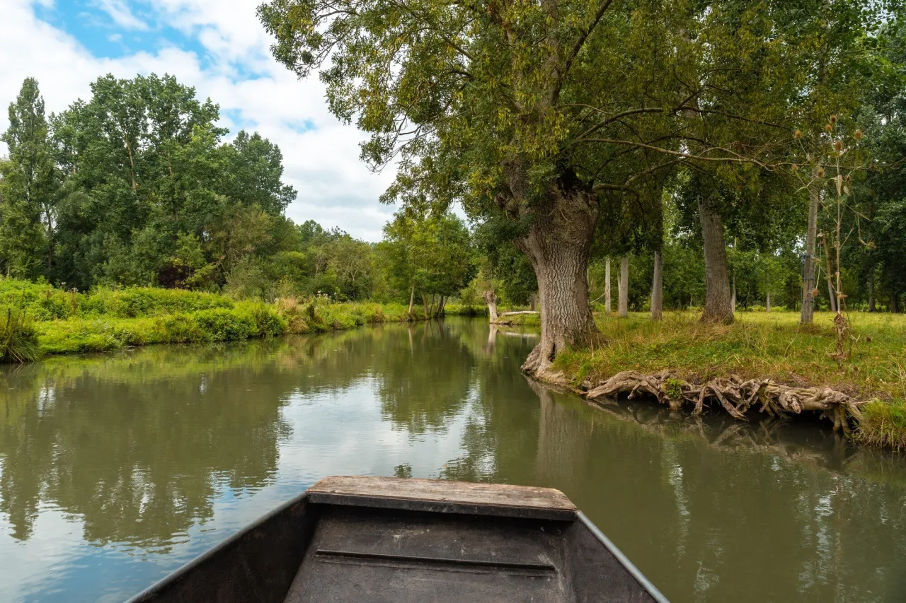
Illustrative photo · Poitou · © unaihuiziphotography / Magnific
Overview
Nature reserve of 2,579 hectares in France, established in 2006.
Réserve biologique intégrale de la sylve d'Argenson is a nature reserve in France (Europe). It is a predominantly terrestrial area. Established in 2006, it covers about 2,579 hectares.
Protections and designations
Natura 2000 · habitats (SAC)
- Massif forestier de Chizé-Aulnay FR5400450
Protected as a nature reserve. International labels and designations: Natura 2000 network (1 site: “Massif forestier de Chizé-Aulnay”). Key dates: established in 2006 and first Natura 2000 site under the Habitats Directive in 2007.
In our collections
Timeline
-
2006
Established
-
2007
First Natura 2000 site under the Habitats Directive
Sources: Wikidata (CC0) for establishment and international labels; EEA Natura 2000 database (CC-BY 4.0) for site designation dates.
Frequently asked questions
Where is Réserve biologique intégrale de la sylve d'Argenson?
In France (Europe). Representative point: 46.1186° N, 0.4182° W.
How large is Réserve biologique intégrale de la sylve d'Argenson?
About 2,579 hectares (26 km²). It is the 21st largest of the 121 nature reserves in France covered by Parkavela.
When was Réserve biologique intégrale de la sylve d'Argenson established?
In 2006.
What habitats and landscapes does Réserve biologique intégrale de la sylve d'Argenson include?
A terrestrial area, with forests.
What rocks lie beneath Réserve biologique intégrale de la sylve d'Argenson?
According to the BRGM's simplified lithological map, the bedrock consists mainly of limestones, marls and gypsum (81% of sampled points) and clays (19%). These are mostly sedimentary rocks.
Which international labels apply to Réserve biologique intégrale de la sylve d'Argenson?
Natura 2000 network (1 site: “Massif forestier de Chizé-Aulnay”).
When is the best time to visit Réserve biologique intégrale de la sylve d'Argenson?
Best time to visit: from April to October, with average temperatures of 11 to 21 °C and moderate rainfall.
What is the nearest large city to Réserve biologique intégrale de la sylve d'Argenson?
Nearest towns of over 50,000 people, as the crow flies: Niort (20 km) and La Rochelle (53 km). Nearest airport: La Rochelle – Île de Ré (LRH), about 56 km away.
How can I reach Réserve biologique intégrale de la sylve d'Argenson by train?
The nearest railway station is Prissé-la-Charrière, about 4 km from the site boundary.
Which species can be seen in Réserve biologique intégrale de la sylve d'Argenson?
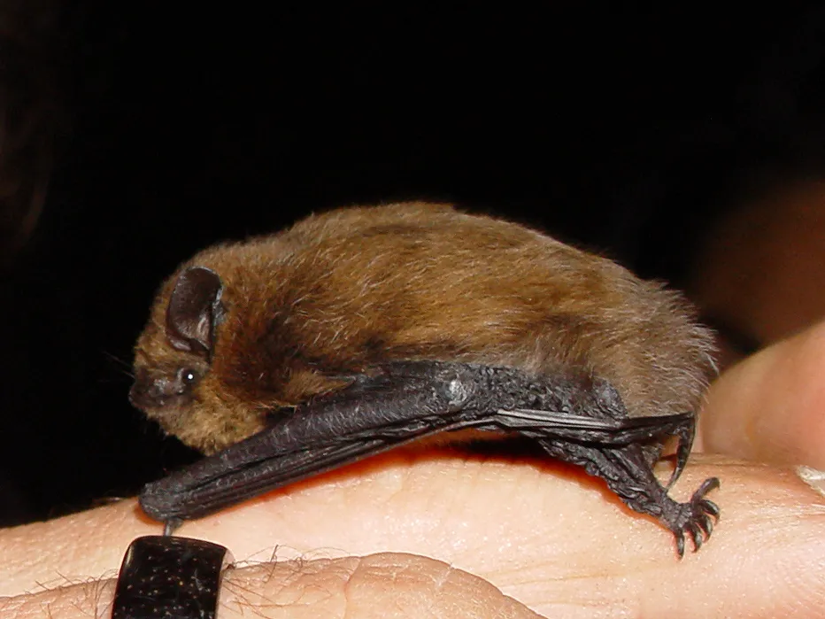
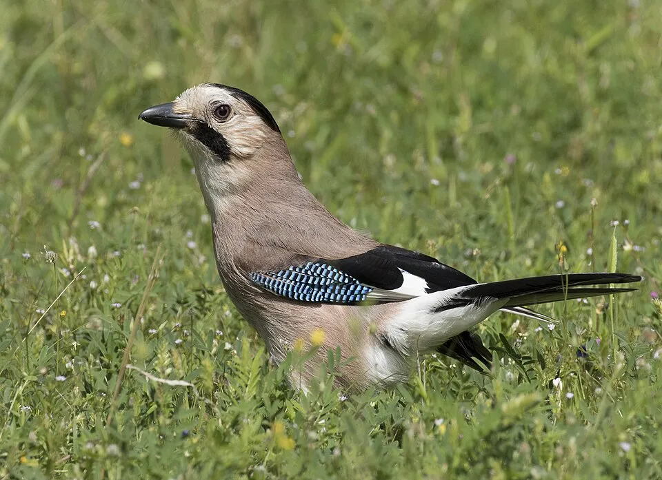
Among the species most often recorded on GBIF are Pipistrellus pipistrellus (Common pipistrelle), Passer domesticus (House Sparrow), Turdus merula (Common Blackbird) and Garrulus glandarius (Eurasian Jay).
© OpenStreetMap
Download the boundary: GeoJSON · GPX Boundary © OpenStreetMap contributors (ODbL).
Geography
The representative point of the site lies at around 79 m above sea level. Over the 1996–2025 period, the mean annual temperature is about 12.9 °C and total precipitation reaches roughly 828 mm per year. The warmest month is usually August, the coolest January, and the wettest December. According to the BRGM's simplified lithological map, the bedrock consists mainly of limestones, marls and gypsum (81% of sampled points) and clays (19%). These are mostly sedimentary rocks.
Area
- Area
- 2,579 ha
- Elevation
- 79 m
- Coordinates
- 46.1186, -0.4182
Bedrock
- Limestones, marls and gypsum 81 %
- Clays 19 %
Sedimentary rocks 100 %
Source: BRGM, simplified lithological map at 1:1,000,000 (Licence Ouverte), 16 points sampled within the boundary.
Climate
● Mean temperature (°C) · ▮ Precipitation (mm)
Source: Copernicus ERA5-Land (C3S, doi:10.24381/cds.68d2bb30), monthly averages 1996–2025 interpolated to the representative point, temperatures adjusted for elevation.
Contains modified Copernicus Climate Change Service information 2026. Neither the European Commission nor ECMWF is responsible for any use that may be made of the Copernicus information or data it contains.
Natural habitats
According to CORINE Land Cover (2018), the site is mainly made up of forests (93%). Woodland is mostly broadleaved. The land is almost flat (mean slope under 2°). The Natura 2000 site overlapping the area lists 3 habitats of European interest, the most extensive being lowland hay meadows (Alopecurus pratensis, Sanguisorba officinalis), semi-natural dry grasslands and scrubland facies on calcareous substrates (Festuco-Brometalia) (* important orchid sites) and Juniperus communis formations on heaths or calcareous grasslands.
Biodiversity
Based on occurrences aggregated by GBIF, several species are regularly recorded within the site. Among the most frequent are Pipistrellus pipistrellus (Common pipistrelle), Passer domesticus (House Sparrow), Turdus merula (Common Blackbird) and Garrulus glandarius (Eurasian Jay). The full list of documented taxa is shown below. The overlapping Natura 2000 site lists 38 species of European interest: 19 mammals, 4 reptiles, 5 amphibians and 10 invertebrates.
Habitats of European interest
From the official form of the Natura 2000 site overlapping the area (areas reported for the whole site).
- Lowland hay meadows (Alopecurus pratensis, Sanguisorba officinalis) 95 ha
- Semi-natural dry grasslands and scrubland facies on calcareous substrates (Festuco-Brometalia) (* important orchid sites) 31 ha
- Juniperus communis formations on heaths or calcareous grasslands 0 ha
Species of European interest
Mammals · 19
Barbastelle (Barbastella barbastellus), Serotine bat (Eptesicus serotinus), Common genet (Genetta genetta), European pine marten (Martes martes), Western Polecat (Mustela putorius), Alcathoe Whiskered Bat (Myotis alcathoe), Bechstein's bat (Myotis bechsteinii), Daubenton's bat (Myotis daubentonii), Geoffroy's bat (Myotis emarginatus), Whiskered bat (Myotis mystacinus), Natterer's bat (Myotis nattereri), Lesser noctule (Nyctalus leisleri) and 7 more
Reptiles · 4
Dark green snake (Coluber viridiflavus), Aesculapian snake (Elaphe longissima), Green lizard (Lacerta viridis), Common wall lizard (Podarcis muralis)
Amphibians · 5
Midwife toad (Alytes obstetricans), Common tree frog (Hyla arborea), Agile frog (Rana dalmatina), Great crested newt (Triturus cristatus), Marbled newt (Triturus marmoratus)
Invertebrates · 10
Greater Capricorn Beetle (Cerambyx cerdo), Eastern Eggar (Eriogaster catax), Marsh fritillary (Euphydryas aurinia), Jersey Tiger (Euplagia quadripunctaria), Woodland brown (Lopinga achine), Stag beetle (Lucanus cervus), Large copper (Lycaena dispar), Large Blue (Maculinea arion), Orange-spotted Emerald (Oxygastra curtisii), Rosalia longicorn (Rosalia alpina)
Source: Natura 2000 standard data forms (EEA, CC-BY 4.0). Not exhaustive: sensitive species are not published.
Species to look out for


Observed species
Occurrences documented via GBIF; they are neither an exhaustive inventory nor proof of current presence.
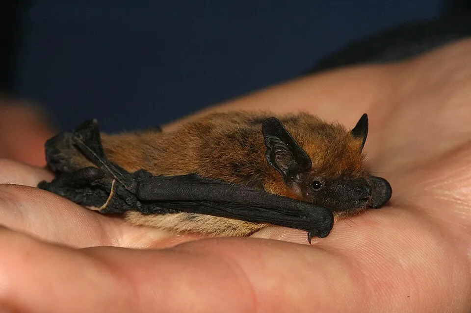
- Common pipistrelle · Pipistrellus pipistrellus · 709
- House Sparrow · Passer domesticus · 558
- Common Blackbird · Turdus merula · 349
- Eurasian Jay · Garrulus glandarius · 265
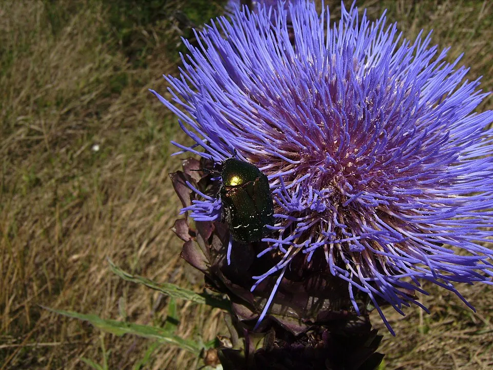
- Rose Chafer · Cetonia aurata · 187
- Kuhl's pipistrelle · Pipistrellus kuhlii · 180
- Red-bodied click beetle · Ampedus quercicola · 169
- Barbastelle · Barbastella barbastellus · 168
- Eurasian Woodcock · Scolopax rusticola · 151
- European turtle dove · Streptopelia turtur · 143
- Woodland Dor Beetle · Anoplotrupes stercorosus · 141
- Song Thrush · Turdus philomelos · 139
+18 more species
- Litargus connexus · 138
- Vincenzellus ruficollis · 117
- Serotine bat · Eptesicus serotinus · 105
- Diplocoelus fagi · 103
- Platystomos albinus · 102
- Great tit · Parus major · 98
- Common Wood Pigeon · Columba palumbus · 93
- Orchesia undulata · 90
- Isorhipis marmottani · 85
- Eurasian blue tit · Cyanistes caeruleus · 81
- Salpingus planirostris · 77
- Redwing · Turdus iliacus · 72
- European ground beetle · Carabus nemoralis · 70
- Abax parallelepipedus · 69
- Corticarina similata · 68
- Ant beetle · Thanasimus formicarius · 66
- Xyleborinus saxesenii · 65
- Xyleborus dispar · 65
Records: GBIF.org (CC-BY). Names: Wikidata (CC0), GBIF. Photos: Wikimedia Commons.
Conservation challenges
The primary purpose of the site is to preserve its natural habitats and the biodiversity they support. The species recorded (Biodiversity tab) reflect its ecological value. The designations it holds frame its management and the control of land use.
According to Global Forest Change data (University of Maryland, Global Forest Watch), about 14 ha of tree cover were lost within the boundary between 2001 and 2023 (under 1% of its area), peaking in 2002 and 2012. These losses include logging, storms and fires, and do not account for regrowth. Apart from forest felling and regrowth (about 660 ha in total), land cover remained almost unchanged between 1990 and 2018 according to CORINE Land Cover. At night, the area gives off virtually no artificial light detectable from space (NASA VIIRS Black Marble composite, 2016). According to the Water Framework Directive assessment (2022 river basin management plans, data 2015–2017), the only river assessed within the site has poor ecological status. Invasive alien species have been recorded within the site since 2000 (GBIF observations), one of them listed as of Union concern. Among them: Vespa velutina (Asian hornet) and Ambrosia artemisiifolia (Annual ragweed).
Pressure indicators
Tree cover lost
14 ha
2001–2023 · < 1% of the area
20012023
Fires since 2016
0
No large fire mapped (fires over about 30 ha)
Light at night
0%
of the area gives off artificial light visible from space
DarkLit
Land cover change
< 0.5%
of the area changed, 1990–2018 · CORINE
forest felling and regrowth: 660 ha in total
Rivers and lakes
0%
of the 4 km of assessed rivers in good or high ecological status · WFD 2022
assessments 2015–2017
Invasive alien species
3
incl. 1 of EU concern · since 2000
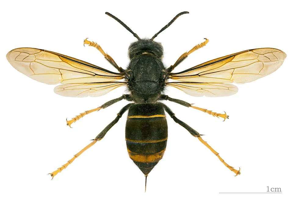 Asian hornet
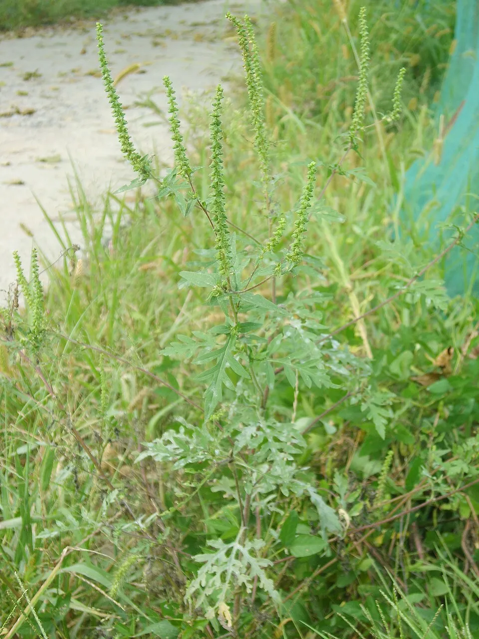 Annual ragweed
Photos: Asian hornet © Didier Descouens · CC BY-SA 4.0; Annual ragweed © Dalgial · CC BY-SA 3.0
Sources: Global Forest Change (Hansen et al., University of Maryland, via Global Forest Watch, CC-BY 4.0); EFFIS, European Commission / Copernicus; NASA Black Marble 2016 (public domain); CORINE Land Cover 2018 (Copernicus) or MODIS.
CORINE Land Cover Change 1990–2018: generated using European Union's Copernicus Land Monitoring Service information (EEA), aggregated by Parkavela; DOI 10.2909/f30f1000-7cf8-43bb-872c-5eb093911b24.
Ecological status of water bodies: European Environment Agency, WISE – Water Framework Directive, 3rd river basin management plans (2022), CC BY 4.0. Official national classification, not comparable between countries.
Invasive alien species: Global Register of Introduced and Invasive Species (ISSG, CC BY 4.0); Union list, Regulation (EU) 1143/2014 (INBO, CC0); GBIF.org records (CC0 / CC BY 4.0), at least 2 per species.
Practical information
Cities and airport
- Niort
20 km as the crow flies - La Rochelle
53 km as the crow flies - Airport: La Rochelle – Île de Ré (LRH)
56 km as the crow flies
Data © OpenStreetMap contributors (ODbL) · Wikidata (CC0)
Access and visiting
The nearest railway station is Prissé-la-Charrière, about 4 km from the site boundary. Nearest towns of over 50,000 people, as the crow flies: Niort (20 km) and La Rochelle (53 km). Nearest airport: La Rochelle – Île de Ré (LRH), about 56 km away. About 110,000 people live within 20 km of the site boundary, 16,000 of them within 10 km; some 50 people are estimated to live inside (GHSL estimate, 2020). This population has grown by about 11% since 2000. To plan a visit (access, opening periods, visitor rules), it is best to consult the official information from the managing body and the official website listed in this page's sources.
Source: OpenStreetMap (ODbL), Wikidata (CC0), October 2026.
When to visit
Best time to visit: from April to October, with average temperatures of 11 to 21 °C and moderate rainfall. Day length ranges from about 8 h 39 min in December to 15 h 45 min in June. Wildlife records published on GBIF peak for birds (May), plants (May and June), butterflies and moths (June and July), dragonflies (June) and mammals (July). These peaks also reflect when observers are most active.
Source: Copernicus ERA5-Land (C3S), monthly averages 1996–2025 at the representative point, temperatures adjusted for elevation.
Contains modified Copernicus Climate Change Service information 2026. Neither the European Commission nor ECMWF is responsible for any use that may be made of the Copernicus information or data it contains.
Wildlife records calendar
JFMAMJJASOND
Birds
Plants
Butterflies & moths
Dragonflies
Mammals
Monthly records published on GBIF (CC-BY), relative to the busiest month; also reflects observer activity.
Gallery
© unaihuiziphotography / Magnific
Sources and licences
- Wikidata: Q64846479
- OpenStreetMap: relation 1178113
- WDPA: 345948
References
- cds.climate.copernicus.eu: climate · CC-BY-4.0
- registry.opendata.aws: elevation of the reference point, detailed relief · PD
- land.copernicus.eu: land cover, land cover change, sea share · COPERNICUS
- doi.org: population around the site · CC-BY-4.0
- wikidata.org: official area, establishment date, official name, nearby cities and airport, access and peaks, lake depths, places to see · CC0-1.0
- eea.europa.eu: bathing water quality, ecological status of waters · CC-BY-4.0
- en.eurovelo.com: EuroVelo cycle routes · ODbL-1.0
- cycling.waymarkedtrails.org: cycle routes · ODbL-1.0
- opentopodata.org: elevations · PD
- forest-fire.emergency.copernicus.eu: wildfires · COPERNICUS
- globalforestwatch.org: tree cover loss · CC-BY-4.0
- gbif.org: seasonality of sightings, invasive alien species, observed species · CC-BY-4.0
- infoterre.brgm.fr: geology · LO-2.0
- pop.culture.gouv.fr: protected heritage · LO-2.0
- hydrosheds.org: lakes · CC-BY-4.0
- natura2000.eea.europa.eu: Natura 2000 habitats and species · CC-BY-4.0
- earthobservatory.nasa.gov: night light · PD
- openstreetmap.org: access and peaks, places to see · ODbL-1.0
- nsidc.org: snow cover · PD
Data © OpenStreetMap contributors (ODbL), Wikidata (CC0) and the sources cited.