
Poland · Terrestrial
Tatra National Park
National park of 21,164 hectares in Poland, established in 1954.
Overview
National park of 21,164 hectares in Poland, established in 1954.
Tatra National Park is located in Poland (Europe). It is a predominantly terrestrial area. Established in 1954, it covers about 21,164 hectares.
Protections and designations
UNESCO Biosphere Reserve
Natura 2000 · habitats (SAC) · 2 sites
- Polana Biały Potok PLH120026
- Tatry PLC120001
Natura 2000 · birds (SPA)
- Tatry PLC120001
Protected as a national park. International labels and designations: UNESCO Biosphere Reserve (“Tatra Transboundary Biosphere Reserve”) and Natura 2000 network (2 sites). Key dates: established in 1954, Biosphere Reserve in 1992, first Natura 2000 site under the Birds Directive in 2004 and first Natura 2000 site under the Habitats Directive in 2008.
In our collections
Timeline
-
1954
Established
-
1992
UNESCO Biosphere Reserve Tatra Transboundary Biosphere Reserve
-
2004
First Natura 2000 site under the Birds Directive
-
2008
First Natura 2000 site under the Habitats Directive 2 such sites designated up to 2009
Sources: Wikidata (CC0) for establishment and international labels; EEA Natura 2000 database (CC-BY 4.0) for site designation dates.
Frequently asked questions
Where is Tatra National Park?
In Poland (Europe). Representative point: 49.2500° N, 19.9333° E.
How large is Tatra National Park?
About 21,164 hectares (212 km²). It is the 4th largest of the 23 national parks in Poland covered by Parkavela.
When was Tatra National Park established?
In 1954.
What habitats and landscapes does Tatra National Park include?
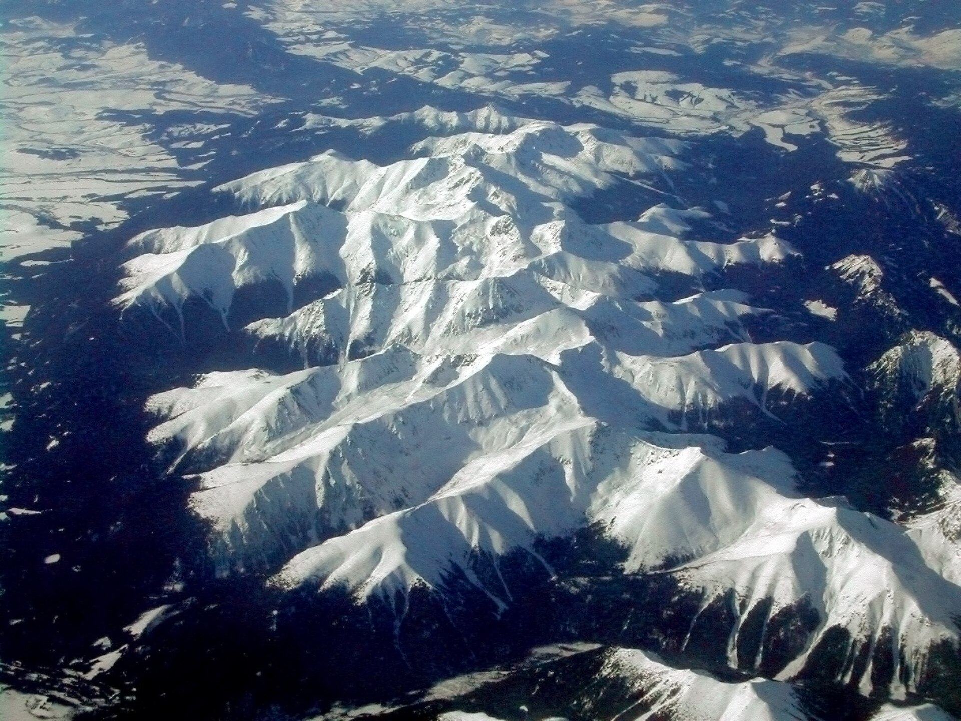
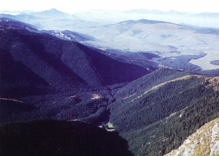
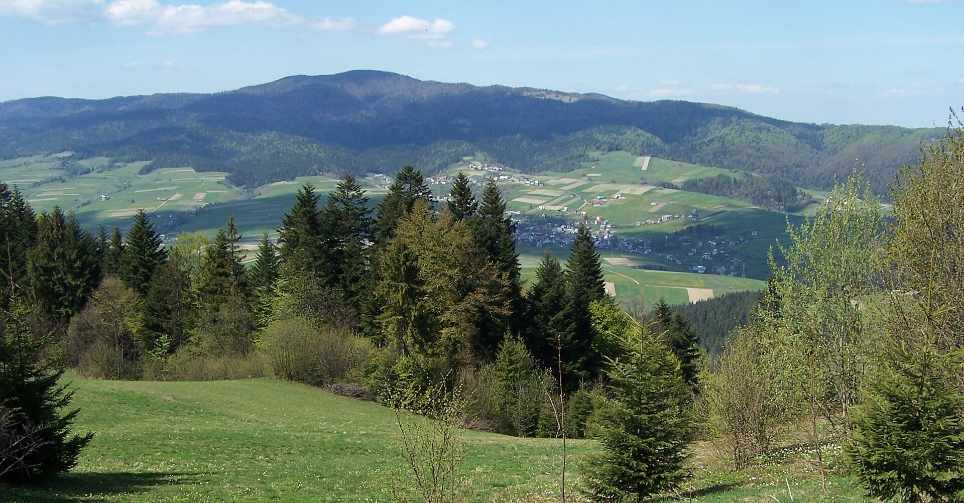
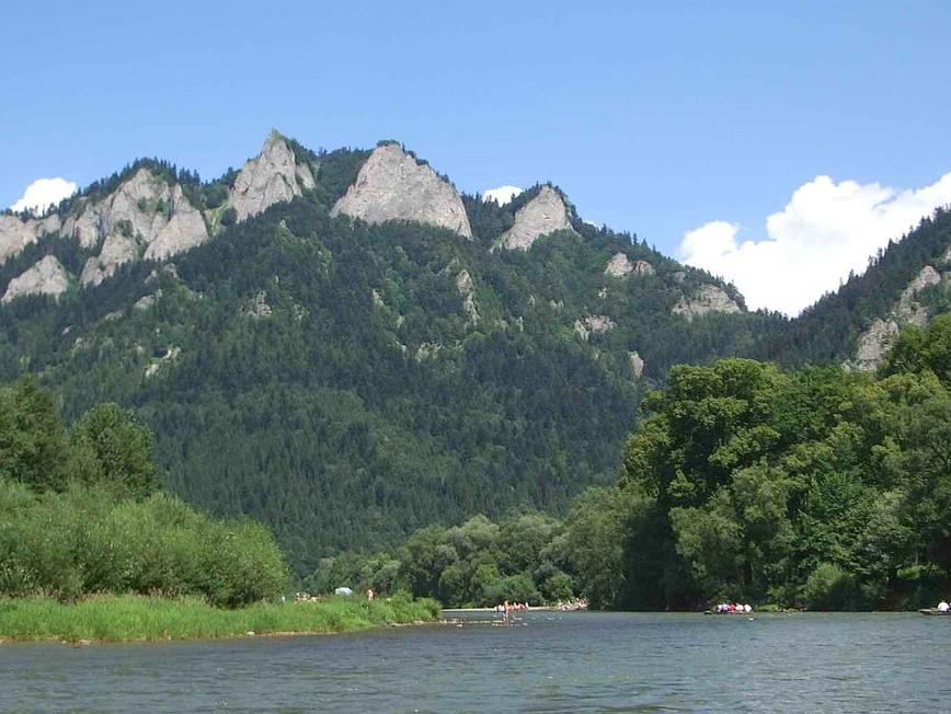
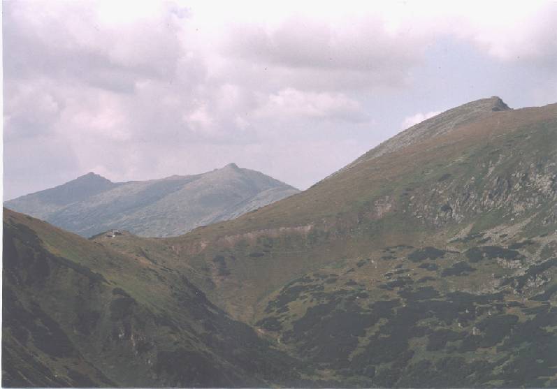
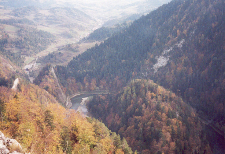
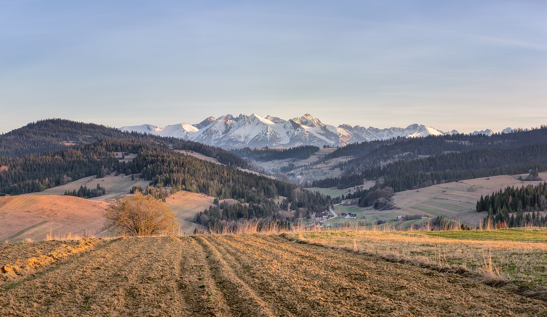
A terrestrial area, with forests and mountains.
What rocks lie beneath Tatra National Park?
According to the European 1:1 million geological map (EGDI), recent unconsolidated deposits – sands and gravels (54% of sampled points) – cover most of the site; among the consolidated rocks: limestones (31%). These are mostly sedimentary rocks. The geological units date mainly from the Quaternary (54% of sampled points).
What is the highest point of Tatra National Park?
Rysy, at 2,499 m (OpenStreetMap).
What are the main summits of Tatra National Park?
Rysy (2,499 m), Mięguszowiecki Szczyt Wielki / Veľký Mengusovský štít (2,438 m), Niżne Rysy, Zadnia Turnia / Malé Rysy, Zadná veža (2,410 m), Niżne Rysy, Skrajna Turnia / Malé Rysy, Predná veža (2,375 m) and Volia veža / Wołowa Turnia (2,373 m) (OpenStreetMap).
Which international labels apply to Tatra National Park?
UNESCO Biosphere Reserve (“Tatra Transboundary Biosphere Reserve”) and Natura 2000 network (2 sites).
When is the best time to visit Tatra National Park?
Mildest period: from June to August, with average temperatures of 8 to 11 °C.
Is there snow in Tatra National Park?
Yes. According to NASA's MODIS satellites (2015–2025 average), snow covers most of the site from December to March, and until April on higher ground, with about 150 snow-covered days a year on average.
What is there to see in Tatra National Park?
35 viewpoints, 21 waterfalls, 37 lakes and ponds and 352 caves, including Kozi Wierch (2,291 m), Buczynowa Siklawa, Zadni Staw Gąsienicowy (1,852 m) and Dziura nad Potokiem (OpenStreetMap).
Where can I stay in Tatra National Park?
9 mountain huts and 4 campsites, including Schronisko PTTK w Dolinie Pięciu Stawów Polskich (1,670 m), Pod Krokwią and Murowaniec (1,500 m) (OpenStreetMap).
Are there historic monuments in Tatra National Park?
Yes. According to Wikidata, 89 monuments listed in the Polish register of monuments stand within the boundary. For example: “Sacred Heart chapel in Zakopane Jaszczurówka” in Jaszczurówka, “Schronisko turystyczne im. St. Staszica” in Brzegi and “Budynek gospodarczy I” in Kościelisko.
What is the nearest large city to Tatra National Park?
Nearest towns of over 50,000 people, as the crow flies: Nowy Sącz (52 km) and Martin (63 km). Nearest airport: Poprad-Tatry (TAT), about 16 km away.
How can I reach Tatra National Park by train?
The nearest railway station is Zakopane, about 2 km from the site boundary.
Where can I get visitor information on site?
Chata Horskej služby, Punkt Informacji Turystycznej TPN and Centrum Informacji Turystycznej.
Are there waymarked hiking trails in Tatra National Park?
Yes. Waymarked hiking routes listed in OpenStreetMap: 168, including Szlak Maryjny, Droga pod Reglami, Cudakowa Polana and Dolina Dudowa. The “Droga pod Reglami” route runs for about 8 km through the site, with some 150 m of ascent on its longest section.
Which species can be seen in Tatra National Park?
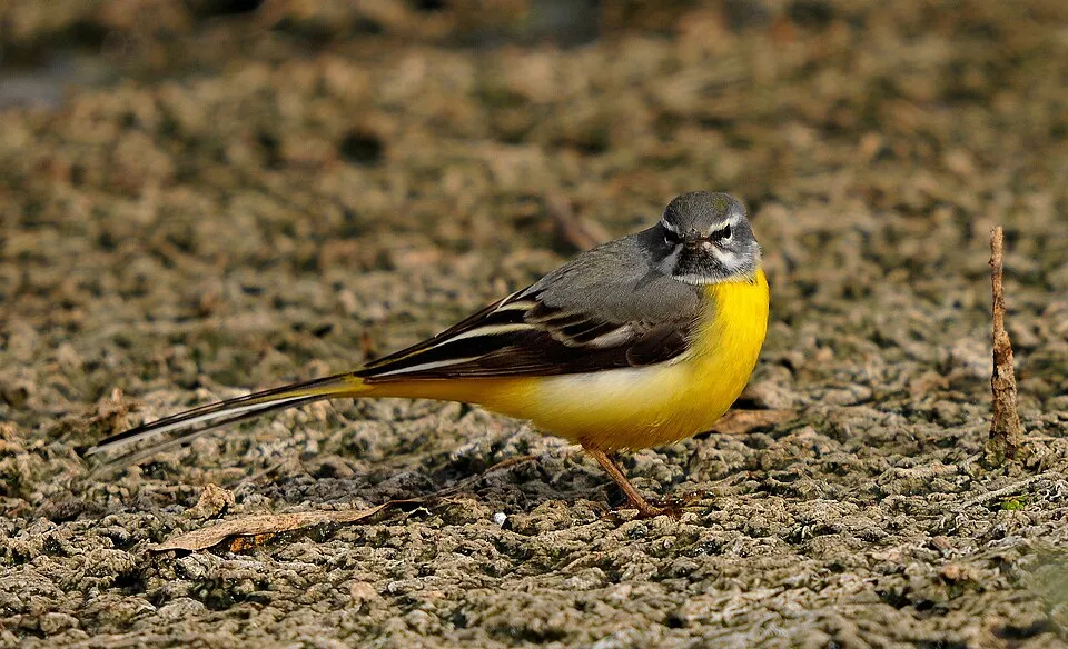
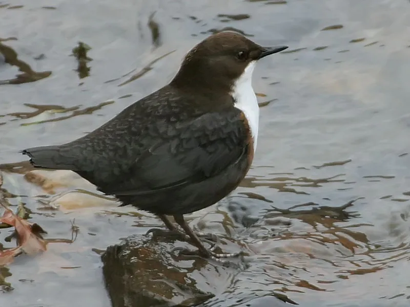
Among the species most often recorded on GBIF are Fringilla coelebs (Eurasian Chaffinch), Periparus ater (Coal tit), Motacilla cinerea (Grey Wagtail) and Cinclus cinclus (White-throated Dipper).
What is the official website of Tatra National Park?
© OpenStreetMap
Download the boundary: GeoJSON · GPX Boundary © OpenStreetMap contributors (ODbL).
Geography
The representative point of the site lies at around 1,806 m above sea level. Over the 1996–2025 period, the mean annual temperature is about 0.6 °C and total precipitation reaches roughly 1,061 mm per year. The warmest month is usually July, the coolest January, and the wettest July. According to the European 1:1 million geological map (EGDI), recent unconsolidated deposits – sands and gravels (54% of sampled points) – cover most of the site; among the consolidated rocks: limestones (31%). These are mostly sedimentary rocks. The geological units date mainly from the Quaternary (54% of sampled points). The site contains 4 lakes larger than 10 ha, totalling 89 ha of water; the largest, Wielki Staw Polski, covers 30 ha (HydroLAKES). Wielki Staw Polski (34 ha) is 79.3 m deep (Wikidata).
Area
- Area
- 21,164 ha
- Elevation
- 1,806 m
- Median elevation
- 1,303 m
- Mean slope
- 21°
- Snow cover
- ≈ 150 days a year
- Lakes over 10 ha
- 4 (89 ha)
- Coordinates
- 49.25, 19.9333
Terrain: Mapzen Terrain Tiles (SRTM, USGS) · Lakes: HydroLAKES (Messager et al. 2016, hydrosheds.org, CC BY 4.0) · depths: Wikidata (CC0)
Elevation bands
- 500–1,000 m 13%
- 1,000–1,500 m 57%
- 1,500–2,000 m 28%
- 2,000–2,500 m 2%
share of the site in each elevation band (smoothed terrain model: summits are rounded off) · Terrain: Mapzen Terrain Tiles (SRTM, USGS)
Bedrock
- Sands and gravels 54 %
- Limestones 31 %
- Gneiss 8 %
- Conglomerates and breccias 8 %
Sedimentary rocks 92 % · Metamorphic rocks 8 % · Main age: Quaternary (54%)
Source: EGDI 1:1M geological map (EuroGeoSurveys and national geological surveys), CC BY 4.0 · 13 sampled points within the site.
Main summits
- Rysy2,499 m
- Mięguszowiecki Szczyt Wielki / Veľký Mengusovský štít2,438 m
- Niżne Rysy, Zadnia Turnia / Malé Rysy, Zadná veža2,410 m
- Niżne Rysy, Skrajna Turnia / Malé Rysy, Predná veža2,375 m
- Volia veža / Wołowa Turnia2,373 m
- Rogata Turniczka / Rohatá vežička2,365 m
- Żabia Turnia Mięguszowiecka / Žabia veža2,336 m
- Cubryńska Strażnica2,335 m
- Svinica / Świnica2,302 m
- Świnicka Kopa2,298 m
Data © OpenStreetMap contributors (ODbL)
Climate
● Mean temperature (°C) · ▮ Precipitation (mm)
Source: Copernicus ERA5-Land (C3S, doi:10.24381/cds.68d2bb30), monthly averages 1996–2025 interpolated to the representative point, temperatures adjusted for elevation.
Contains modified Copernicus Climate Change Service information 2026. Neither the European Commission nor ECMWF is responsible for any use that may be made of the Copernicus information or data it contains.
Snow cover measured by satellite
J
F
M
A
M
J
J
A
S
O
N
D
average share of the site under snow · snowiest parts · ≈ 150 days a year
Snow cover: MODIS/Terra MOD10CM v61 (Hall & Riggs, 2021, NASA NSIDC DAAC, doi:10.5067/MODIS/MOD10CM.061), imagery from NASA GIBS (ESDIS); 2015–2025 average, grid of about 5 km.
Natural habitats
According to CORINE Land Cover (2018), the site is mainly made up of forests (49%), heath and scrub (28%) and grassland and meadows (11%). Woodland is mostly coniferous. Elevation ranges from about 930 m to 2,499 m (highest point: Rysy). Median elevation is 1,303 m, and 30% of the site lies above 1,500 m (SRTM elevation model). The terrain is steep: 22% of slopes exceed 30° (mean slope 21°). The 2 Natura 2000 sites overlapping the area list 32 habitats of European interest (8 priority), the most extensive being acidophilous Picea forests of the montane to alpine levels (Vaccinio-Piceetea), bushes with Pinus mugo and Rhododendron hirsutum (Mugo-Rhododendretum hirsuti) and Asperulo-Fagetum beech forests.
Biodiversity
Based on occurrences aggregated by GBIF, several species are regularly recorded within the site. Among the most frequent are Fringilla coelebs (Eurasian Chaffinch), Periparus ater (Coal tit), Motacilla cinerea (Grey Wagtail) and Cinclus cinclus (White-throated Dipper). The full list of documented taxa is shown below. The overlapping Natura 2000 sites list 49 species of European interest: 26 birds, 11 mammals, 2 amphibians, 3 invertebrates and 7 plants.
Habitats of European interest
From the official forms of the 2 Natura 2000 sites overlapping the area (areas reported for each whole site).
- Acidophilous Picea forests of the montane to alpine levels (Vaccinio-Piceetea) 7,035 ha
- Bushes with Pinus mugo and Rhododendron hirsutum (Mugo-Rhododendretum hirsuti) priority 2,516 ha
- Asperulo-Fagetum beech forests 1,024 ha
- Siliceous alpine and boreal grasslands 714 ha
- Alpine and subalpine calcareous grasslands 380 ha
- Mountain hay meadows 223 ha
- Species-rich Nardus grasslands, on silicious substrates in mountain areas (and submountain areas in Continental Europe) priority 209 ha
- Alpine Larix decidua and/or Pinus cembra forests 166 ha
and 24 more
Species of European interest
Birds · 26
Boreal Owl (Aegolius funereus) resident, Water Pipit (Anthus spinoletta) breeding, Golden Eagle (Aquila chrysaetos) breeding, Hazel Grouse (Bonasa bonasia) resident, Eurasian Eagle-owl (Bubo bubo) resident, Common redpoll (Carduelis flammea) breeding, Eurasian Dotterel (Charadrius morinellus) passage, Black Stork (Ciconia nigra) breeding, White-throated Dipper (Cinclus cinclus) breeding, Corn Crake (Crex crex) breeding, White-backed Woodpecker (Dendrocopos leucotos) resident, Black Woodpecker (Dryocopus martius) resident and 14 more
Mammals · 11
Barbastelle (Barbastella barbastellus), Grey wolf (Canis lupus), Eurasian otter (Lutra lutra), Eurasian Lynx (Lynx lynx), Marmota marmota latirostris, Tatra pine vole (Microtus tatricus), Bechstein's bat (Myotis bechsteinii), Geoffroy's bat (Myotis emarginatus), Greater mouse-eared bat (Myotis myotis), Tatra chamois (Rupicapra rupicapra tatrica), Brown bear (Ursus arctos)
Amphibians · 2
Yellow-bellied toad (Bombina variegata), Montandon's newt (Triturus montandoni)
Invertebrates · 3
Carabus variolosus, Pseudogaurotina excellens, Geyer's whorl snail (Vertigo geyeri)
Plants · 7
Moravian Monkshood (Aconitum firmum subsp. moravicum), Buxbaumia moss (Buxbaumia viridis), Campanula serrata, Tatra Scurvy-grass (Cochlearia tatrae), Lady's-slipper orchid (Cypripedium calceolus), Hamatocaulis moss (Hamatocaulis vernicosus), Slovak Pasque Flower (Pulsatilla slavica)
Source: Natura 2000 standard data forms (EEA, CC-BY 4.0). Not exhaustive: sensitive species are not published.
Species to look out for


Observed species
Occurrences documented via GBIF; they are neither an exhaustive inventory nor proof of current presence.
- Eurasian Chaffinch · Fringilla coelebs · 562
- Coal tit · Periparus ater · 478
- Grey Wagtail · Motacilla cinerea · 475
- White-throated Dipper · Cinclus cinclus · 459
- European robin · Erithacus rubecula · 422
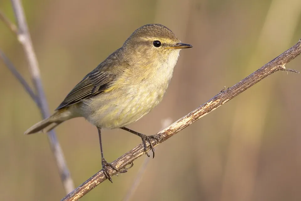
- Common Chiffchaff · Phylloscopus collybita · 407
- Eurasian Wren · Troglodytes troglodytes · 402
- Northern Raven · Corvus corax · 364
- Eurasian Jay · Garrulus glandarius · 345
- Common Blackbird · Turdus merula · 337
- Eurasian Blackcap · Sylvia atricapilla · 330
- Goldcrest · Regulus regulus · 325
+18 more species
- Great tit · Parus major · 313
- Black Redstart · Phoenicurus ochruros · 297
- Song Thrush · Turdus philomelos · 292
- Willow Gentian · Gentiana asclepiadea · 283
- Alpine Accentor · Prunella collaris · 280
- Northern Nutcracker · Nucifraga caryocatactes · 276
- Water Pipit · Anthus spinoletta · 263
- Fieldfare · Turdus pilaris · 252
- Willow Warbler · Phylloscopus trochilus · 252
- Dunnock · Prunella modularis · 250
- Red Crossbill · Loxia curvirostra · 231
- White Wagtail · Motacilla alba · 227
- European Crested Tit · Lophophanes cristatus · 219
- Eurasian Bullfinch · Pyrrhula pyrrhula · 217
- Eurasian Siskin · Spinus spinus · 201
- Mallard · Anas platyrhynchos · 197
- Common Kestrel · Falco tinnunculus · 183
- Common Swift · Apus apus · 170
Records: GBIF.org (CC-BY). Names: Wikidata (CC0), GBIF. Photos: Wikimedia Commons.
Conservation challenges
The primary purpose of the site is to preserve its natural habitats and the biodiversity they support. The species recorded (Biodiversity tab) reflect its ecological value. The designations it holds frame its management and the control of land use.
According to Global Forest Change data (University of Maryland, Global Forest Watch), about 2,910 ha of tree cover were lost within the boundary between 2001 and 2023 (14% of its area), peaking in 2014 and 2018. These losses include logging, storms and fires, and do not account for regrowth. Apart from forest felling and regrowth (about 2,590 ha in total), land cover remained almost unchanged between 1990 and 2018 according to CORINE Land Cover; only some 10 ha were built over. At night, 1% of the area gives off artificial light detectable from space (NASA VIIRS Black Marble composite, 2016). Built-up and developed land (buildings, business areas, roads, quarries) covers 1% of the area (CORINE Land Cover). According to the Natura 2000 forms, of 30 assessed habitats of European interest, 26 are in excellent condition and the rest in good condition. According to the Water Framework Directive assessment (2022 river basin management plans, data 2014–2019), none of the 68 km of rivers assessed within the site reaches good ecological potential; they mostly have poor ecological potential. Since 2000, 5 invasive alien species have been recorded within the site (GBIF observations), one of them listed as of Union concern under EU Regulation 1143/2014. Among them: Impatiens glandulifera (Himalayan Balsam), Lupinus polyphyllus (Large-leaved lupine) and Salvelinus fontinalis (Brook trout).
Pressure indicators
Tree cover lost
2,906 ha
2001–2023 · 14% of the area
20012023
Fires since 2016
0
No large fire mapped (fires over about 30 ha)
Light at night
1%
of the area gives off artificial light visible from space
DarkLit
Built-up land
1%
buildings, business areas, roads, quarries
Land cover change
< 0.5%
of the area changed, 1990–2018 · CORINE
forest felling and regrowth: 2,590 ha in total
Rivers and lakes
0%
of the 68 km of assessed rivers at good or high ecological potential (mostly heavily modified water bodies) · WFD 2022
assessments 2014–2019
Invasive alien species
5
incl. 1 of EU concern · since 2000
 Himalayan Balsam
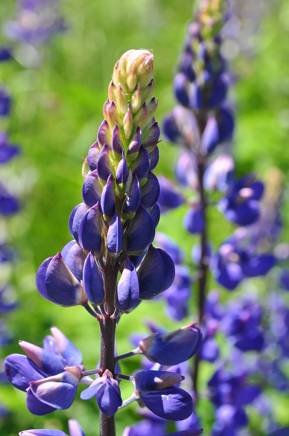 Large-leaved lupine
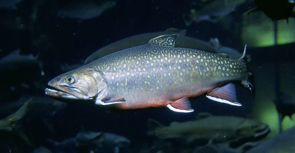 Brook trout
 Small balsam
Photos: Himalayan Balsam © Guptaele · CC BY-SA 4.0; Large-leaved lupine © Joe Mabel (on Flickr as Joe Mabel from Seattle, US) · CC BY-SA 3.0; Brook trout © Engbretson, Eric · Public domain; Small balsam © André Karwath aka Aka · CC BY-SA 2.5
Sources: Global Forest Change (Hansen et al., University of Maryland, via Global Forest Watch, CC-BY 4.0); EFFIS, European Commission / Copernicus; NASA Black Marble 2016 (public domain); CORINE Land Cover 2018 (Copernicus) or MODIS.
CORINE Land Cover Change 1990–2018: generated using European Union's Copernicus Land Monitoring Service information (EEA), aggregated by Parkavela; DOI 10.2909/f30f1000-7cf8-43bb-872c-5eb093911b24.
Ecological status of water bodies: European Environment Agency, WISE – Water Framework Directive, 3rd river basin management plans (2022), CC BY 4.0. Official national classification, not comparable between countries.
Invasive alien species: Global Register of Introduced and Invasive Species (ISSG, CC BY 4.0); Union list, Regulation (EU) 1143/2014 (INBO, CC0); GBIF.org records (CC0 / CC BY 4.0), at least 2 per species.
Practical information
Cities and airport
- Nowy Sącz
52 km as the crow flies - Martin
63 km as the crow flies - Airport: Poprad-Tatry (TAT)
16 km as the crow flies
Visitor information
- Chata Horskej služby
1 km from the site boundary - Punkt Informacji Turystycznej TPN
within the site - Centrum Informacji Turystycznej
1 km from the site boundary - Zako Love
1 km from the site boundary
Parking
33 public car parks listed within the site
Parking TPN Dolina Kościeliska - KiryMala LakaPalenica BiałczańskaŁysa Polana
Things to see
35 viewpoints · 21 waterfalls · 37 lakes and ponds · 352 caves
- Kozi Wierch
viewpoint · 2,291 m - Buczynowa Siklawa
waterfall - Zadni Staw Gąsienicowy
lake or pond · 1,852 m - Dziura nad Potokiem
cave - Tatrzańskie Serduszko
viewpoint
Where to stay
9 mountain huts · 4 campsites
- Schronisko PTTK w Dolinie Pięciu Stawów Polskich
Staffed hut · 1,670 m · 67 beds - Pod Krokwią
campsite - Murowaniec
Staffed hut · 1,500 m - Polana Rogoźniczańska PZA
campsite - Schronisko Głodówka
Staffed hut · 1,120 m · 98 beds
Hiking
168 waymarked routes listed, including:
Szlak MaryjnyDroga pod ReglamiCudakowa PolanaDolina DudowaGaborowa Przełęcz WyżniaBłyszcz
By bike
+ 4 local loops
Signed cycle routes: this does not mean that cycling is allowed on footpaths.
Data © OpenStreetMap contributors (ODbL) · Wikidata (CC0)
Routes © OpenStreetMap contributors (ODbL), via Waymarked Trails
Waymarked hiking routes
M02-14 Szlak Maryjny - etap 1.
7.1 km within the site ↗ 104 m↘ 146 m 899–1,003 m
up to T1 · hiking
Cudakowa Polana - Chuda Przełączka
3.9 km within the site ↗ 862 m↘ 0 m 964–1,831 m
up to T2 · mountain hiking
Dolina Dudowa - Niżnia Kominiarska Polana
3.5 km within the site ↗ 306 m↘ 220 m 1,016–1,330 m
Polana Chochołowska – Rakoń
3.7 km within the site ↗ 568 m↘ 0 m 1,131–1,703 m
up to T2 · mountain hiking
Tracks © OpenStreetMap contributors (ODbL), clipped to the boundary; elevation gain and profiles computed on the longest section from Mapzen Terrain Tiles (≈ 30 m), indicative only. Indicative difficulty (SAC scale, OpenStreetMap, via Waymarked Trails): check with the park.
Access and visiting
The nearest railway station is Zakopane, about 2 km from the site boundary. Nearest towns of over 50,000 people, as the crow flies: Nowy Sącz (52 km) and Martin (63 km). Nearest airport: Poprad-Tatry (TAT), about 16 km away. About 320,000 people live within 20 km of the site boundary, 82,000 of them within 10 km; some 3,000 people are estimated to live inside (GHSL estimate, 2020). Visitor information on site: Chata Horskej služby, Punkt Informacji Turystycznej TPN and Centrum Informacji Turystycznej. Public car parks listed within the site: 33, including Parking TPN Dolina Kościeliska - Kiry, Mala Laka and Palenica Białczańska. Waymarked hiking routes listed in OpenStreetMap: 168, including Szlak Maryjny, Droga pod Reglami, Cudakowa Polana and Dolina Dudowa. To see: 35 viewpoints, 21 waterfalls, 37 lakes and ponds and 352 caves, including Kozi Wierch (2,291 m), Buczynowa Siklawa, Zadni Staw Gąsienicowy (1,852 m) and Dziura nad Potokiem. Where to stay: 9 mountain huts and 4 campsites, including Schronisko PTTK w Dolinie Pięciu Stawów Polskich (1,670 m), Pod Krokwią and Murowaniec (1,500 m). To plan a visit (access, opening periods, visitor rules), it is best to consult the official information from the managing body and the official website listed in this page's sources.
Source: OpenStreetMap (ODbL), Wikidata (CC0), October 2026.
Built heritage
According to Wikidata, 89 monuments listed in the Polish register of monuments stand within the boundary. Among them are 6 religious buildings and 4 houses and civic buildings. Examples include “Sacred Heart chapel in Zakopane Jaszczurówka” in Jaszczurówka, “Schronisko turystyczne im. St. Staszica” in Brzegi and “Budynek gospodarczy I” in Kościelisko.
6 religious buildings4 houses and civic buildings
-
Sacred Heart chapel in Zakopane Jaszczurówka
Jaszczurówka -
Schronisko turystyczne im. St. Staszica
Brzegi · 20th c. -
Budynek gospodarczy I
Kościelisko -
Kaplica św. Jana Chrzciciela na Polanie Chochołowskiej
Witów -
Schronisko turystyczne
Brzegi · 19th c. -
Budynek gospodarczy II
Kościelisko -
Kaplica św. Krzyża
Zakopane · 19th c. -
Willa LEONTYNÓWKA
Zakopane · 19th c.
and 81 more
Source: Wikidata (CC0), monuments in each country’s official heritage protection registers, at national or regional level. Each item links to its Wikidata entry.
When to visit
Mildest period: from June to August, with average temperatures of 8 to 11 °C. Average temperatures drop below 0 °C from November to April: frost is common. Precipitation peaks from May to July (up to 150 mm per month). These averages apply to the site's representative point (1,806 m); higher up it is markedly cooler and snow lasts longer. According to NASA's MODIS satellites (2015–2025 average), snow covers most of the site from December to March, and until April on higher ground, with about 150 snow-covered days a year on average. Day length ranges from about 8 h 13 min in December to 16 h 13 min in June. Wildlife records published on GBIF peak for birds (June and July), plants (July and August), butterflies and moths (July) and mammals (September). These peaks also reflect when observers are most active.
Source: Copernicus ERA5-Land (C3S), monthly averages 1996–2025 at the representative point, temperatures adjusted for elevation.
Contains modified Copernicus Climate Change Service information 2026. Neither the European Commission nor ECMWF is responsible for any use that may be made of the Copernicus information or data it contains.
Wildlife records calendar
JFMAMJJASOND
Birds
Plants
Butterflies & moths
Mammals
Monthly records published on GBIF (CC-BY), relative to the busiest month; also reflects observer activity.
Gallery
© Qvidemus · CC BY 3.0
© Opioła Jerzy · CC BY 2.5
© Aneta Pawska · CC BY 3.0
© Jerzy Opioła · CC BY-SA 4.0
© Aneta Pawska · CC BY 3.0
© EMeczKa. Podziękowania za pomoc dla / Thanks for help to Aotearoa · CC BY-SA 4.0
Sources and licences
- Wikidata: Q609353
- OpenStreetMap: relation 2226518
- Official website: https://tpn.gov.pl/
- Wikipedia: en.wikipedia.org/wiki/Tatra_National_Park,_Poland
- WDPA: 848
References
- cds.climate.copernicus.eu: climate · CC-BY-4.0
- registry.opendata.aws: elevation of the reference point, detailed relief · PD
- land.copernicus.eu: land cover, land cover change, sea share · COPERNICUS
- doi.org: population around the site · CC-BY-4.0
- wikidata.org: official area, establishment date, protected heritage, official name, nearby cities and airport, access and peaks, lake depths, places to see, official website · CC0-1.0
- eea.europa.eu: bathing water quality, ecological status of waters · CC-BY-4.0
- en.eurovelo.com: EuroVelo cycle routes · ODbL-1.0
- cycling.waymarkedtrails.org: cycle routes · ODbL-1.0
- opentopodata.org: elevations · PD
- forest-fire.emergency.copernicus.eu: wildfires · COPERNICUS
- globalforestwatch.org: tree cover loss · CC-BY-4.0
- gbif.org: seasonality of sightings, invasive alien species, observed species · CC-BY-4.0
- europe-geology.eu: geology · CC-BY-4.0
- hydrosheds.org: lakes · CC-BY-4.0
- natura2000.eea.europa.eu: Natura 2000 habitats and species · CC-BY-4.0
- earthobservatory.nasa.gov: night light · PD
- openstreetmap.org: access and peaks, places to see · ODbL-1.0
- hiking.waymarkedtrails.org: route difficulty · ODbL-1.0
- nsidc.org: snow cover · PD
- wikidata.org: Wikipedia article · CC-BY-SA-4.0
Data © OpenStreetMap contributors (ODbL), Wikidata (CC0) and the sources cited.