
Poland · Terrestrial
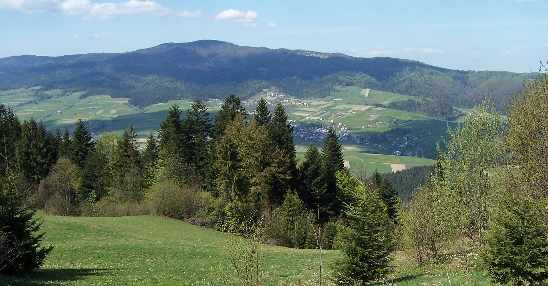
Ciężkowice-Rożnów Landscape Park
Landscape park of 18,247 hectares in Poland, established in 1995.
Overview
Landscape park of 18,247 hectares in Poland, established in 1995.
Ciężkowice-Rożnów Landscape Park is located in Poland (Europe). It is a predominantly terrestrial area. Established on 16 November 1995, it covers about 18,247 hectares.
Protections and designations
Natura 2000 · habitats (SAC) · 2 sites
- Dolny Dunajec PLH120085
- Ostoje Nietoperzy okolic Bukowca PLH120020
Protected as a landscape park. International labels and designations: Natura 2000 network (2 sites). Key dates: established in 1995 and first Natura 2000 site under the Habitats Directive in 2008.
In our collections
Timeline
-
1995
Established
-
2008
First Natura 2000 site under the Habitats Directive 2 such sites designated up to 2011
Sources: Wikidata (CC0) for establishment and international labels; EEA Natura 2000 database (CC-BY 4.0) for site designation dates.
Frequently asked questions
Where is Ciężkowice-Rożnów Landscape Park?
In Poland (Europe). Representative point: 49.8171° N, 20.8241° E.
How large is Ciężkowice-Rożnów Landscape Park?
About 18,247 hectares (182 km²). It is the 56th largest of the 121 landscape parks in Poland covered by Parkavela.
When was Ciężkowice-Rożnów Landscape Park established?
On 16 November 1995.
What habitats and landscapes does Ciężkowice-Rożnów Landscape Park include?
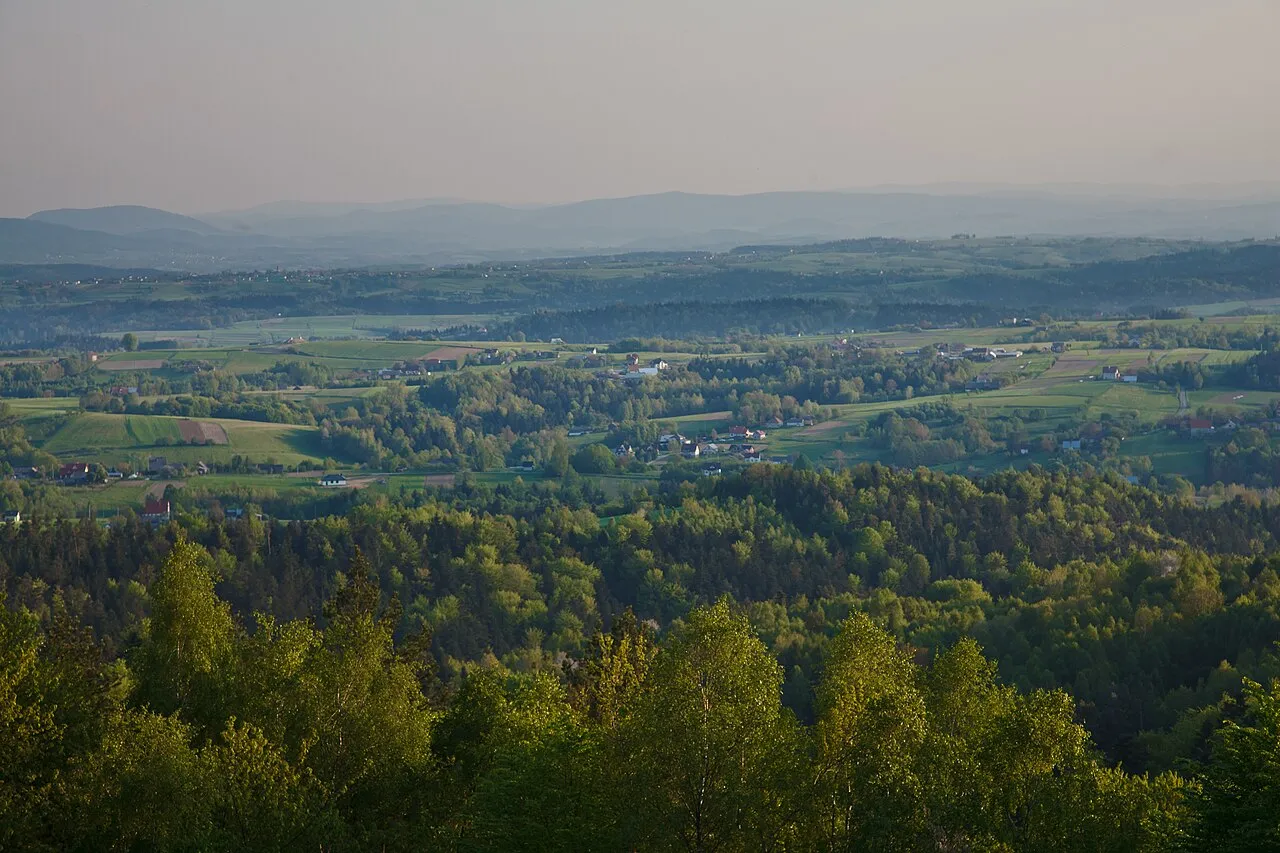
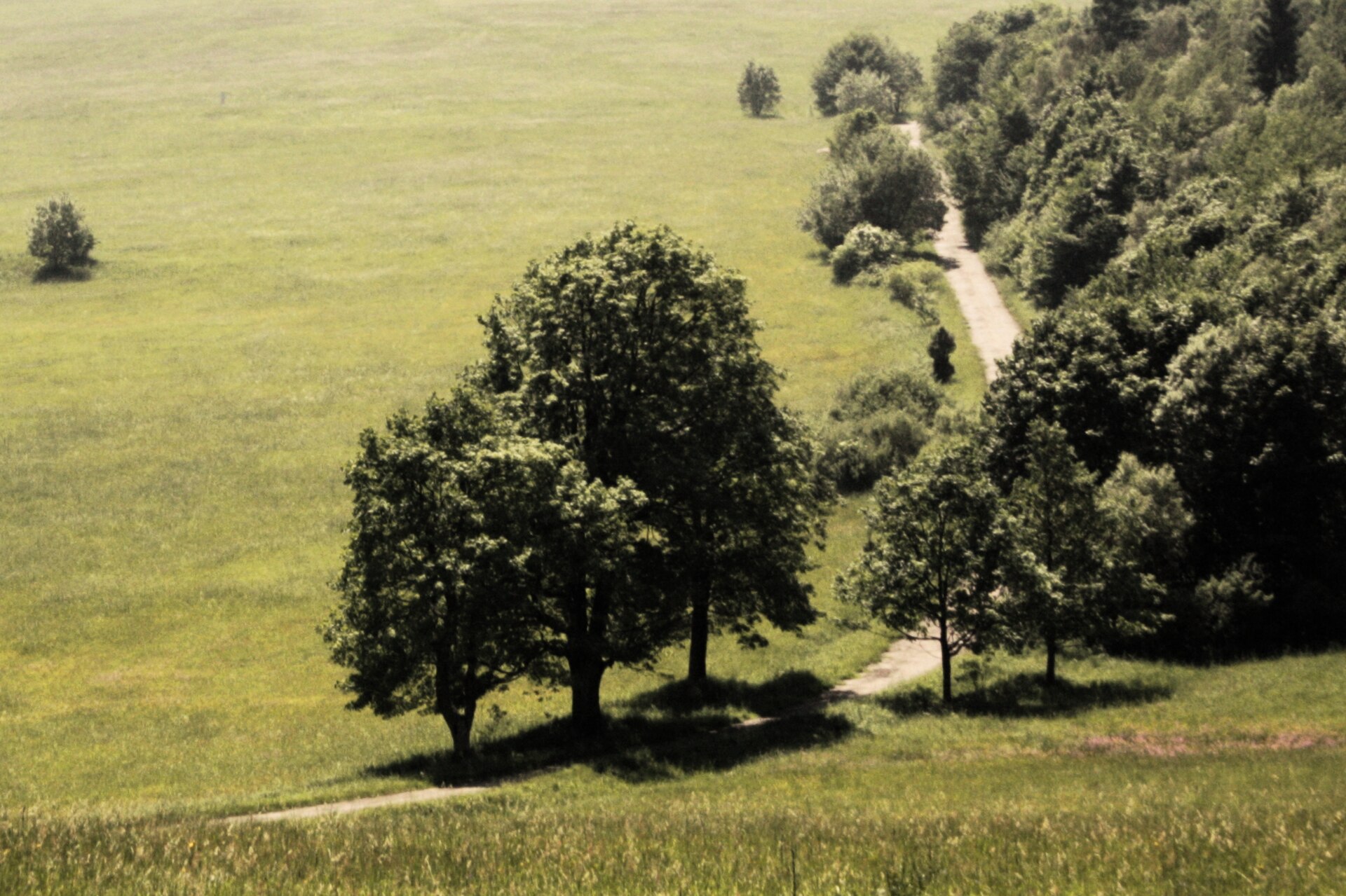
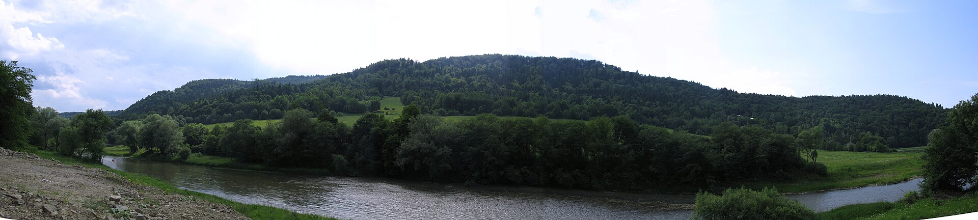
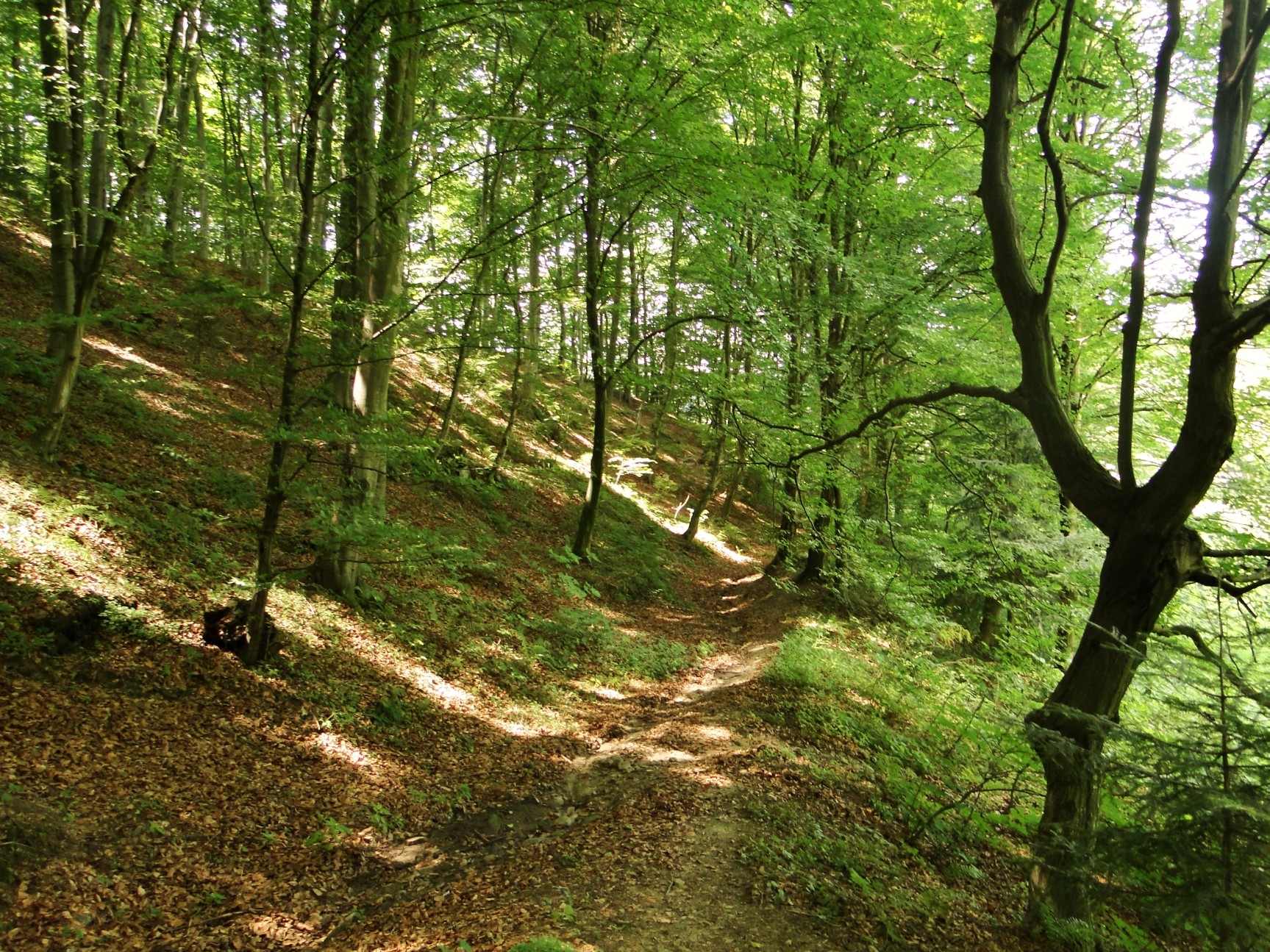
A terrestrial area, with forests.
What rocks lie beneath Ciężkowice-Rożnów Landscape Park?
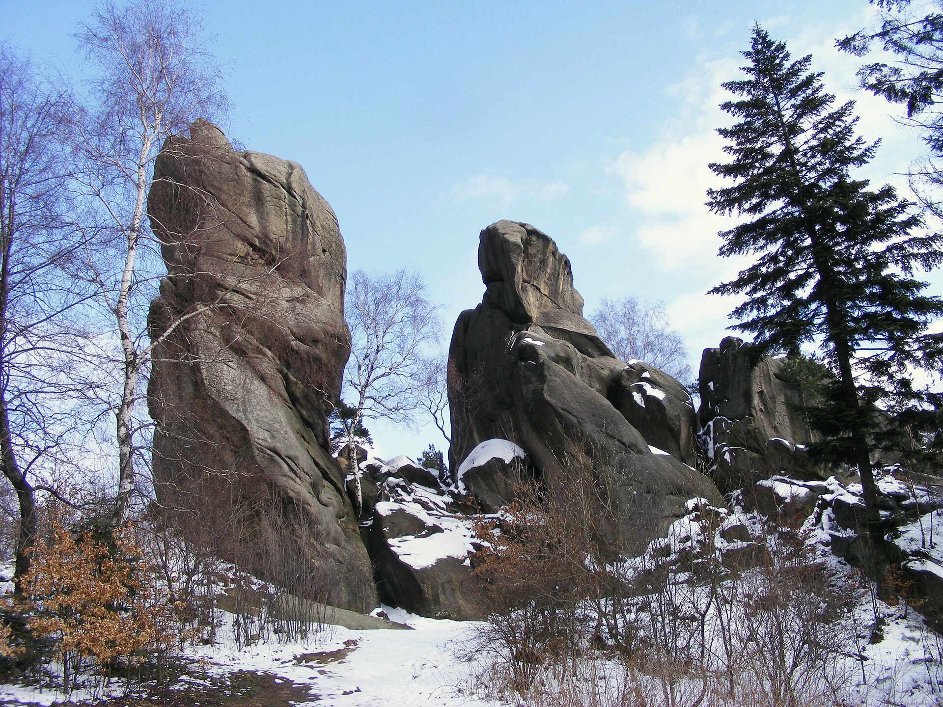
According to the European 1:1 million geological map (EGDI), recent unconsolidated deposits – sands and gravels (50% of sampled points) and clays and silts (10%) – cover most of the site; among the consolidated rocks: sandstones (40%). These are mostly sedimentary rocks. The geological units date mainly from the Quaternary (60% of sampled points).
What are the main summits of Ciężkowice-Rożnów Landscape Park?
Rosulec (Jastrzębia Góra) (515 m), Jamna (483 m), Mogiła (478 m), Patria (471 m) and Styr Południowy (469 m) (OpenStreetMap).
Which international labels apply to Ciężkowice-Rożnów Landscape Park?
Natura 2000 network (2 sites).
When is the best time to visit Ciężkowice-Rożnów Landscape Park?
Mildest period: from June to August, with average temperatures of 16 to 19 °C.
Is there snow in Ciężkowice-Rożnów Landscape Park?
Yes. According to NASA's MODIS satellites (2015–2025 average), snow covers most of the site in January, with about 50 snow-covered days a year on average.
What is there to see in Ciężkowice-Rożnów Landscape Park?
8 viewpoints, 4 waterfalls and 13 caves, including Ratusz, Wodospad Ciężkowicki, Jaskinia Krótka and Wieża widokowa w Bruśniku (OpenStreetMap).
Where can I stay in Ciężkowice-Rożnów Landscape Park?
1 campsite (OpenStreetMap).
Are there historic monuments in Ciężkowice-Rożnów Landscape Park?
Yes. According to Wikidata, 56 monuments listed in the Polish register of monuments stand within the boundary. For example: “Cmentarz partyzantów z okresu II wojny światowej” in Rzepiennik Strzyżewski, “Manor house of Ignacy Paderewski in Kąśna Dolna” in Kąśna Dolna and “Mur ogrodzeniowy” in Tursko.
What is the nearest large city to Ciężkowice-Rożnów Landscape Park?
Nearest towns of over 50,000 people, as the crow flies: Nowy Sącz (18 km) and Tarnów (20 km). Nearest airport: John Paul II International Airport Kraków-Balice (KRK), about 70 km away.
How can I reach Ciężkowice-Rożnów Landscape Park by train?
Bogoniowice Ciężkowice railway station lies within the site.
Where can I get visitor information on site?
Punkt Informacji and Centralny Punkt Informacyjny Źródlanego Szlaku.
Are there waymarked hiking trails in Ciężkowice-Rożnów Landscape Park?
Yes. Waymarked hiking routes listed in OpenStreetMap: 13, including Tarnów, Tarnów Koszyce, Szalowa and Jamna bacówka.
Which species can be seen in Ciężkowice-Rożnów Landscape Park?
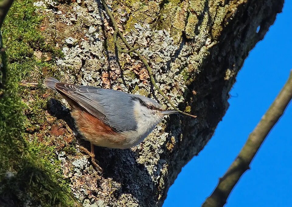
Among the species most often recorded on GBIF are Fringilla coelebs (Eurasian Chaffinch), Parus major (Great tit), Sitta europaea (Eurasian Nuthatch) and Periparus ater (Coal tit).
© OpenStreetMap
Download the boundary: GeoJSON · GPX Boundary © OpenStreetMap contributors (ODbL).
Geography
The representative point of the site lies at around 435 m above sea level. Over the 1996–2025 period, the mean annual temperature is about 8.1 °C and total precipitation reaches roughly 908 mm per year. The warmest month is usually July, the coolest January, and the wettest July. According to the European 1:1 million geological map (EGDI), recent unconsolidated deposits – sands and gravels (50% of sampled points) and clays and silts (10%) – cover most of the site; among the consolidated rocks: sandstones (40%). These are mostly sedimentary rocks. The geological units date mainly from the Quaternary (60% of sampled points).
Area
- Area
- 18,247 ha
- Elevation
- 435 m
- Median elevation
- 330 m
- Mean slope
- 8°
- Snow cover
- ≈ 50 days a year
- Coordinates
- 49.8171, 20.8241
Terrain: Mapzen Terrain Tiles (SRTM, USGS)
Bedrock
- Sands and gravels 50 %
- Sandstones 40 %
- Clays and silts 10 %
Sedimentary rocks 100 % · Main age: Quaternary (60%)
Source: EGDI 1:1M geological map (EuroGeoSurveys and national geological surveys), CC BY 4.0 · 10 sampled points within the site.
Main summits
- Rosulec (Jastrzębia Góra)515 m
- Jamna483 m
- Mogiła478 m
- Patria471 m
- Styr Południowy469 m
- Olszowa465 m
- Chyb461 m
- Styr460 m
- Wieprzek456 m
- Sucha Góra (Wypalona Góra)433 m
Data © OpenStreetMap contributors (ODbL)
Climate
● Mean temperature (°C) · ▮ Precipitation (mm)
Source: Copernicus ERA5-Land (C3S, doi:10.24381/cds.68d2bb30), monthly averages 1996–2025 interpolated to the representative point, temperatures adjusted for elevation.
Contains modified Copernicus Climate Change Service information 2026. Neither the European Commission nor ECMWF is responsible for any use that may be made of the Copernicus information or data it contains.
Snow cover measured by satellite
J
F
M
A
M
J
J
A
S
O
N
D
average share of the site under snow · snowiest parts · ≈ 50 days a year
Snow cover: MODIS/Terra MOD10CM v61 (Hall & Riggs, 2021, NASA NSIDC DAAC, doi:10.5067/MODIS/MOD10CM.061), imagery from NASA GIBS (ESDIS); 2015–2025 average, grid of about 5 km.
Natural habitats
According to CORINE Land Cover (2018), the site is mainly made up of farmland (52%) and forests (46%). Woodland mixes broadleaved and coniferous trees. Elevation ranges from about 220 to 440 m (sampled elevations, SRTM). The 2 Natura 2000 sites overlapping the area list 6 habitats of European interest (1 priority), the most extensive being alpine rivers and the herbaceous vegetation along their banks, Luzulo-Fagetum beech forests and Asperulo-Fagetum beech forests.
Biodiversity
Based on occurrences aggregated by GBIF, several species are regularly recorded within the site. Among the most frequent are Fringilla coelebs (Eurasian Chaffinch), Parus major (Great tit), Sitta europaea (Eurasian Nuthatch) and Periparus ater (Coal tit). The full list of documented taxa is shown below. The overlapping Natura 2000 sites list 14 species of European interest: 4 mammals, 3 amphibians, 6 fish and 1 invertebrate.
Habitats of European interest
From the official forms of the 2 Natura 2000 sites overlapping the area (areas reported for each whole site).
- Alpine rivers and the herbaceous vegetation along their banks 86 ha
- Luzulo-Fagetum beech forests 29 ha
- Asperulo-Fagetum beech forests 22 ha
- Alluvial forests with Alnus glutinosa and Fraxinus excelsior (Alno-Padion, Alnion incanae, Salicion albae) priority 13 ha
- Caves not open to the public 0 ha
- Galio-Carpinetum oak-hornbeam forests 0 ha
Species of European interest
Mammals · 4
Eurasian Beaver (Castor fiber), Eurasian otter (Lutra lutra), Greater mouse-eared bat (Myotis myotis), Lesser horseshoe bat (Rhinolophus hipposideros)
Amphibians · 3
European fire-bellied toad (Bombina bombina), Yellow-bellied toad (Bombina variegata), Great crested newt (Triturus cristatus)
Fish · 6
Asp (Aspius aspius), Barbel (Barbus barbus), Carpathian Barbel (Barbus carpathicus), European bullhead (Cottus gobio), European brook lamprey (Lampetra planeri), Grayling (Thymallus thymallus)
Invertebrates · 1
Source: Natura 2000 standard data forms (EEA, CC-BY 4.0). Not exhaustive: sensitive species are not published.
Species to look out for


Bird
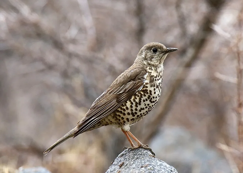
Mistle Thrush
Turdus viscivorus16 records © Imran Shah from Islamabad, Pakistan · CC BY-SA 2.0
Observed species
Occurrences documented via GBIF; they are neither an exhaustive inventory nor proof of current presence.
- Eurasian Chaffinch · Fringilla coelebs · 19
- Great tit · Parus major · 19
- Eurasian Nuthatch · Sitta europaea · 18
- Coal tit · Periparus ater · 17
- Mistle Thrush · Turdus viscivorus · 16
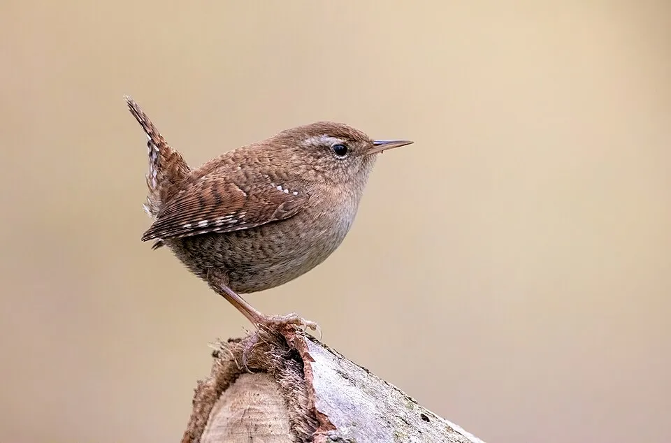
- Eurasian Wren · Troglodytes troglodytes · 16
- Common Blackbird · Turdus merula · 15
- Great Spotted Woodpecker · Dendrocopos major · 14
- Common Buzzard · Buteo buteo · 14
- Song Thrush · Turdus philomelos · 13
- Eurasian Treecreeper · Certhia familiaris · 12
- Eurasian Jay · Garrulus glandarius · 12
+18 more species
- Common Firecrest · Regulus ignicapilla · 12
- Goldcrest · Regulus regulus · 11
- European robin · Erithacus rubecula · 11
- Eurasian Blackcap · Sylvia atricapilla · 11
- Eurasian blue tit · Cyanistes caeruleus · 10
- Wood Warbler · Phylloscopus sibillatrix · 10
- Willow Tit · Poecile montanus · 9
- European Crested Tit · Lophophanes cristatus · 9
- Common Chiffchaff · Phylloscopus collybita · 9
- European Goldfinch · Carduelis carduelis · 9
- Black Woodpecker · Dryocopus martius · 8
- Greenish Warbler · Phylloscopus trochiloides · 8
- Long-tailed Tit · Aegithalos caudatus · 8
- Stock Dove · Columba oenas · 8
- Hard Fern · Struthiopteris spicant · 8
- European Green Woodpecker · Picus viridis · 7
- Eurasian Golden Oriole · Oriolus oriolus · 7
- Grey Wagtail · Motacilla cinerea · 7
Records: GBIF.org (CC-BY). Names: Wikidata (CC0), GBIF. Photos: Wikimedia Commons.
Conservation challenges
The primary purpose of the site is to preserve its natural habitats and the biodiversity they support. The species recorded (Biodiversity tab) reflect its ecological value. The designations it holds frame its management and the control of land use.
According to Global Forest Change data (University of Maryland, Global Forest Watch), about 144 ha of tree cover were lost within the boundary between 2001 and 2023 (under 1% of its area), peaking in 2016 and 2023. These losses include logging, storms and fires, and do not account for regrowth. According to CORINE Land Cover, land cover here remained almost unchanged between 1990 and 2018 (less than 0.5% of the area affected). At night, 4% of the area gives off artificial light detectable from space (NASA VIIRS Black Marble composite, 2016). According to the Natura 2000 forms, of 4 assessed habitats of European interest, 2 are in excellent condition and the rest in good condition. According to the Water Framework Directive assessment (2022 river basin management plans, data 2014–2019), only 33% of the 34 km of rivers assessed within the site are in good or high ecological status; the others mostly have moderate ecological status.
Pressure indicators
Tree cover lost
144 ha
2001–2023 · < 1% of the area
20012023
Fires since 2016
0
No large fire mapped (fires over about 30 ha)
Light at night
4%
of the area gives off artificial light visible from space
DarkLit
Built-up land
< 1%
buildings, business areas, roads, quarries · farmland 52%
Land cover change
< 0.5%
of the area changed, 1990–2018 · CORINE
Rivers and lakes
33%
of the 34 km of assessed rivers in good or high ecological status · WFD 2022
assessments 2014–2019
Invasive alien species
1
recorded since 2000
Sources: Global Forest Change (Hansen et al., University of Maryland, via Global Forest Watch, CC-BY 4.0); EFFIS, European Commission / Copernicus; NASA Black Marble 2016 (public domain); CORINE Land Cover 2018 (Copernicus) or MODIS.
CORINE Land Cover Change 1990–2018: generated using European Union's Copernicus Land Monitoring Service information (EEA), aggregated by Parkavela; DOI 10.2909/f30f1000-7cf8-43bb-872c-5eb093911b24.
Ecological status of water bodies: European Environment Agency, WISE – Water Framework Directive, 3rd river basin management plans (2022), CC BY 4.0. Official national classification, not comparable between countries.
Invasive alien species: Global Register of Introduced and Invasive Species (ISSG, CC BY 4.0); Union list, Regulation (EU) 1143/2014 (INBO, CC0); GBIF.org records (CC0 / CC BY 4.0), at least 2 per species.
Practical information
Cities and airport
- Nowy Sącz
18 km as the crow flies - Tarnów
20 km as the crow flies - Airport: John Paul II International Airport Kraków-Balice (KRK)
70 km as the crow flies
Visitor information
- Punkt Informacji
within the site - Centralny Punkt Informacyjny Źródlanego Szlaku
< 1 km from the site boundary
Things to see
8 viewpoints · 4 waterfalls · 13 caves
- Ratusz
viewpoint - Wodospad Ciężkowicki
waterfall - Jaskinia Krótka
cave - Wieża widokowa w Bruśniku
viewpoint - Wodospad Czarownic
waterfall
Where to stay
1 campsite
Hiking
13 waymarked routes listed, including:
TarnówTarnów KoszyceSzalowaJamna bacówkaJamnaPławna PKP
By bike
EV11 · 5 km VDuna Velo Dunajec · 4 km
+ 4 local loops
Signed cycle routes: this does not mean that cycling is allowed on footpaths.
Data © OpenStreetMap contributors (ODbL) · Wikidata (CC0)
Contains information from EuroVelo GPX tracks downloaded from www.EuroVelo.com on 2026-10-22, which is made available here under the Open Database License (ODbL). EuroVelo® is a registered trademark of the ECF. Routes © OpenStreetMap contributors (ODbL), via Waymarked Trails
Access and visiting
Bogoniowice Ciężkowice railway station lies within the site. Nearest towns of over 50,000 people, as the crow flies: Nowy Sącz (18 km) and Tarnów (20 km). Nearest airport: John Paul II International Airport Kraków-Balice (KRK), about 70 km away. About 560,000 people live within 20 km of the site boundary, 130,000 of them within 10 km; some 17,000 people are estimated to live inside (GHSL estimate, 2020). Visitor information on site: Punkt Informacji and Centralny Punkt Informacyjny Źródlanego Szlaku. Waymarked hiking routes listed in OpenStreetMap: 13, including Tarnów, Tarnów Koszyce, Szalowa and Jamna bacówka. The EuroVelo 11 cycle route (East Europe Route) crosses the site for about 5 km, mostly developed and signed; another signed cycle route also passes through: “VDuna Velo Dunajec” (EuroVelo, OpenStreetMap). To see: 8 viewpoints, 4 waterfalls and 13 caves, including Ratusz, Wodospad Ciężkowicki, Jaskinia Krótka and Wieża widokowa w Bruśniku. Where to stay: 1 campsite. To plan a visit (access, opening periods, visitor rules), it is best to consult the official information from the managing body and the official website listed in this page's sources.
Source: OpenStreetMap (ODbL), Wikidata (CC0), October 2026.
Built heritage
According to Wikidata, 56 monuments listed in the Polish register of monuments stand within the boundary. Among them are 27 religious buildings and 17 houses and civic buildings. Examples include “Cmentarz partyzantów z okresu II wojny światowej” in Rzepiennik Strzyżewski, “Manor house of Ignacy Paderewski in Kąśna Dolna” in Kąśna Dolna and “Mur ogrodzeniowy” in Tursko.
27 religious buildings17 houses and civic buildings
-
Cmentarz partyzantów z okresu II wojny światowej
Rzepiennik Strzyżewski -
Manor house of Ignacy Paderewski in Kąśna Dolna
Kąśna Dolna · 19th c. -
Mur ogrodzeniowy
Tursko -
Cmentarz w Bruśniku
Bruśnik -
Kapliczka św. Floriana
Ciężkowice · 19th c. -
Ogrodzenie ze ścianą pomnikową
Rzepiennik Strzyżewski -
Grobowiec rodziny Steckich w Paleśnicy
Paleśnica -
Outbuilding of the manor in Kąśna Dolna
Kąśna Dolna · 19th c.
and 48 more
Source: Wikidata (CC0), monuments in each country’s official heritage protection registers, at national or regional level. Each item links to its Wikidata entry.
When to visit
Mildest period: from June to August, with average temperatures of 16 to 19 °C. Average temperatures drop below 0 °C from December to February: frost is common. Precipitation peaks in July (up to 130 mm per month). According to NASA's MODIS satellites (2015–2025 average), snow covers most of the site in January, with about 50 snow-covered days a year on average. Day length ranges from about 8 h 07 min in December to 16 h 19 min in June. Wildlife records published on GBIF peak for birds (May) and plants (July). These peaks also reflect when observers are most active.
Source: Copernicus ERA5-Land (C3S), monthly averages 1996–2025 at the representative point, temperatures adjusted for elevation.
Contains modified Copernicus Climate Change Service information 2026. Neither the European Commission nor ECMWF is responsible for any use that may be made of the Copernicus information or data it contains.
Wildlife records calendar
JFMAMJJASOND
Birds
Plants
Monthly records published on GBIF (CC-BY), relative to the busiest month; also reflects observer activity.
Gallery
© Mateusz Giełczyński · CC BY-SA 3.0
© Mateusz Giełczyński · CC BY-SA 3.0
© Djw77 · CC BY-SA 3.0
© Pankrzysztoff · CC BY-SA 3.0
© Mateusz Giełczyński · CC BY-SA 4.0
© Mateusz Gieczyński · CC BY-SA 3.0
Sources and licences
- Wikidata: Q5124820
- OpenStreetMap: relation 19589486
- Wikipedia: en.wikipedia.org/wiki/Ciężkowice-Rożnów_Landscape_Park
- WDPA: 148563
References
- cds.climate.copernicus.eu: climate · CC-BY-4.0
- registry.opendata.aws: elevation of the reference point, detailed relief · PD
- land.copernicus.eu: land cover, land cover change, sea share · COPERNICUS
- doi.org: population around the site · CC-BY-4.0
- wikidata.org: official area, establishment date, protected heritage, nearby cities and airport, access and peaks, lake depths, places to see · CC0-1.0
- eea.europa.eu: bathing water quality, ecological status of waters · CC-BY-4.0
- en.eurovelo.com: EuroVelo cycle routes · ODbL-1.0
- cycling.waymarkedtrails.org: cycle routes · ODbL-1.0
- opentopodata.org: elevations · PD
- forest-fire.emergency.copernicus.eu: wildfires · COPERNICUS
- globalforestwatch.org: tree cover loss · CC-BY-4.0
- gbif.org: seasonality of sightings, invasive alien species, observed species · CC-BY-4.0
- europe-geology.eu: geology · CC-BY-4.0
- hydrosheds.org: lakes · CC-BY-4.0
- natura2000.eea.europa.eu: Natura 2000 habitats and species · CC-BY-4.0
- openstreetmap.org: official name, access and peaks, places to see, trail difficulty, wheelchair access · ODbL-1.0
- earthobservatory.nasa.gov: night light · PD
- nsidc.org: snow cover · PD
- wikidata.org: Wikipedia article · CC-BY-SA-4.0
Data © OpenStreetMap contributors (ODbL), Wikidata (CC0) and the sources cited.