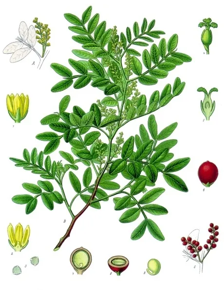
Plant
Mastic Tree
Pistacia lentiscus22 records © Franz Eugen Köhler, Köhler's Medizinal-Pflanzen · Public domain
Italy · Mixed
Regional nature park of 285 hectares in Italy, established in 1987.
Regional nature park of 285 hectares in Italy, established in 1987.
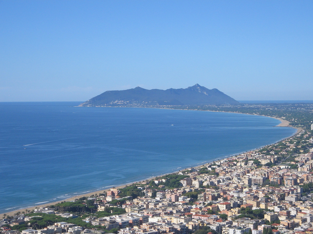
Gianola and Monte di Scauri Regional Park is a regional nature park in Italy (Europe). It covers both land and sea. Established in 1987, it covers about 285 hectares.
Protected as a regional nature park. International labels and designations: Natura 2000 network (1 site: “Promontorio Gianola e Monte di Scauri”). Key dates: established in 1987 and first Natura 2000 site under the Birds Directive in 1999.
Sources: Wikidata (CC0) for establishment and international labels; EEA Natura 2000 database (CC-BY 4.0) for site designation dates.
In Italy (Europe). Representative point: 41.2501° N, 13.6837° E.
About 285 hectares (3 km²). It is the 122nd largest of the 128 regional parks in Italy covered by Parkavela. About 100 ha are at sea.
In 1987.
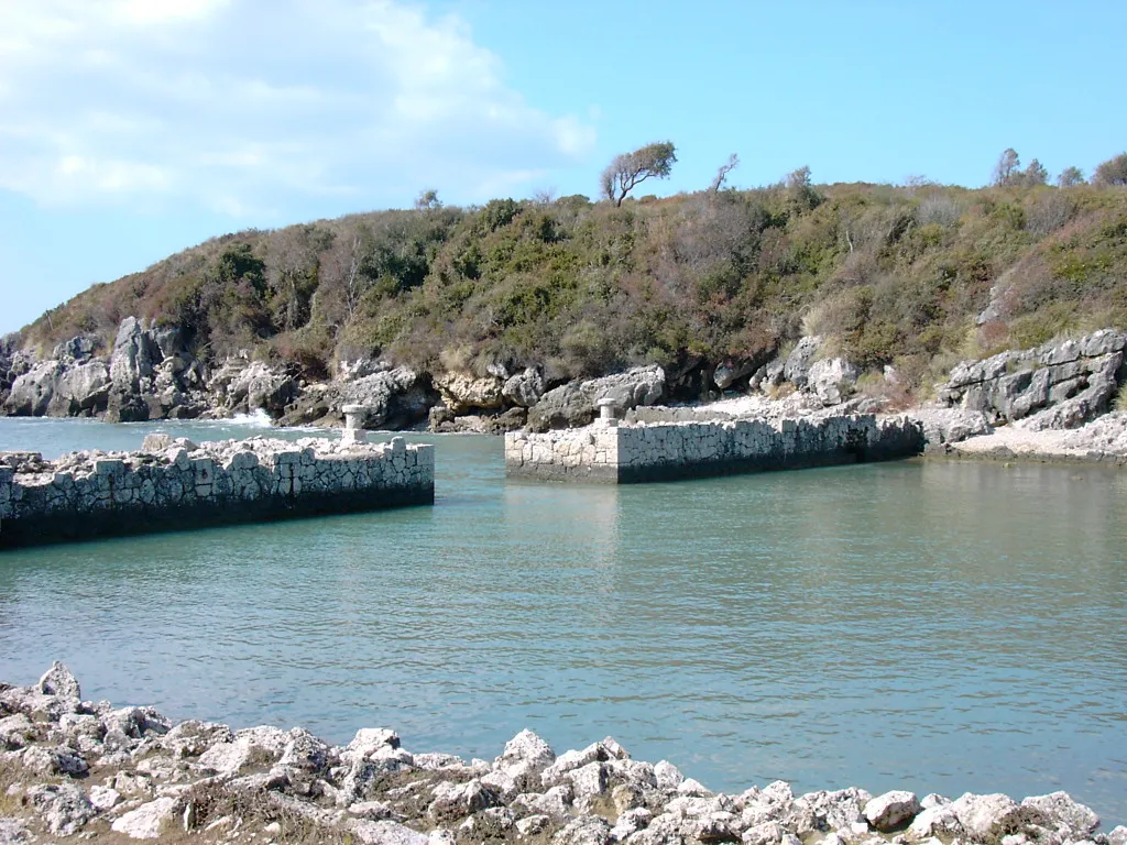
An area spanning land and sea, with coasts.
According to the European 1:1 million geological map (EGDI), the bedrock consists mainly of carbonate rocks (63% of sampled points). These are mostly sedimentary rocks. The geological units date mainly from the Neogene (63% of sampled points).
Monte Scauri, at 126 m (OpenStreetMap).
Natura 2000 network (1 site: “Promontorio Gianola e Monte di Scauri”).
Best time to visit: from April to September, with average temperatures of 13 to 25 °C and moderate rainfall.
1 viewpoint (OpenStreetMap).
Campsite Lorygiordi Park Gianola (OpenStreetMap).
Yes. According to Wikidata, one monument protected as Italian national cultural heritage stands within the boundary. For example: “Torre Quadrata” in Minturno.
5 monitored bathing sites lie in or within 1 km of the site; official 2025 classification: 5 excellent (European Environment Agency). Swimming is only permitted at the sites and times authorised locally.
Nearest towns of over 50,000 people, as the crow flies: Giugliano in Campania (55 km) and Marano di Napoli (57 km). Nearest airport: Naples (NAP), about 64 km away.
The nearest railway station is Minturno - Scauri, about 2 km from the site boundary.
Yes. Waymarked hiking routes listed in OpenStreetMap: 2. The “CAur1 · Cammino degli Aurunci - Tappa 1” route runs for about 6 km through the site.
Among the species most often recorded on GBIF are Pistacia lentiscus (Mastic Tree), Myrtus communis (Common myrtle), Quercus suber (Cork oak) and Smyrnium olusatrum (Alexanders).
© OpenStreetMap
Download the boundary: GeoJSON · GPX Boundary © OpenStreetMap contributors (ODbL).
The representative point of the site lies at around 52 m above sea level. Over the 1996–2025 period, the mean annual temperature is about 16.0 °C and total precipitation reaches roughly 1,170 mm per year. The warmest month is usually August, the coolest January, and the wettest November. According to the European 1:1 million geological map (EGDI), the bedrock consists mainly of carbonate rocks (63% of sampled points). These are mostly sedimentary rocks. The geological units date mainly from the Neogene (63% of sampled points).
Terrain: Mapzen Terrain Tiles (SRTM, USGS)
Sedimentary rocks 100 % · Main age: Neogene (63%)
Source: EGDI 1:1M geological map (EuroGeoSurveys and national geological surveys), CC BY 4.0 · 16 sampled points within the site.
● Mean temperature (°C) · ▮ Precipitation (mm)
Source: Copernicus ERA5-Land (C3S, doi:10.24381/cds.68d2bb30), monthly averages 1996–2025 interpolated to the representative point, temperatures adjusted for elevation.
Contains modified Copernicus Climate Change Service information 2026. Neither the European Commission nor ECMWF is responsible for any use that may be made of the Copernicus information or data it contains.
According to CORINE Land Cover (2018), the land area is mainly made up of farmland (43%), Mediterranean scrub (35%) and forests (22%). Woodland is mostly broadleaved. The sea covers about 30% of the site. Elevation ranges from sea level to 126 m (highest point: Monte Scauri). The Natura 2000 site overlapping the area lists 7 habitats of European interest, the most extensive being Quercus suber forests, Thermo-Mediterranean and pre-desert scrub and low formations of Euphorbia close to cliffs.
Based on occurrences aggregated by GBIF, several species are regularly recorded within the site. Among the most frequent are Pistacia lentiscus (Mastic Tree), Myrtus communis (Common myrtle), Quercus suber (Cork oak) and Smyrnium olusatrum (Alexanders). The full list of documented taxa is shown below. The overlapping Natura 2000 site lists 16 species of European interest: 10 birds, 1 mammal, 3 reptiles and 2 amphibians.
From the official form of the Natura 2000 site overlapping the area (areas reported for the whole site).
Common Kingfisher (Alcedo atthis) wintering, European Nightjar (Caprimulgus europaeus) breeding, Great Spotted Cuckoo (Clamator glandarius) passage, Little Egret (Egretta garzetta) passage, Peregrine Falcon (Falco peregrinus) resident, Black-winged Stilt (Himantopus himantopus) passage, Red-backed Shrike (Lanius collurio) breeding, Mediterranean gull (Larus melanocephalus) passage, Alpine Swift (Tachymarptis melba) passage, Sandwich Tern (Thalasseus sandvicensis) wintering
Hermann's tortoise (Testudo hermanni), Italian Aesculapian Snake (Zamenis lineatus), Aesculapian Snake (Zamenis longissimus)
Source: Natura 2000 standard data forms (EEA, CC-BY 4.0). Not exhaustive: sensitive species are not published.
Plant
22 records © Franz Eugen Köhler, Köhler's Medizinal-Pflanzen · Public domain
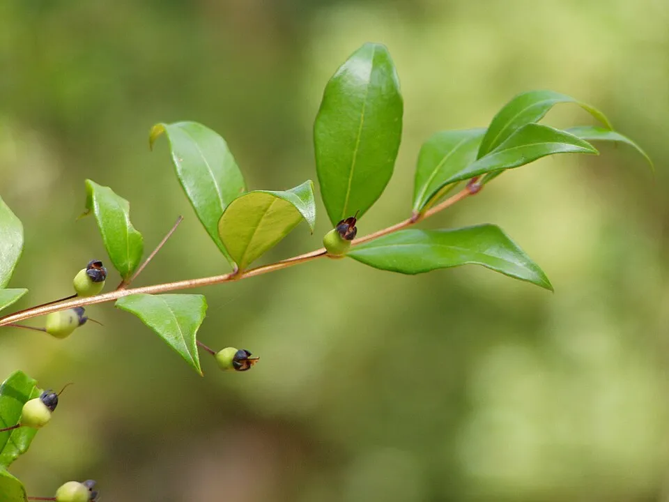
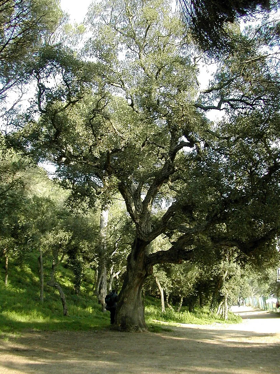
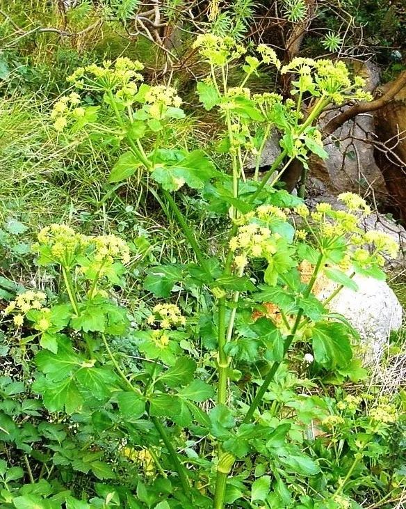
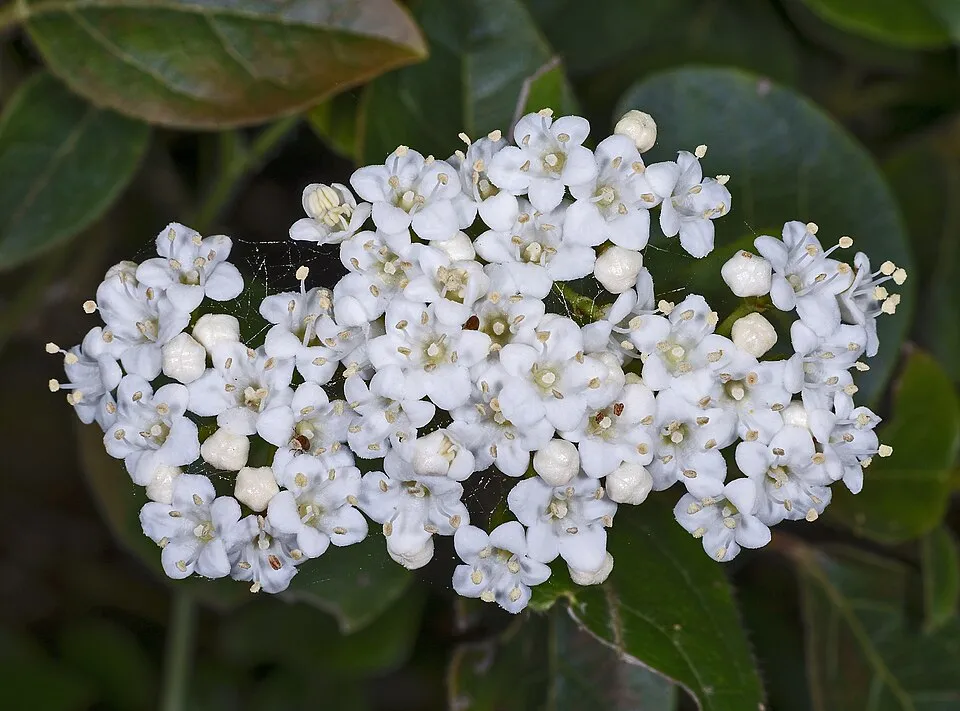
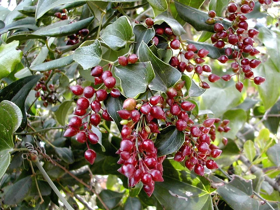
Occurrences documented via GBIF; they are neither an exhaustive inventory nor proof of current presence.
Records: GBIF.org (CC-BY). Names: Wikidata (CC0), GBIF. Photos: Wikimedia Commons.
The primary purpose of the site is to preserve its natural habitats and the biodiversity they support. The species recorded (Biodiversity tab) reflect its ecological value. The designations it holds frame its management and the control of land use.
At night, 100% of the area gives off artificial light detectable from space (NASA VIIRS Black Marble composite, 2016). According to the Natura 2000 forms, all 7 assessed habitats of European interest are in good condition. According to the Water Framework Directive assessment (2022 river basin management plans, data 2015–2020), water bodies assessed within the site: coastal waters, 1 of 1 in good ecological status or better.
0
No large fire mapped (fires over about 30 ha)
100%
of the area gives off artificial light visible from space
< 1%
buildings, business areas, roads, quarries · farmland 30%
Coastal waters: 1 of 1 good or better
assessments 2015–2020
Sources: Global Forest Change (Hansen et al., University of Maryland, via Global Forest Watch, CC-BY 4.0); EFFIS, European Commission / Copernicus; NASA Black Marble 2016 (public domain); CORINE Land Cover 2018 (Copernicus) or MODIS.
Ecological status of water bodies: European Environment Agency, WISE – Water Framework Directive, 3rd river basin management plans (2022), CC BY 4.0. Official national classification, not comparable between countries.
1 viewpoint
2 waymarked routes listed
Data © OpenStreetMap contributors (ODbL) · Wikidata (CC0)
6 km within the site ↗ 19 m↘ 25 m 0–27 m
Tracks © OpenStreetMap contributors (ODbL), clipped to the boundary; elevation gain and profiles computed on the longest section from Mapzen Terrain Tiles (≈ 30 m), indicative only.
5 monitored bathing sites in or within 1 km of the site · 2025 classification
Source: European Environment Agency, official bathing water classification (Directive 2006/7/EC, CC-BY 4.0). Swimming is only permitted at the sites and times authorised locally.
The nearest railway station is Minturno - Scauri, about 2 km from the site boundary. Nearest towns of over 50,000 people, as the crow flies: Giugliano in Campania (55 km) and Marano di Napoli (57 km). Nearest airport: Naples (NAP), about 64 km away. About 150,000 people live within 20 km of the site boundary, 83,000 of them within 10 km (GHSL estimate, 2020). This population has grown by about 5% since 2000. Waymarked hiking routes listed in OpenStreetMap: 2. To see: 1 viewpoint. Where to stay: campsite Lorygiordi Park Gianola. To plan a visit (access, opening periods, visitor rules), it is best to consult the official information from the managing body and the official website listed in this page's sources.
Source: OpenStreetMap (ODbL), Wikidata (CC0), October 2026.
According to Wikidata, one monument protected as Italian national cultural heritage stands within the boundary. It is “Torre Quadrata” in Minturno.
Source: Wikidata (CC0), monuments in each country’s official heritage protection registers, at national or regional level. Each item links to its Wikidata entry.
Best time to visit: from April to September, with average temperatures of 13 to 25 °C and moderate rainfall. Precipitation peaks in November (up to 210 mm per month). Day length ranges from about 9 h 13 min in December to 15 h 08 min in June. Wildlife records published on GBIF peak for plants (April and May). These peaks also reflect when observers are most active.
Source: Copernicus ERA5-Land (C3S), monthly averages 1996–2025 at the representative point, temperatures adjusted for elevation.
Contains modified Copernicus Climate Change Service information 2026. Neither the European Commission nor ECMWF is responsible for any use that may be made of the Copernicus information or data it contains.
Monthly records published on GBIF (CC-BY), relative to the busiest month; also reflects observer activity.
Data © OpenStreetMap contributors (ODbL), Wikidata (CC0) and the sources cited.