Fish
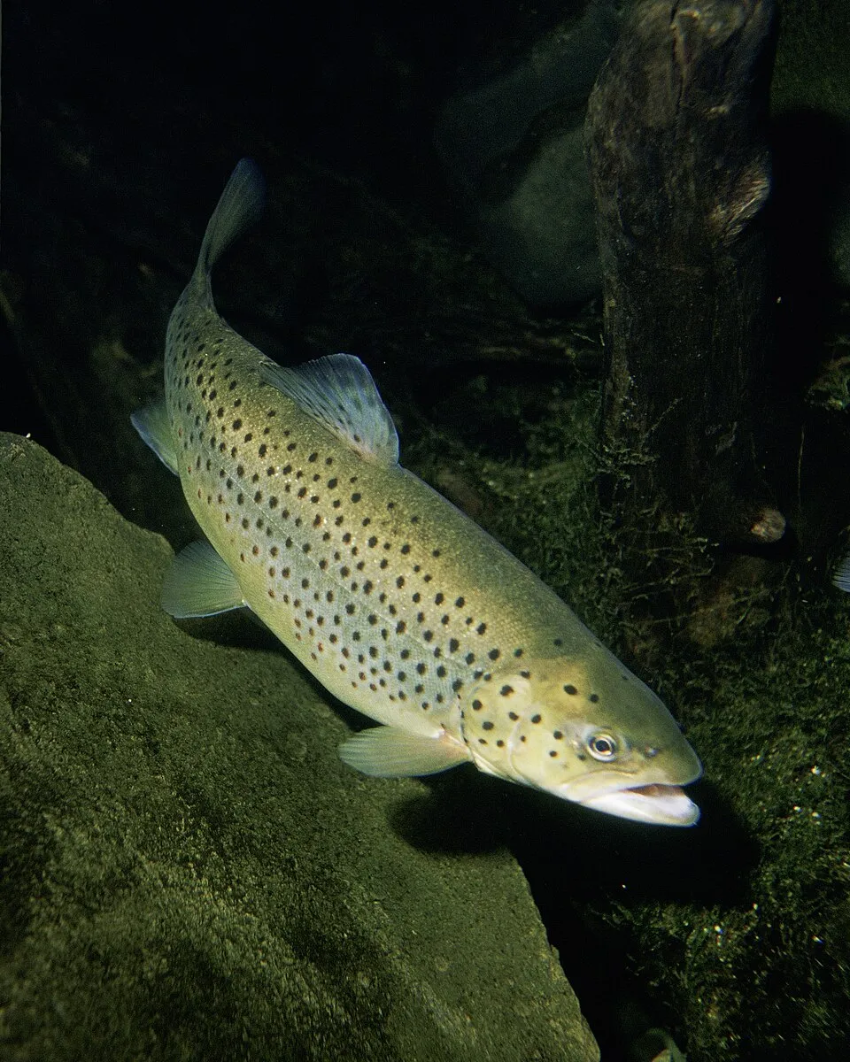
Brown Trout
Salmo trutta19,844 records © Eric Engbretson for U.S. Fish and Wildlife Service · Public domain
France · Terrestrial
Regional nature park of 327,937 hectares in France, established in 1995.
Regional nature park of 327,937 hectares in France, established in 1995.
Grands Causses Regional Natural Park is a regional nature park in France (Europe). It is a predominantly terrestrial area. Established in 1995, it covers about 327,937 hectares.
Protected as a regional nature park. International labels and designations: UNESCO World Heritage (“The Causses and the Cévennes, Mediterranean agro-pastoral Cultural Landscape”) and Natura 2000 network (24 sites). Key dates: established in 1995, first Natura 2000 site under the Birds Directive in 2006, first Natura 2000 site under the Habitats Directive in 2006 and World Heritage listing in 2011.
Sources: Wikidata (CC0) for establishment and international labels; EEA Natura 2000 database (CC-BY 4.0) for site designation dates.
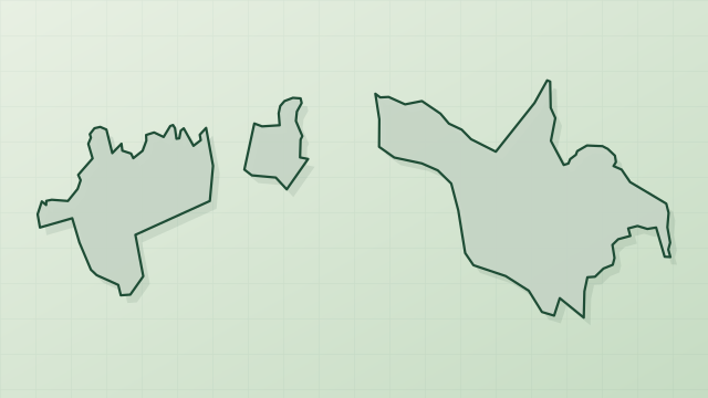
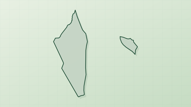
In France (Europe). Representative point: 44.0677° N, 3.0387° E.
About 327,937 hectares (3,279 km²). It is the 7th largest of the 59 regional parks in France covered by Parkavela.
In 1995.
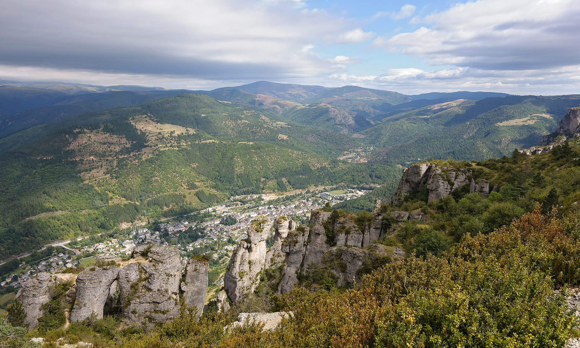
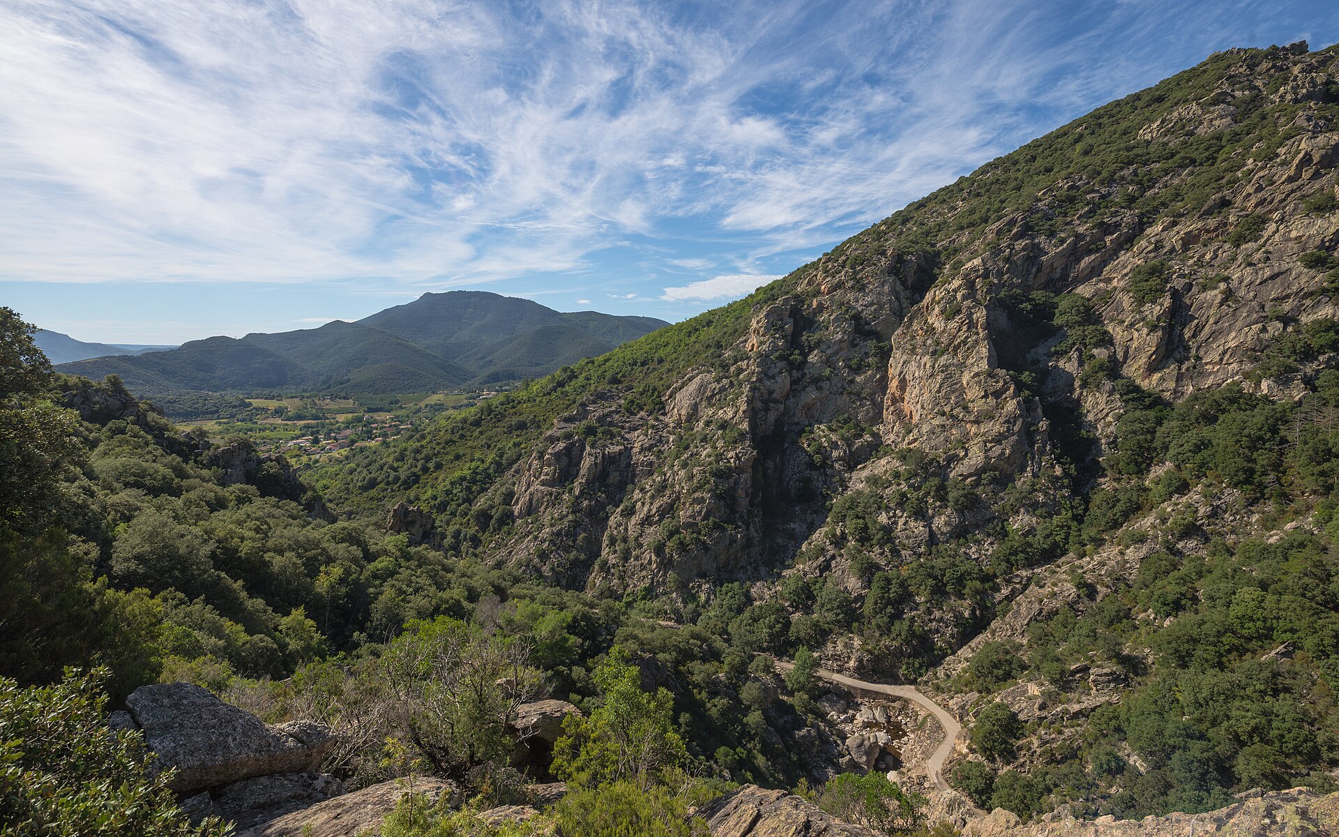
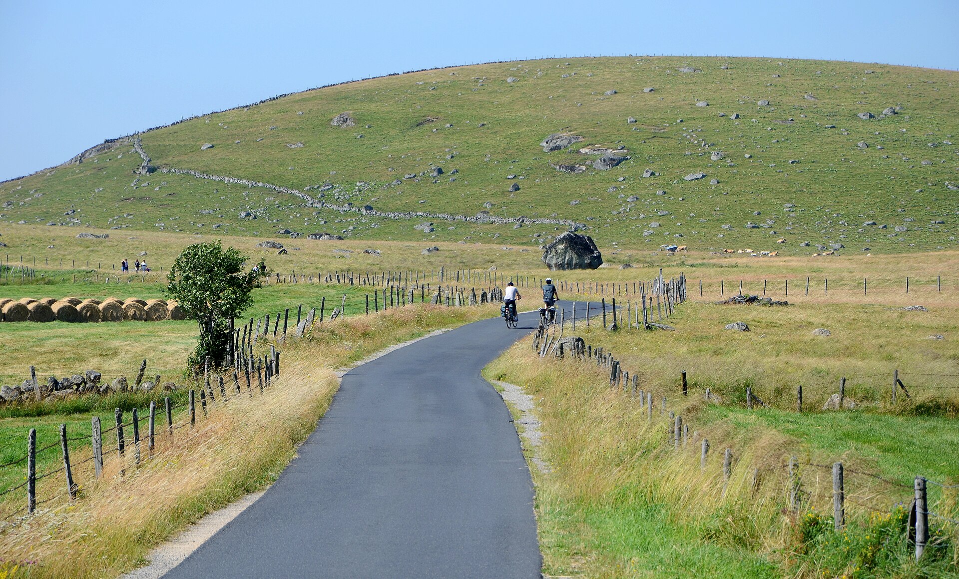
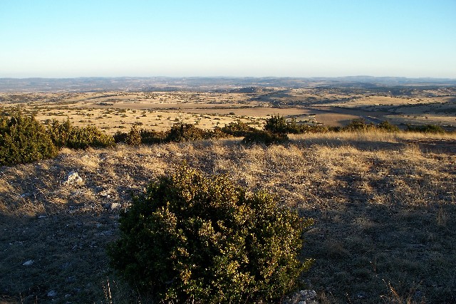
A terrestrial area, with forests and mountains.
According to the BRGM's simplified lithological map, the bedrock consists mainly of limestones, marls and gypsum (44% of sampled points), sandstones (31%) and shales and sandstones (19%). These are mostly sedimentary rocks.
Puech del Pal, at 1,155 m (OpenStreetMap).
Puech del Pal (1,155 m), Mont Seigne (1,121 m), Merdelou (1,110 m), Puech Oustenc (1,051 m) and Roquefage (1,036 m) (OpenStreetMap).
UNESCO World Heritage (“The Causses and the Cévennes, Mediterranean agro-pastoral Cultural Landscape”) and Natura 2000 network (24 sites).
Best time to visit: from May to October, with average temperatures of 11 to 20 °C and moderate rainfall.
236 viewpoints, 9 waterfalls, 30 lakes and ponds, 3 natural arches, 440 caves and 1 bird hide, including Château d'eau (460 m), Cascade de l'Homède, Bassin du Pesquié and Arche (OpenStreetMap).
11 mountain huts and 113 campsites, including Abri sous roche, Aire communale St-Jean-et-St-Paul and Caselle à Dody (OpenStreetMap).
Yes. According to the French Ministry of Culture's Mérimée database, 153 historic monuments stand within the boundary, 56 of them with the highest level of protection (classé). For example: “Dolmen de Tièrgues” in Saint-Affrique, “Ferme fortifiée des Brouzes” in Saint-Georges-de-Luzençon and “Lavoir de l'Ayrolle” in Millau.
22 monitored bathing sites lie in or within 1 km of the site; official 2025 classification: 15 excellent, 6 good and 1 sufficient (European Environment Agency). Swimming is only permitted at the sites and times authorised locally.
Nearest towns of over 50,000 people, as the crow flies: Albi (28 km) and Montpellier (33 km). Nearest airport: Rodez-Aveyron (RDZ), about 25 km away.
Montpaon railway station lies within the site.
Maison Forestière le Mayni, Maison Forestière le Cayla and Maison forestière de La Calm.
Yes. Waymarked hiking routes listed in OpenStreetMap: 92, including Larzac Templier et Hospitalier, Tour du Larzac, Saint-Beauzély and Longuiers. The “Tour du Larzac - tracé principal” route runs for about 108 km through the site, with some 1,660 m of ascent on its longest section.
Among the species most often recorded on GBIF are Salmo trutta (Brown Trout), Pipistrellus pipistrellus (Common pipistrelle), Phoxinus phoxinus (Common minnow) and Gobio gobio (Gudgeon).
© OpenStreetMap
Download the boundary: GeoJSON · GPX Boundary © OpenStreetMap contributors (ODbL).
The representative point of the site lies at around 619 m above sea level. Over the 1996–2025 period, the mean annual temperature is about 10.6 °C and total precipitation reaches roughly 888 mm per year. The warmest month is usually July, the coolest January, and the wettest October. According to the BRGM's simplified lithological map, the bedrock consists mainly of limestones, marls and gypsum (44% of sampled points), sandstones (31%) and shales and sandstones (19%). These are mostly sedimentary rocks.
Terrain: Mapzen Terrain Tiles (SRTM, USGS)
share of the site in each elevation band (smoothed terrain model: summits are rounded off) · Terrain: Mapzen Terrain Tiles (SRTM, USGS)
Sedimentary rocks 75 % · Metamorphic rocks 25 %
Source: BRGM, simplified lithological map at 1:1,000,000 (Licence Ouverte), 16 points sampled within the boundary.
Data © OpenStreetMap contributors (ODbL)
● Mean temperature (°C) · ▮ Precipitation (mm)
Source: Copernicus ERA5-Land (C3S, doi:10.24381/cds.68d2bb30), monthly averages 1996–2025 interpolated to the representative point, temperatures adjusted for elevation.
Contains modified Copernicus Climate Change Service information 2026. Neither the European Commission nor ECMWF is responsible for any use that may be made of the Copernicus information or data it contains.
According to CORINE Land Cover (2018), the site is mainly made up of forests (37%), farmland (31%) and grassland and meadows (23%). Woodland is mostly broadleaved. Elevation ranges from about 130 m to 1,155 m (highest point: Puech del Pal). Median elevation is 666 m, and 78% of the site lies above 500 m (SRTM elevation model). The 24 Natura 2000 sites overlapping the area list 44 habitats of European interest (9 priority), the most extensive being semi-natural dry grasslands and scrubland facies on calcareous substrates (Festuco-Brometalia) (* important orchid sites), Quercus ilex and Quercus rotundifolia forests and Medio-European limestone beech forests of the Cephalanthero-Fagion.
Based on occurrences aggregated by GBIF, several species are regularly recorded within the site. Among the most frequent are Salmo trutta (Brown Trout), Pipistrellus pipistrellus (Common pipistrelle), Phoxinus phoxinus (Common minnow) and Gobio gobio (Gudgeon). The full list of documented taxa is shown below. The overlapping Natura 2000 sites list 85 species of European interest: 24 birds, 25 mammals, 1 reptile, 4 amphibians, 5 fish, 16 invertebrates and 10 plants.
From the official forms of the 24 Natura 2000 sites overlapping the area (areas reported for each whole site).
and 36 more
Cinereous Vulture (Aegypius monachus) resident passage, Common Kingfisher (Alcedo atthis) resident, Tawny Pipit (Anthus campestris) breeding, Golden Eagle (Aquila chrysaetos) resident, Eurasian Eagle-owl (Bubo bubo) resident, Eurasian Stone-curlew (Burhinus oedicnemus) breeding, European Nightjar (Caprimulgus europaeus) breeding, Short-toed Snake Eagle (Circaetus gallicus) breeding, Hen Harrier (Circus cyaneus) resident wintering breeding, Montagu's Harrier (Circus pygargus) breeding, Black Woodpecker (Dryocopus martius) breeding resident, Ortolan Bunting (Emberiza hortulana) breeding and 12 more
Barbastelle (Barbastella barbastellus), Eurasian Beaver (Castor fiber), Serotine bat (Eptesicus serotinus), Savi's Pipistrelle (Hypsugo savii), Eurasian otter (Lutra lutra), Common bent-wing bat (Miniopterus schreibersii), Alcathoe Whiskered Bat (Myotis alcathoe), Bechstein's bat (Myotis bechsteinii), Lesser mouse-eared myotis (Myotis blythii), Long-fingered bat (Myotis capaccinii), Daubenton's bat (Myotis daubentonii), Geoffroy's bat (Myotis emarginatus) and 13 more
Midwife toad (Alytes obstetricans), Natterjack (Bufo calamita), Western Spadefoot (Pelobates cultripes), Marbled newt (Triturus marmoratus)
Mediterranean Barbel (Barbus meridionalis), European bullhead (Cottus gobio), Common Bullhead (Cottus perifretum), South-West European Nase (Parachondrostoma toxostoma), Souffia (Telestes souffia)
White-clawed Crayfish (Austropotamobius pallipes), Greater Capricorn Beetle (Cerambyx cerdo), Eastern Eggar (Eriogaster catax), Marsh fritillary (Euphydryas aurinia), Jersey Tiger (Euplagia quadripunctaria), Pronged clubtail (Gomphus graslinii), Stag beetle (Lucanus cervus), Splendid Cruiser (Macromia splendens), Large Blue (Maculinea arion), Hermit beetle (Osmoderma eremita), Orange-spotted Emerald (Oxygastra curtisii), Apollo (Parnassius apollo) and 4 more
Mountain arnica (Arnica montana L.), Lady's-slipper orchid (Cypripedium calceolus), Yellow gentian (Gentiana lutea L.), Small red peat moss (Sphagnum capillifolium), Toothed sphagnum (Sphagnum cuspidatum), Flat-topped bog-moss (Sphagnum fallax), Magellan's sphagnum (Sphagnum magellanicum), Papillose sphagnum (Sphagnum papillosum), Russow's sphagnum (Sphagnum russowii), Summer Lady's-tresses (Spiranthes aestivalis (poir.) rich.)
Source: Natura 2000 standard data forms (EEA, CC-BY 4.0). Not exhaustive: sensitive species are not published.
Fish
19,844 records © Eric Engbretson for U.S. Fish and Wildlife Service · Public domain
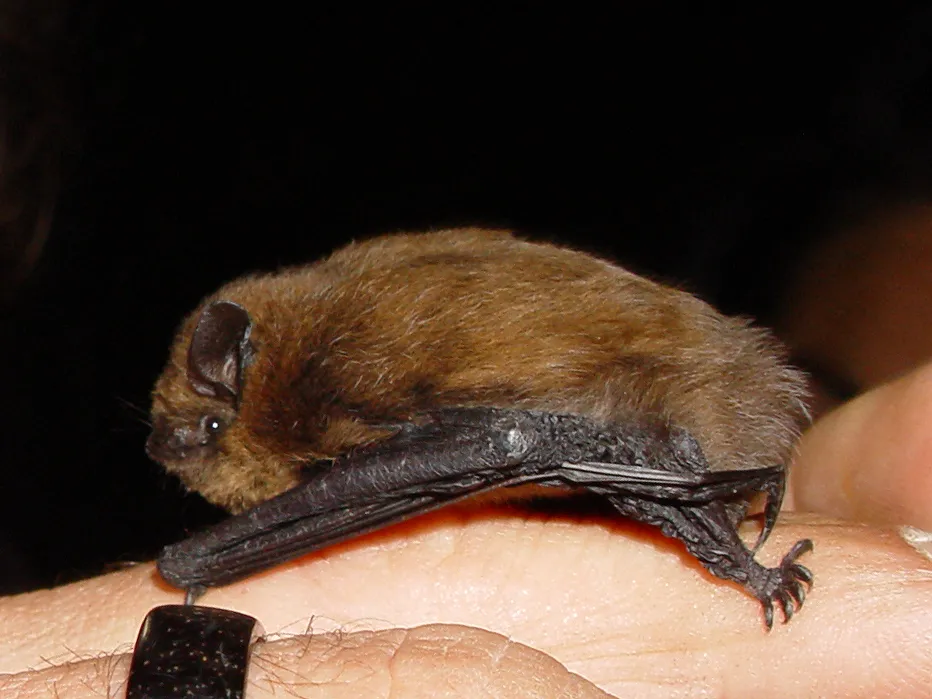
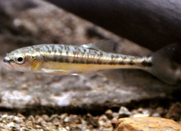
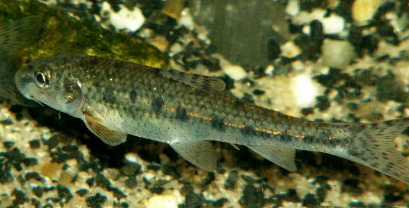
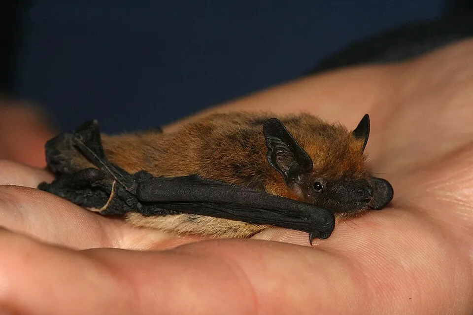

Occurrences documented via GBIF; they are neither an exhaustive inventory nor proof of current presence.
Records: GBIF.org (CC-BY). Names: Wikidata (CC0), GBIF. Photos: Wikimedia Commons.
The primary purpose of the site is to preserve its natural habitats and the biodiversity they support. The species recorded (Biodiversity tab) reflect its ecological value. The designations it holds frame its management and the control of land use.
According to Global Forest Change data (University of Maryland, Global Forest Watch), about 10,010 ha of tree cover were lost within the boundary between 2001 and 2023 (3% of its area), peaking in 2018 and 2023. These losses include logging, storms and fires, and do not account for regrowth. According to the European CORINE Land Cover inventory (Copernicus), land cover changed on about 2,410 ha of the site between 1990 and 2018 (under 1% of its area). Forest felling and regrowth add about 6,380 ha in total over the period. Since 2016, the European EFFIS system (Copernicus) has mapped 44 fires here, burning about 2,408 ha within the boundary; the largest, in August 2022 (near Mostuéjouls), covered 600 ha. At night, 4% of the area gives off artificial light detectable from space (NASA VIIRS Black Marble composite, 2016). Built-up and developed land (buildings, business areas, roads, quarries) covers 1% of the area, and farmland 31% (CORINE Land Cover). According to the Natura 2000 forms, of 42 assessed habitats of European interest, 18 are in excellent condition and 5 in average or reduced condition. According to the Water Framework Directive assessment (2022 river basin management plans, data 2012–2017), 70% of the 1,165 km of rivers assessed within the site are in good or high ecological status. Other assessed water bodies: lakes, 2 of 3 in good ecological status or better. Since 2000, 94 invasive alien species have been recorded within the site (GBIF observations), 21 of them listed as of Union concern under EU Regulation 1143/2014. Among them: Pacifastacus leniusculus (Signal crayfish), Myocastor coypus (Coypu) and Vespa velutina (Asian hornet).
10,009 ha
2001–2023 · 3% of the area
2,408 ha
burned within the boundary (44 mapped fires)
4%
of the area gives off artificial light visible from space
1%
buildings, business areas, roads, quarries · farmland 31%
2,410 ha
changed cover, 1990–2018 · CORINE · < 1% of the area
forest felling and regrowth: 6,380 ha in total
70%
of the 1,165 km of assessed rivers in good or high ecological status · WFD 2022
Lakes: 2 of 3 good or better
assessments 2012–2017
94
incl. 21 of EU concern · since 2000
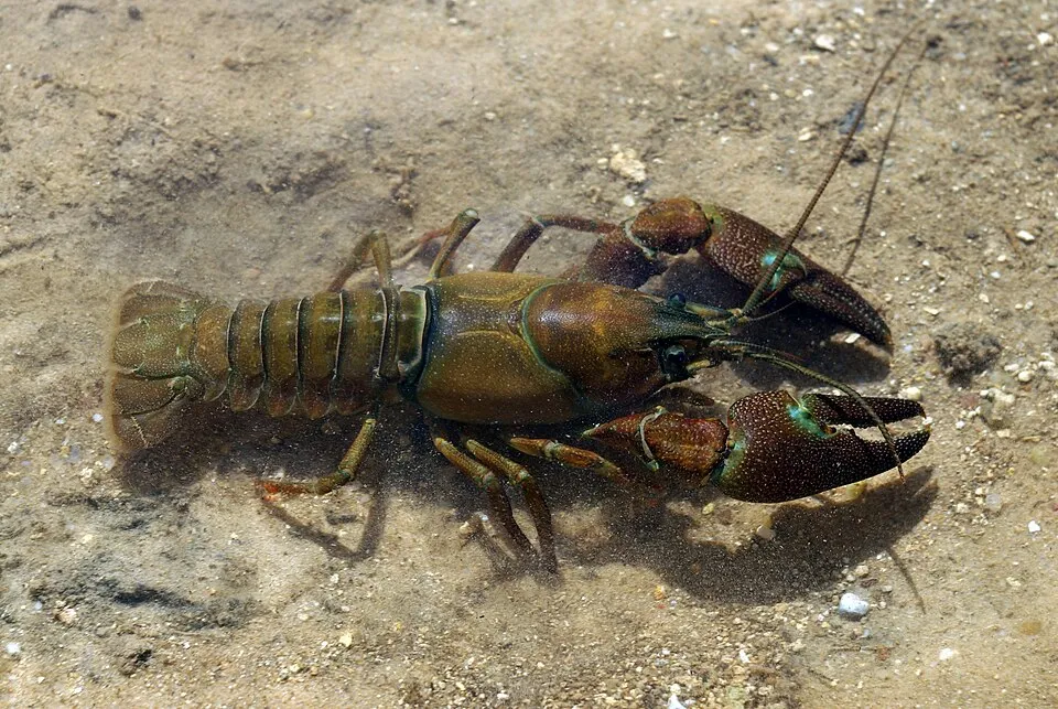 Signal crayfishEU
 CoypuEU
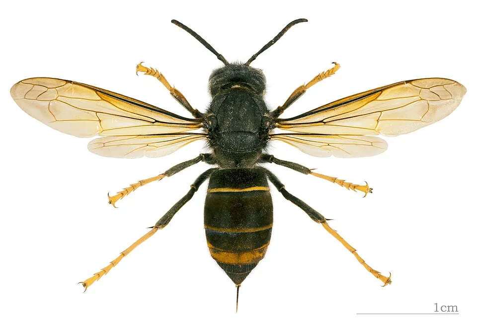 Asian hornetEU
 Tree-of-heavenEU
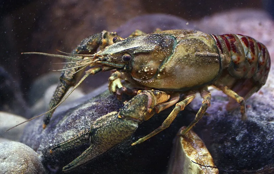 Spinycheek crayfishEU
 Paper mulberryEU
 PumpkinseedEU
 Japanese KnotweedEU
Photos: Signal crayfish © David Perez · CC BY 3.0; Coypu © Philippe Amelant · CC BY-SA 3.0; Asian hornet © Didier Descouens · CC BY-SA 4.0; Tree-of-heaven © Darkone · CC BY-SA 2.5; Spinycheek crayfish © Astacoides · CC BY-SA 3.0; Paper mulberry © Didier Descouens · CC BY-SA 4.0; Pumpkinseed © Cephas · CC BY-SA 3.0; Japanese Knotweed © W.carter · CC0-1.0
Sources: Global Forest Change (Hansen et al., University of Maryland, via Global Forest Watch, CC-BY 4.0); EFFIS, European Commission / Copernicus; NASA Black Marble 2016 (public domain); CORINE Land Cover 2018 (Copernicus) or MODIS.
CORINE Land Cover Change 1990–2018: generated using European Union's Copernicus Land Monitoring Service information (EEA), aggregated by Parkavela; DOI 10.2909/f30f1000-7cf8-43bb-872c-5eb093911b24.
Ecological status of water bodies: European Environment Agency, WISE – Water Framework Directive, 3rd river basin management plans (2022), CC BY 4.0. Official national classification, not comparable between countries.
Invasive alien species: Global Register of Introduced and Invasive Species (ISSG, CC BY 4.0); Union list, Regulation (EU) 1143/2014 (INBO, CC0); GBIF.org records (CC0 / CC BY 4.0), at least 2 per species.
236 viewpoints · 9 waterfalls · 30 lakes and ponds · 3 natural arches · 440 caves · 1 bird hide
11 mountain huts · 113 campsites
92 waymarked routes listed, including:
Signed cycle routes: this does not mean that cycling is allowed on footpaths.
Reported by OpenStreetMap contributors (ODbL); check with the park before visiting.
Data © OpenStreetMap contributors (ODbL) · Wikidata (CC0)
Routes © OpenStreetMap contributors (ODbL), via Waymarked Trails
77.7 km within the site ↗ 1,325 m↘ 1,323 m 529–867 m
Tracks © OpenStreetMap contributors (ODbL), clipped to the boundary; elevation gain and profiles computed on the longest section from Mapzen Terrain Tiles (≈ 30 m), indicative only.
22 monitored bathing sites in or within 1 km of the site · 2025 classification
and 12 more
Source: European Environment Agency, official bathing water classification (Directive 2006/7/EC, CC-BY 4.0). Swimming is only permitted at the sites and times authorised locally.
Montpaon railway station lies within the site. Nearest towns of over 50,000 people, as the crow flies: Albi (28 km) and Montpellier (33 km). Nearest airport: Rodez-Aveyron (RDZ), about 25 km away. About 290,000 people live within 20 km of the site boundary, 99,000 of them within 10 km; some 85,000 people are estimated to live inside (GHSL estimate, 2020). This population has grown by about 23% since 2000. Visitor information on site: Maison Forestière le Mayni, Maison Forestière le Cayla and Maison forestière de La Calm. Waymarked hiking routes listed in OpenStreetMap: 92, including Larzac Templier et Hospitalier, Tour du Larzac, Saint-Beauzély and Longuiers. The site is crossed by 2 signed cycle routes: “V85 Véloroute Montauban Quissac” and “V86 La Vallée du Lot à vélo” (OpenStreetMap). OpenStreetMap contributors list 4 wheelchair-accessible places, including Maison de la Scipione and Office de Tourisme Larzac-Vallée; check with the park before visiting. To see: 236 viewpoints, 9 waterfalls, 30 lakes and ponds, 3 natural arches, 440 caves and 1 bird hide, including Château d'eau (460 m), Cascade de l'Homède, Bassin du Pesquié and Arche. Where to stay: 11 mountain huts and 113 campsites, including Abri sous roche, Aire communale St-Jean-et-St-Paul and Caselle à Dody. To plan a visit (access, opening periods, visitor rules), it is best to consult the official information from the managing body and the official website listed in this page's sources.
Source: OpenStreetMap (ODbL), Wikidata (CC0), October 2026.
According to the French Ministry of Culture's Mérimée database, 153 historic monuments stand within the boundary, 56 of them with the highest level of protection (classé). Among them are 56 religious buildings, 34 castles and fortifications and 30 houses and civic buildings. Notable classé monuments include “Dolmen de Tièrgues” in Saint-Affrique, “Ferme fortifiée des Brouzes” in Saint-Georges-de-Luzençon and “Lavoir de l'Ayrolle” in Millau.
and 145 more
Source: Mérimée database, French Ministry of Culture (Licence Ouverte 2.0). Each record links to the Plateforme ouverte du patrimoine (POP).
Best time to visit: from May to October, with average temperatures of 11 to 20 °C and moderate rainfall. These averages apply to the site's representative point (619 m); higher up it is markedly cooler. Day length ranges from about 8 h 54 min in December to 15 h 28 min in June. Wildlife records published on GBIF peak for birds (May and June), plants (May and June), butterflies and moths (June and July), dragonflies (July) and mammals (July and August). These peaks also reflect when observers are most active.
Source: Copernicus ERA5-Land (C3S), monthly averages 1996–2025 at the representative point, temperatures adjusted for elevation.
Contains modified Copernicus Climate Change Service information 2026. Neither the European Commission nor ECMWF is responsible for any use that may be made of the Copernicus information or data it contains.
Monthly records published on GBIF (CC-BY), relative to the busiest month; also reflects observer activity.
Data © OpenStreetMap contributors (ODbL), Wikidata (CC0) and the sources cited.